One of the easiest hikes to get a remarkable panorama of the Greater Caucasus.
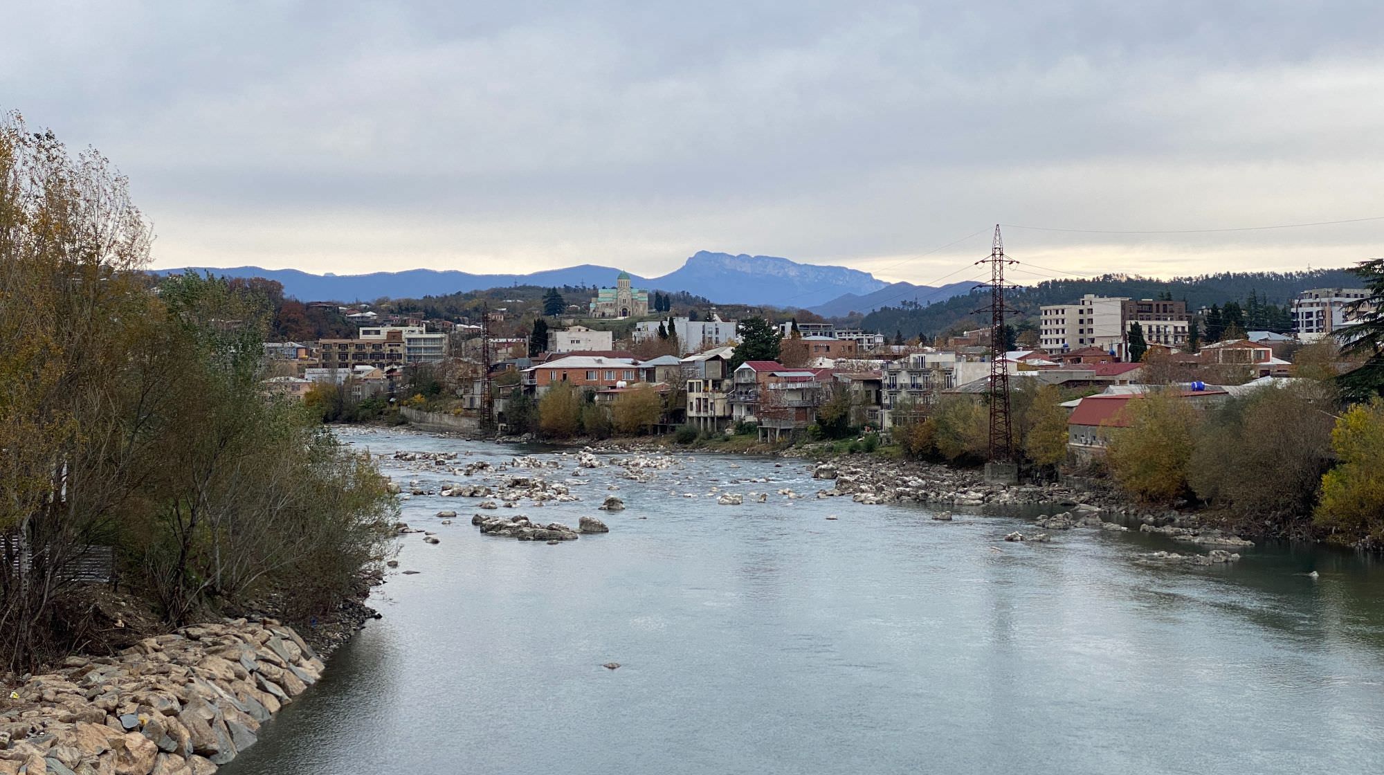
Even though already in Lechkhumi, Mt. Khvamli (2.001m) can be considered as Kutaisi's "Hausberg" (backyard mountain). Thanks to its striking rectangular shape and its isolated position, the mountain is not only dominating the city’s panorama in the north but is also home for many legends such as the Prometheus tale. Khvamli can be walked as a short hike or as the starting point for longer adventures such as heading to opposing Askhi massif. On good days it offers an outstanding view on the Greater Caucasus reaching from Zemo Svaneti to Racha.
Originally a moderate 30km hike from the Tskhenistskhali to the Rioni valley, the route fell victim to the local development. Since 2020, it is connected by an asphalted street coming from Okureshi (Tsageri side). What remained is the final 2km ascent from the parking spot to the peak (two hours back and forth) and the possibility to hike down towards the Rioni river (14 km). Checking out the nearby Tekenteri Well – a cave under a tree reminding of the rabbit whole in "Alice in Wonderland" – may take you another 15 to 20 minutes.
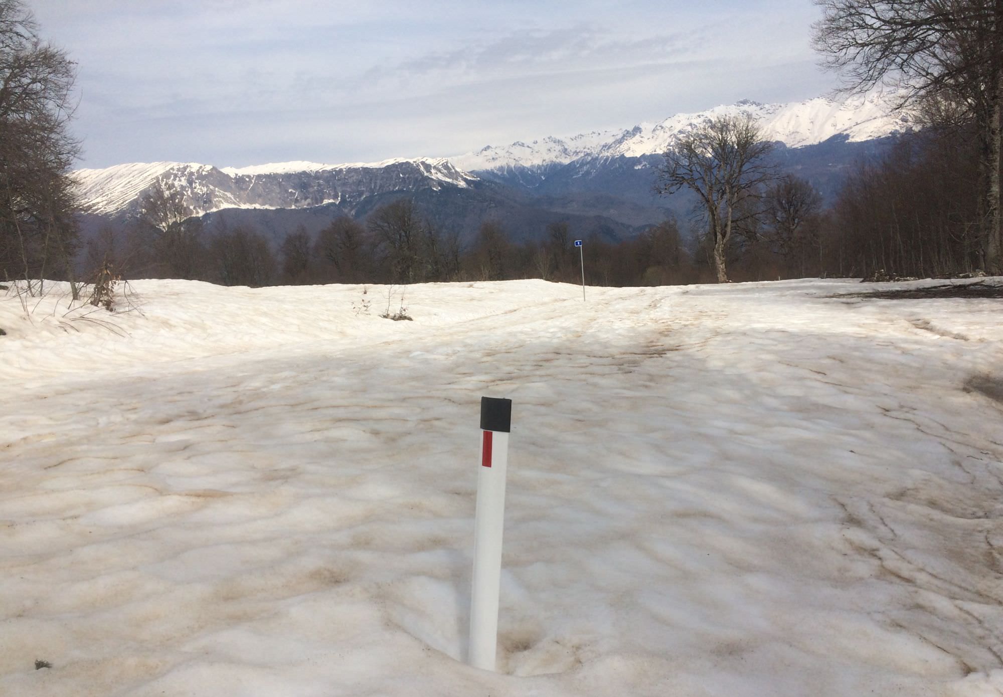
In winter, the hike can easily require an entire day as you have to leave your car further down the street and march through high snow – beautiful but also exhausting.
Apart from one or two smaller rocky sections, the hike is smooth and easy. Nonetheless, sturdy footwear and maybe even a stick are recommended due to the slippery nature of the terrain. From the first snowfall until the melting of the last snowfields in early summer, special attention should be paid to the many craters defining the landscape.
Due to the southern exposure of the peak and its snow-free steep face, Mt. Khvamli looks inviting throughout the entire year. Anyhow, in winter it is harder to access as the entire ascend (including the asphalted street) is turning into an idyllic snowy landscape barely touched by sun until April or May. Going at the beginning or the end of the hiking season might be the best choice to also avoid high vegetation.
Only 1,5 hours from Kutaisi, Khvamli is best reached by car or taxi (in 2022, about 150 GEL with GoTrip.ge); some horsepower is needed to manage the slope of up to 20% but apart from that any, car can manage the asphalted street. Alternatively, you can take the Kutaisi-Tsageri-marshrutka (11am, 2pm, 4pm; about 6 GEL) and hop off at the village of Okureshi – the marked starting point of the original hike – or at the new asphalted street some three kilometres later to catch a ride or walk.
In case you want to hike up from the Rioni side, it’s best to get to Tvishi (Kutaisi-Ambrolauri-Oni-marshrutka; around 10am; 8 GEL) and start your adventure from there – be warned, the road is in a sorry state. Up to the peak you have to manage 14 kilometres: eight kilometres to the crossroad; another six kilometres to the top.
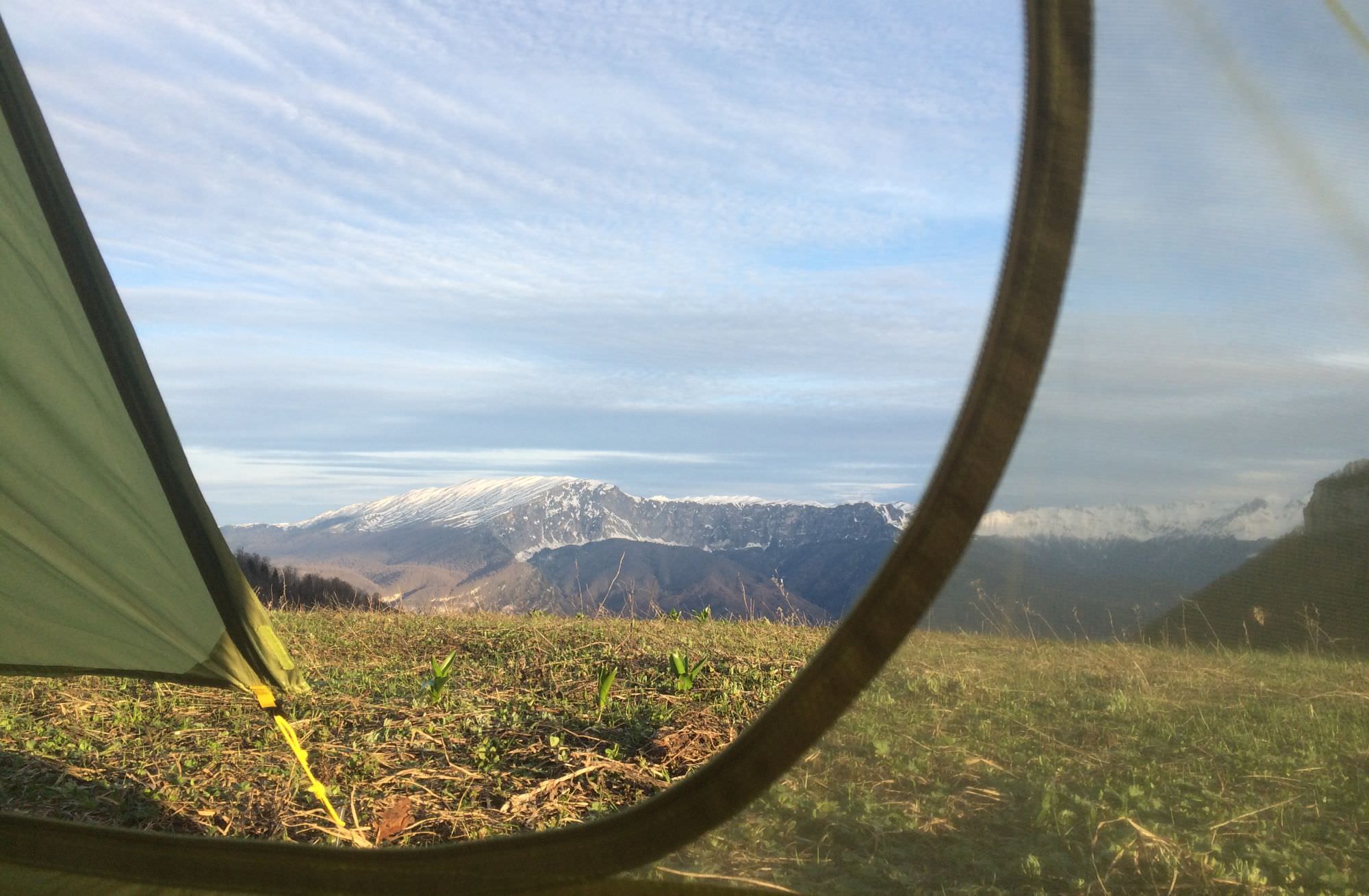
Both villages are no dedicated tourist spots, but you should be able to find a small guesthouse in case you want to embed this daytrip into a longer adventure. You may have a better chance in Tvishi as it is sprinkled by small wineries which regularly host guests. Moreover, you can find some camping possibilities along the way – all marked in the gpx file.
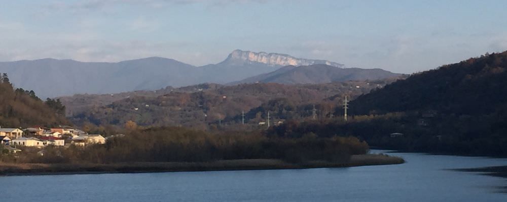
View on Mt. Khvamli from Kutaisi
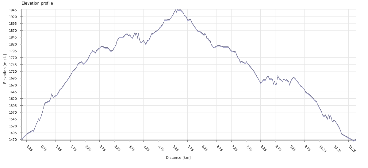
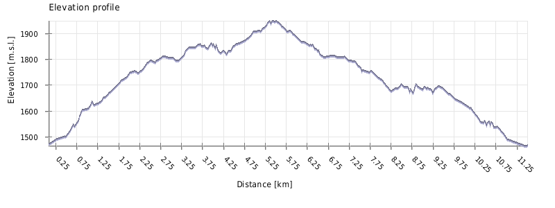
| Distance | 4 km |
| Trail type: | Roundtrip |
| Max. elevation: | 2001m |
| Min. elevation: | 1712m |
| Total climb: | 492m |
| Total descent: | 492m |
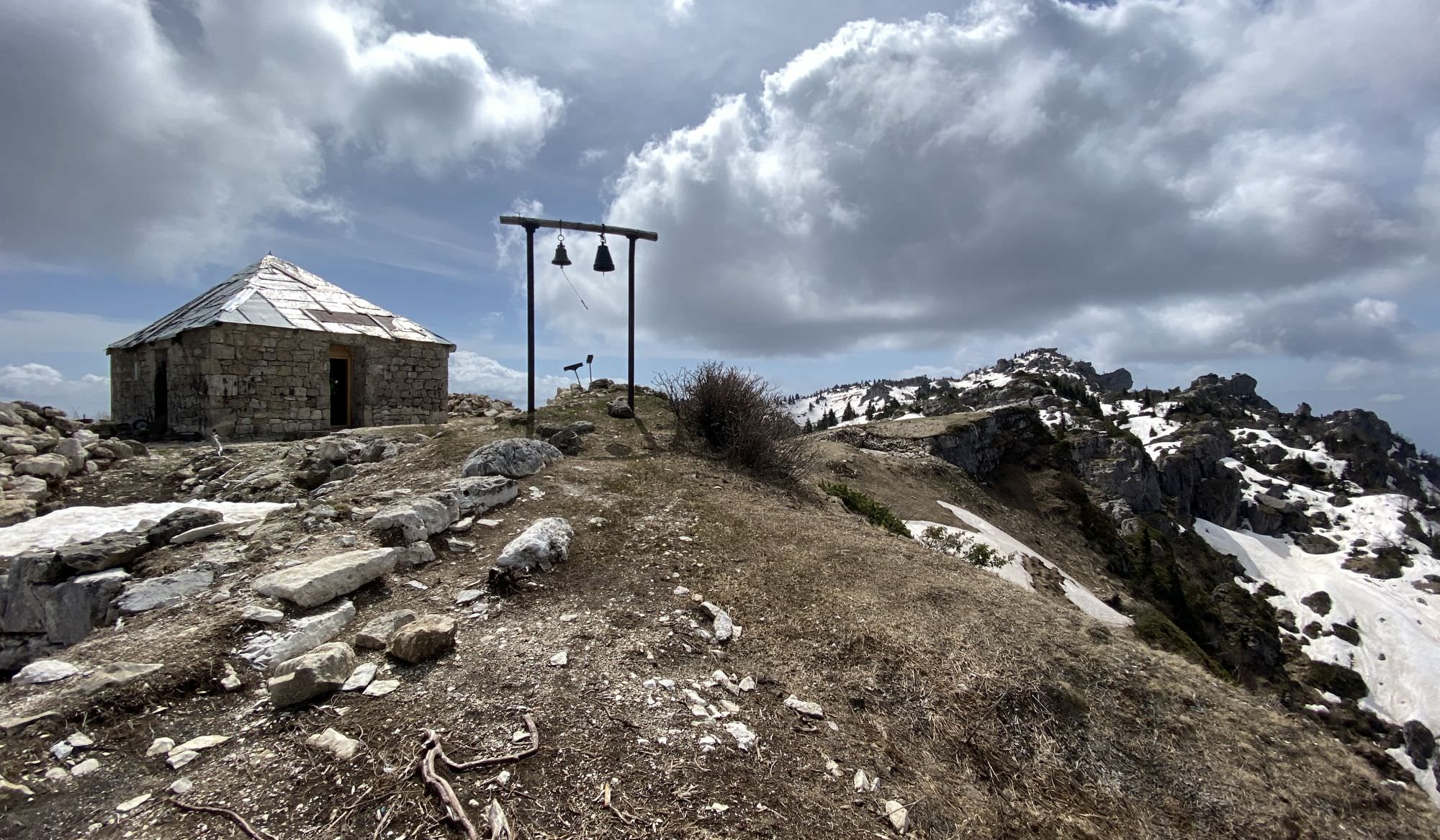
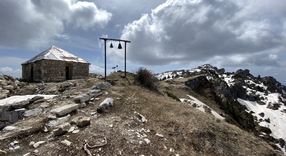
The marked route starts at the parking spot where you will also find water and a picknick area nearby (it's officially marked for camping, but it should not be your priority choice). From here head up through the forest. After about 900 metres of slow ascent, you have the chance to visit the small St. George church before heading to the peak. Therefore, turn right and head up for some metres from where you can enjoy a great view on opposing Askhi massif (about 2.300 metres). Today's building is the reconstruction of a slightly bigger 13th-century church; it is a popular place of pilgrimage on the local holiday "Khvamloba" (Khvamli Day), which is celebrated every year on the 8th Saturday after Easter. Due to the nice view, the surrounding is also a camping option.
Snowy St. George church
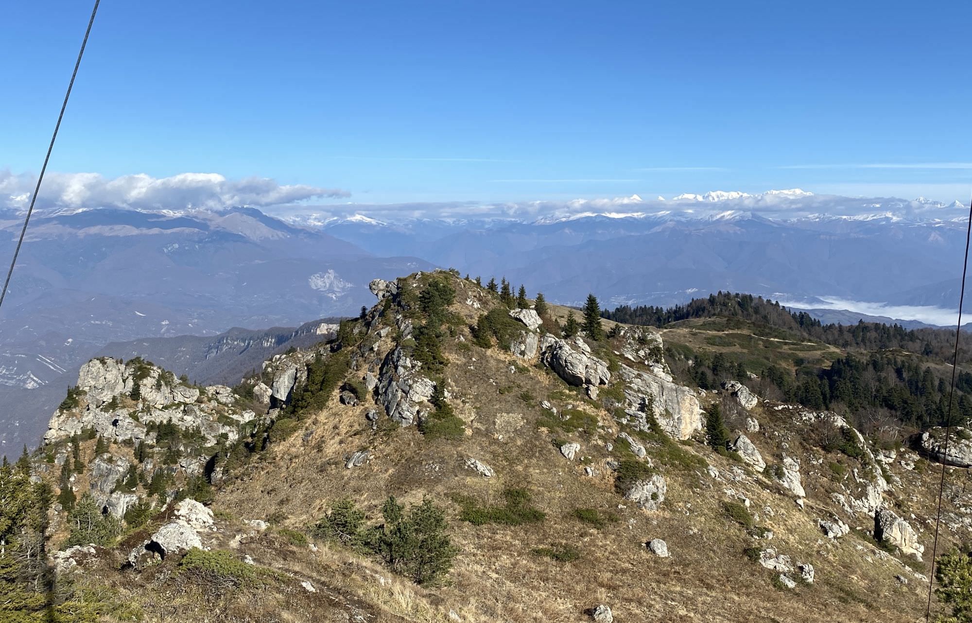
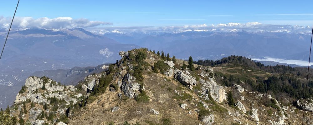
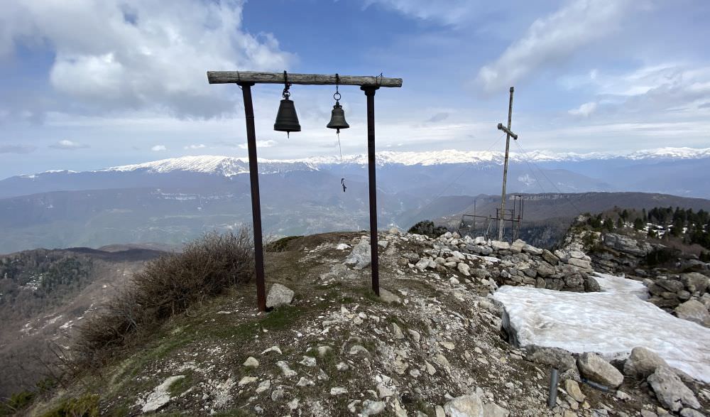
From the church, return to the yellow sign and head southwards through the open area. Some hundred metres later you will reach mixed woodland. Enter and slowly descend into a deep crater and climb it on the other side. The path here is very slippery and narrow, so pay particular attention to where you step; at its end a tiny rocky section is waiting for you. Once out, you will already see the summit cross on an exposed boulder. To reach it, make a small bow downwards on your right side and head up again – you can also walk on the lefthand side, but you'll have to fight your way through rhododendrons on the way.
Mt. Khvamli seen from the distance
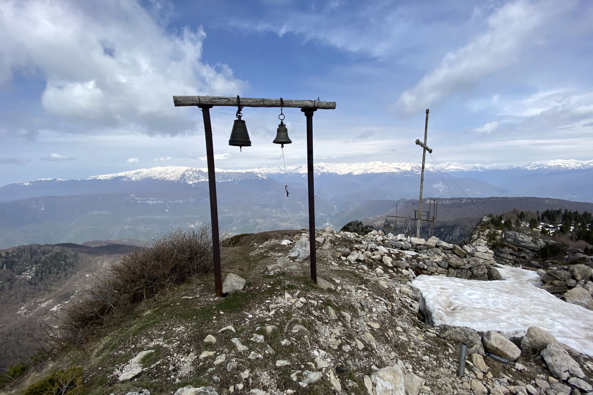
From the top, enjoy the 360-degree view with Kutaisi and the Sairme ridge in the south, Askhi in the north-west, and the Greater Caucasus all over the north. The way back is the same as up and will also take you about one hour.
Coming from the top, before you reach the Okureshi-Tvishi-junction, a yellow sign is indicating the short walk to the well. The path is first heading down into the forest and then up for some metres. There are red-white-red marks, but they are rather easy to miss; so, look out for a small picknick area where you turn right. The entrance to Tekenteri well is under a large beech tree which resembles the rabbit whole allowing Alice to enter another world in Lewis Carroll’s child novel.
The cave below the tree is 16-18 metres deep and housing a well connected to an underground river – especially in spring you can hear the melting snow running through the channels. Back in May 2021, there was a simple mechanism (cup on a rope) to get up some water, but it wasn’t there anymore in November 2022. In general, be careful as the whole is not anyhow secured. Do not enter the well without special climbing gear and an experienced guide.
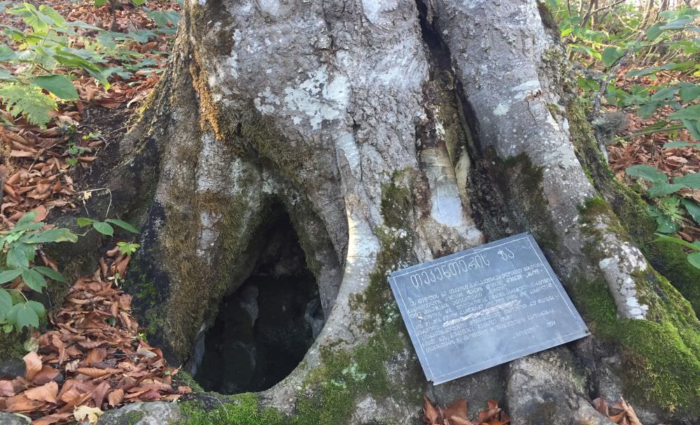
Tekenteri well
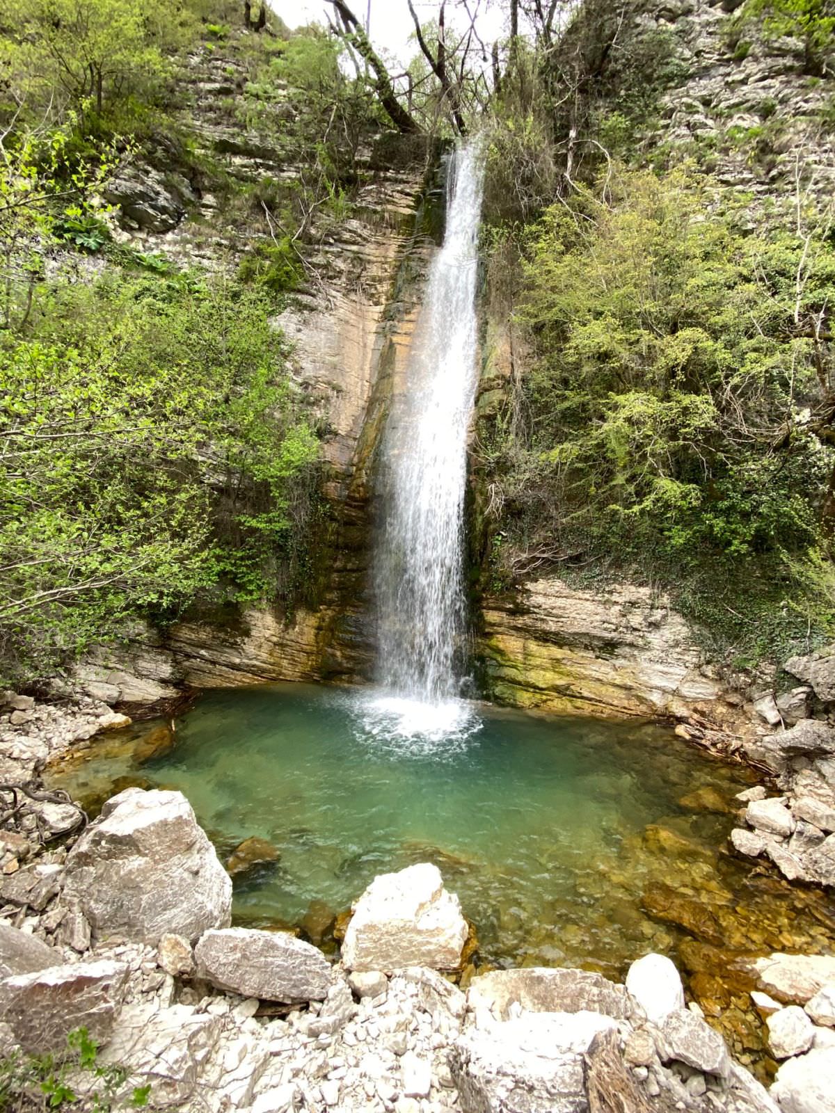
For those who want to hike a bit more and camp, going down to Tvishi might be a nice option. Coming from the top (six kilometres), a small mud road turns right at an elevation of 1.450 m (good camping possibility) and leads you for another eight kilometres down to the vinery village of Tvishi. The route is very easy to follow, passes a small lake and descends through the forest until you reach the Lakhepa waterfall and a hidden lagoon, where you can also camp. Some minutes later you are already at the Rioni river and the Kutaisi-Ambrolauri-road. You can either try this hike in one very long day or split it into two smooth sections.
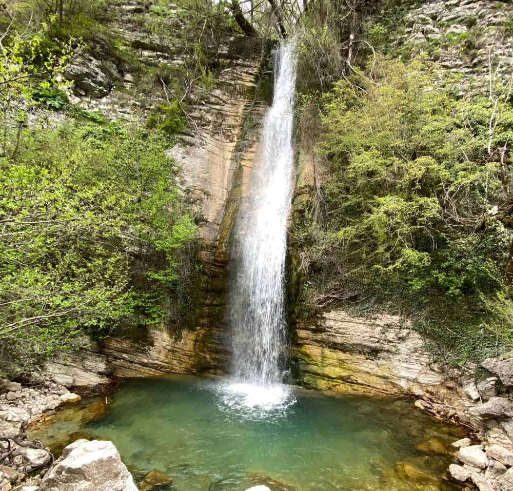
Lakhepa waterfall near Tvishi
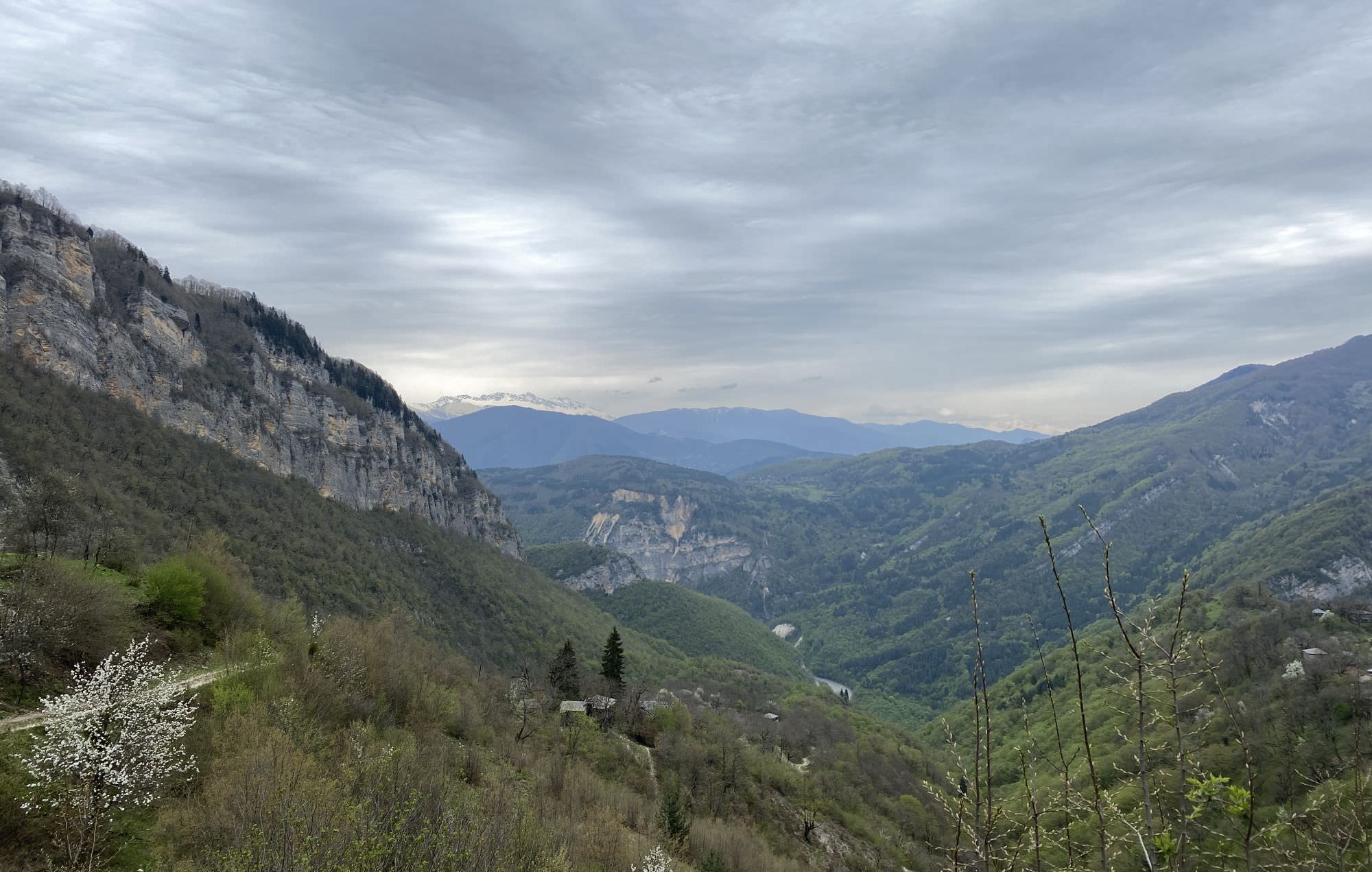
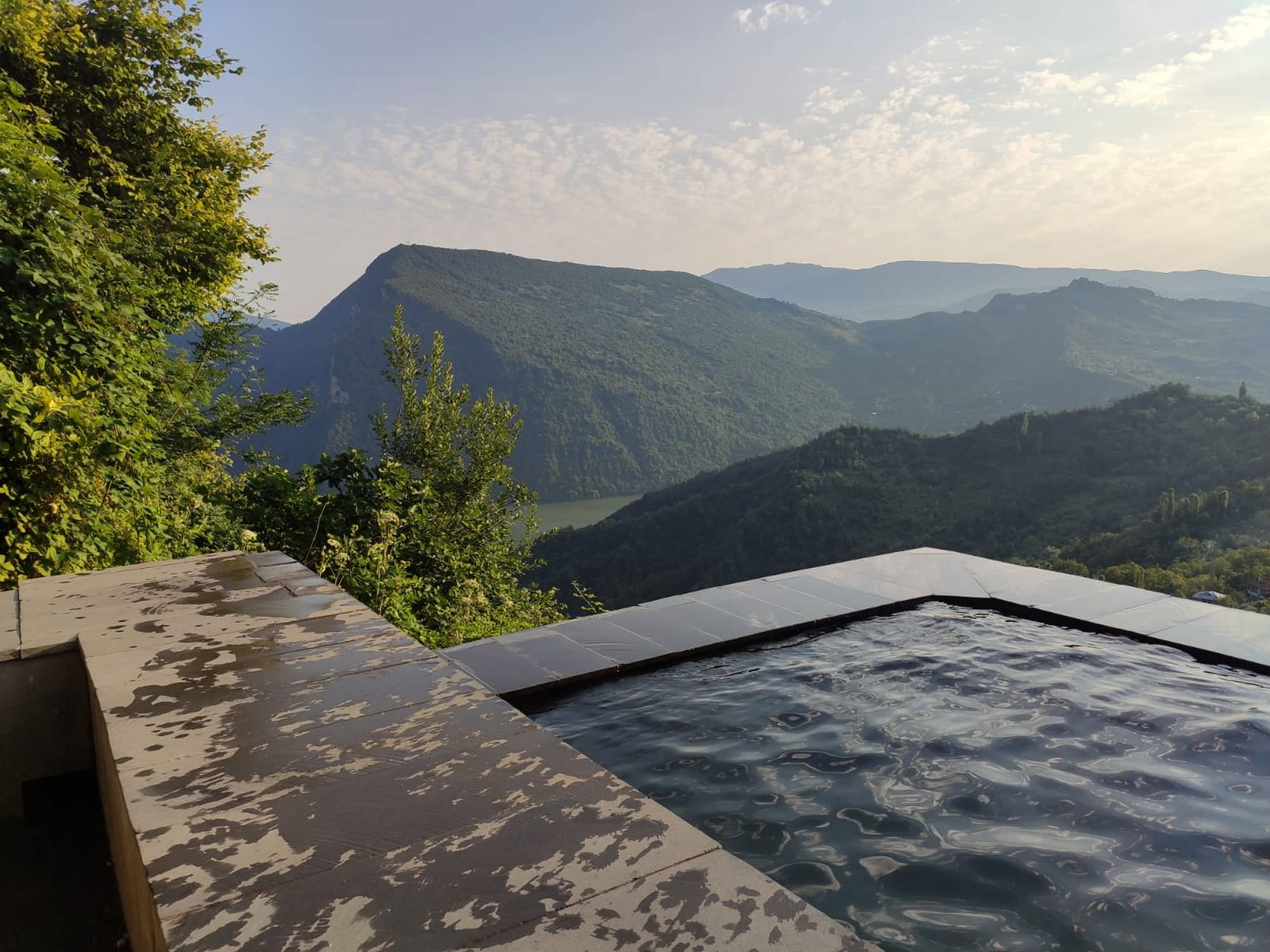
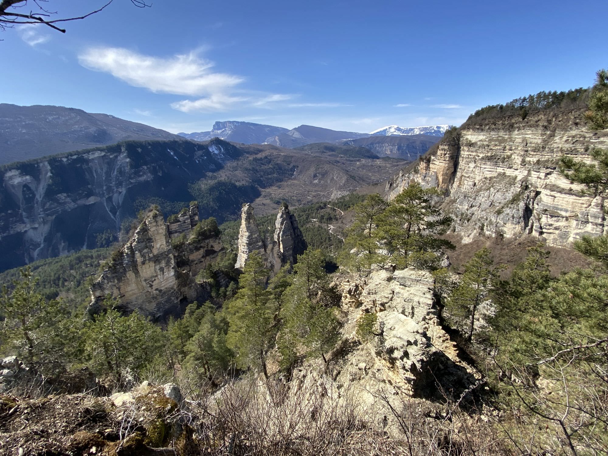
Starting on the same route towards Tvishi, you may turn northwards after already three kilometres and head for the Ghvirishi waterfall further up the Rioni. Passing the villages of Nakuraleshi and Tskhukusheri, you should be able to reach the natural sight after another ten kilometres. From here, you head down to Alpana for another four kilometres where you will meet the Kutaisi-Ambrolauri-road. As you are close-by already, you may also consider a visit to the Sairme pillars or the scenic Lailashi pool. Reaching the waterfall should take you one additional day, discovering all possible sights maybe two.
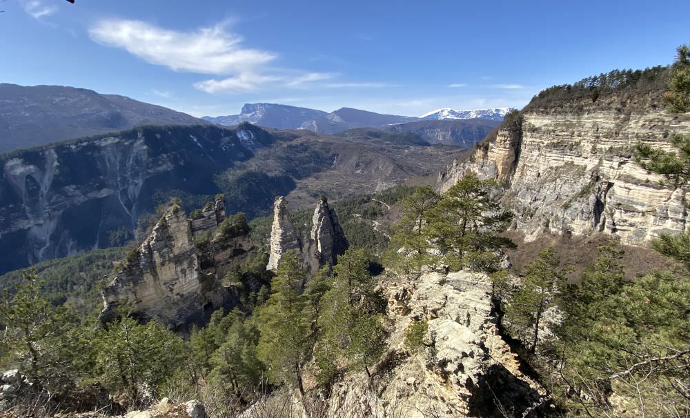
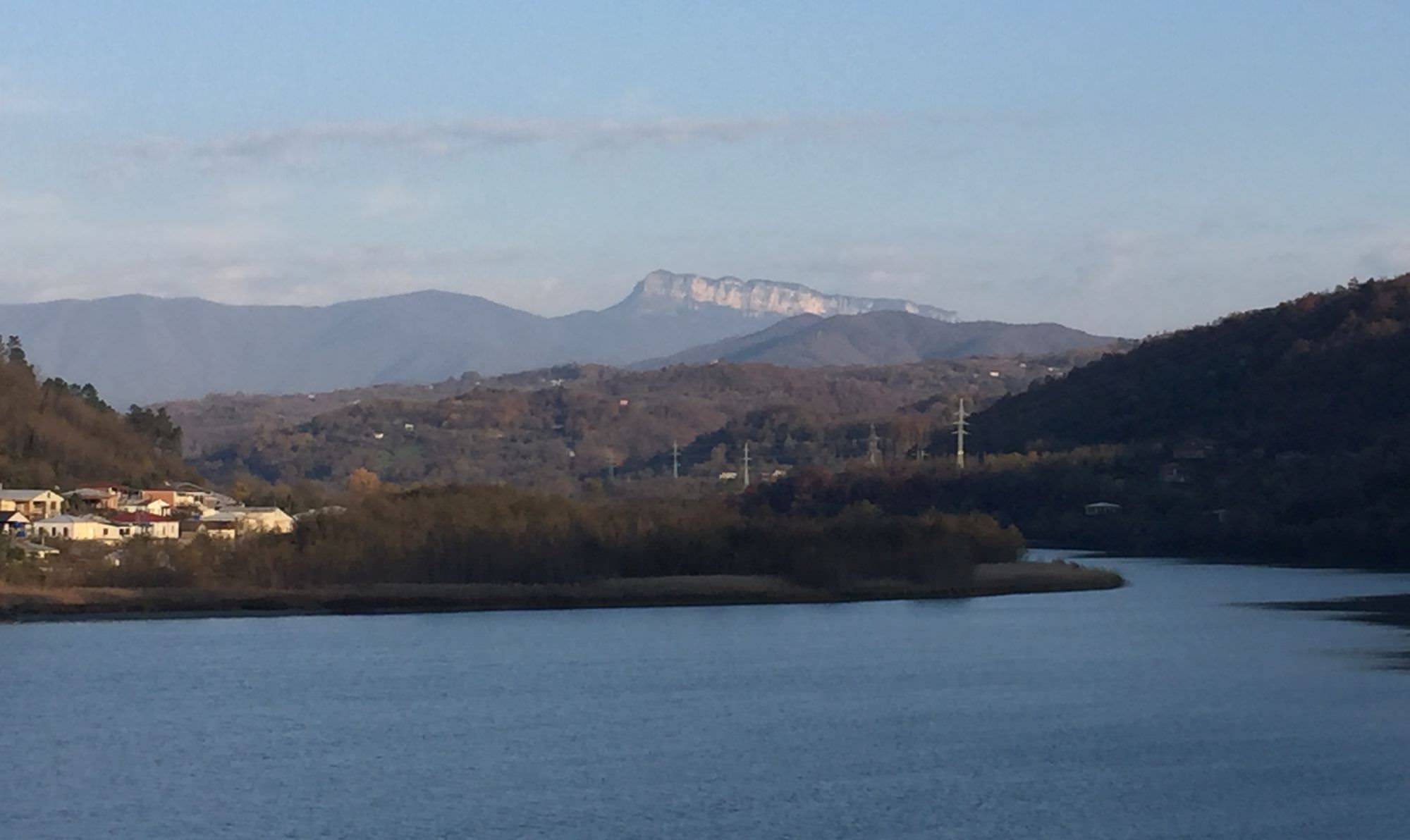
Sairme pillars
Heading down towards Okureshi might be an appealing alternative and allow the ascend of opposing Askhi massif (about 2.300m). Here you may consider a circular trip from Zubi to Kulbaki, to head from the top of the massif down towards the Martvili or Okatse canyons, or to go for the Lebarde lakes. All three options should take you between two and four additional days.
Askhi massif from St. George church
The trail was hiked by Chloé Tremblay and Philipp Bienek, who also provided pictures, gpx and the hike description. Thanks a lot!