A little-known trek connecting the lowlands of Imereti with the rugged highlands of Racha.
This spectacular yet virtually unknown 2-3 day trek highlights the stark changes in Georgian geography as it weaves through thick forests and looming alpine cliffs, connecting the fertile lowlands of Imereti with the rugged highlands of Racha.
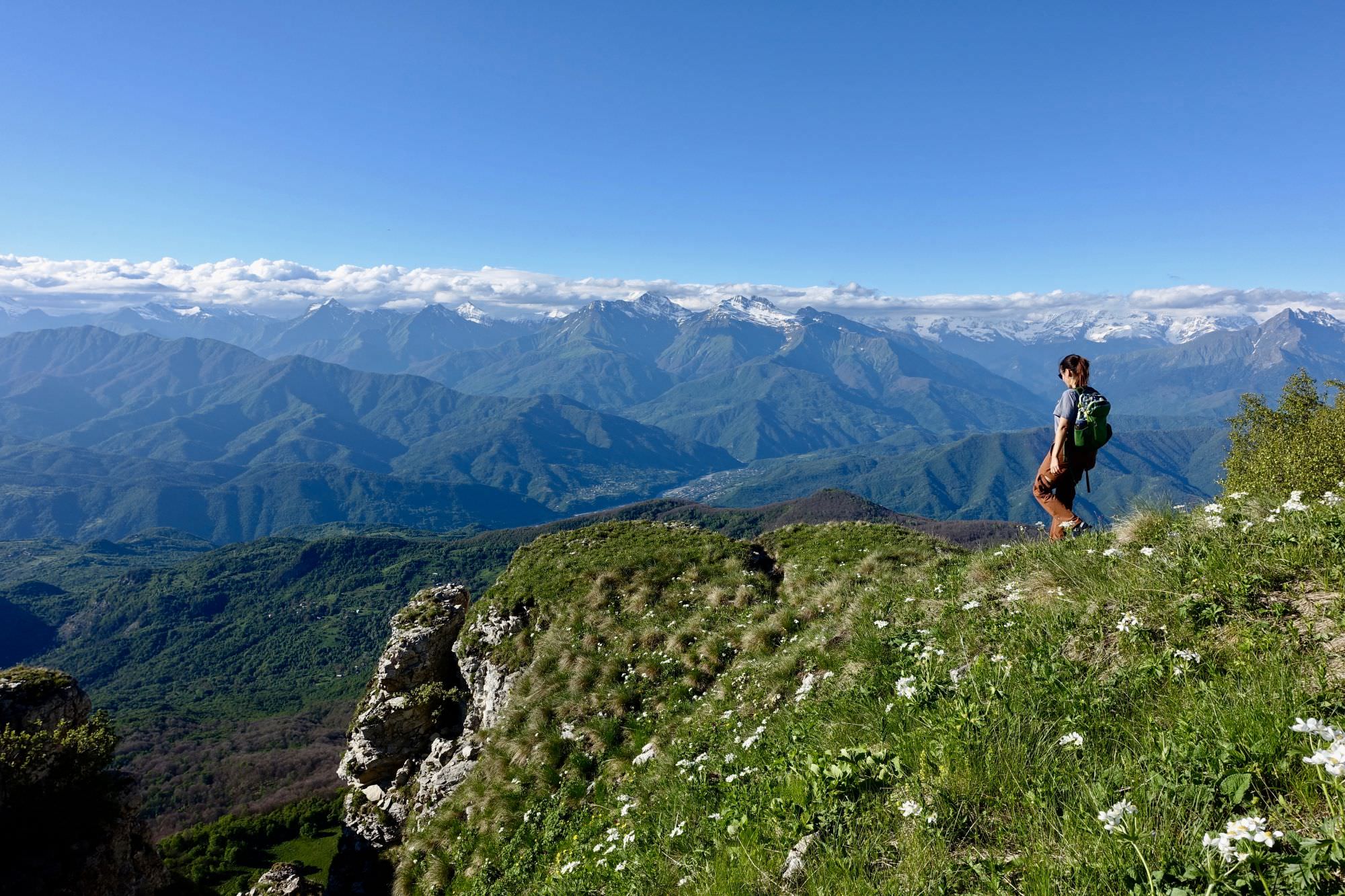
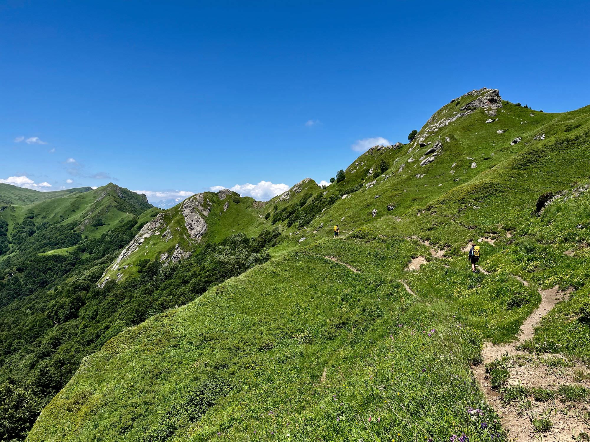
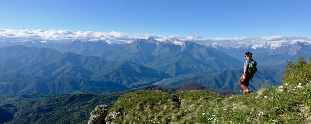
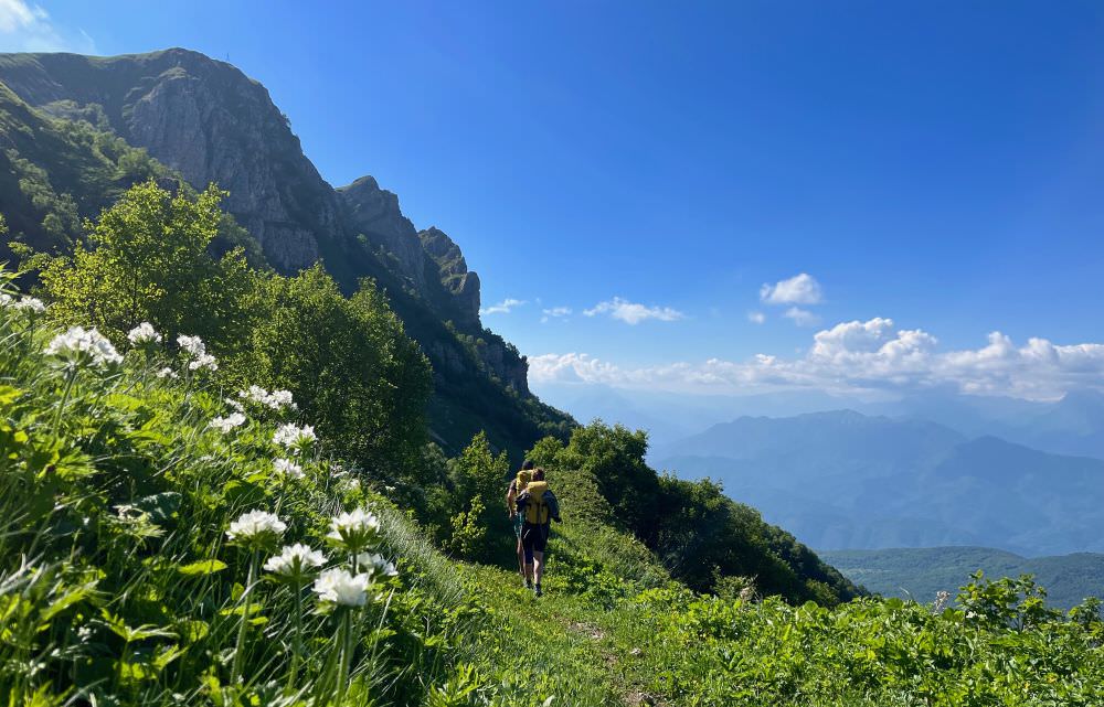
For hikers willing to make the climb, it offers solitude, dramatic views, and a window into a much under-visited part of Georgia. The highlight of the trek is a stunning 10km ridge traverse leading to the King Tamar Cliffs, which grants you sweeping views over the plains of Imereti to the south and the striking wall of the Greater Caucasus to the north.
This trek is part of the new Imereti-Racha section of the long-distance Transcaucasian Trail (TCT). This 50km section works well as a stand-alone trek, but you can also connect this hike to more of Imereti’s lowlands in the south and (in coming years) to Svaneti in the northwest. See more here.
The trek follows old shepherd trails, which were scouted and improved by the TCT team between 2021-2022. In summer 2022, TCT crews cleared the section between the King Tamar Cliffs and Korta, making the forest easier to navigate. However, the trail is still unmarked and mostly unmaintained. Its condition is generally good, but hikers should be ready to navigate based on their GPS track.
Most hikers will need 2-3 days, depending on when you start and where you camp. The trek involves a substantial climb, so for many hikers it may make sense to break it up into 3 days. However, you need to be strategic about your campsites, because once the climb starts, both flat spots and water are rare. See more info about campsites in the notes and map.
For the most part, this route is straightforward, but you need to be comfortable navigating based on a GPS track without markings. The terrain is nontechnical, but some route-finding is required and parts of the hike are steep.
Physically, the difficulty can vary depending on how much time you allocate. If you're used to long days of climbing/descending (2000m+), 2 days is perfectly manageable, but the days are pretty long and demanding. If you prefer a more relaxed pace, breaking up the hike into 3 days will reduce the difficulty significantly.
This trek works well in both directions. Personally, I prefer to start at Imereti (Drbo village) since the transition from the lowlands to the highlands is always more dramatic and the first views of the Greater Caucasus as you crest the ridge – extra rewarding. However, hikers who tested this route in both directions gave very positive reviews.
There are a few springs closer to the end points of the trail, with the last piped springs being 8km from Drbo and at the top of the village in Korta. Nearly everything else along the way is seasonal sources. These are usually flowing nicely in May and through, but by the second half of July, many will already be dry. The exception is the bigger stream in a small valley up on the cliffs (at km 29 coming from Drbo), which hikers have reported using as a camp spot through autumn.
Plan accordingly– after early-mid July, you should not plan to rely on these seasonal sources. You should be prepared for a long water carry and potentially dry camping.
If need be, there is an alternate route marked in the gpx log, which takes you back down into the forest to a river valley. This is a good alternate to know about if you get desperate for water or if you encounter bad weather.
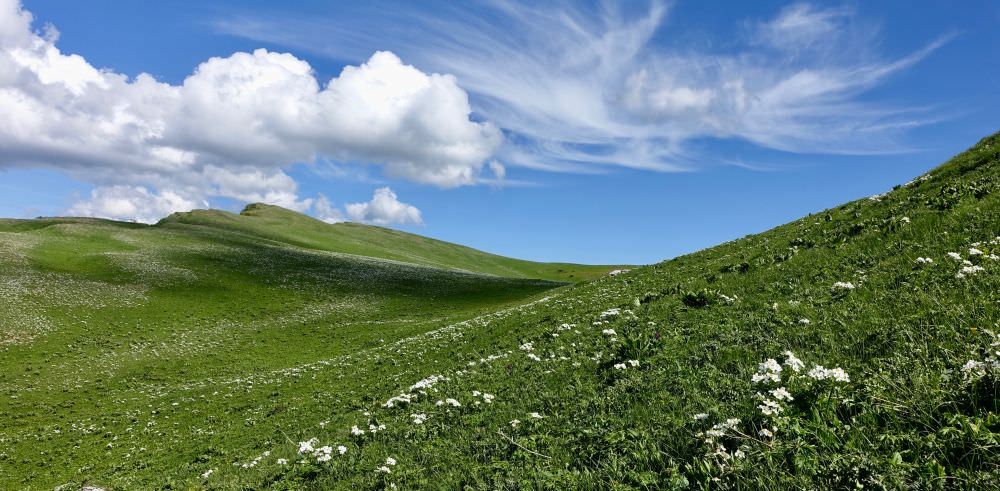
Wildflowers on the ridge in early June
Wild camping will be necessary along this route. See the GPX track for some suggested campsites. Note that there is a long stretch of the climb without any water sources, so you need to be prepared to either stop early and camp by one of the sources near Drbo, dry camp along the way, or make it all the way to the suggested camping location up on the ridge at kilometer 29.
There are several guesthouses in Oni, as well as a few in Sachkhere (a 20-min drive from Drbo).
Like other parts of the Caucasus, snow can linger until June and start falling as early as October. However, the comparatively lower elevation of this hike (max: 2300m) makes it a good shoulder-season option when the higher passes are not yet open or when snow is starting to fall at higher elevations. Do keep in mind that the higher-elevation parts of this route are also on some very steep slopes, so they should be approached with extreme caution in the event of snow.
Spring tends to arrive in April/May. From May until July the hillsides are an explosion of wildflowers and you get striking views of the snow-capped Greater Caucasus, making it a particularly dramatic time to hike the route. Water from seasonal springs is also more abundant during this time, reducing the need for long water carries. But by the same coin, you’re more likely to encounter early-summer thunderstorms and muddy conditions.
From July to August, the hillsides start to dry out, and by the second half of July, many of the seasonal water sources will already be dry. Plan accordingly– you may need to be prepared for a long water carry and dry camping. High summer can be very hot during the middle of the day, especially at lower elevations.
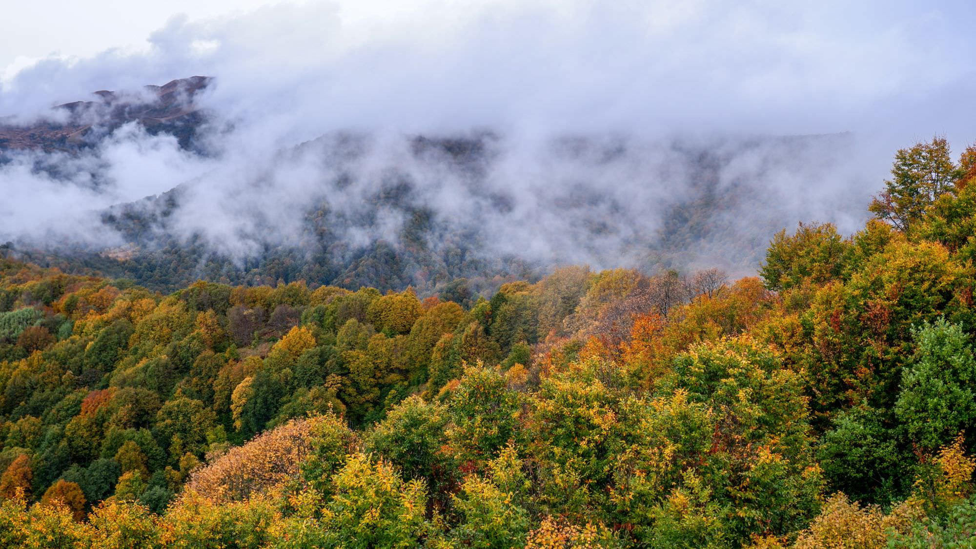
The autumn colors, cooler temperatures, and slightly more stable weather make September to October another particularly good time to visit. Racha is known for its autumn colors and the lush, deciduous forest that covers large sections of this route is dramatic in fall, as are the views on the already snow-bound Greater Caucasus. Again, keep in mind that many smaller water sources that are flowing in early summer will be dry.
The months of November to April usually see the higher parts of this landscape covered in snow. Winter hiking is likely to be possible on the lower parts of the route in the forest, but of course dependent on the amount of accumulated snowfall at any given time, which can vary from year to year. The upper sections of the route near Shkmeri are becoming known for ski touring, with several good potential routes around depending on conditions.
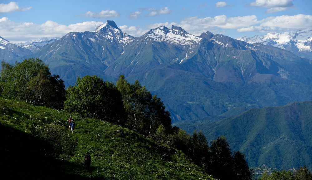
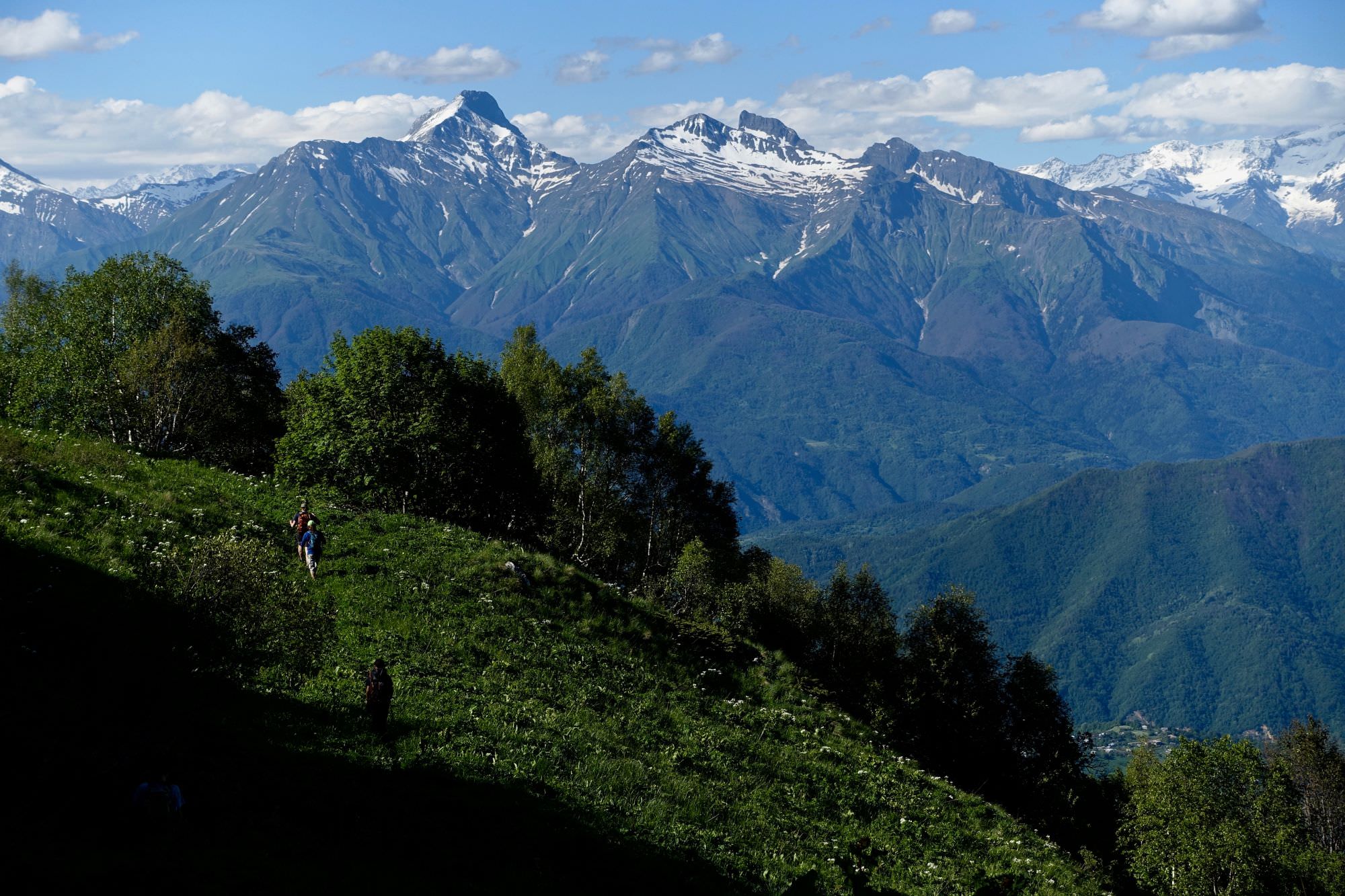
Close-up of mountains of Racha during the Imereti-Racha trek
Drbo is a 20-minute drive from Sachkhere, which is easily accessible from Tbilisi or Kutaisi via marshrutka. Bus from Tbilisi leaves daily at 9 am from the Didube bus station (final destination being Oni in Racha) for about 25 GEL. From Kutaisi, there is a daily marshrutka to Sakhere departing from the bus station situated behind McDonalds. It runs from 7:40 till 17:00 in 40-minutes intervals, the ticket costs 8 GEL.
Once at Sachkhere, you can hire a taxi for the rest of the trip or hitchhike along the road. It is only 10km, so you can also walk.
Your best bet is to hitchhike to Sachkhere or arrange a ride in advance. Hitchhiking should be easy, given that nearly everyone traveling out of Drbo will be passing through Sachkhere.
There are several marshrutkas during the day, leaving mostly in the Kutaisi direction (with at least one going directly for Tbilisi). First one leaves around 7 am from the bus station situated at the roundabout by the city entrance, right behind the bridge. Then there are another ones leaving at 9 am and 3 pm. I strongly recommend to ask your landlord to make a call and reserve a place for you, since they often get quite full.
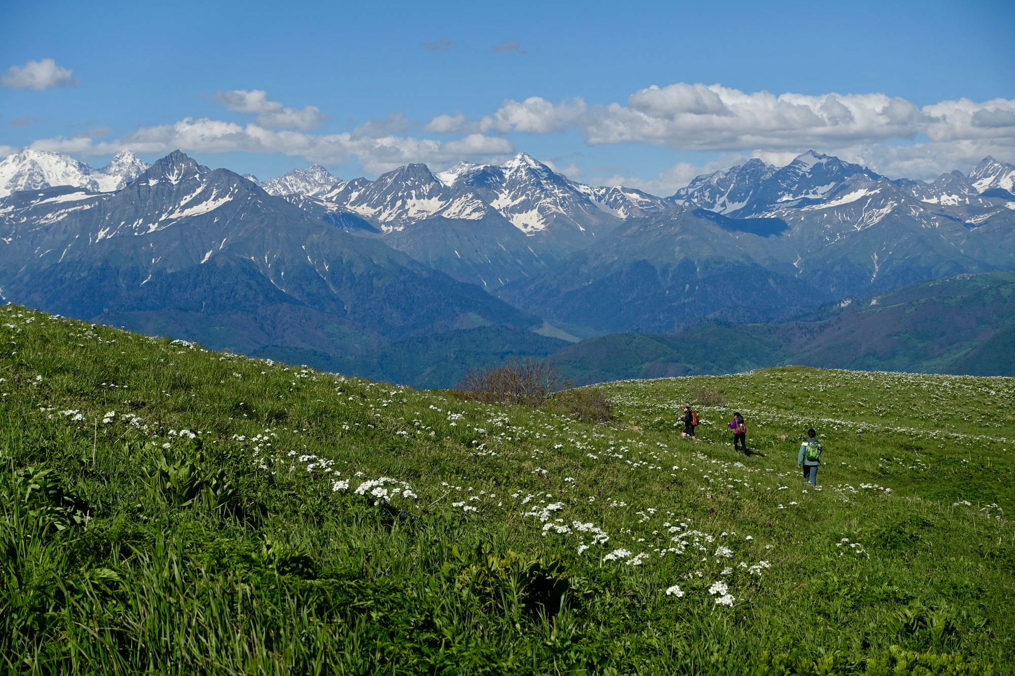
Views along the route
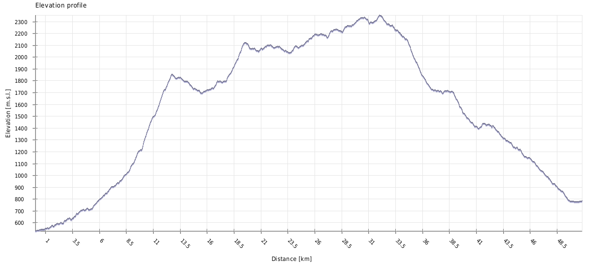
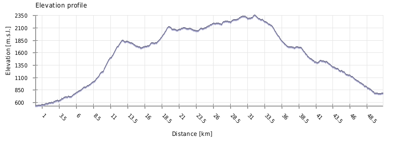
| Distance | 51 km |
| Trail type: | AB trip |
| Max. elevation: | 2353m |
| Min. elevation: | 528m |
| Total climb: | 2540m |
| Total descent: | 2280m |
Can be split into 2 days to break up the climb, particularly if you start later in the day and want to stop earlier, or if you plan ahead to dry camp in between water sources.
From the Drbo village shop, turn north and follow the road on the west bank of the stream that runs through the village for 1.4 kilometers. Look for a turn towards the northeast where cars drive through the stream. Turn here, and look for a footpath following the west bank of the stream.
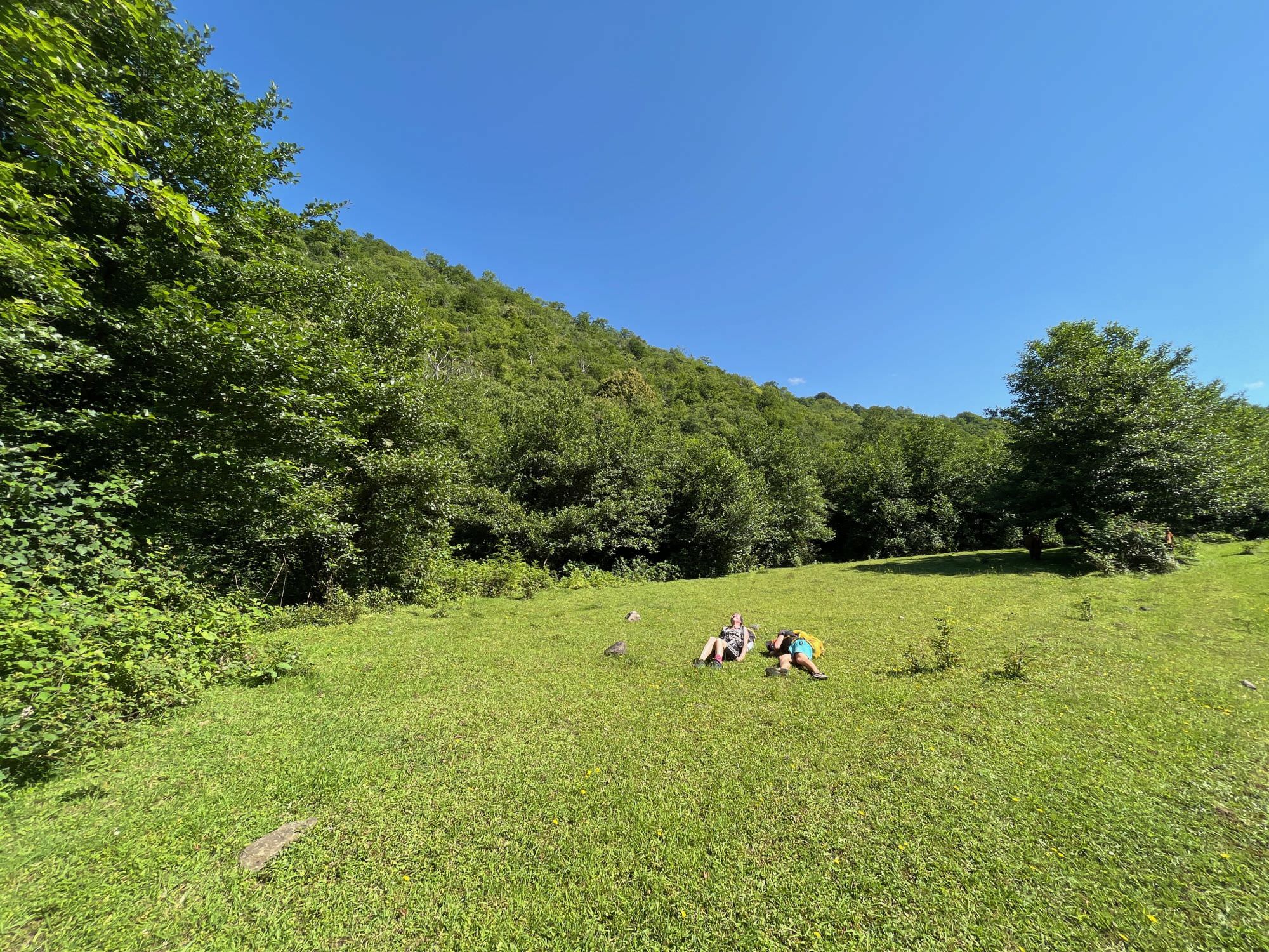
Be prepared for several stream crossings in this section. The path mostly hugs the west bank and there are a few small footbridges, although you will still have to cross the stream back and forth a few times. Roughly 2 kilometers after turning off the main road, you’ll see a nice camping spot in a flat field close to the river. This would be a good place to spend the night if you’re arriving late.
After another 2 kilometers, you'll pass a shepherd hut with a nice picnic shelter, which is sometimes used by locals. The fields around the hut are also open and would be nice for camping (of course, you should ask permission if anyone is nearby). There is a spring nearby– continue a few hundred meters on the trail (which is now a jeep track and can be quite muddy after rain). Where the jeep track turns a corner and heads east, look about 10 meters upstream for a small spring piped from the ground.
You would be wise to fill up here– after this, you will pass a few other small streams and a few very small springs along your way over the ridge, but this is the last piped spring until Korta. In addition, there are other water sources noted ahead that you can treat, but they are unreliable in the second half of the summer and autumn. The bigger sources– e.g. the large stream up high on the ridge near Skhmeri – should be running. The other sources were small in early July 2022 and dried up a few weeks later.
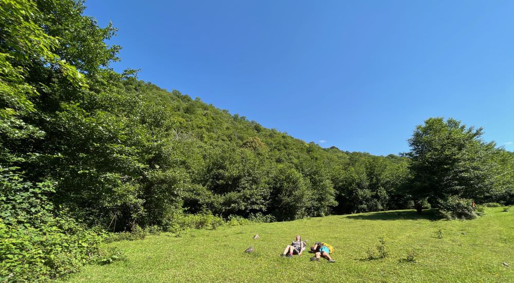
An ideal camping spot near Drbo
Continue on the jeep track. Another 2km after the spring, you will pass another field that would make a good camping spot if needed. There is a seasonal stream a little ways ahead.
500m after this field, you’ll come to an intersection. Turn slightly left instead of continuing to follow the main jeep track. The path will lead toward a stream and follow a nice singletrack through the forest. However, although the singletrack path continues, look for a sharp switchback turning uphill to the left. Instead of following the path along the bank of the stream, you need to turn uphill and start climbing.
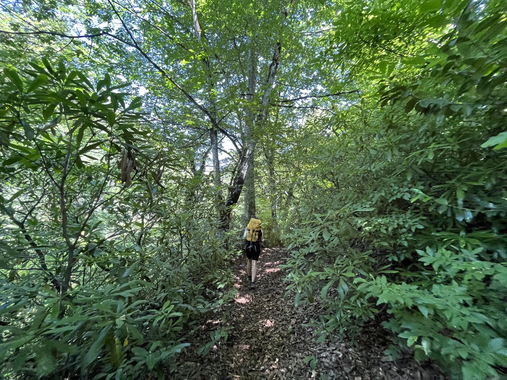
Now the real climb starts, as you start to gain elevation through a beautiful old forest. Soon you’ll come by the remains of an old building partially taken over by the forest– a nice spot for a break.
Continue along the path to the west of the ruins. It will take you on a nice stretch of singletrack through rhododendrons. Soon you’ll turn to the west, crossing a stream (running on July 7, 2022). Aside from a few small seasonal streams, this is your last chance to fill up with water until you get up high on the ridge towards Shkmeri.
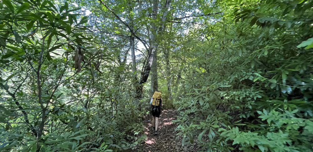
Climbing through the forest
Shortly after, the trail gets somewhat overgrown, then rejoins an intersecting network of jeep tracks. Turn north. The next 4 kilometers are a relatively steep climb, but the path is clear. After you reach the ridge, you’ll start gently dropping down into the next valley. After a kilometer you’ll pass another flat spot that could be used for camping (and clearly has), but which has no water source.
About a kilometer after that flat spot, you’ll come to a jeep track intersection. Follow the track continuing straight. If needed, at this intersection there is an alternate route that veers slightly west and goes down to the bottom of the river valley. If it is a dry season and you need water, this can be a good alternate instead of going straight up to the ridge; this jeep track rejoins the ridge at a later point, but you’ll add more climbing and skip some of the first great views. Unless you need water, continue along the ridge track, soon turning towards the northeast.
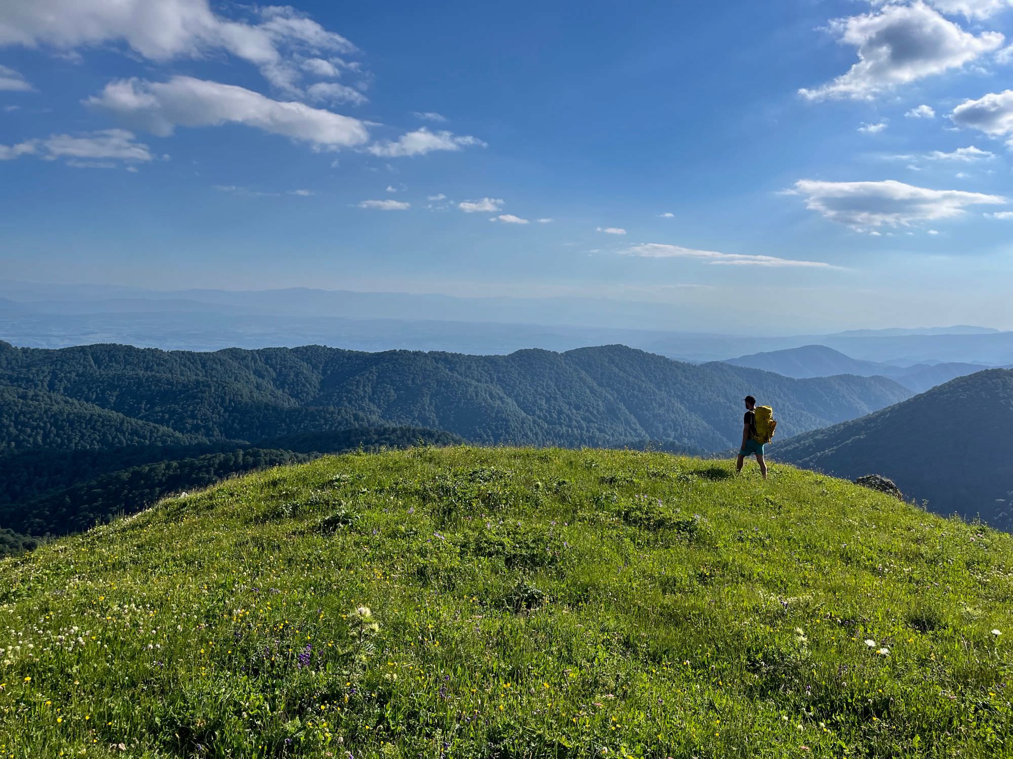
Get ready for the next climb: From this ridge, you will continue northeast and gain 300m of elevation quite quickly. This time you’ll be well-rewarded, however; you’ll crest above the trees and get sweeping views of the plains stretching south through Imereti.
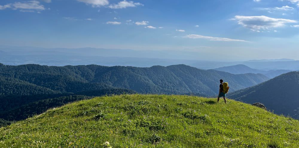
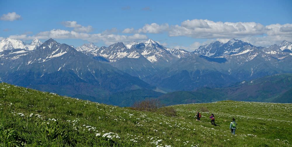
Admiring Imereti
Once you reach the top of this ridge, the trail becomes much less steep, instead following the contour lines of the ridge along some singletrack and animal tracks that weave in and out of the forest. Shortly after you pass a ruined shelter, you’ll turn towards the northwest to continue to follow the ridge. As you follow the curve of the ridge, earlier in the year you may find some small water sources, but don’t count on this later in the summer or fall.
Soon you’ll climb out of the forest and come to a small meadow. Continue straight across. There are a few intersecting jeep tracks (one goes down to the river valley, which joins the other alternate path mentioned earlier), but you want to continue straight. You’ll pass a small farm.
One kilometer after the farm, and then again half a kilometer after that, you’ll pass two small seasonal springs on the ridge (running in early July 2022, not running in August 2022). They are both quite small and hard to fill up water bottles from; you’ll need something with which to collect water. These will almost certainly be dry by mid to late summer.
As you continue along the ridge, about 2 kilometers after the second spring, you’ll see a larger stream in the bottom of the small valley to the south. This is a more reliable source. You can also find nice camping spots near the stream in the wide and grassy terrain. This is a great spot to break up the hike. However, even though this area is slightly sheltered relative to the ridge, keep in mind that it is still quite high and exposed and would not be pleasant during a thunderstorm.
Following the ridge
Can be split into 2 days to break up the climb, particularly if you start later in the day and want to stop earlier, or if you plan ahead to dry camp in between water sources.
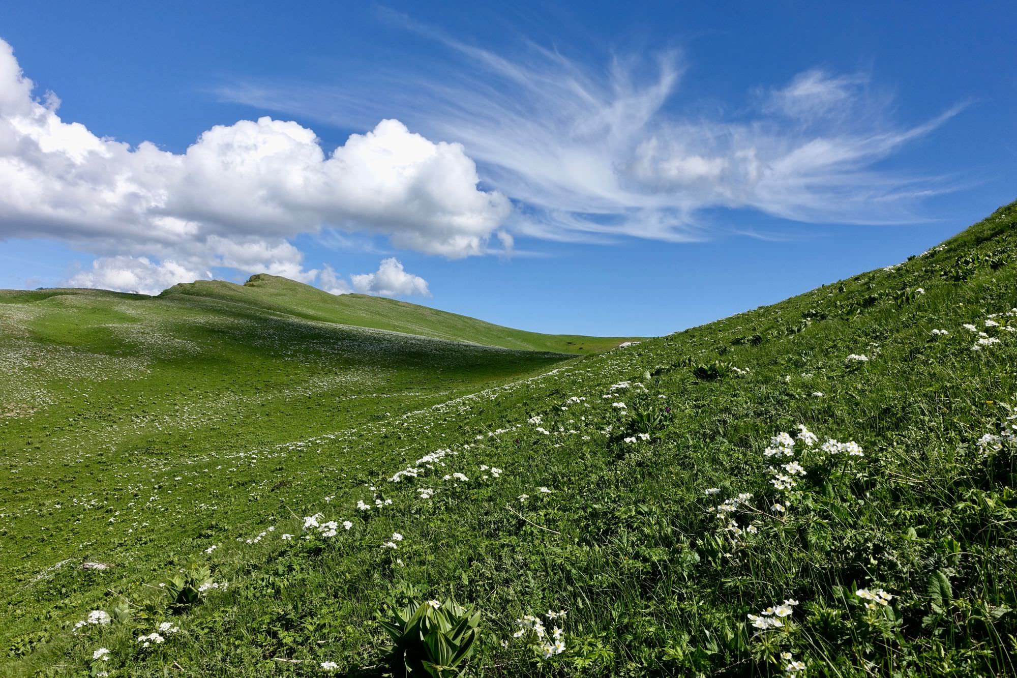
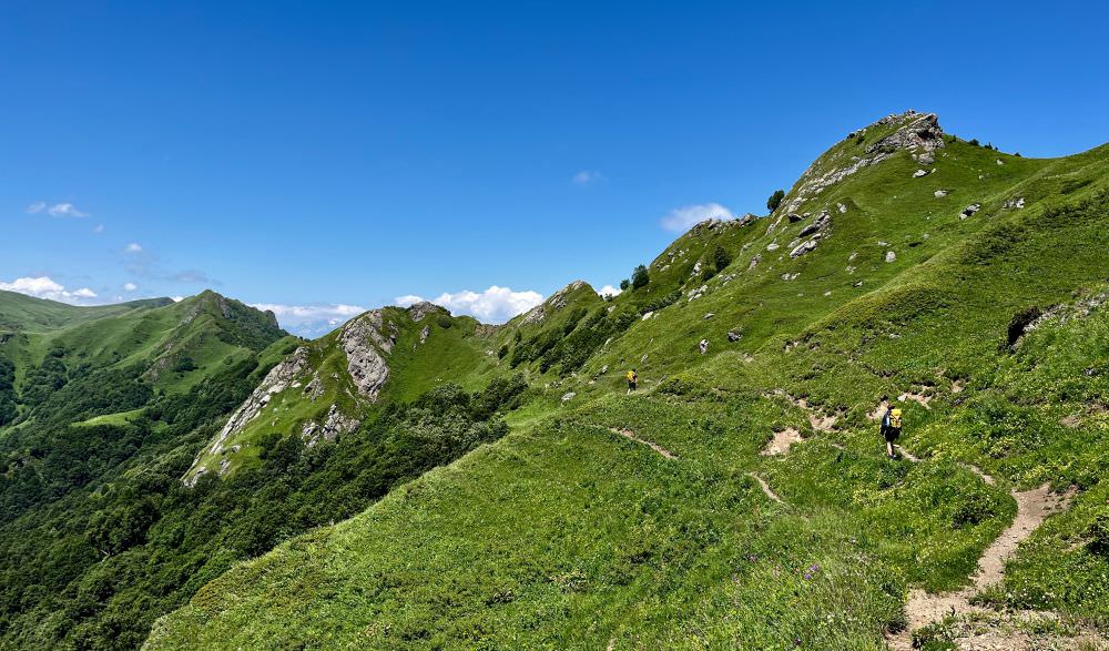
Continue on the ridge; the path alternates between top of the ridge and contour lines on the side. When the ridge widens out into more open terrain, the trail disappears into grassy wildflower fields, but it’s straightforward to continue following the ridge. Enjoy the wide views of the Greater Caucasus range to the north!
As you near the end of the ridge traverse, you'll approach the distinctive King Tamar Cliffs. Keep an eye out for a small trail turning down below the cliffs on the northern side.
Beginning of descent from King Tamar Cliffs
The small trail weaves through rhododendron bushes and traverses below the cliffs before turning north and beginning a steeper descent. At times it gets a bit overgrown, but overall the path is straightforward to follow. As you descend into the forest, you'll spot occasional orange trail flags; these are from the TCT crews who cleared the route in June 2022.
In the forest, the trail turns northwest– keep an eye out for the trail flags. The trail weaves through an old forest with widely dispersed trees, staying on small ridges where possible above the muddier lower ground.
Close to Korta, you’ll exit the forest into a beautiful clearing with an excellent view of the cliffs you just descended. (You may even see a wooden camp table crafted by the 2022 trail crews.) This would make a good spot to camp. There is no water directly nearby, but the spring at the top of the village is a short walk.
![View on Greater Caucasus towards Oni from alternative path in winter]](/Images/Treks/ImeretiRacha/09_KortaCamp.jpg)
Nice campsite near Korta
Continue to Korta. There is a spring immediately as you enter the village.
Follow the jeep track through Korta. It may be possible to hitch a ridge out from here to Oni, or you can continue walking along the dirt road. It is another 10km to the center of Oni. You’ll pass through the villages of Khirkhonisi and Komandeli along the way, both of which have springs.
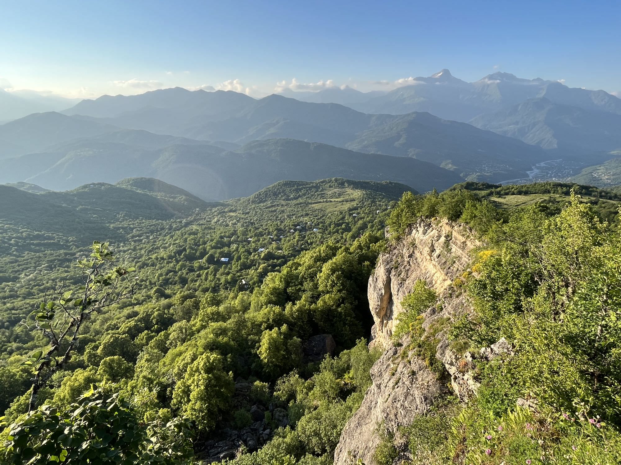
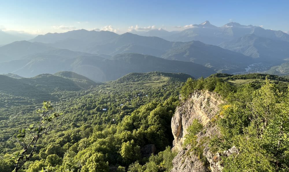
Between Korta and Khirkhonisi, just off the main road, there is an excellent viewpoint with views of Oni, the surrounding mountains, and the river valley. It is a very short walk and highly recommended.
Continue walking into the center of Oni. Congratulations!
Viewpoint on the way to Oni
This trail guide was written by Meagan from Transcaucasian Trail team. An extra thank you to the volunteers who worked to open up this section. You can learn more about the project and how to get involved as a volunteer at the TCT website.