Smooth half-day hike with great views for those who want to see more than Gergeti.
It’s true, going up to Gergeti Trinity Church and from there further to Altihut and the glacier to enjoy the breath-taking views on Mt. Kazbeg is a must-do when visiting Stepandsminda. Nonetheless, there is more to explore in the neighbourhood such as the Gveleti waterfalls, the less known Arsha-Gergeti-route, Arsha valley with its waterfalls, ruins and wonderful views on Mt. Arzi (3.963m), as well as the nearby village Pansheti (caves, towers and mineral springs), which can be easily combined with this half-day hike.
You may need three to four hours to explore the Arsha valley, take a bath in at least one of the waterfalls and make a panoramic picknick. If you feel like more, you can explore close-by Pansheti or even head up to Geregti glacier and make it a one-day adventure.
The valley tour is a smooth undertaking. Anyhow, sturdy footwear is always recommendable, especially for the way up and the exploration of the Toti ruins.
As long as snow allows, this hike should be manageable all-year-long. But as diving into the waterfall(s) is part of the adventure you should focus on the summer and autumn months; ideally even late in the season on the last warm days to avoid too high vegetation.
If you intend only to do the valley round, just ask yourself if you want to bath first or refresh yourself at the end of the hike. In case you choose this hike as a more scenic and exciting start for your climb up to Gergeti glacier, then turn north-east to the waterfalls and join the main route later.
Looking for a place to stay in Stepantsminda before the hike?
These are my favorite guesthouses.
Getting to Arsha is easy, assuming you are starting from Stepantsminda. You can either hitchhike or take a taxi - since the route is only 6km long, you shouldn´t pay more than 20 GEL.
If you want to take taxi from Arsha, better get some phone numbers in advance at Stepantsminda since getting it here might not be easy. Of course, you can also hitchhike - the traffic on the Georgian Military Highway is quite intense, so you shouldn´t wait for long.
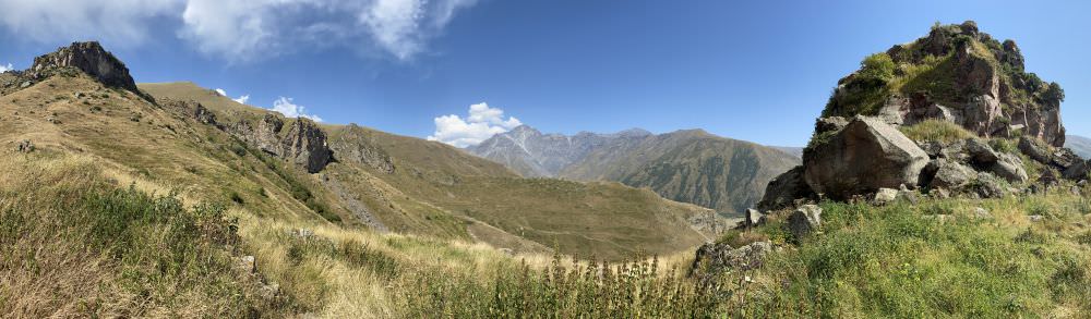
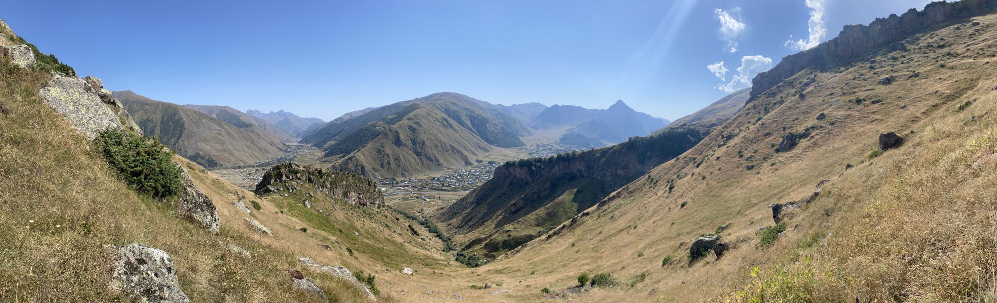
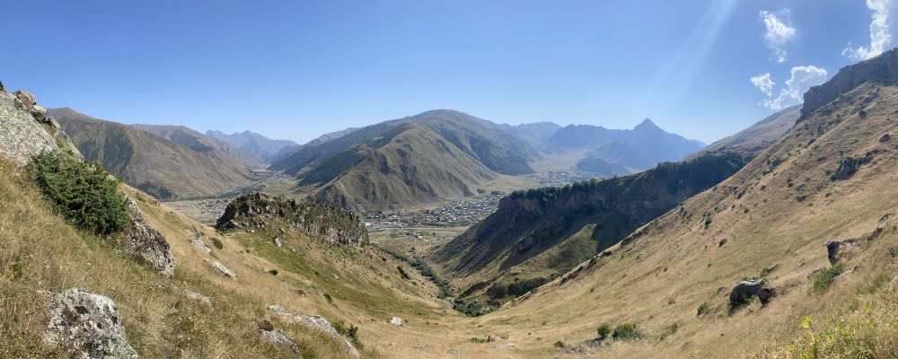
Views from the plateau above Arsha
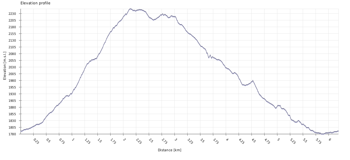
| Distance | 6.2 km |
| Trail type: | Roundtrip |
| Max. elevation: | 2247m |
| Min. elevation: | 1780m |
| Total climb: | 615m |
| Total descent: | 615m |
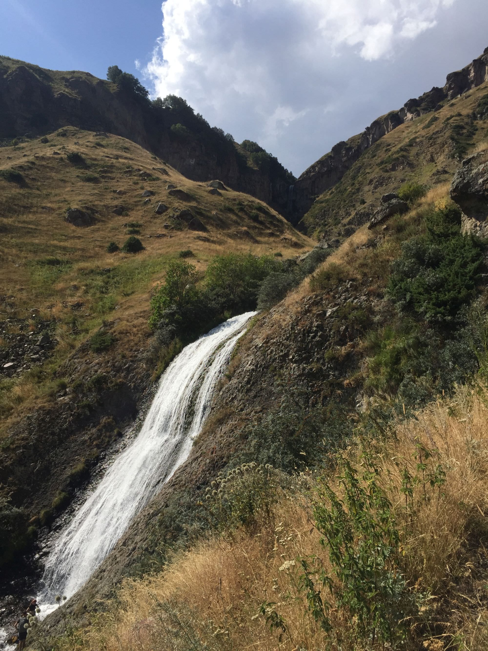
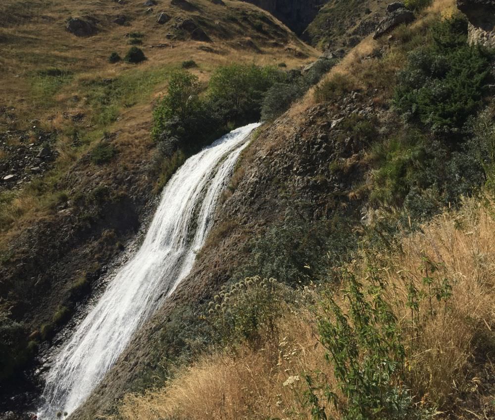
Coming from Arsha bridge head straight until a small crossing, where you can also leave your car, which makes it a good starting and ending point for today’s round trip. Head right if you want to see the waterfalls first and follow the street until the small Arshistskhali river, where you can normally also find many locals bathing and making barbeque. Cross it over a makeshift bridge and follow the small path in parallel to the stream for about ten minutes until Arsha waterfall. The pool around it is deep and wide enough to take a proper dive in – just be careful, it’s slippery.
Woman’s Hair waterfall is further up the same stream and less accessible. If you want to get a better view on the long water strains which resemble open long hair, you can choose either side of the river and come back to the main path later.
Woman's Hair waterfall above Arsha
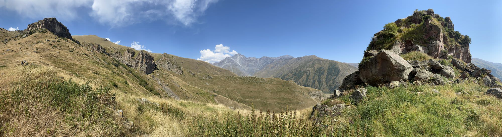
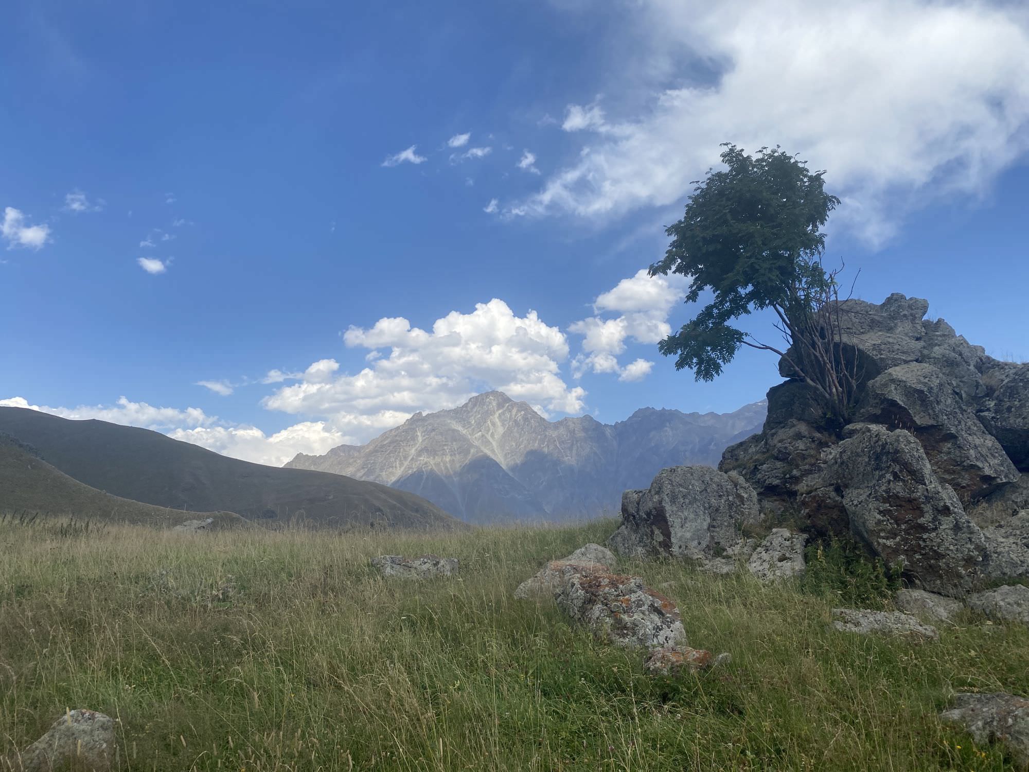
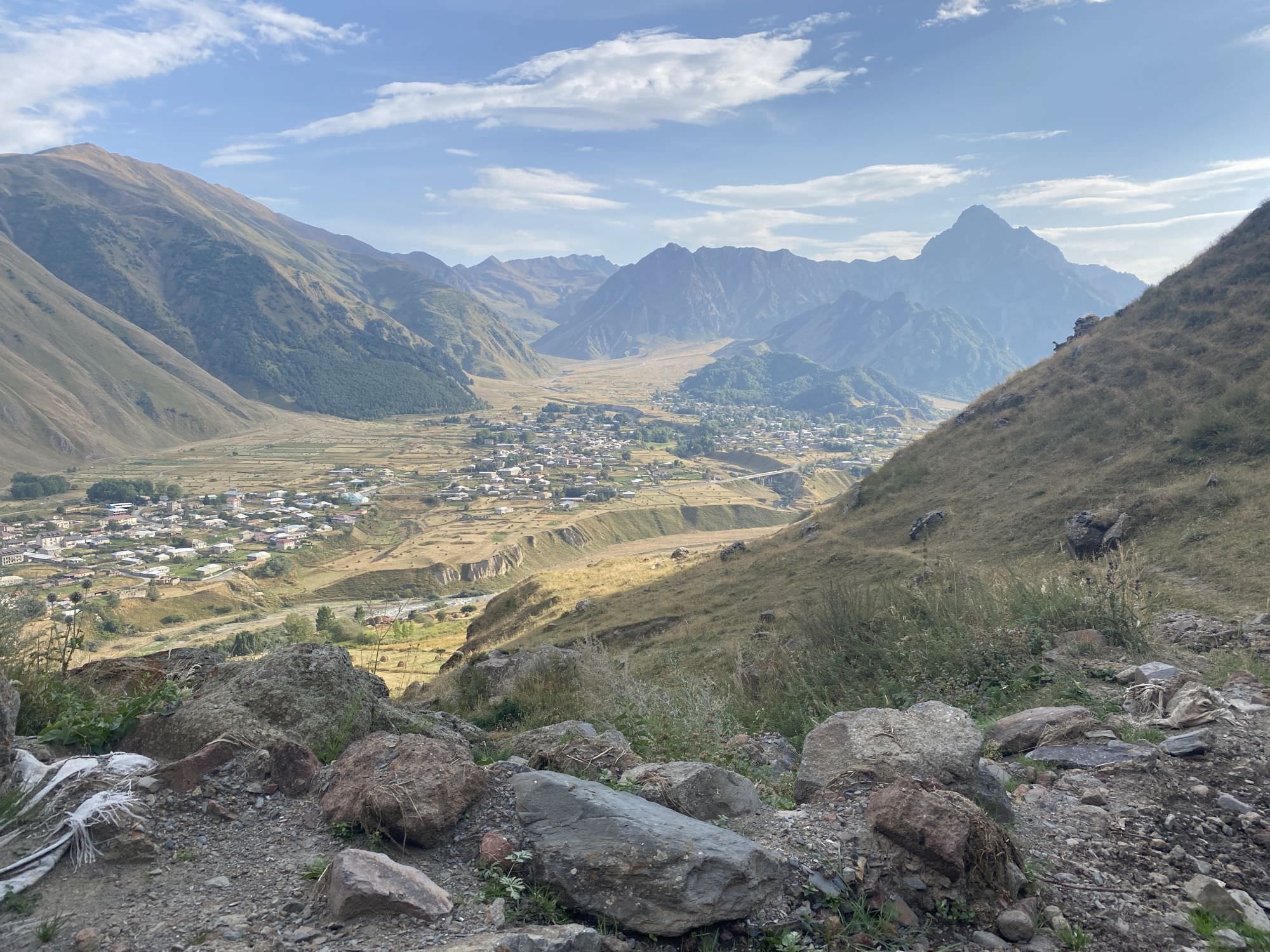
From Arsha waterfall go back on the well-trotted path for some metres and turn left. On the way up, the trail with disappear and appear regularly but a boulder and the visible ridge will give you a good indication. Have a look around from time to time to get a nice view into the surrounding valleys such as Sno/Juta. Once on a small plateau turn westwards and gain meter by meter. On about 2.000 metres of altitude turn your head to the north-east and spot a single tree on a big boulder. From here enjoy the sight of Mt. Arzi (3.963m) right on the Georgian-Russian border.
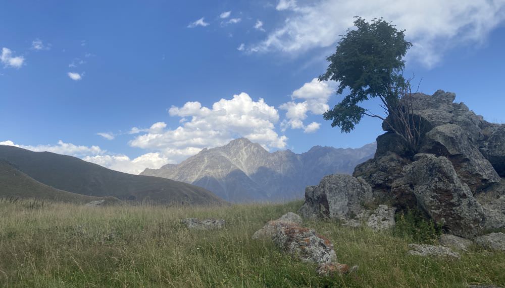
Scenic viewpoint on Mt. Arzi
Turn around and head some metres further up where you pass the track up to Geregti glacier. From here, the path descends again into the Arsha valley. You can either head down rather straight and cross the river or take the bridge a bit further up the stream. Soon you will come to another small crossing where you have to decide if you want to explore (left) or surround (right) the Tito ruins on the dirt road. Walking through the village is impressive but unfortunately also connected with high hogweed and other stinging plants. To join the main road, you will have to pass by three new huts and make a big loop along the edge; once there, it’s then only a steady way down until you are back at the starting point. All in all, it should take you an hour from the ruins.
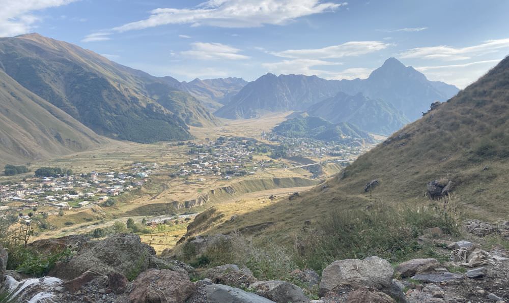
On the way down
Instead of hoping back on a car, you may want to think about walking back to Stepandsminda to explore nearby Pansheti village with all its sights. In not even two kilometers, you will first pass by a three-storage medieval cave complex called "Sinners' huts", which was used by monks for several centuries. Soon after you come to the old village center and a traditional tower. From there it takes you two kilometers to the mineral outdoor pool, and a total of four until Stepandsminda; the area in between is also quite popular for camping and rock climbing.
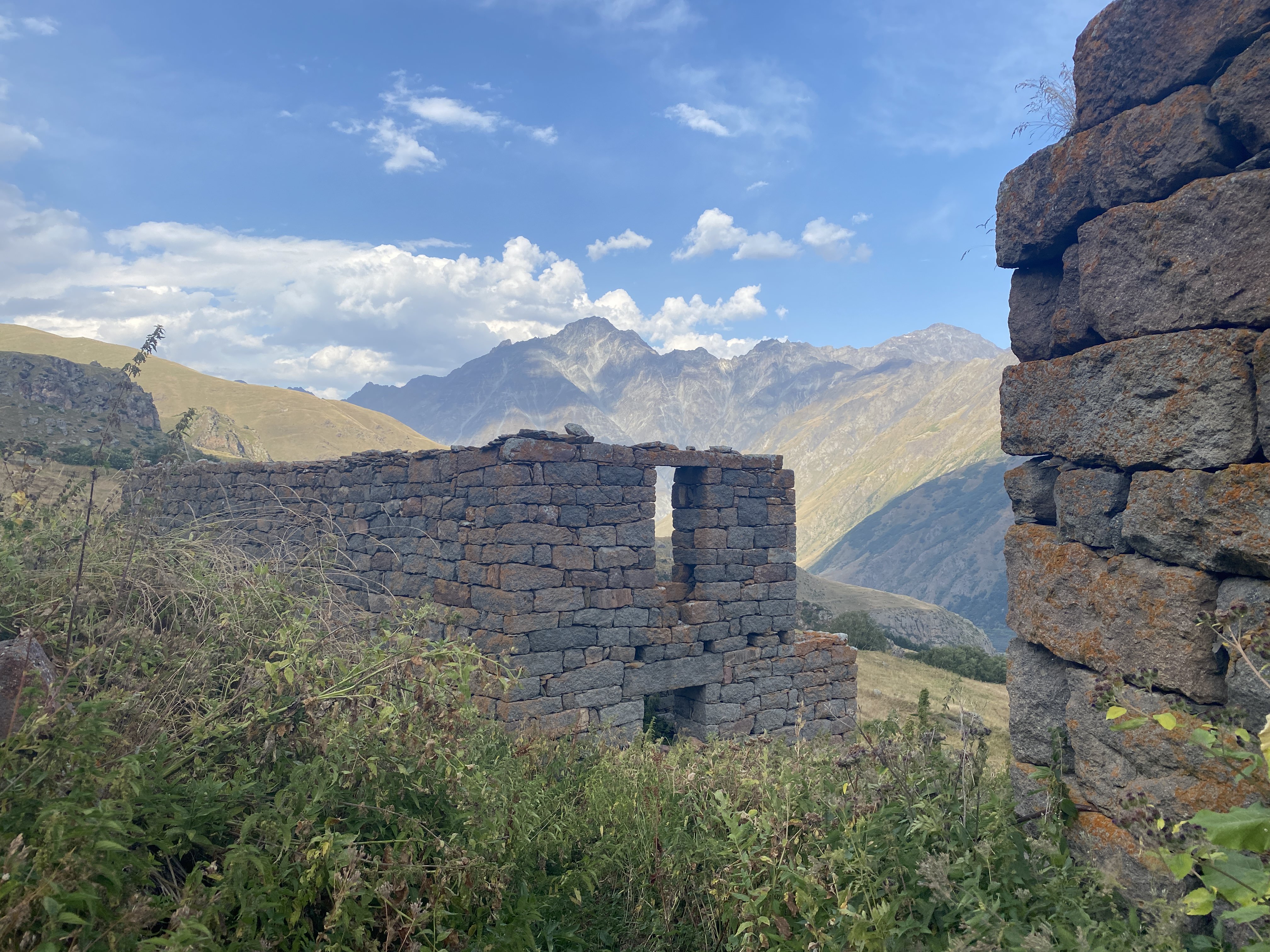
Ruins of Toti village
The trail was hiked by Anousha Radzad, Gareth Roberts, Chloé Tremblay and Philipp Bienek, who also provided pictures, gpx and the hike description.