Discovering the natural beauty of Imereti, Guria and Samtskhe-Javakheti in one hike.
While some may have connected the spa resort of Sairme and astronomical observatories in Abastumani by car or by bike through Sairme and Zekari passes, few have explored the Meskheti mountain range separating those two places by feet. A pity, as it offers plenty of possibilities to explore beautiful, remote places like the Jaji mountain lakes and the Khani waterfalls, far away from Georgia's crowded hiking spots. The range spreads over a total of 140 kilometres from the Black Sea coast in Adjara into the Borjomi valley in Samtskhe-Javakheti and reaches its maximum altitude with Mt. Mepistskaro (literally ‘origin of the king’) at 2.850 metres.
The main route will lead you within four days from the village of Ukhuti along the ridge back to the spa resort Sairme; same is valid for the alternative end in Abastumani. Anyhow, ending in Kakaskhidi may take you up to five days, in the small hamlet Khani even six days, while diving deep into the Kharagauli-Borjomi National Park will require several more days based on your intended destination.
The hike requires moderate to high physical fitness (e.g., elevation gain on Day 1 and distances over 20km per day) as well as proper navigation skills for the unmarked sections and some stamina to cover the rather endless and dull road down to Sairme or Kakaskhidi; the Abastumani section is by path more appealing.
Extending this hike into the Borjomi National Park will maybe turn it even into very hard due to the pure length and strong food and water management skills as you won't see people for more than a week.
As the Meskheti mountain range stretches from the Black Sea coast until the Borjomi NP, it is a core element of a thru-hike from the capital Tbilisi to the Black Sea coast or vice versa. The route described below (especially Day 3 and the Day 4 option to Borjomi) is a perfect starting point to connect the Jaji lake to Bakhmaro, and from there further to the coast. In the other direction, you can either go through Bakuriani and the Javakheti volcanic plateau or in parallel further north through the Ateni Valley before you reach the Algeti National Park and finally Tbilisi. Based on your physical condition this might be possible in up to three weeks.
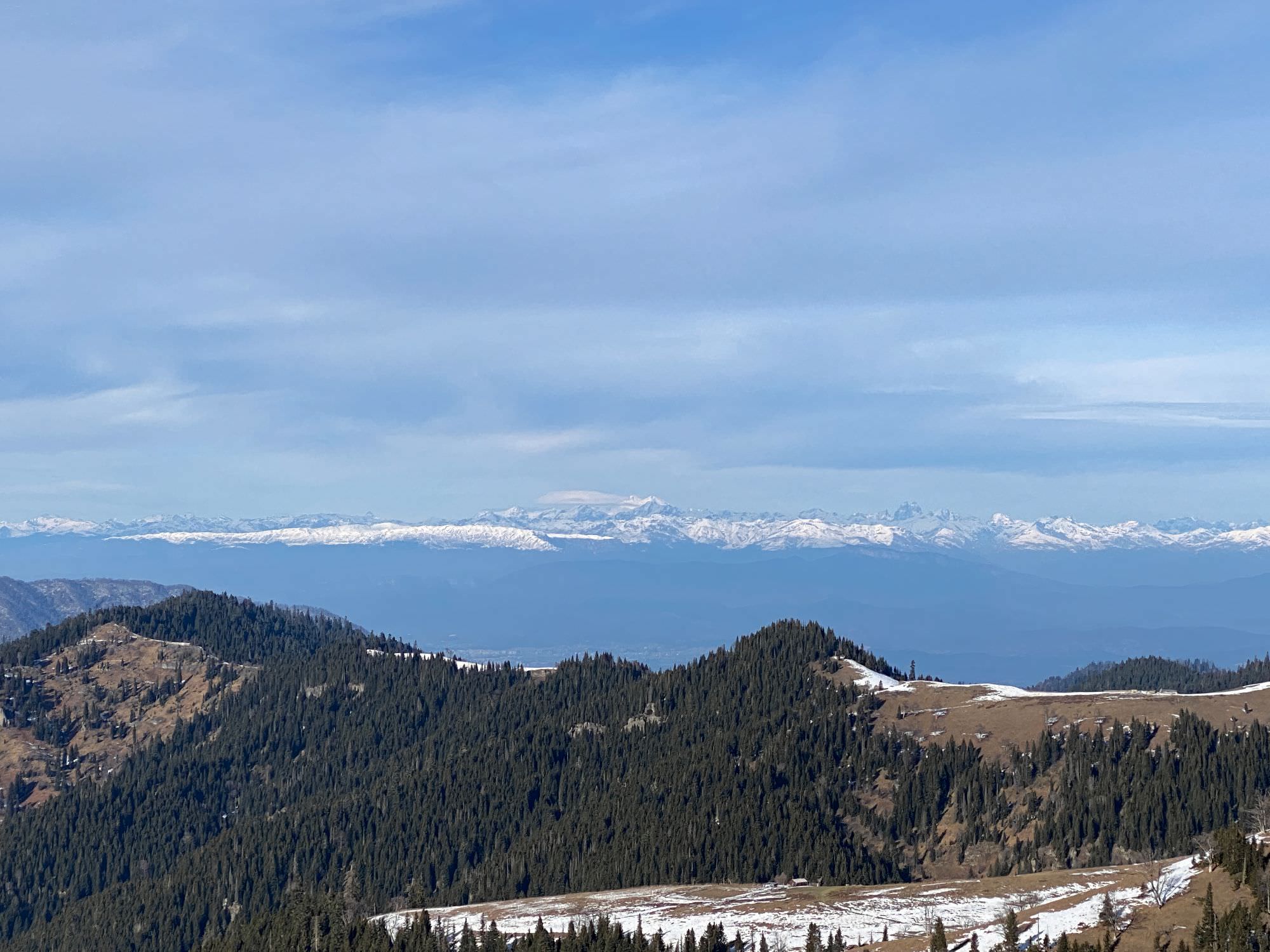
Based on own experiences, the Sairme and Zekari Passes (both about 2.250m) should be free of most snow in late April or beginning of May; anyhow, other sections close to Mepistskaro go up to nearly 2.750 metres and may need more time until hikable. July was a good time to manage the four-day tour, which should be possible until end of September probably.
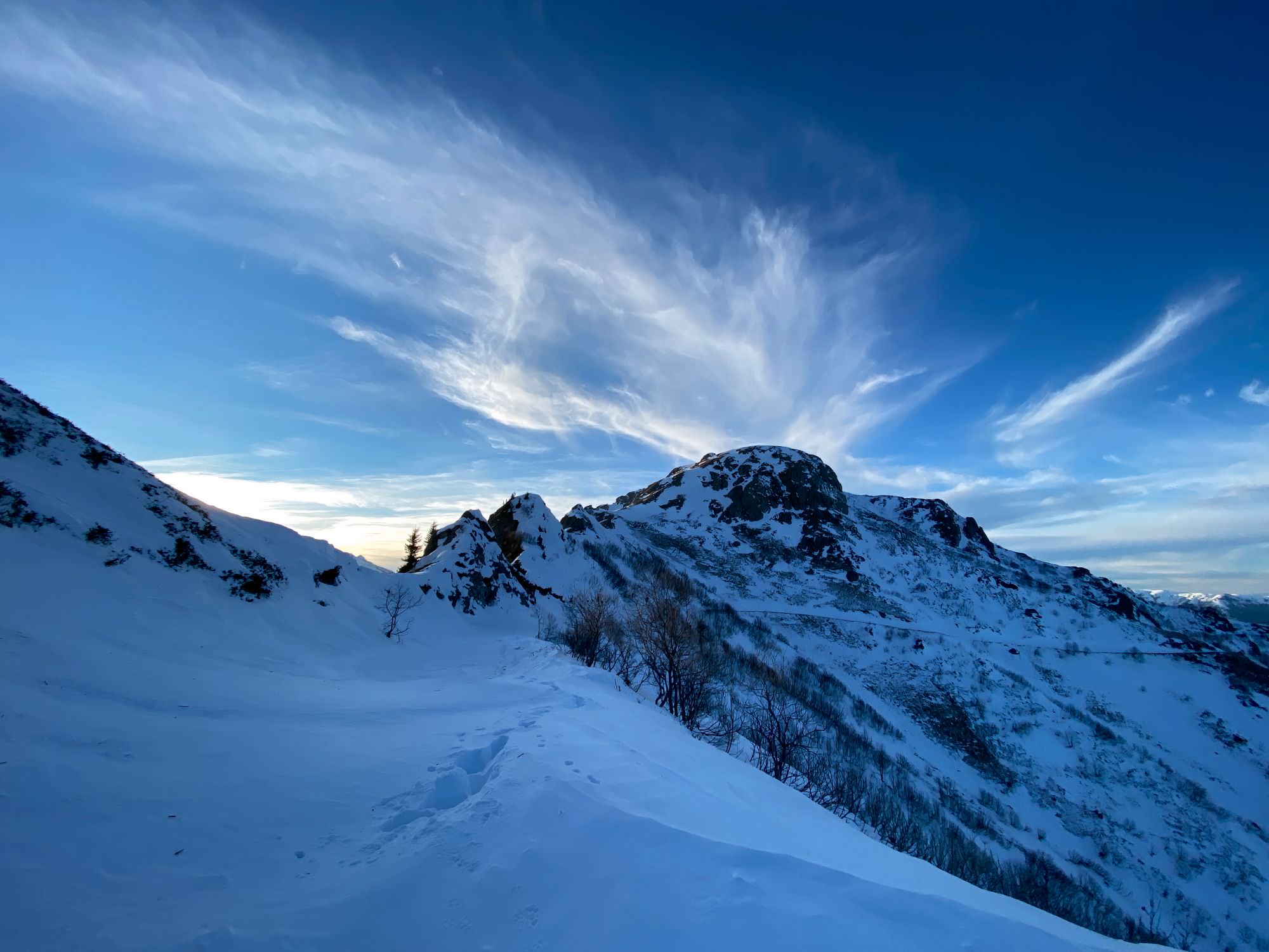
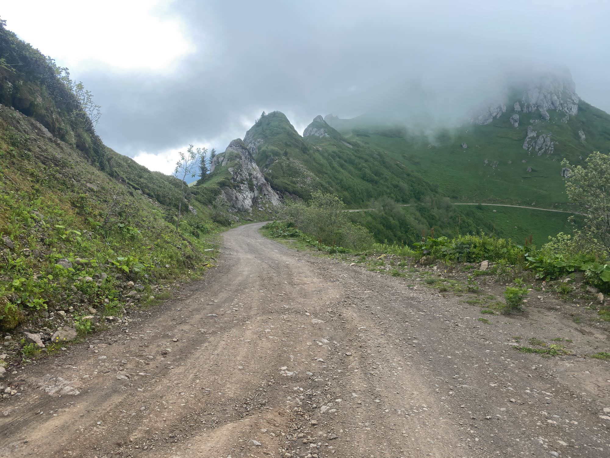
In winter, just going straight from Sairme to the passes and back (or down to Abastumani) is also a very nice, but also very demanding and cold two-day experience in deep snow.
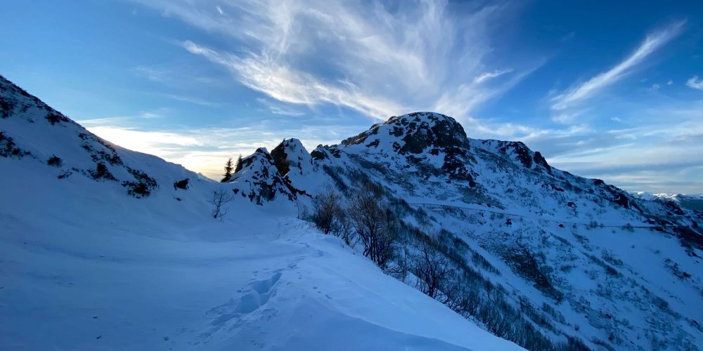
Abastumani-Sairme road in winter
Regarding changes in elevation and other geographic conditions, it does not really matter. Starting from Ukhuti may feel more natural as you have possible highlights like some spa reward in Sairme, the Khani waterfalls or the Abastumani observatories at the end of your journey – and hence, always a motivating goal ahead.
There will be sufficient water sources along the way to fill-up your reserves at least once a day as you regularly pass by rivers and springs. There are no huts or similar until entering the Borjomi-Kharagauli National Park. Once in Sairme or Abastumani, you will find a range of guesthouses and hotels.
Ukhuti is a small village somewhere between Baghdati and Vani on the Imeretian side of the Meskheti mountain range. There are three marshrutka per day from Kutaisi to Ukhuti (09:45; 14:45; 18:45) and back (08:00; 13:00; 17:00). The bus leaves on the back side of the bus station at Chavchavadze Avenue, costs 5 GEL, and takes about an hour.
All year long, there is one daily marshrutka from Sairme (14:00) through Baghdati (arriving 14:40; departing 15:00) to Kutaisi (around 15:45). It leaves from a small bakery at the end of the central park at the very beginning of the resort (marked in the gpx-file). In the holiday season (July and August), there should be more minibuses to Kutaisi and Baghdati due to higher demand, but the additional departure times vary. In case, you find yourself nearly alone on the marshrutka you may pay up to 15 GEL; if it is crowded it might be around 5 GEL. Taxis may cost between 30-50 GEL one way; consider that some drivers may only accept if you also pay the way back.
In case you want to start in Sairme, the only minibus you can take from Kutaisi leaves from the bus station (behind McDonald's on Chavchavadze) at 11:00 am.
Tricky. As of now, this side valley is not too much connected. There might be a marshrutka once or twice a day from Khani via Kakaskhidi to Baghdati, but we could not get any such information. Trying to fetch a ride or ordering a taxi (GEL) might be more reliable. Especially with the new Abastumani-Baghdati street being finished (whenever that is) it should be easier to hitchhike and there might even be new minibus routes in place then. Taxis should cost the same like for Sairme.
Even trickier than Kakaskhidi as it is the dead-end of the valley. Just try and see what happens. Taxis should cost the same like for Sairme and Kakaskhidi.
Even though it is meant to be a touristic place and even though there should be some public transport, the locals could not give us reliable information on the marshrutkas. Anyhow, it was the post-Covid spring 2021 and the situation hopefully improved since then – especially with the planned by-pass road, the renovated observatories, and new hotels like a Rooms branch.
Once in Akhaltsikhe, marshrutkas to Tbilisi and Kutaisi should run every two to three hours and cost between 15 and 20 GEL.
The park's main hiking routes start/end in Likani and Atskuri on the Borjomi side as well as in Marelisi near to Kharagauli. The latter is rather tricky to leave by marshrutka (the train might be an option), but from Likani and Atskuri you can fetch a ride or a local marshrutka to Borjomi and from there you'll have all possibilities.
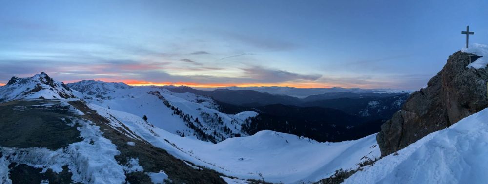
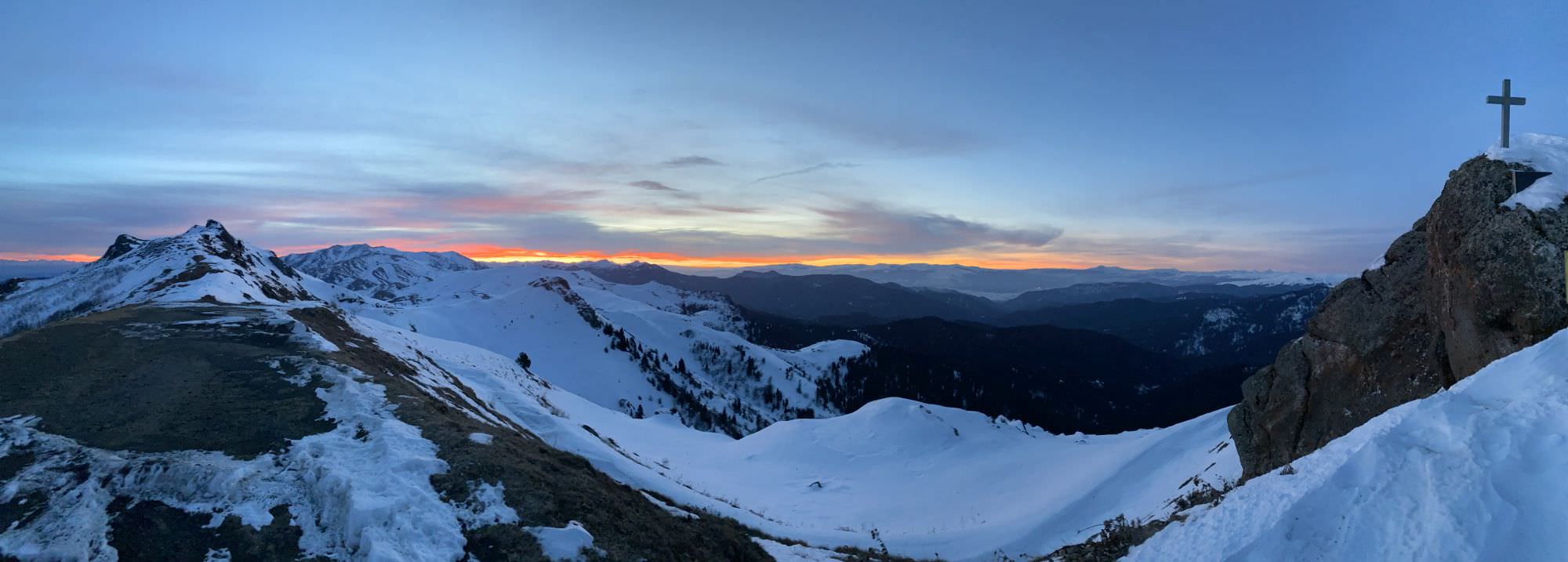
Sairme and Zekari pass in Winter
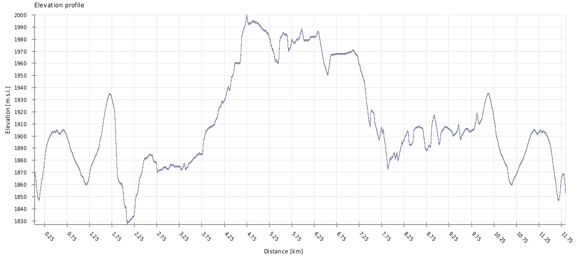
| Distance | 80.9 km |
| Trail type: | AB trip |
| Max. elevation: | 2795m |
| Min. elevation: | 388m |
| Total climb: | 4387m |
| Total descent: | 3902m |
Day 1 is a typical "you have to earn it" day: not too exciting until reaching the tree line and quite some metres to go up. 1.805 metres of elevation gain over 16,5 kilometres makes an average gradient of nearly 11% - keep that in mind.
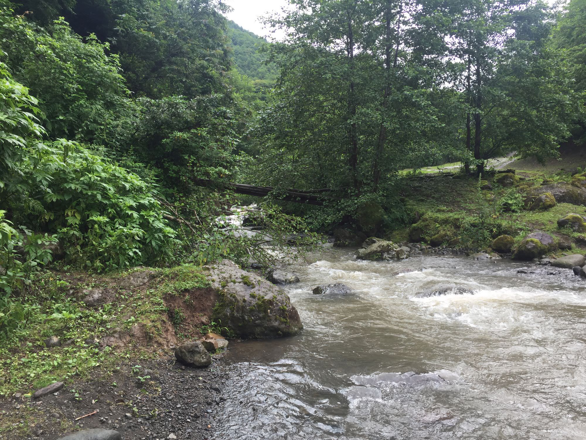
From the village centre follow the only big mud road in southern direction until you spot the first white-yellow-white marks on trees and rocks (it should not take too long). While you still have a mixed landscape around there with some meadows or fields, this will change into forest once you crossed the Komiswyali river at around three kilometres – there is still a kind-of bridge, but I’d not really recommend it. Once over, the way up to the alpine meadows around Mt. Lamazgora (2.174; ‘Beautiful Mountain’) feels like a never-ending connection of forest serpentines with emergency camping spots here and there; nothing outstanding but they would do the job.
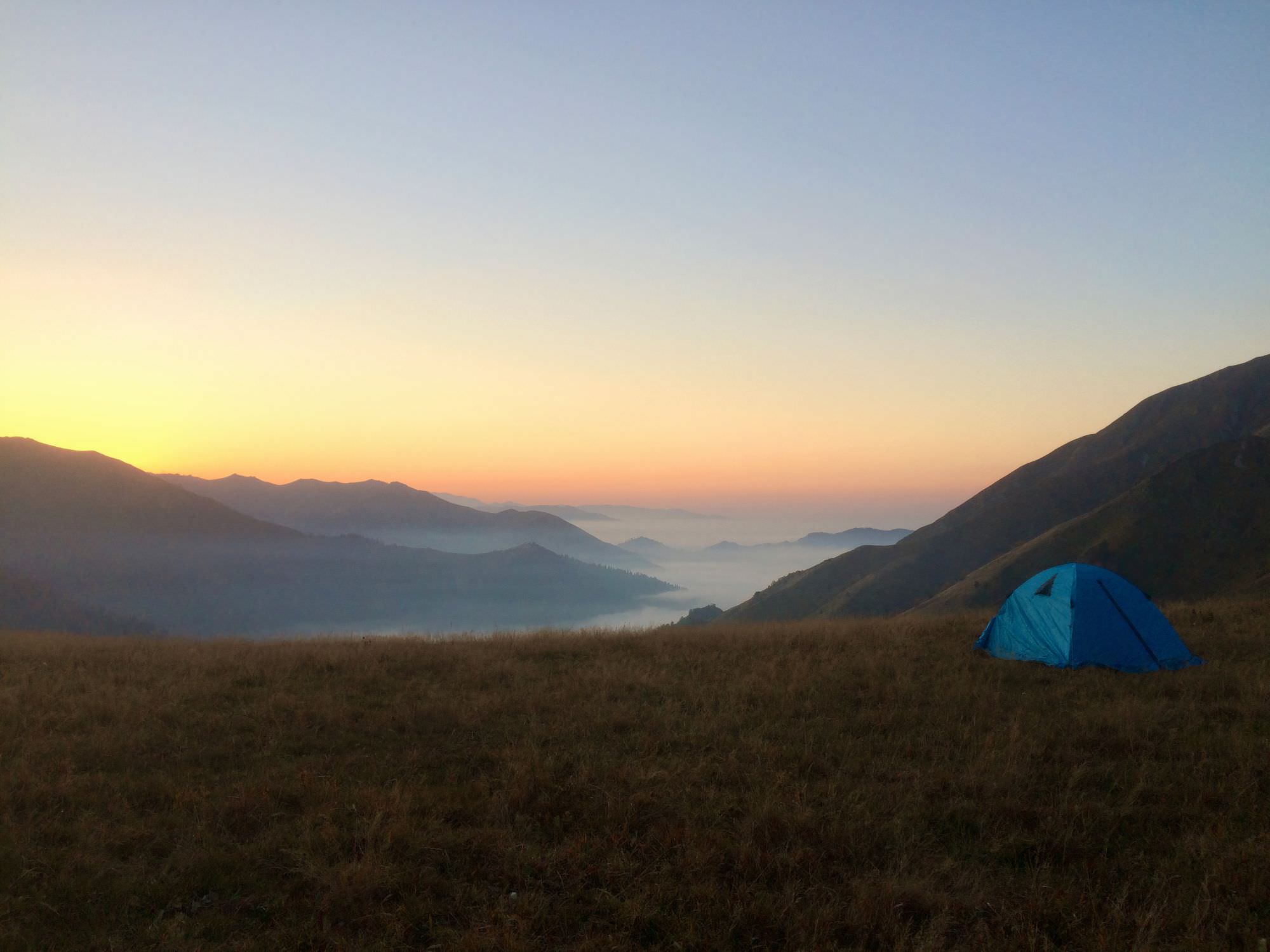
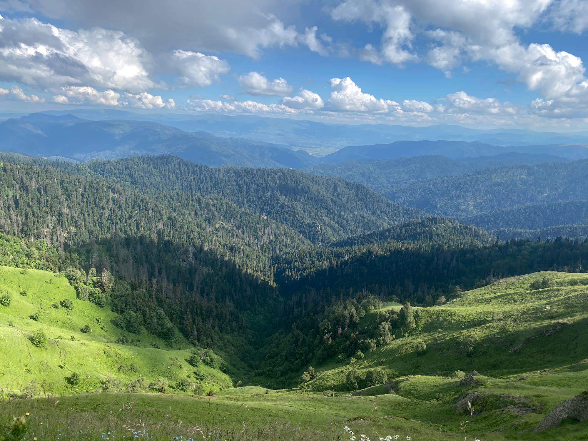
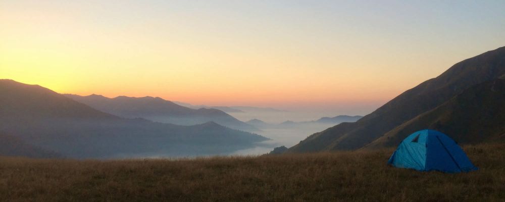
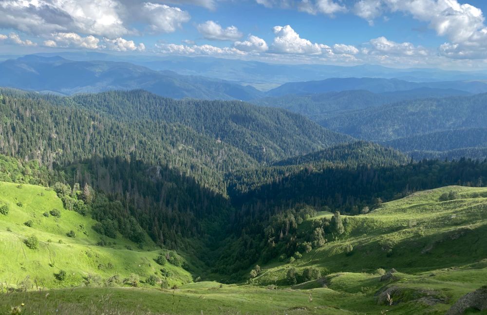
Until an old shack around kilometre twelve (about five hours) there is not really much to see but trees. Only from there you’ll slowly start to get a more open surrounding and the possibility to see today’s destination Mt. Lamazgora. Pass by another hut (which according to the sounds should have a small river behind) and soon you’ll have most of Imereti to your feet. Go for another 1,5-2 kilometres, leave the shepherd huts to your right and reach an open space where you’ll be able to make camp. Around there, you’ll also be able to get your first glance of Mt. Didmaghali (2.558m), where you will head to on Day 3 – someone ran out of creativity here as the mountain is simply called 'big high'.
View on Mt. Didmaghali
Today's section will be continuously on an easy-to-follow, nearly forgotten but very picturesque dirt road, which offers a variety of camp spot alternatives. From Mt. Lamazgora you'll first ascend to Shua Gora (2.286m; ‘middle mountain’) and soon make your first step into Guria before you encounter a broken yellow trail sign. Somewhere around here starts supposedly also the shortcut to Sairme in eastern direction (see Day 2 Alternatives at the end of this description).
Anyhow, you continue your hike on the main road, surround Mt. Patara Loboroti (2.415m) and head towards Mt. Didi Loboroti (2.730m). At its feet you will find another yellow trail sign: while the left (south-eastern) route leads certainly to today's destination Jaji Lake, there should also be a trail leading westward towards Zemo Surebi (also see Day 2 Alternatives).
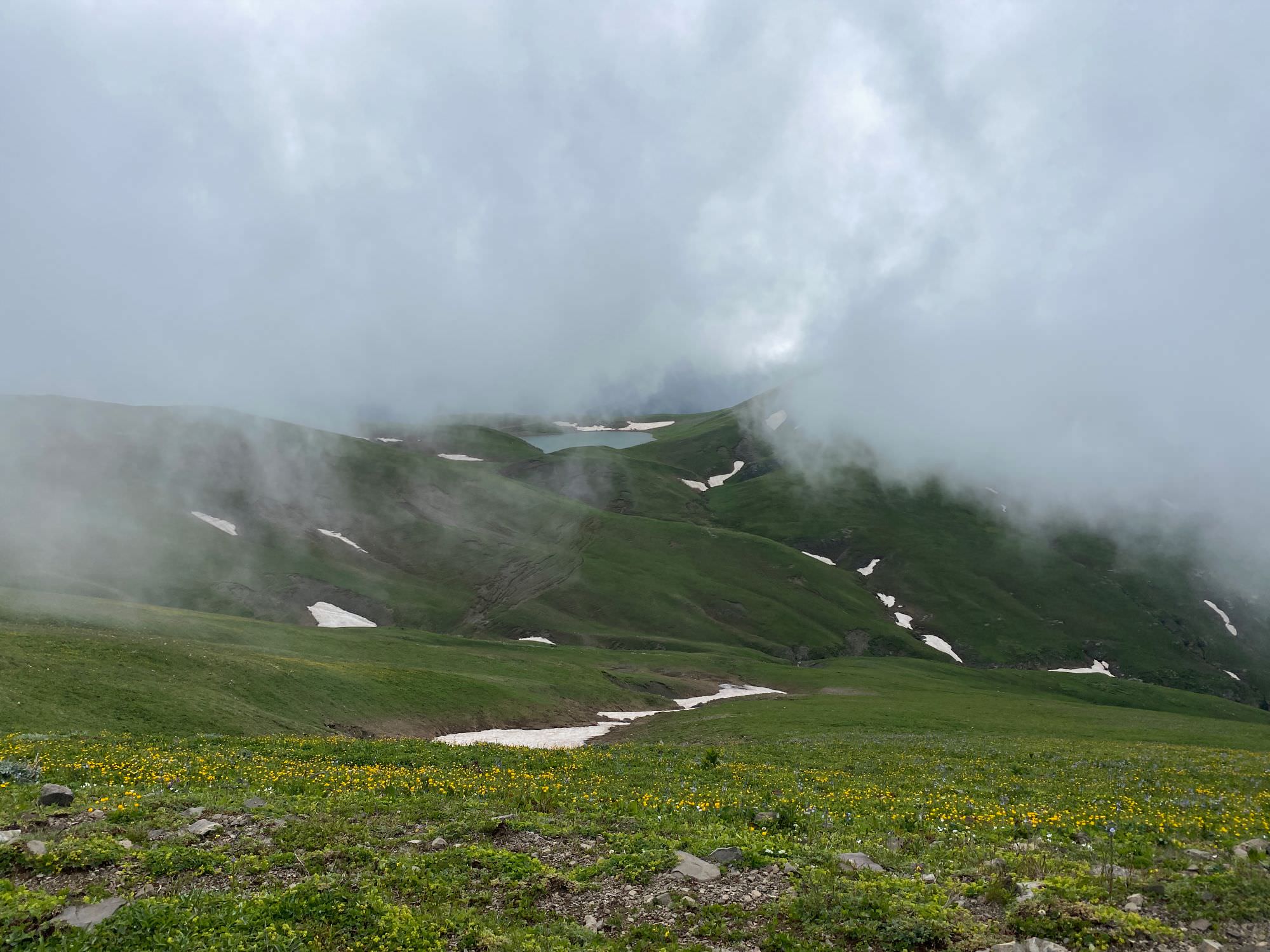
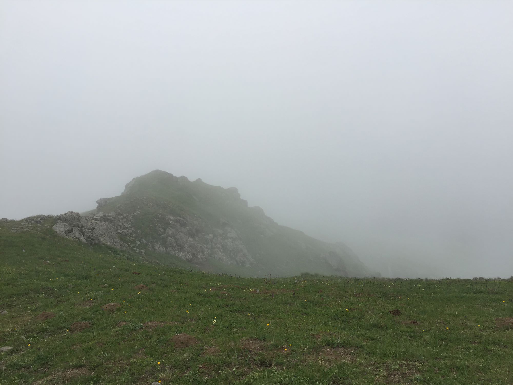
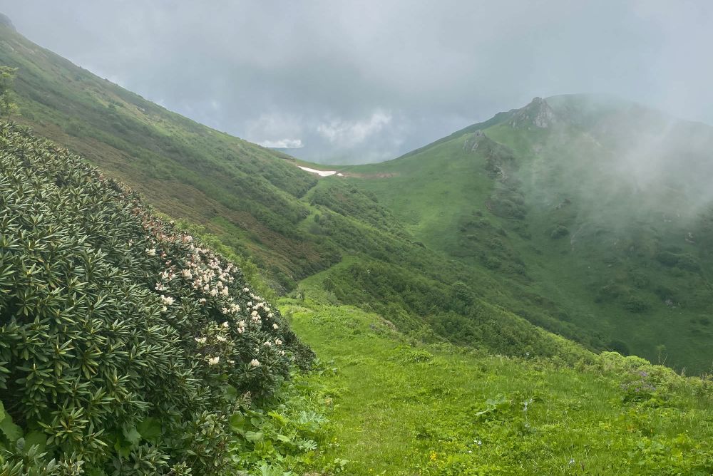
Your most attention is needed at kilometre 14,5 today, where you should not be tempted to follow a well-worked out mud road on the left (eastern direction), but continue straight (southward). Once you managed that, enjoy the green around you and some quite remarkable rock formations ahead. Towards Mt. Mepistskaro (2.850m; 'origin of the king' – I can’t tell you which one though) the trail gets slightly narrower and rockier. You will ascend to nearly 2.750 metre and may find yourself surrounded by fog, which is quite normal for this area.
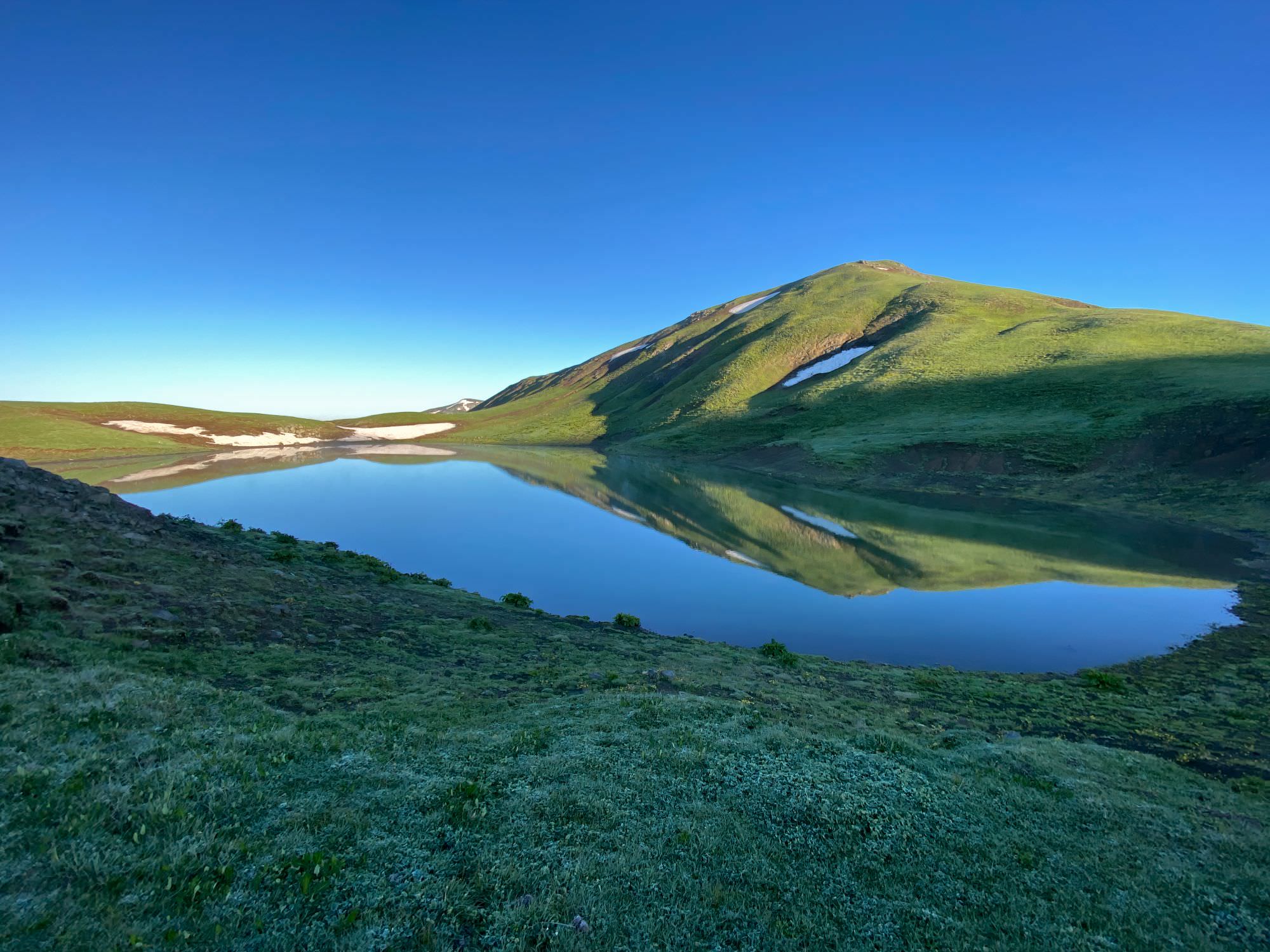
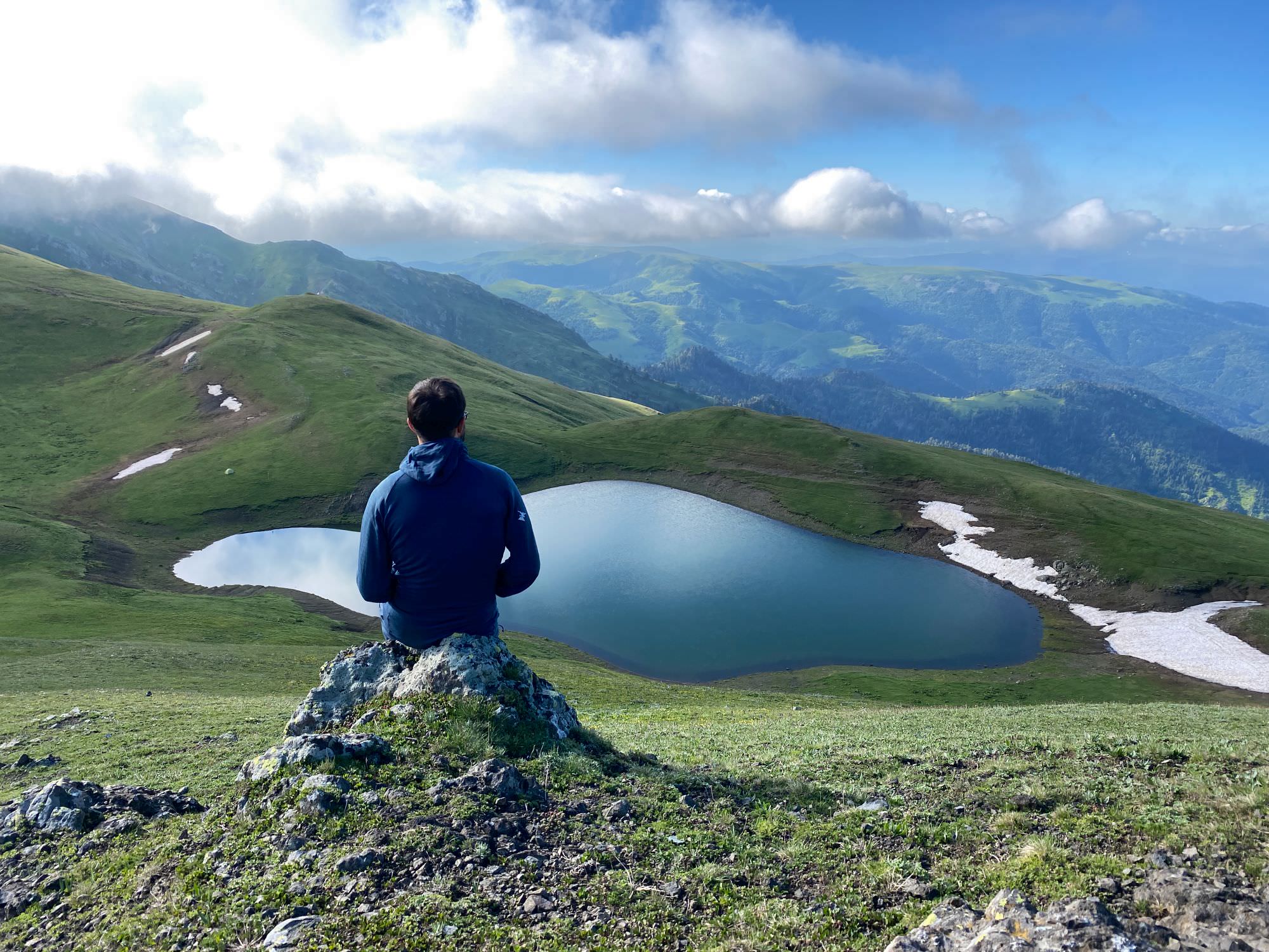
Even though you know Jaji lake has to be just in front of you, its actual appearance out of all this grey mist might take you quite surprising. To reach it, just follow the dirt track, pass by a crossroad which you will come back to the next morning, and find yourself a nice camping spot at the water.
Jaji lake
You may end your day or start the next one with a small hike from the lake to Mt. Jaji (2.742m), which should be around one kilometre and take another 30 minutes back and forth. You are officially at Big Jaji lake right now; in case you also want to see the Small Jaji Lake, go southwards for about two more kilometres.
Day 3 is the trickiest part of this hike as you have to pay high attention to the marks (which might be hidden in the fog) and be confident enough to make your own decisions when they get a bit mixed up.
Leave Jaji Lake in eastern direction and pass through the crossroad you came from yesterday and start to ascend a well-trotted cow-path up the ridge. You'll soon reach the highest point of this hike on an unnamed mountain at about 2.800 metres. Shortly after, you will see the first white-yellow-white marks on rocks. The area around is a quite wide and open space, so don’t worry too much about being exactly ‘on track’ but rather try to ensure the right direction: east-southeast.
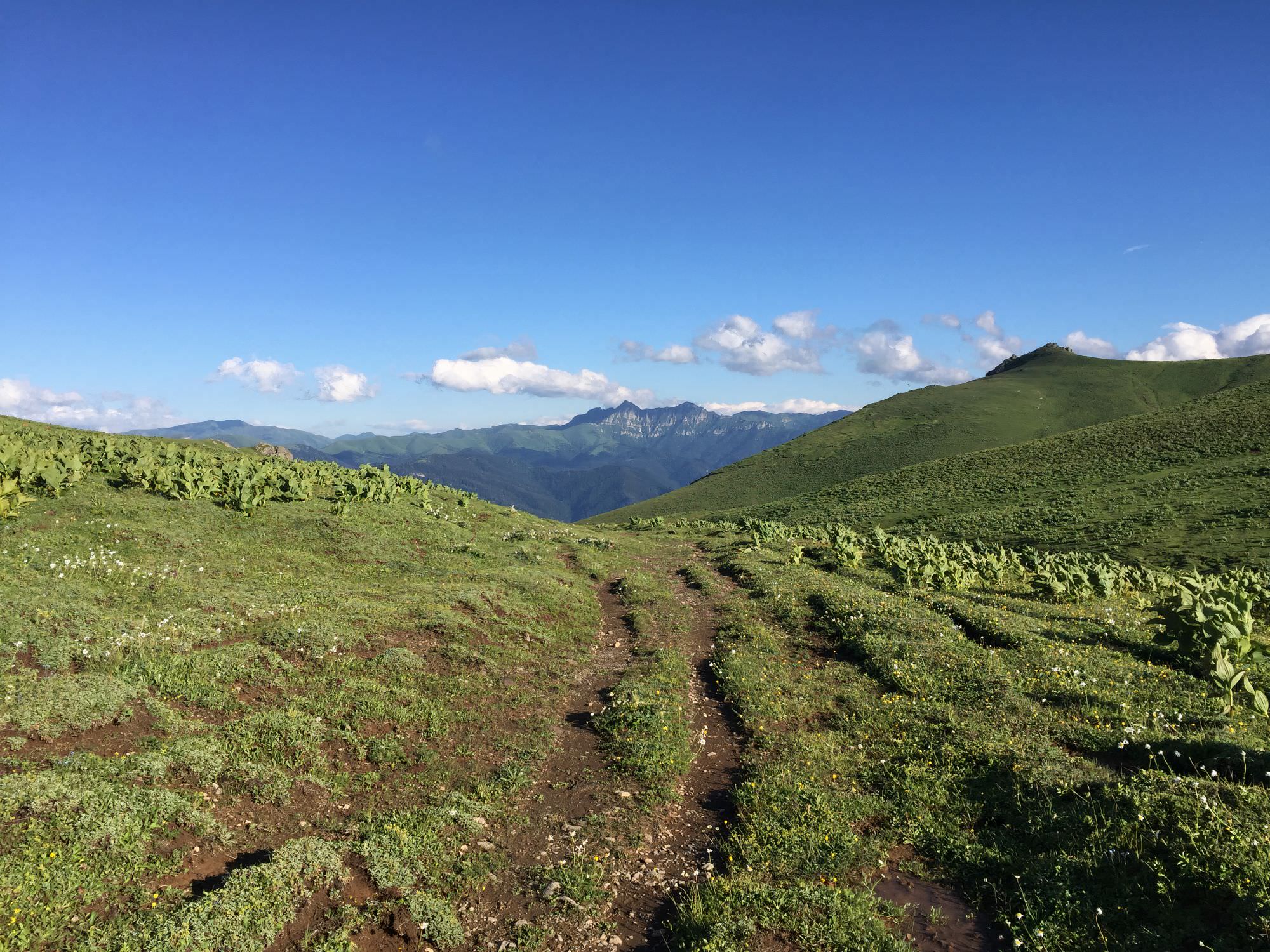
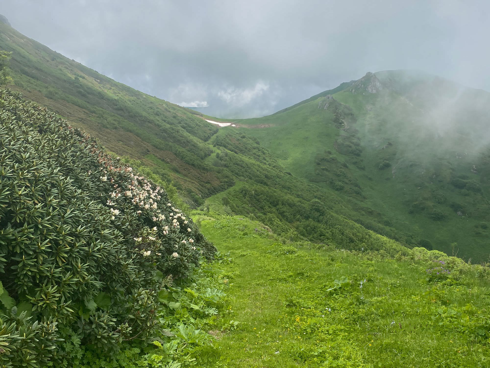
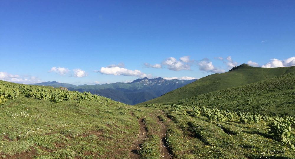
Soon, you will get a great view into the Sairme valley. Continue walking on a quite wide ‘grass’ road on the northern slope of a small ridge and then slightly ascend this exact ridge. Once on top, you will have a massive green meadow in front of you – interestingly enough, despite all the green, there was not a single animal grassing there in July. The Abastumani-Jaji Lake-road in applications like Gaia make a big bow to the south at this point, but you can honestly just walk straight and safe a kilometre of walking or so. In this area as well, try more to keep the direction and the elevation rather than following an exact track – this would either way be very hard with all this knee-high grass.
Looking back at the grass road
Just after about 2,5 kilometres again, you will join a proper mud road. Southwards, it only leads to an abandoned hut (maybe that’s why the animals are missing, too), while eastwards is the direction to go. Along Mt. Mamlismta (2.489m; ‘rooster mountain’) you will find several back-up water sources and soon come to one of the essential points of today’s journey at kilometre 10: intuitively following the road will lead you straight to the Abastumani observatories; leaving the road to a small path in north-eastern direction will bring you to Sairme. Believe me, it feels wrong on the first metres, but they are (fainted) marks and a well-trotted path.
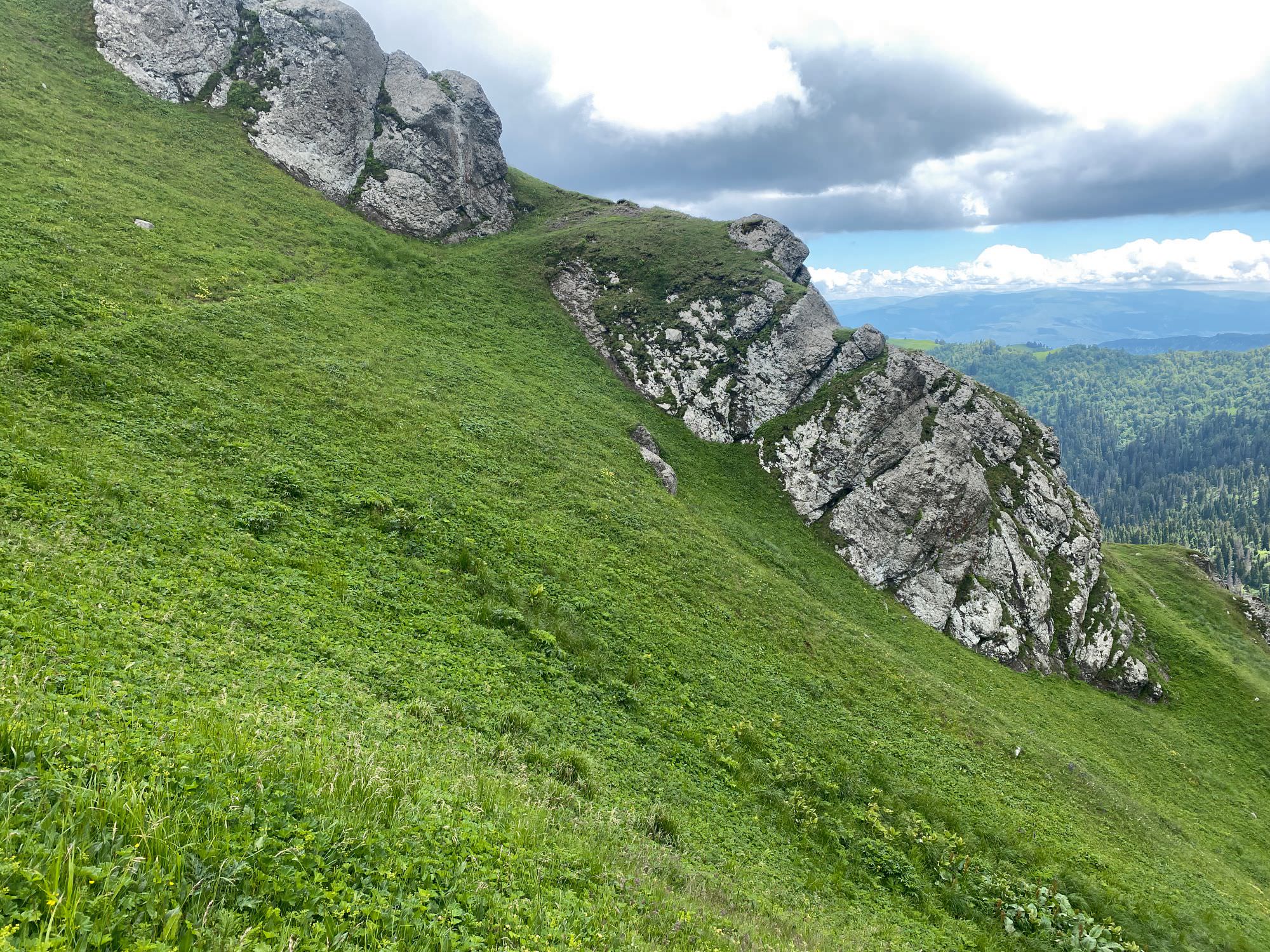
Anyhow, don’t fall too much in love with your surrounding yet, as you have to pay attention another time not even two kilometres later. Once you could enjoy the view from a rock formation, the trail marks surprisingly change from white-yellow-white to white-blue-white. Those blue marks want to lead you around the small peak in front of you on the southern ridge; this is possible but not recommendable at all. It is extreme bushwhacking on a steep slope and hence actually quite dangerous. The alternative, going up straight, is obviously not properly indicated – the reason why we followed the old marks. Just look out to the top, where you should see a metal bar (probably a signpost) sticking out. Go there, and then re-join the gpx-trail at kilometre 12,5.
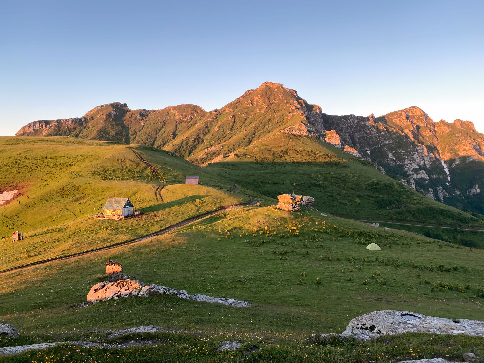
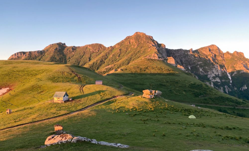
Latest now, you are officially in the Borjomi-Kharagauli National Park, but not yet on the official Zekari Overpass-trail. Continue eastwards on a step-by-step better-trotted path and realise that the marks changed once more now to white-red-white. At kilometre 14, you will encounter a quite new and well-equipped but as of July 2021 empty hut – the only inhabitants at that time were a young bird family.
Less than a kilometre later you’ll see the first used farms and a total of five kilometres later, you are at the Sairme pass. Congratulations!
View down from the Sairme pass towards Abastumani
Head to the north-east towards Sairme on the big (and unpleasant to walk) dirt road for about 4,5 kilometres to find yourself a camping spot with an outstanding view and free-running horses all around. From there, you cannot only see Kutaisi and the Greater Caucasus in the back, but you can recap your entire hike so far, as all relevant peaks are right in front of you: Lamazgora, Shua Gora, Patara Loboroti, Didi Loboroti, Mepistskaro, Mamlismta and of course Didmaghali.
View on Didmaghali from camp spot
The walk down to Sairme is unfortunately not worth too many words and your best views of the day will already be on your first metres when leaving the camp site. You'll start by surrounding Mt. Didmaghali on the northern side, pass by two or three shepherds’ huts (there are quite some dogs, but we had no troubles) and then descent into the forest. It’s a similar experience to Day 1 (“never-ending connection of forest serpentines”) but this time downwards and on a harder dirt road than Ukhuti’s forest road. There is a small waterfall after about seven kilometres, which is one of the few, if not the only, place to have a proper break.
Down in Sairme, also consider some 10-15 minutes to stroll through the Central park and taste the different mineral waters: there are a total of four springs with different compositions and hence, slightly different healing properties. I’d not label them ‘tasty’ but as you are around already, you should give it a try.
If you don’t feel too much like a rather dull four-to-five-hour-walk (it’s all fine in the beginning but the sameness of the scenery in combination with the summer sun and humidity gets a bit tiering), you should have a good chance to fetch a ride with local tourists, who want to enjoy the view from Sairme and Zekari Pass, have a picknick and return to Sairme or further throughout the afternoon.
Thanks to its length, location as well as usage for livestock and trading over the centuries, the Meskheti mountain range offers various attractive alternatives to the above-described main route.
Sairme shortcut or Zemo Surebi (not recorded; should be marked)
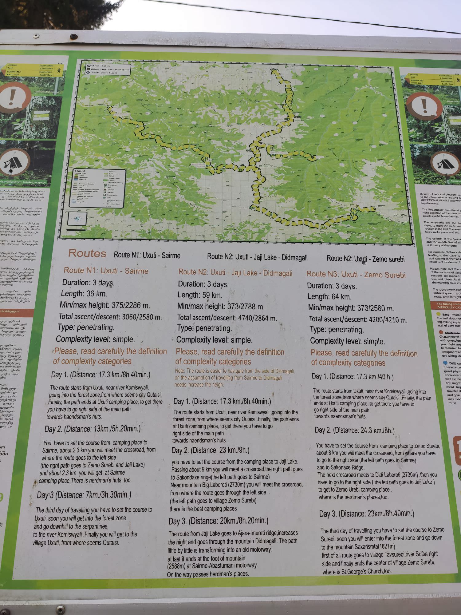
Instead of heading to Jaji Lake, there are two alternatives from the Lamazgora meadows: a Sairme shortcut (about 20km / one to two more days) and Zemo Surebi (about 47km / two more days). They are both outlined on a hiking map (in slideshow pictures) when driving up to Ukhuti, but we did not see any particular trail signs. The broken ones, which might lead the respective way are marked in the gpx-file.
Bakhmaro and further to the Black Sea (recorded and marked from Bakhmaro)
As mentioned in the introduction, you can combine this hike with a thru-hike to the Black Sea coast. Therefore, head westwards to the resort of Bakhmaro (37 km / two days) and from there to Lomismta and further towards the sea (up to 85 km / up to five days).
Dertseli (not recorded; not marked)
Coming from the north, you can also head straight down to the south and finish your hike in the summer farms of the Dertseli village (about 18km) or even further in Adigeni (about 34km), both in Samtskhe-Javakheti close to the Turkish border.
For all of the below, once at the Sairme pass, follow the big dirt road in eastern (Abastumani) instead of north-western (Sairme) direction.
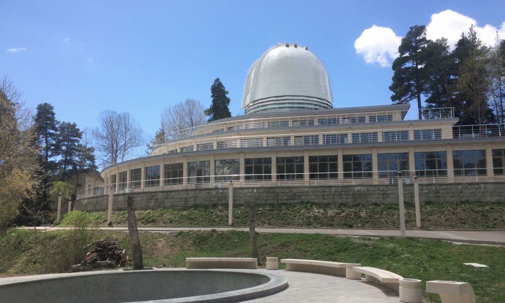
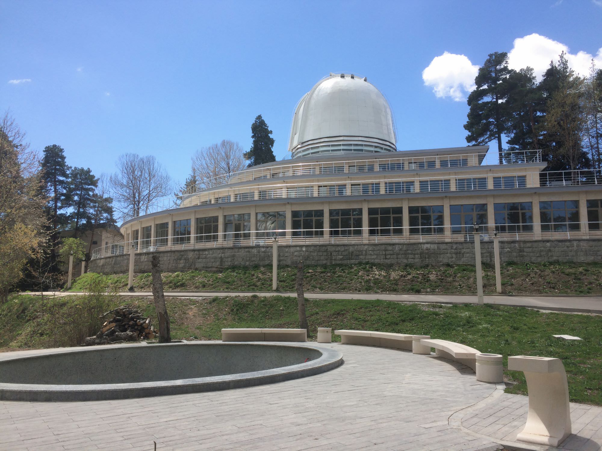
One of the few renovated Abastumani observatories
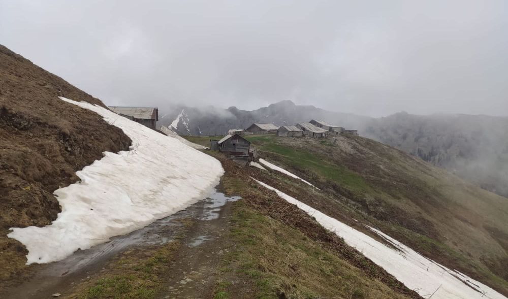
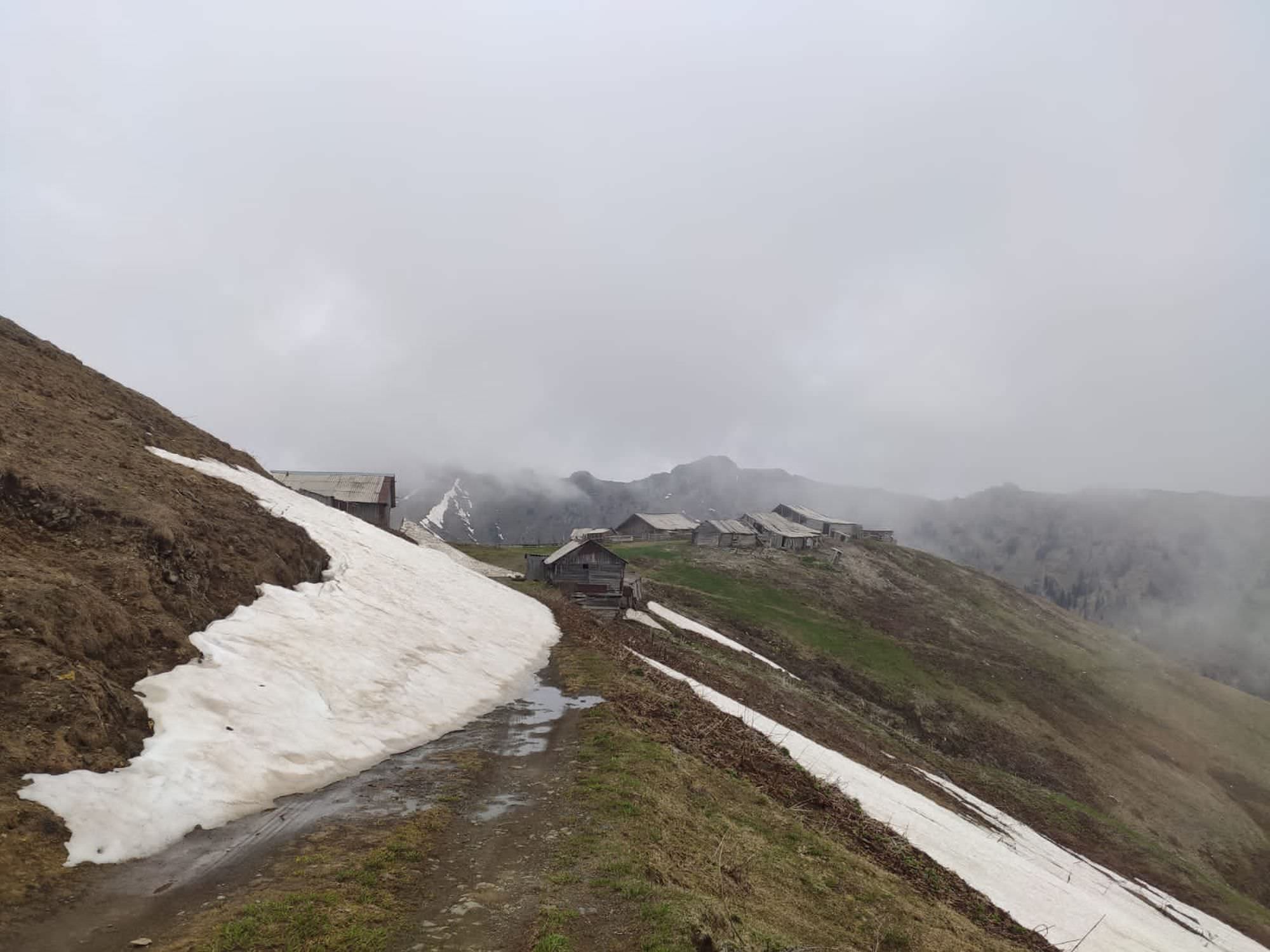
Hamlet before Zekari Pass
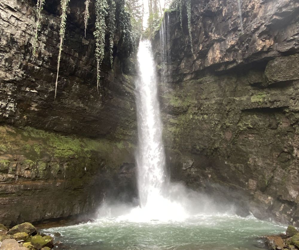
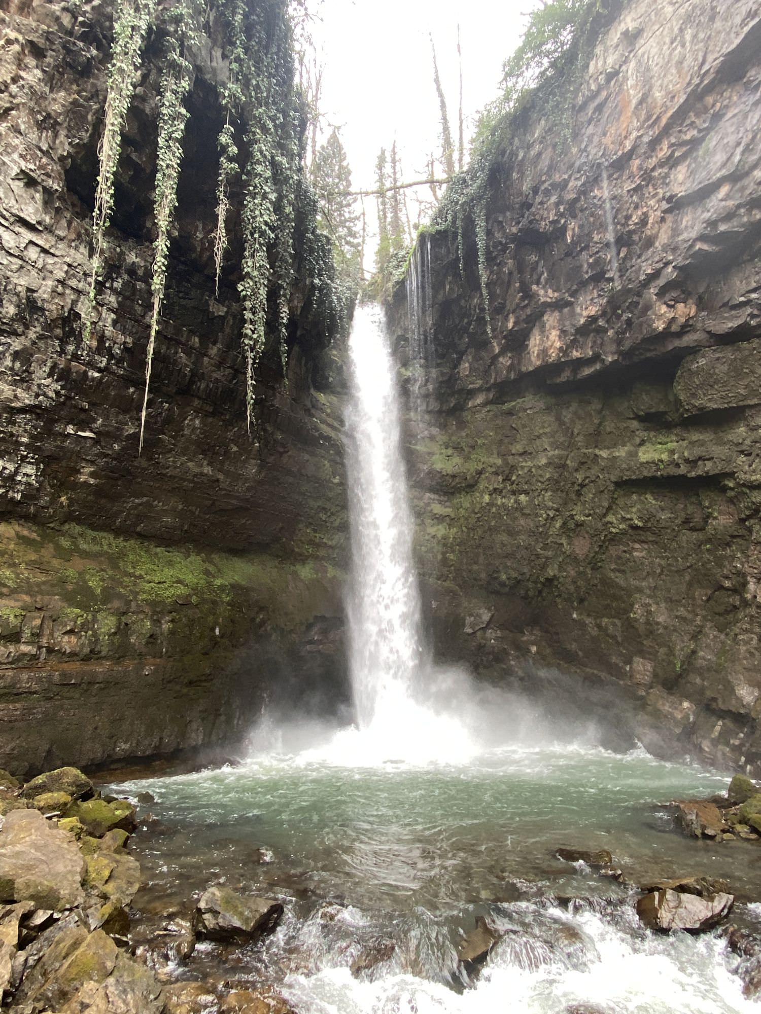
Khani waterfall
Different sections of the trail were hiked by Chloé Tremblay, Philipp Bienek, and their friends in January 2021 (Sairme-Sairme Pass), March 2021 (Khani Waterfalls), April 2021 (Kakaskhidi-Abastumani), February 2022 (Ukhuti), and July 2022 (Ukhuti-Sairme). They also provided pictures, the GPX, and the trail description. Thanks a lot!