Experiencing some of Georgia's most famous skiing slopes and beyond by feet.
While Bakuriani was already a well-known skiing resort amongst locals before, it has been pushed in the last years by the Georgian government to gain worldwide attention for organising several free-style championships and becoming host of the 2025 European Winter Youth Olympic Festival. Nonetheless, the resort is more than just winter sports and the nearby 'Georgian Arctic' (Tabatskuri Lake) but also popular as a summer retreat and a nice location for smaller off-season hikes. Its central location in the country also makes it a possible route for a thru-hike from the capital Tbilisi to the Black Sea coast.
The nearly 20km-long hike can be managed in one long day or nicely split up into two equal sections. Especially in winter, when days are short, the second option might be favourable.
The hike is easy to walk and mostly easy to follow. Aiming for one long day requires some fitness.
The trail should be hikable most of the year. The busy winter tourism season between January and March should be avoided though if possible. By doing so, you’ll automatically also avoid the most severe snow.
Throughout winter the first part of the hike until Didi Mitarbi Lake is frequently used by snow mobiles to explore the wonders of nearby Tabatskuri Lake, also known as ‘Georgian Artic’. The final kilometres of the second part down towards Bakuriani are actually on a ski slope. Hence, pay high attention to the activities around you and avoid the peak of the winter sport season.
For the ambitious ones, this hike can also be a section of a big thru-hike from the capital Tbilisi to the Black Sea coast or vice versa. Bakuriani and the neighbouring Ktsia-Tabatskuri Managed Reserve can be reached by foot from Tbilisi by the Algeti National Park. Once in Bakuriani you continue to the Borjomi National Park and then further through the Sairme and Zekari Pass, Jaji Lake, and finally through Bakhmaro to the Black Sea coast. Based on your physical condition this might be possible in up to three weeks.
If you intend only to do the valley round, just ask yourself if you want to bath first or refresh yourself at the end of the hike. In case you choose this hike as a more scenic and exciting start for your climb up to Gergeti, then turn north-east to the waterfalls and join the main route later.
Doesn’t really matter. Either way, you will start and end near Bakuriani's municipal centre.
It's easiest to have sufficient water for one or two days with you. Nonetheless, there are water sources along the trail; a small creek runs for instance through the indicated camping spot.
Regarding accommodation, you should always be able to find something in or around Bakuriani – from budget hotels to private lodges. For smaller groups, the Eco Chalet in Patara Mitarbi might be a nice choice, which is easy to connect with the hike starting in Didi Mitarbi (another five kilometre); they also have snow-shoes and other winter equipment like sledges.
From Tbilisi (up to four times a day incl. 8:00am and 9:00am; provider 'Nige' at Didube Bus Station) and Kutaisi (once a day at 10:00 am; McDonald’s Chavchavadze) there are direct minibuses, which both should cost between 15 and 20 GEL these days and take between three and four hours. Alternatively, you can always go to Borjomi and continue by local buy or taxi from there; the famous panorama train 'Kukushka' is unfortunately still out of service as it seems.
Leave Bakuriani just as you arrived: to Kutaisi, the only bus leaves at 3:00pm; to Tbilisi four times spread over the day.
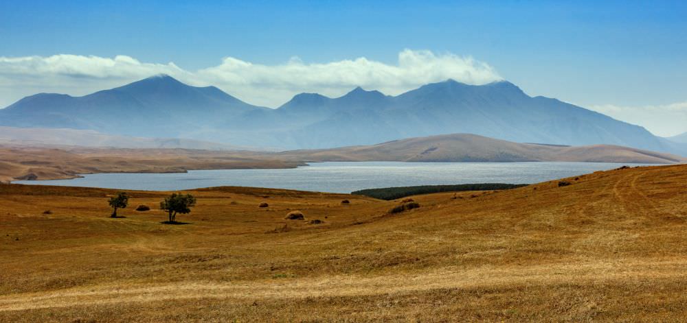
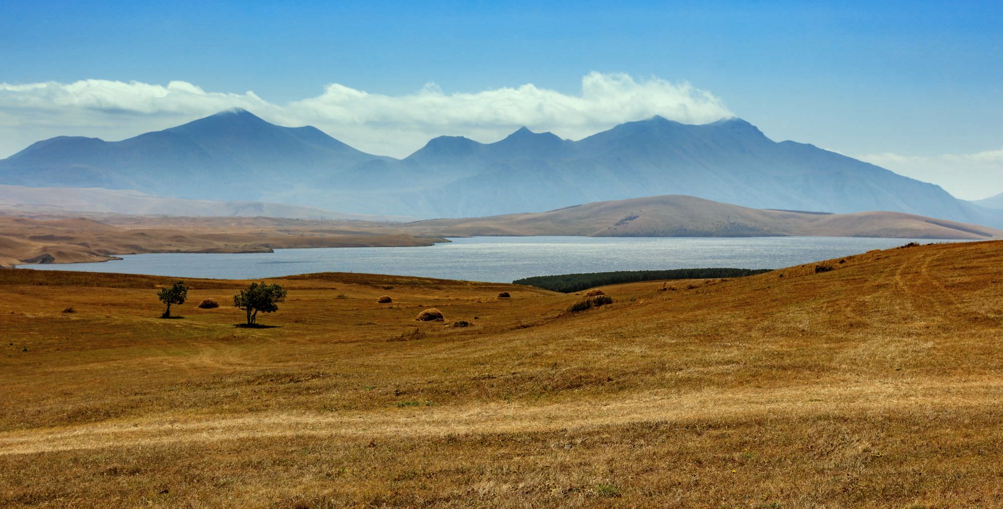
Tabatskuri lake (from the other side)
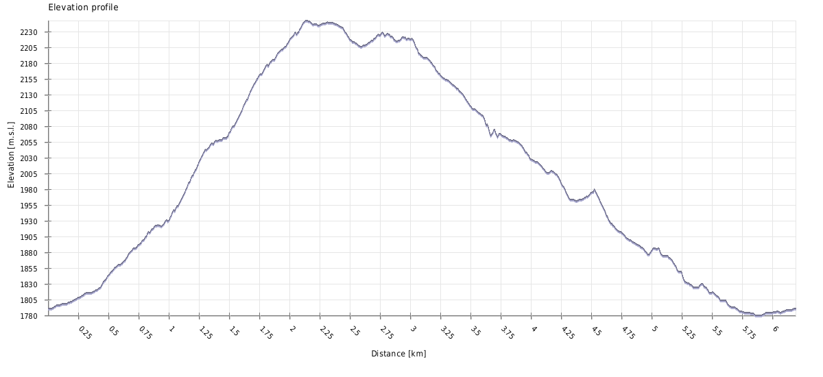
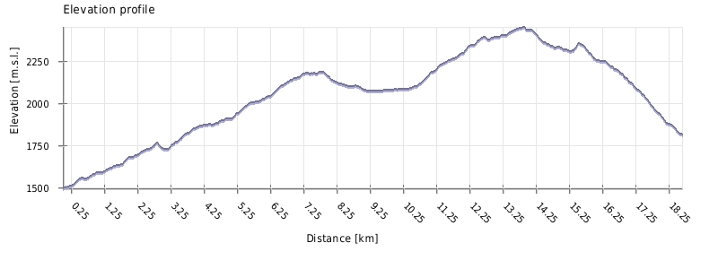
| Distance | 19.5 km |
| Trail type: | Roundtrip |
| Max. elevation: | 2255m |
| Min. elevation: | 1496m |
| Total climb: | 1168m |
| Total descent: | 841m |
The recorded hike starts in the village of Didi Mitarbi (about 6km from Bakuriani’s centre), which can be reached by feet on asphalted and mud roads as well as by taxi; the drivers may charge you 20-25 GEL and justify this with the bad road conditions and the need of a 4x4 (in winter).
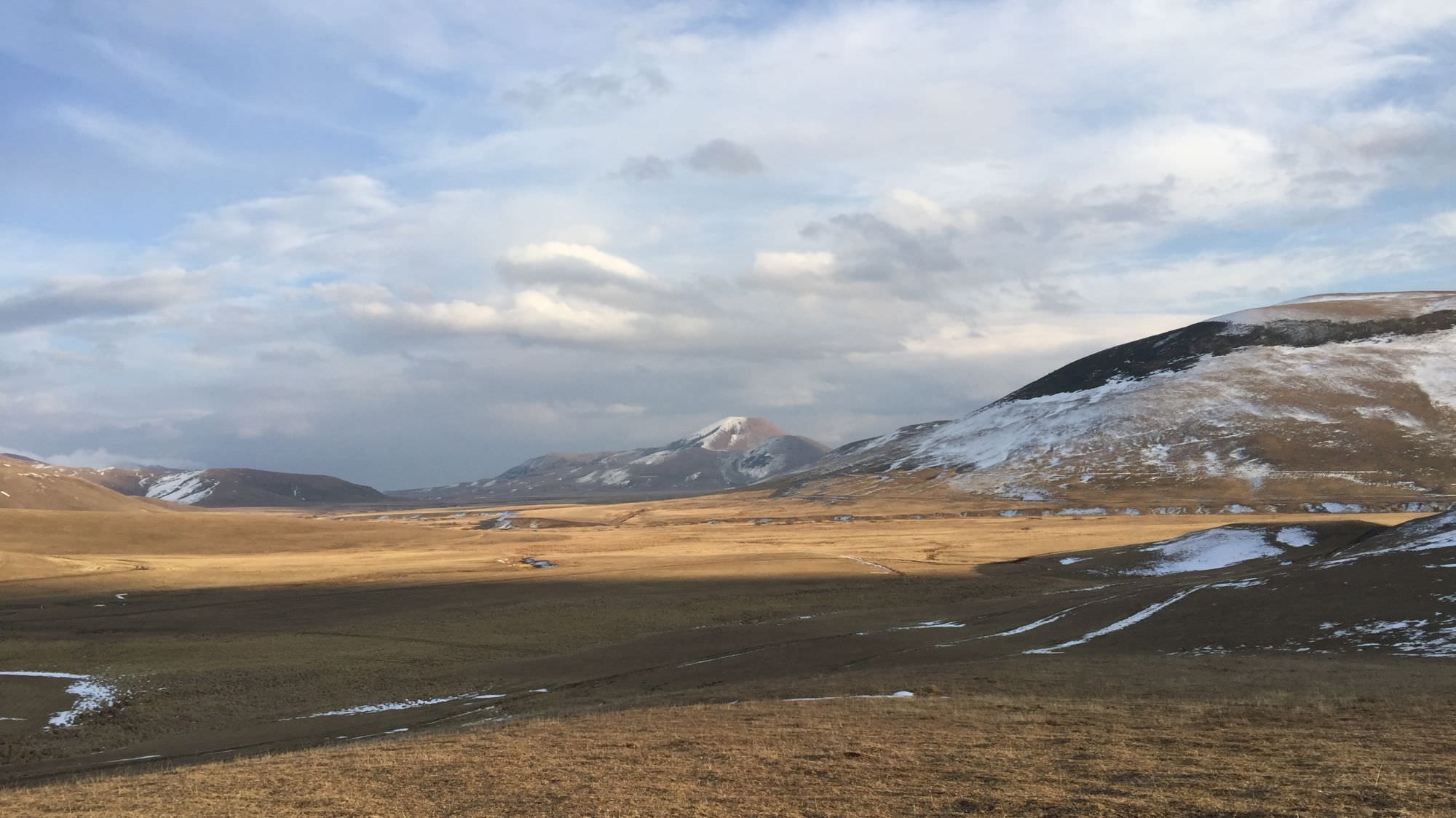
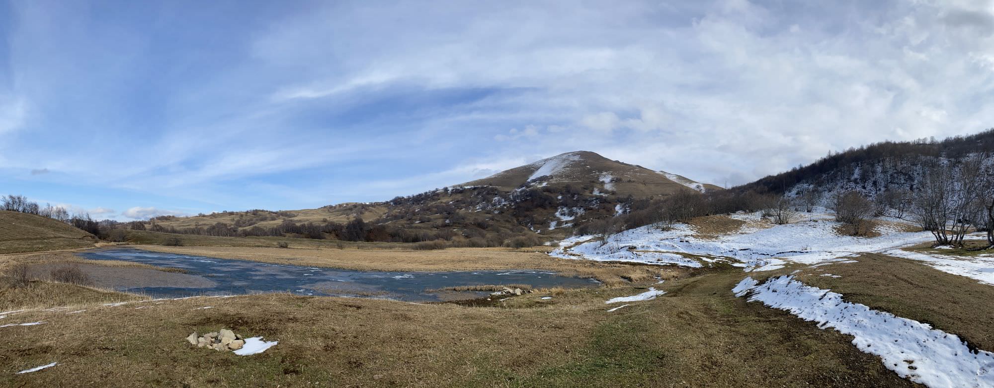
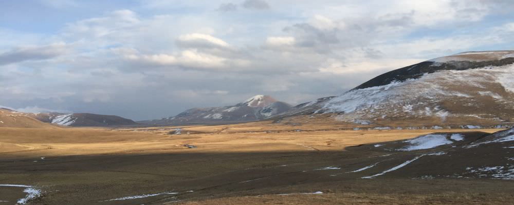
From the small bridge in the middle of the village slowly ascend in eastern direction, pass by the old school building and soon find yourself first on a green meadow, then in the trees. Follow the forestry road until it bends to the left after about 2,5 kilometres. It is possible to follow this road towards the Didi Mitarbi Lake, but the smaller, more appealing trail heads straight forward – it’s a bit hard to spot but once you crossed the small crescent it is easy to follow. About an hour later, you’ll reach the aforementioned lake with Mt. Sabatknevi (2.273m) in the back.
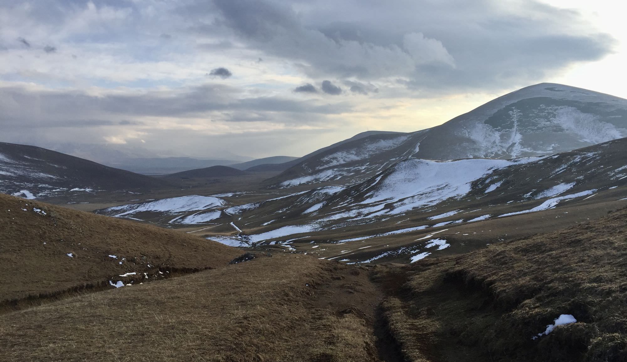
View into Ktsia-Tabatskuri Managed Reserve
At the lake you turn into southern direction and slowly continue your ascent until roughly 2.180 metres from where you can have a look over the endless wide of the Ktsia-Tabatskuri Managed Reserve. After a small descent, you will also be able to find yourself a camping spot in a small river delta at the foot of Mt. Kenchakaro (2.349m).
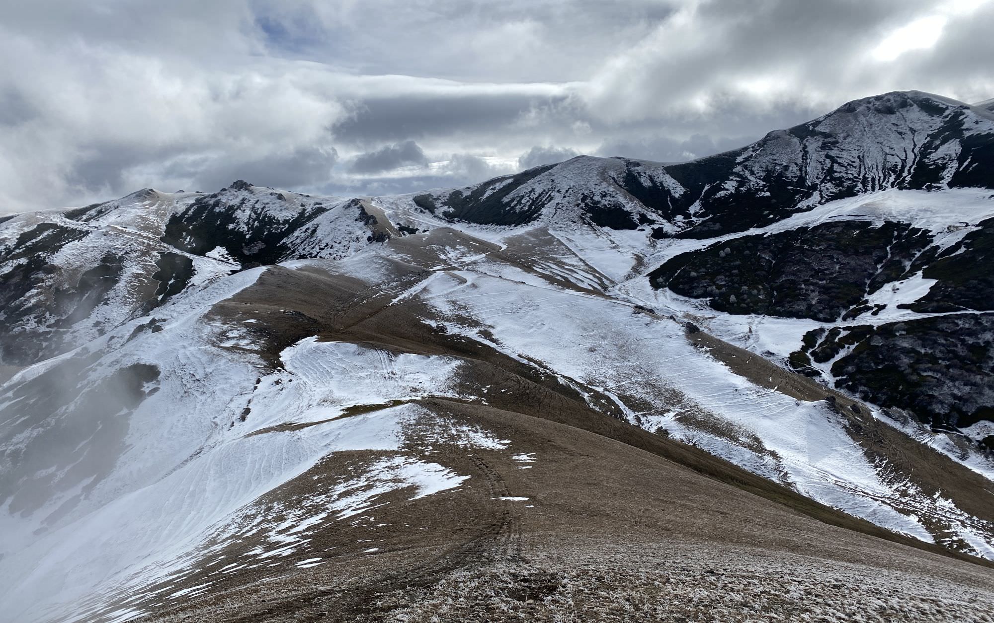
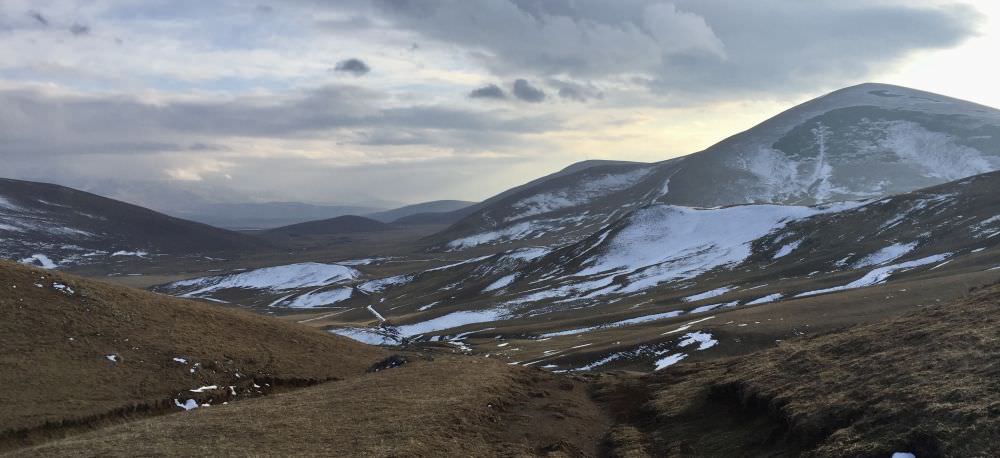
The land in front of you is permeated by small streams, which makes small crossings unavoidable; anyhow, you should be able to reduce it to one or two by staying rather north of the main stream. Once done, slowly ascend the northern ridge, an accumulation of smaller and bigger hills, which leads you over a distance of five kilometres through several nice viewpoints to the highest point of the hike on about 2.450m.
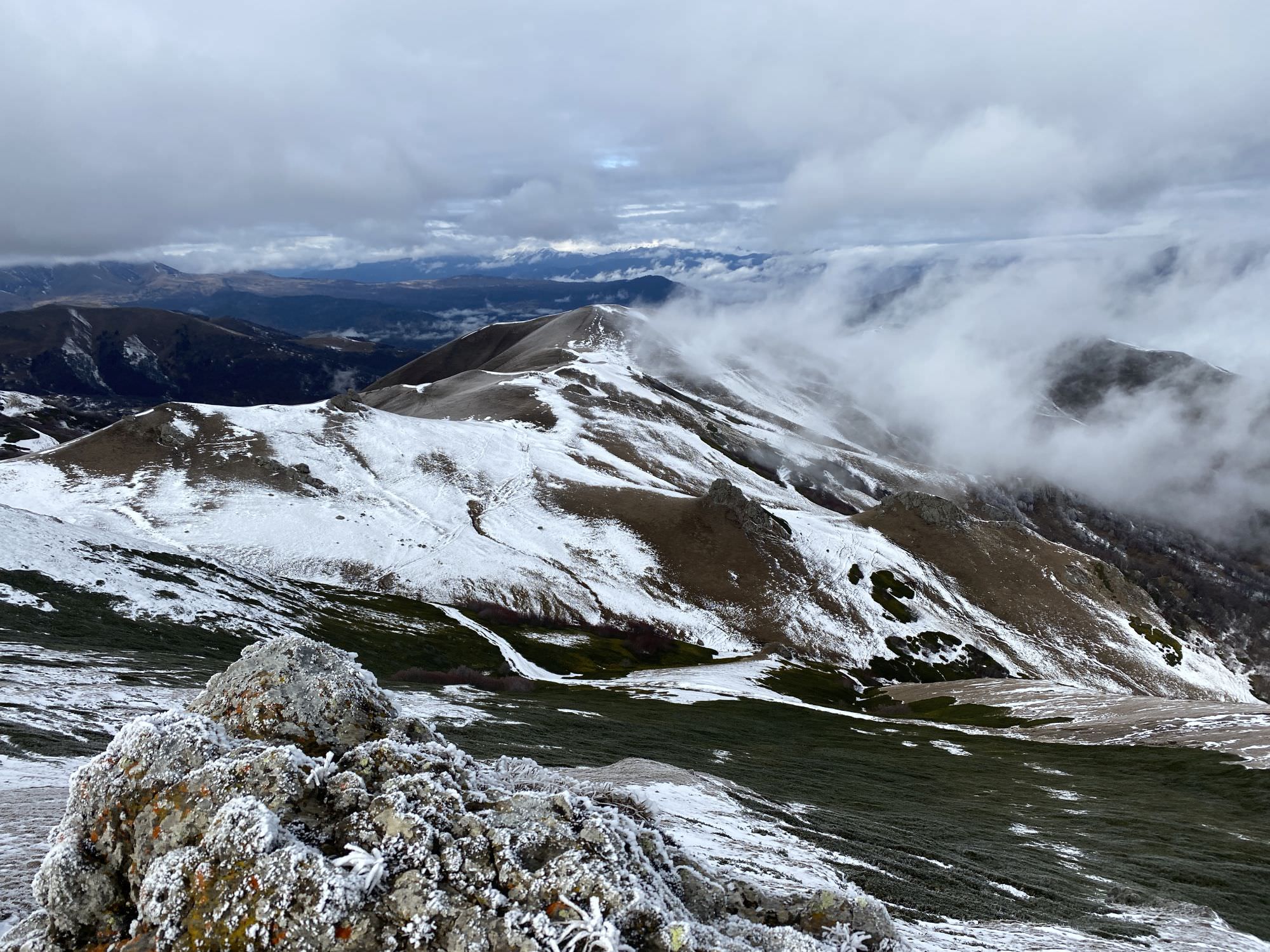
Snowy ridge towards Bakuriani
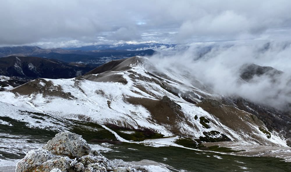
There, turn to the north-west and follow the ridge ahead until you reach the Kokhta 2 ski lift. You are now on top of Bakuriani and simply have to follow the ski slope down towards the town. At the bottom, you will encounter smaller lifts for skiing beginners and soon some houses. To the centre it’s another three kilometres or a short taxi ride.
The trail was hiked in November 2021 by Christina Nefzger, Rebekka B., Chloé Tremblay, and Philipp Bienek, who also provided pictures, the GPX, and the trail description.