A remote hike in Western Svaneti on the fine line between ecstasy and desperateness.
The Western Svaneti, and the vicinity of Nenskra valley in particular, is known for an abundance of glacier lakes. There are Okrostskali lakes and also more remote lakes such as Blue and Kharkha, Tskhvandiri, Okrila, and Dalari. And, of course, Memuli lakes, which we will cover here.
While these lakes are slowly becoming popular among those who are looking for the next level of exploration and remoteness, they are still unknown to the broader public. That´s because the beauty of these lakes comes with a high price and demands your sweat and blood – literally! – in exchange.
The hike from Kvemo Memuli (settlement down in the valley) to the main lake and back takes only two long days. Anyhow, you should calculate an entire day each way for getting to and leaving from Kvemo Memuli; especially if you don’t have car and if you need to get your trekking permit on-site. In case you want to add the third lake, you should consider one more day.
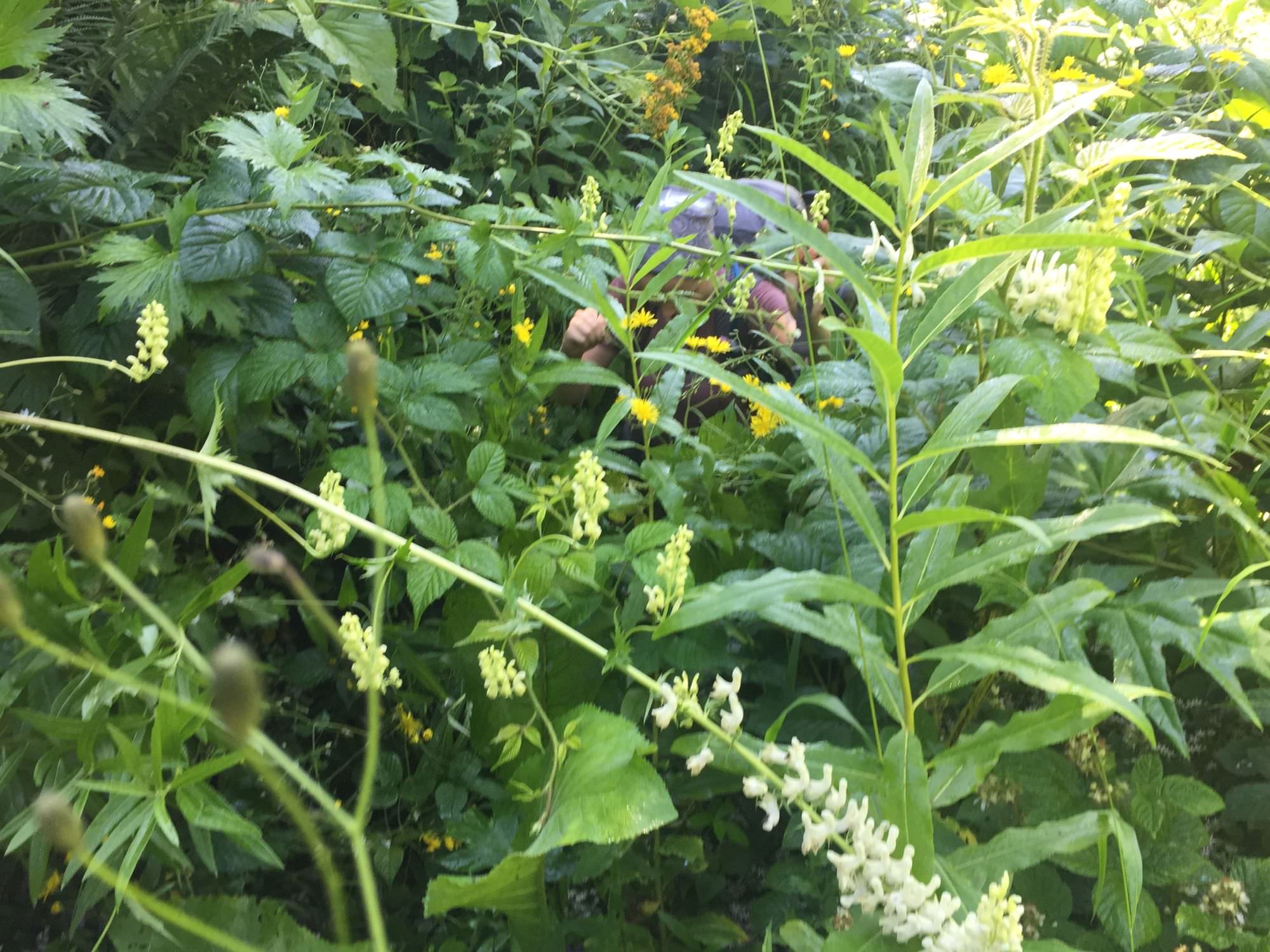
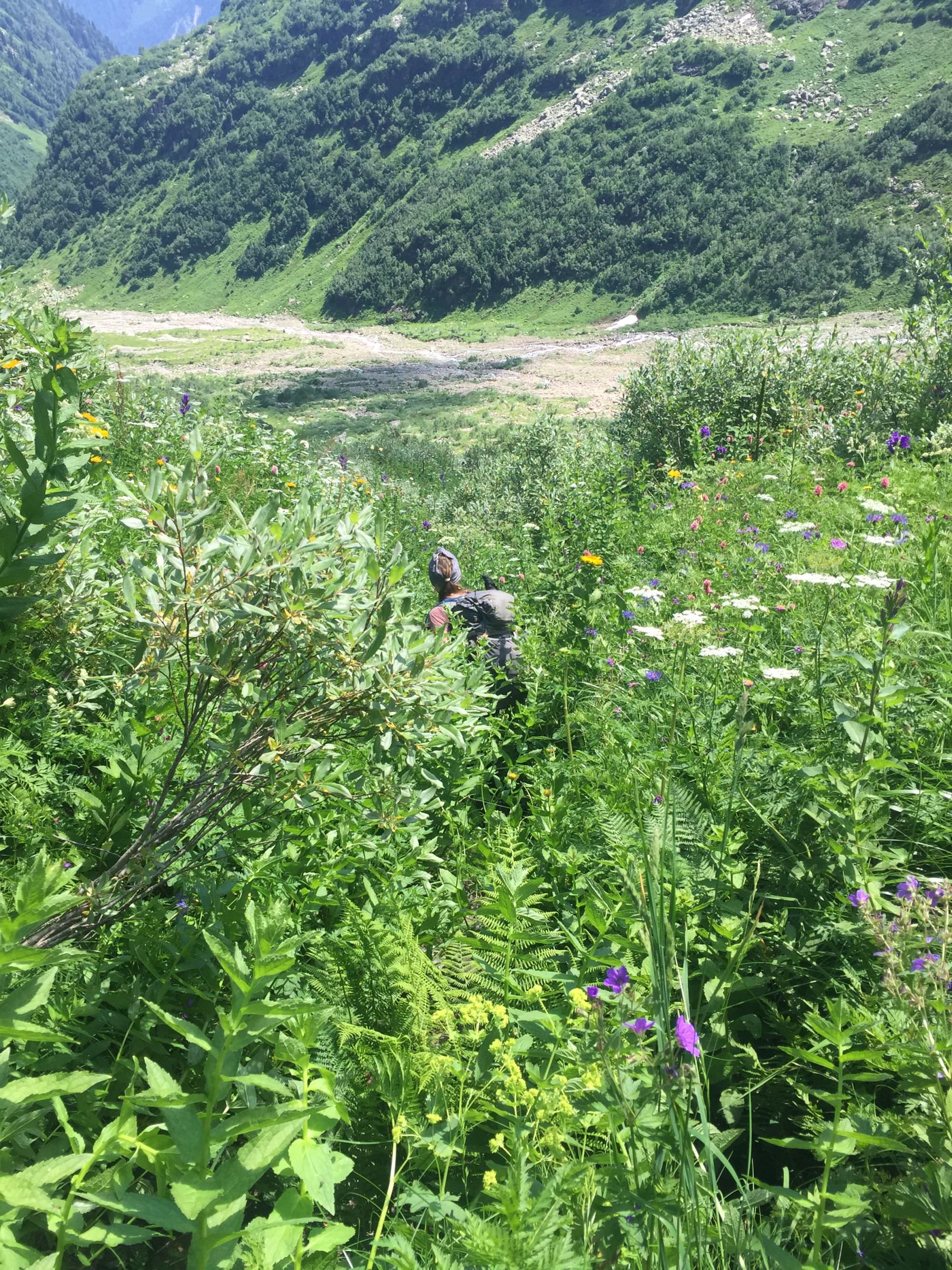
The best season to head up to Memuli is probably from mid of July to mid of September. July allows longer days but also brings higher vegetation (up to 2 meters), more insects, and the lake(s) could still be frozen; moreover, the third lake may be completely out of reach. Vice versa, September should reduce the level of bush walking noticeably, but days are much shorter, and you may face first snow.
If you still have other hikes described as "challenging but rewarding" on your agenda, you probably should go for one of those first. Memuli is a bucket list hike for experienced adventurers. Yes, the surrounding is beautiful, but you will encounter a variety of circumstances you may not be too fond of: hard to reach starting point; entry permit required; a steep mud road; a poorly marked trail, when it's needed the most; smaller and bigger river crossings; bush walking (incl. hogweed); more bush walking on slippery steep terrain; steep rock sections; and every kind of insects which love to eat your blood and make you itchy for days. Hence, both already demanding physically, your mental resilience will be tested as well.
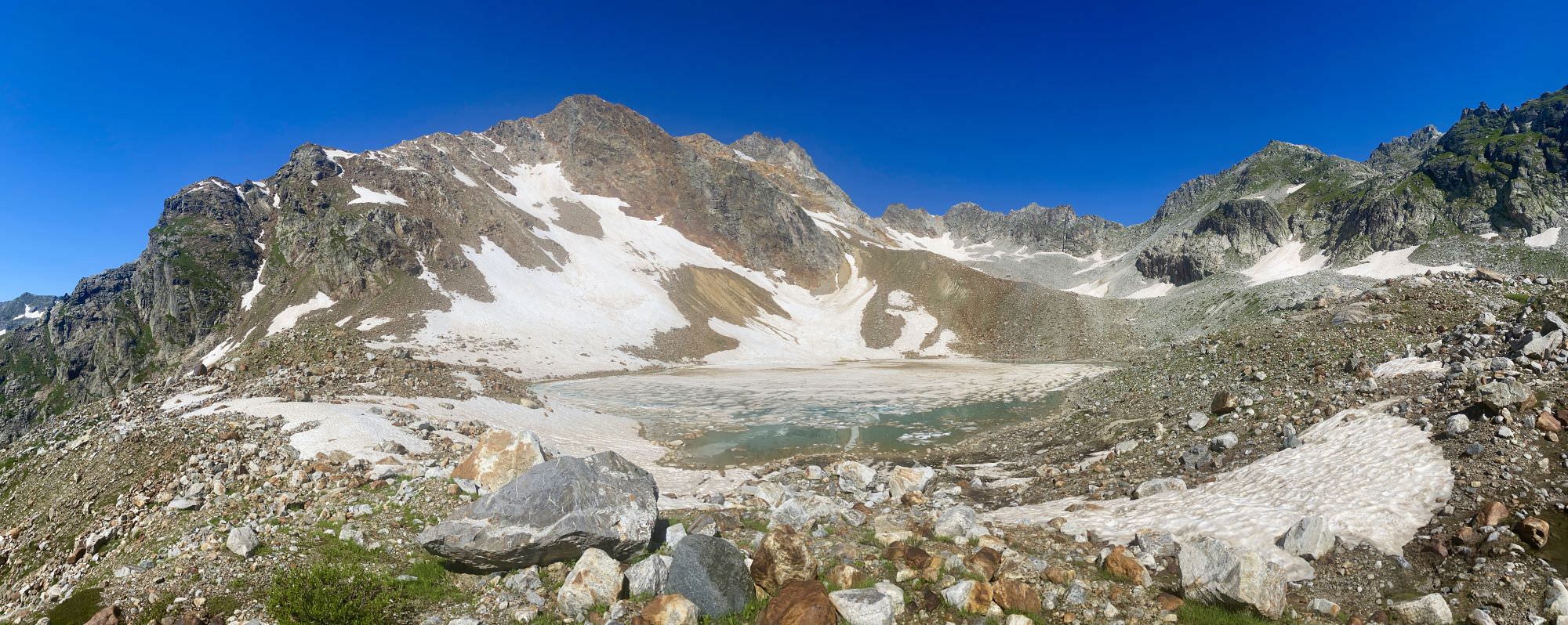
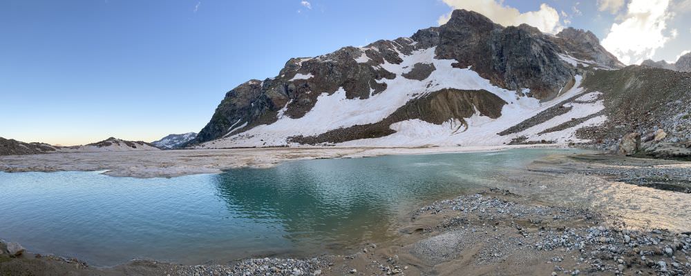
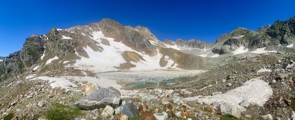
As of now, there are a total of three Memuli lakes. Their counting is rather confusing from a hiker’s perspective as it is not by the order of accessing them (from one to two to three) but by the time they appeared through glacier melting. The first lake on about 2.650 meters is not on the described route and not worth visiting according to all locals we talked to due to its completely overgrown steep surrounding. The second lake at 2.760 meters is the most known and displayed in the title picture. Lake three lies on 2.905 meters; the trail goes from the second lake along the Memuli glacier which makes its hikability less reliable.
Water is easy to access on many parts of the trail before you start the steep last kilometer up to the second lake. Good spots to refill are the campsite at Kvemo Memuli; a small forest creek shortly after the Memuli waterfall; all way along the upper part of the Tskhvandiri river (especially around Zeda Memuli); and at the lakes themselves. Also, the border police will be happy to help out if needed.
While Chuberi itself will offer you various guesthouses and plenty of families ready to host you, on the trail, the summer settlement Kvemo Memuli and the area around the lonely hut at Zeda Memuli are your best picks for camping. Once you passed the latter, you have to make it all way up to the main lake or turn around as the area in between is either too rocky or too steep to put up a tent. At the second lake you will find maybe seven or eight nice spots, and you may even camp down to the lake if snow allows. The third lake offers possibilities as well, though less in number.
Due to the vicinity of the Memuli lakes to the Georgian-Abkhazian administrative boundary line (ABL) and the Russian border, you need an entry permit for this hike. Based on where you are, you can either get it at Division N9 in Mestia (Kakhiani Str. 53) or directly at the local section headquarter in Chuberi (marked in the gpx-file; mobile: +995 591 816 820).
As you probably have to manage everything with the Chuberi unit in Georgian (our experience), you may want to fill in an application upfront on the website of the Georgian Border Police or contact them through Facebook. You won’t get the permission this way, but a back-up contact person you can call in the worst case if you don’t manage language-wise.
Your best choice is to take one of the regular marshrutkas to Mestia and to get off some minutes behind Khaishi at the small restaurant Tobari, at the mouth of the Nenskra valley. From Tbilisi (7am; +995 595 700 892) the ride should cost you about 50 GEL; from Kutaisi (officially 10 am, in high season often earlier; +995 599 118 185) they will charge you the Mestia fare of 40 GEL; from Zugdidi (between 10am and 3pm when full; +995 577 7724 46) it may be 30 GEL.
Especially for Tbilisi and Kutaisi it is better to call in advance and to be there in time as spots are rare. Once off the bus, take the smaller non-asphalted street on the left towards Chuberi (right is going to Mestia) and put up your thumb. Though it may take you two or three rides, this is still way more comfortable than walking additional 20km on dirt roads to the Chuberi border police at the very end of the commune. Alternatively, you can try to arrange a local driver (e.g., Mirza Kaldani; +995 591 816 806) who picks you up at the junction or even in Zugdidi.
Independent on how you travel, ensure to stay on the western side of the river once you left the center of Chuberi as you have to get to the border police before starting the hike.
In case you don’t have a car waiting for you, the eastern river side is the better option on the way back. Once in Tita, the first all-year settlement, your chances to catch a ride are increasing with every meter closer to the commune center.
Once you are back at the Mestia-Zugdidi Street you can hope for another hitchhike towards Zugdidi or stop one of the marshrutkas coming from Mestia. The main ones leave already in the morning at 8am and should be at the Chuberi junction just around 9:30/10:00 am. Smaller ones run also in the afternoon; Karlo (+995 595 705 184) for instance leaves Mestia normally every day around 2:00 pm and might be at the Tobari restaurant around 3:30/4:00pm – better to give him a ring in advance.
In case you still have some strength left or you don’t feel like the same way home, think of hiking from Chuberi to Nakra and then all the way to Mestia or even Ushguli.
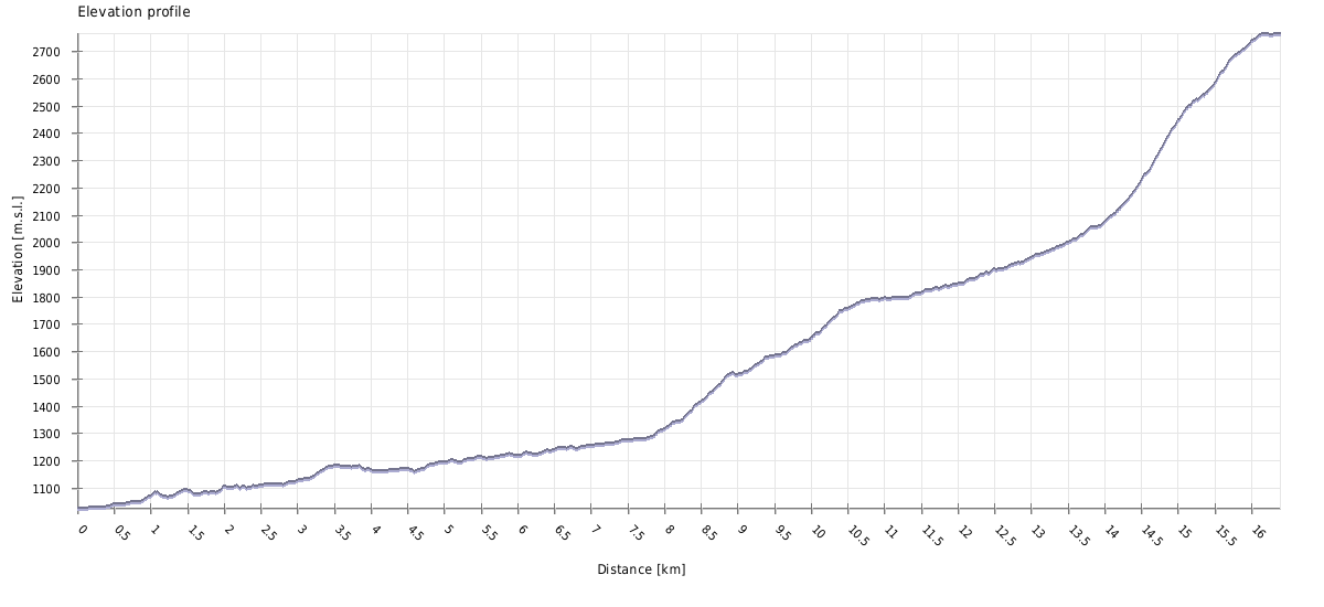
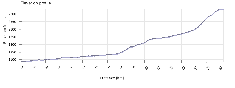
Second Memuli lake
| Distance | 25.4 km |
| Trail type: | Roundtrip |
| Max. elevation: | 2765m |
| Min. elevation: | 1094m |
| Total climb: | 1895m |
| Total descent: | 1836m |
Your first day starts at the main building of the border police in Chuberi. Here, you must register and get your permit, which you also have to show to a second post some five kilometres further up the river. As tourists are rather rare in that area, the entire procedure may take about an hour and several calls with the superiors to avoid any mistakes. Have some mean of identification with you, a proof that you know the way (gpx file on your phone or hiking map) and indicate the number of days you plan to stay. Be aware, that there is no phone service at all on the way up and around the lakes. Hence, in case something goes wrong, they will only come for you after your planned hiking period is over.
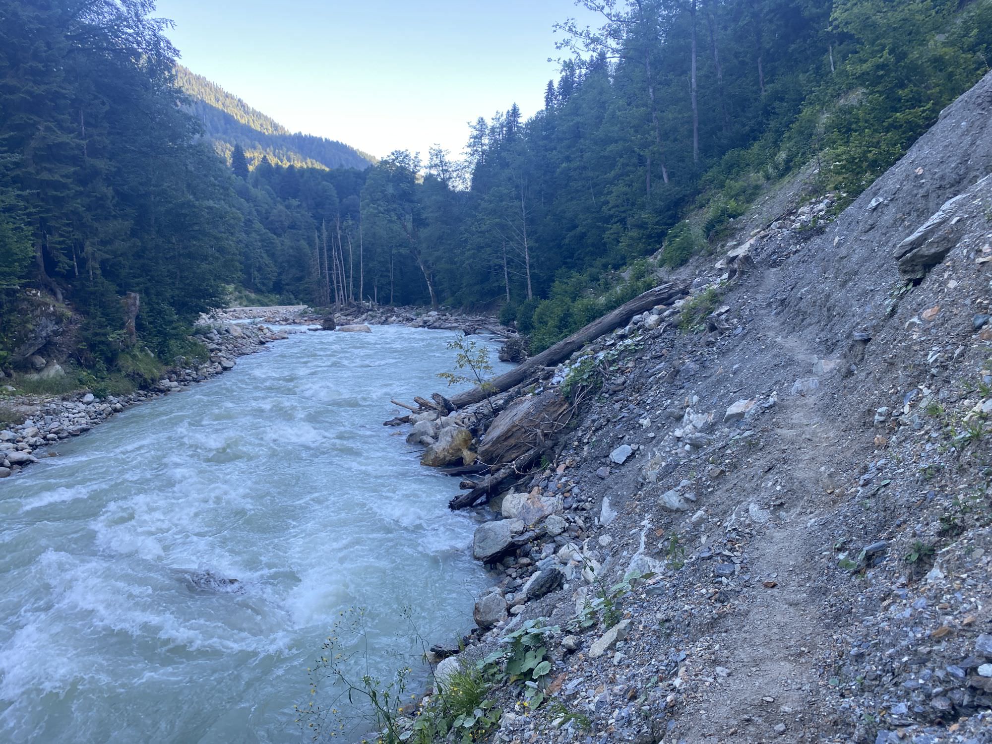
Once the paperwork is done, head to the north where you will pass by the remnants of the big metal bridge, which has been there until a big landslide in 2021. It is still on most maps, and we were told, that it shall be put back in autumn 2022, when the Nenskra river is lower again. Anyhow, I would not rely too much on that promise and the small hidden trail along the water is also more scenic and enjoyable than the dirt road on the other side. In case you want to reach Kvemo Memuli – the start of the actual ascend – by car, you must turn around and take the small bridge called "Mokle" (Georgian for "short") between Kari and Lari (about 3km) or the big metal bridge in the commune centre (about 7km).
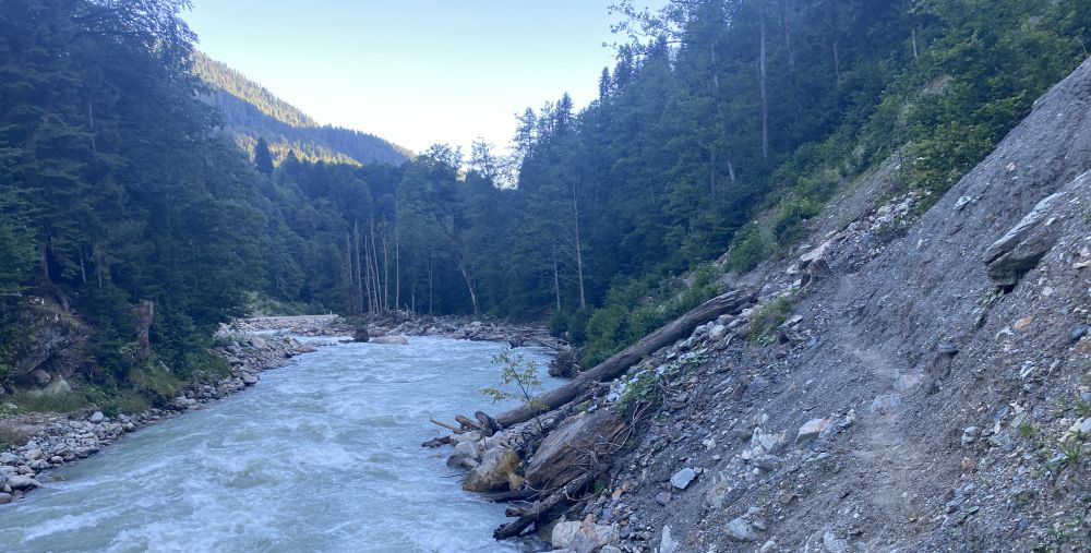
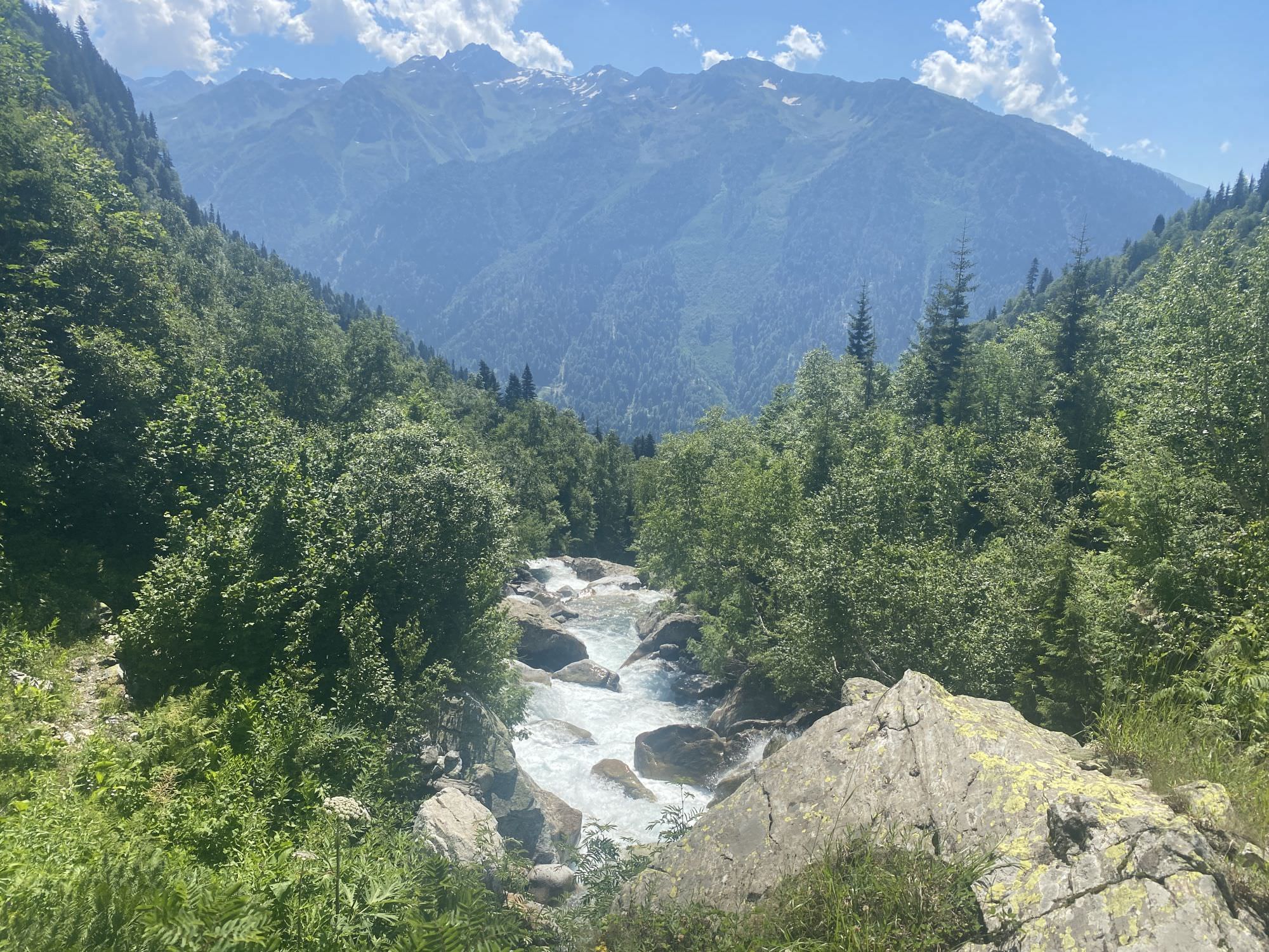
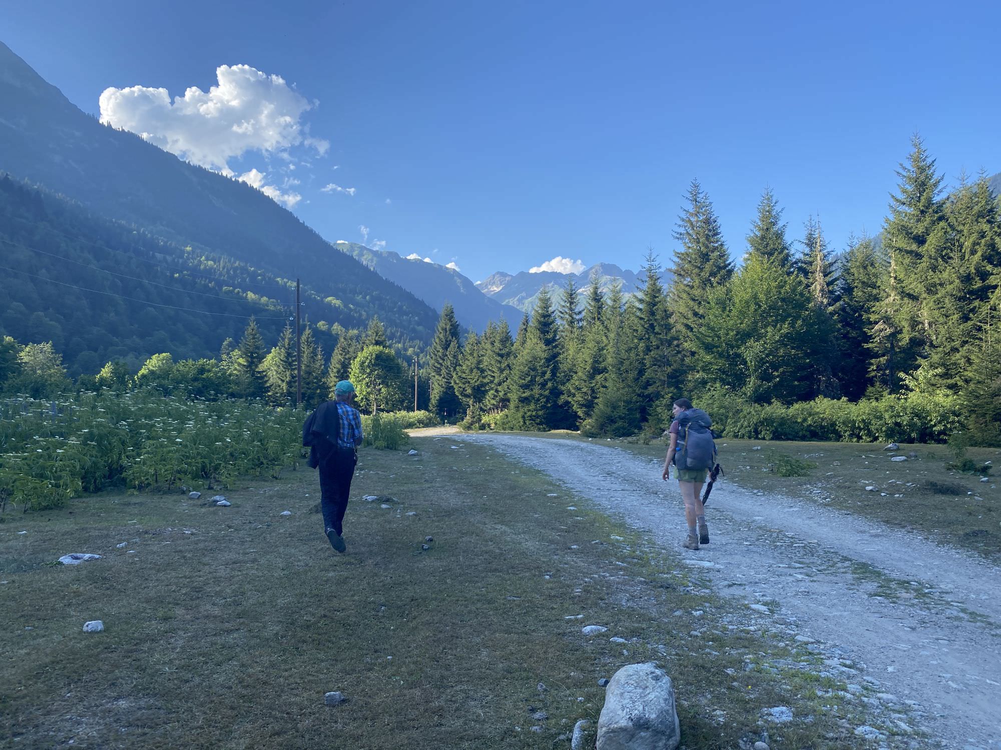
Narrow trail along the river
On foot, you will soon come to a point where a wide forestry road is leading upwards. Here, stick to the small nearly hidden path right next to river. Though rather steep and narrow, it is well trotted and shouldn’t be too much of a challenge. After 2,5 kilometres the scenery will change to a forest setup and another kilometre later you will find yourself on a meadow. Shortly after you will come to a big and unappealing gravel track and pass through a small nameless settlement. Before you finally come to the summer farms of Kvemo Memuli you will have to report yourself to the second, smaller border police checkpoint – on the way back you also have to come here and leave your permit with them.
After a total of two to 2,5 hours you should reach a number of huts and the information board about the hike. Set up your tent some meters behind along the small creek and call it a day – just pay attention that you are not too close to the free walking bulls and dogs.
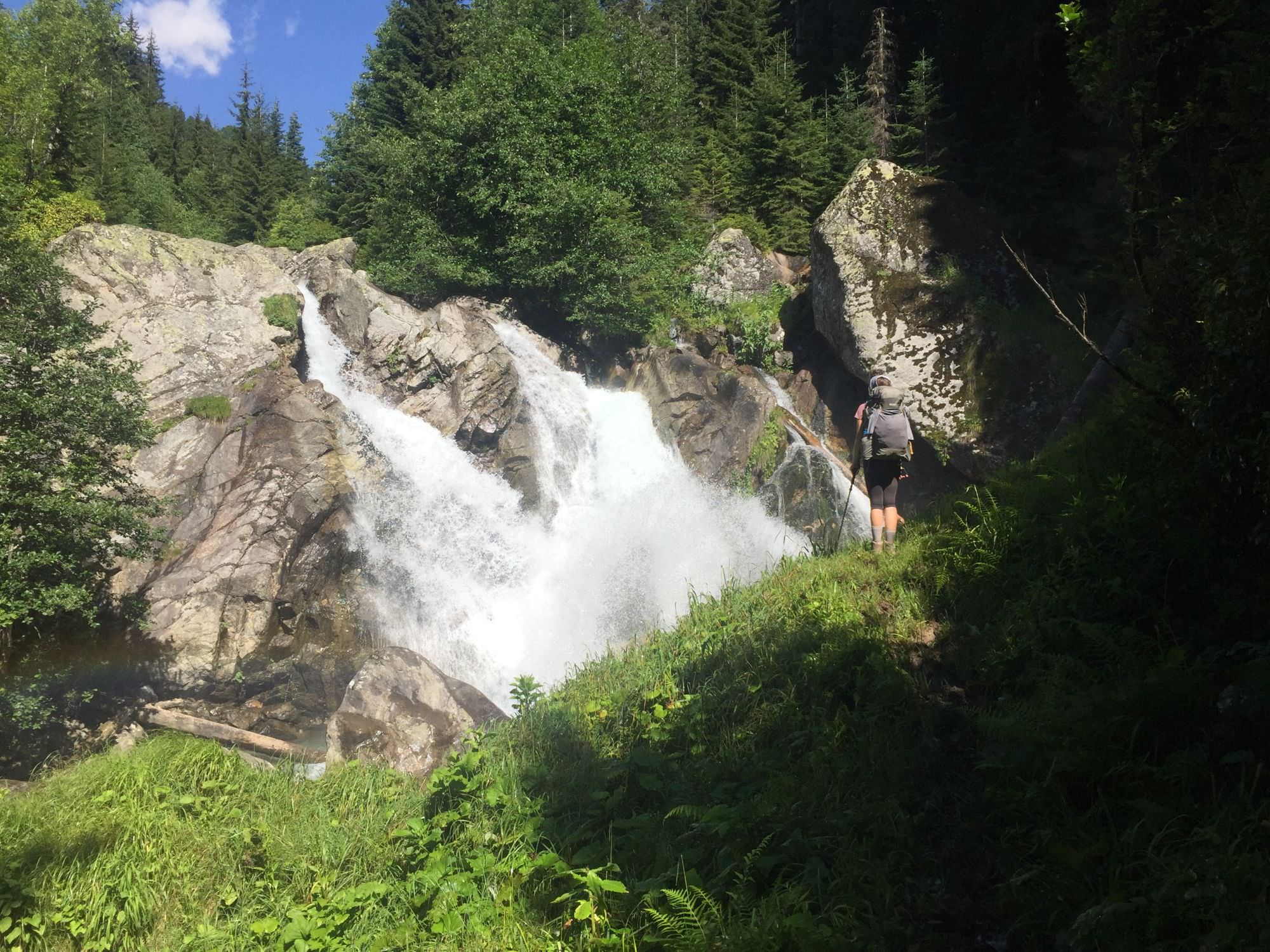
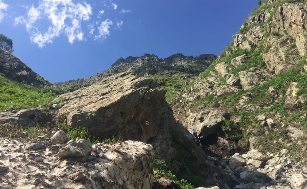
While you will only walk 6,5 kilometres today, you should take off in time as you may need a total of eight to ten hours up to the lake. From the trail sign, follow the wooden fence into the forest and find yourself on a wide, dry, and steep forestry road. Follow it for a bit more than a kilometre until a crossroad – at this moment you managed already 250 metres in height. Here, look up right and try to find a white-yellow-white mark on a big tree in about 15 metres distance. Behind it is a small well-trodden track, although the start may be covered by fallen trees. In case you missed it and followed the more inviting wide road on the left, no worries: you can walk this one as well until its end, fight your way some metres up through plants and meet the actual trail around a marked tree (see gpx). Just several hundred metres later you will already encounter a massive single standing stone in the mid of the forest; go around it on the left and enjoy the refreshing breeze of the Memuli waterfall.
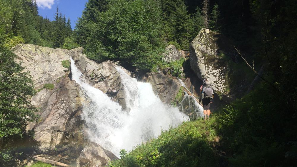
Memuli waterfall
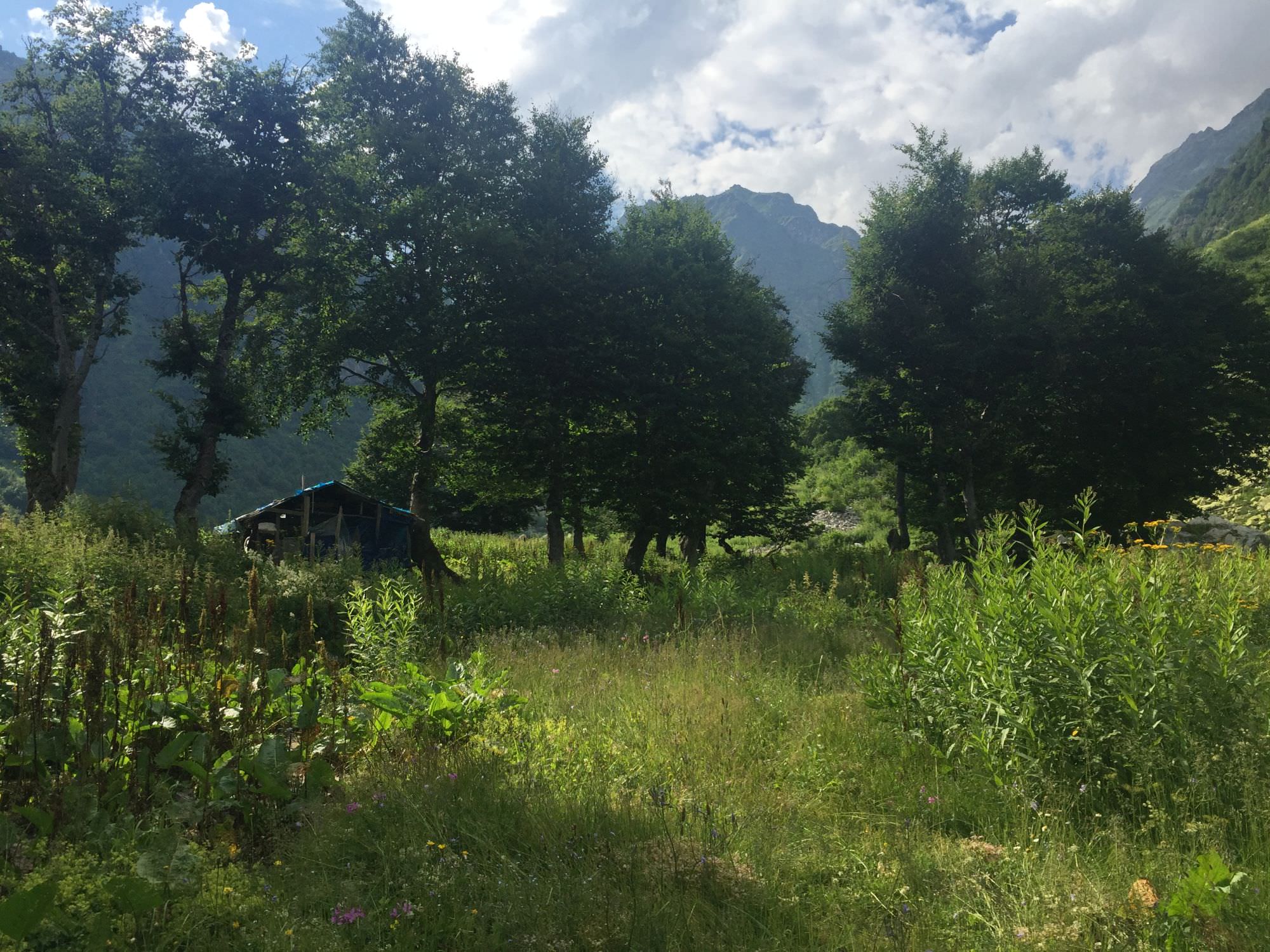
From here, enter the forest again. The path is straightforward and will cross a small river, where locals also installed a small ‘tab’ to enjoy a cup of water and to fill up your reserves. Soon, the path gets gradually steeper and also more overgrown. You can’t get lost though as you constantly walk in parallel to the strong Tskhvandiri river; this also allows some nice views on the way. After a total of three kilometre, you will reach the tree line (about 1.800 metres) and soon find yourself on a small meadow with a single working hut: Welcome to Zeda Memuli!
From here, follow the river for another kilometre until you have to cross; in case vegetation allows you to spot all trail marks you might be able to find the intended location. Anyhow, there are several manageable options and you either way will have to cross several smaller and bigger streams at least one more time until you reach the dried area in between the two main arms. Important is to head in north-west direction and come along a big single-standing marked boulder. From here it is another kilometre until you face the steep, green ascend to the second Memuli lake on your right side. For those even more adventurous turn westwards and find your way along Okrilatavi (3.606 metres) to the Okrila lakes (about 2.900 metres).
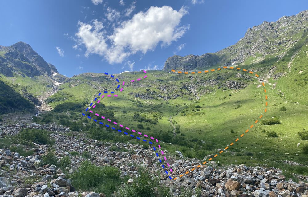
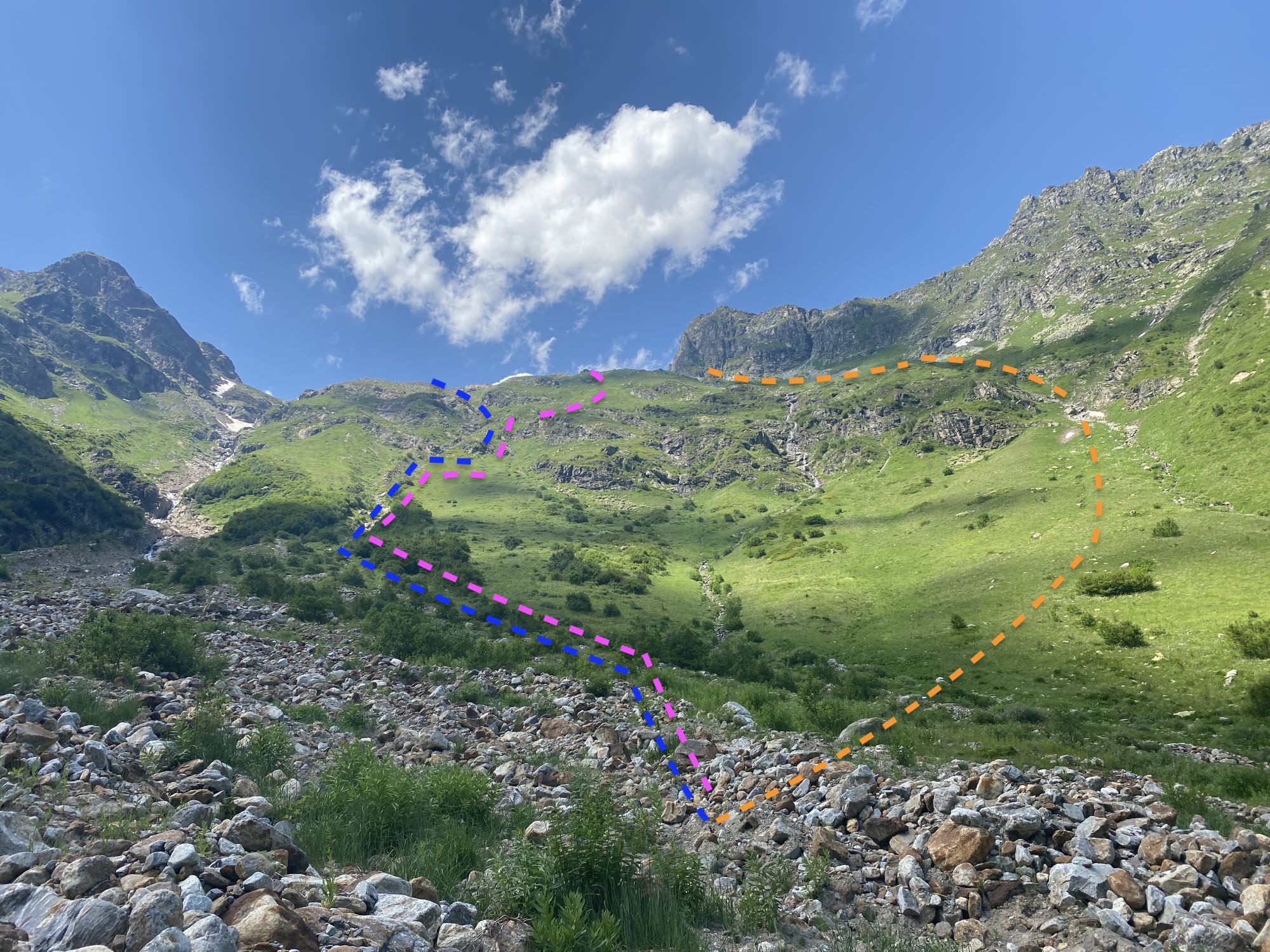
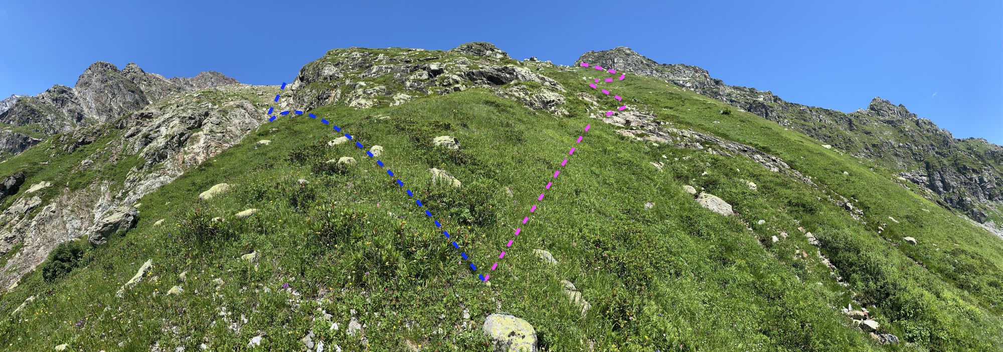
Possible ascends to Memuli lake
As roughly indicated in the picture above, there are three different possibilities to tackle the way up:
Locals recommended the eastern path to us; anyhow, all three options have their pros and cons. By distance (1,5 kilometres) and elevation (750 metres) they are all basically the same; the question is more which terrain you prefer the most, where to tackle high vegetation, and when to manage the biggest gain in altitude. To be honest, they are all not great and it will take you up to four hours either way.
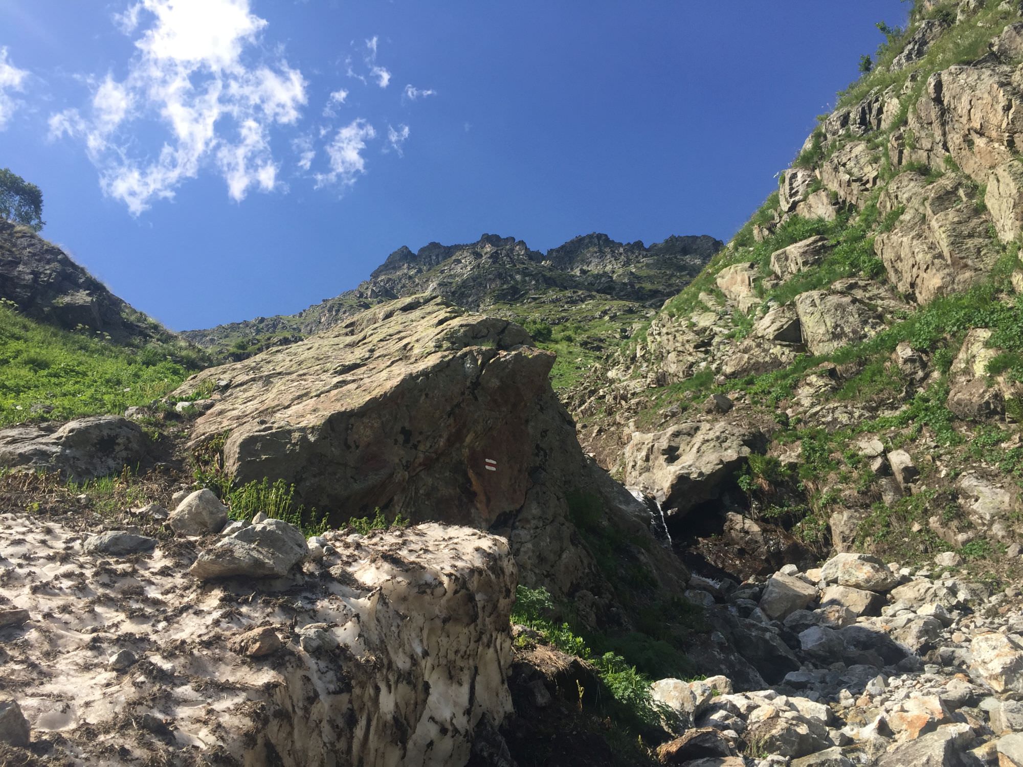
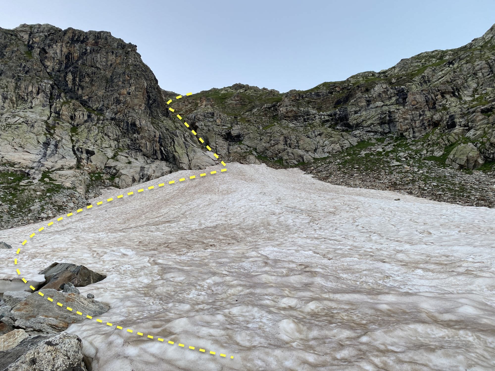
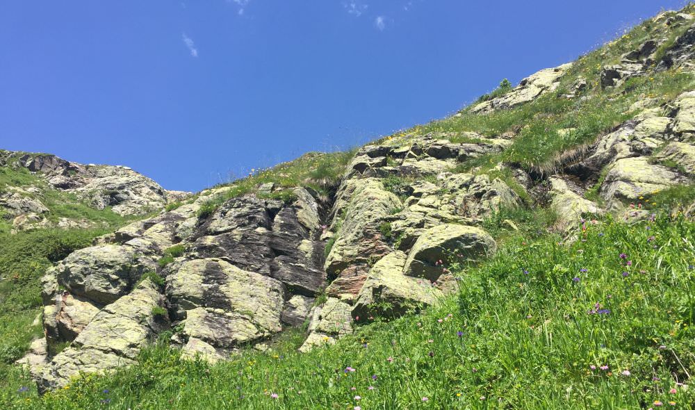
The eastern route has the advantage to start rather smooth as you walk the first about 500 metres diagonal up to a marked big rock on 2.350 metres, and as the vegetation is rather low here (knee high). From here on it turns very steep (comparable to the steep ascend from Shovi to Udziro lake) and you have to climb on all fours – either through a narrow, slippery, rocky riverbed or in parallel to it through very dense and high undergrowth, which does not allow to know where you actually step.
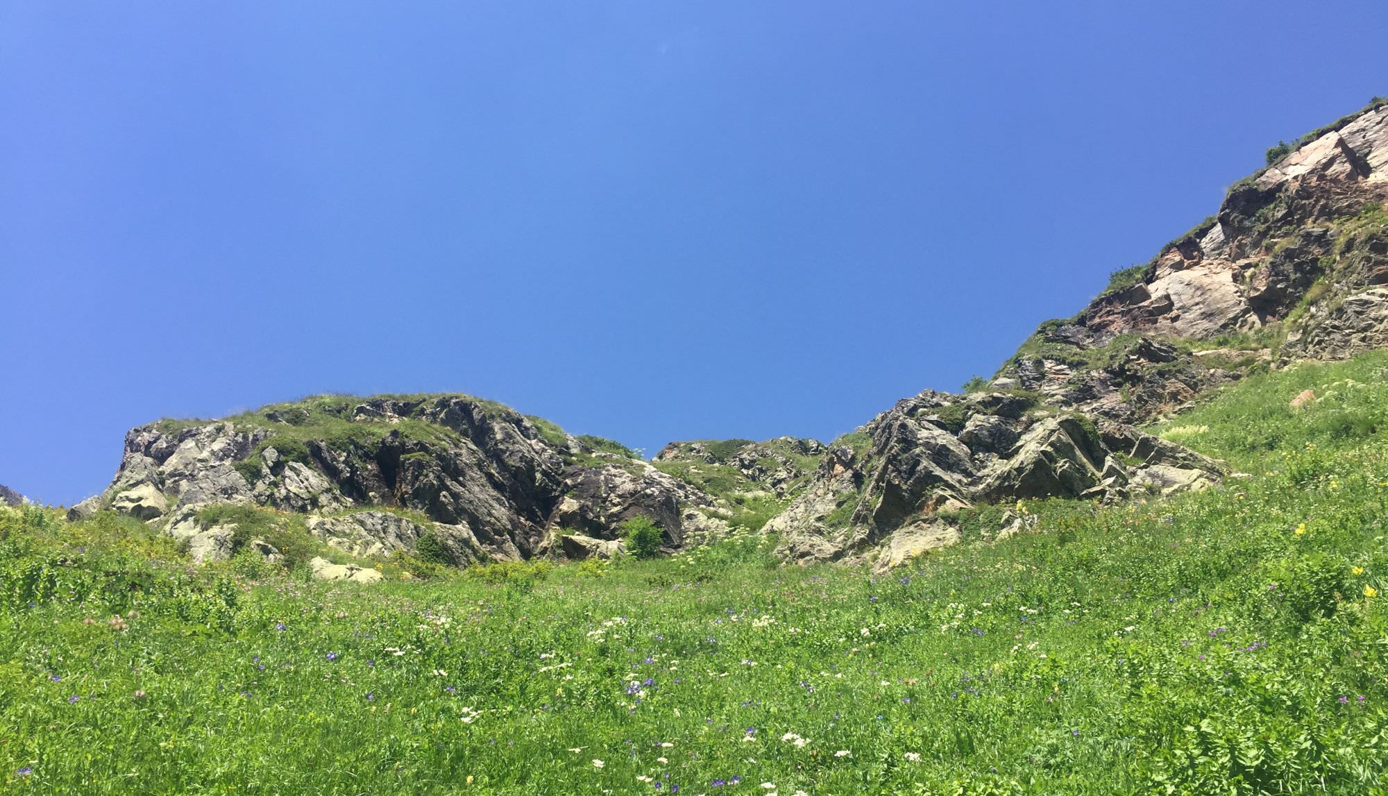
Marked stone en route to the Memuli lake
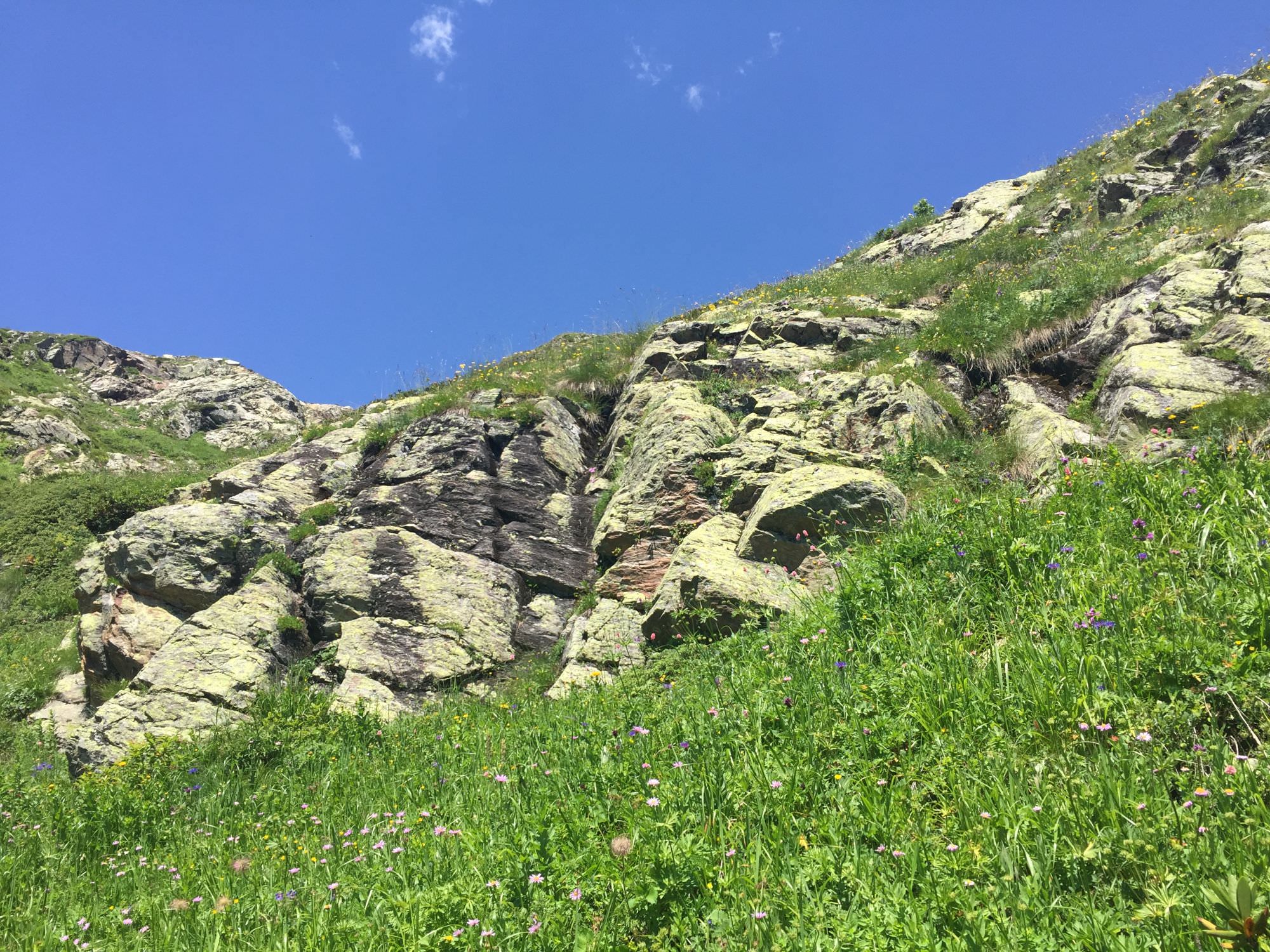
Around two hours after starting the steep ascend you will reach first rhododendron fields on about 2.450 metres. Soon you will enter a nicer-to-walk rock field; by looking up to the peaky ridge in front of you, you can also already imagine how you will reach the lake.
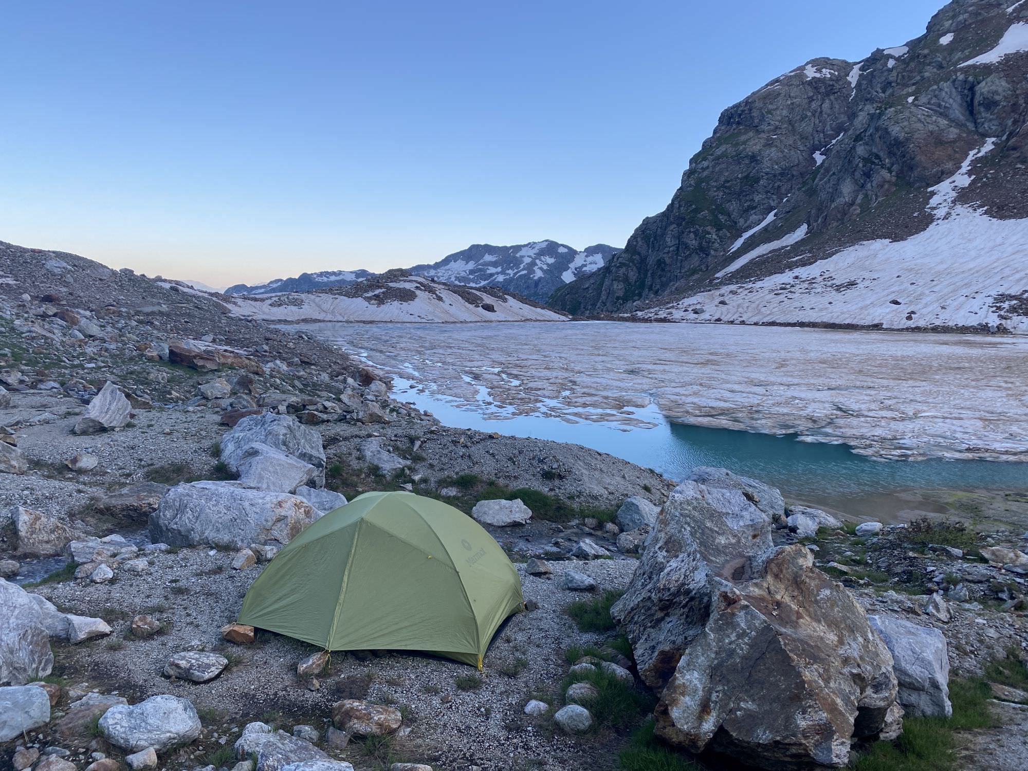
Towards 2.650 metres you will spot a growing number of rhododendrons and big rocks in front of you. You can either continue on the stone field or already turn towards the greenish area. Some metres later you will reach the first campable, flat spot since Zeda Memuli and another 15 minutes later you will finally reach your destination, the second Memuli lake.
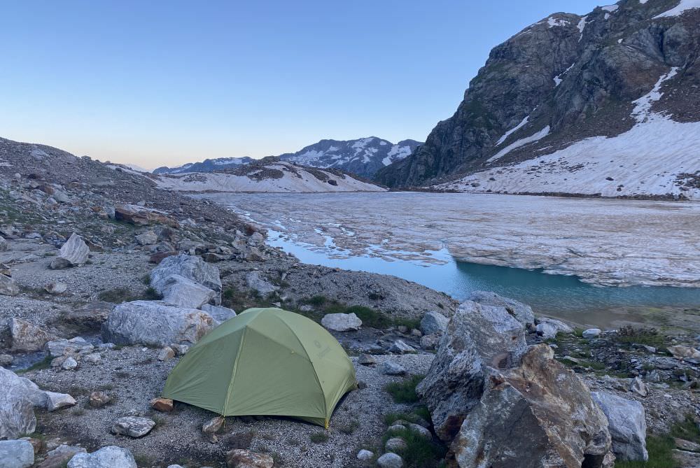
Camping at the second Memuli lake
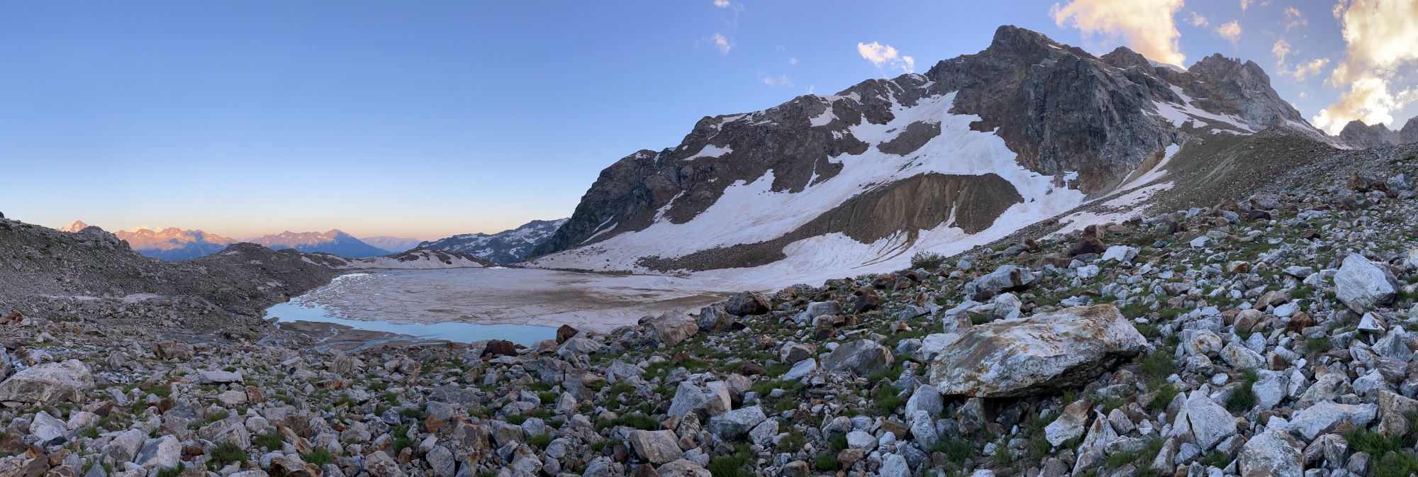
Once settled, allow yourself a small evening stroll to enjoy the setting in all its beauty. Head uphill from your camping spot to get some nice evening views on the lake and the small, slightly higher side valley where the stream feeding Memuli is originating.
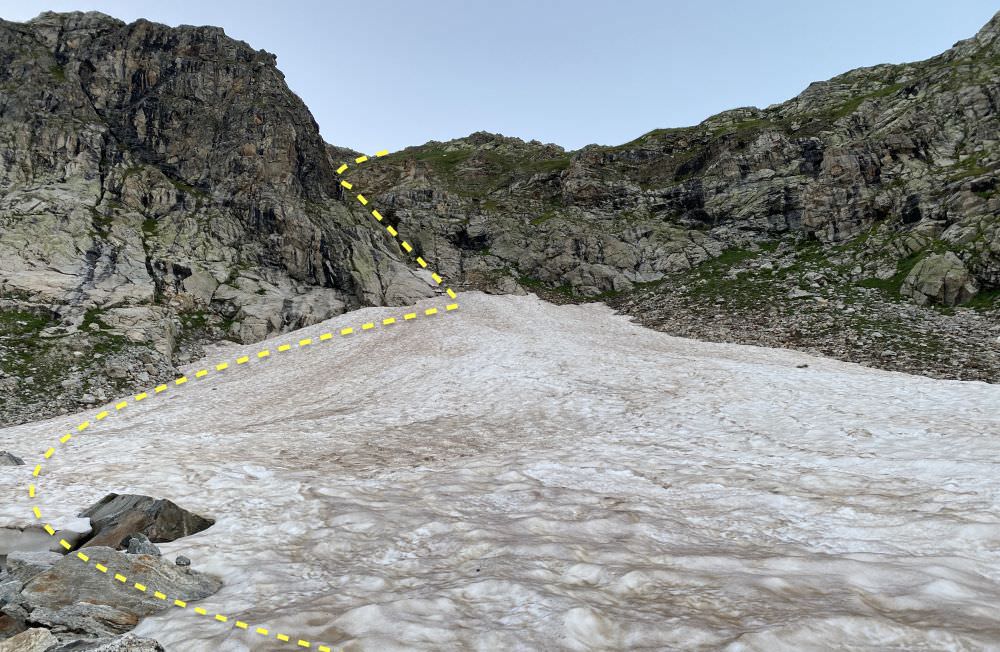
Due to a still considerable amount of snow on the southern side of the ridge and the warnings of the locals that the trail is steeper on the northern slope, we skipped to take that risk. Until finally walked and described by Caucasus Trekking contributors, you can find some some photos on Bisna.ge – gpx log for this section comes also from their website.
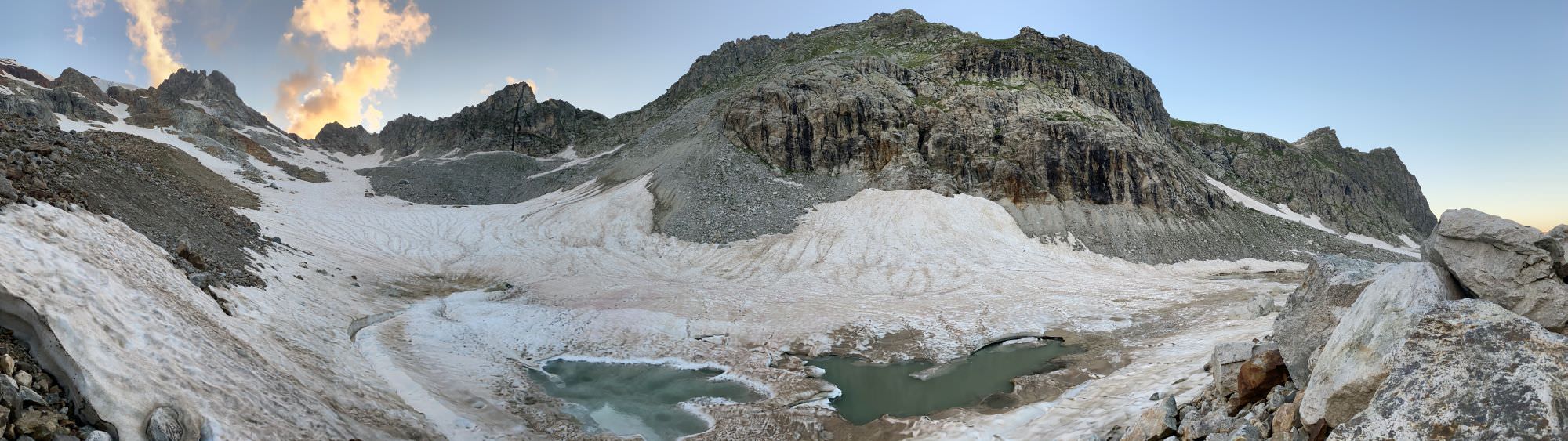
From your camping spot head basically straight up north towards the Kodori range – not into the small snow-covered side valley. Here, you will rather steeply traverse your way up through rocky formations. Soon, you should reach the highest point around 3.000 meters. Then be prepared to lose about 100 metres of altitude in less than 200 metres of distance before you continue your way northwards on that level. On your left-hand side you should be able to see parts of the glacier, on your right-hand side you may have the chance to spot the first Memuli lake (about halfway) some 150 metres lower.
View on way up (beginning of August 2022)
To increase your flexibility and speed in this steep terrain you may consider leaving your tent behind at the second lake and continue with a daypack.
As there are a total of three options for ascend, it also allows to differ the descend a little and to gather some more impressions from the surrounding. For the central and western route, head south-west to the opposite side where the lake has its outflow into the Tskhvandiri valley. Here, you have perfect views in both directions and can enjoy the lake panorama a last time.

Junction of western and central route
The central trail (pink) now first leads a bit inland (towards the eastern route) and then takes a big bow in western direction. As of now, the overall direction is more important than the exact path as one may prefer rocks over grass, or vice versa. Soon you will find yourself in or a long a rather dry small riverbed leading downwards; shortly after already at the point where the western (blue) and central route join on a small ridge. From here you will have to cross two stone formations in only some minutes: the first assembles stairs; the second is more like a long tube – both may not be too much fun with rain.
Stairway to Memuli
Once you passed those two landmarks, you are free to find your way down into the Tskhvandiri river: either through the dry riverbed in the west or through the grasslands in the center. The recorded trail is a mix of both as it starts on the green but then turns towards the rocks as the vegetation simply got too high – earlier may have been better. As the trees separating grass and riverbed get very dense, very early you unfortunately will not have too many options to change from one terrain to the other.
Just as for the ascend, the descend of those 750 metres of altitude will take you some four hours. From here, just take the same route as up: stay on the dry area between the two big river arms, look out for the big, marked boulder, and cross the water at a shallow spot. Once done, follow the river until Zeda Memuli and then through the forest to Kvemo Memuli. Put up your tent and take some rest from a long and exhausting day.
The way back from Kvemo Memuli to Tita is easy and straight forward. Just follow the dirt road, report yourself to the smaller border police station, and after an hour you should find yourself already in Tita. From here on, just check for cars which may speed up your way down to the centre of the Chuberi commune – if you feel like it, about halfway you will pass a hut with mineral water. Once you have phone service again, just text or call the headquarters of the Chuberi border police; no need to pass by physically but they highly appreciate some additional confirmation that everything is all right.
Nodari
The trail was hiked by Chloé Tremblay and Philipp Bienek, who also provided pictures, the GPX, and the trail description. Hiking description is dedicated to Nodari, Mirza, Tengiz, and all the other locals without whom our hiking experiences wouldn’t be the same, who give us rides, invite us to their homes, and share their knowledge on the Georgian mountains.