Spectacular 5-day route following little-known shepherd's paths
"So, Oto, do you see some tourists on this route?"
"Yes, yes, from time to time, they come - on foot and on horses."
"And how many approximately passed this year?"
"That I can tell you precisely. This year, you are the first."
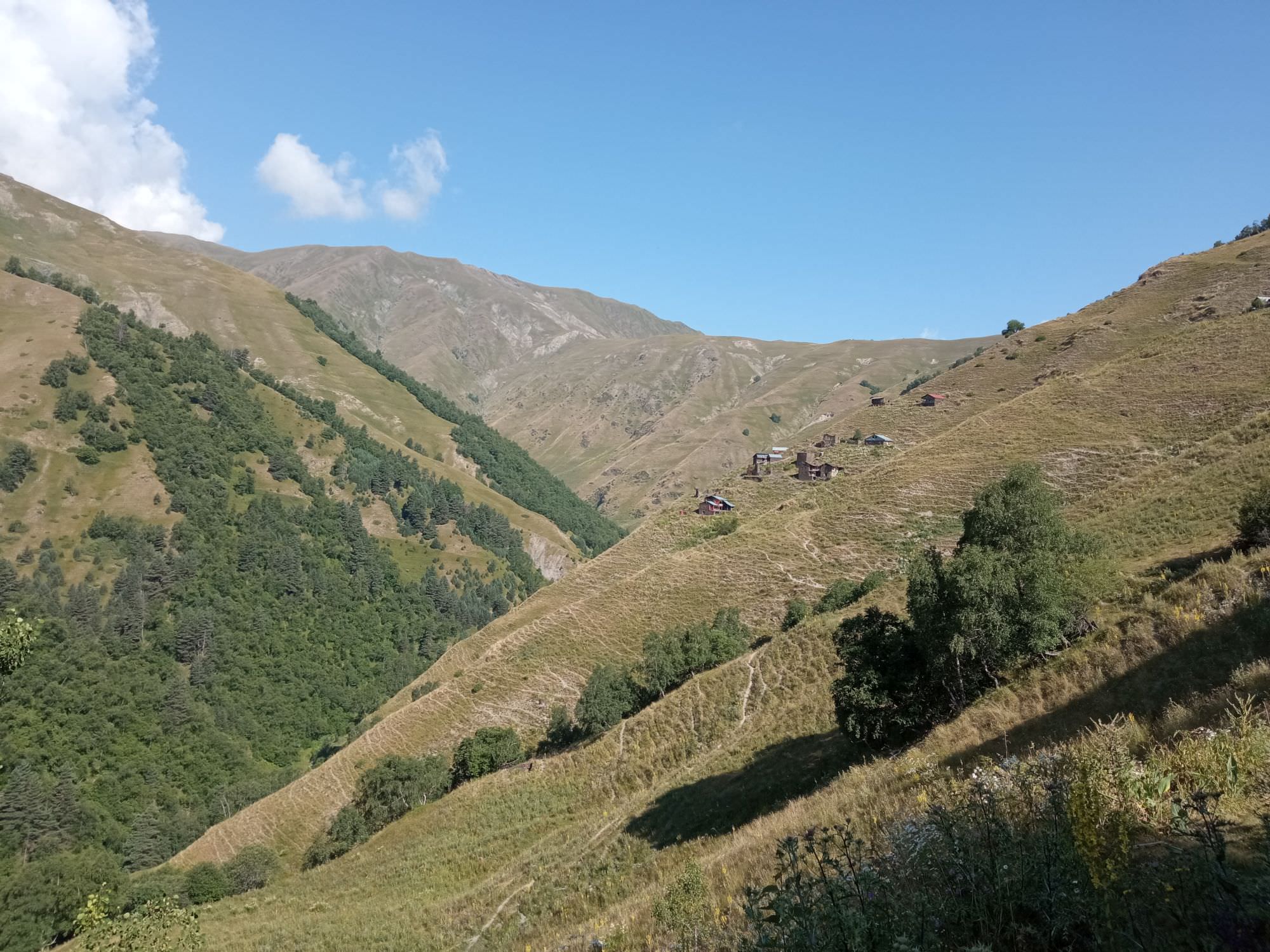
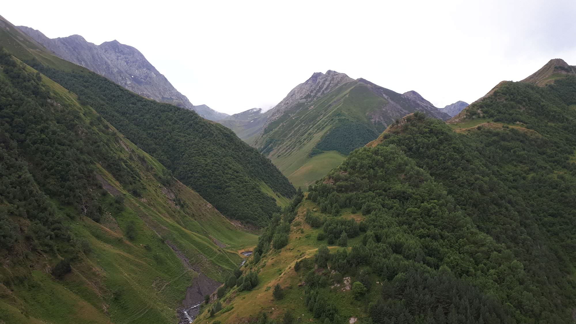
Trekkers coming to Tusheti certainly cannot complain about the lack of choices. Crossing of "Samkin" pass is another of the region's "grand treks" - a spectacular 5-day route crossing the mountains into the adjacent Pankisi gorge. Like many other walks in the area, also this one follows an ancient path, now almost forgotten by anyone but a handful of shepherds. Which is kind of a pity, since this trek deserves more publicity. Not only it explores the rarely visited villages of southern Tusheti, but also crosses two mountain passes, offers great views, a wonderful sense of remoteness and visits Pankisi gorge, one of the more exotic Georgian regions.
Under normal circumstances, this trek should take 5 days if done from Pankisi gorge and half a day less if you start from Tusheti. Either way, due to the length of the trek, you better have one day in reserve, just in case you are not lucky with the weather.
By a length or altitude difference, this is not some extremely difficult trek, but it has its challenges. There is a trail to follow most of the time, but sometimes, when it's most needed, it disappears and you have to fight your way through some overgrown hillside or something similar. Also, pay good attention to your map or phone - the route is walkable, but at some places, it can be easily lost and as a result, you might find yourself in some pretty unpleasant terrain, just like us ;)
Water is not an issue during the first half of the trek (if starting from Tusheti), but once you cross the Samkinvrostsveri pass, some planning is needed. There is no water during the traverse of the 3000m high ridge towards Mt. Ortsveri and even once you start descending by Chkatana ridge, it takes a while till the first water spring is found (and there are no camping spots nearby). Still, it's completely manageable since there is no more than a day of walking between individual water sources.
As for the shelter, it is possible to sleep in the guesthouse on the first night of the trek, but beyond that, you will have to camp.
While reaching Tusheti from the lowlands has a certain undisputable charm, this direction is also much harder due to the altitude difference. Also, it could be a bit dull on the first day since it will take you at least 4 hours of hard work to get above the tree line and get some views.
Also, for these reasons, we did this trek from the Tusheti direction - but if you don't mind the challenge, both directions work well. So feel free to decide depending on your other plans.
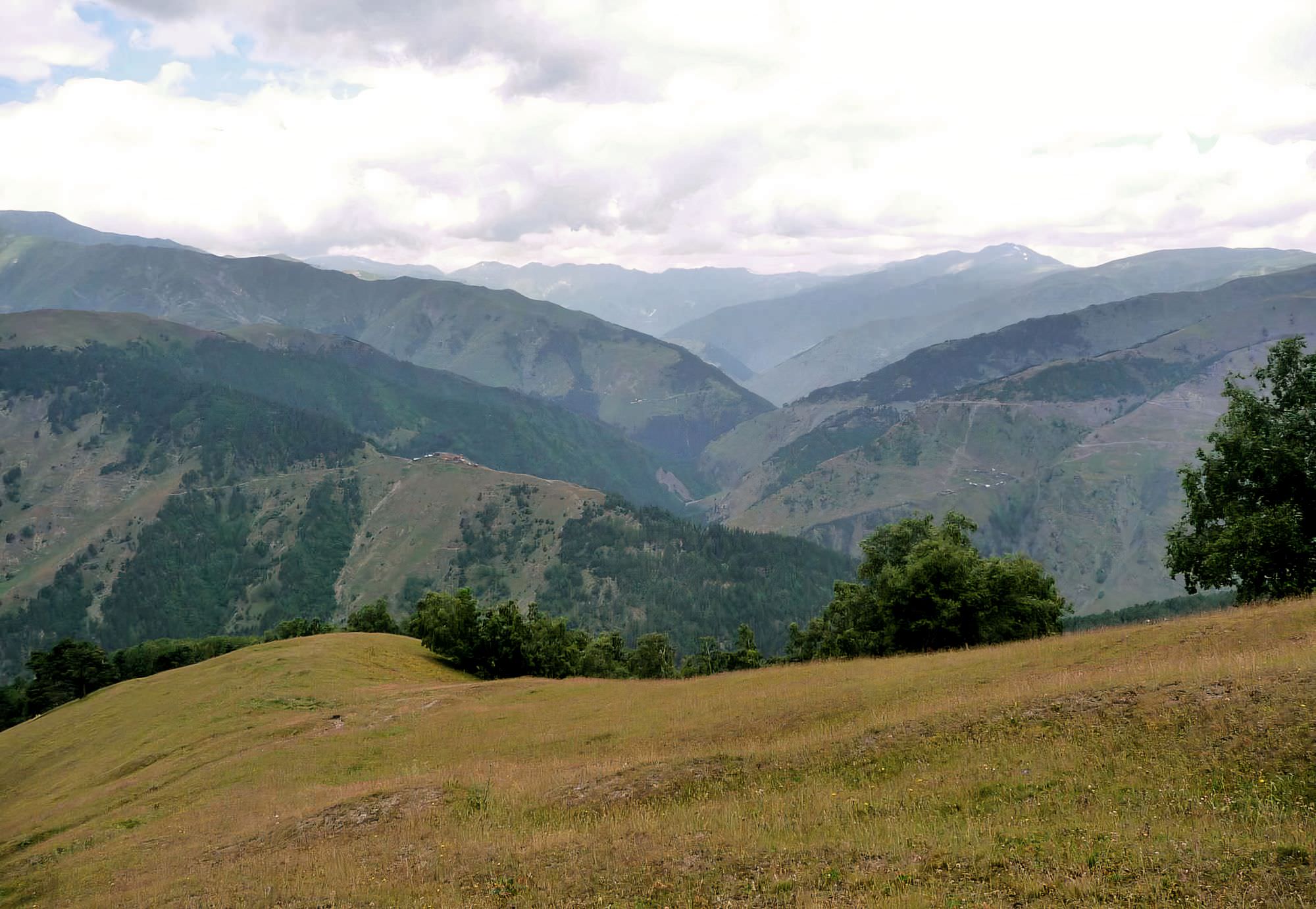
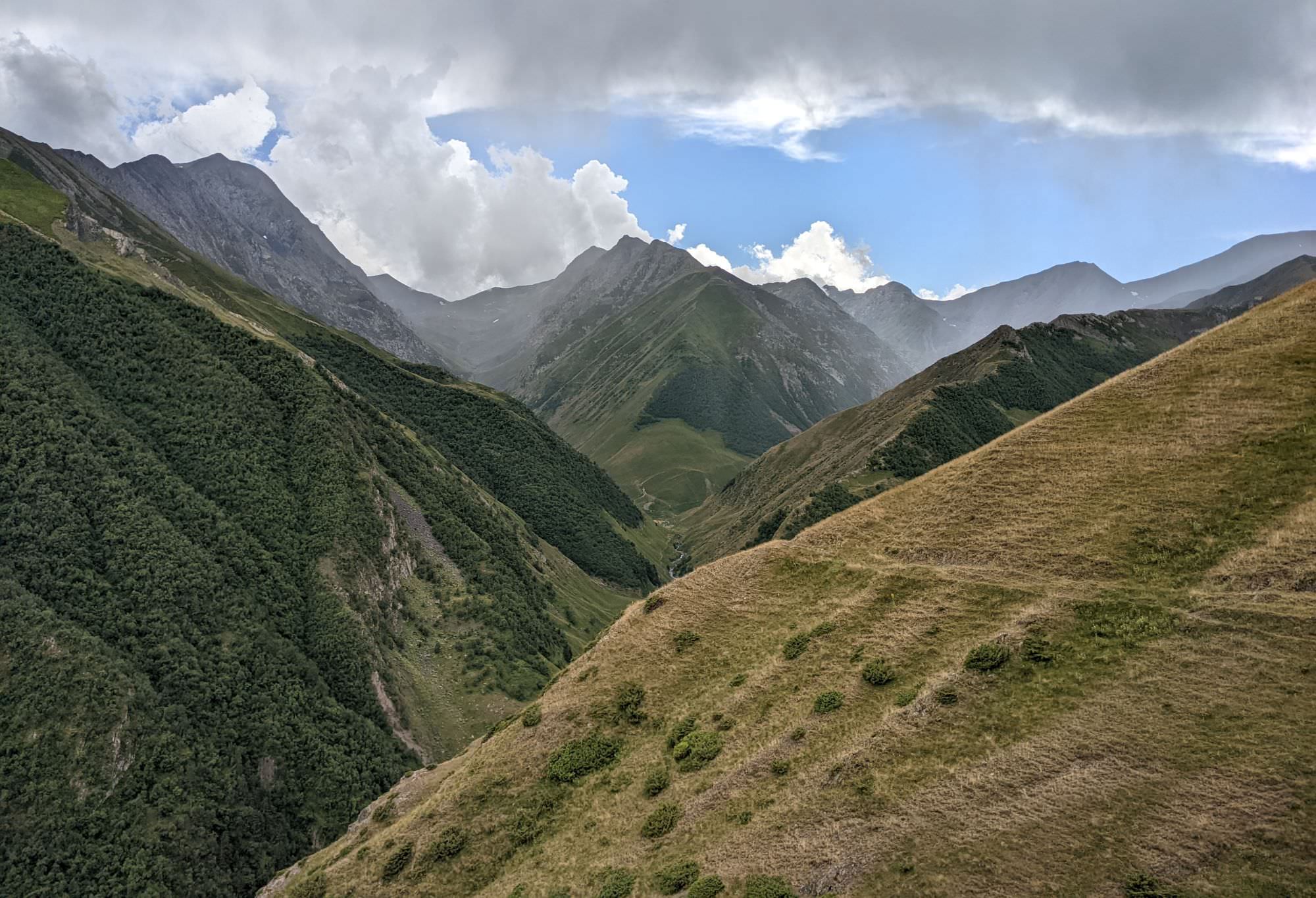
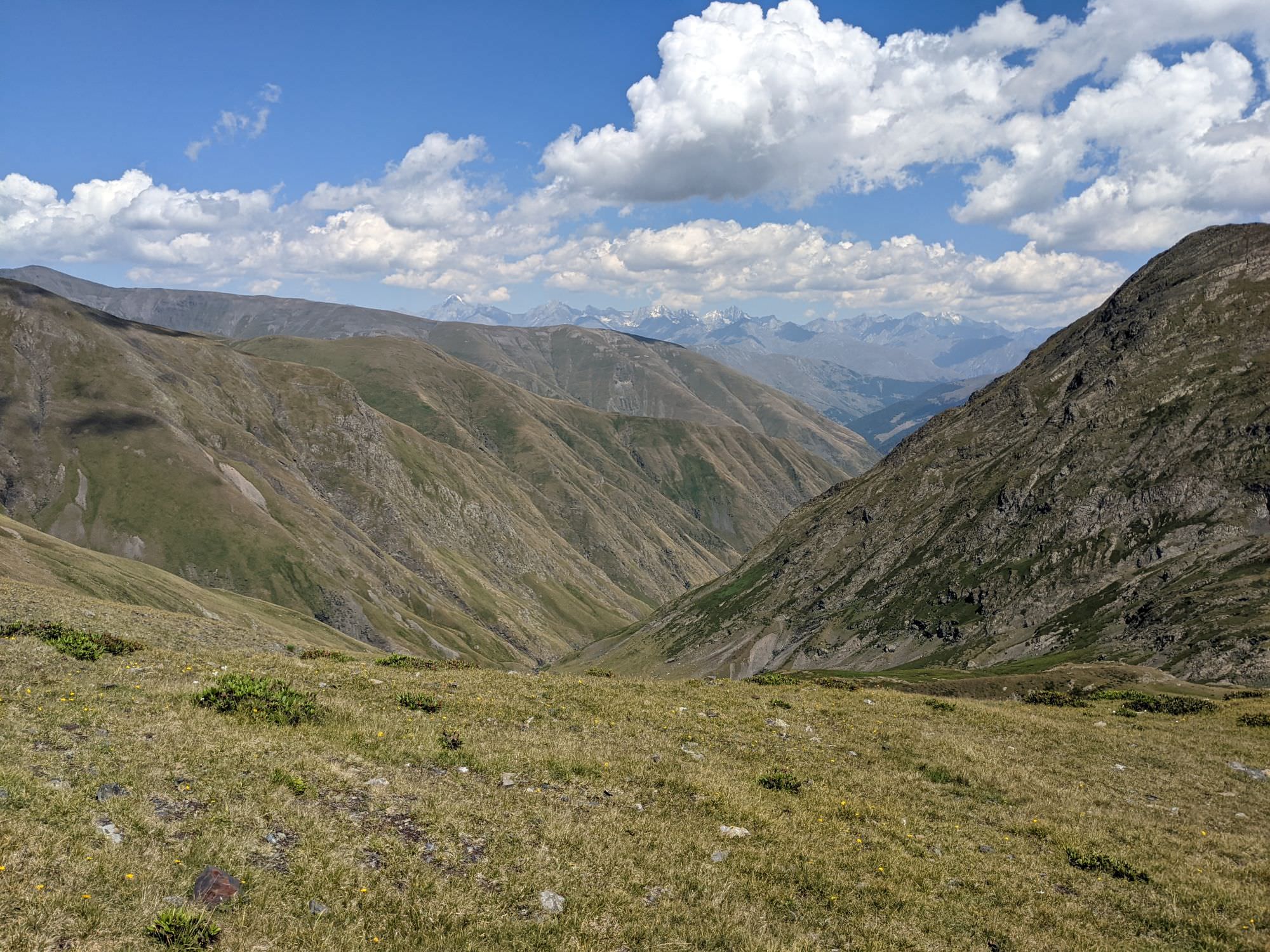
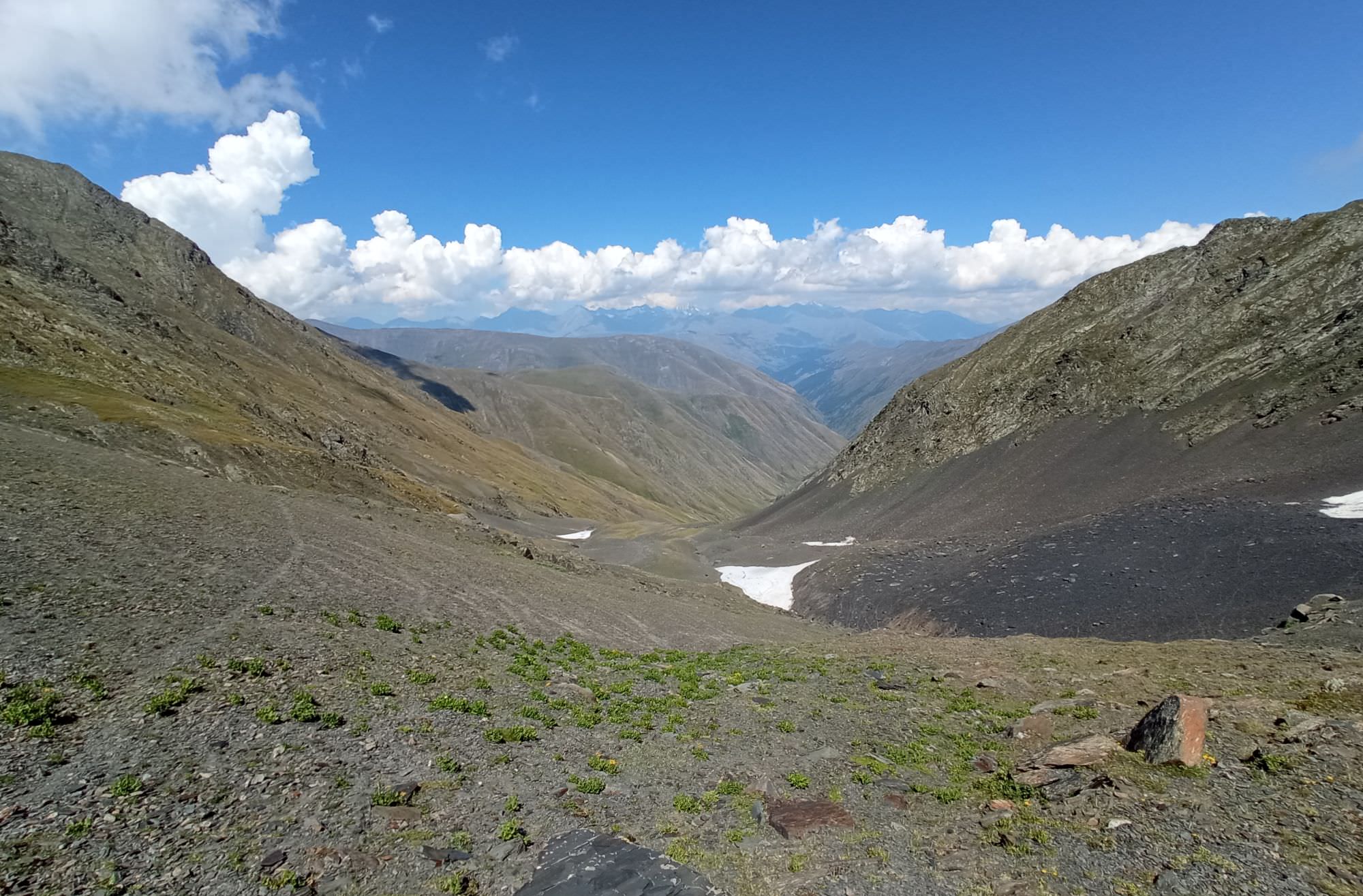
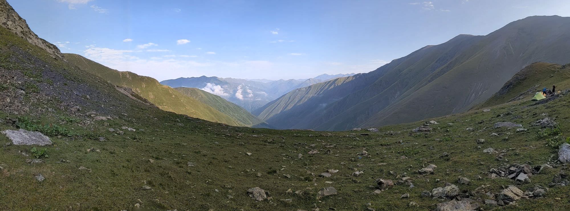
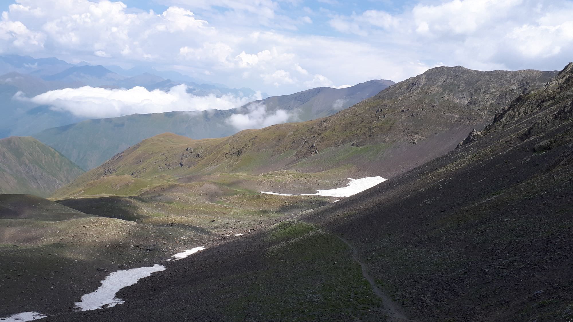
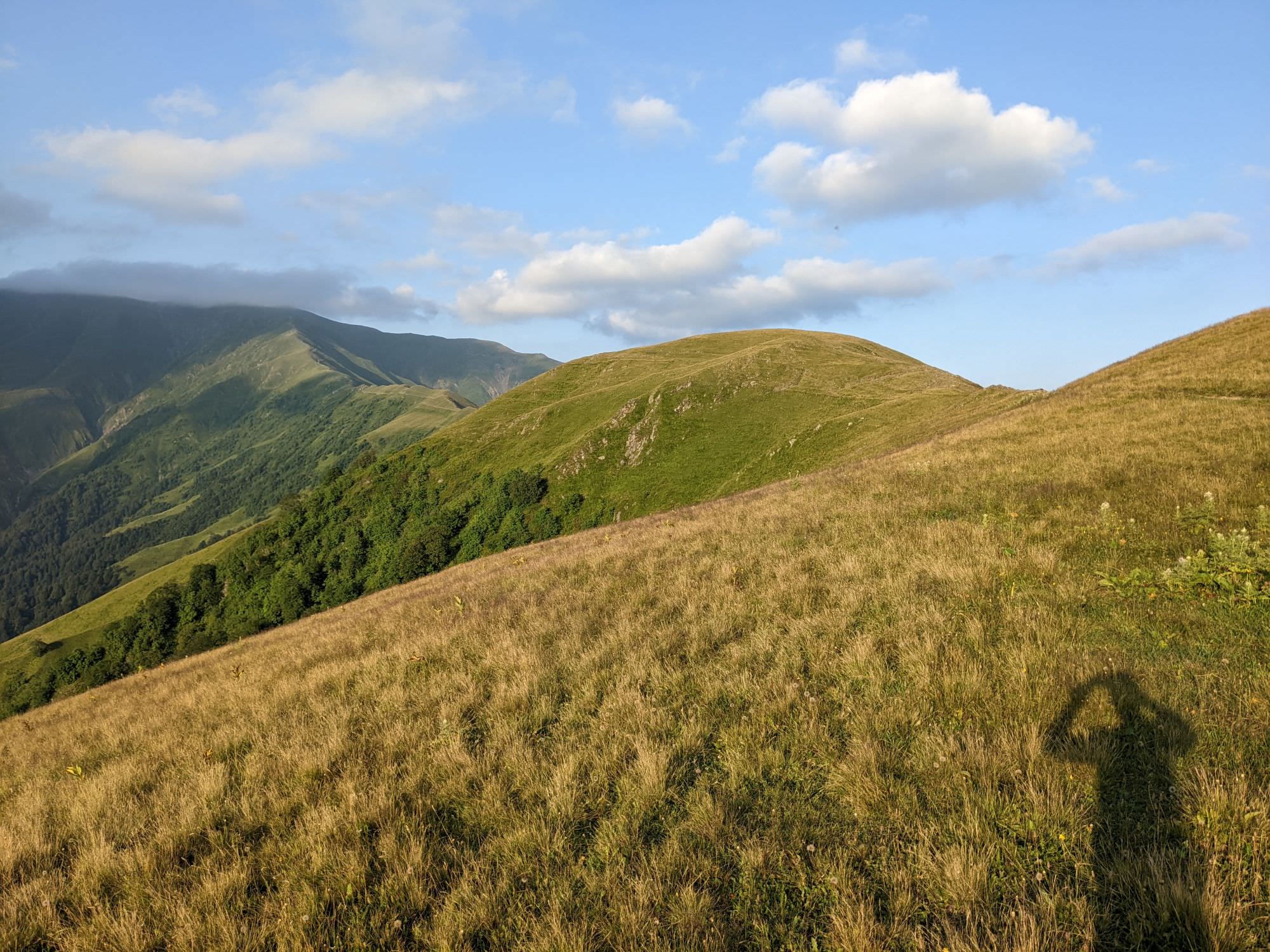
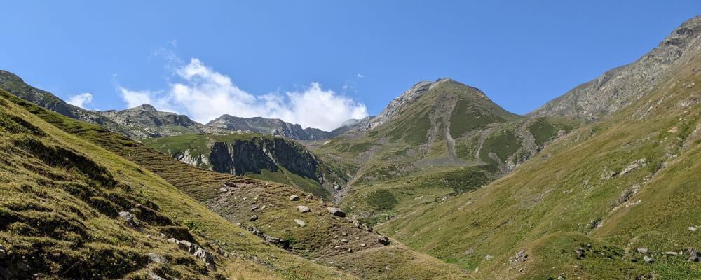
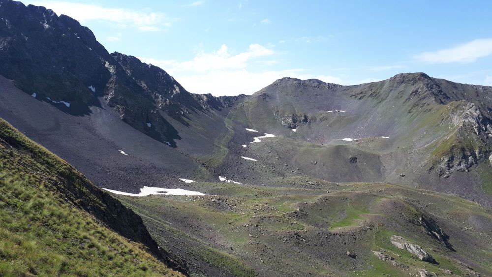
View from Samkinvrostsveri pass to the south
By jeep:
There is no public transport to Tusheti. To get to Omalo, you will need to hire a driver with 4WD. If you are traveling from Tbilisi, you will first need to get to Kvemo Alvani village - this can be done by marshrutka or a taxi.
The marshrutka departs from Ortachala bus station in Tbilisi at 9.00 am and arrives at Alvani more than two hours later (price 15 GEL). Drivers are used to tourists and often arrange them further transport to Tusheti. Just confirm with the driver that he is going all the way to Alvani, they sometimes try to drop passengers in Telavi in order to make them hire another taxi to Alvani. Or they simply want to hook you up with the jeep driver from Telavi but that is OK if the price is right.
There are two other marshrutkas to Alvani, departing in the afternoon (at 13:45 and 16:00). You can also board a bus to Telavi which are much more frequent and from there, it is a short ride to Alvani.
If you want to take a taxi from Tbilisi to Alvani instead of a bus, the price can be anywhere 100 and 150 GEL (it grows with your distance from the Ortachala station :))
In Kvemo Alvani, the bus or taxi will drop you at the main (and the only) junction. This is the place from which depart jeeps to Tusheti so if you get here before noon, you should be easily able to hire a driver.
In 2026, the ride to Omalo takes over 4 hours and costs 100-120 GEL per passenger (or about 450-600 GEL for the whole jeep). BBC once placed it among the "10 Most Dangerous Roads in the World", but with a good driver, it definitely doesn´t feel like that. In navigates pretty steep mountainside but the road is usually wide enough and unless you are passing another car and need to navigate to the very edge of the road, there is no reason to feel nervous. Still, accidents happen here and the road claims lives every year. Therefore, even if you have your own car, for this stretch of the road, it may be better to use the service of the local driver.
By hitchhiking:
Hitchhiking can be "hit or miss" since jeeps traveling to Omalo are usually booked by tourists and full. And even when they are not, tourists might be reluctant to pick someone who just walked a few hundred meters beyond the departure point and raised a thumb (especially if he is dressed up in Arc´teryx gear like a couple of "travel hackers" we saw there the last time :)). Professional drivers will rarely pick you up for free. Therefore, your best bet will be locals heading to Omalo for a visit - but it may take a while until some show up.
Another option is the Kamaz truck which brings supplies from the lowlands to Omalo. These drivers usually pick up passengers for a symbolic price but the truck has no fixed schedule. It departs like each other day in the morning, so it can´t be relied upon.
Pankisi gorge can be easily reached from Tbilisi. Marshrutkas depart from Ortachala bus station (daily at 7:30 and 14:20). This trip takes 3 hours and costs 15 GEL. Another option is to take a minibus to Telavi or Akhmeta (hourly from 7:30 from Ortachala station), from where you can take a bus or cheaper taxi to Pankisi valley.
Taxi from Tbilisi to Pankisi will cost you at least 100 GEL. You can either hire the whole car or try to get a spot in one of shared taxis which depart from Isani bus station.
We took the bus to Tbilisi which was leaving at 6:15 am from the bus stop in Jokolo and from what we heard, there should be another one in the afternoon, around 2 pm. Still, you should consult your host at Pankisi to get update about the current timetable and ask him to book a place in the bus for you.
While I have no ambition to write a complex guide to Pankisi gorge, I need to touch on some points since this region IS different from almost any other in Georgia. That's because it is inhabited mostly by Kists, people of Chechen origin who moved into Georgia in the 19th century. Which means that majority of Pankisi are Sunni Muslims. As a result of lacking development combined with an influx of refugees after the Chechen wars in the 90s, it got its share of troubles with islamic extremism and even Georgians avoided it some 20 years ago. However, things improved greatly over the past years and the region now experiences a small tourist boom.
When visiting Pankisi, keep the following in mind:
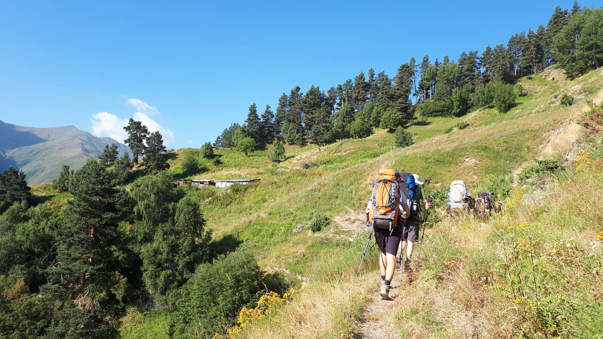
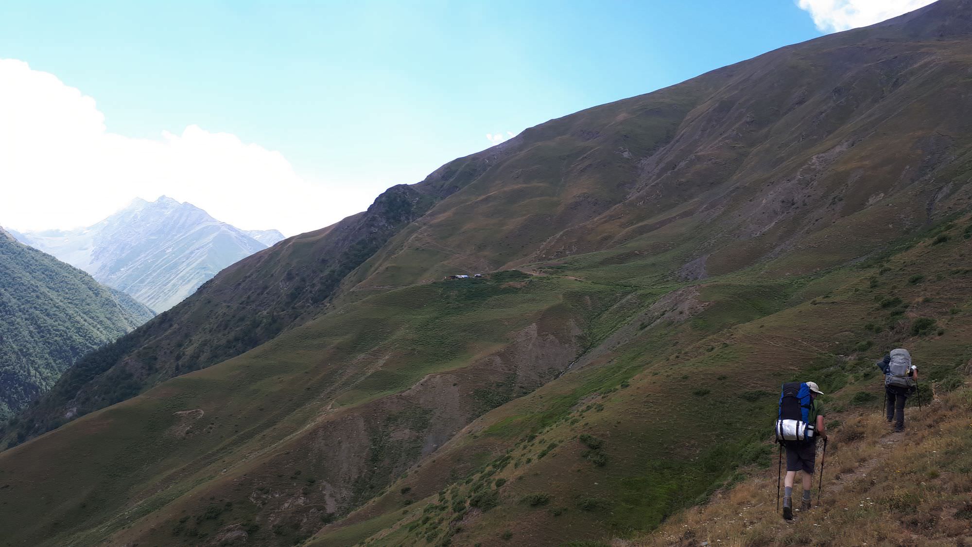
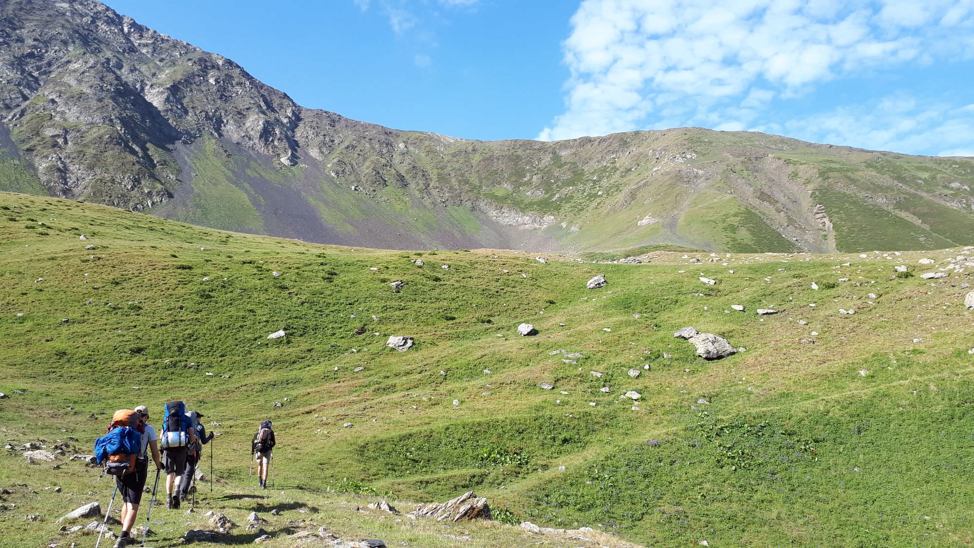
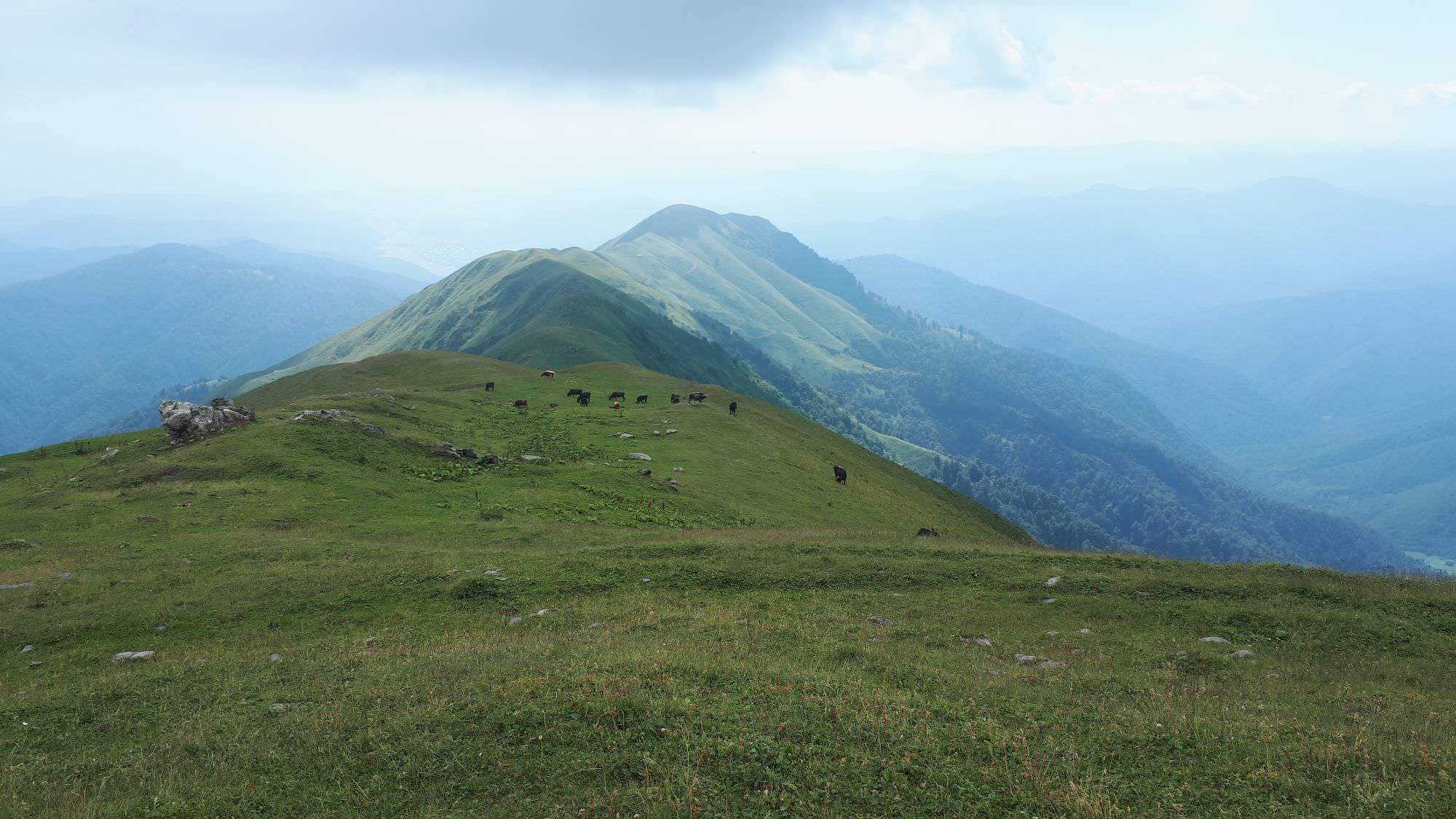
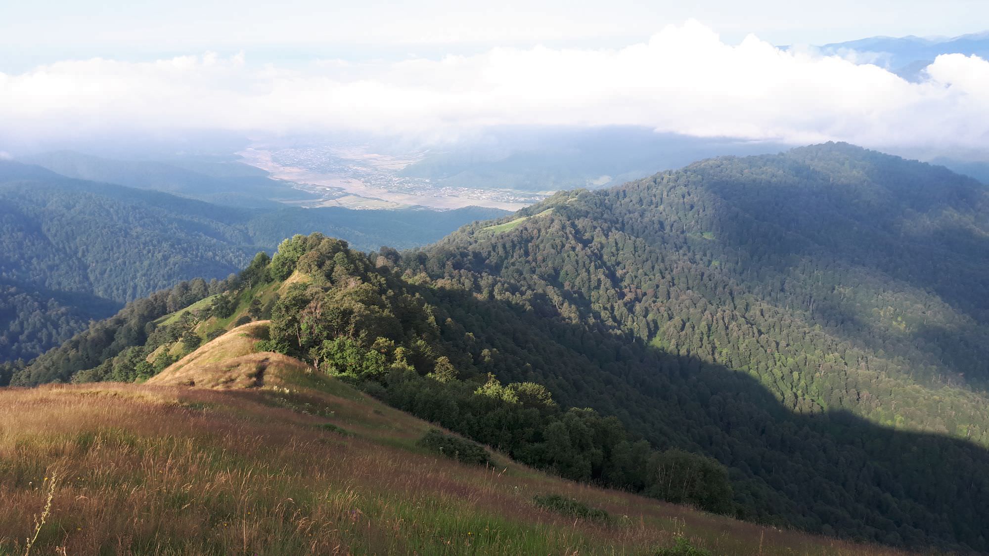
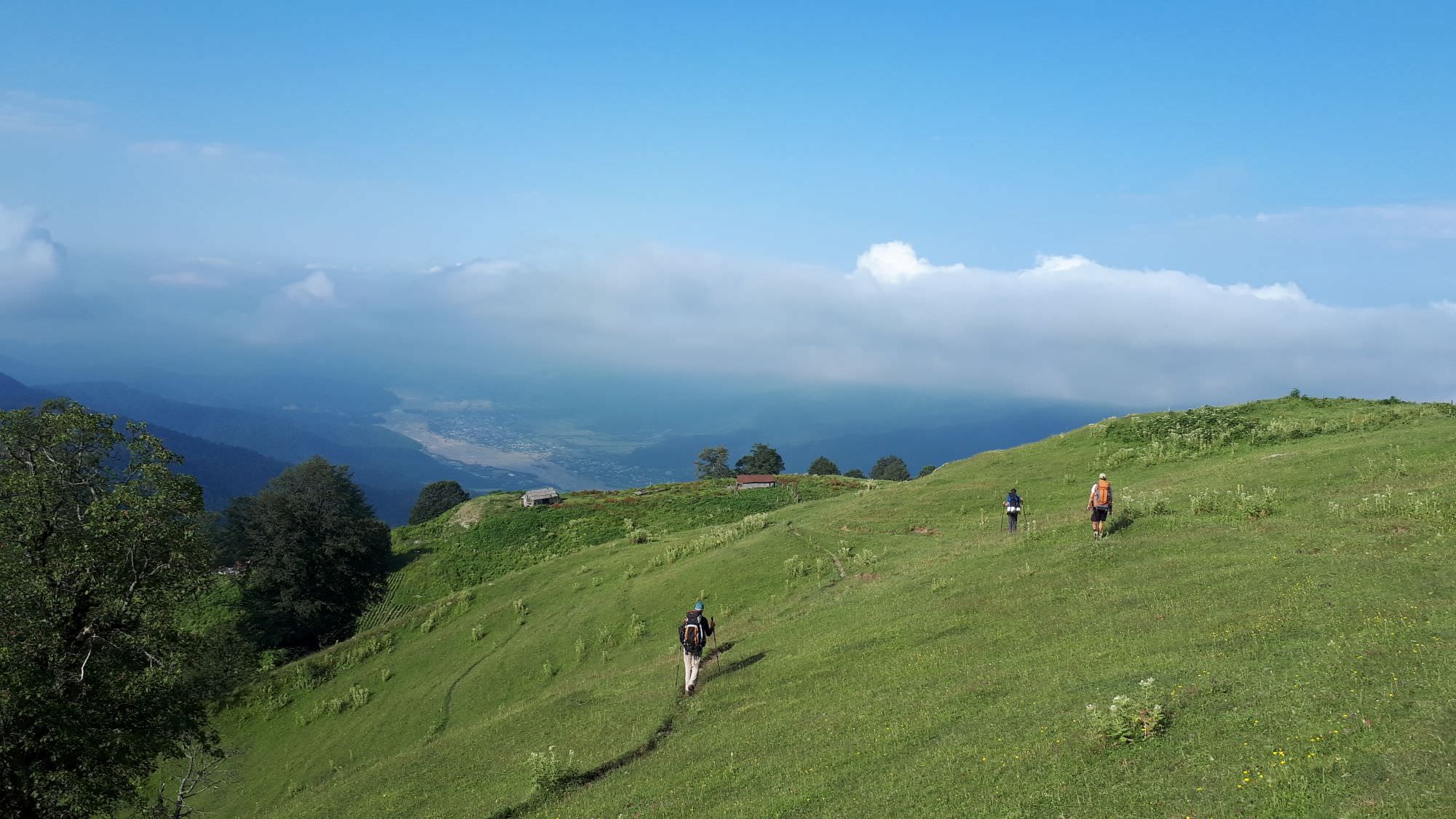
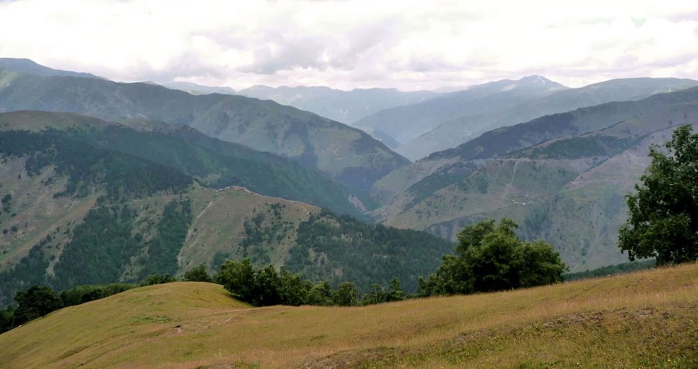
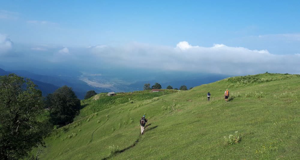
En route to the Pankisi gorge
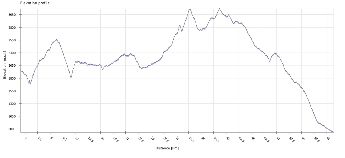
Relive 'From Tusheti to Pankisi by Samkinvrostsveri pass'
| Distance | 63 km |
| Trail type: | AB trip |
| Max. elevation: | 3157m |
| Min. elevation: | 733m |
| Total climb: | 4873m |
| Total descent: | 6101m |
From Upper Omalo head to the south - stay on the marked path on the right side of the hillside. You will reach the car road and then turn to the right. Follow the car zigzag road. After approx. 1 km you can see a big road sign for the direction of Shenako and Diklo. But today we are going in an opposite direction - turn right behind it.
Pass a small quarry on the right and continue on the road which ends at a house. Keep still the same direction, passing by the house until you reach an break, where there is a sharp drop-off. After the break go right down the meadow, following the trail towards the opposite forest, down the hill. Continue through the forest, following the zigzag trail still down until you reach the river.
At the river, cross the wooden bridge (N 42°22´17,8´´ E 045°37´11,0´´, altitude 1663 m) and right after the bridge, take the trail to the left and climb up the hill on the serpentine. After 3 km, the forest turns into a meadow - at its edge take the trail to the left up the hill. Keep this direction and after approx. 0.5 km you will reach the village Khahabo.
Pass the village and immediately turn right onto a small trail - the large road leads to Chiglaurta, so it is useless to us. After 50 m turn right to the road up. The road ends up with a small field. Do not go beyond the road's end as the field is a holy place (Mariamtsminda). At this point turn sharply to the left and cross the meadow diagonally up.
From Mariamtsminda the path is relatively visible. Keep up on the top of the meadow, then take the upper path going to the forest. The path leads through the forest more or less on the contour line. On the road, you will cross the small stream (not recommended to take the water here due to the abundance of cows).
After some 400 m from the stream the trail turns up, but the path is hardly visible. Here you come to the meadow when there is no path. Keep diagonally up and on the top of the meadow turn right up when you reach another meadow. Here turn right and up through the lower part of the meadow. The trail leads up to the large meadow on the slope below the top of Kekh mountain chain. To the forest, the path is clear at this point.
The meadow is called Shantlovani (marshland). It should be crossed roughly in the middle. Khakhabo village is visible on the left side far below. The path is hardly visible, keep up to the left towards the groups of pine trees. Reaching the mountains chain turn to the right for some 100 m and then follow the path turning to the left roughly on the contour line between the trees. You cross the small stream and keep on the path leading slightly up to the Apakurta pass (2551m).

Apakurta pass from Kekhi mountain
From the pass, you have nice views of the Gometsari valley. The closest village is Gogrulta, more distant village further to the right is Dochu. The path goes down and right. You will cross a small stream (possible to take the water, but the flow is weak). From the stream, the path zig-zags down through the meadow called Apakurta. You can also go right down to the first trees of the pine and birch forest.
The path sneaks through the forest and leads down to the large meadow. Here the remnants of the houses are located (the winter houses of Gogrulta – Gogrulta boslebi/Lashkaraulta). Go down along the houses.
At the lower end of the meadow, take the path through the forest further down up to the river Oritskali. Here firstly cross the stream which conjuncts to the main river (you can jump over). Oritskali has to be crossed through the shallow ford. After the ford, go a few steps against the stream, and below the tree starts the ascent to Gogrulta. Zigzag the path through the small forest with views back to Lashkaraulta.
Gogrulta village visible in the distance
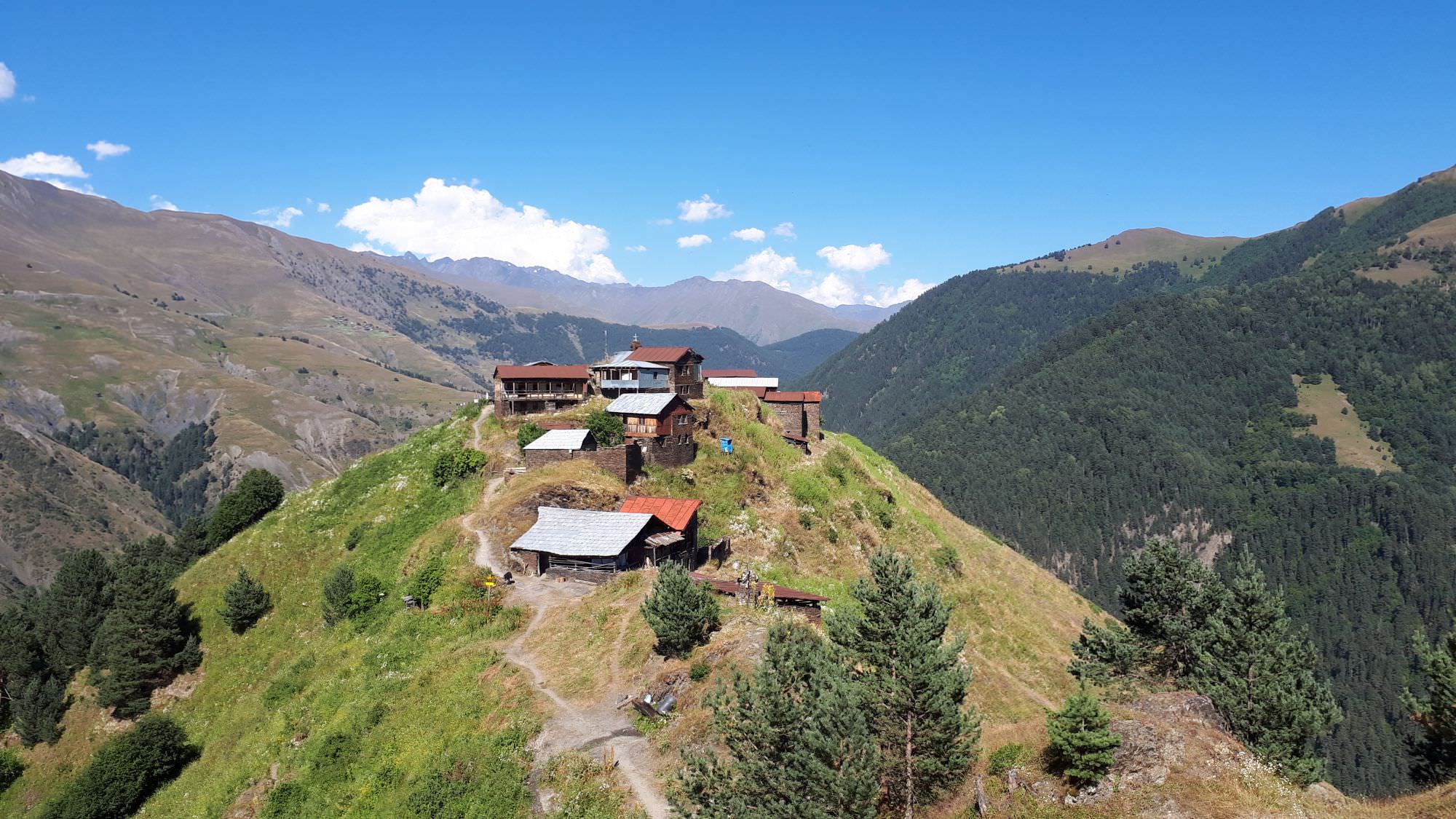
Once you reach a small ridge, turn to the right and keep on the path staying up on the elevation. The ruins of a tower will be seen on the left on the opposite hill through the meadow. Pass along the ruins of the house. Some 200 m above the house, the view of Gogrulta opens in front of the path. Continue on the path going now roughly on the contour line until you reach the Gogrulta village. The village is spectacularly positioned on a high cliff and offers great views of Gometsari Alazani.
Important notice: Once you reach the village, the sacred place (Mariamtsminda) is on your left side above the water spring - a "khati" (small stone shrine) with a bell and skulls. No women are allowed on the sacred hill, but keeping on the path is acceptable.
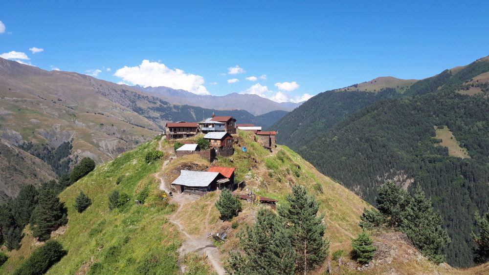
Approaching Gogrulta village
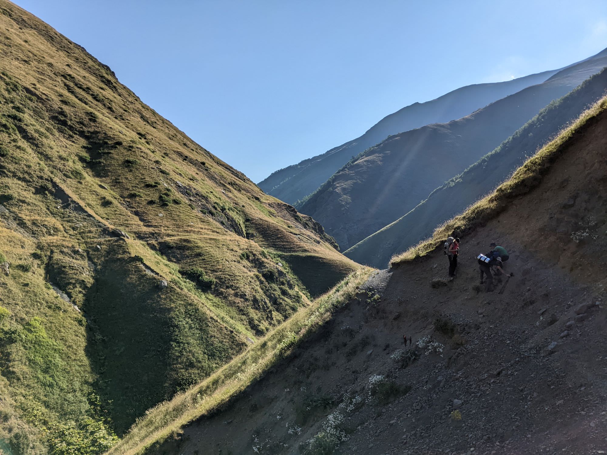
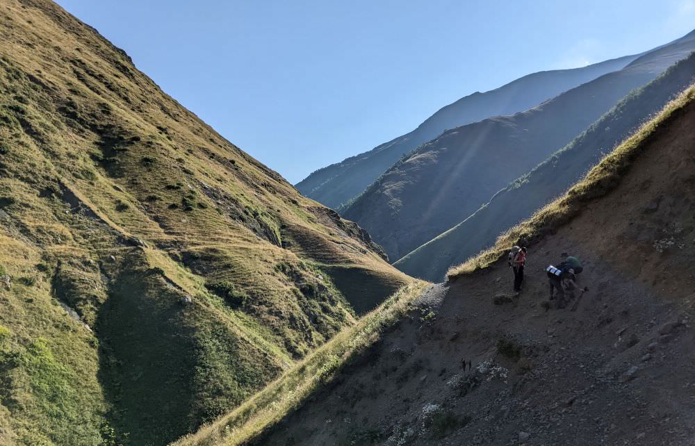
Start hiking in the direction you came from, traversing the hillside to the south. You will reach a small junction with a ruined hut after some 600 meters, but this time, stay on the contour line. The trail will eventually lead you to a large shepherd's hut, where it disappears - pass below the hut and it should reappear soon enough. Then it enters the forest.

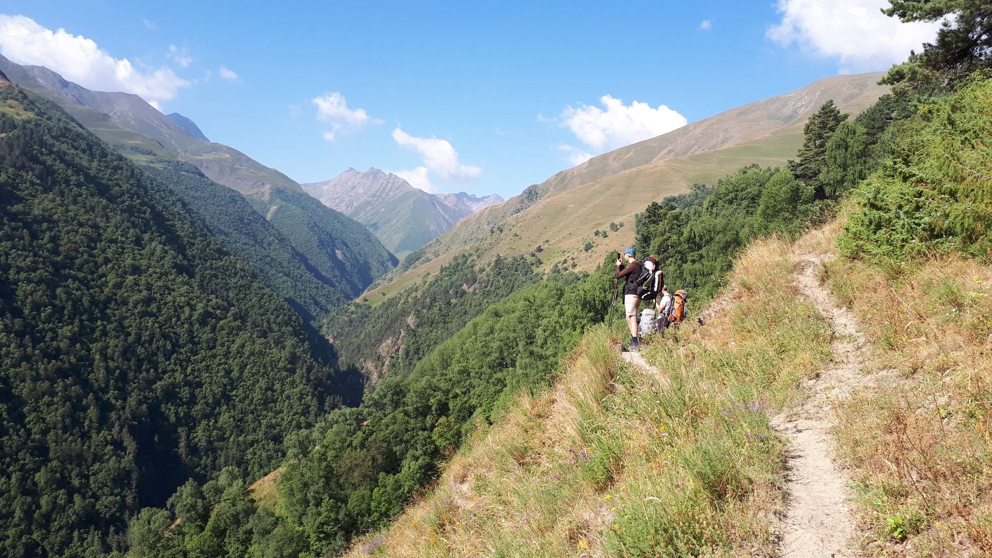
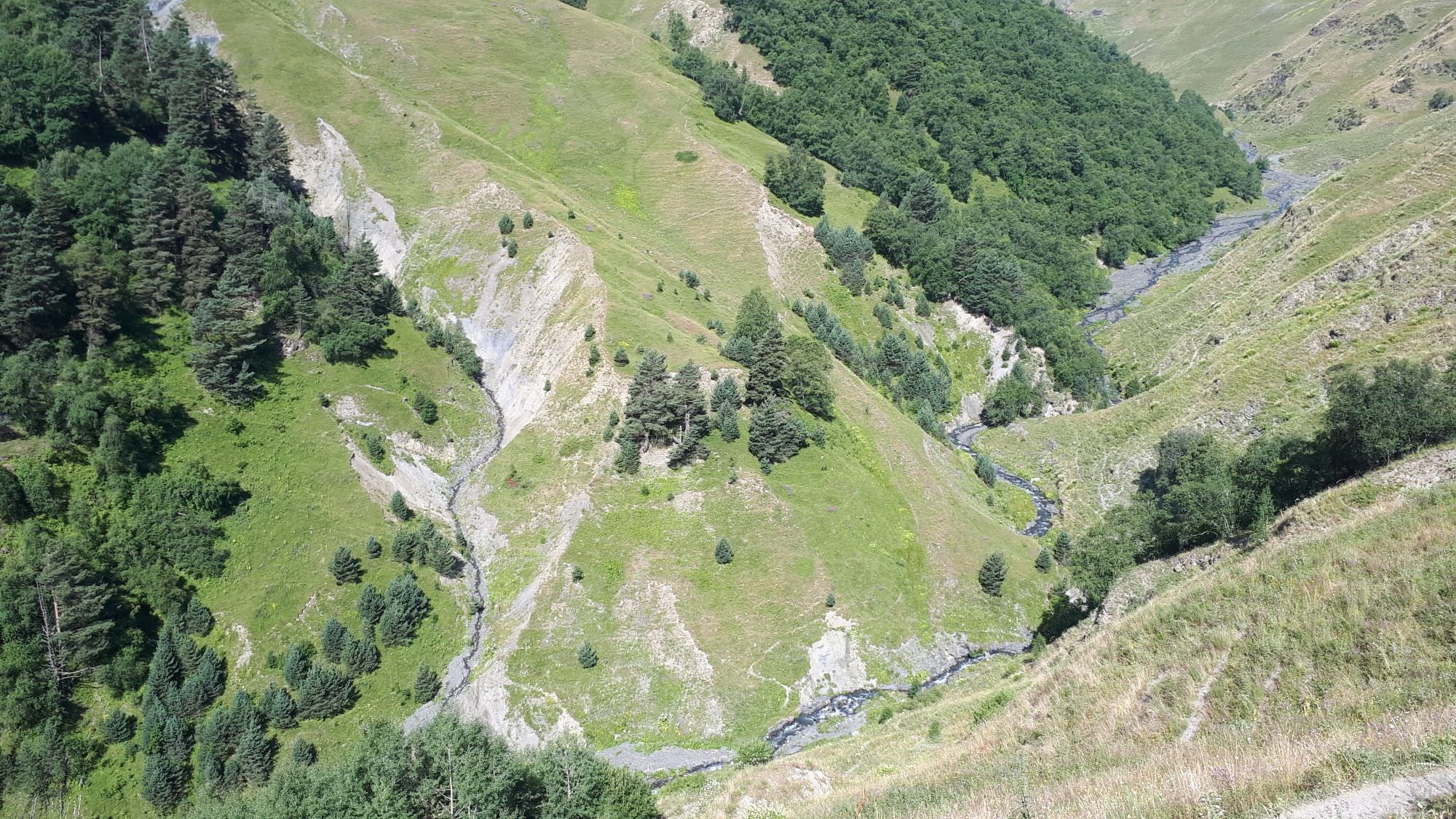
Traverse above the Oritskali valley
Overall, this is a very pleasant section of the trail. The trail traverses a pretty steep hillside so you have good views of Oritskali valley below, it is narrow, but safe, well-trodden and mostly flat. You keep seeing Oristskali valley ahead, but can´t follow it straight away, since the mountain wall is interrupted by Vestomkhev valley. Here, the trail turns north to follow this smaller subsidiary and soon enough, you will see Sachigovlo village ahead. Pass the village - the river is now not nearly as deep below as before. Not far behind the village, some 150 meters at most, you need to hit a small trail going down to the river while the main trail continues further west towards Vestmo. It´s not too visible, but you shall see remains of the trail at the opposite hillside so the crossing point is pretty obvious.
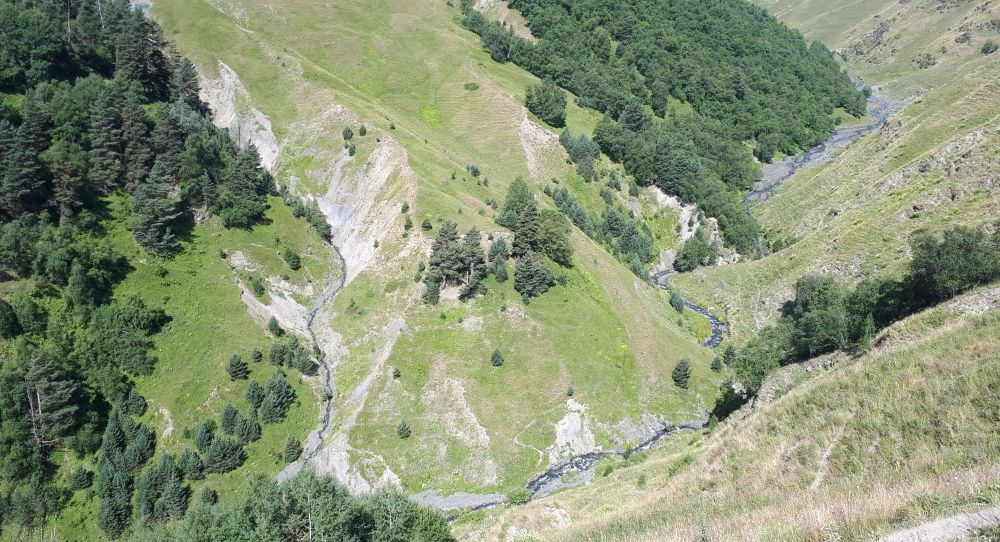
Faint trail visible at the other side of Vestomkhev. You can also see it climbing the opposite hillside.
Once you cross the river (very shallow at this spot), you need to follow the trail directly climbing the opposite hillside (ignore the another trail to the left, beyond the gully of Vestomkhev subsidiary). It´s in bad condition, but still good enough to be traceable. This way, you need to climb 150 altitude meters, which will bring you onto a larger trail connecting Vestmo village with Oristskali valley. Here, turn left and follow this larger, well-trodden track snaking above the treeline. First, it climbs a bit, but then flattens up.
Follow this track for more than a kilometer, until it reach a rather large gully, the last one you need to cross in order to return to Oristskali valley. The gully is too large to cross, so it is necessary to follow it upstream, towards the spot where it forks. Here, the trail appears again, and guides you to the bottom of the gully and over both small creeks. Climbing to the other side of the gully is obvious - the trail is almost non-existent, but it's the only spot where it looks somewhat possible.
From now on, all goes much smoother. The trail reappears, first only faint one, then well-trodden and flat. In less than 30 minutes, you shall reach a camp, occupied by a company of friendly shepherds led by Oto Gigoidze. And also company of not-so-friendly dogs, so approach carefully. This is a great place for the break, we had a really nice time here. The trail then traverses the hillside of the Oristskali valley for another hour, till another large valley joins it from the east - Sakarostskali.
Luckily, no huge detour this time - the trail drops to the valley floor and makes you cross both the Sakarostskali and Oristskali rivers a little above their confluence. The trail then continues on the eastern bank of Oristskali, sticking pretty close to the river - by this time, your campsite is well within sight. It is situated at the confluence of two main streams forming Oritskali ("Two waters") river. To reach it, you will need to cross a small bridge. There is an abandoned hut with some flat space around it, but it's kinda overgrown and wet. So we decided to pitch our tents a little further from the river, on a dried flat spot beneath the wooden cross (but it´s also possible to camp at large flat spot right by the river). As for the water, we collected it from the eastern branch of the river since it's shorter.

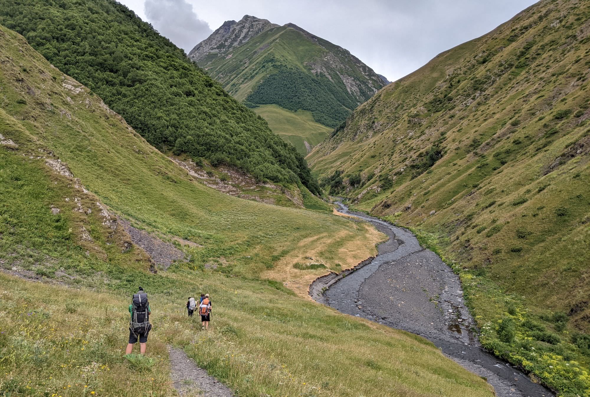
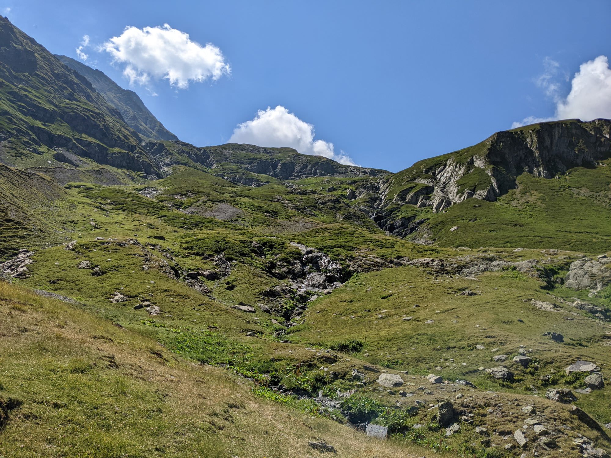
Approaching the campsite. Oritskali pass visible to the left, route to Samkinvrostsveri to the right
In the morning, follow the small trail running by the eastern branch of the Oritskali river. It is in decent condition, with only two problematic spots. The first one occurs after mere 300 meters - a landslide has destroyed some 10 meters of trail, the terrain is trickery and caution is needed. Not much later, there is another landslide, but this one is easier to cross since there is a new trail running about 5 meters above the ruined one.
The first landslide is the most problematic
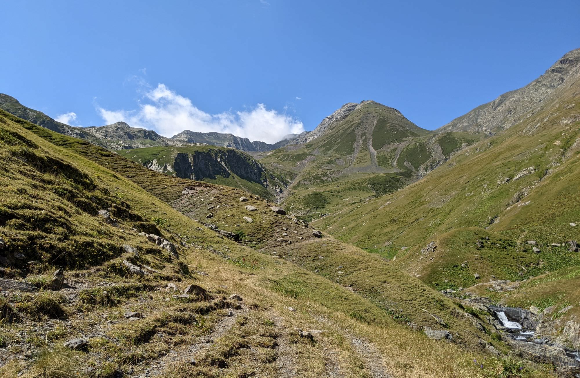
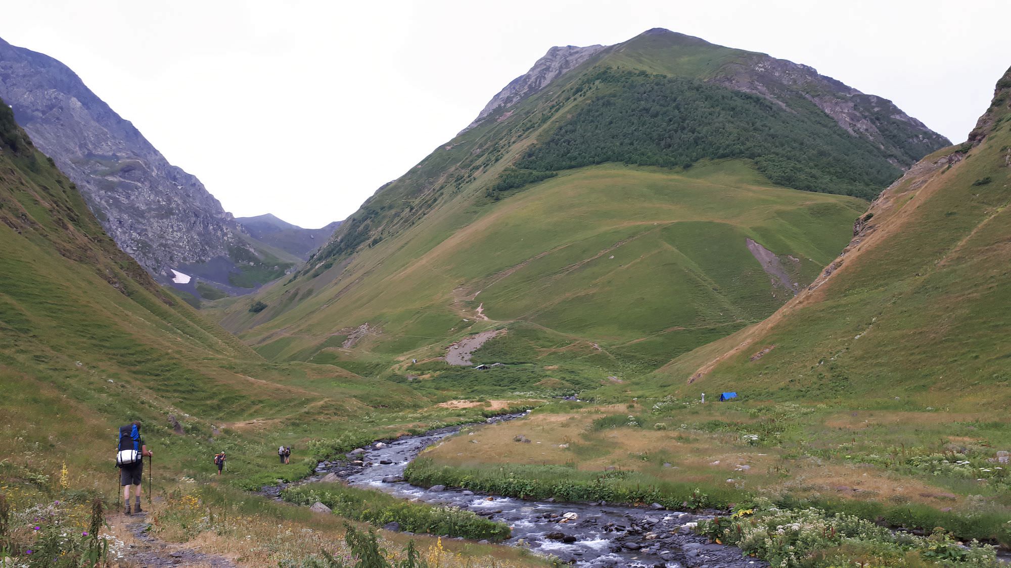
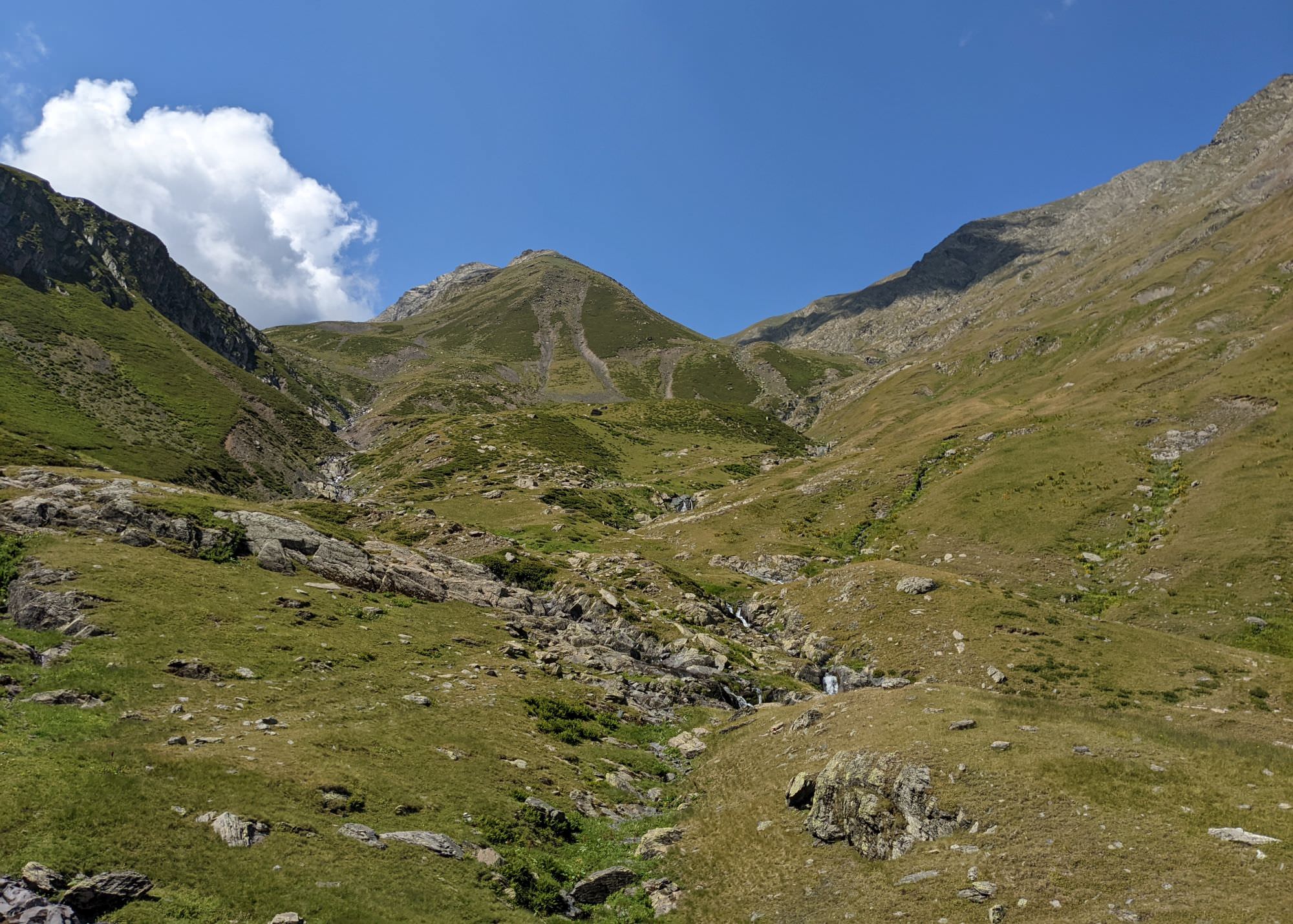
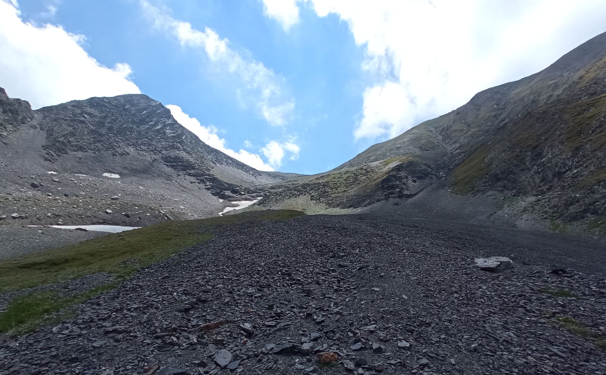
The trail sticks to the river. After two kilometers, the river enters the gorge so you will have to climb over 100 meters and climb rocks at its top to be able to proceed, but the trail is obvious all the time. After another kilometer, you exit the narrow valley and reach the wide bowl, where streams from several directions converge - there is also a hut at the other side of the river, which may be occupied. You are at an altitude of 2350m and need to overcome the final 800 altitude meters to the Samkinvrostsveri pass.
Right above you, there is a rock towering between creeks, covered with rhododendrons. You need to climb it from the left side - from time to time, something resembling a trail might appear, but later, you will be on your own. And once you climb above this rock, you need to pay attention. The upper part of the valley is split by several side ridges and if you continued in the original direction, you would end up in the wrong one (like us :)). To reach the pass, you need to push as much right as you can. There will be obstacles - apart from rhododendron creeks, you might have to cross one or two creeks running in deep ravines. Don't try to cross at all costs, just follow them upstream and cross when possible.
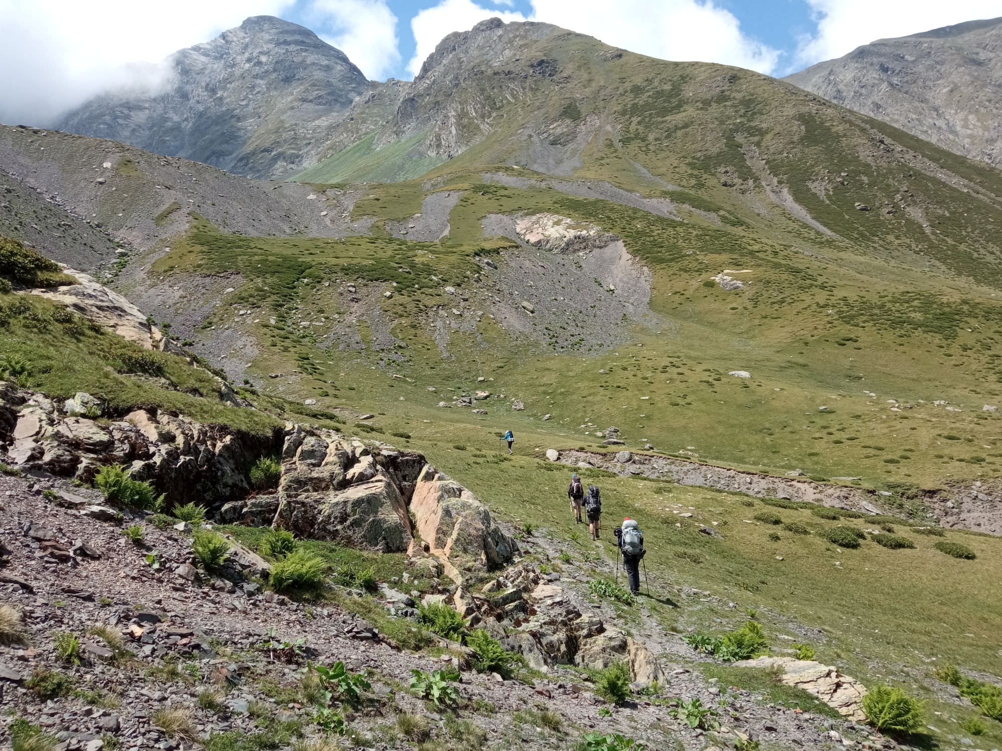
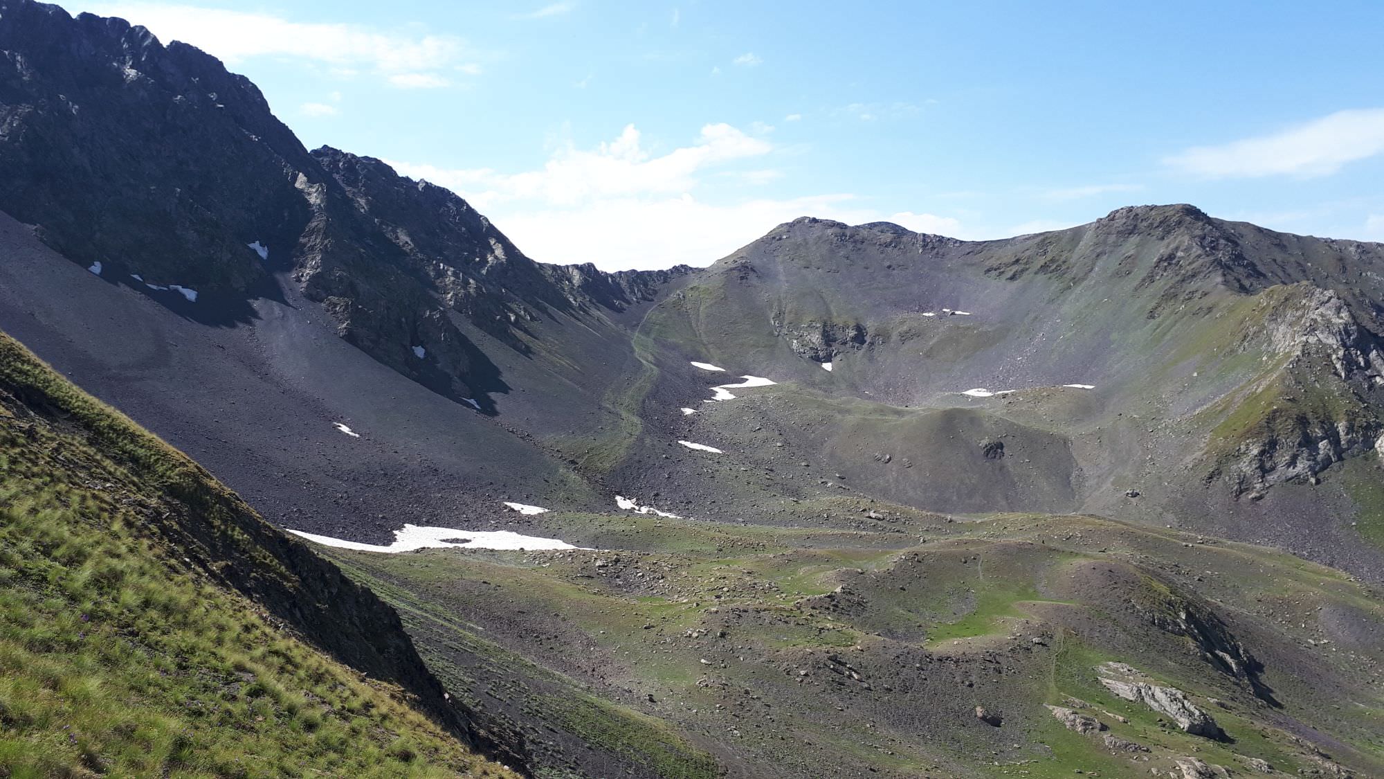
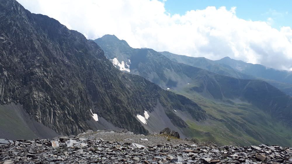
Samkinvrostsveri pass is the one to the right
At the altitude of 2800m, if you reach the correct upper valley, the pass comes into sight some 350 meters above - all you have to do is to follow the valley to the top. The pass is situated at the left (northern) side of the mountain depression and is marked by a stone pyramid.
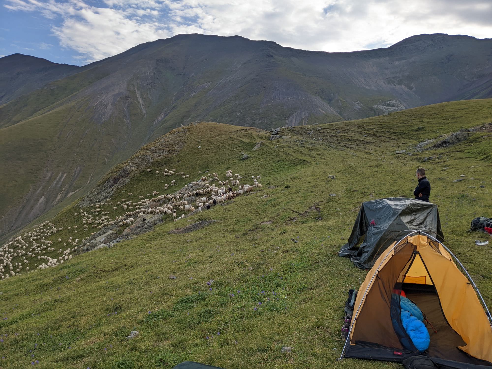
Views to the other side are great. You can see Didgverdi mountain as well as a shepherd's hut situated below - that's your next destination. However, the southern side of the pass is pretty steep so you may want to stick to the left and "hug the mountainside" a bit so you lose altitude more slowly. You may also encounter a herd of sheep and have to alter your course to avoid dogs.
Once you leave the steepest part behind, a trail appears again. It will leave you to the aforementioned shepherd's hut. During our trek, it was occupied by two Kist youngsters who spoke neither English nor Russian and rather than friendly, looked pretty flabbergasted, so we continued for another 100 meters and set a camp on flat grass behind a small hill. Water can be found at the spring beneath the hut. Congratulations, the hardest day of the trek is behind. Take a good rest and enjoy views of endless mountains as well as of the Didgversistskali valley below where, in my opinion, nobody set foot in a decade or more.

At the Didgverdi campsite
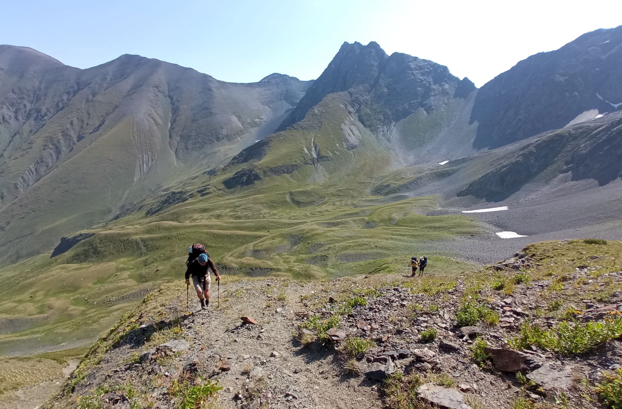
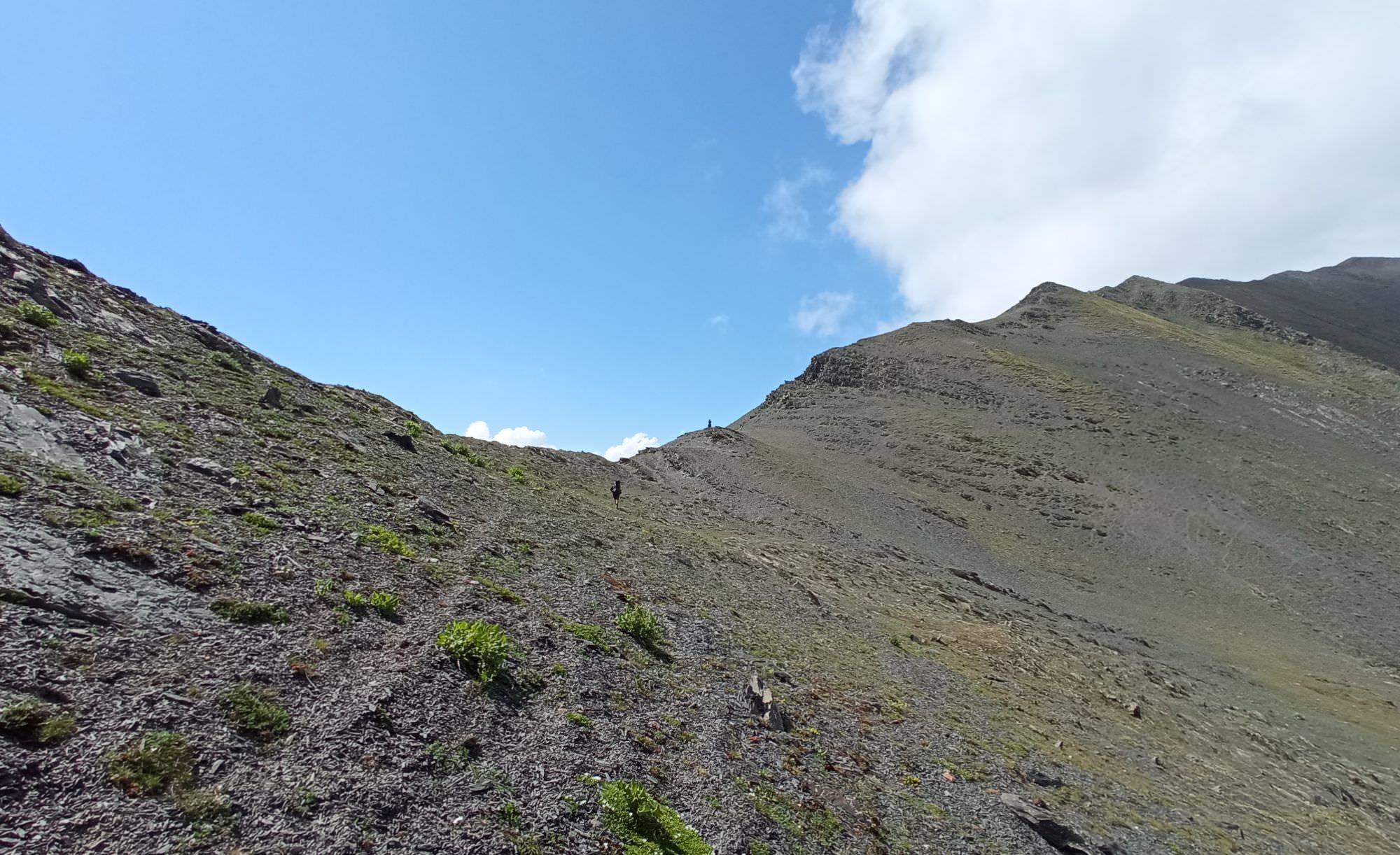
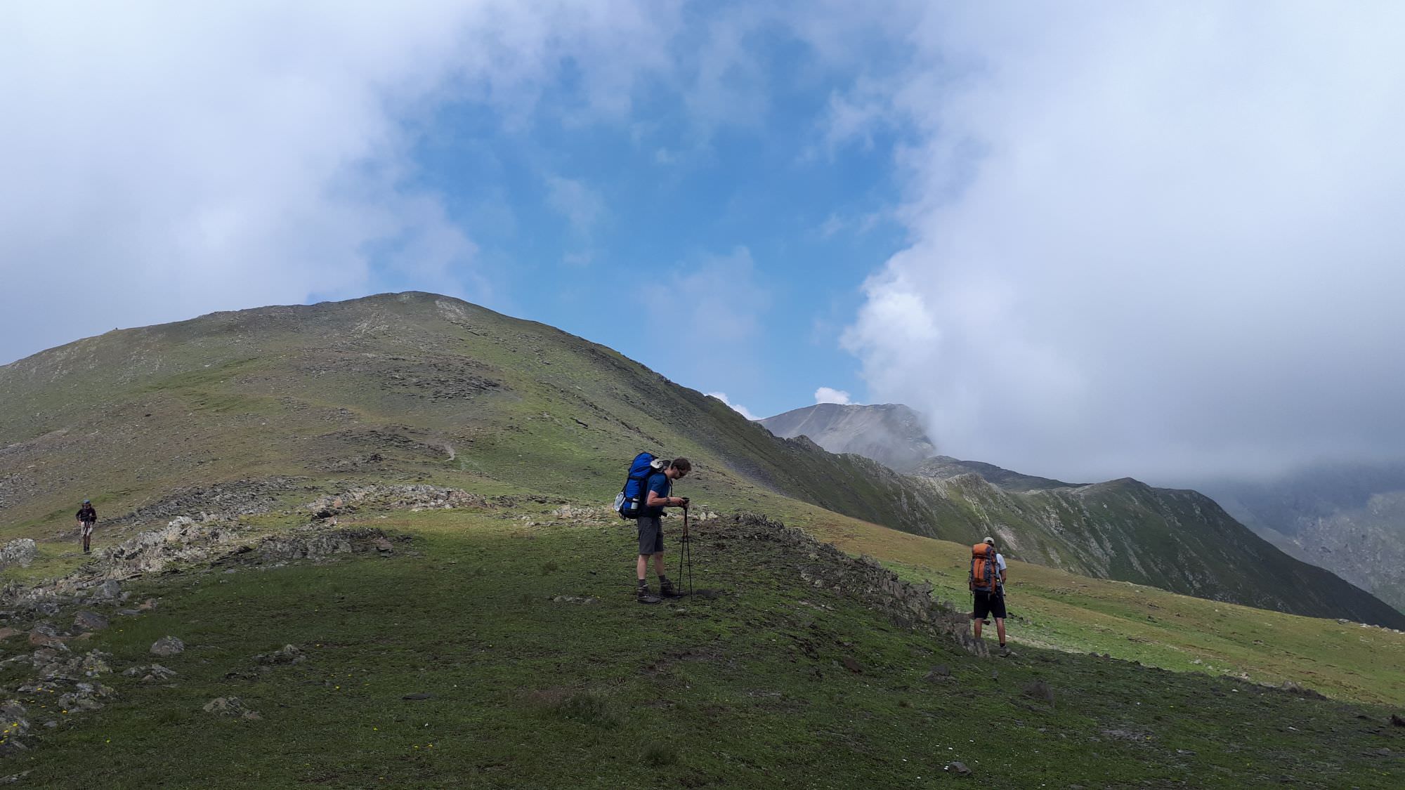
Follow the trail running along the contour line in the southern direction. After 15 minutes, a small side ridge rises ahead of you. Climb some 170 altitude meters to a pretty nice viewpoint at its top, then follow it to the south. But not for long - soon, you will see that to reach the next pass, you will need to overcome one more small valley in between so need to go down a bit. Don´t hesitate too long with it - the terrain is too steep to traverse and the later you start going down, the harder it becomes.
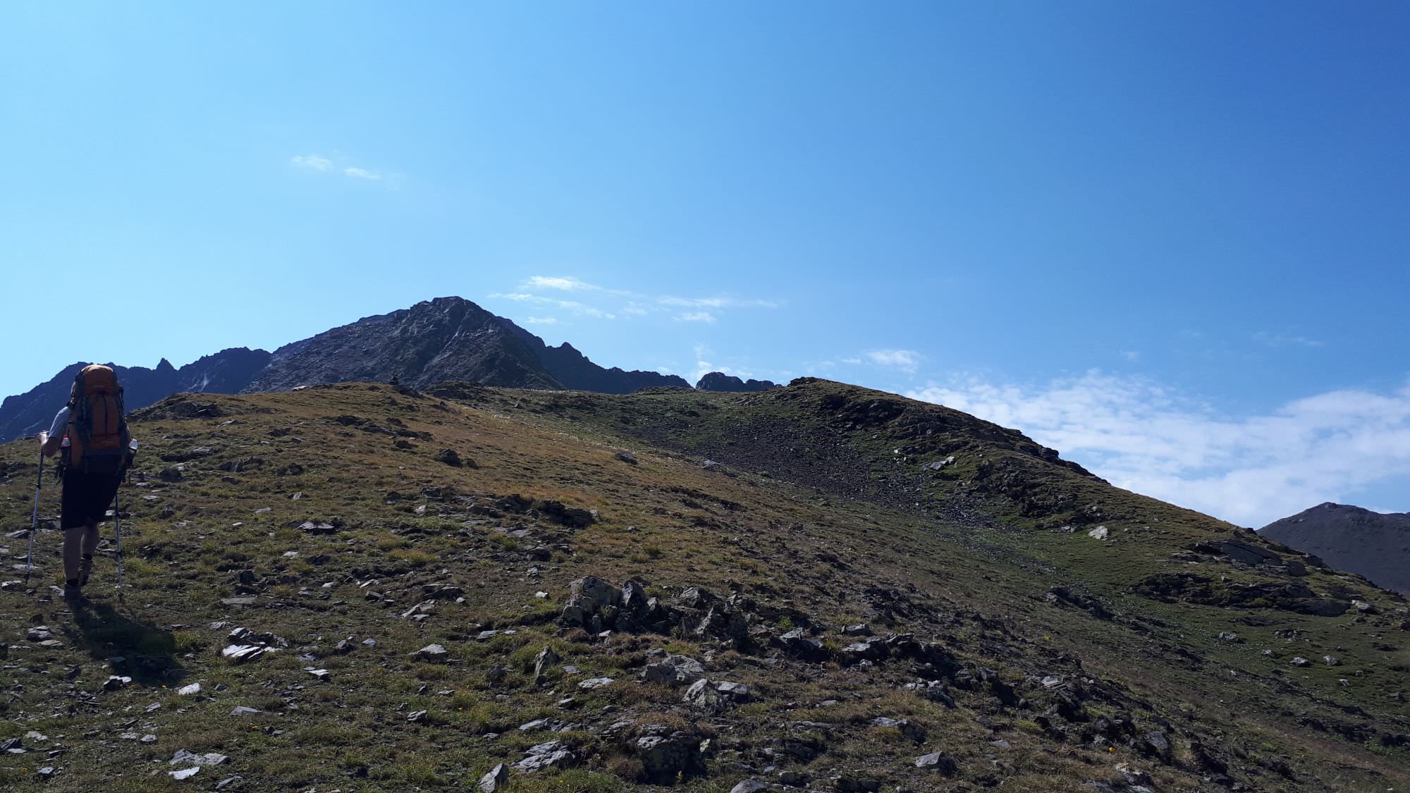
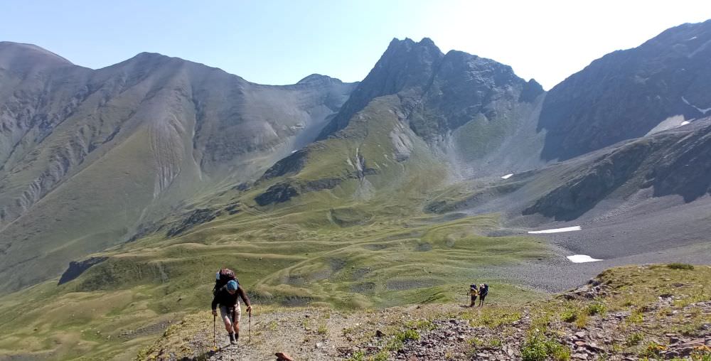
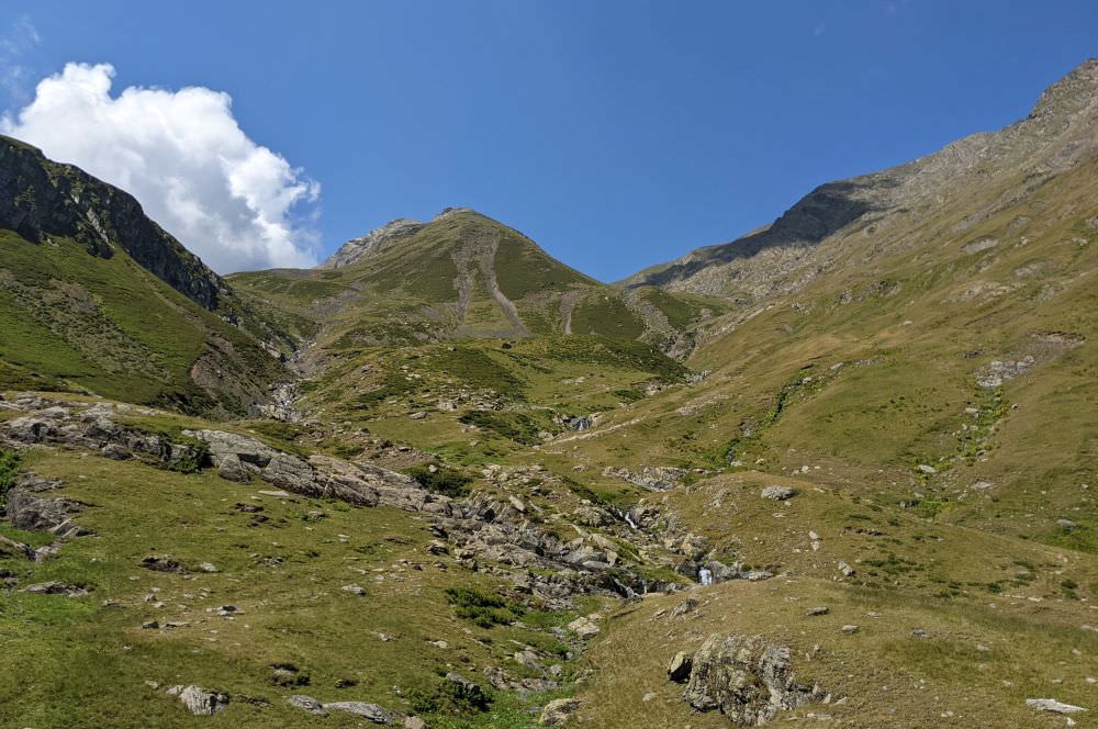
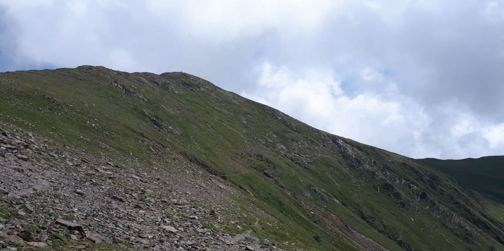
Final pass ahead with the the old trail going up
At the bottom, you shall find some streams and tiny, snow-covered lakes. From here, you need to cover another 150 altitude meters to a small, nameless dent in the mountain wall. Luckily, the trail to the top is well visible from the distance.
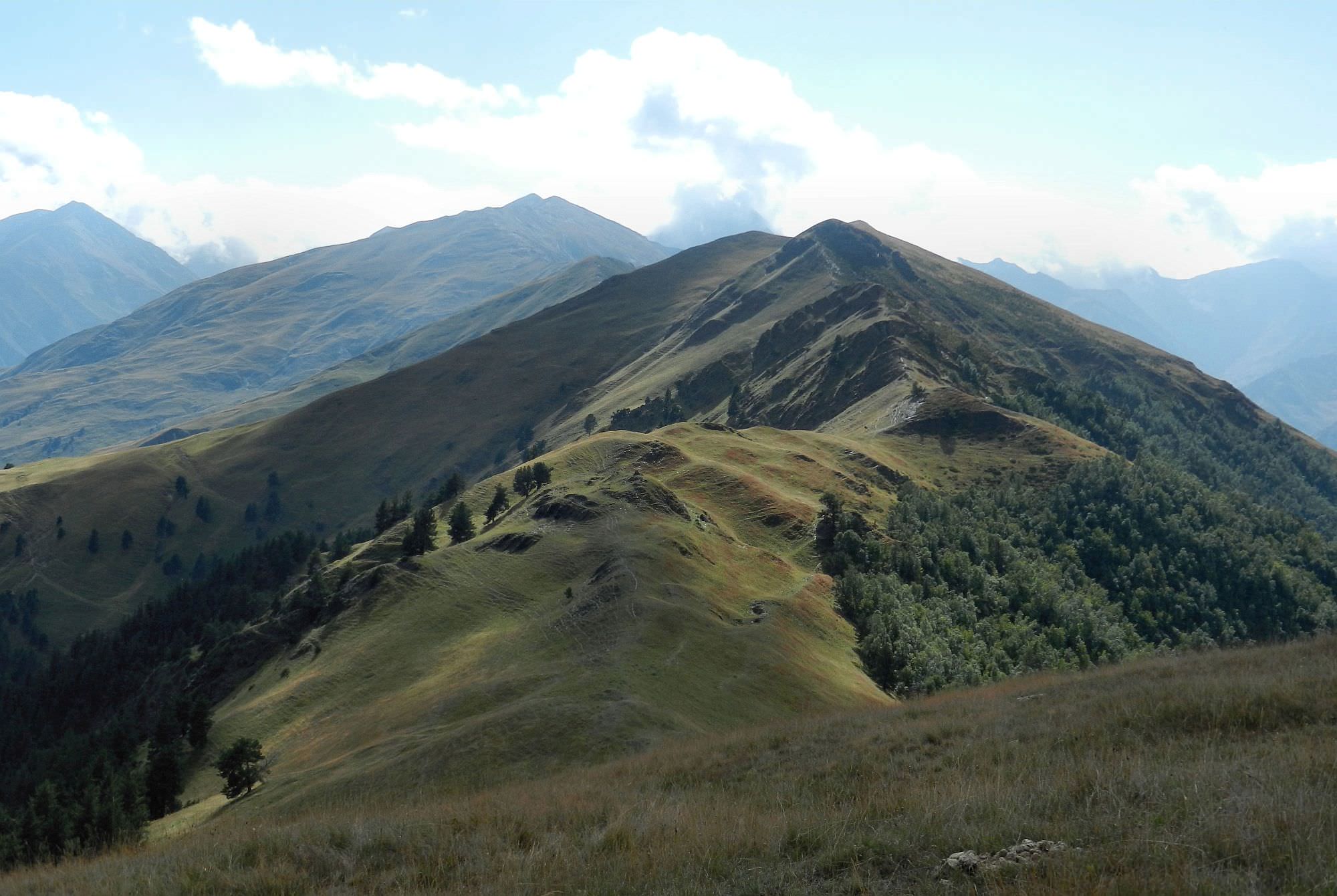
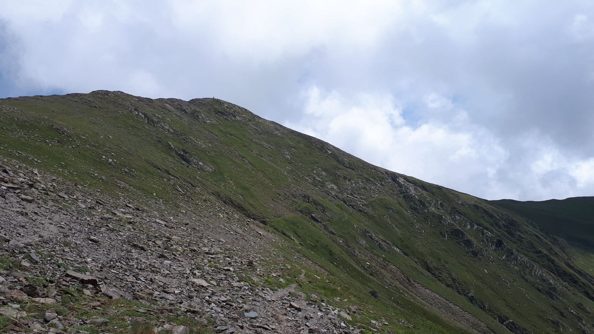
The trail from the pass follows the top of the ridge in the southern direction and is pretty pleasant, flat or going down. After two kilometers, the ridge splits when you approach a stone cairn standing in solitude on a hill, it sharply turns to the left and descends onto a small plateau - ahead on your right, you might see a car road to Tusheti in the distance. The top of the ridge becomes too rocky here so you need to look for a trail, bypassing it from the western side. However, don´t stay on it for too long, because it would lure you down into the valley and every meter you lose here, you will have to climb again and very soon. As soon as you pass the rock on your left, climb again toward the top of the ridge. The trail doesn´t continue at the very top but follows the contour line a little below it.
Ahead, you can see Ortsveri (2988m), the last prominent hill of this range. The trail bypasses it from the west, going some 100 altitude meters below. Of course, you also might want to climb it - it is the most approachable from the SW/S side. From the top, you might see a nice lake right at the other side - might work as a nice campsite, but it´s quite low, at 2670m. Once you pass Ortsveri, the trail reaches a large plateau and then turns west, following the top of the dropping ridge.
Trail bypasses Ortsveri mountain from the right
From here, it is pretty straightforward. You will pass a large plateau at 2500m, but there is no water yet. Another flat spot can be found by an occupied shepherd's hut at an altitude of 2240m. From here, the trail goes down the northern side of the range towards a bunch of abandoned huts some 100 meters below. There, right on the road, you shall find a large freshwater spring. However, we haven´t found solid camping spots around and since we didn´t want to make this trip to get water twice, we did all our evening cooking there and only then returned with all bottles full back to the ridge and broke a camp there (there are several decent spots on the next 1km of the trail).
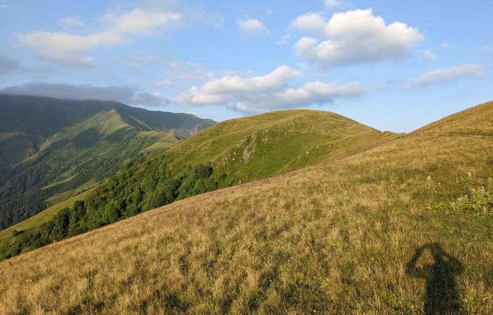
Looking back to where we came from
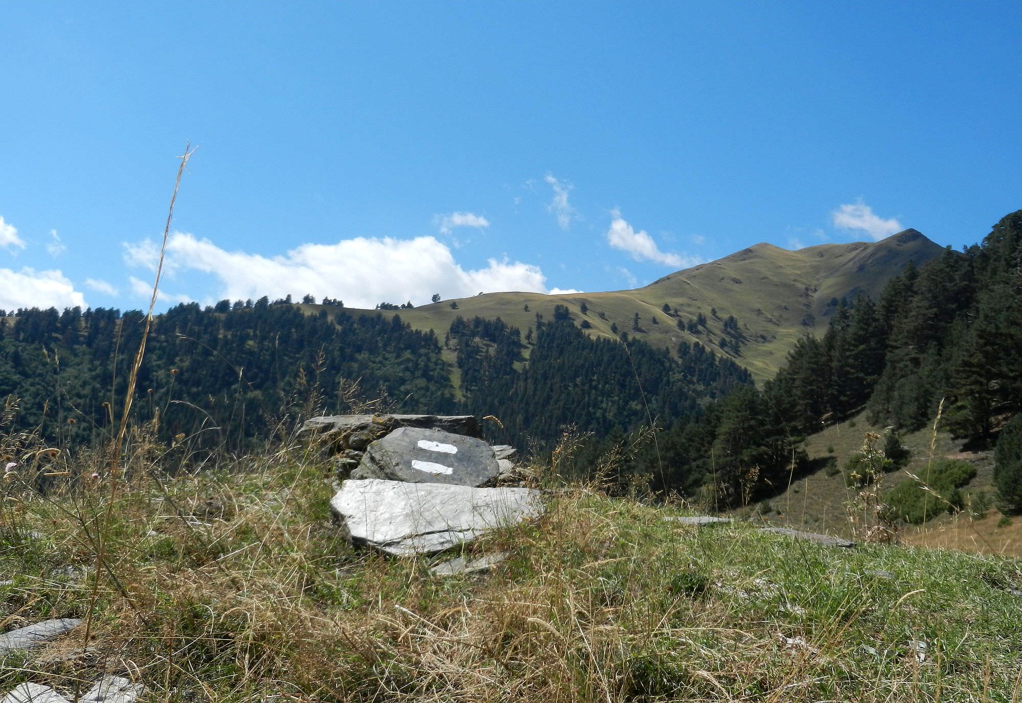
This section should take you no more than 4 hours (unless you are walking in the opposite direction). It's pretty straightforward - just going down. The trail sticks to the top of the ridge - any side trail trying to lure you down into the valley can be ignored.
Along the route, you shall pass several shepherds' huts. Those at 1870m are in a derelict state, another one at 1730m looked preserved, but there was nobody around (there was also not a particularly clean spring below). There are bunches of trees around the trail even earlier, but after this second hut, you will enter a proper forest (after a short intermezzo with ferns). The trail snakes in the forest and eventually turns south, following one side ridge down towards Mukushevi creek - it's not hard to follow even without the map. The forest looks preserved and I am sure a dendrologist could explain a lot about it, but I am an IT guy so can tell that there are some nice trees and blackberries.
At Mukushevi creek, the trail turns into a dirt track. You can take a dip at a local bathing spot to refresh yourself before the final 3km walk to Omalo village. On this stretch, you will have to cross the creek and its subsidiaries like 6-7 times, so you might want to switch to sandals (or, if the water level is low, you might cross most of these creeks without getting wet). Then the trail emerges at the northern edge of Omalo village (not to be confused with Omalo in Tusheti where this trek starts). Congratulations, you did it :)
Abandoned shacks en route down to Omalo