A spectacular trek in the western, less-visited part of Svaneti.
Nice trek traversing western, less-visited part of Svaneti. It connects villages in two remote, (still) pristine valleys and also offers great views from the area around Utviri pass.
The trail was newly marked in 2017 by white/red marking and metal signposts. Additionally, there were some markings added by TCT team so you shouldn't lose your way.
If you are fast, fit and don´t have a heavy backpack, the trek can be finished also in one long day. Which makes sense, because if you start here, you are probably going for full or at least partial Svaneti crossing. And each other section of this route can be comfortably done without a need of tent.
And if you think it's too far, you can still split it into two days and spend a night around the pass. Which is not bad option either, because you will be rewarded by some fabulous views.
The major part of track is a dirt road so walking is not difficult. The elevation is substantial (nearly 2000m). If done in one day it is an extremely demanding hike, if in two days, it´s only moderate.
Just wait for a marshrutka traveling between Zugdidi and Mestia and ask the driver to drop you at the Tobari village, at the mouth of Nenskra valley (65km before Mestia). He should charge you up to 20 GEL. From there it takes about 2 hours to walk to Chuberi.
In Zugdidi, You can also arrange for a taxi to take you straight there. They will charge around 100 GEL or even more, depending on your bargain skill. They will tell you that the part from Tobari to Chuberi is really steep and that the road is bad but that is not true. The road is mostly paved and climbs just slightly.
It is just one hour walk to the main road. Hail any marsrutka going either to Zugdidi or Mestia. They should charge you from 20 - 25 GEL.
Still, most of the hikers who take the effort to finish this trek continue trekking further east, towards Etseri.
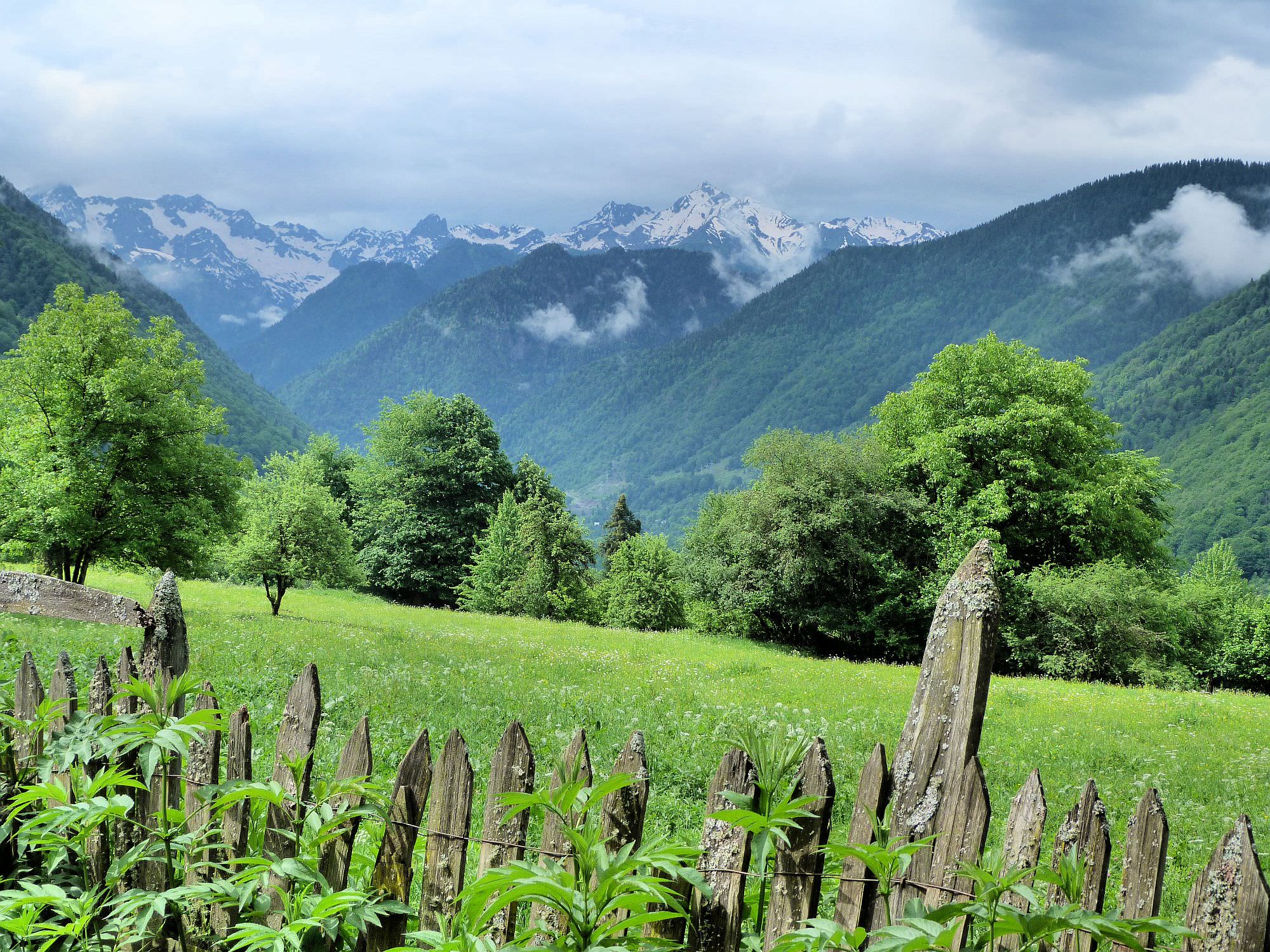
Nenskra dam is a controversial project which, once completed, will flood a large parts of the upper Nenskra valley and divert water from both Nenskra and Nakra rivers. The Korean-Georgian joint venture is being pushed by Georgian authorities who try to exploit the country’s hydropower resources. The problem is that in "the hunt for megawatts", other social and environmental impacts are ignored. The mood within the local population is also quite mixed: while some strongly condemn the construction, others are looking forward to more job opportunities and improved infrastructure, especially roads. As usual for such projects, the acting companies also try to buy the locals’ support; in Nakra the school building has been fully renovated, a new football pitch has been sponsored, and the village's mineral spring turned into a barbeque place with a small Svanetian tower. The trail doesn’t directly pass through the construction site but still, the dam is a big theme in the area and most of the people will have a strong opinion about it, so you should know what's going on there.
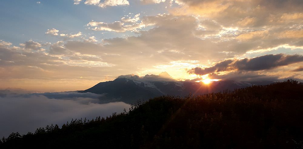
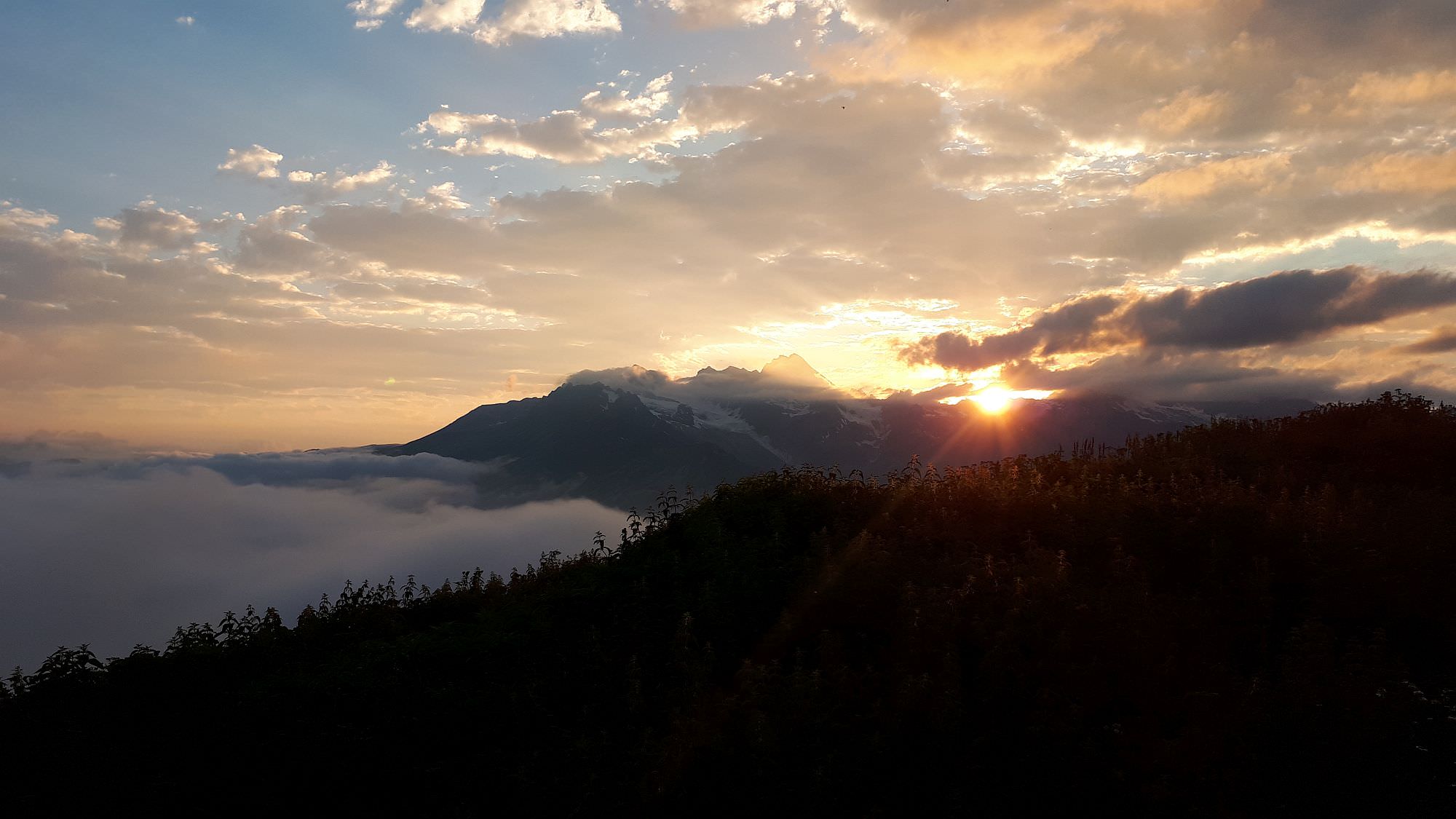
Sunset from the last hut west of the pass
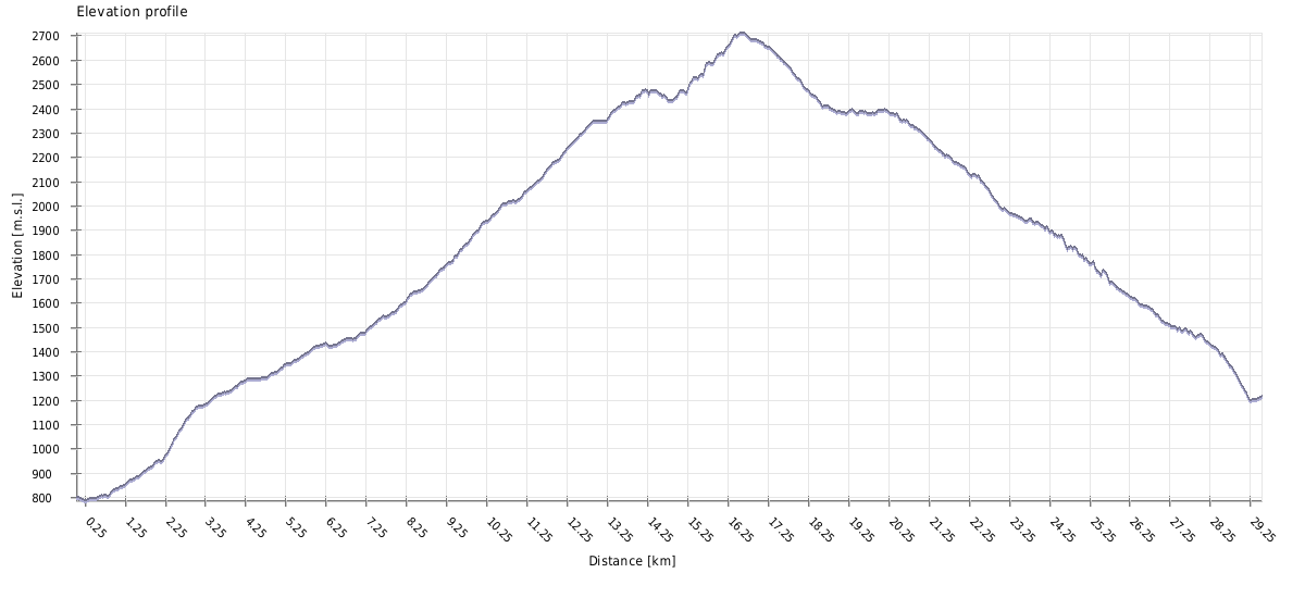
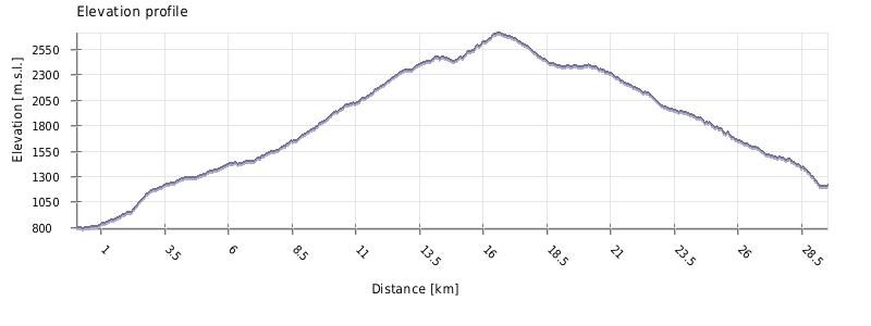
| Distance | 30 km |
| Trail type: | AB trip |
| Max. elevation: | 2711m |
| Min. elevation: | 787m |
| Total climb: | 2468m |
| Total descent: | 2057m |
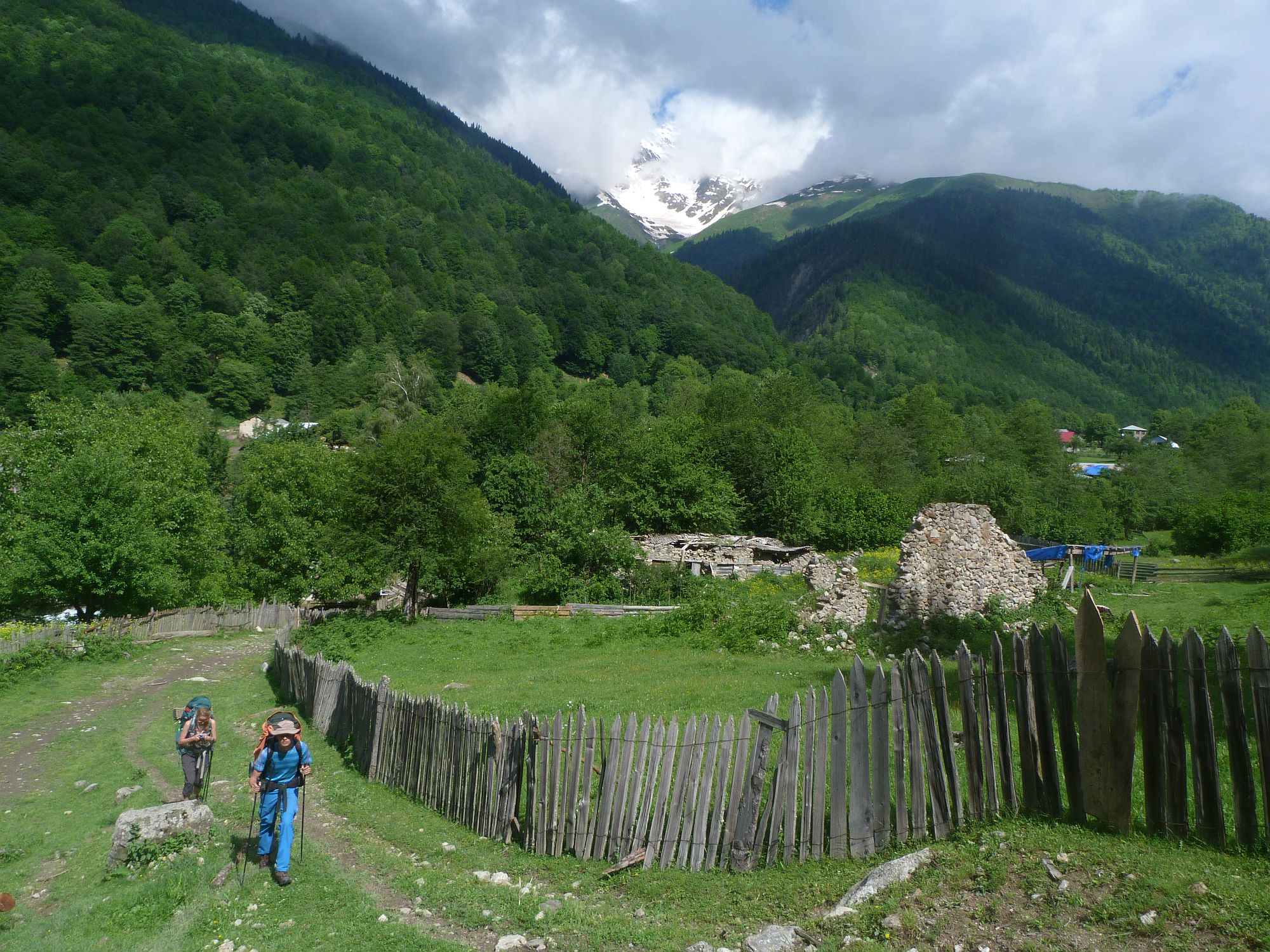
The marked trail begins in Chuberi, by the bridge over Nenskra river (there is an infopanel with the map of trail as well). Chuberi is a small village, there are just a couple of guesthouses and a small shop.
The trail follows for 200 meters the eastern bank of the river and then turns right. Then it winds slowly up along wooden fences of houses until it joins the larger road which follows Gvashkhara river. Shortly after, you will reach a signpost. Here, you have two options how to climb to Zemo Marghi village. Shorter route (also recorded in the gpx log) turns left and leads over two streams bridged by wooden logs (first is right on the trail but the second one is some 20 meters upstream). Then it follows the dirt track till it turns left onto a smaller trail. This trail climbs through a beautiful forest until a fence appears on your right side - towards the end, the trail gets quite narrow and hard to walk but it will lead you all the way to the village.
The longer but more comfortable route follow the track which serpentines up towards Zemo Marghi. Just don´t forget to turn left on the crossroad before the village in order to cross the river Markhi (there is a bridge). You can turn right, pass a gate and take a shortcut to reconnect the the official trail.
After both routes merge, the trail crosses Zemo Marghi village, leading you through four cattle gates. A couple hundred meters after the last gate, you can make a detour to the Kirar Mount Camp - it lies to the right, at the other side of the Marghi river, and might be good spot for a break even if you don't plan to sleep there. Not much can be said about the dirt road - it goes through pastures and woods, gradually climbing while staying close to the Marghi river. There are a couple of dilapidated huts along the road. Finally, you shall emerge out of the forest. This is where the dirt road end, right by just another shepherd's shack.
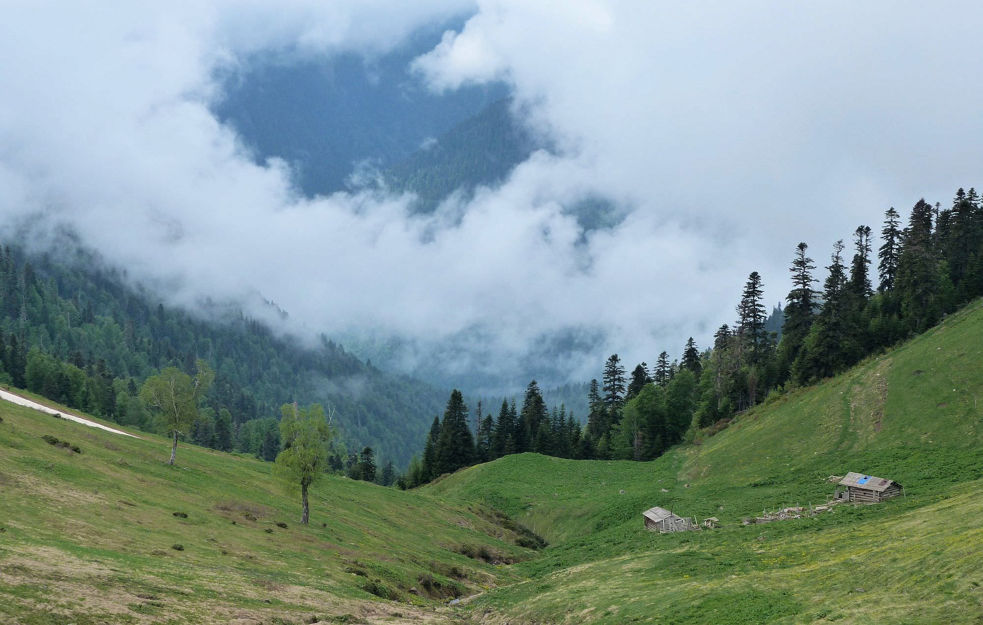
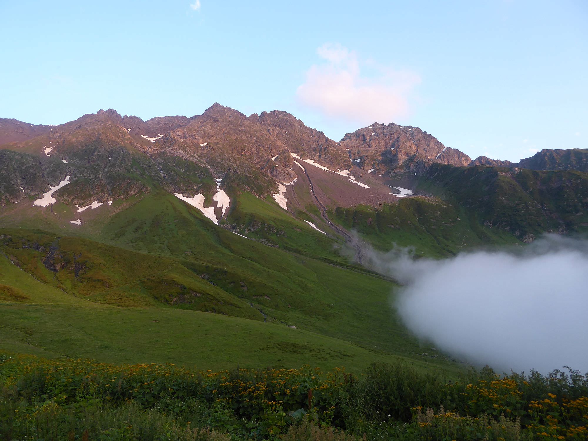
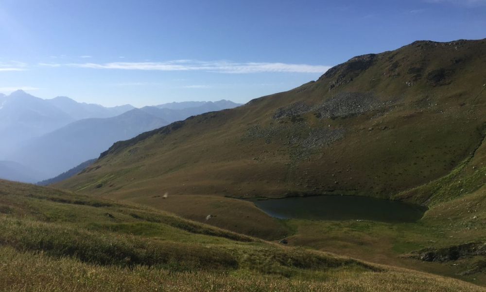
From here, follow the trail to the left of Marghi river until you hit the signpost and then turn left up the small ridge which separates the valleys of the Marghi and the Tita rivers. Soon you will reach several huts. There is again a dirt road that leads past a small lake (in late season nearly dried out) to the last hut before the pass. The hut is in a bad condition and not suitable for sleeping, but nearby is enough space to put tents and water is also not far - an ideal place to camp if you left Chuberi late.
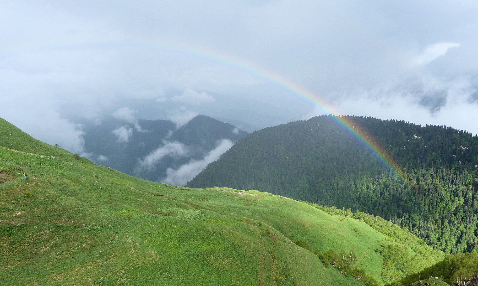
From the hut, the trail continues to the east, towards the elevation covered with rhododendrons. But instead of climbing it, it bypasses it from the left side and then slowly climbs on the southern side of Tita valley until it reaches the pass 300 meters higher. Along the trail, there are some eroded parts and landslides but none of those sections looked really dangerous. There may be also snow (it was there in the beginning of July when we were there) so bring good shoes and possibly hiking poles.
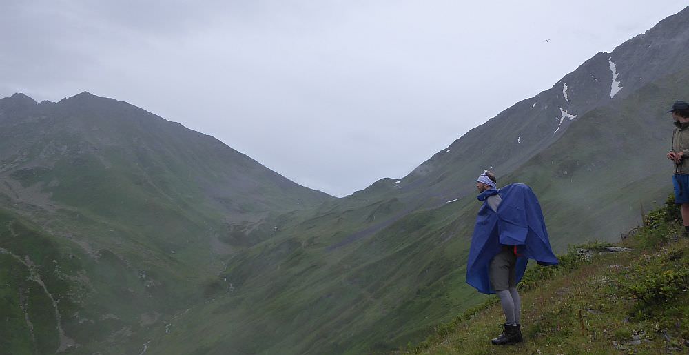
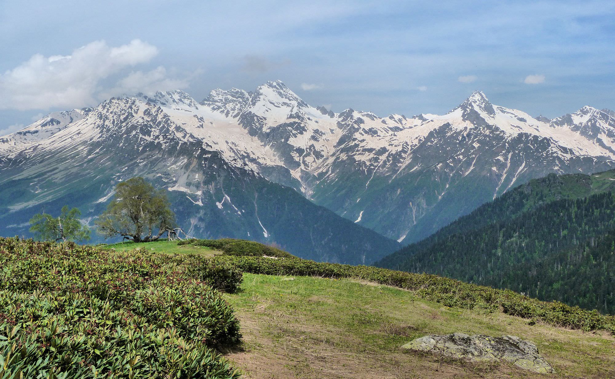
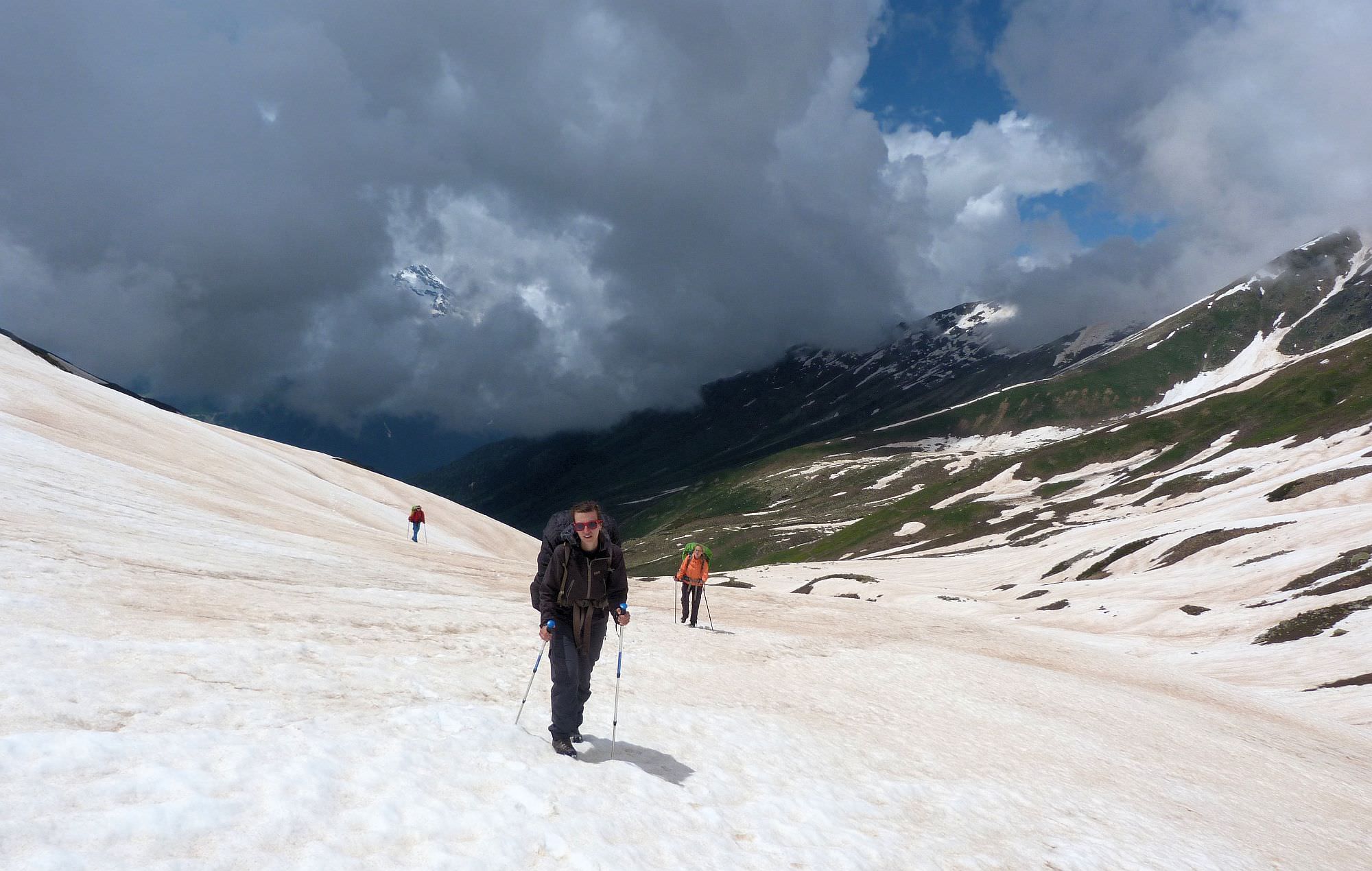
Utviri pass ahead
Utviri pass has the altitude of 2711 meters, but is quite unremarkable - flat and grassy. If you have few more hours to spare and would like to climb even higher, a good destination is the 3225m high mountain South Kirar which offers stunning views in all directions. To reach it, just follow the top of the ridge in the southern direction - the climb is non-technical.
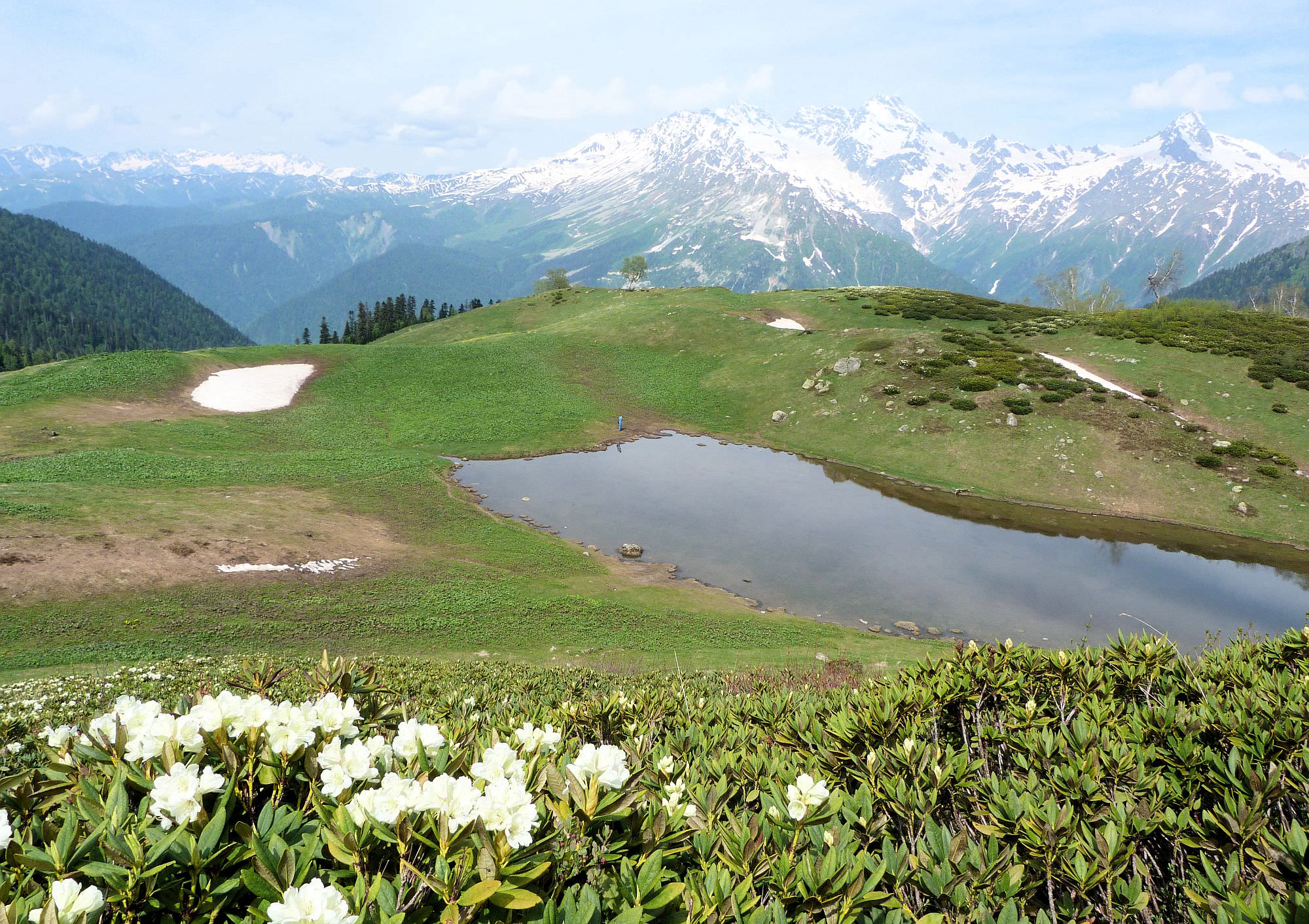
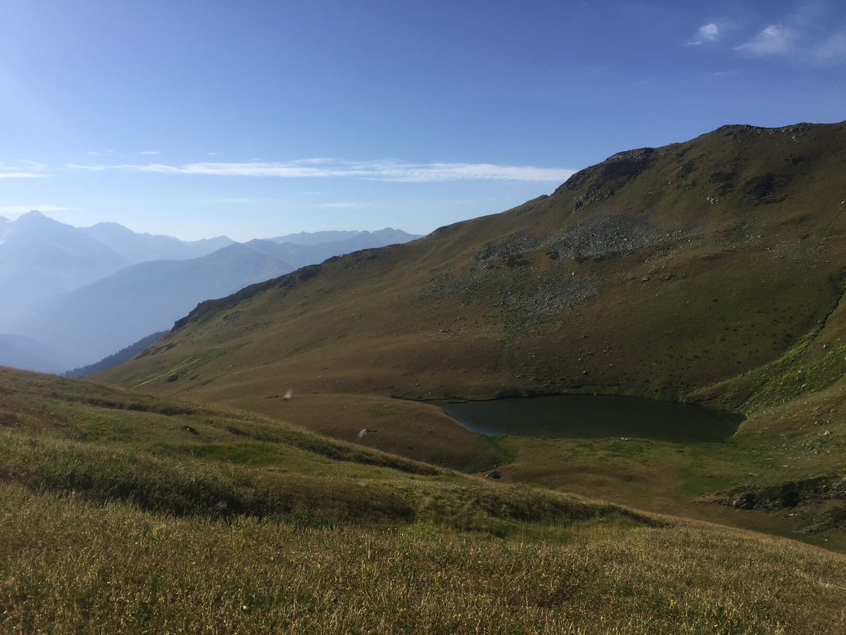
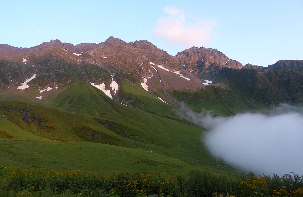
Behind the Utviri pass, about 15 mins of walk, there is the Ltnari mountain lake that is amazing for swimming and quite warm during the season. To reach it, follow a small trail on your right-hand side; first not too visible, it will soon turn into a well trotted path at which's end the lake is waiting. Pending on the time of the day, you can also camp here. Instead of walking all the way back to the pass, you can also simply cut inland and meet again with the main route.
Ltnari lake, situated right beneath the Utviri pass
In case you descend from the Utviri pass, the main trail continues leftwards, following the yellow signposts. At these places, it becomes overgrown and quite hard to follow.
Finally, you will see a large square boulder ahead. The trail here sharply turns to the left and drops to the Utviri stream. In the spring and early summer, the stream may be swollen from the melting glaciers and has to be crossed on foot (there is no bridge).
The rest of the trail descends on a dirtroad through pastures and meadows, passing the cottages. The first of those stands at the elevation 2400m - according to maps and signposts, this is also an official camping spot. Avoid at all costs! The place reminds Verdun battlefield, minus the trenches, but with tons of cow shit. Literally, any other flat place along the trail is hundred times better. Anyhow, especially when walking the other way around from Nakra to Chuberi, you may have to stay around there due to time and distance; instead of taking the marked spot, look out for the hut next to the water pipe, and descend from there for some meters into the green. At least some comfort and close to a water source.
From the "official camping spot", the trail zig-zags some 300 elevation meters down do another hut. Here, the trail is overgrown by a jungle of weeds; instead of fighting your way through the small path along the hut, stay on the wider road and make a small bow around it. It's some hundred meters longer but way easier to walk without the fear of itches and stitches. Anyhow, once you reach the river, you will find yourself on a nice dirt track. From here, you can just follow the dirt road until you reach the village of Nakra.
The gpx file also contains a shortcut shortly before the village - it leaves the dirt road and will get you to the village center – while it may be walkable from top, it is not recommendable when walking from Nakra to Chuberi as it starts simply too steep and densely grown, which impedes you from spotting the best way to follow. So, this "shortcut" is not necessary, you can just stay on the dirt road and follow it to the northern edge of the village.
In the lower part of the village, you will find a bridge crossing the Nakra river. Before walking on, look out for the natural mineral spring, which has been just renovated. The water is said to help any stomach illness one may have – the taste might be a point of discussion. Fill all your bottles there as you will have a steep ascend ahead if you continue from Nakra to Gheshderi on this trail. Alternatively, you can just stay on the dirt road and follow it to the northern edge of the village.
Severan new guesthouses popped over past years in the Chuberi area, mostly providing a very good value. Most of them are situated in the Kvemo Marghi village.
Guesthouse Babi - modern, cozy guesthouse with terrific food and very friendly hosts. There are also nice showers, hot water, good water pressure... and all of that for a very fair price. The only downside is tricky booking - the owner speaks only Georgian and Russian. If you don't, better write him on WhatsApp instead of calling so he can translate and respond.
Booking: +995 599 244162
Hotel Chubezeni - probably the most modern hotel in the valley. Nice rooms, supportive staff and tasty food. Rooms offer amenities typical for a 3-star hotel such as TV, so it should be of no surprise that the price is also higher compared to smaller guesthouse. It is still a pretty good value for the money, but for a real low-cost travellers, they also offer the camping in the garden.
Website: https://www.hotelchubezeni.ge/ (shows prices, but otherwise pain to navigate)
Guesthouse LariLari - wonderful guesthouse situated in the northern part of Zemo Marghi village. Not the newest one, but very cosy and clean. Also, the owners are very hospitable and friendly, hard to find some downside. Did I mention that they cook also very well?
Booking: +995 599 312935 (owner speaks English)
Kirari Mount Camp - this place is pretty special. First of all, it is situated above the Zemo Marghi village, across the river from the trail. Which puts you into much better position if you want to hike to Nakra in a single day.
And second thing - yes, this is a camping ground. But there are also several three A-shaped huts for rent. Very small, basically just a roof over the double bed, but also extremely cheap - a mere 60 GEL per night for the whole hut. CIn the price are included also shared amenities such as kitchen (unless pre-agreed otherwise, everyone cooks his own meals), toilets, showers and a kitchen. Btw, owners are terrific - very hospitable and always ready to help. Such as with transfer - they bring people even from the Zugdidi - Mestia road, and for a very reasonable price.
Booking: +995 597 56 59 75 (Jaba, speaks English)
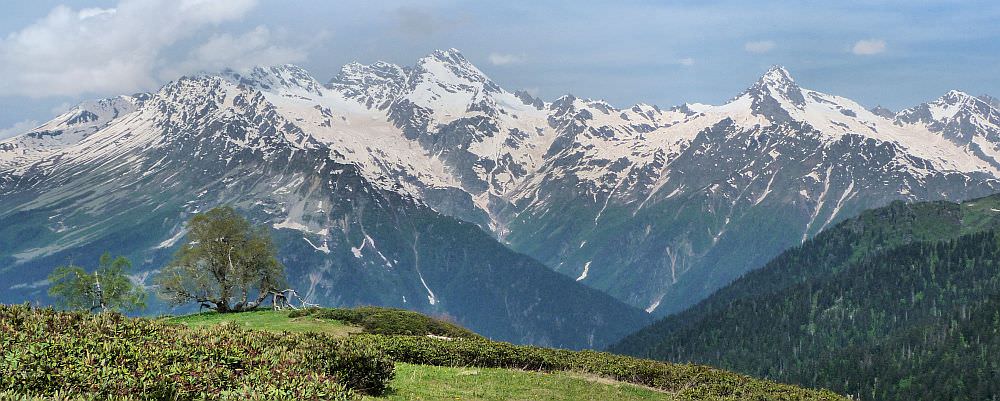
South Kirar massif, situated south of Utviri pass
This article was originally written by Czech hiker Miloš Hejný who finished the trail in the early summer of 2018. Updated by me after I walked it in 2019. Chloé Tremblay and Philipp Bienek hiked the other way around from Chuberi to Nakra in August 2022 and provided their remarks and further pictures. Thanks a lot!