Trek to remote, pristine lakes in the western Svaneti.
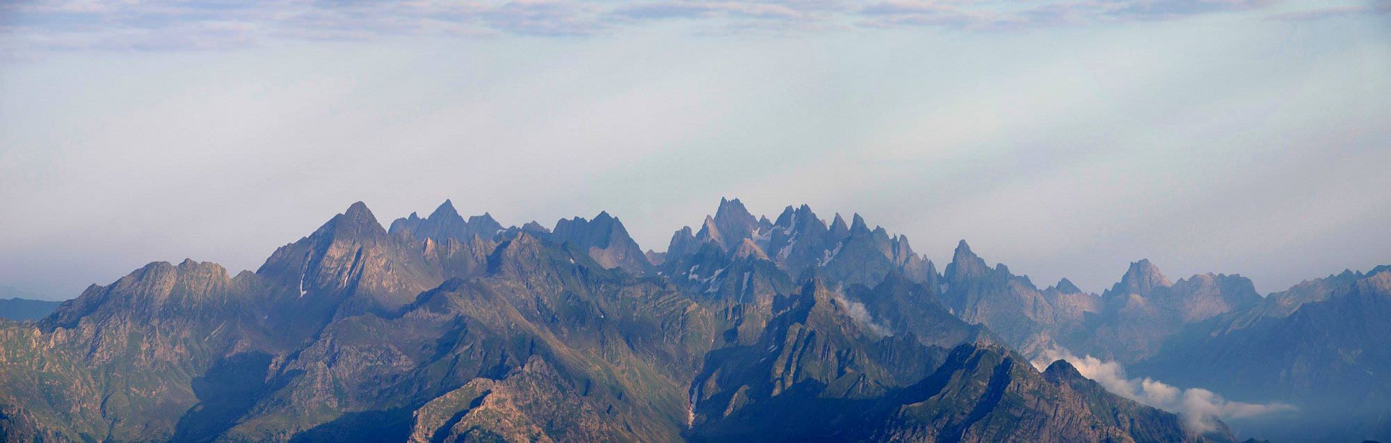
Remote, difficult and spectacular - these three words best describe the trek to Okrostskali lakes. Both lakes lie in the mountains of western Svaneti, close to the border with Abkhazia. In many aspects, they resemble Tobavarchkhili lakes so this trek could be a good pick for purists looking for pristine nature who feel that Toba route became too “mainstream”.
This parameter is quite tricky since it’s impossible to predict if you will be able to hire a jeep and how far it will take you. Under ideal circumstances, this trek could be done even in three days, but better expect four.
At the lower altitude, the trail often disappears in high vegetation, higher be prepared for some steep slopes. There is also one possibly difficult river crossing - this is not a good pick for casual hikers.
The best period is from the mid-July till the mid-September. Earlier, the Ormeleti river which you need to cross is much stronger and some steeper slopes by the lakes are still covered with snow. If you depart in the second half of September, you must prepare for shorter days and possible early snowfalls.
The most convenient would be to use the regular marshrutka traveling between Zugdidi and Mestia. Just ask the driver to drop you at the mouth of the Nenskra valley (it costs about 15 GEL). It is near Khaishi, behind the bridge over the Inguri river - there is a road branching north and a pointer saying Chuberi. Follow the road for about 15 minutes and you should come to the bridge over Nenskra river. Here starts the Lukhi village.
Again, your best bet is the Zugdidi - Mestia marshrutka. Walk back to the main road (ideally to some place where it can safely stop) and wait for the first one. Or hitchhike, the traffic is dense enough.
If you want to keep hiking, head north, deeper into Nenskra valley and then cross Utviri pass to Nakra.
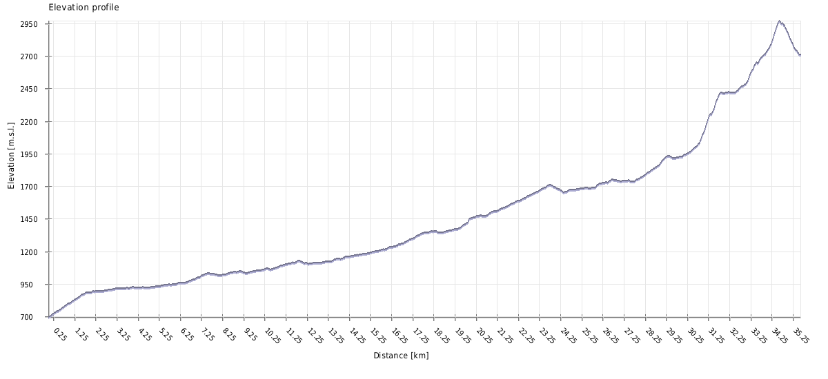
| Distance | 71,2 km |
| Trail type: | Roundtrip |
| Max. elevation: | 2970m |
| Min. elevation: | 693m |
| Total climb: | 2958m |
| Total descent: | 2958m |
Track starts in the Lukhi village and follows the dirt road heading west, into the Ormeleti gorge. This road is 25km long and is used by woodcutters, so it’s larger part is usually passable by trucks. I recommend to hire a jeep or truck to take you as deep into the valley as possible since the walk on the road is not too exciting. Also, without a jeep, you won’t be able to finish this section in a day and the whole trek will take at least 4 days (so you will have to camp by the small lake, not a big one).
OK, so let’s assume that you got dropped in the forest, some 15 km west of Lukhi. Follow the road for an hour or two and turn left onto the side road on the spot indicated on a map. This track soon ends at the abandoned carriage left in the forest and you need to keep walking west - your progress will be slowed down by swampy terrain and aggressive flies.
After 2km, you will emerge from the forest close to the river and enter the meadows - there is no path, just the jungle of weeds. Pants and long-sleeved t-shirt will come really handy, maybe even a machete.
Keep walking in parallel to the Ormeleti river until you reach its confluence with Okrostskali (there is also a ruined hut at your at your side of the river ). You need to cross Ormeleti below the confluence, at the spot where it´s widest and most shallow. Then turn south - follow a clearing between a pine forest (to the left) and groups of trees lining the Okrostskali (to the right). You may find some faint remains of the original trail but most of the time, you will just trudge through the high grass.
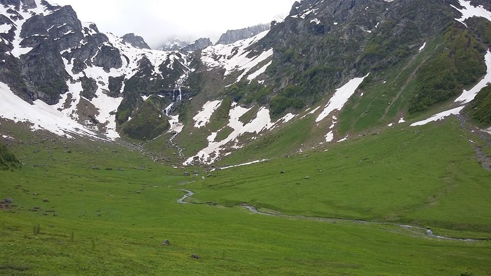
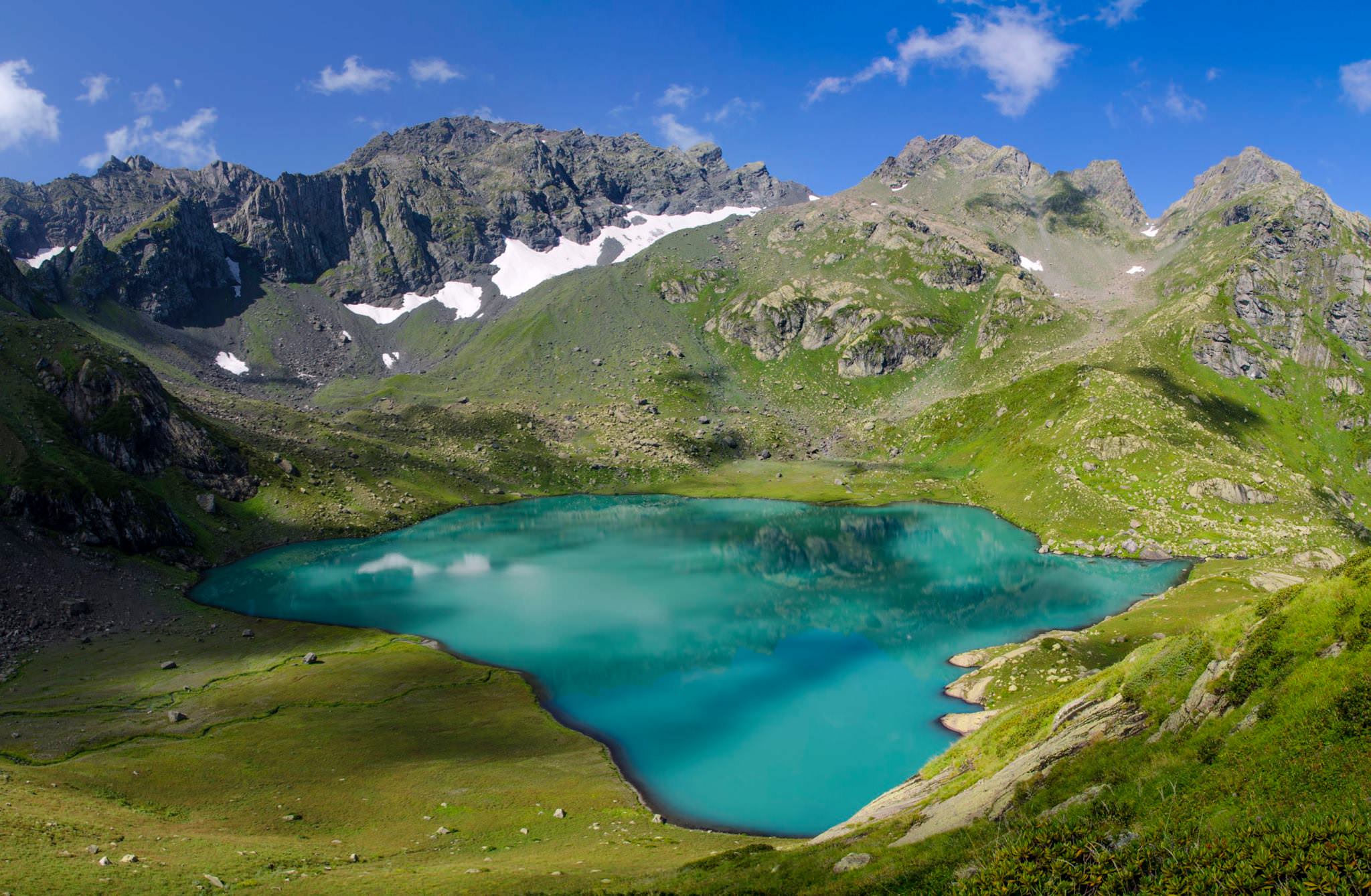
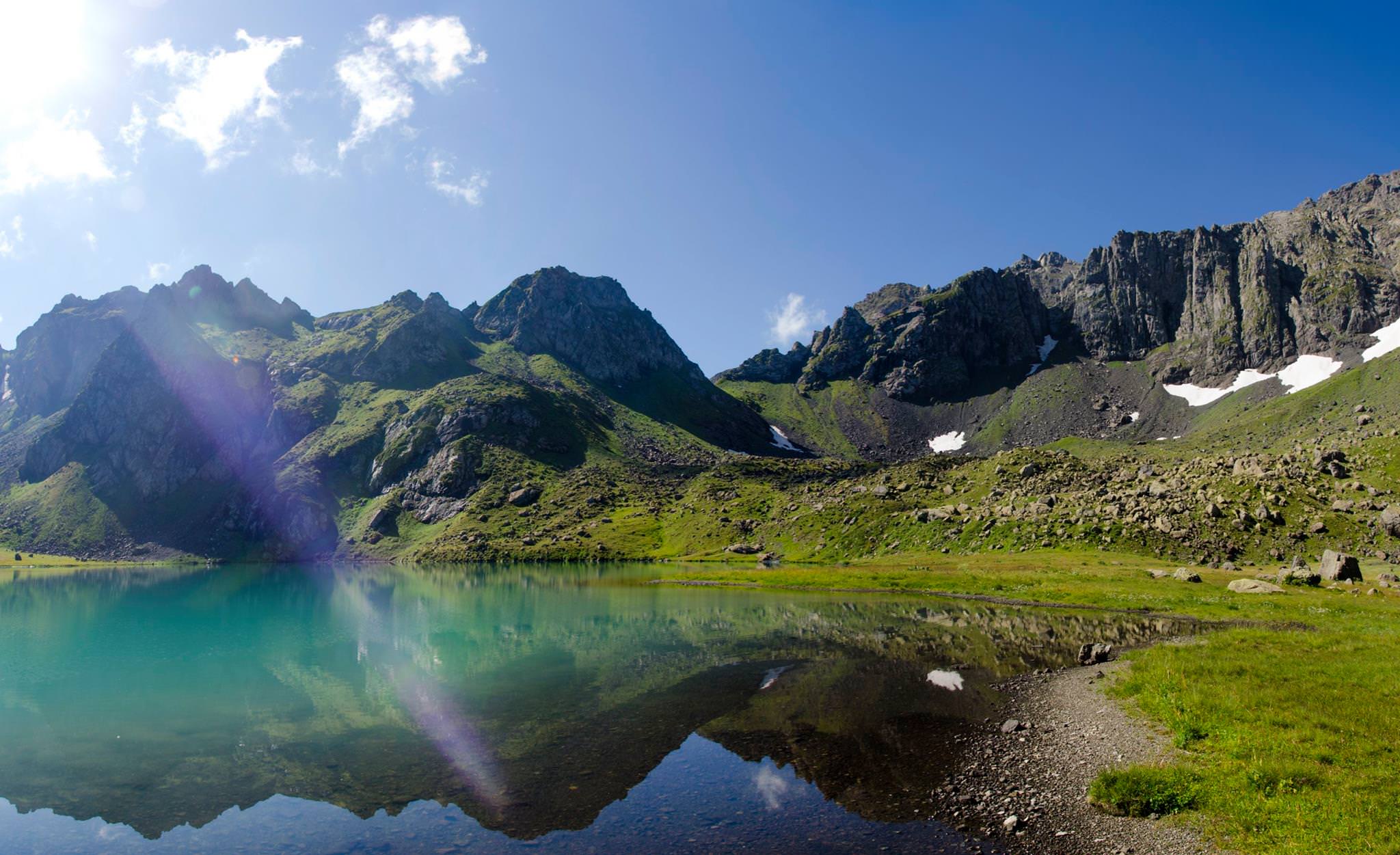
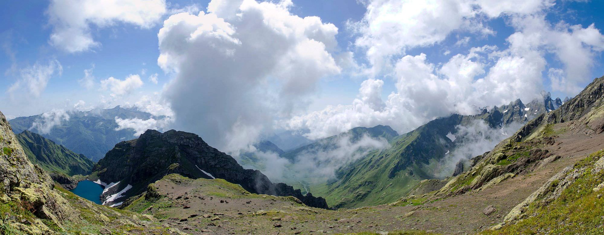
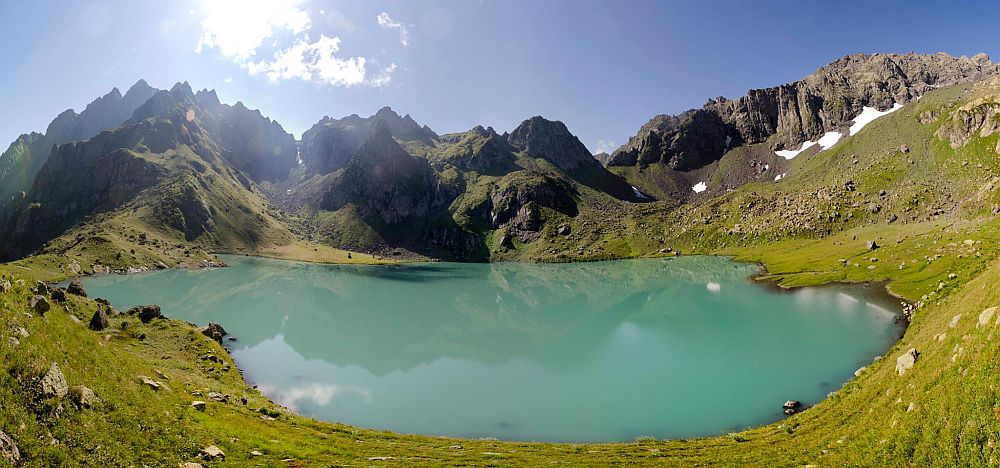
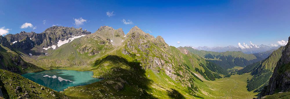
After you cross a small hill covered with deciduous forest, you will find yourself at the edge of a large plateau. At its other side, you can see a steep rocky slope. There is an impressive cascade waterfall flowing down these rocks - it is fed by Okrostskali lake. Plateau has the altitude 2000m and is a solid place to camp. I usually prefer to camp by the lake but if you want to split the trek into even sections, this place is simply better.
Leave the tents on the plateau and take just a daypack - it´s more convenient since you will return here in the evening.
First, you need to reach the waterfall and climb the rocky slope to the place where the water originates. It looks menacing at a larger distance but there is a nice, marked trail to the right of the waterfall. However, you will need to ascent 400 vertical meters so it´s no easy feat.
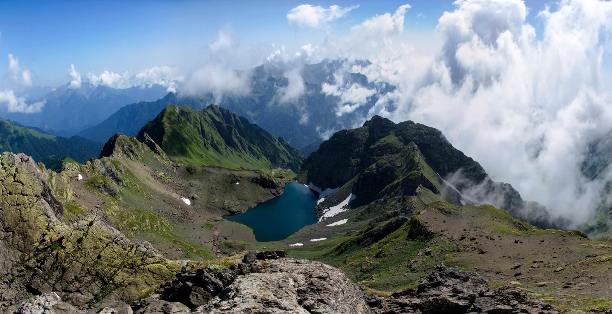
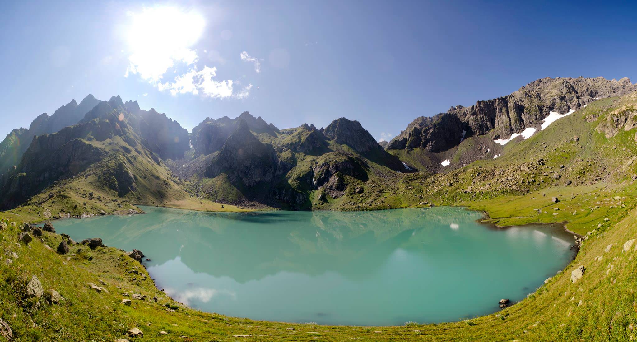
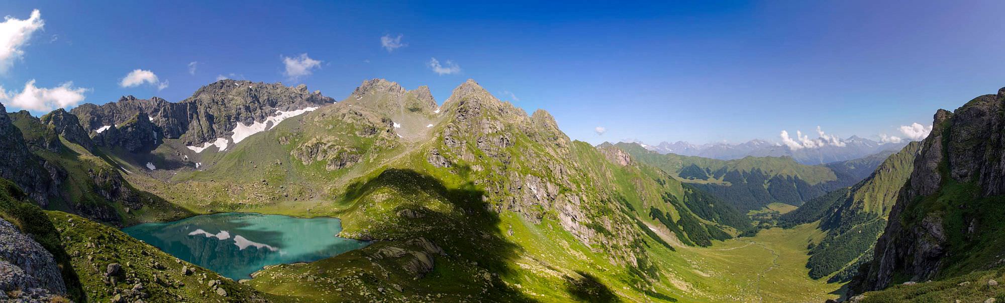
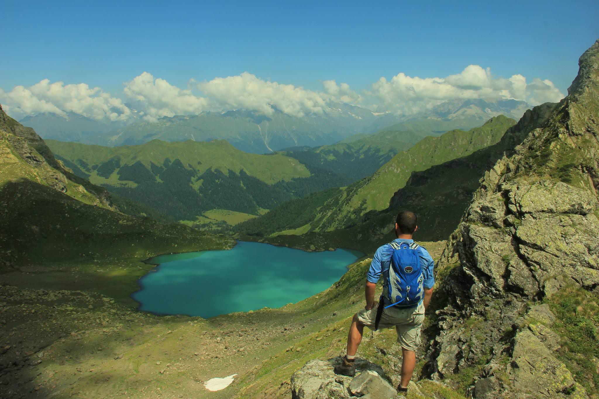
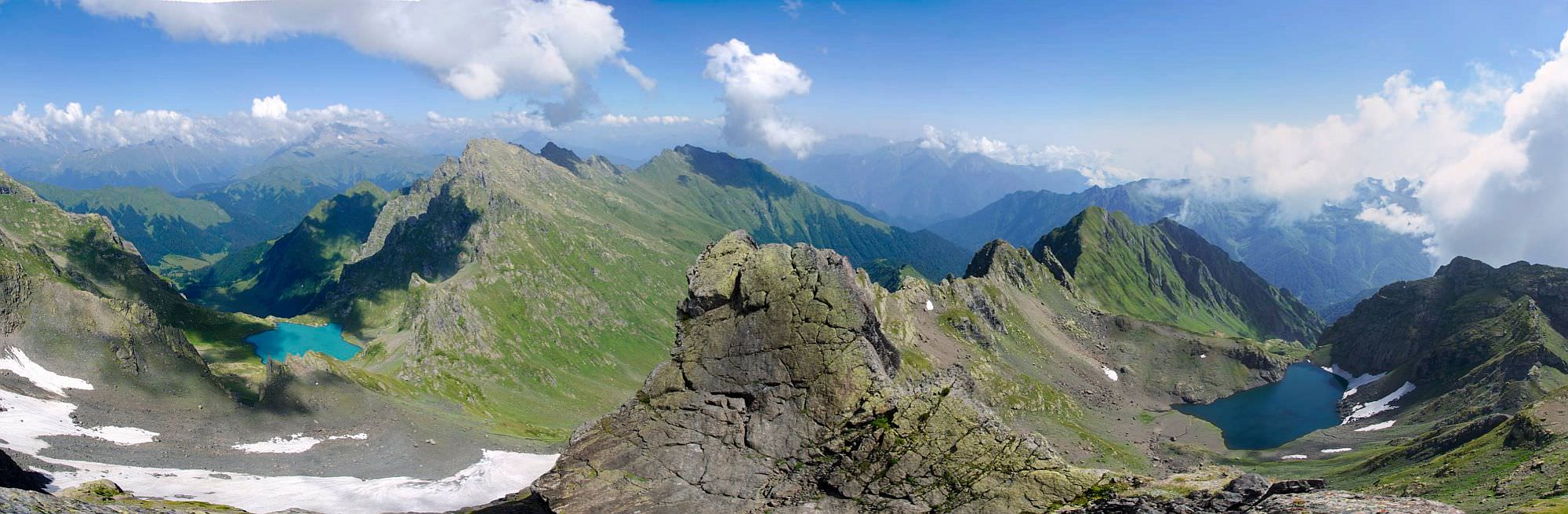
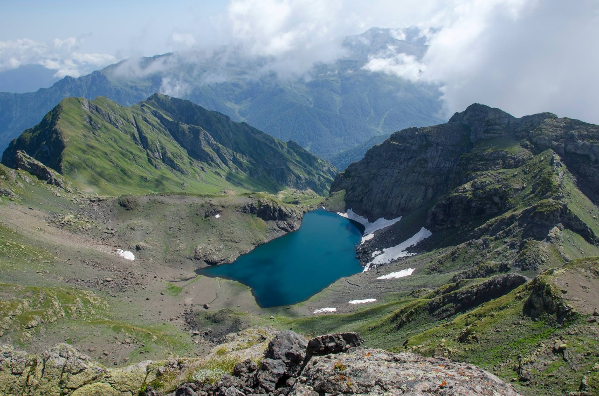
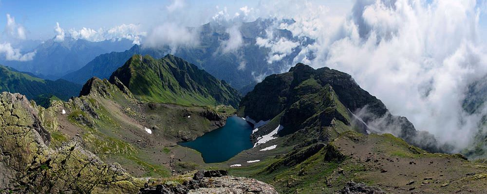
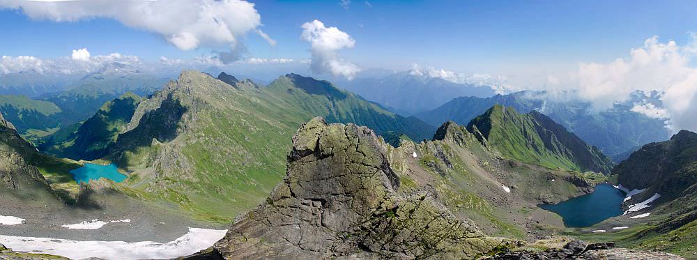
Once you are at the top, Didi Okrostskali (Great Golden/Colorful) appears in front of you. After a well-deserved break, you need to reach the Ergzashira pass (2600m) lying above its opposite side - it doesn´t take long as the elevation difference is only 200m. From the pass, you see a Kvaka gorge to the south. To the west of you runs the mountain ridge towards the main ridge which has north-south direction. You need to get there, but can´t just follow the top of the ridge you are standing on since the terrain is not walkable.
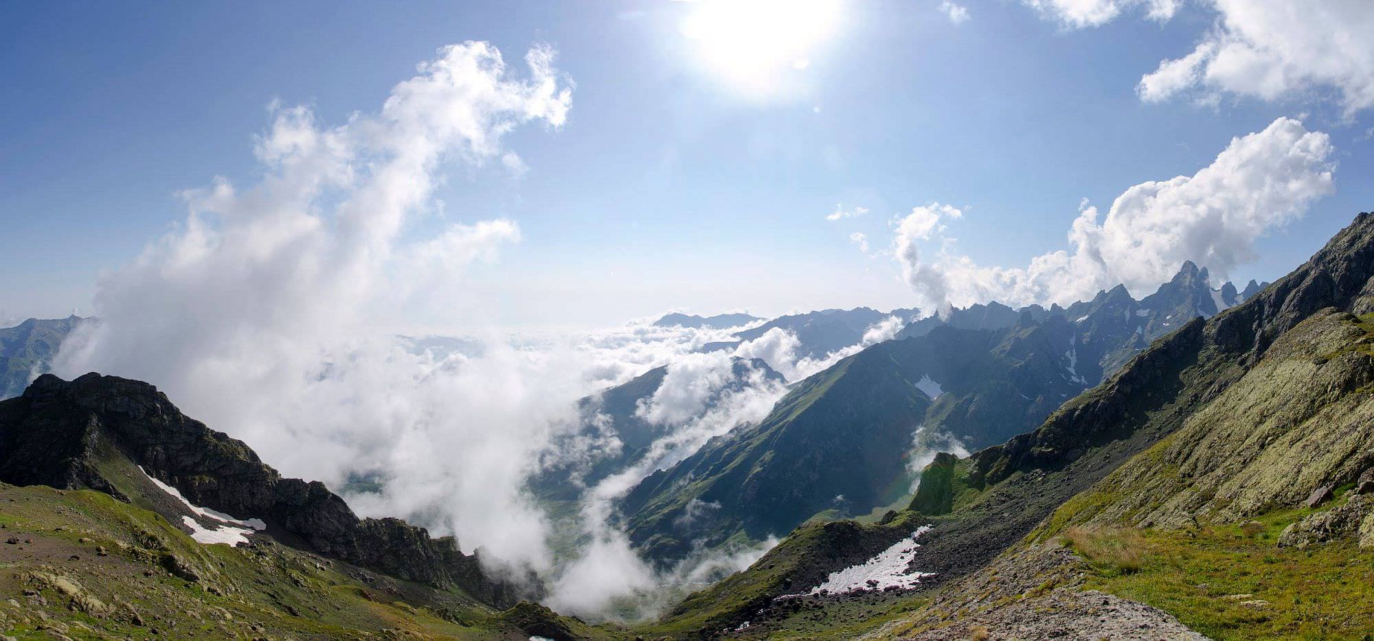
What to do? Head southwest while keeping your altitude and then climb towards the main ridge. The terrain is steep and usually covered with residual snow, so the caution is in place. Once at the top, you are close to the border of the breakaway region of Abkhazia. There is a Russian military base 10km away in the Ghalidzga valley below so stay on the ridge and head south. This is the best part of the journey since you will enjoy great panoramic views - not only you will see a larger lake you left behind, but soon you will see also a smaller lake to the left.
Descent to the lake, have a lunch, take a dip and once you are fully rested, return the same way to your camp.
This day is straightforward - return the same way you arrived. However, even though you are walking only downhill and already know the trail, the distance may be too large to cover in a day. So be prepared also to camp in the forest. The main problem is that, unlike on the trip to the lakes, you cannot call a jeep now so will have to walk the whole distance by yourself. Unless you are picked by local woodcutters, but I wouldn´t rely on that too much.
The greatest credit for this article goes to Zura Natsvlishvili who visited these lakes in summer 2017 with his friends and collected all necessary info. Photos were provided by Giorgi Chubinidze and Beso Chikvinidze. Didi madloba to all of them!