Nice trek exploring little-visited trails and villages of Tushetis Alazani valley.
This nice trek allows you to explore less frequented parts of Tusheti. It crosses mountains forming the southern side of the valley of Tushetis Alazani river and passes several traditional Tush villages, only barely touched by tourism. A highlight of the trek is the crossing of Apakurta pass and the stay at Gogrulta, one of the most picturesque Tush villages, mainly due to its stunning location on a rocky outcrop high above the valley. The route is marked by red markings.
2024 update: Currently, in the early July of 2024, this trek cannot be completed because of the destroyed bridge between Omalo and Khakhabo.
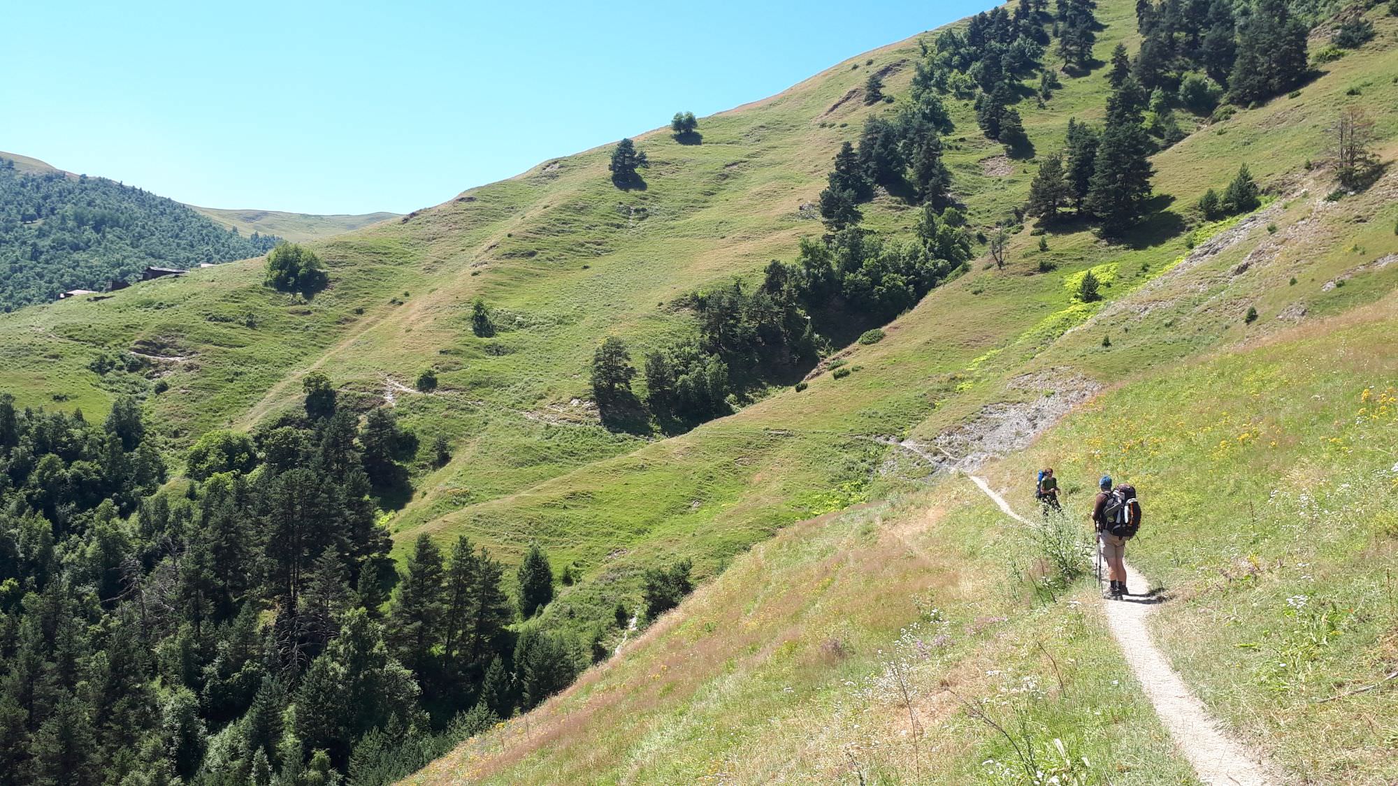
The first day is quite demanding, with the trail going up and down all the time. The second section, from Gogrulta to Jvarboseli is much easier.
Both directions are viable, choose Omalo as a start only cos it's the hub of the region. But the opposite direction can be taken as well if you are doing a counter-clockwise loop around Tushetian villages. It even has some advantages since if you start from Jvarboseli, it gives you a better chance to sort out the problematic river crossing (ask if there is a bridge in advance, hire a car from locals etc).
By jeep:
There is no public transport to Tusheti. To get to Omalo, you will need to hire a driver with 4WD. If you are traveling from Tbilisi, you will first need to get to Kvemo Alvani village - this can be done by marshrutka or a taxi.
The marshrutka departs from Ortachala bus station in Tbilisi at 9.am and arrives at Alvani two hours later (price 20 GEL). Drivers are used to tourists and often arrange them further transport to Tusheti. Just confirm with the driver that he is going all the way to Alvani, they sometimes try to drop passengers in Telavi in order to make them hire another taxi to Alvani. Or they simply want to hook you up with the jeep driver from Telavi but that is OK if the price is right.
If you want to take a taxi from Tbilisi to Alvani instead of a bus, the price can be anywhere 100 and 150 GEL (it grows with your distance from the Ortachala station :))
In Kvemo Alvani, the bus or taxi will drop you at the main (and the only) junction. This is the place from which depart jeeps to Tusheti so if you get here before noon, you should be easily able to hire a driver.
The ride to Omalo takes about 4-5 hours and costs about 100 GEL per passenger (or about 350-400 GEL for the whole jeep). BBC once placed it among the "10 Most Dangerous Roads in the World", but with a good driver, it definitely doesn´t feel like that. In navigates pretty steep mountainside but the road is usually wide enough and unless you are passing another car and need to navigate to the very edge of the road, there is no reason to feel nervous. Still, the accidents happen here and the road claims a few lives every year. Therefore, even if you have your own car, for this stretch of the road, it may be better to use the service of the local driver.
Since July 2024, there is also another, rather comfortable option. A popular Georgian transport provider, GoTrip.ge, added Omalo into the list of their destinations. Only a few of their drivers offer this route yet, but that shall eventually change. And the prices they offer are pretty decent - the cost of a drive from Tbilisi all the way to Omalo start at around 450 GEL.
By hitchhiking:
Hitchhiking can be "hit or miss" since jeeps traveling to Omalo are usually booked by tourists and full. And even when they are not, tourists might be reluctant to pick someone who just walked a few hundred meters beyond the departure point and raised a thumb (especially if he is dressed up in Arc´teryx gear like a couple of "travel hackers" we saw there the last time :)). Professional drivers will rarely pick you up for free. Therefore, your best bet will be locals heading to Omalo for a visit - but it may take a while until some show up.
Another option is the Kamaz truck which brings supplies from the lowlands to Omalo. These drivers usually pick up passengers for a symbolic price but the truck has no fixed schedule. It departs like each other day in the morning, so it can´t be relied upon.
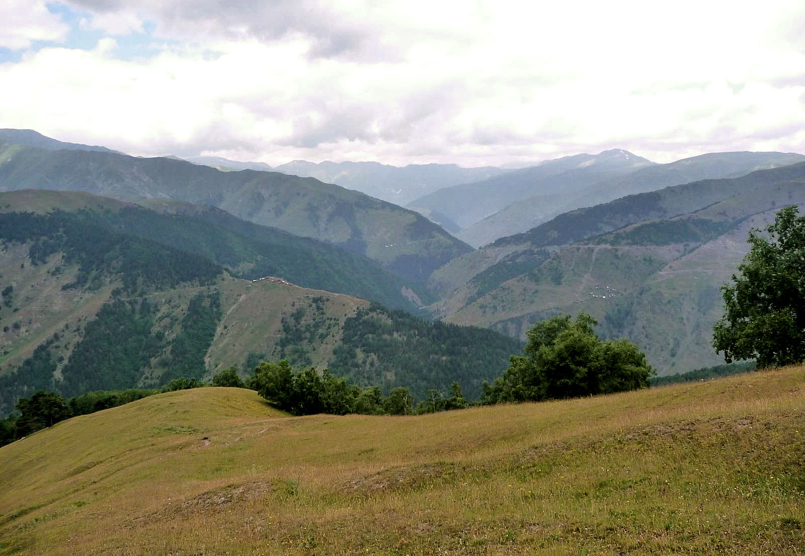
If you reached Jvarboseli, there is a decent chance you plan to continue on foot. There are several options. You can start trekking towards Verkhovani and Nakle-Kholi pass, from where you can either descend to Parsma to see more Tush villages or traverse the Pirikita range to see more of a nature. You can also follow the road back to Omalo which takes one a day - not the most exciting hike since it's on a dirt road but views are great, nevertheless. Or you can take a direction towards Gogrulta village. And you can also continue deeper into the Tushetis Alazani valley, crossing to Pankisi gorge or towards Borbalo pass and Khevsureti.
And, of course, you should be able to hire also jeep back to Omalo - the cost of such ride should be about 200 GEL
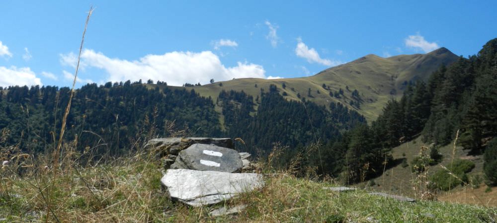
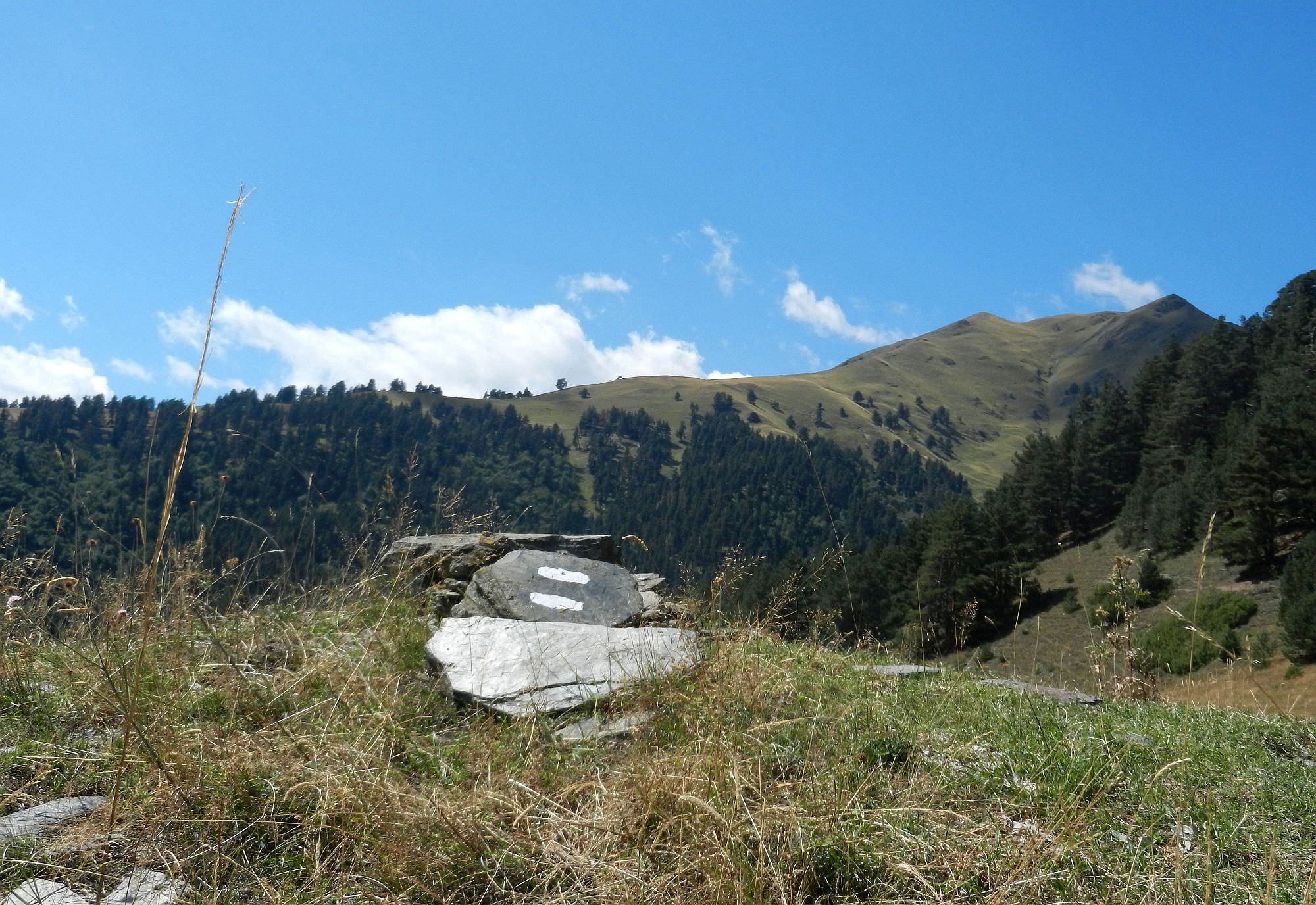
Tourist marking near Khakhabo
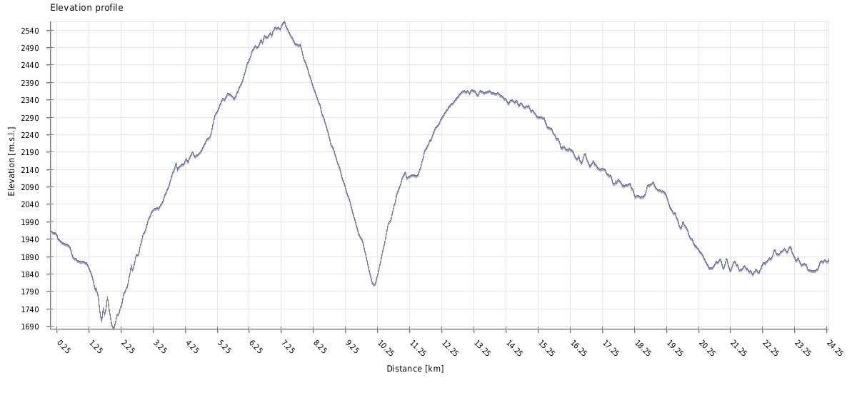
| Distance | 24 km |
| Trail type: | AB trip |
| Max. elevation: | 2561m |
| Min. elevation: | 1690m |
| Total climb: | 1768m |
| Total descent: | 1856m |
From Upper Omalo head to the south - stay on the marked path on the right side of the hillside. You will reach the car road and then turn to the right. Follow the car zigzag road. After approx. 1 km you can see a big road sign for the direction of Shenako and Diklo. But today we are going in an opposite direction - turn right behind it.
Pass a small quarry on the right and continue on the road which ends at a house. Keep still the same direction, passing by the house until you reach an break, where there is a sharp drop-off. After the break go right down the meadow, following the trail towards the opposite forest, down the hill. Continue through the forest, following the zigzag trail still down until you reach the river.
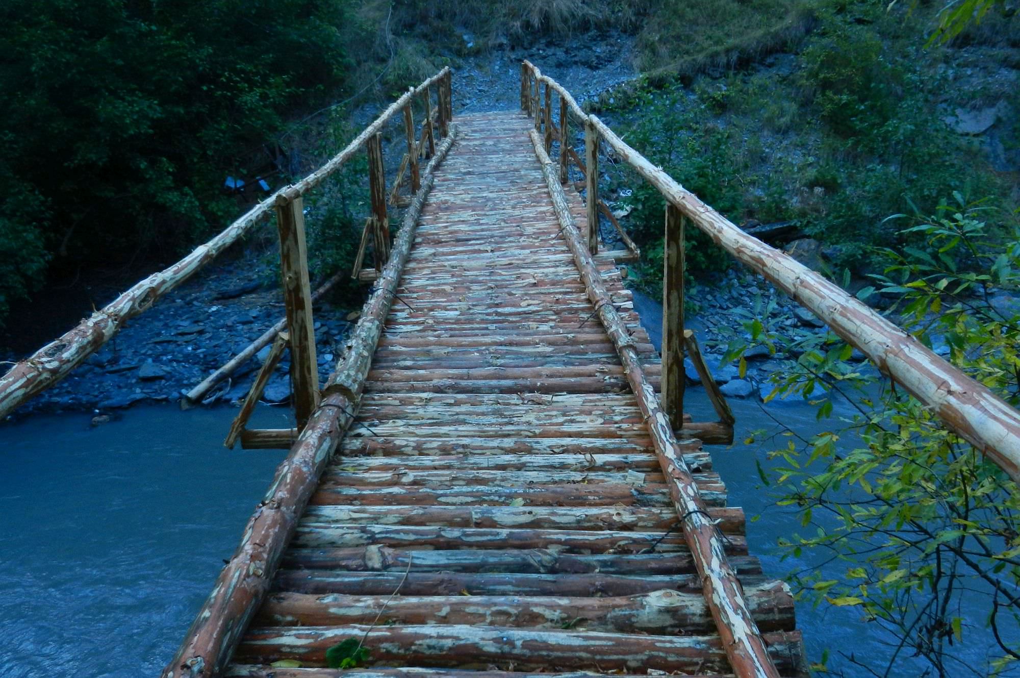
At the river, cross the wooden bridge (N 42°22´17,8´´ E 045°37´11,0´´, altitude 1663 m) and right after the bridge, take the trail to the left and climb up the hill on the serpentine. After 3 km, the forest turns into a meadow - at its edge take the trail to the left up the hill. Keep this direction and after approx. 0.5 km you will reach the village Khahabo.
2024 update: On 1st July of 2024, I got a feedback that the wooden bridge is destroyed and therefore impassable. It will be certainly fixed, but I don't know when. If you find out that it has been fixed, pls let me know.
Pass the village and immediately turn right onto a small trail - the large road leads to Chiglaurta, so it is useless to us. After 50 m turn right to the road up. The road ends up with a small field. Do not go beyond the road's end as the field is a holy place (Mariamtsminda). At this point turn sharply to the left and cross the meadow diagonally up.
From Mariamtsminda the path is relatively visible. Keep up on the top of the meadow, then take the upper path going to the forest. The path leads through the forest more or less on the contour line. On the road, you will cross the small stream (not recommended to take the water here due to the abundance of cows).
After some 400 m from the stream the trail turns up, but the path is hardly visible. Here you come to the meadow when there is no path. Keep diagonally up and on the top of the meadow turn right up when you reach another meadow. Here turn right and up through the lower part of the meadow. The trail leads up to the large meadow on the slope below the top of Kekh mountain chain. To the forest, the path is clear at this point.
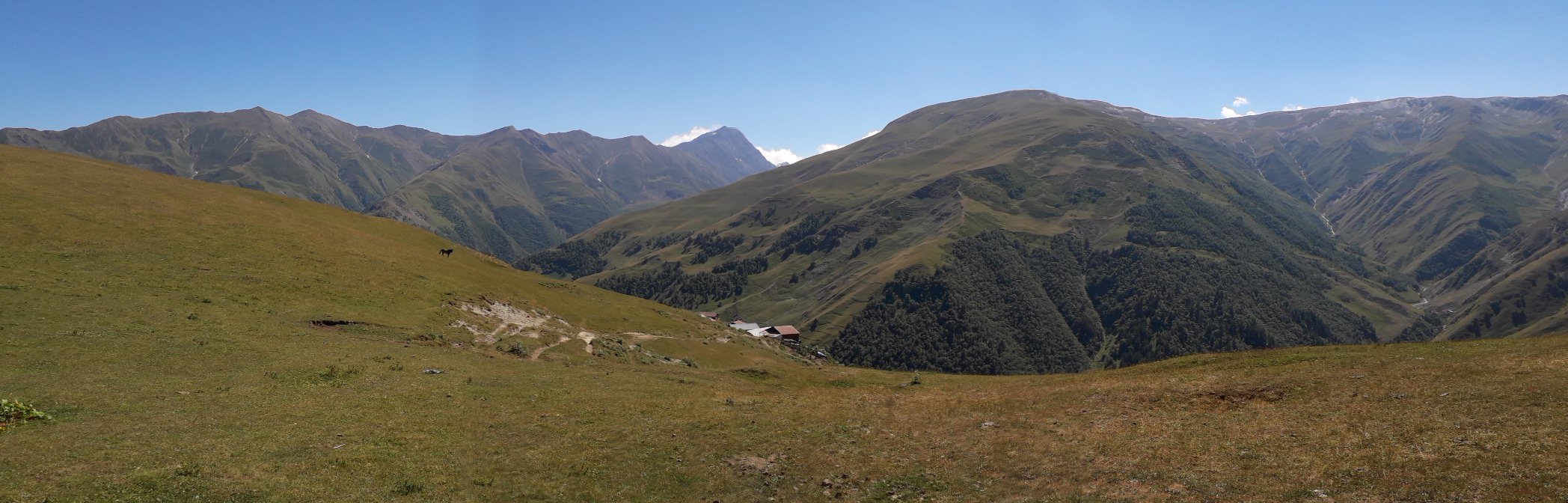
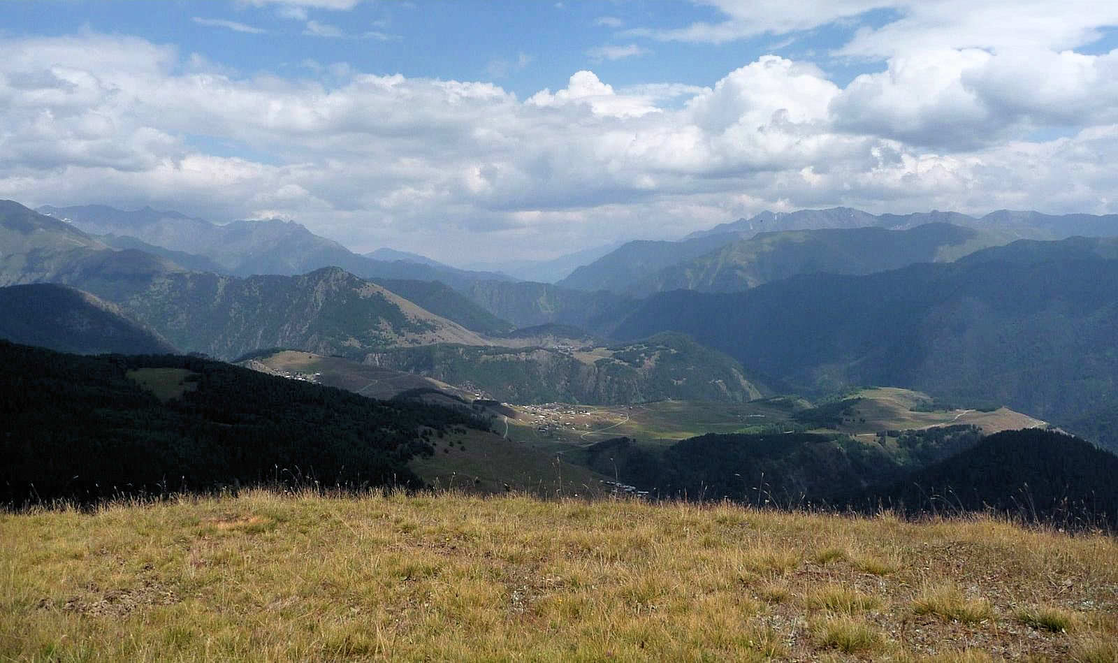
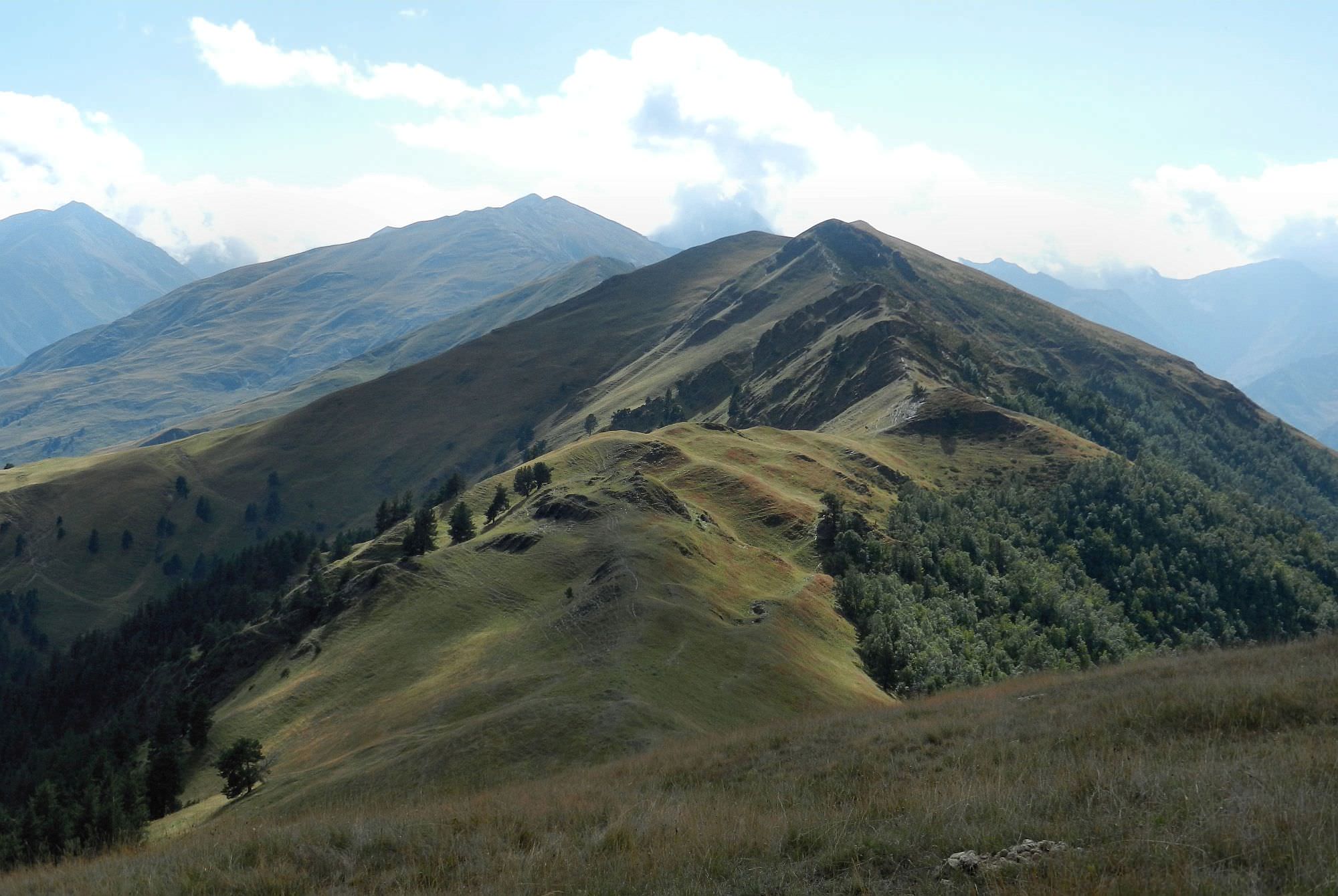
The meadow is called Shantlovani (marshland). It should be crossed roughly in the middle. Khakhabo village is visible on the left side far below. The path is hardly visible, keep up to the left towards the groups of pine trees. Reaching the mountains chain turn to the right for some 100 m and then follow the path turning to the left roughly on the contour line between the trees. You cross the small stream and keep on the path leading slightly up to the Apakurta pass (2551m).
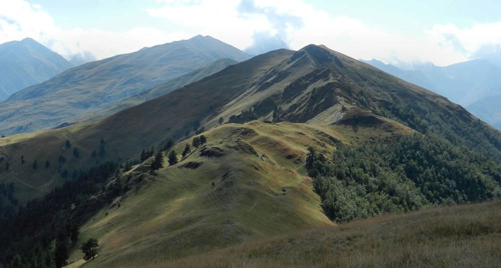
Apakurta pass from Kekhi mountain
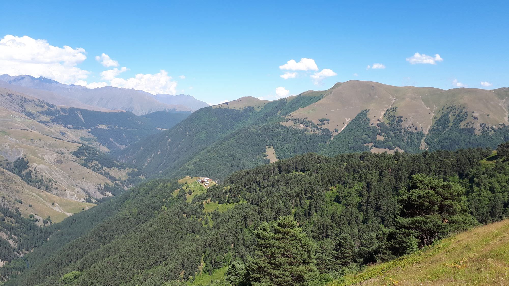
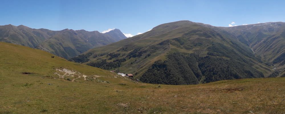
From the pass, you have nice views of the Gometsari valley. The closest village is Gogrulta, more distant village further to the right is Dochu. The path goes down and right. You will cross a small stream (possible to take the water, but the flow is weak). From the stream, the path zig-zags down through the meadow called Apakurta. You can also go right down to the first trees of the pine and birch forest.
The path sneaks through the forest and leads down to the large meadow. Here the remnants of the houses are located (the winter houses of Gogrulta – Gogrulta boslebi/Lashkaraulta). Go down along the houses.
At the lower end of the meadow, take the path through the forest further down up to the river Oritskali. Here firstly cross the stream which conjuncts to the main river (you can jump over). Oritskali has to be crossed through the shallow ford. After the ford, go a few steps against the stream, and below the tree starts the ascent to Gogrulta. Zigzag the path through the small forest with views back to Lashkaraulta.
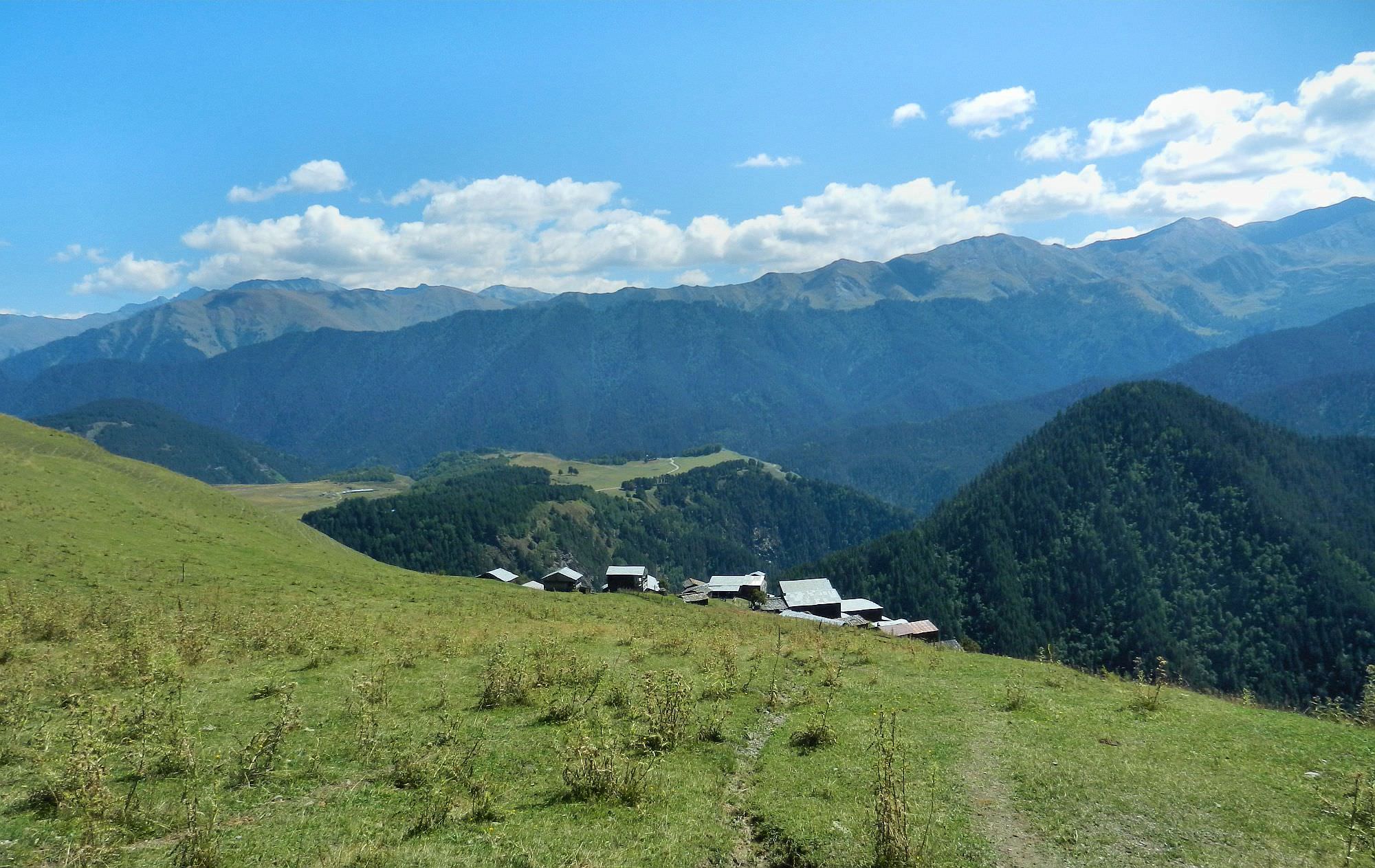
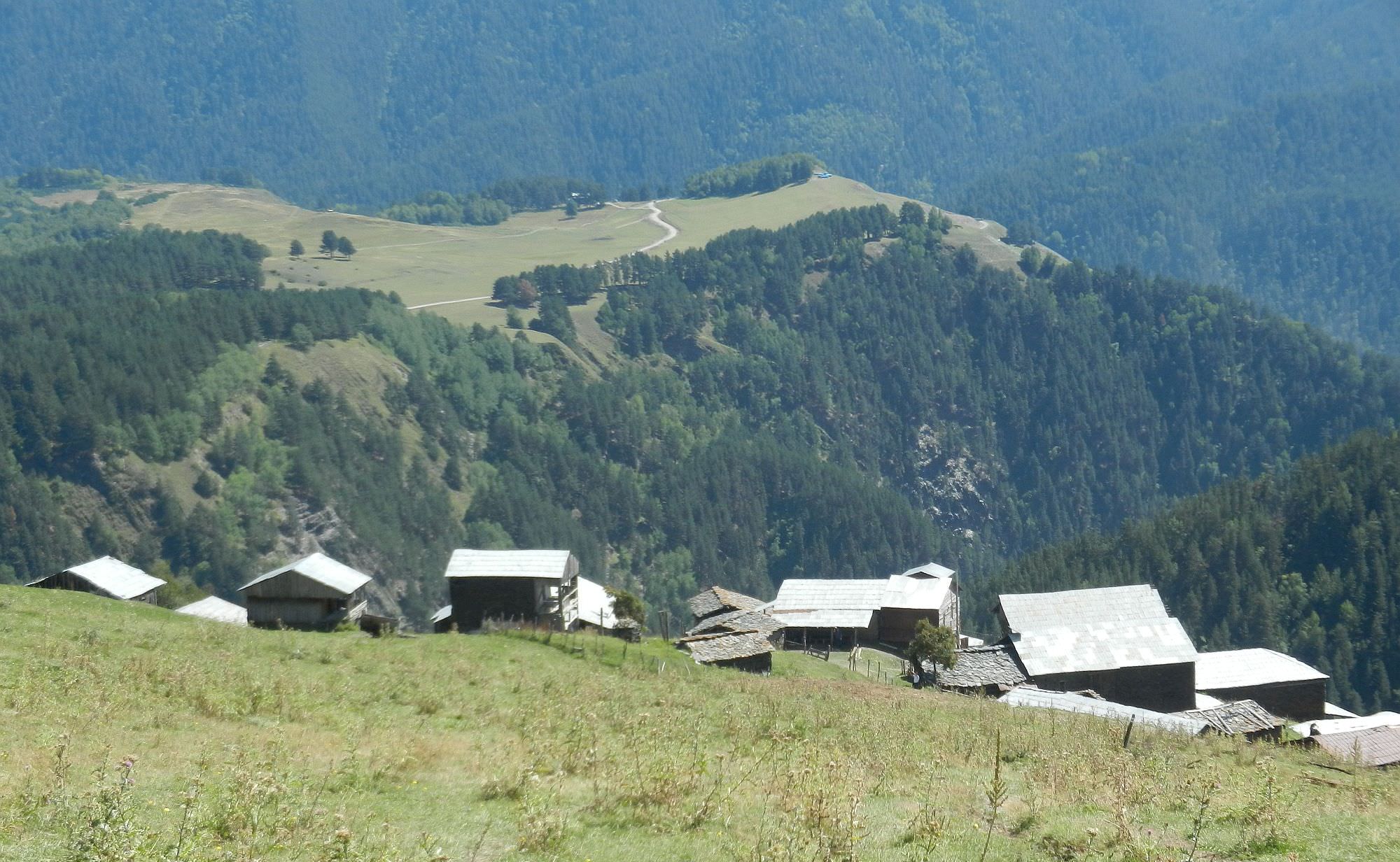
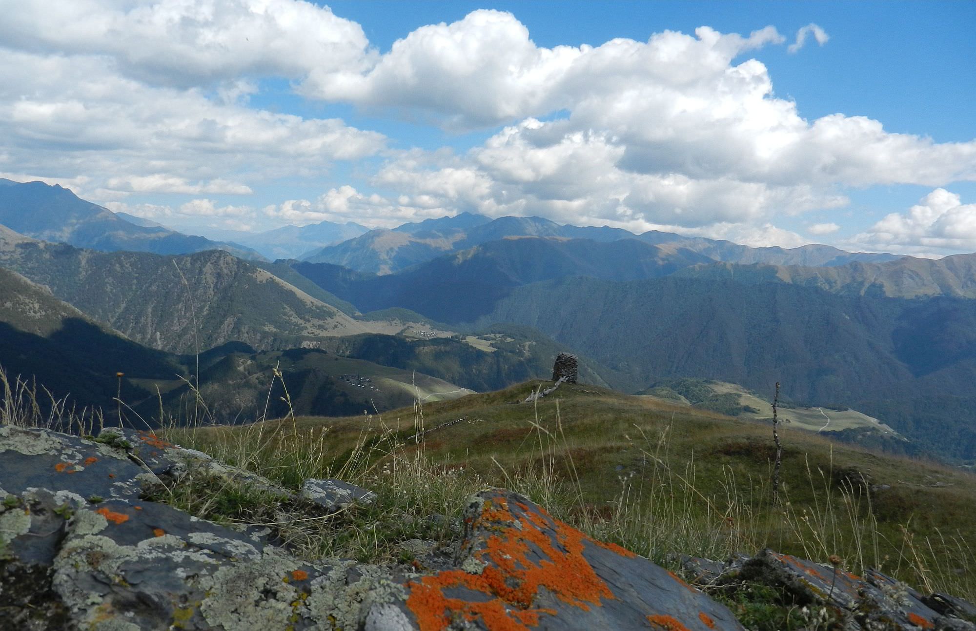
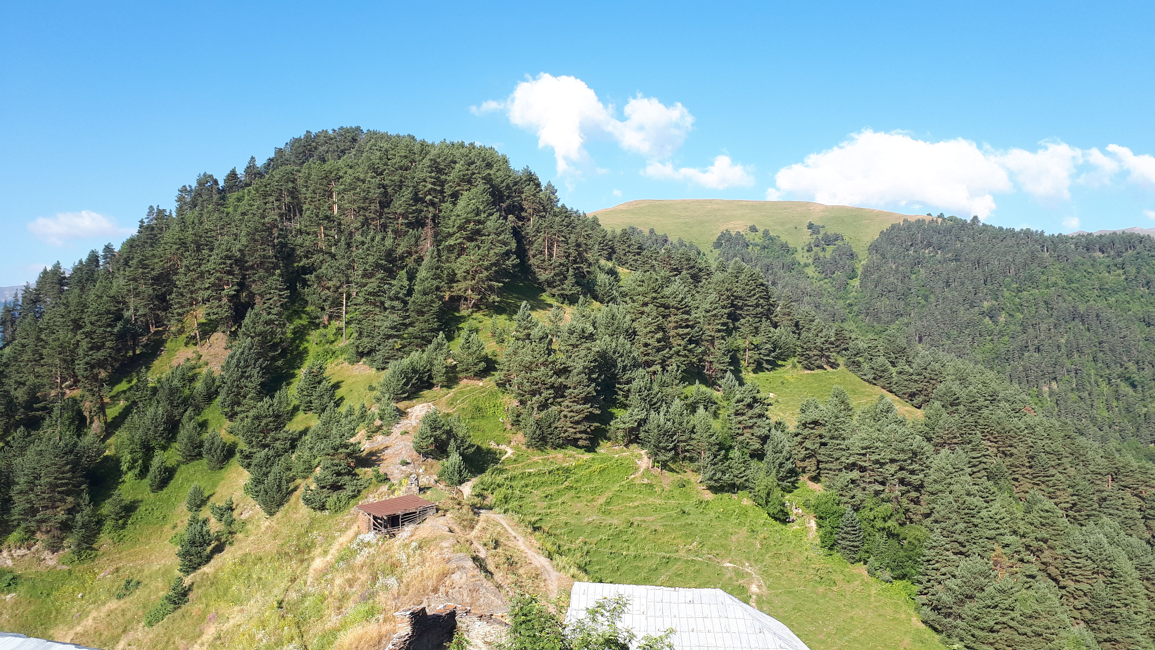
Once you reach a small ridge, turn to the right and keep on the path staying up on the elevation. The ruins of a tower will be seen on the left on the opposite hill through the meadow. Pass along the ruins of the house. Some 200 m above the house, the view of Gogrulta opens in front of the path. Continue on the path going now roughly on the contour line until you reach the Gogrulta village. The village is spectacularly positioned on a high cliff and offers great views of Gometsari Alazani.
Important notice: Once you reach the village, the sacred place (Mariamtsminda) is on your left side above the water spring. No women are allowed on the sacred hill, but keeping on the path is acceptable.
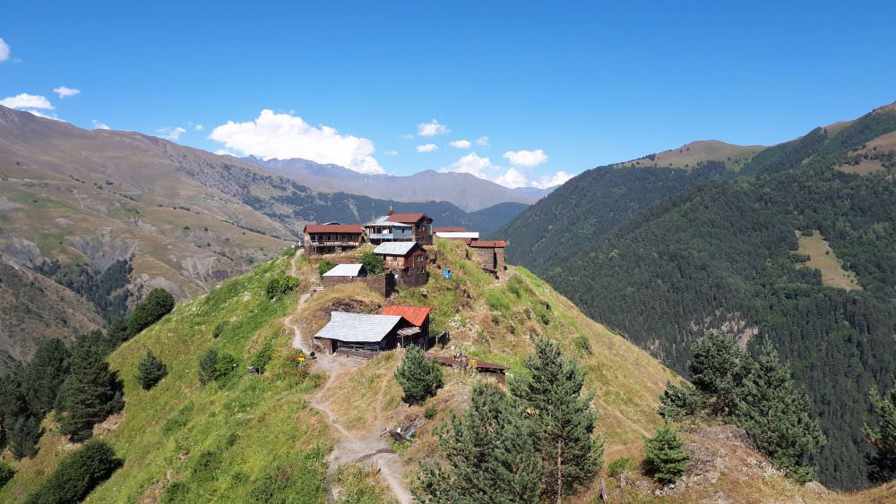
Approaching Gogrulta village
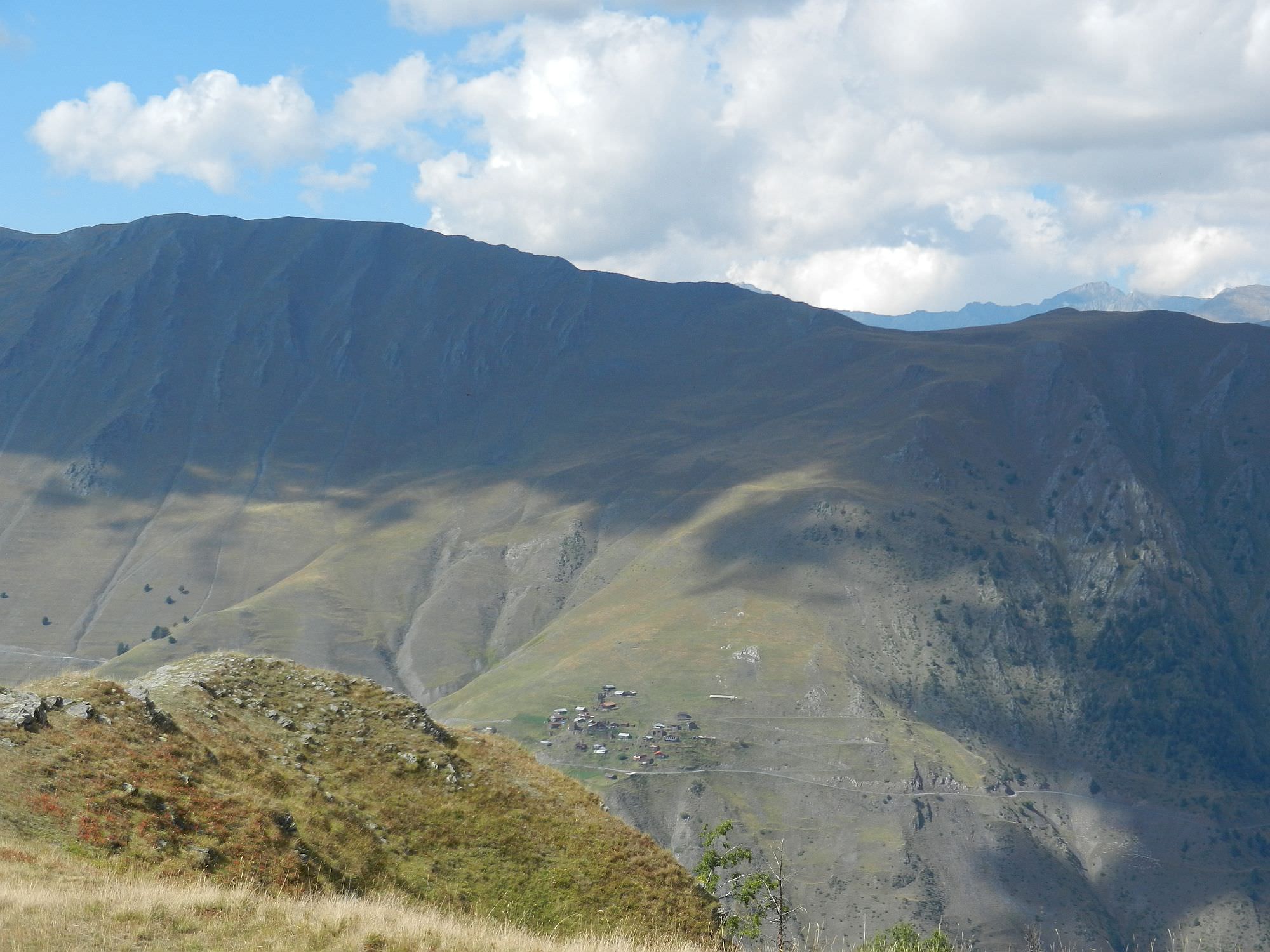
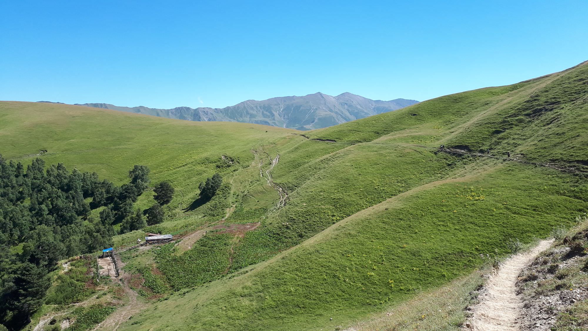
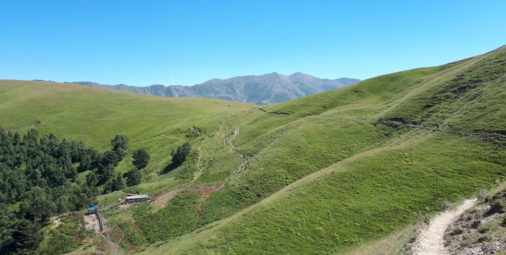
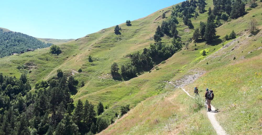
The trail starts at the hiking pointer at the entrance to the Gogrulta village. First, follow a wide trail climbing the forested ridge in the southwestern direction. In some 30 minutes, the forest ends and you will emerge below Mt. Kitemta (2418m). Here, the trail turns to the left and traverses the hillside some 50 altitude meters beneath the top of the hill. Once you pass the mountain, you will find yourself on a pretty flat ridge used for grazing. The trail here might be harder to find due to numerous cowpaths, but you basically follow the ridge, there is even one pole marker to help you out.
Not far behind this marked lies a small saddle - you shall see Vestomta village to the south and below and a small fenced memorial right ahead. Here, the trail leaves the ridge and follows the contour line on its northern side (you can see a shepherd hut right below). Some 300 meters later, it enters the forest again.
Looking back at the trail to the small pass
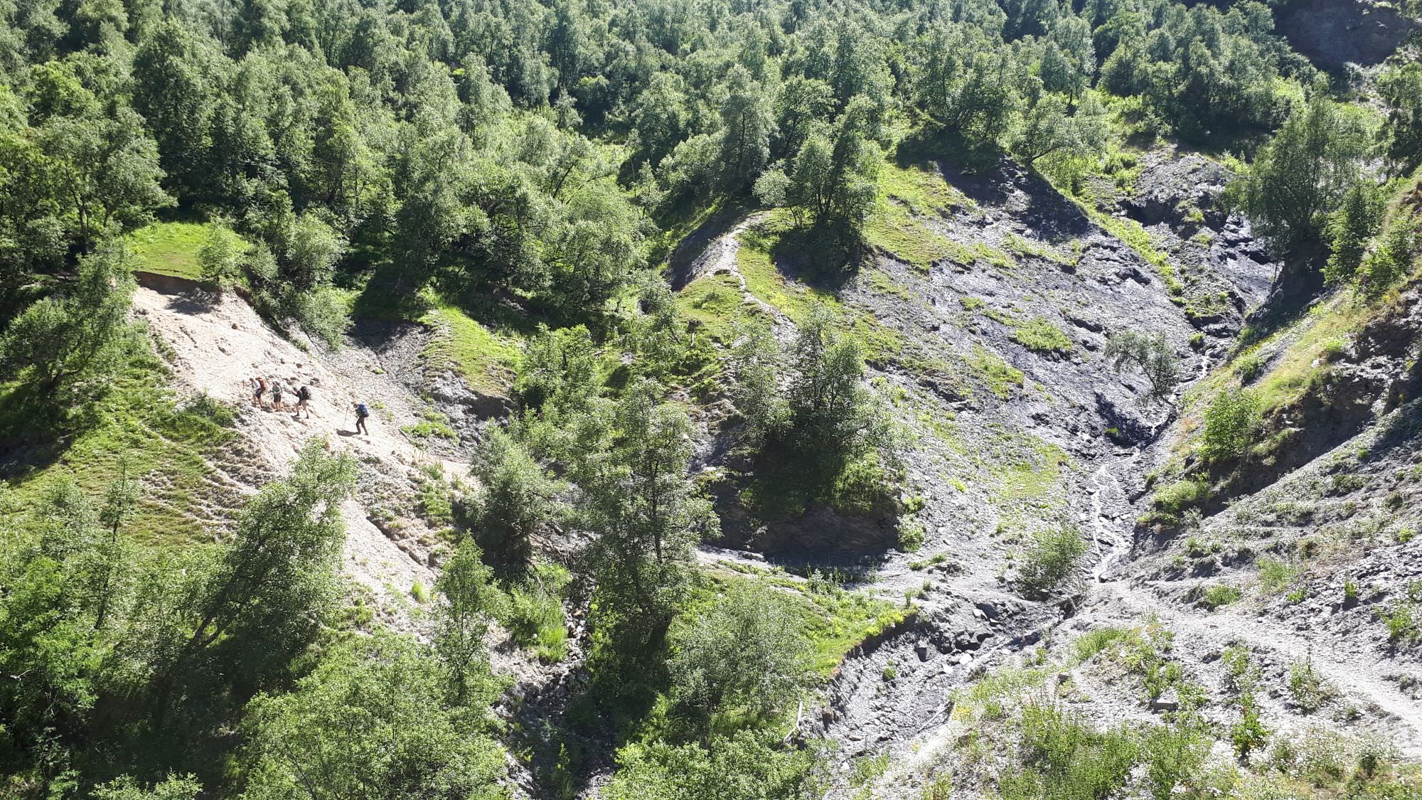
Walk through the forest is pleasant - the trail is well-trodden and goes rather down than up. Finally, some 1,5 km later, there is a rather steep drop to the nameless creek. Cross it and follow the trail for 200 meters to another branch of the same creek. Once you cross this one, the forest ends and you find yourself on an open hillside.
The next section is pretty straightforward - you follow quite a narrow, but nice footpath traversing the hillside. You will pass the ruins of an abandoned hamlet Bukhurta and one kilometer later reach the village Iliurta. From here, you will continue on a wide dirt track, descending through the forest some 200 altitude meters. Then, you will find yourself on the main road running at the bottom of Tushetis Alazani valley. Turn left and follow it for another two kilometers, till you see Jvarboseli village on the other side of the river.
Looking back at Bukhurta and nice, narrow trail leading to it
This means you need to cross the river, but that may not be easy - there is no permanent bridge. It might be worth checking out the river a little before the village - sometimes, locals build a small footbridge here, though it often doesn´t survive spring floods, there should be a small footpath heading to it. If there is no bridge, walk past the village some 100 meters till you reach the major turn-off to the right. This is the route used by jeeps coming to the village - the river is wide, but not too deep and under normal circumstances passable also for a hiker (expect water well above your knees, this is not an easy crossing). If you don´t feel like doing it, try to catch the attention of people in the village, someone might come to pick you up with a horse or a jeep. Once in the village, you can spend a night at a very pleasant Posholi guesthouse.
If you plan to climb Nakle-Kholi pass on the next day, it could make more sense to continue 2km further to Verkhovani village - today´s segment is quite easy so you should have enough time for that. The trail follows the northern bank of the river so you will need to cross it at Jvarboseli either way. At Verkhovani, one can find guesthouse Lamata, but in past seasons, it used to open only during high season (Jul-Aug). If you plan to stay here, better confirm it´s open beforehand - their phone is +995 99 70 03 78. They don´t speak English, so you may want to ask your Georgian landlord/driver/whatever to do the call for you.

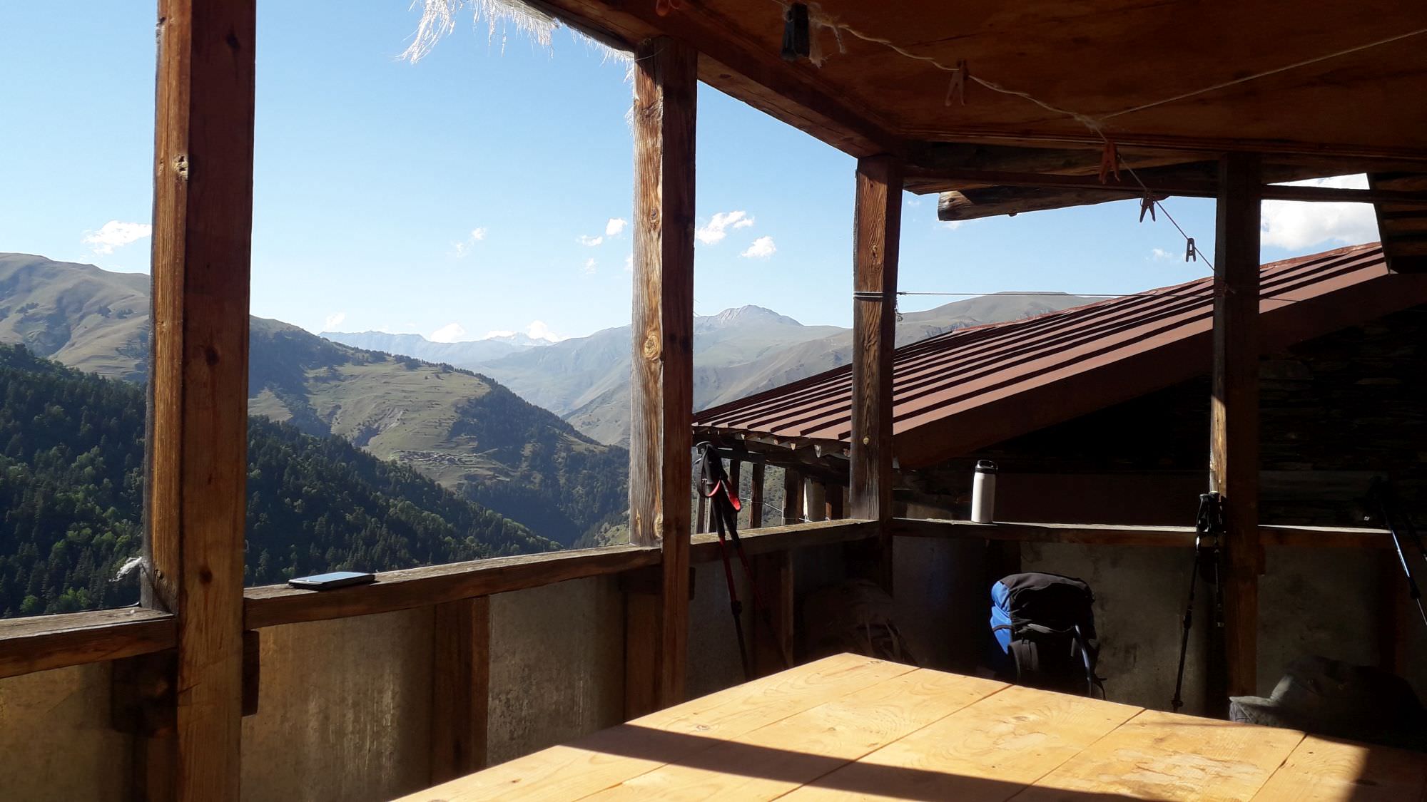
View from Sokrat's guesthouse in Gogrulta
Description of day 1 was written by Slavomir Horak, expert on Tusheti and organizer of Tusheti Help Camp, annual volunteering event. His website about Tusheti in Czech language can be found here