by Michal Curylo
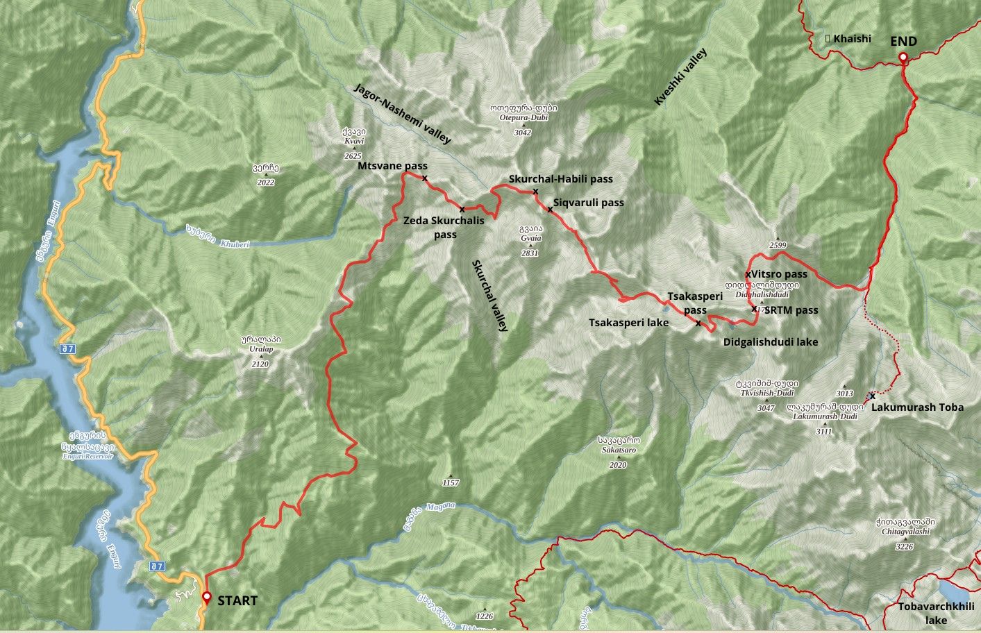
The following report is an account of a 4.5-day exploration in the Egrisi range. The intent of this trip was to connect the Western part of the Egrisi mountains with the system of trails connecting the lakes of the Eastern Egrisi.
Our journey begins at 13.00, when our marshrutka breaks down near a WW2 memorial on the Zugdidi-Mestia road. We take a dirt road which starts on the opposite side of the road and runs next to a small, old water pipe.
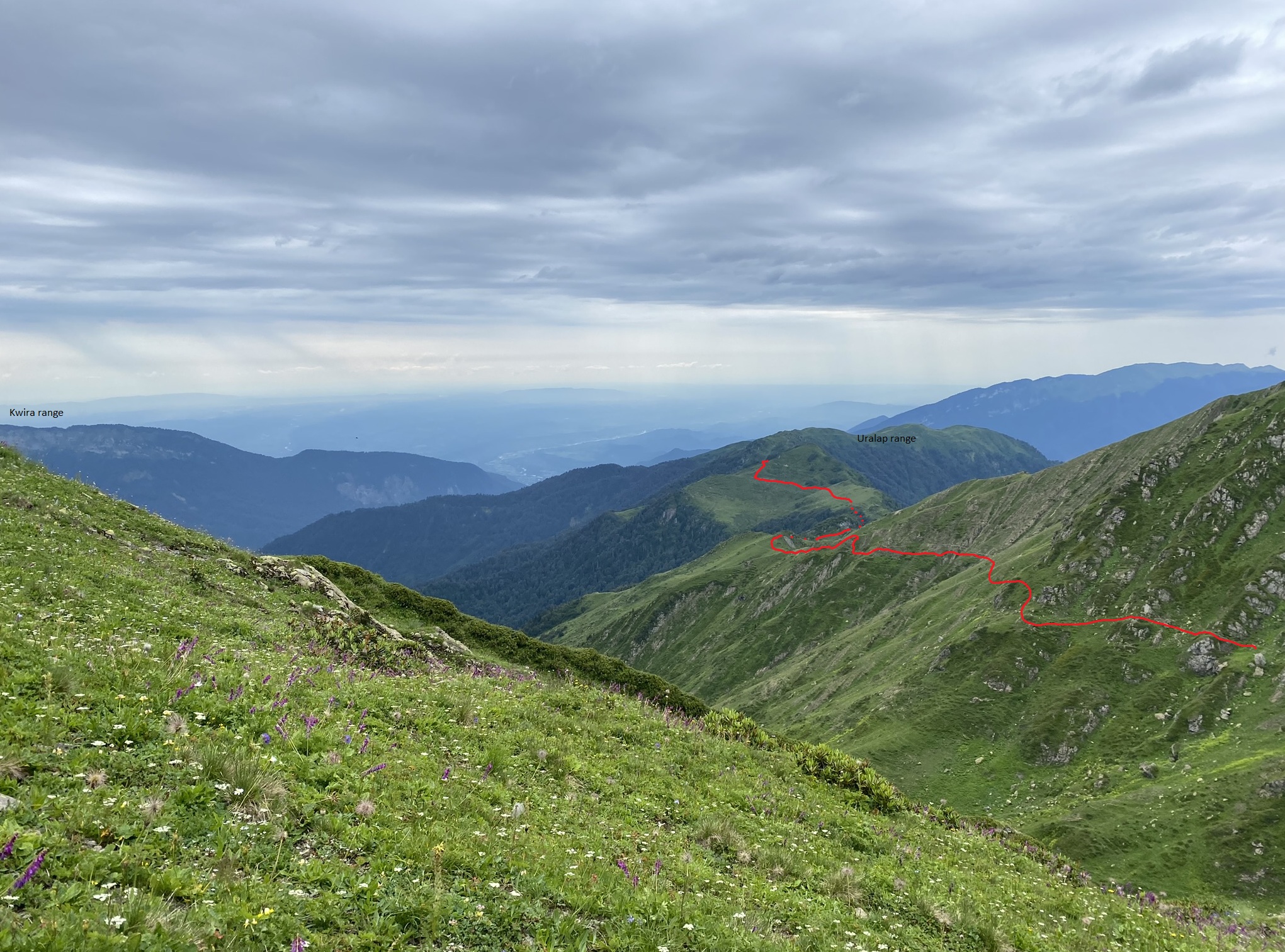
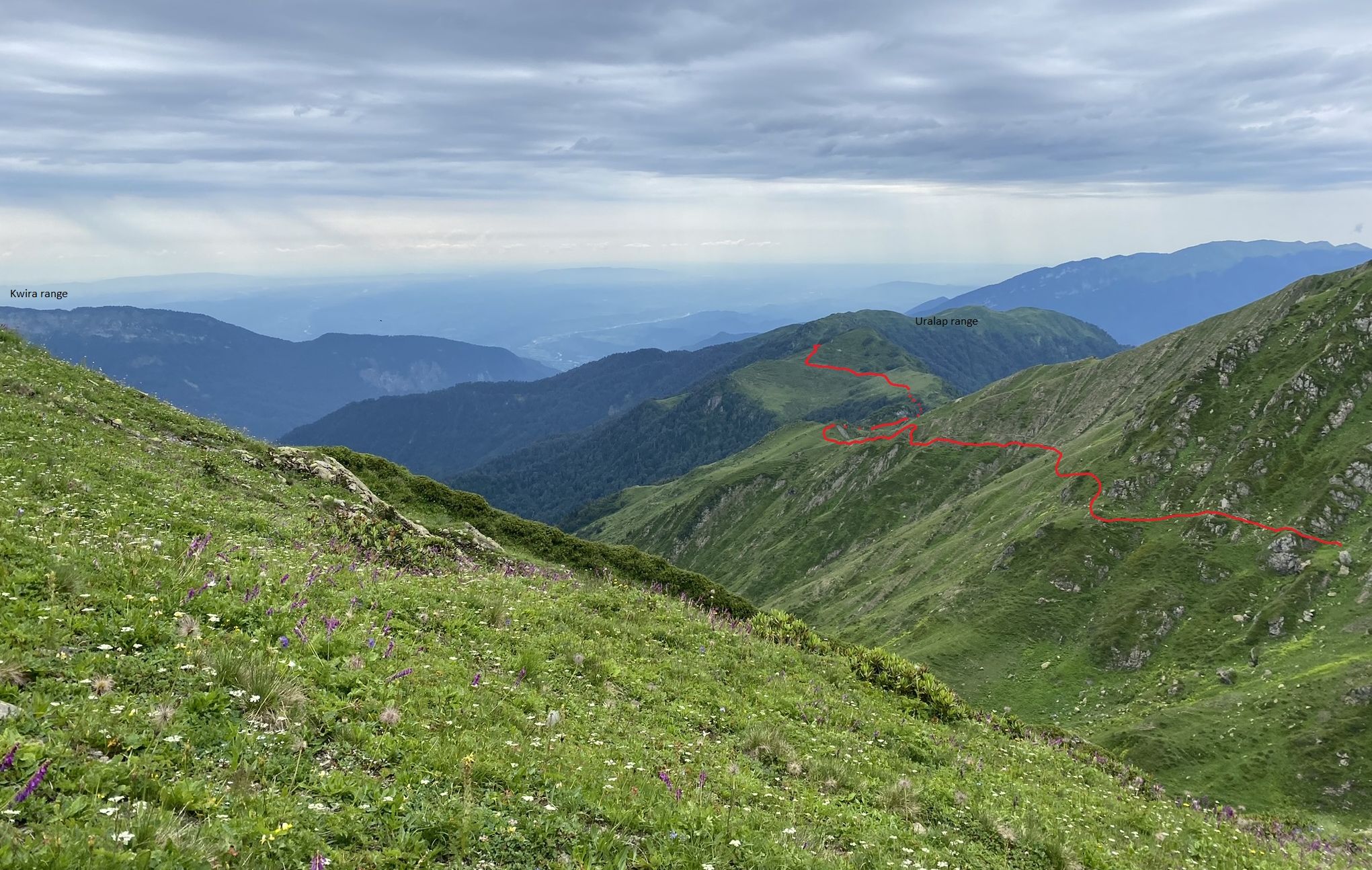
On a crossroads we realize that the route which we hoped to take to move directly to the Uralap peak is fenced off and marked for private use. We decide to take the path which takes a more gradual approach on the south-eastern approaches of the Uralap range.
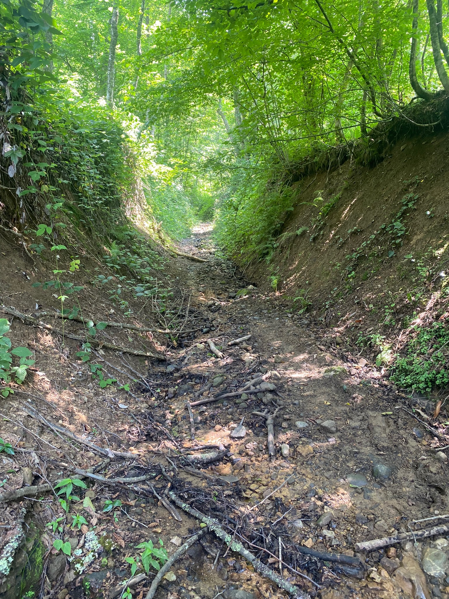
The road then passes a small bridge over the Chagra river. Overall, is is deteriorated sufficient to support horse travel. There are numerous water sources alongside the occasional berries. The road will remain this way throughout the day.
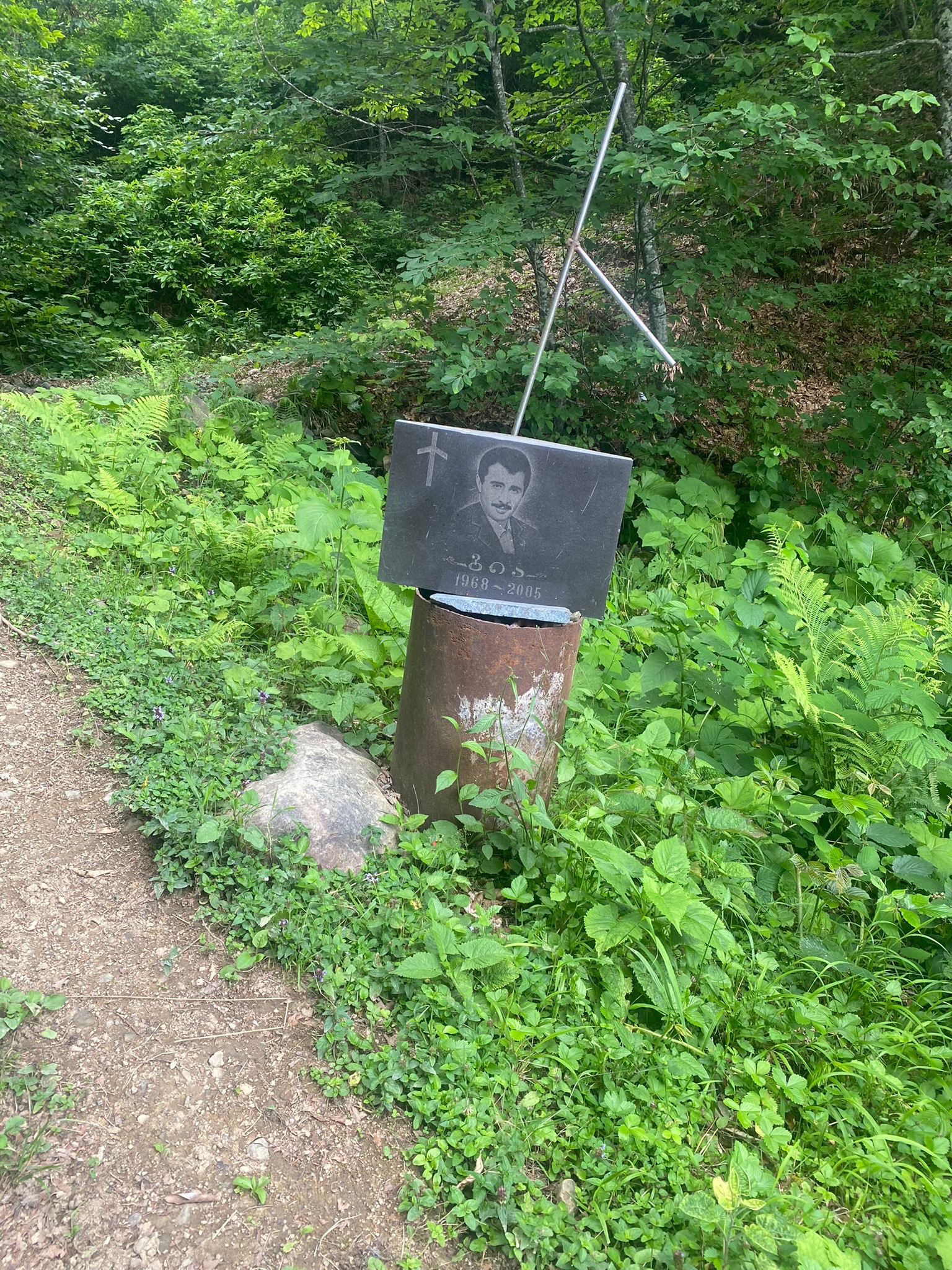
We see no other signs of recent human habitation. At 14.00 we pass through a gravestone of a man named Gia/გია (1968-2005), St. Nino's cross on his grave has one arm broken off. Two and a half hours later, we pass through a second sign of civilization in the form of two dilapidated wooden huts.

Gia's memorial
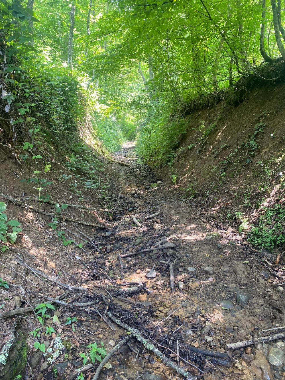
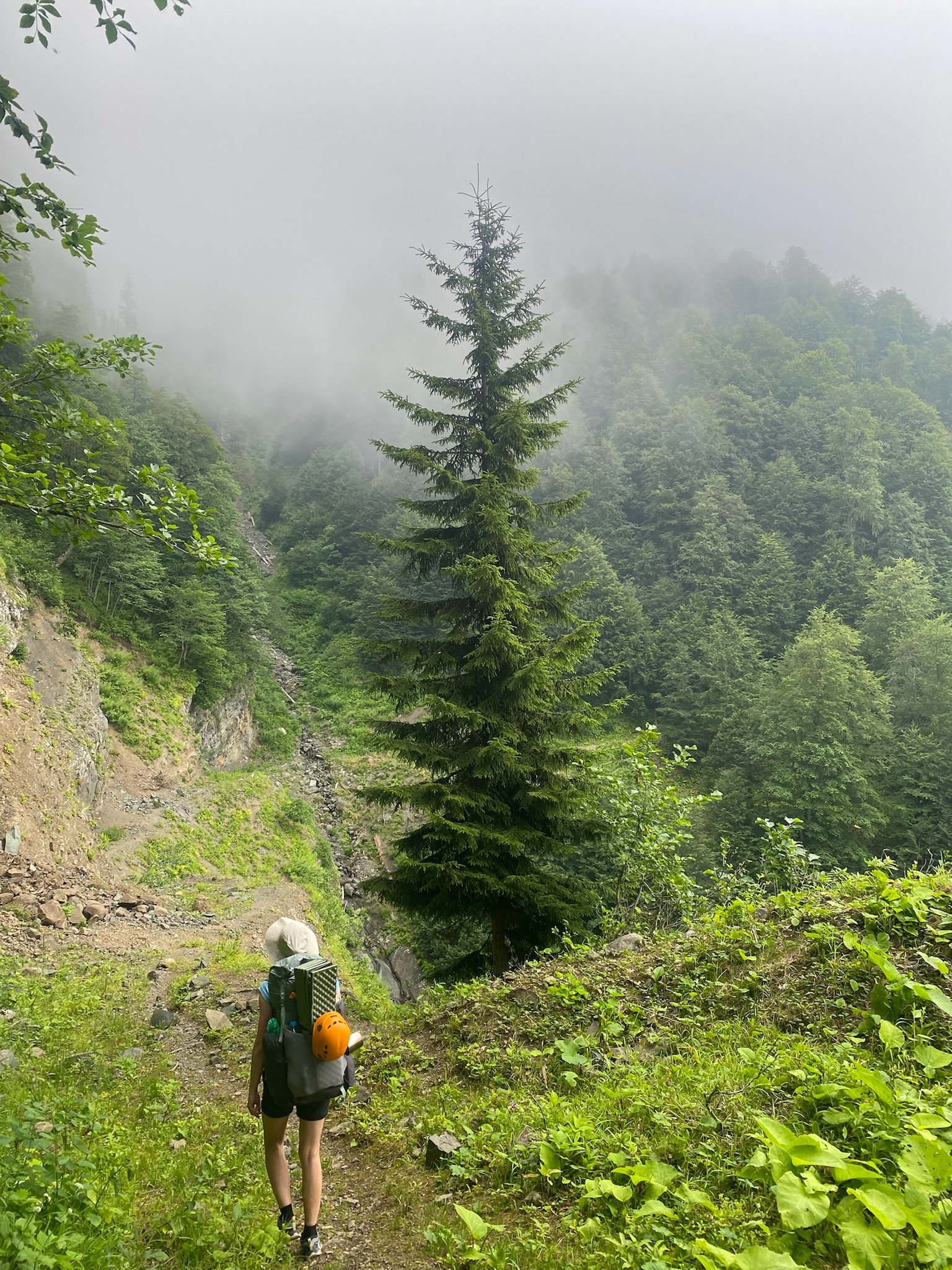
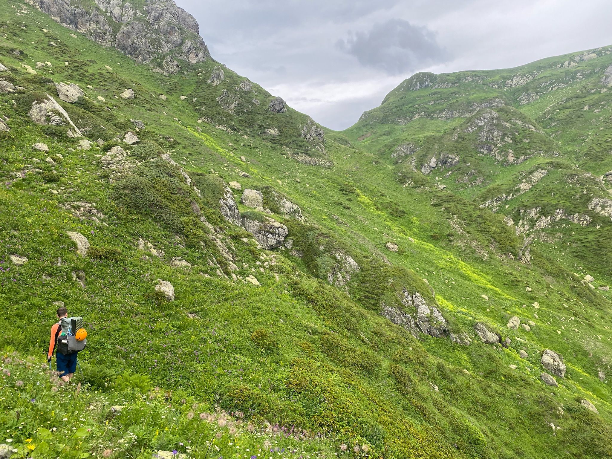
Dirt road through the forest
At this point we realize that our marshrutka driver must have taken two of our six water bottles to cool of his broken radiator and neglected to return them. We seriously consider returning but decide to push on. Few hours later we find an old, empty plastic Coke bottle which we clean to the best of our abilities, fill with water, and promise to use only in case of emergency.
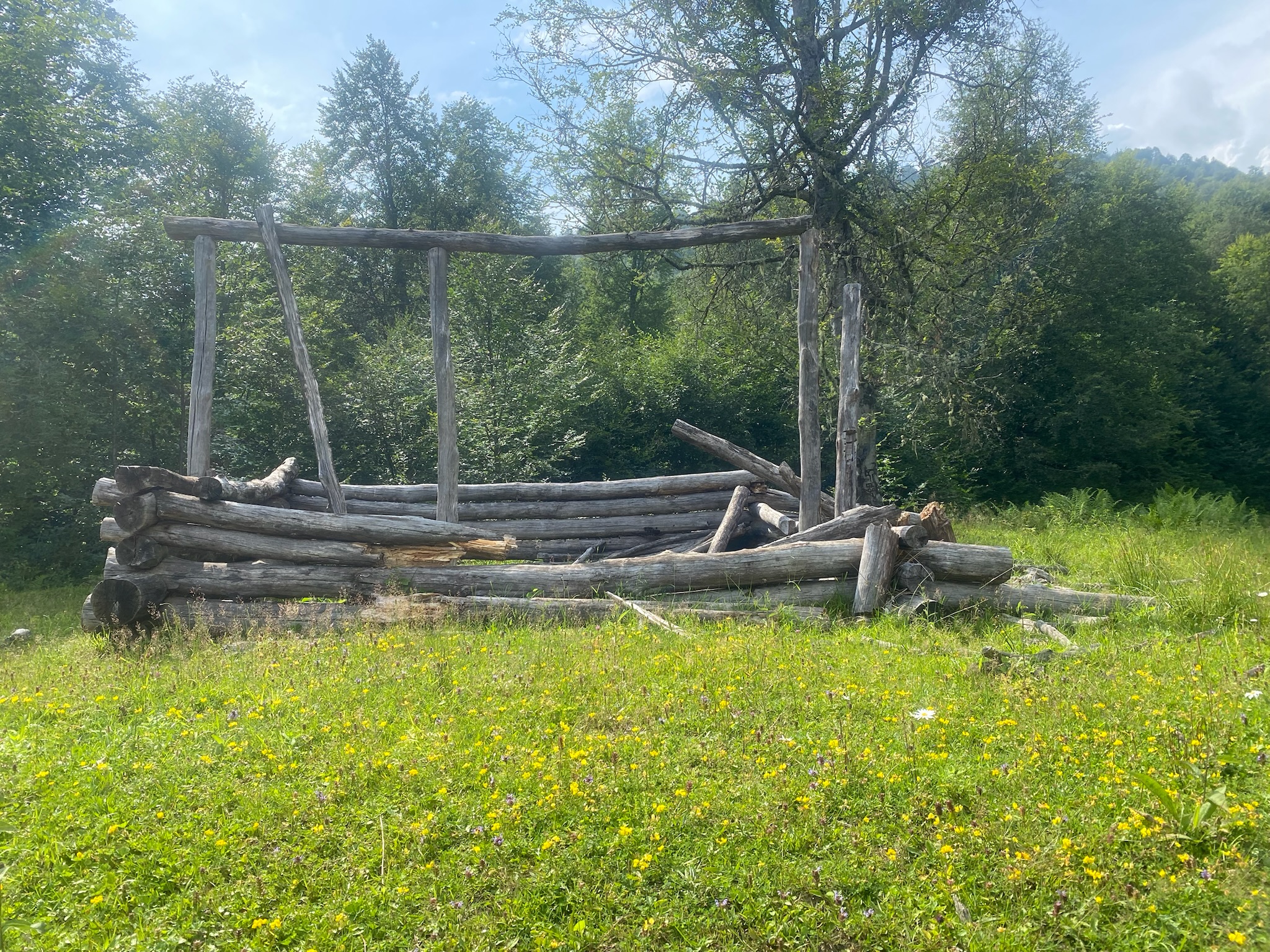
We halt at 6pm near another destroyed wooden hut. The road ceased gaining elevation about ~20mins ago and deteriorates significantly 200m north from our campsite. We decide to camp early as we expect a few hours of bushwalking on an upwards push to the alpine altitudinal zone without any sensible place to camp.
After setting up our campsite Karina starts to prepare food. Michał locates the nearest water source (~150m down the road) and scouts out a path up the woods which we follow on the morning of day 2.
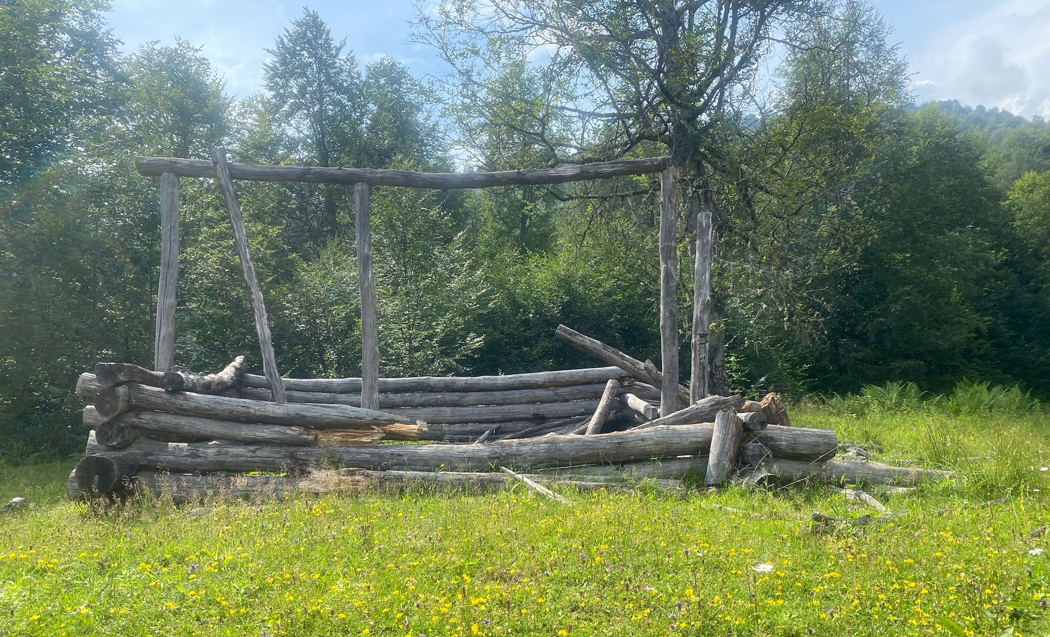
Ruined huts

Upper part of the road

Upper part of the road
We set off in cloudy weather at 9:40. We turn left on a critical "crossroads" onto what initially seems to be the worse path. Yesterday's reconnaissance showed that the path to the right deteriorates and disappears in the forest.
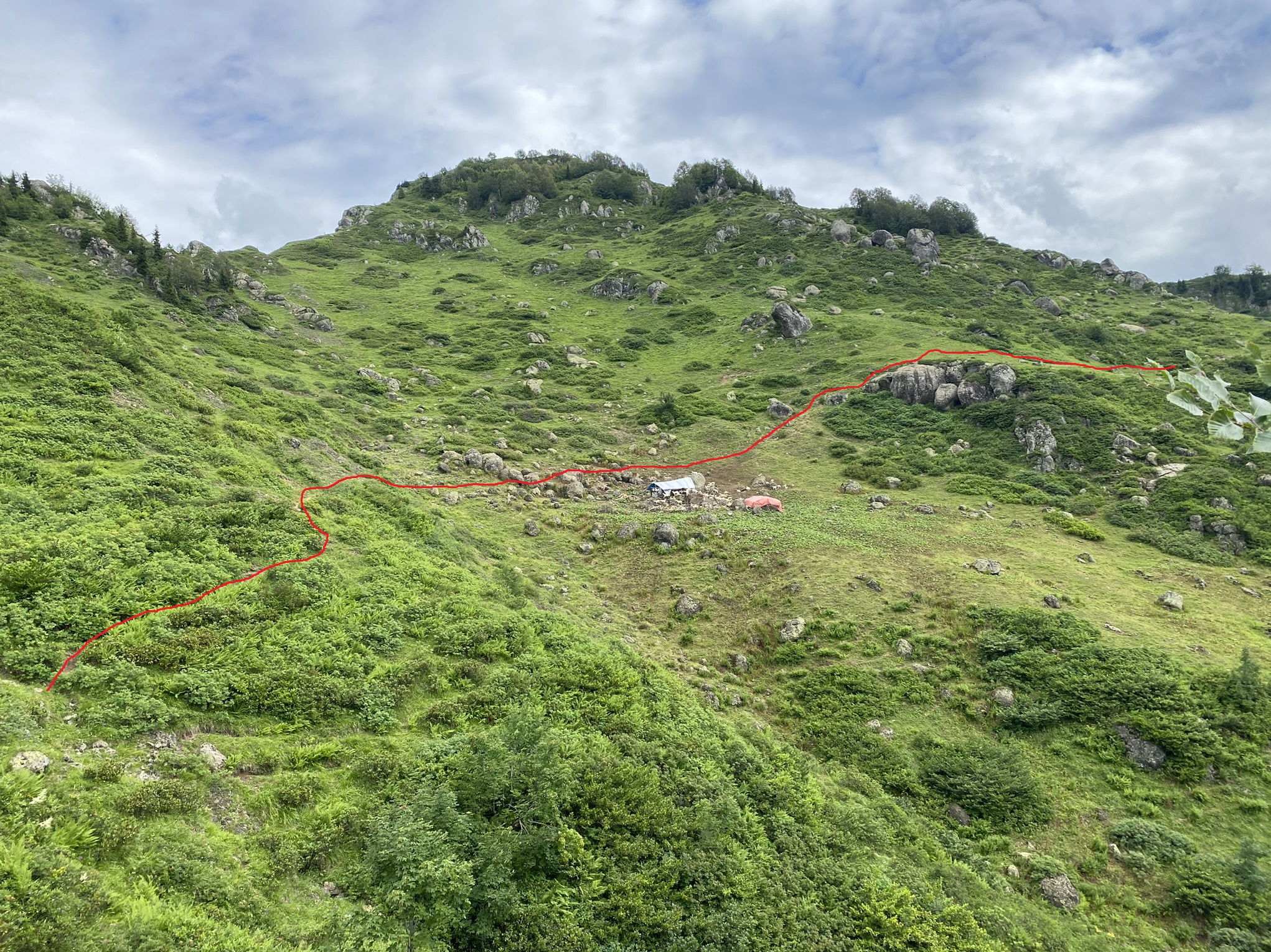
With time the path improves and after 40mins leads to a mountain farm. Three farmers greet us with goat cheese and a few shots of chacha.
Mountain farms
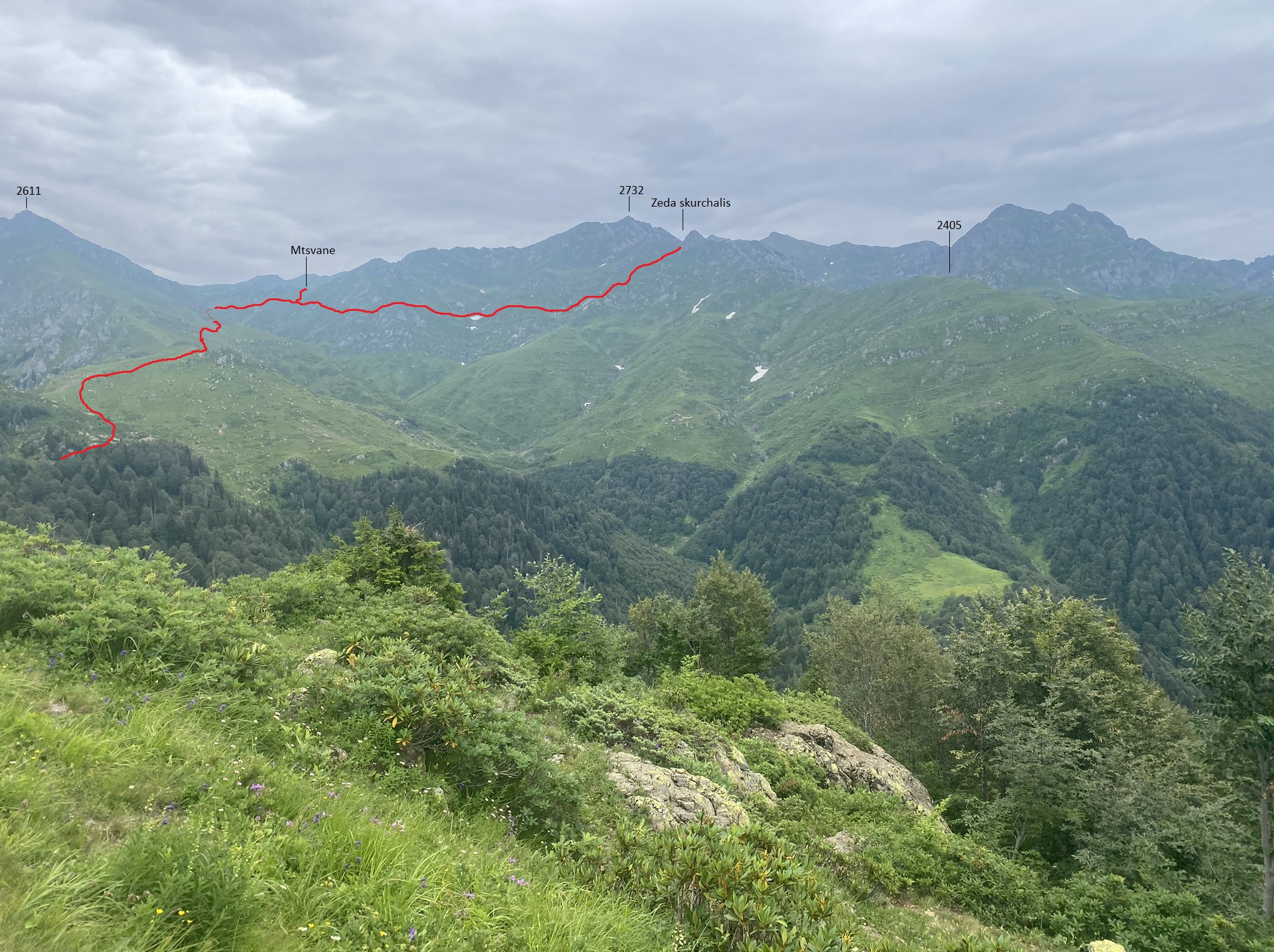
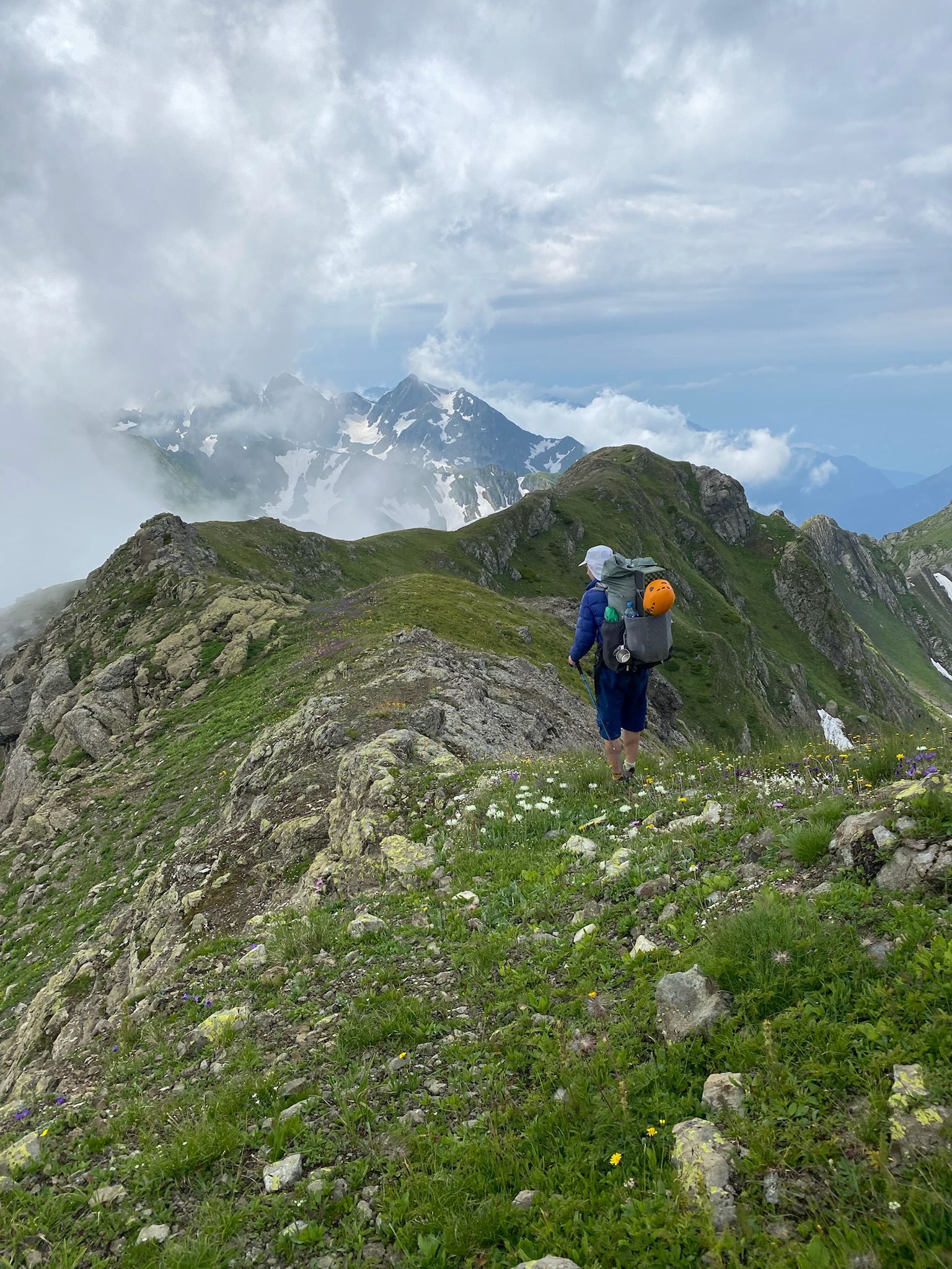
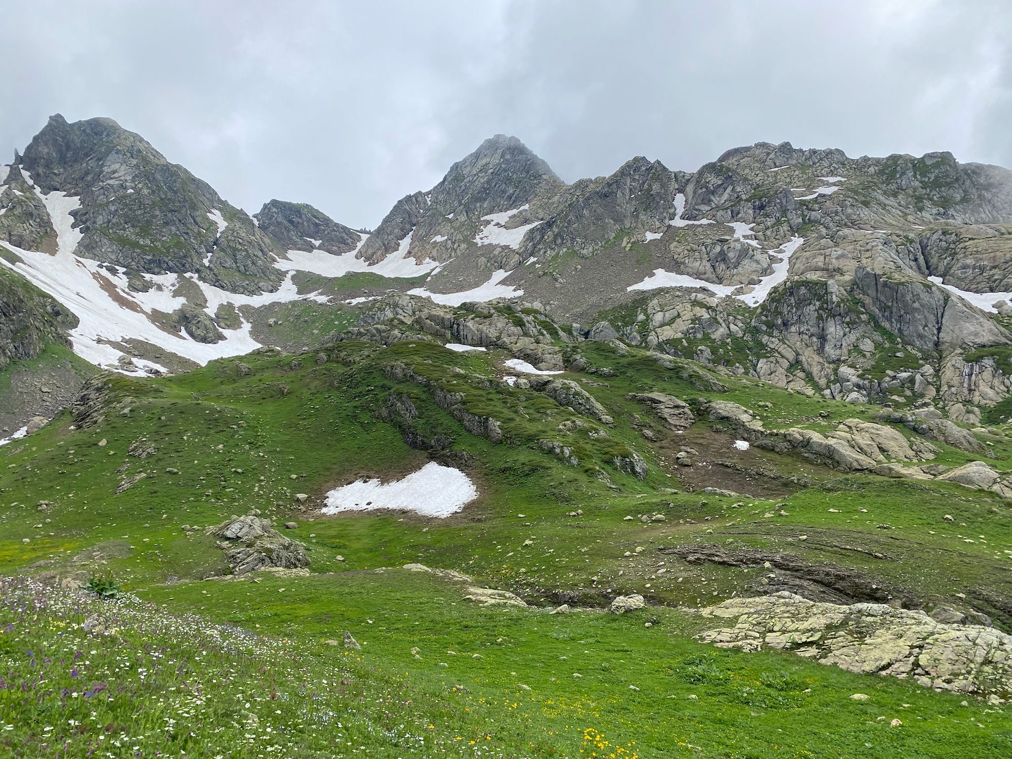
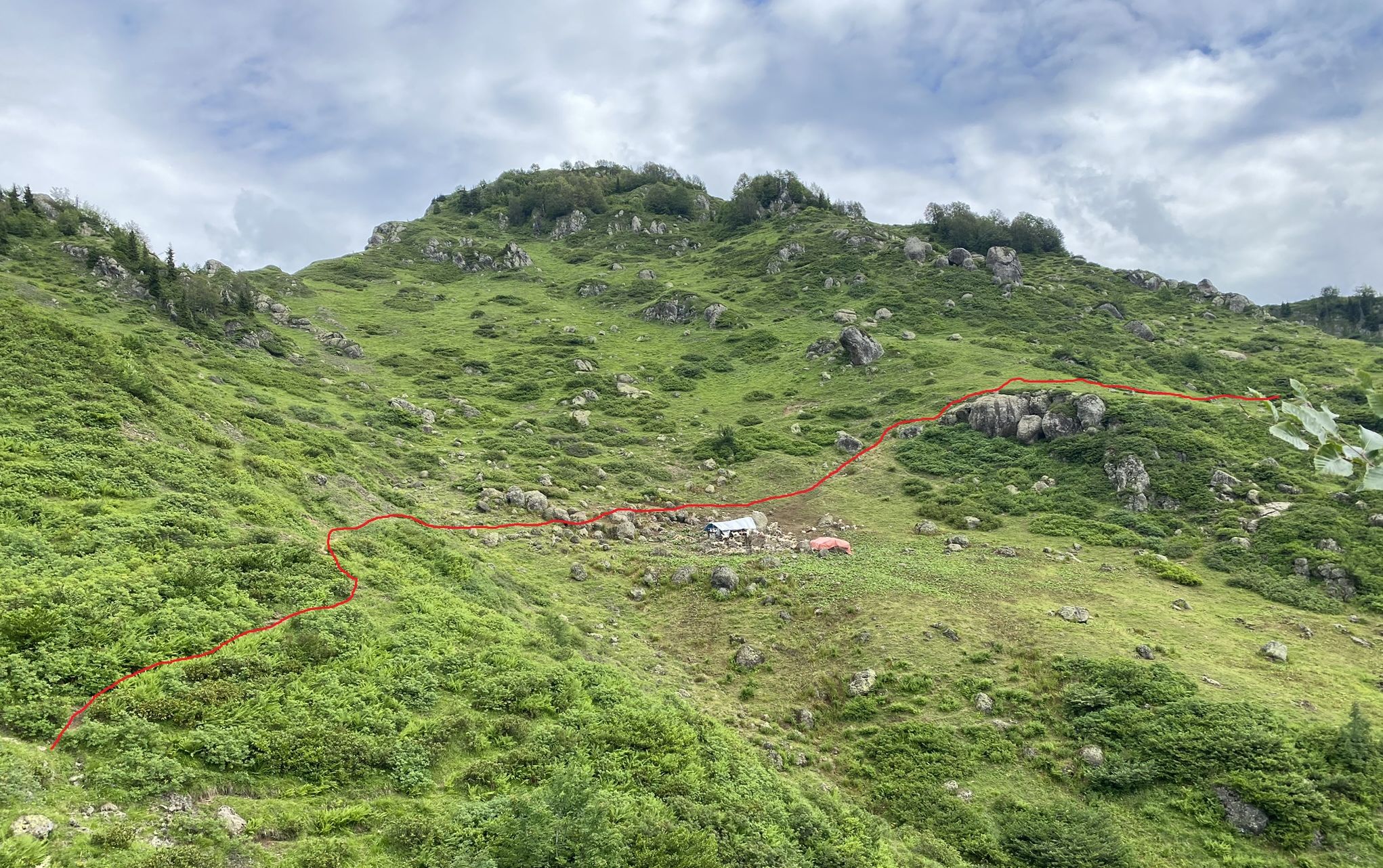
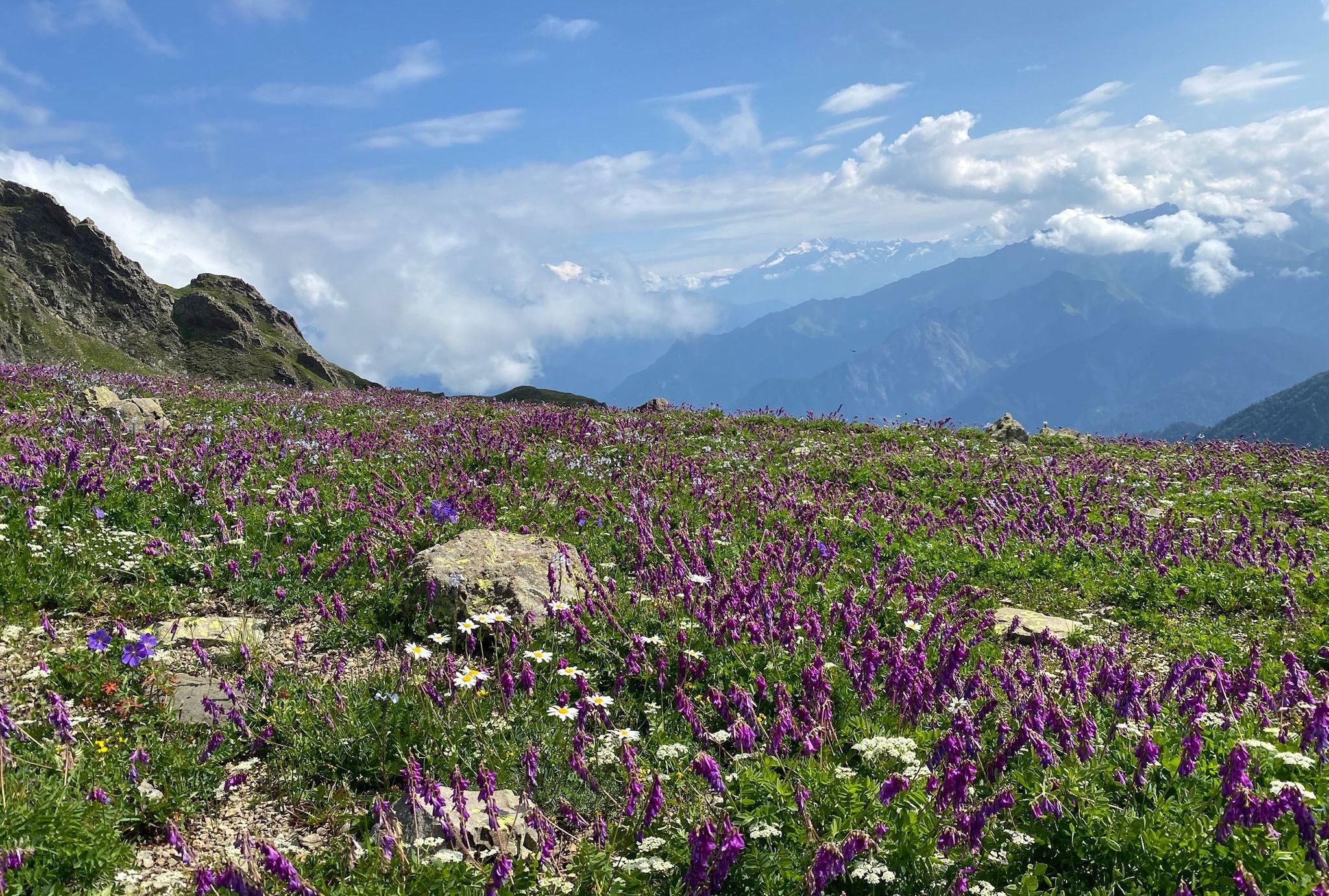
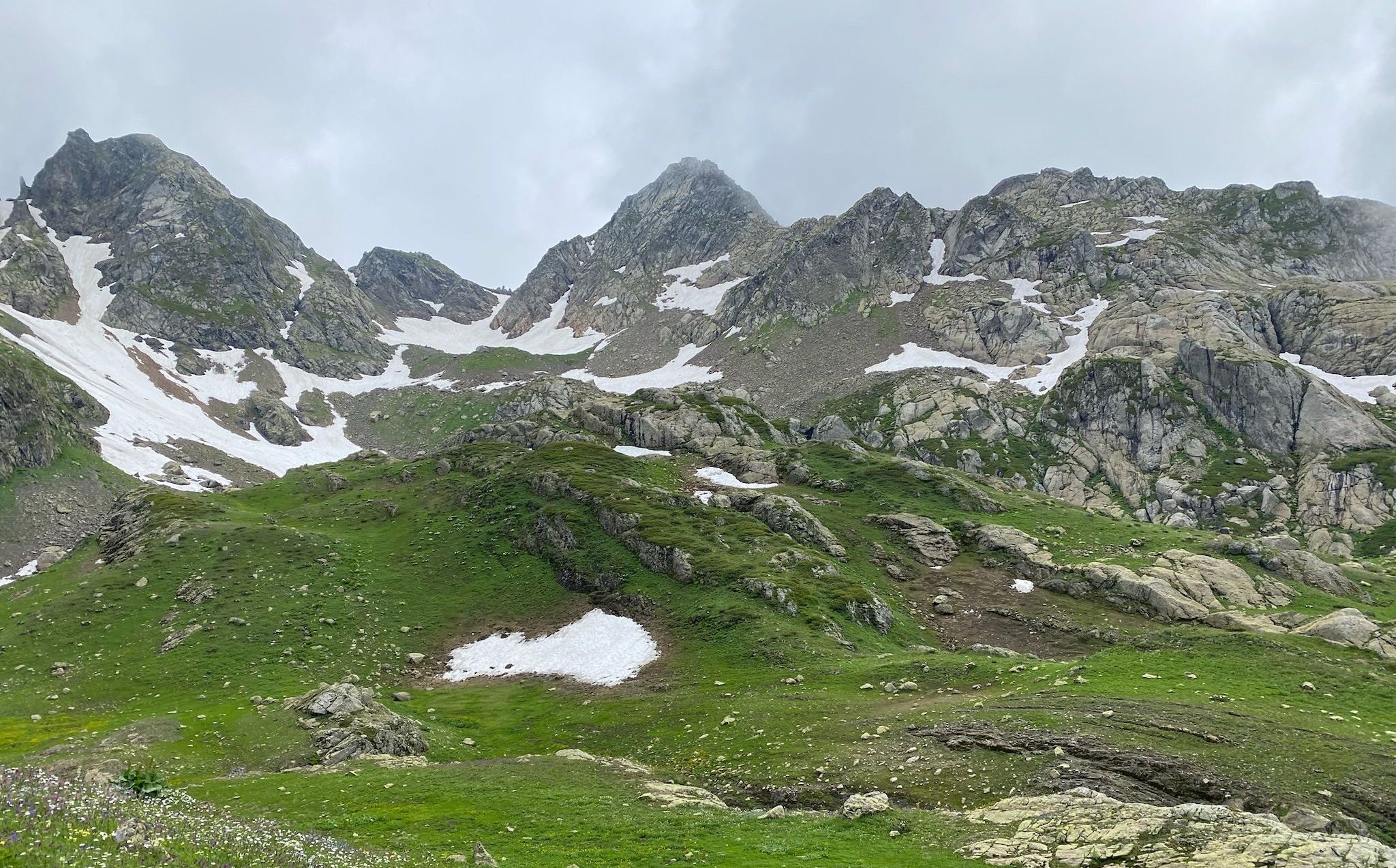
We set off at 11.00 due north following animal paths on the eastern slopes of the ridgeline. The hiking over the alpine meadows is easy and scenic - with views of the Megrelian lowlands, Kvira mountain and the Egrisi range. After 30mins we reach a short section through a small wood, where the path slightly improves. After crossing the tree line, we pass a small group of horses and cows but thankfully no guard dogs.
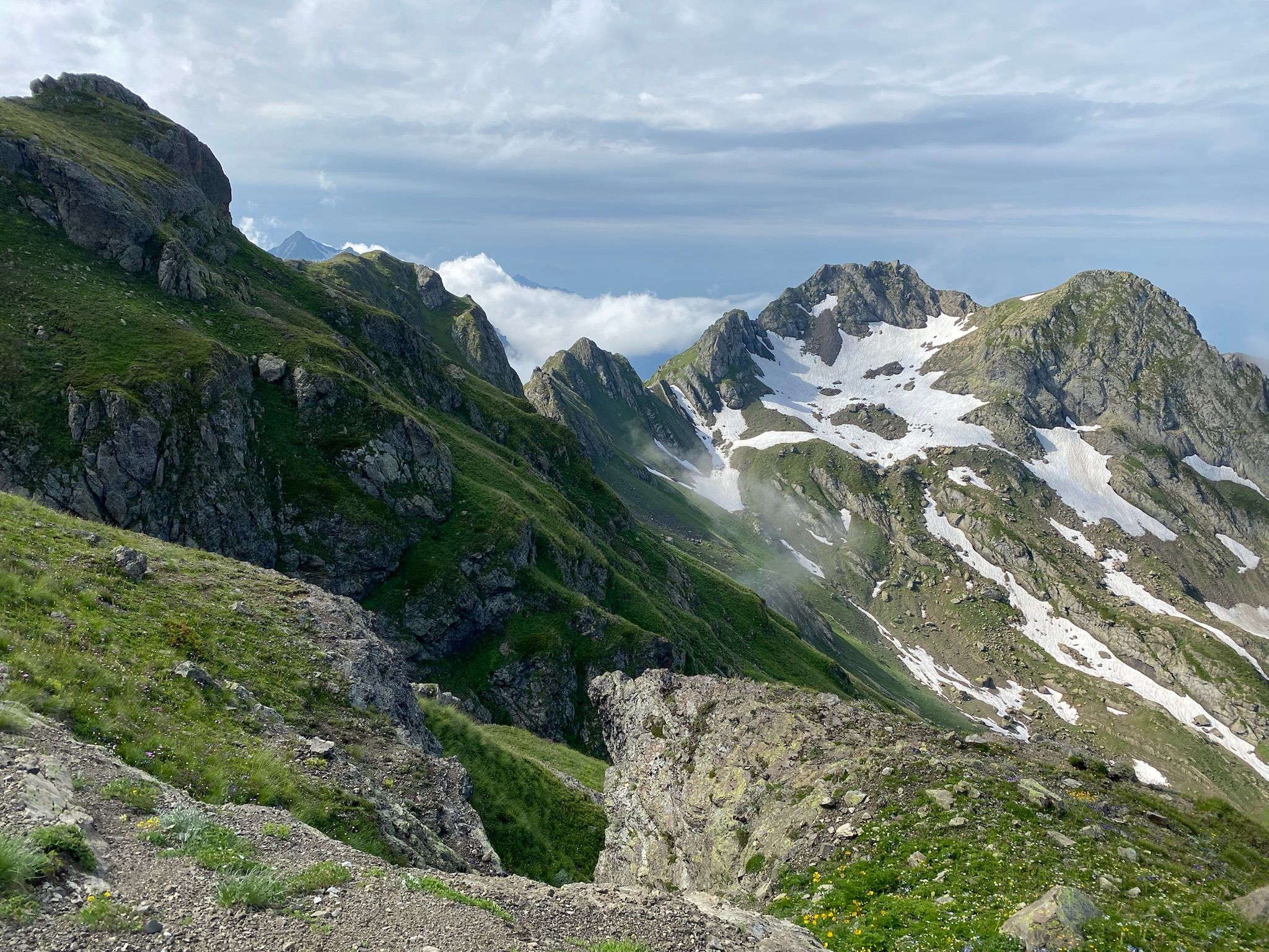
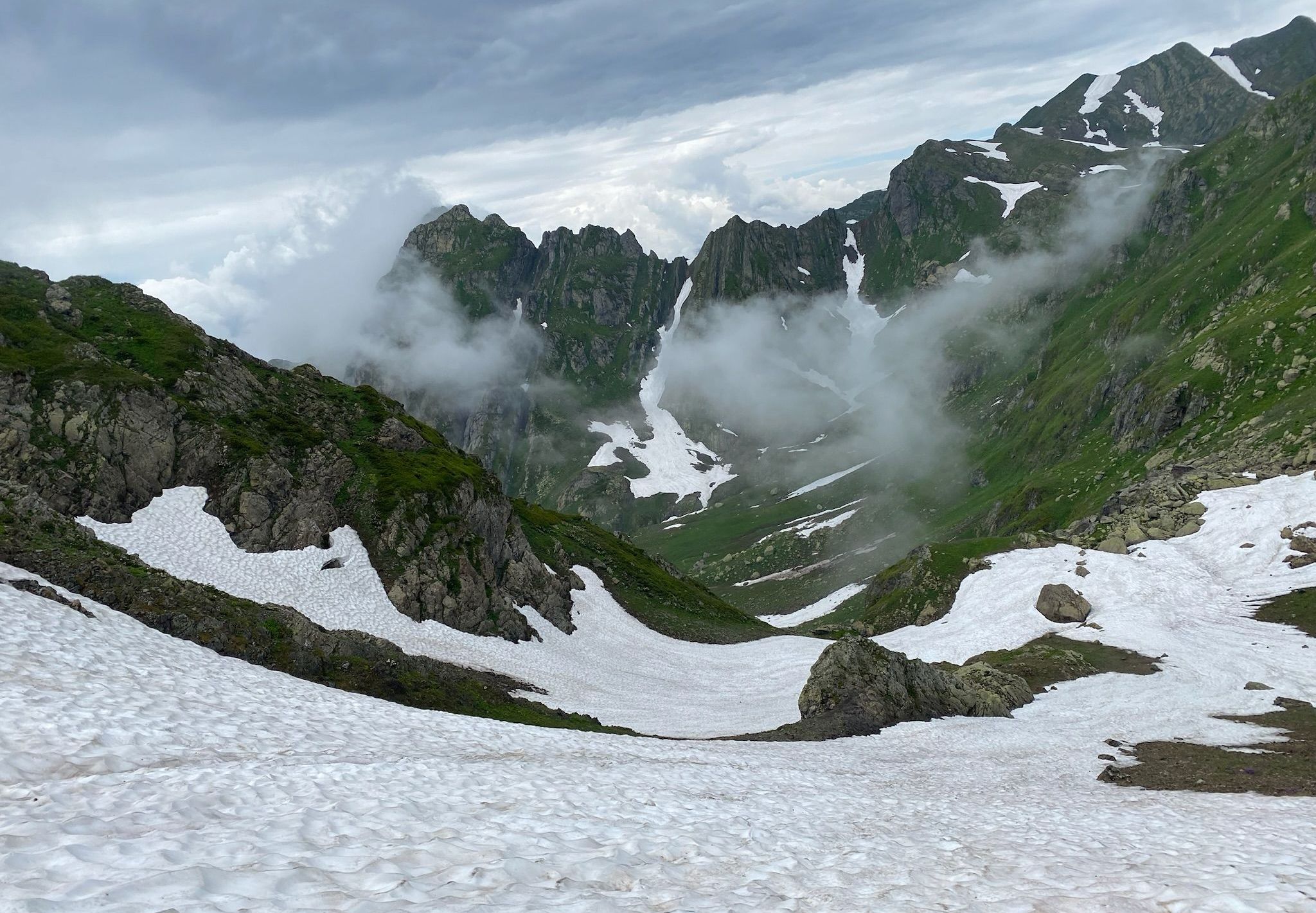
At 13:40 we reach a pass connecting the valleys of Sastskhene and Jagor-Nashemi (Proposed name: Mtsvane). We start to traverse the main Egrisi ridge on its southern slopes as the animal tracks disappear. There are numerous small streams flowing out of the remaining patches of thawing snow.
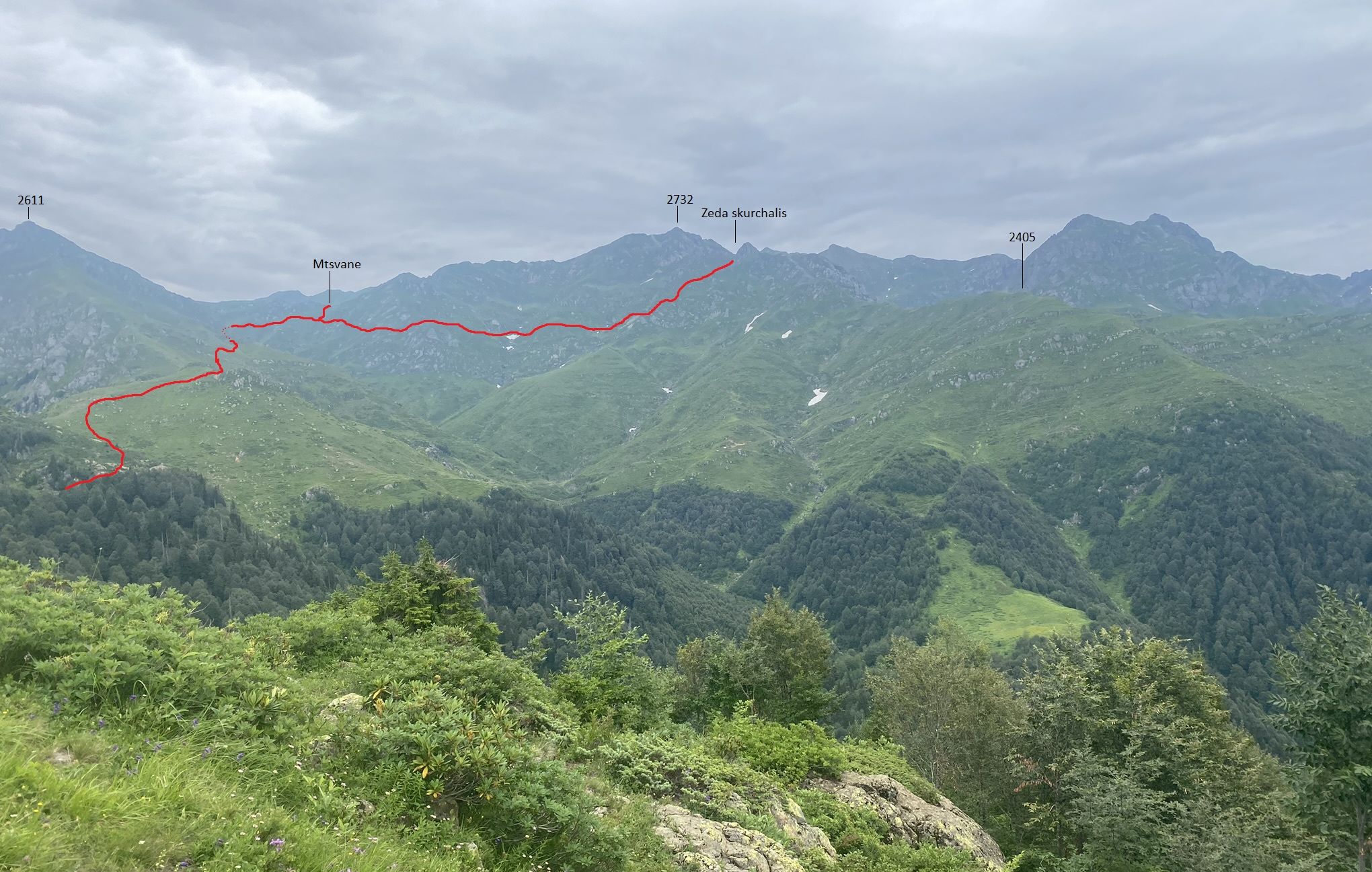
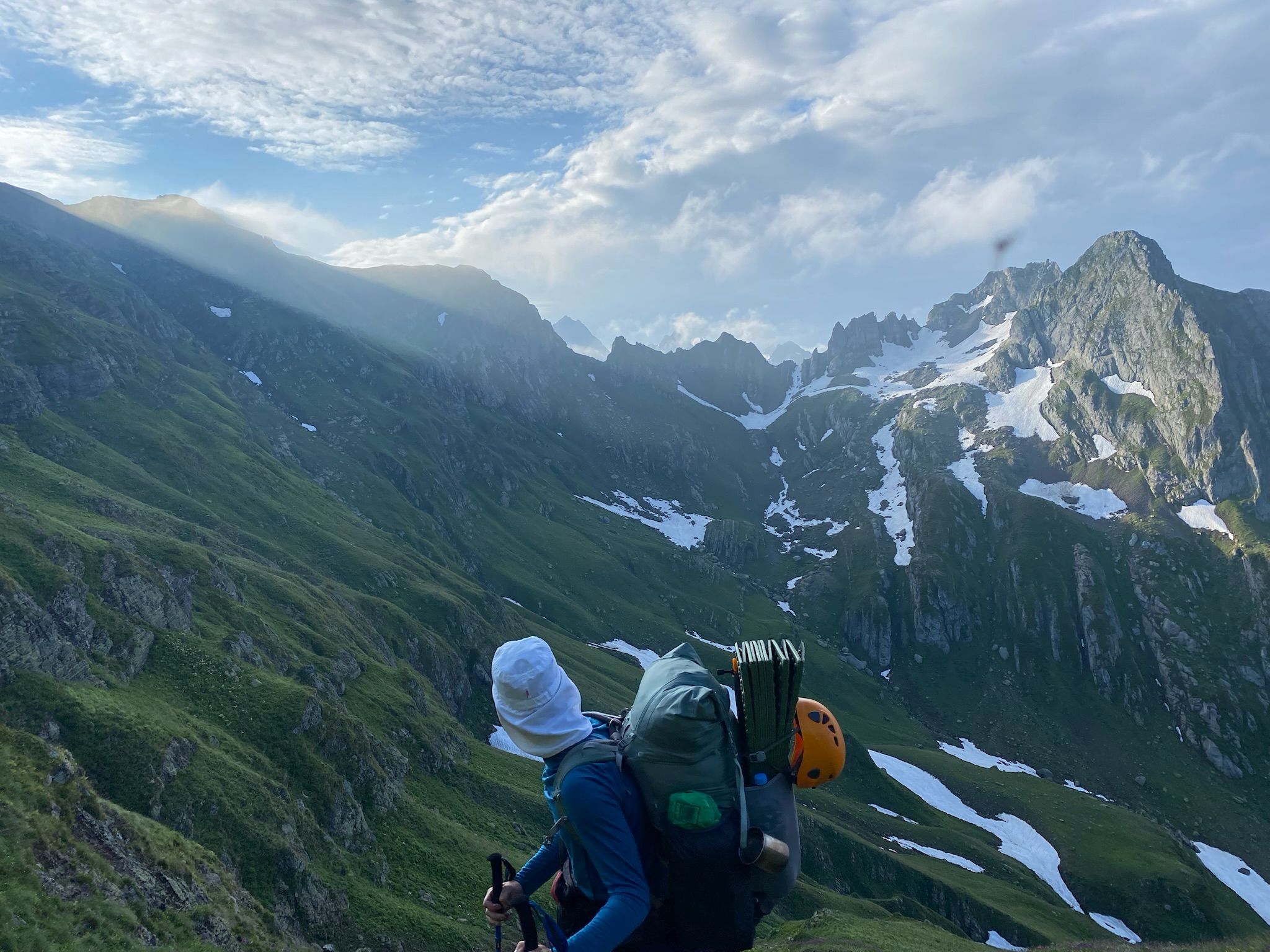
View of the upcoming trail
And looking back from the Mtsvane pass
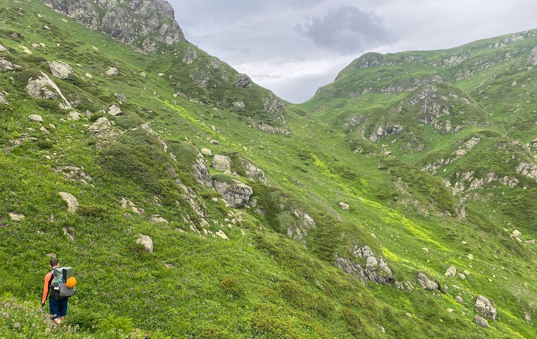
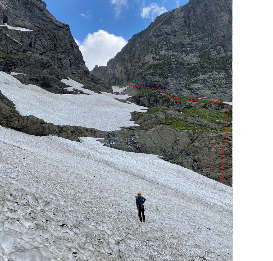
At 15.15, after a short section of steep incline on some small, loose rocks we reach another pass, this time connecting us to the Skurchal river valley [proposed name: Zeda Skurchalis].
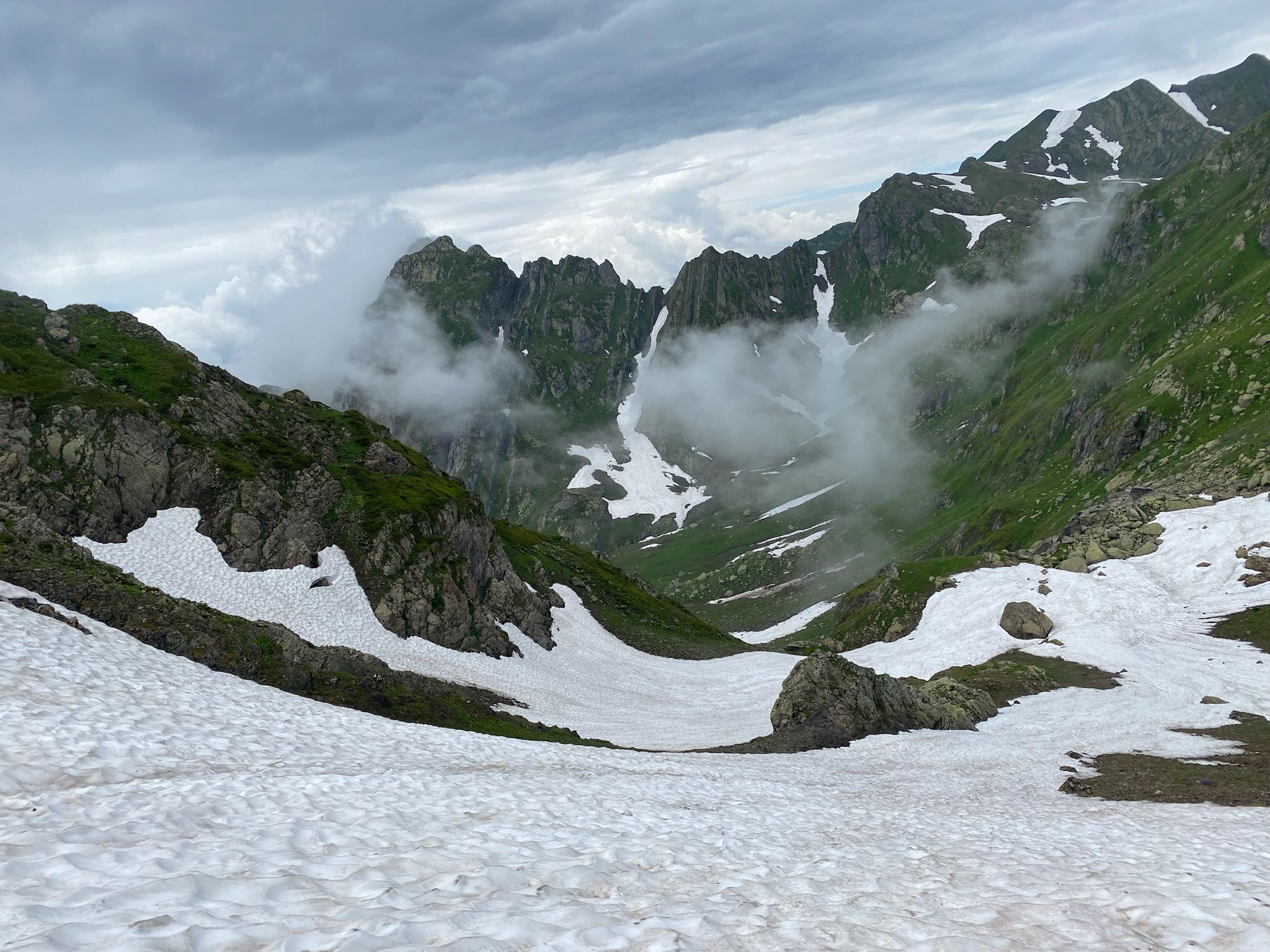
After resting we continue our westward traverse without descending to the river. The terrain is very difficult forcing us to cross multiple rocky gullies and doing a few short II-class scrambles. After an hour we reach a deep canyon running perpendicular to the ridge. Seeing no way down that would not require a rappel we decide to climb down to the river and set up camp.
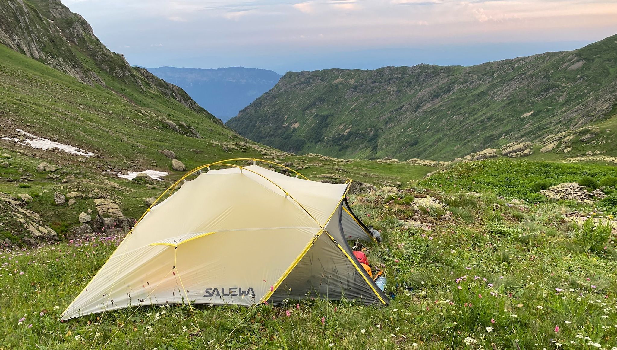
We reached our campsite at 16.40. We find traces of long-gone human habitation in the form of some old stone structures (either foundations of a hut or a small sheep-pen).
Difficult terrain along the route to Zeda Skurchalis pass
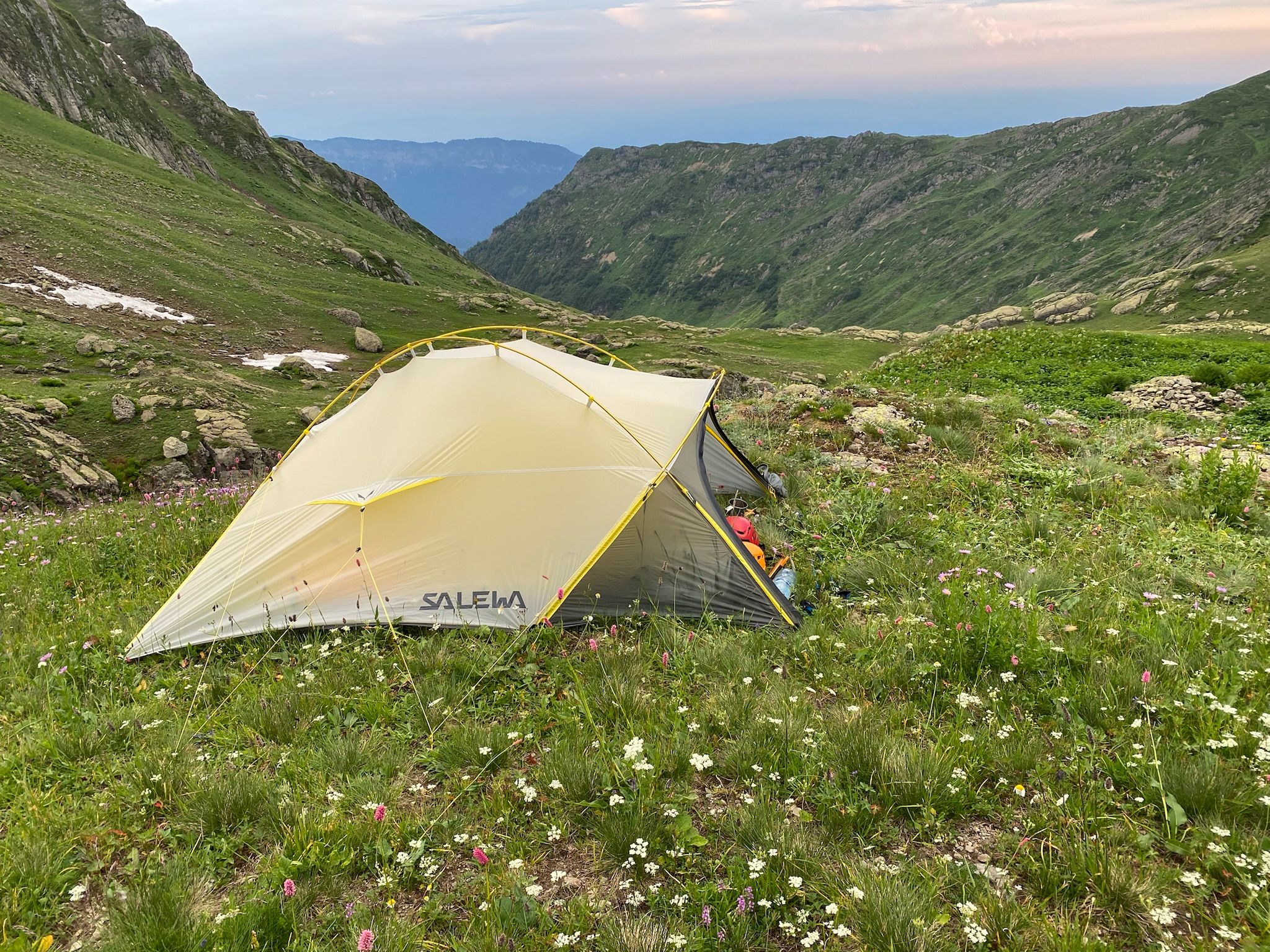
Camping in Skurchal valley
We set of at 6.30 aiming for the Djagor-Nashum (1A) pass. The terrain is steep but through carefully choosing our path we are able to avoid any scrambling. Our approach is observed by a seemingly unbothered mountain goat atop the Skurchal waterfalls.

Views over Skurchal valley towards Mt. Gwalija
Nashemi valley
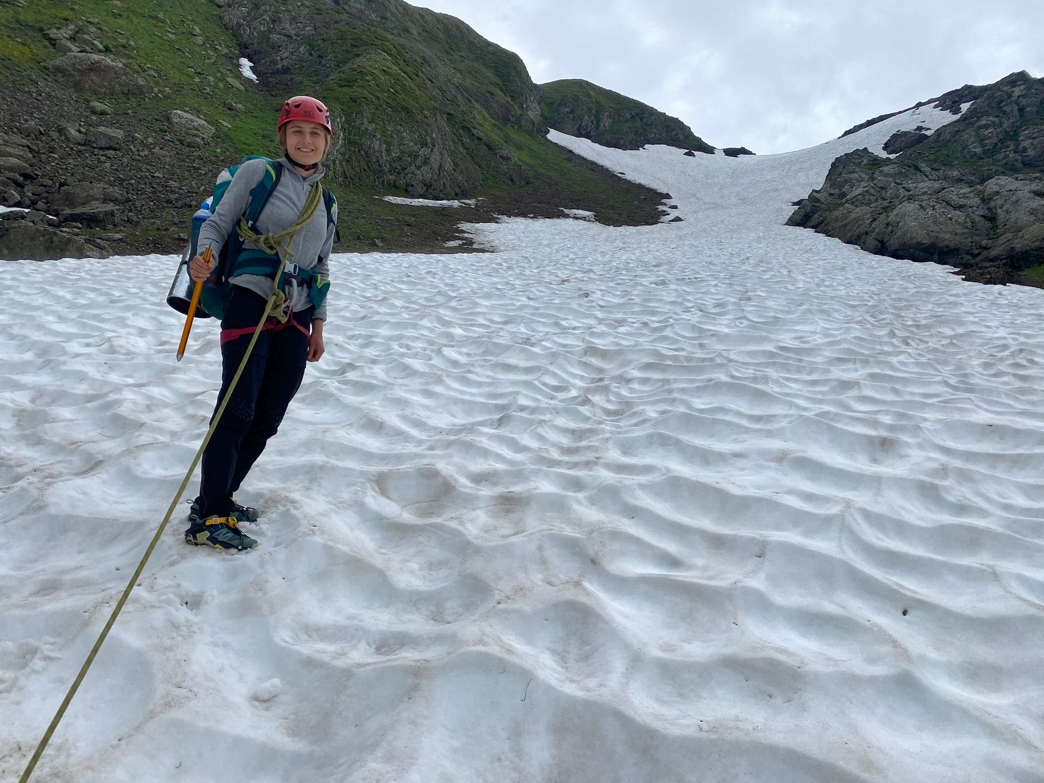
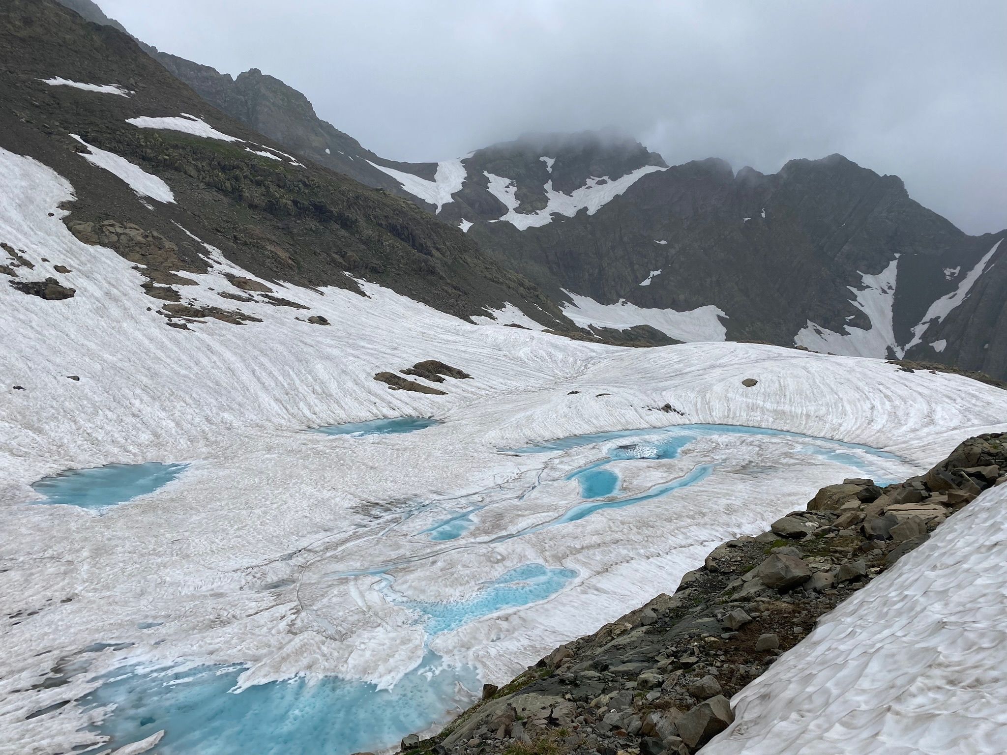
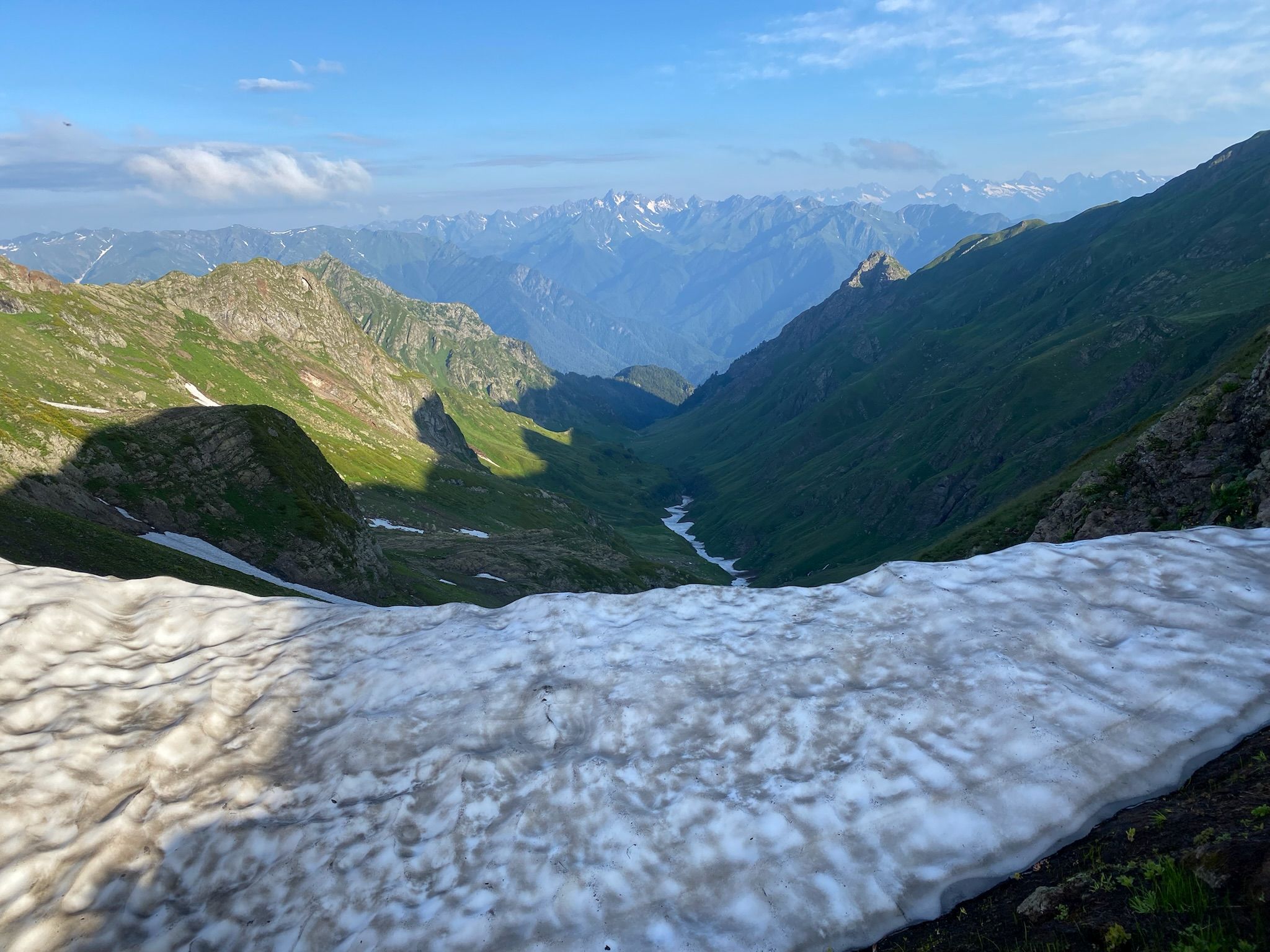
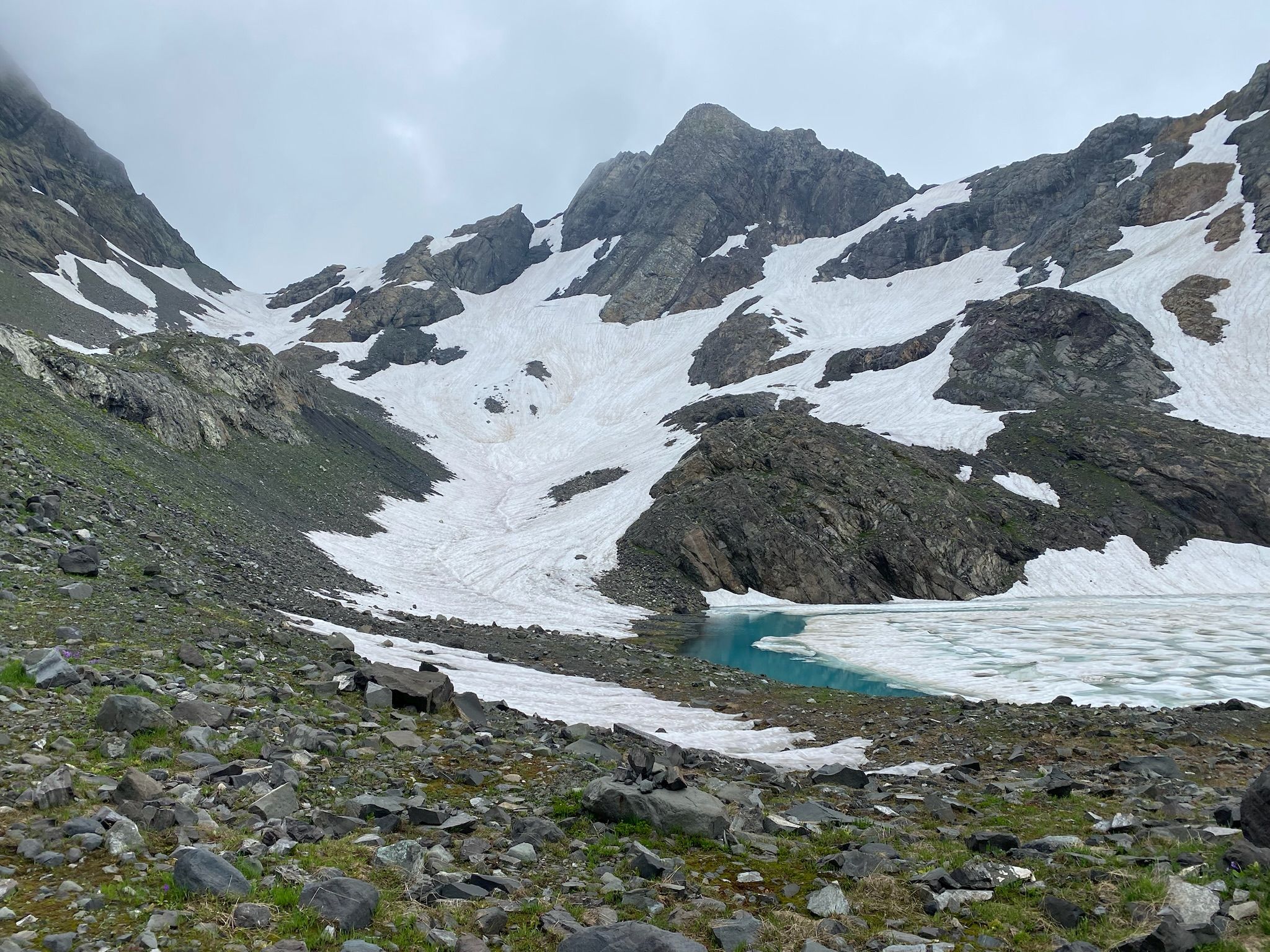
After reaching the pass at 7.30 we take a 30min traverse leading us to the source of the Skurchal – a large reservoir of snow with a river flowing underneath where we take an hour-long halt to have breakfast as well as dry our shoes & socks wet from the morning dew.

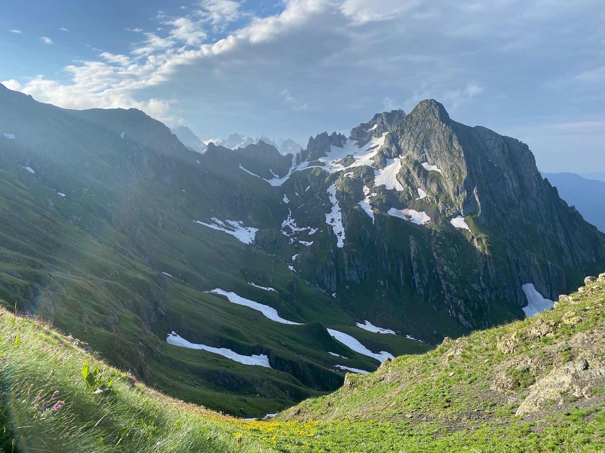
Gwalija mountain
Hybi pass in the distance
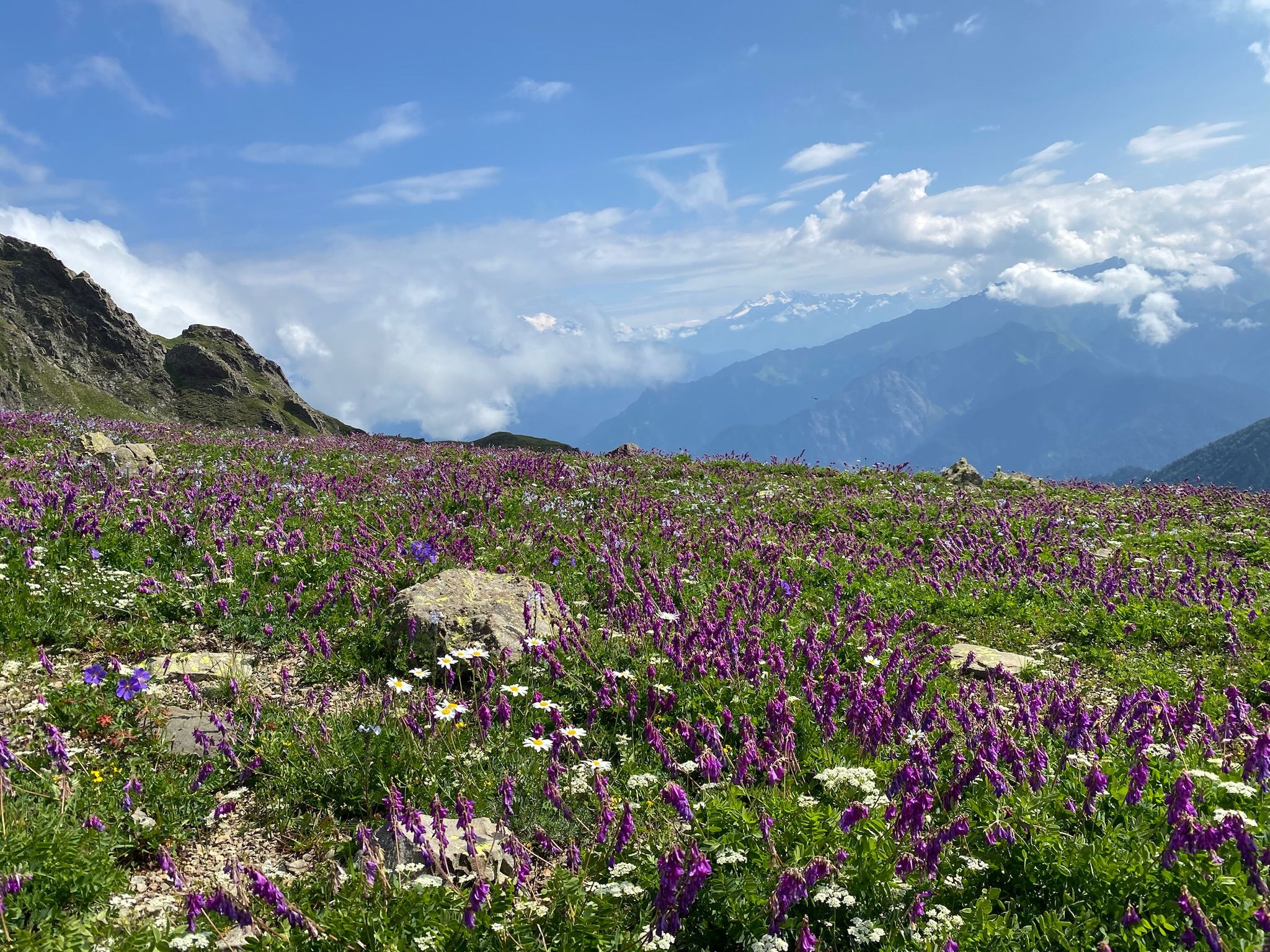
Along the route to the "Siqvaruli pass"
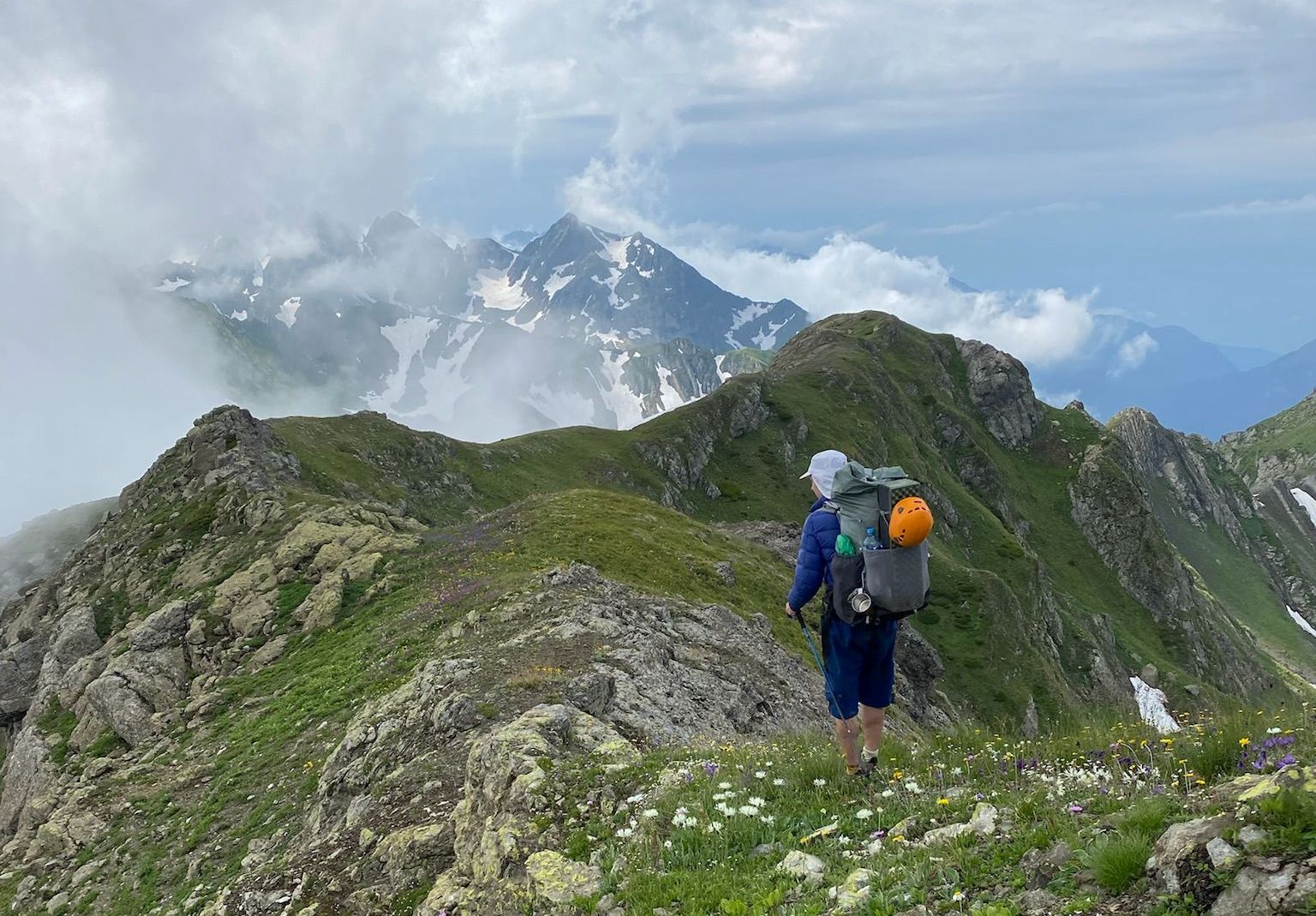
At 10.15 we descend to a flowery pass with magnificent views of the twin peaks of Elbrus which connect the valleys of the Habili and the right tributary of Hybi. At this spot, I decide to pull out the engagement ring I keep hidden in my pack and propose to Karina. We stop there to rest, eat lunch and celebrate. (Proposed name: Siqvaruli (სიყვარული) pass)
Siqvaruli pass
After some celebrations we set of at 11.00 in the direction of the Hybi pass. We traverse the south-western slopes of the main ridge, as V.Zavjalov's party did. We find this terrain slightly challenging: the slopes are steep, the ground is loose and the vegetation makes our travel slippery. At no point do we fear for our safety, but the terrain slows us down considerably.
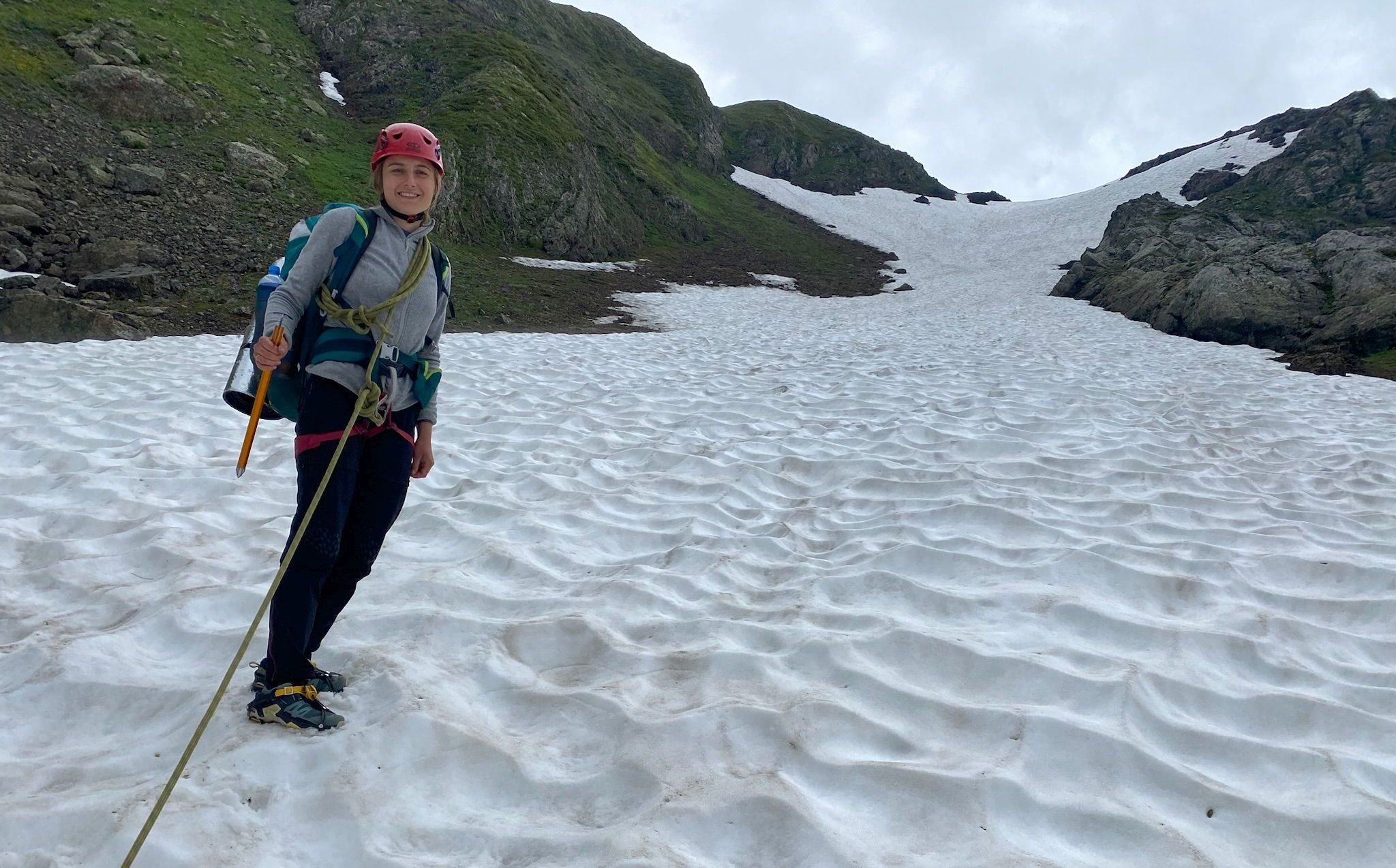
We are greeted at the Hybi pass at 12.00 with summer downpours and seek shelter under a hastily set up tent. The rains ease up at 14.00 and 15 minutes later we start walking up the snow-covered Hybi pass. In these conditions the ascent could be done using just crampons, but out of an abundance of caution we tie ourselves with a rope and take out our ice axes. We reach the top of the pass after another quarter hour. We briefly explore the ridgeline to the south-west but the incoming clouds make our attempts at reconnaissance purposeless.
Ascent of the Hybi pass
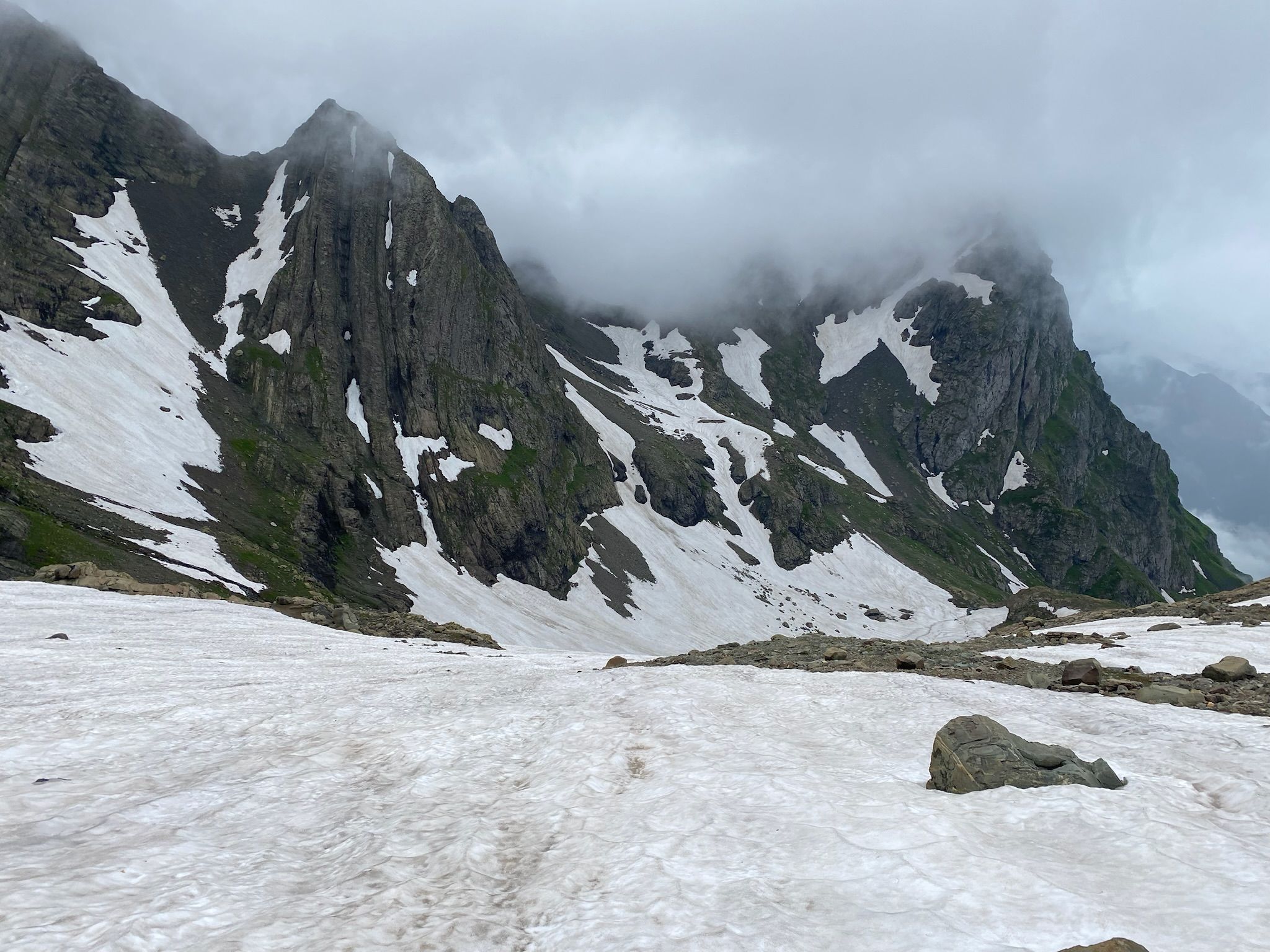
We start moving north-east perpendicular to the flow of the Hybi. We pass the Zandaryiaki pass. Here we part ways with the route described by V.Zavjaov. In our estimation the pass does not merit the 1A grade, but 1B. Local erosion seems to have made the initial drop of the pass significantly more difficult than what was described in 2015. In our opinion its upper part is not passable without basic alpine equipment and a rope, at least in mid-July.
The weather begins to deteriorate quickly. All signs point to a prolonged storm - very poor visibility, rain, and heavy winds. We stumble our way down the Hybi pass having to trace our steps a number of times once we reach impassable terrain on the southern slopes of the main ridgeline.
On the bottom of the valley at 16.30, we decide to look for a higher point and not to sleep on the flat floodplain which dominates the center section of the valley. This is due to the poor weather which we are afraid will bring some flooding to the area.
Looking back from the Hybi pass
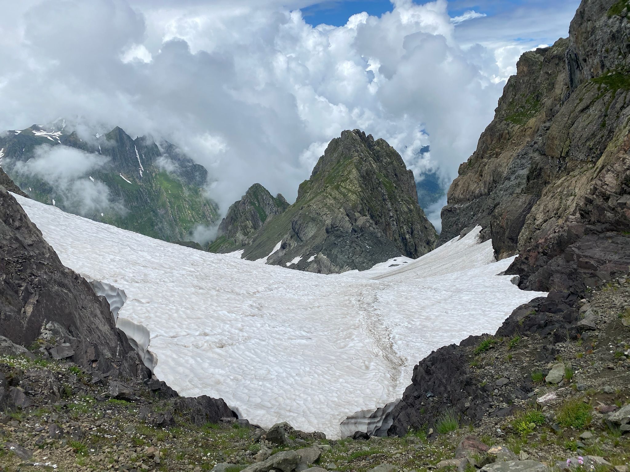
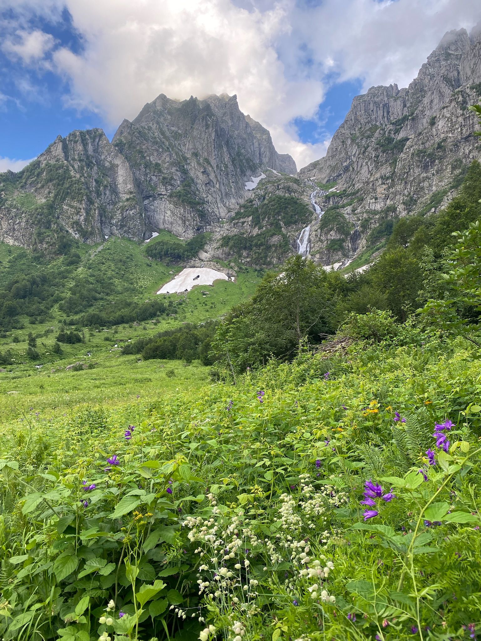
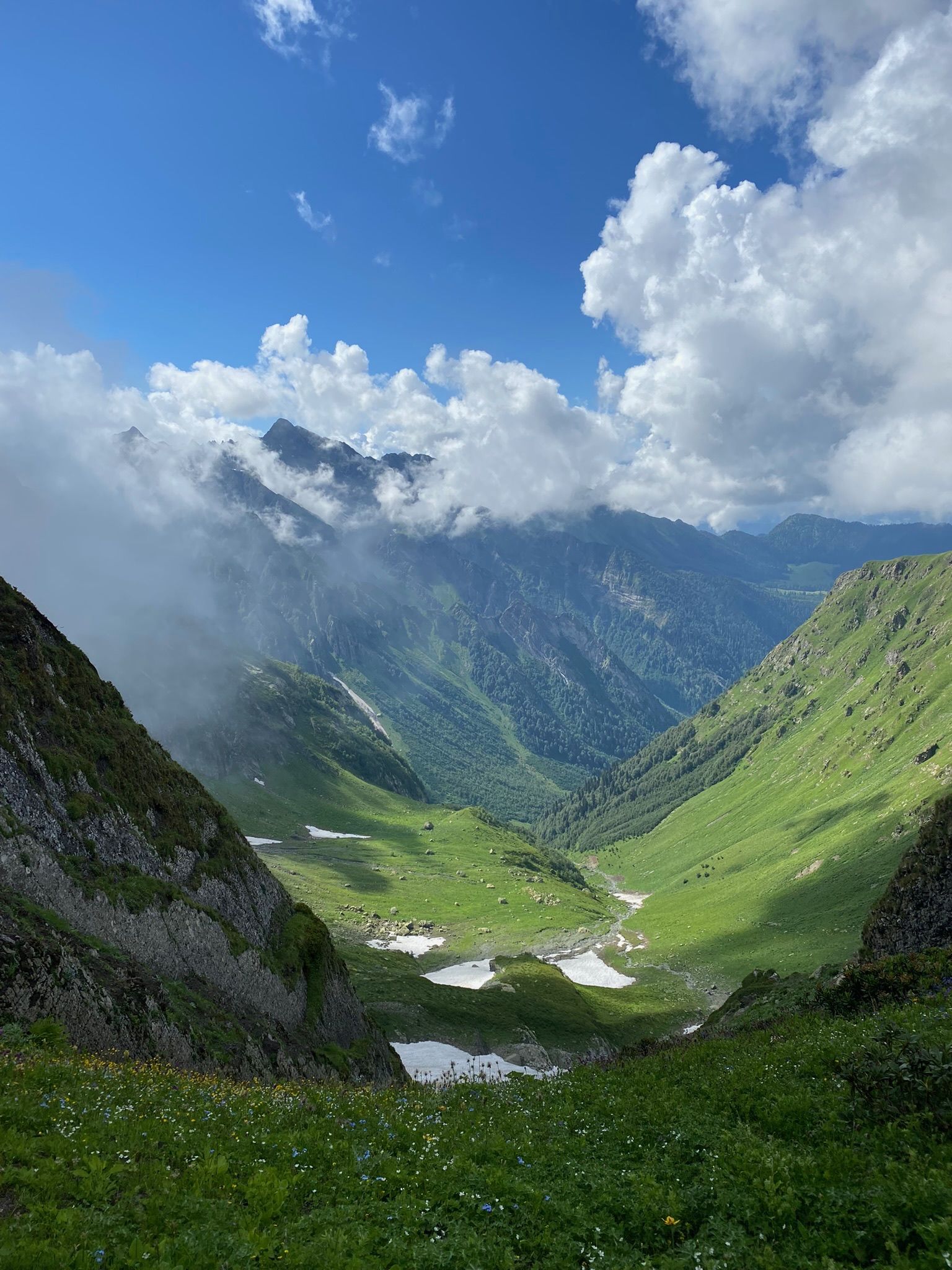
We spend the night of the 20th and the majority of the 21st of July in our tent weathering the storm. We start hiking at 16.30 with the objective of reaching the Tsakasperi lake and get a good starting position for trying to find a path between the Didgalishdudi lake and the SRTM pass.
We set off in a brief interlude between thick clouds pushed through the valley by easterly winds and use this moment to take photos of the very steep section separating the Hybi valley from the Tsakasperi lake. By the time we approach these slopes, put on our helmets and tie ourselves with rope we are once again completely submerged in the cloud cover. This turns out to be a very challenging section through a combination of a very steep slope, high exposition and intermittently: loose rocks, slippery vegetation, and a few short rocky sections of II/II+ UIAA class scrambles. Due to the extremely poor visibility, we must rely on the photos we made from our base camp to navigate up these walls.
Along the route to Tsakasperi lake
Lessons from day 4:
There is cellular signal from Magti if you climb the hilltop overlooking the Patara Tsakasperi from the north!
The valley of Toba Tsakasperi is a heaven for birdwatchers. Especially in the morning the area teems with avifauna's life & song.
The climb from the Upper Hybi valley to the Tsaksperi lake is challenging and future parties should consider using a short climbing rope there – at least in slippery, foggy conditions. In our case we felt no need to belay each other. Despite the sub-optimal weather, we felt comfortable relying just on simul climbing.
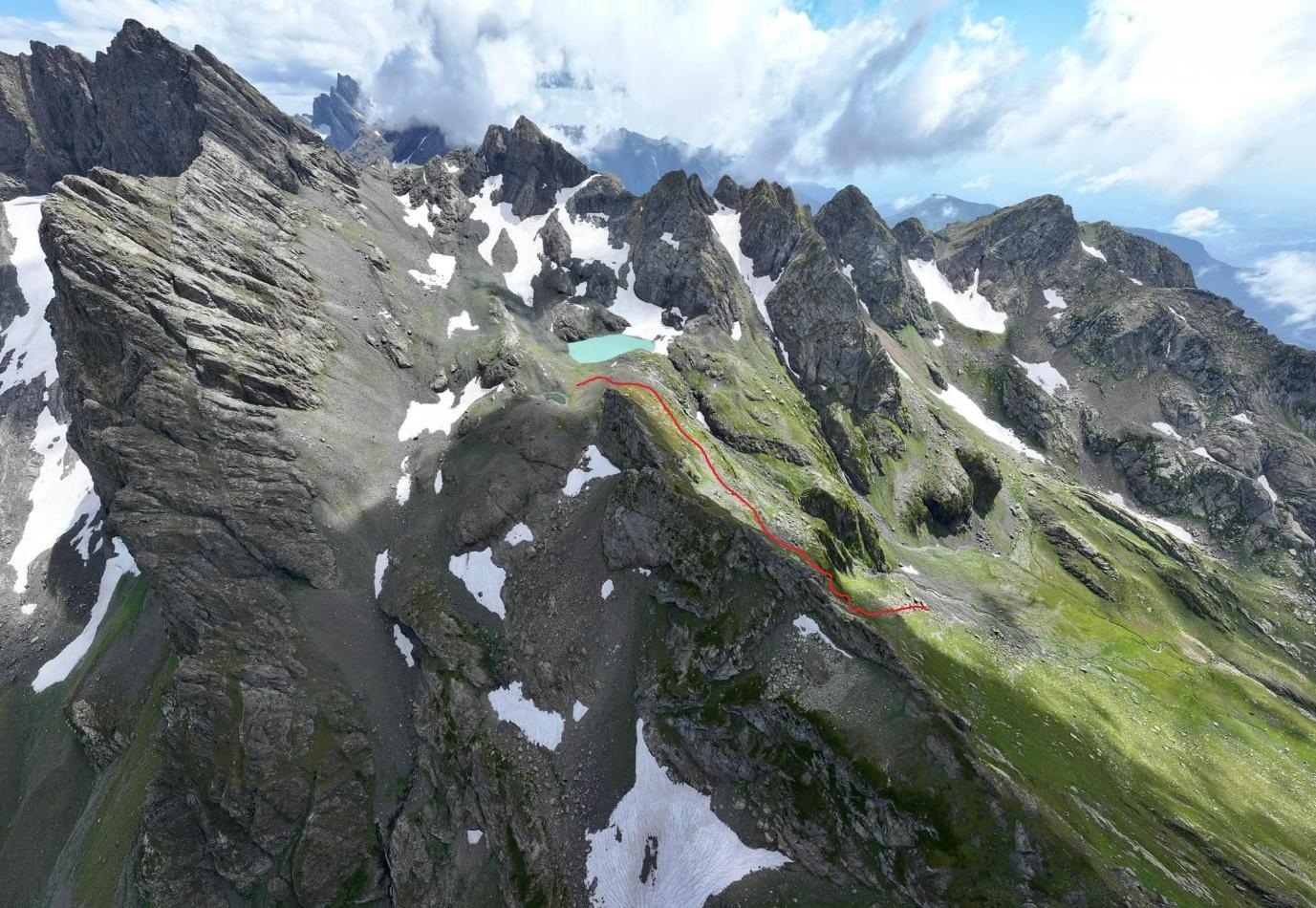
Many thanks for the drone photos by Thomas who covered "Georgia Travel's" route two months after our trip.

Drone photo of the area by Thomas Van Hemert
After breakfast, we set of on the trail described by the "Georgia Travel" team at 9.35. On our way onto the pass, we come across a mountain goat at a distance no further than 10m (a small ridgeline obscured the goat from us and vice-versa). At 10.00 we reach the first unnamed pass [proposed name: Tsakasperii pass] the trail marker there is completely broken with only a heavily bent metal post remaining.
We slowly descend a small valley and turn left at a red trail marker doing a short, easy scramble up a small rock wall. At 10.45 we emerge on a large ledge and change our direction once again to the N-NE. At 10.40 the ledge ends, and we move more or less in a directly straight line to the still frozen Didgalishdudi lake which we reach at 11.45. At this moment we end our 2.5h trip down the route scouted out by the "Georgia Travel" team.

Didgalishdudi lake
The lake is visible from beneath the seasonal glacier and greets us with a few brief showers, so we decide to move on to the SRTM pass without taking a break. We take a long trip around the lake as we are unsure of where exactly the lake starts and where the seasonal glacier ends. We reach the twin lakes under the SRTM pass [proposed names: SRTM-Dasavletit & SRTM-Aghmosavletit] without much difficulty by 12.40.
Climb to the SRTM pass
Looking back
After a short halt at 13.00 we set off downwards the SRTM pass. The large crevasses visible on numerous satellite photos of the area are still hidden at this time of the year, so we move cautiously. We descend the upper part of the pass without much difficulty and turn onto a pass previously unmarked on any maps [proposed name: Vitsro (ვიწრო); 1B]. After a short time, at 13.20 we encounter a tall rockface which we decide to climb down.

View of the Vitsro pass (on the right) from the SRTM pass
This is the only part of our trip during which we decide to belay each other (although we felt the need to do so only "from the hip"). This is a short, yet slightly technical section which in our opinion should not be tackled without a climbing rope.
During our downclimb Karina losses her ice axe in an accident but is not injured in any way. This is problematic, as we still have a long way to go down the glaciated pass. What we don't know is that we will have two more long sections through melting, seasonal glaciers which were not visible to us at the time.
Karina leads the way down the glacier, with Michał holding on to our team's remaining ice axe. We reach the end of the ice at 14.35. There we quickly set up a tent during another brief summer downpour.
We continue on our way at 15.00 with a series of easy downclimbs on grassy & rocky surfaces on a ledge separating the two parts of the glacier (one flowing from the Didghalisdudi pass the other on our right).

Looking down from the Vitsro pass
Descent from the Vitsro pass
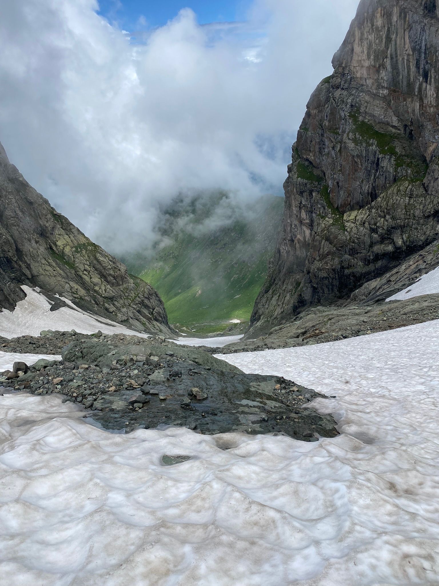
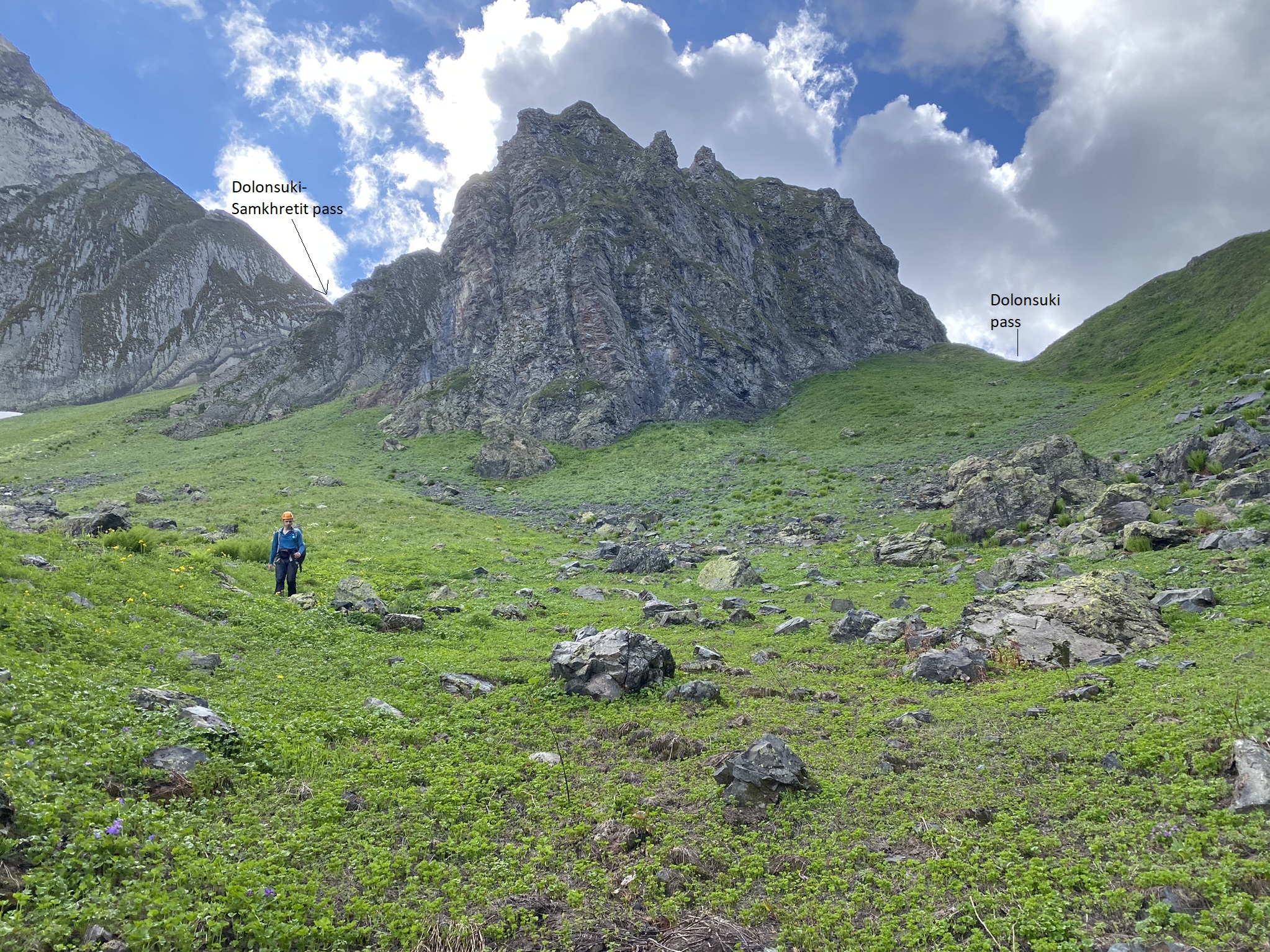
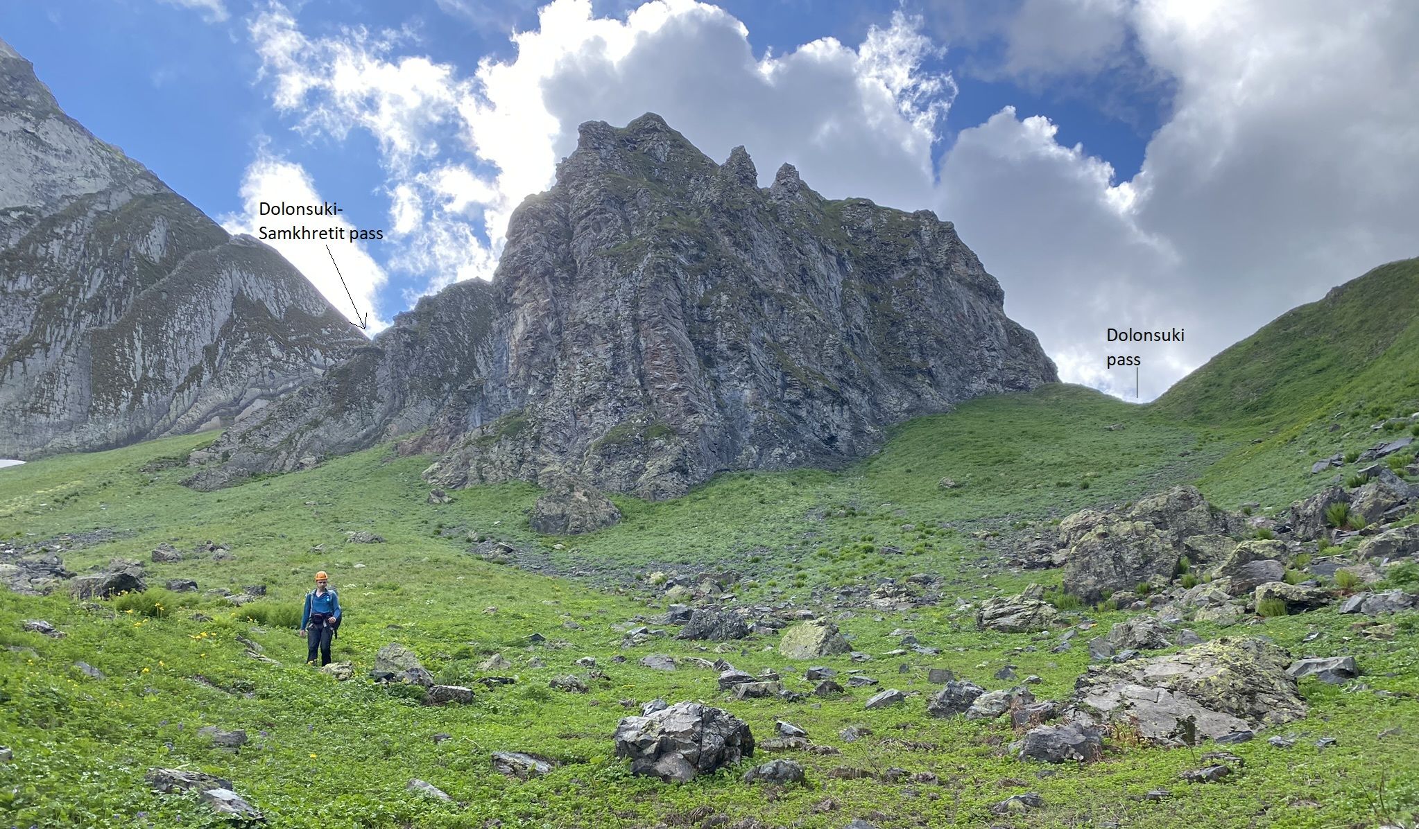
We make another traverse of the rightward glacier at 15.30. Afterwards we start moving upwards to a narrow pass unmarked on any maps and located southwards of the previously ungraded Dolonsuki pass [proposed grade: 1A]. We reach its highest point at 16.15 and continue moving downwards following any rivers and streams on our way. The southern part of the pass is covered with small, sand-like rocks which quickly fill our shoes but are otherwise non-problematic. Near the confluences of the valleys of the two aforementioned passes Michał nearly steps on a snake – please be cautious when crossing this area. As we continue to lose elevation the vegetation quickly becomes thicker, and the trip slowly devolves into laborious bushwacking. The descent is only occasionally broken down by short sections of downclimbing and walking on delicate remains of seasonal snows.
Green valley below
On the way down
At 18.00. We emerge onto a large snowfield which we cross to the east and walk near it's edge perpendicular to the river. The roar of the rivers flowing right under our feet are disheartening but we see no other way to proceed.
Mountains behind
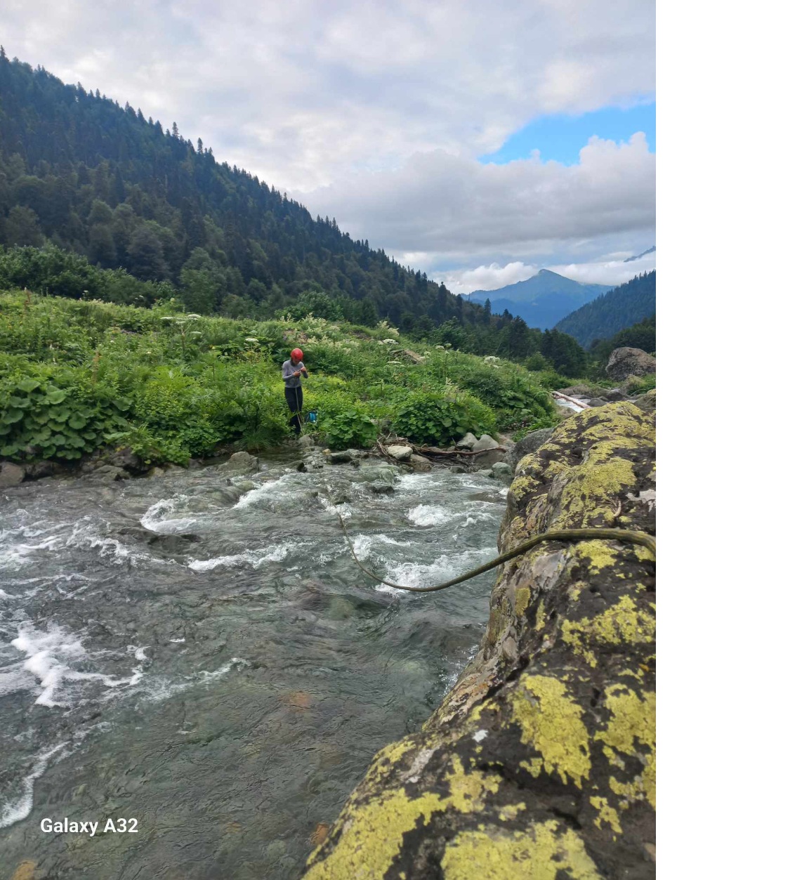
At 18.46. we meet the last obstacle separating us from the desolate footpath to Lakamurash Toba – the Theischi river. After taking 15mins to find a suitable crossing we cross it at [42.84037, 42.22030] doing so while tied together. In our opinion this crossing should not be undertaken without a partner and a rope.
After the crossing we take the barely visible Lakhamurash path to the village of Khaishi. This is a long part of the trip which results in some minor hogweed burns and a long nightwalk next to the river. However, seeing that the route down this path is already well described we will end our report here.

View towards Lakamurash Toba lake
Crossing of Theischi river
| Author | Year | Relevance to our trip | Link |
|---|---|---|---|
| Slava Zavjalov | 2015 | Half-day of our trip. From Jagor-Nashemi pass to Zandaryaki pass. | View report |
| Georgia Travel | 2019 | 2hrs 30mins of our trip. From Tsakasperi to Didghalishdudi lake. | View report |
Aside from these two reports we were able to discuss our plans with two hikers who traveled in this general region before: Besik Chikvinidze, who covered a trail similar to the one described by V. Zavjalov, and Vahur Lokk, who gave us the idea of scouting the Dolonsuki pass.
Link to the original, more detailed report: Google Docs