Trek climbing to the foot of Mt. Laila, the highest mountain of Svaneti range.
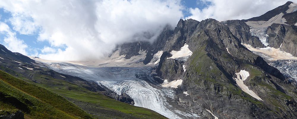
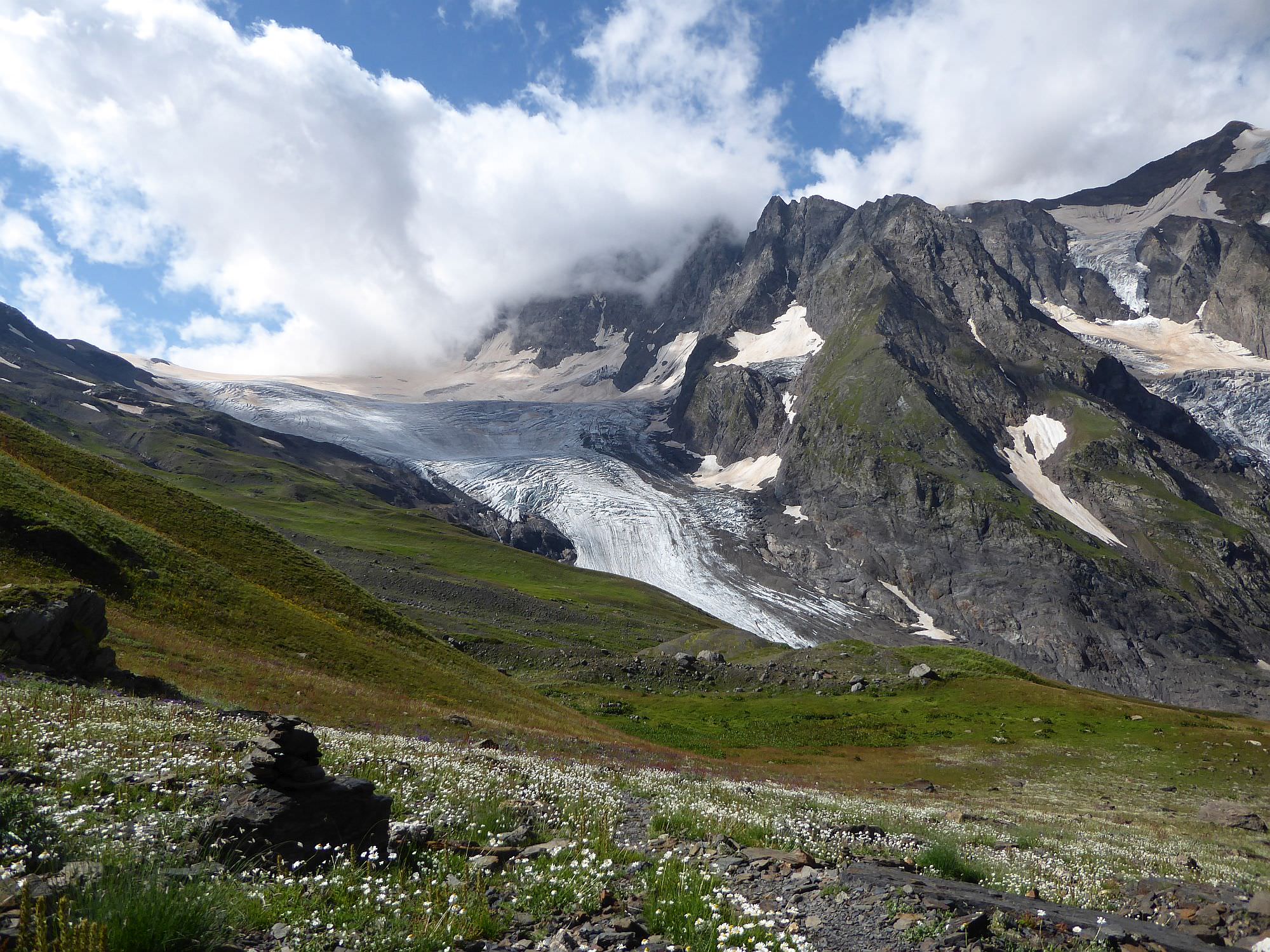
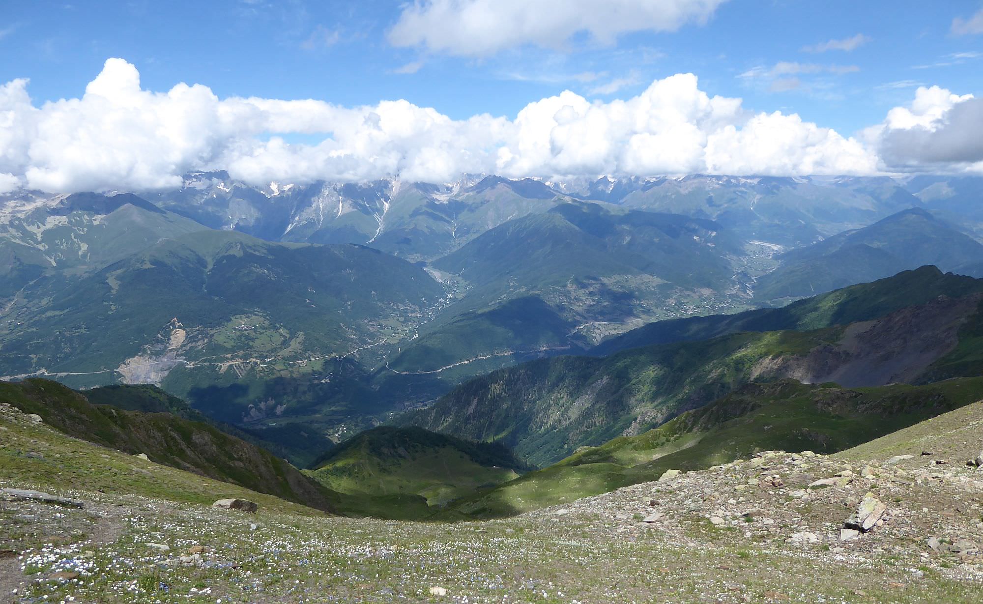
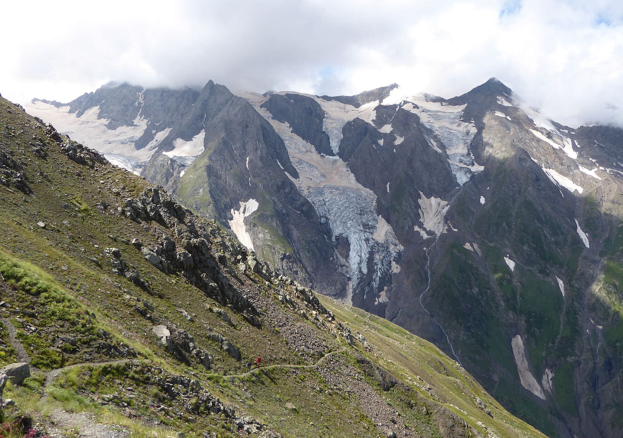
A very nice trek climbing to the foot of Mt. Laila (4008m, in Georgian known as Lahili), the highest mountain of Svaneti range. It is mostly used by mountaineers (the destination is the trek is so-called Laila Base Camp), but it´s pretty interesting also from a hiker´s perspective. To reach the glacier, one has to cross Chizdhi pass (3100), one of the highest hiking passes in Svaneti. From here, one can admire the mountain wall of Greater Caucasus and even Mt. Elbrus (5642m) looming behind. The vicinity of Laila glacier is very scenic, too, there are many other smaller glaciers, icefalls and other ice formations.
The only downside of this route is that it´s a roundtrip, you have to return the same way (unless you plan to cross the glacier and continue south to Mananauri, but that´s much more difficult route).
Greatly depends on how much time are you willing to allocate. If you have only 2 days, the difficulty is definitely Hard (1800m up and 250m down in a day with the camping gear). If you have three days, the difficulty is Moderate.
You can make it to the glacier in a day (by the trek parameters below), but another day is needed to get back again.
No public transport, you will need a taxi to get here. The usual price for the ride from Mestia is in a range of 100 - 150 GEL.
Again, the taxi is the only option unless you are willing to hike 4 km up and down to the main road. The price is usually 80-100 GEL (there are only a few taxis in the village). So I recommend to make an advance agreement with the driver who drove you here and book also a return trip - if you book two rides instead of a single one, you should be able to negotiate a bit better price.
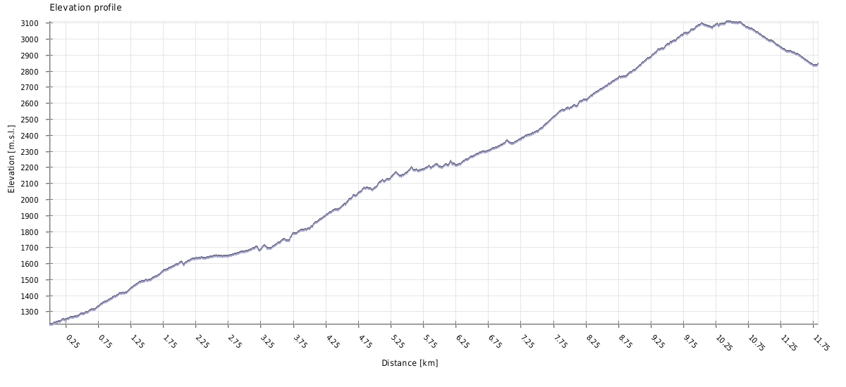
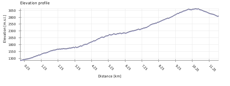
| Distance | 10,7 km |
| Trail type: | A=>B trip |
| Max. elevation: | 3107m |
| Min. elevation: | 1224m |
| Total climb: | 2065m |
| Total descent: | 442m |
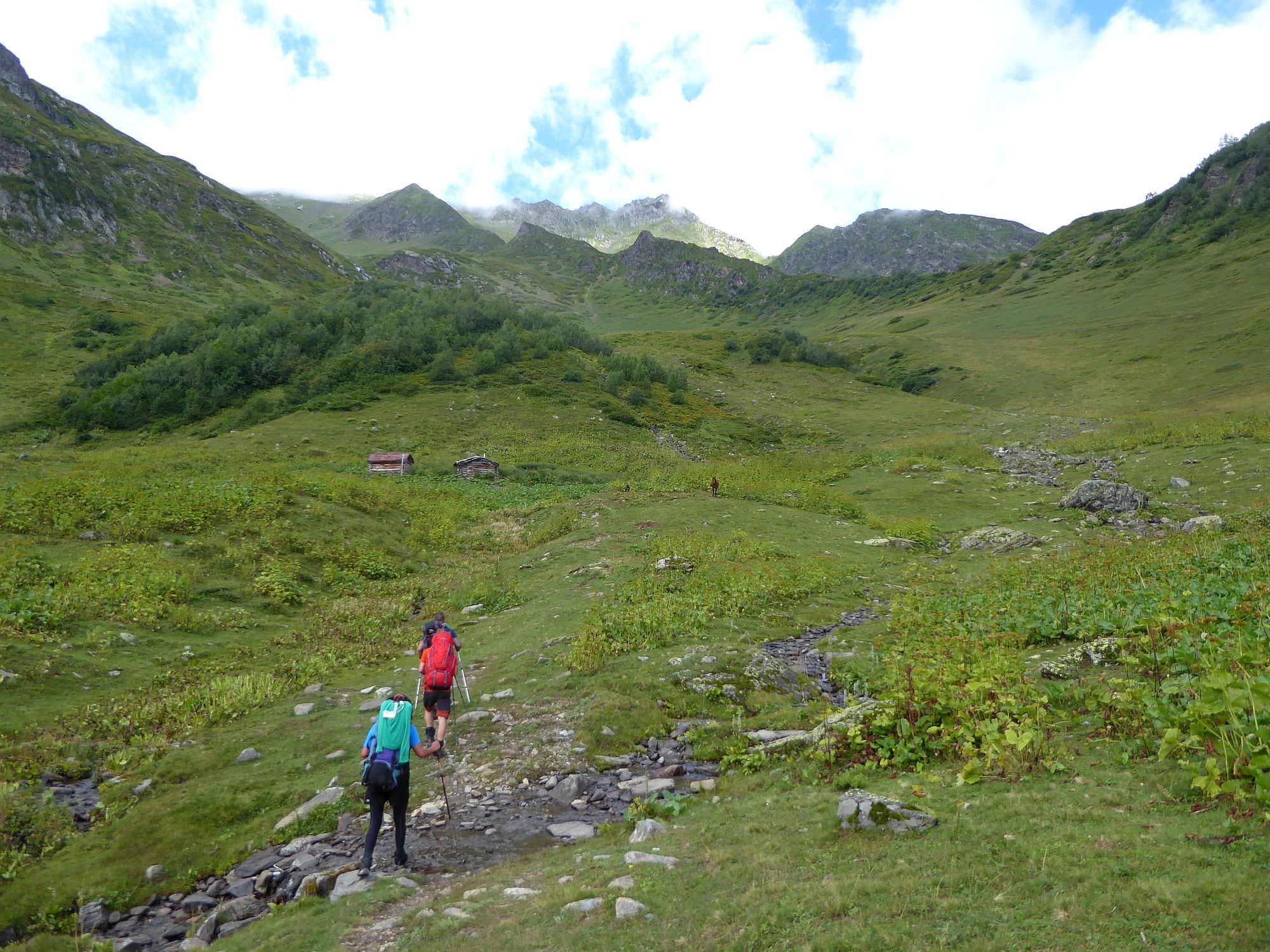
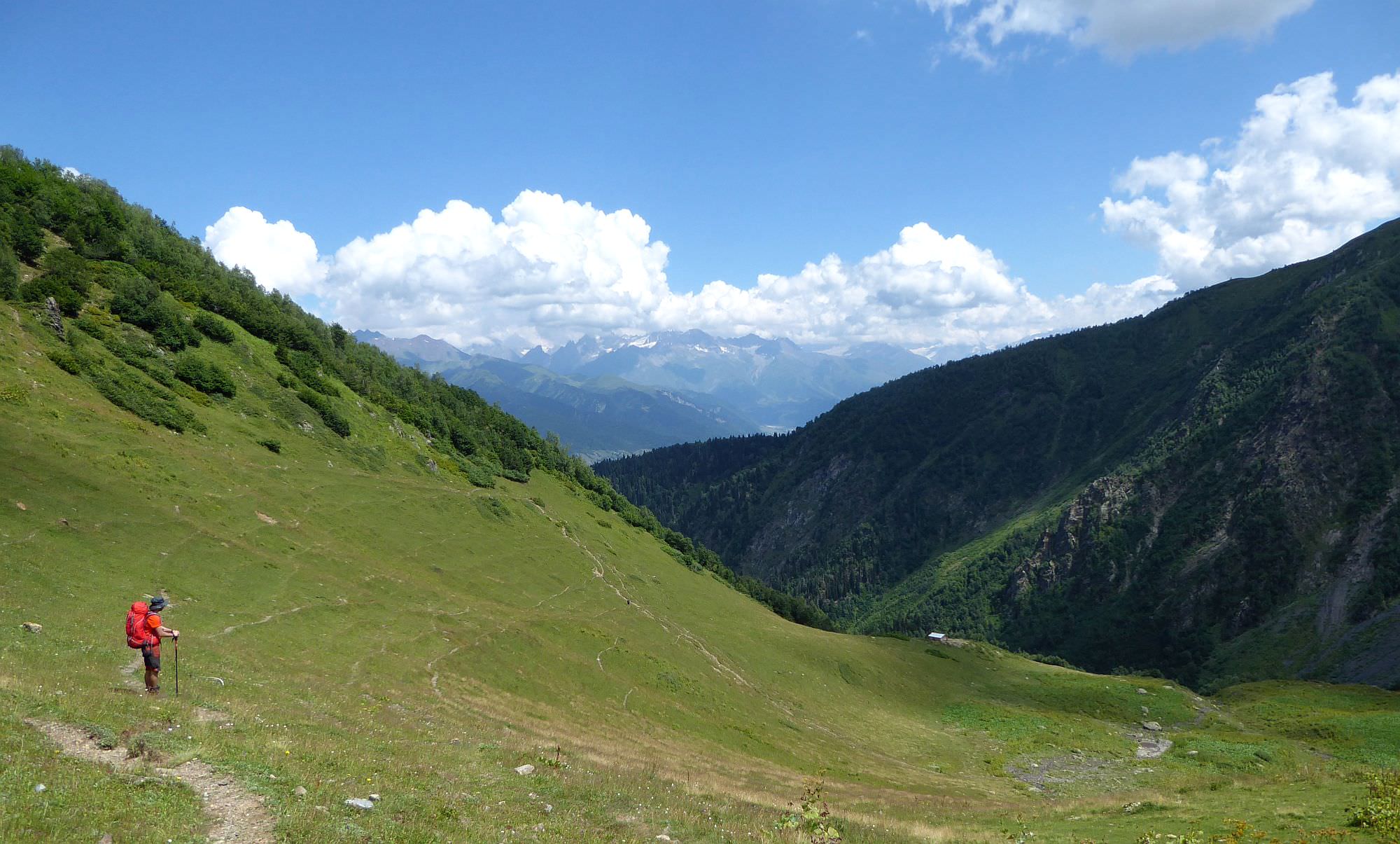
The trail starts at the Tskhumari community school, there is an info panel and the first pointer - the trail is marked by white/red rectangles. Follow the road to the south, cross the Tviberi village (there is a water spring at the main square). Behind the village, you will notice several transmitters. Take the alley road to the right of them, so on your left side will be a pasture enclosed with a fence. The road then enters the forest and starts rising. At the elevation of 1600, it joins another track climbing from Lezgara village - shorter, but even steeper.
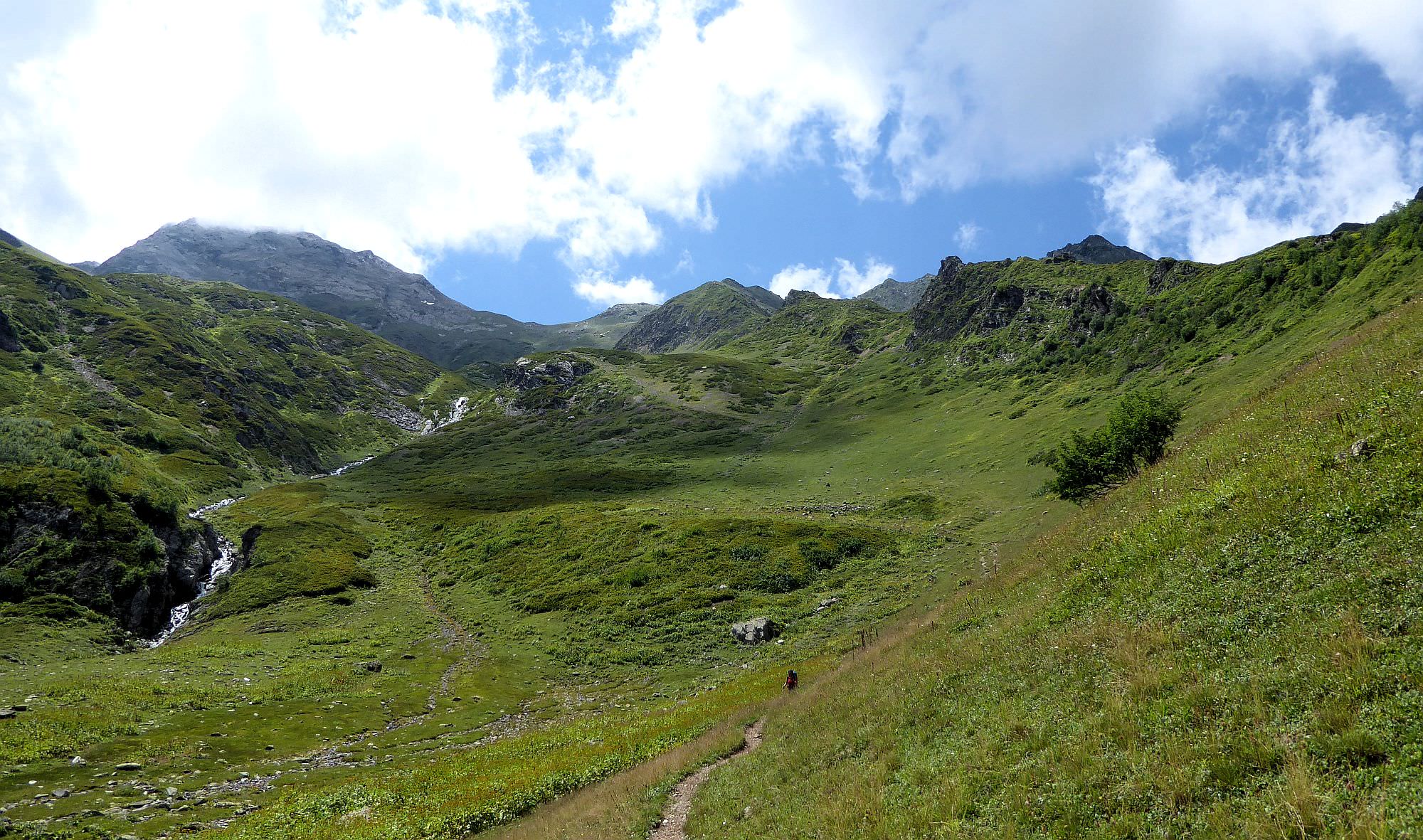
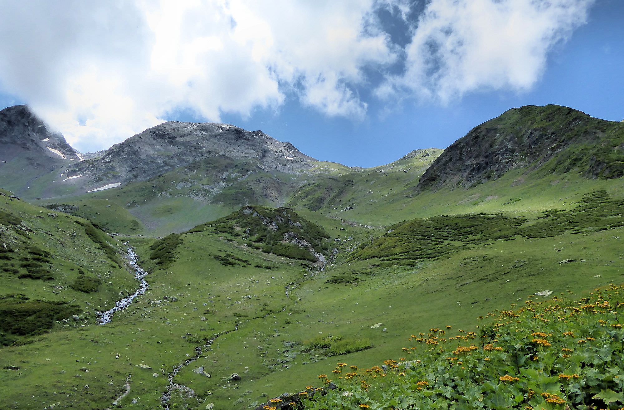
From the junction, the road rises only mildly. One kilometer further, it crosses a small meadow with a small river and shortly afterward reaches a junction. You can see some hut ahead, but you need to turn right onto the steeply rising dirt track. It will lead you to another meadow with the shepherd's hut and a small spring.
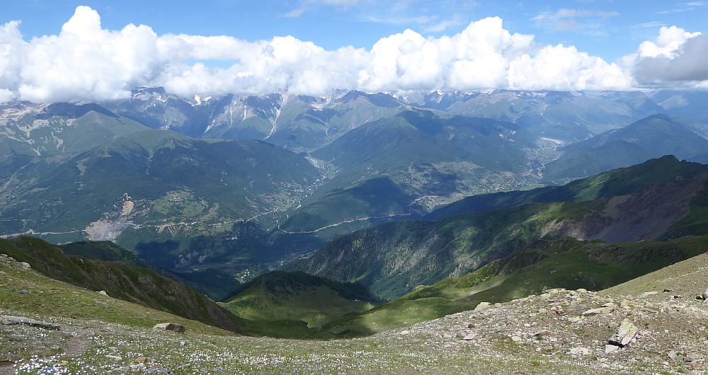
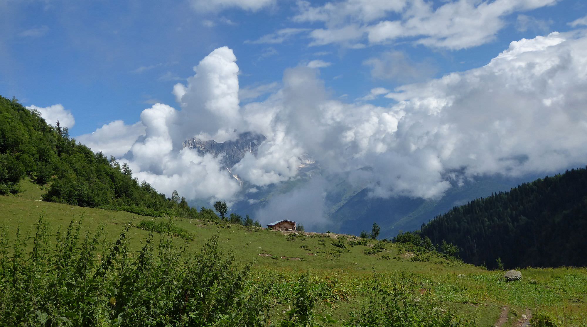
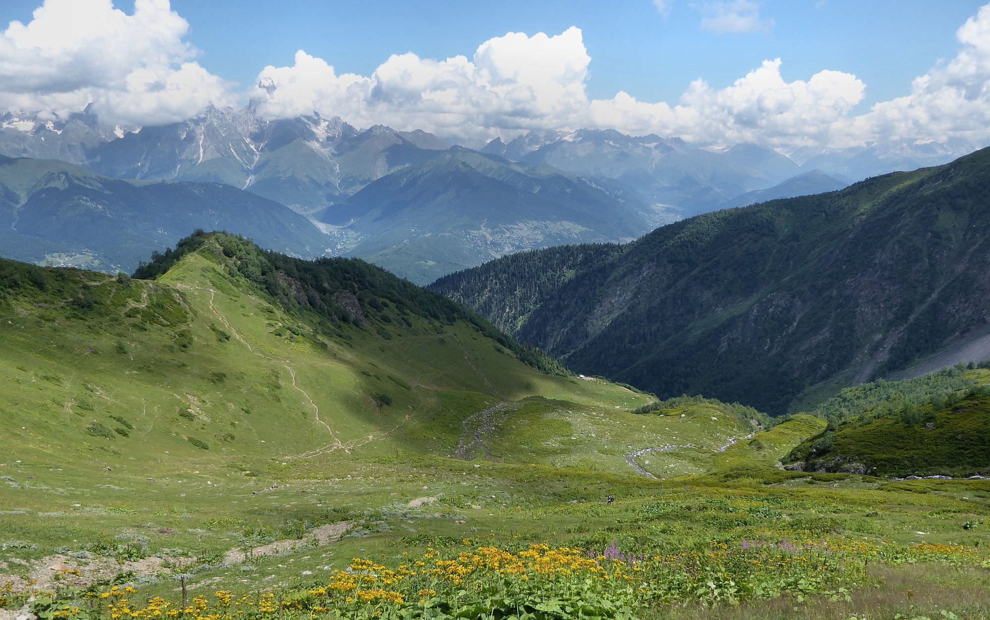
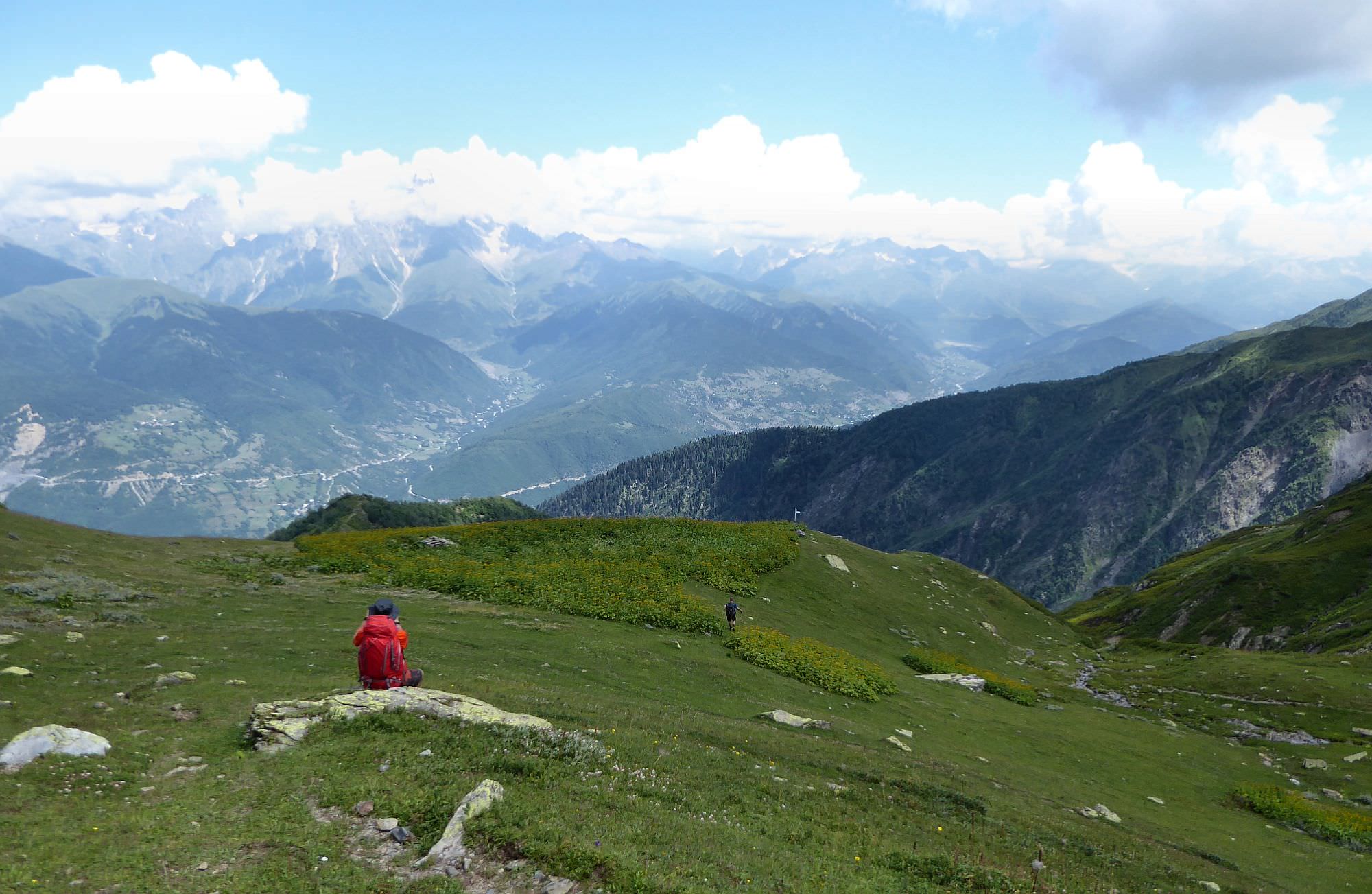
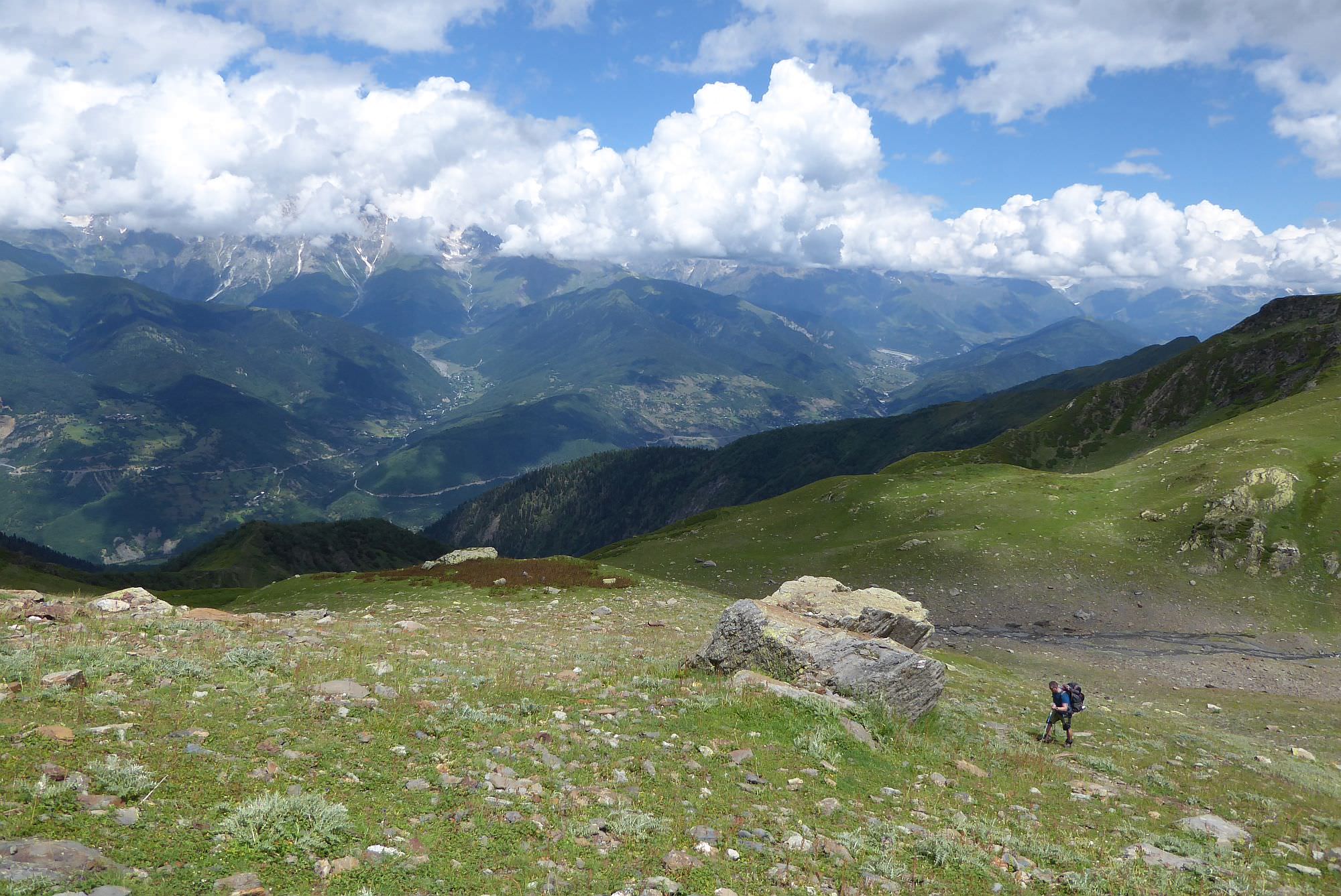
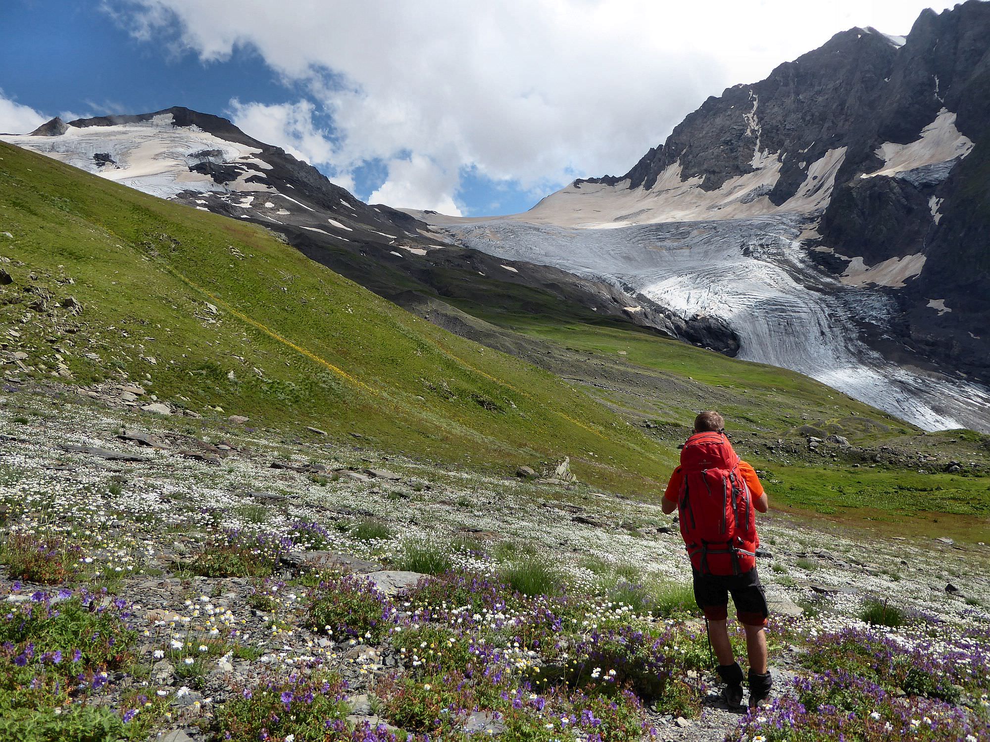
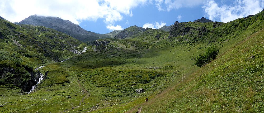
The road keeps climbing through the forest until, at the elevation of 2200m emerges onto a plateau known as Lashira. On it´s opposite side, you will see several shepherd's huts ahead. The owners sell beer and even rent donkeys to help you with the backpacks. On your right, you might notice meager remains of a shelter once known as Lashira hut, which used to be the only proper mountain shelter in Svaneti. The plateau is a good place for a break since you can finally enjoy nice views (among others, Mt. Ushba behind you and also Chizdhi pass high above).
Lashira hut, when it still stood
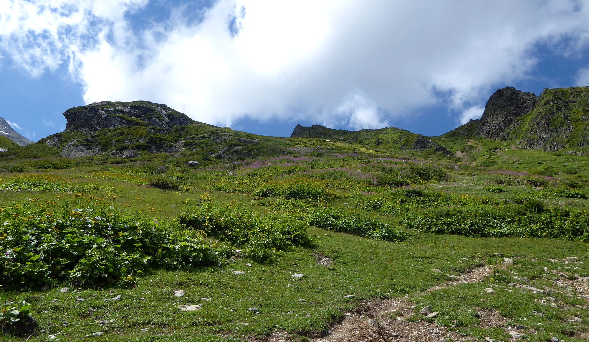
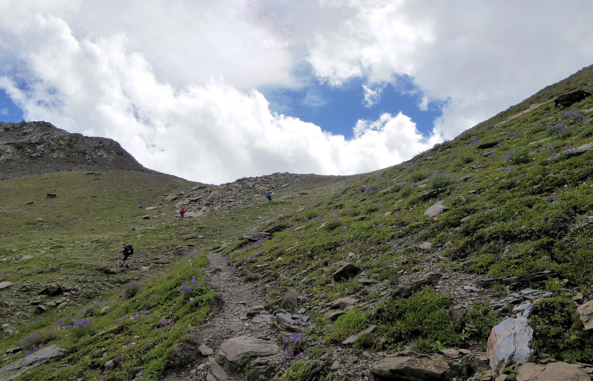
From the huts, follow the marked and well-trodden trail which climbs the opposite hillside. About halfway to the top, turn sharply to the left. On your right side will be a small ridge covered with bushes and small trees. To your left, you will see Lezgaratvibi river forming a small, but nice waterfall. The trail goes in-between, first ascending only mildly but once the terrain becomes steeper, it turns into a series of switchbacks.
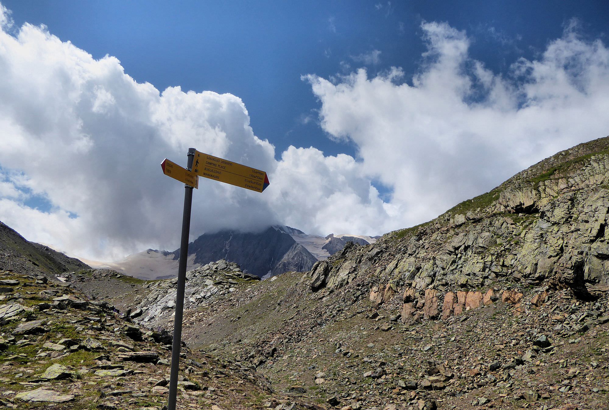
At the elevation of 2600m, you will reach a small plateau with a hiking pointer. If you want to split the trek into three days, this is a good place to break a camp - you are already high enough, there is some flat space and also a water nearby.
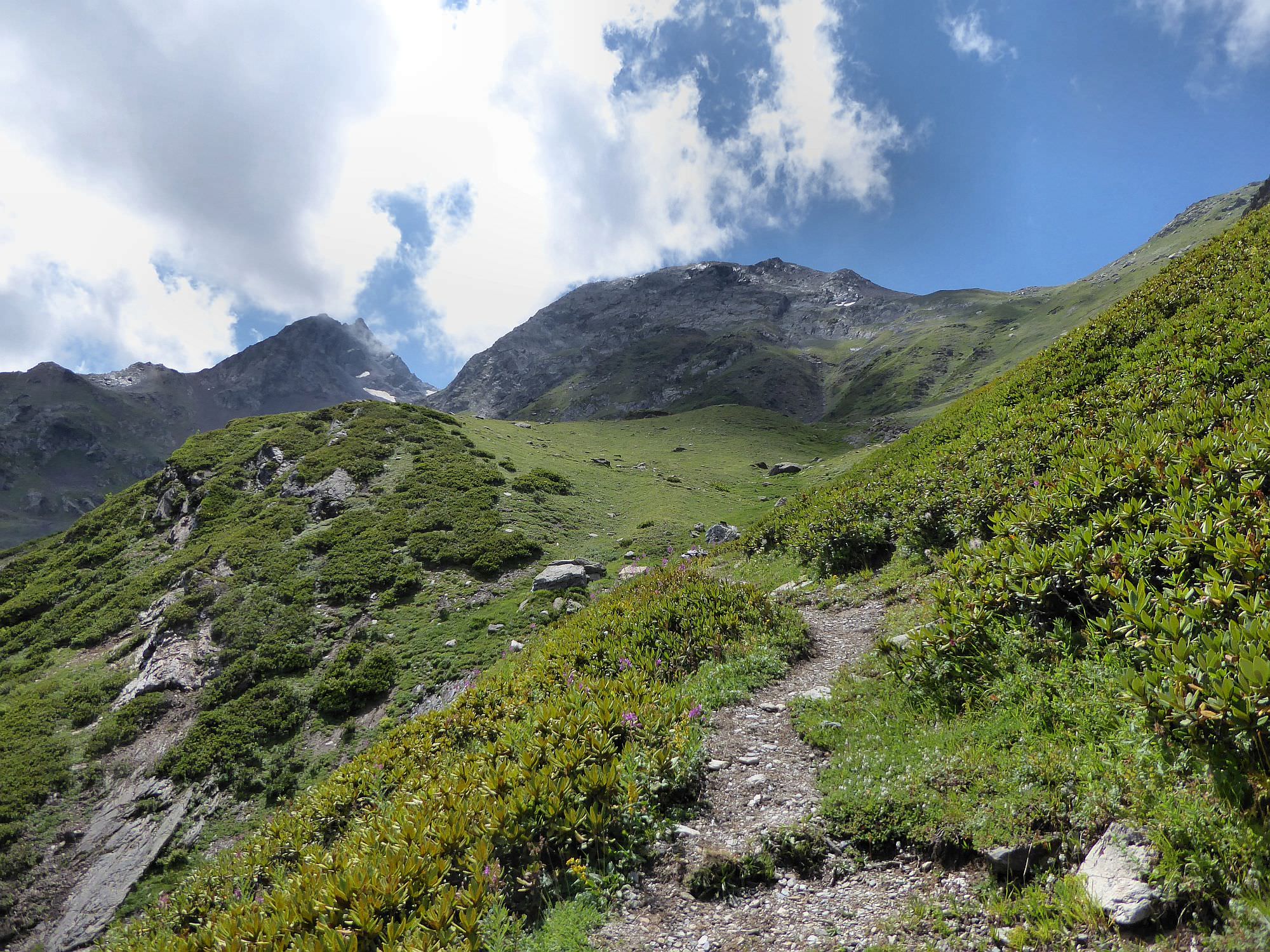
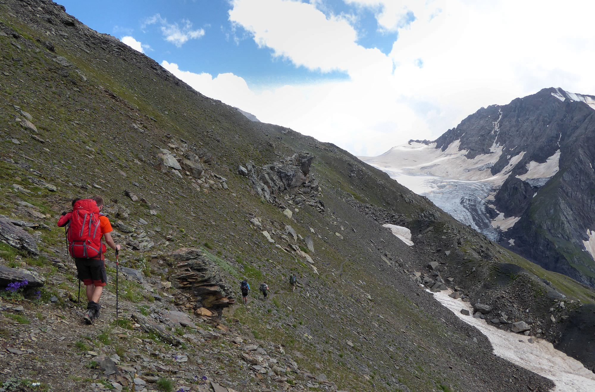
Now you can clearly see Chizdhi pass five hundred meters above. First, traverse the hillside to bypass the lower section where the river flows. The trail will lead you to two small elevations covered with rhododendrons. Once you reach them, it turns again into a series of endless, steep switchbacks. And will stay the same until you reach the actual pass.
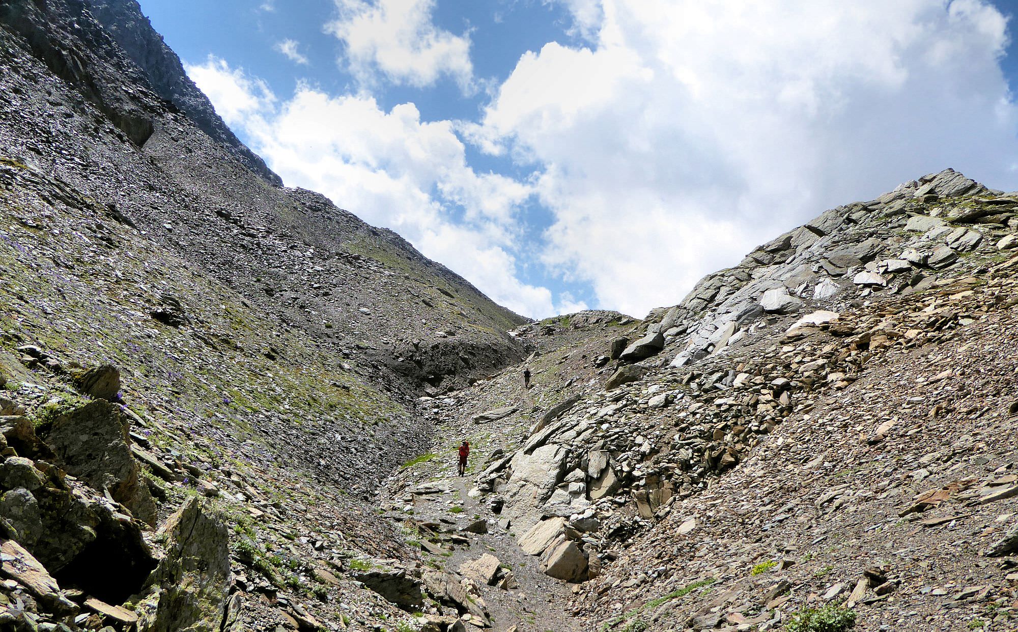
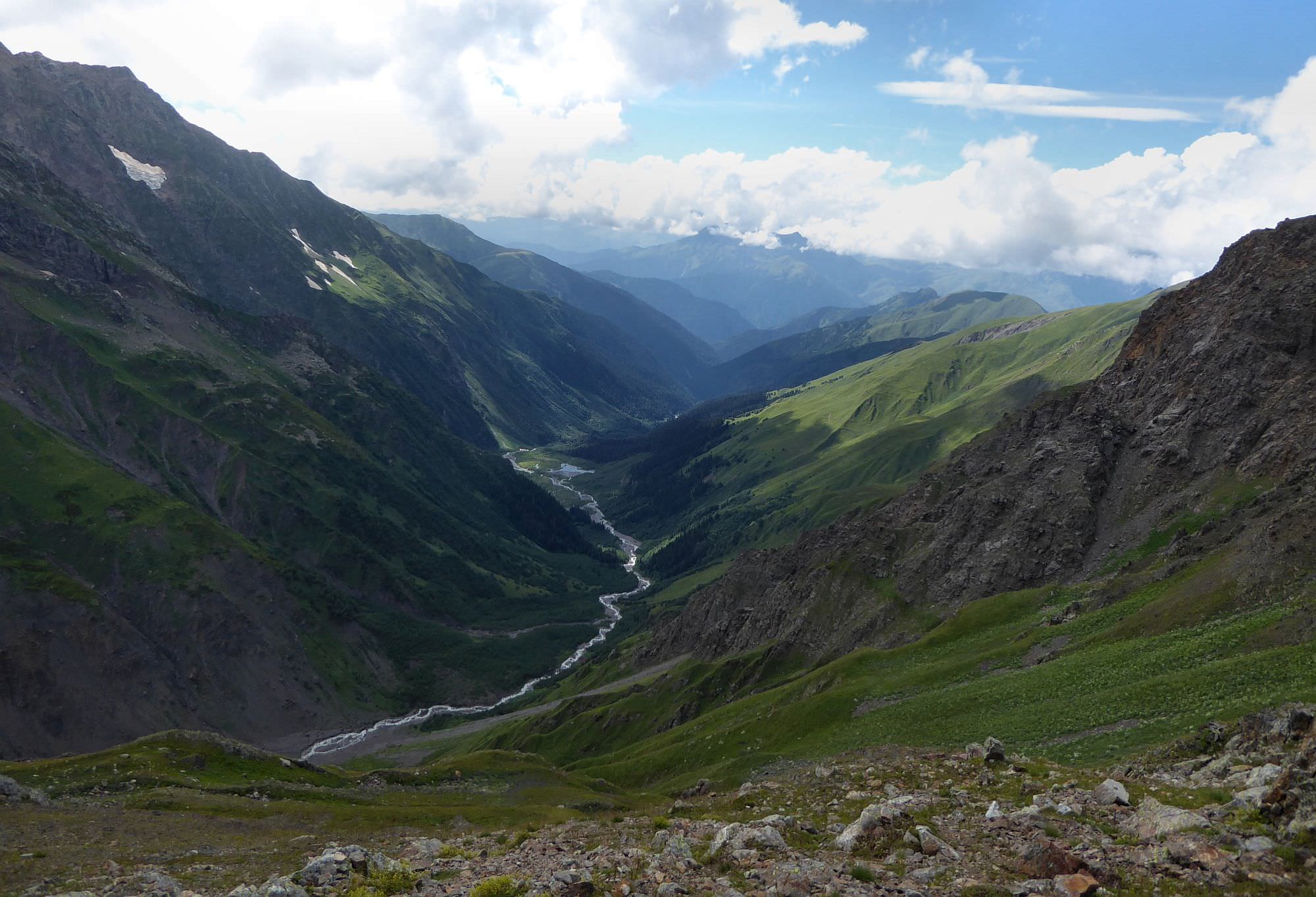
Chizdhi pass lies at the elevation of 3100m. It consists of two adjacent ridges separated by a small gully. Descend into the gully and traverse it to the south, until the trail leads you onto another mound. From here, it heads down across a quite steep hillside.
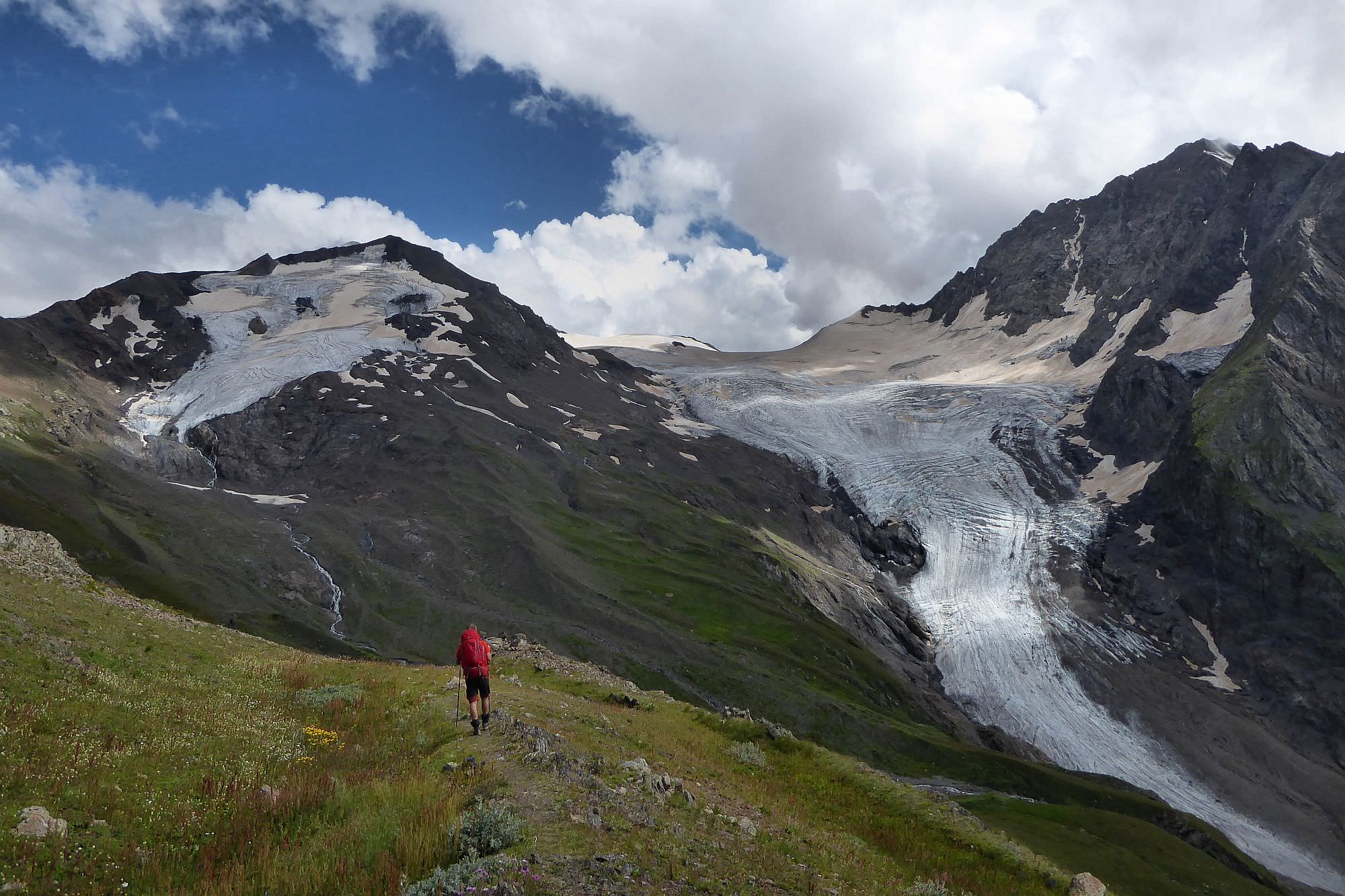
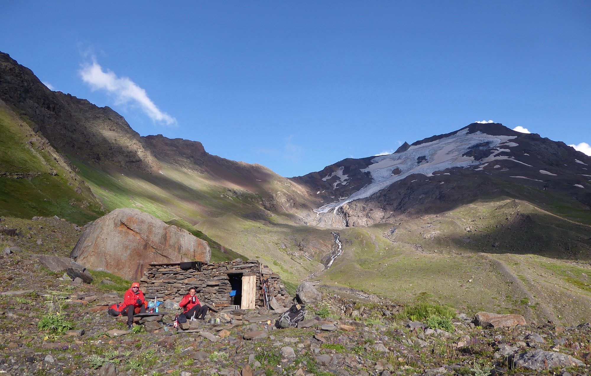
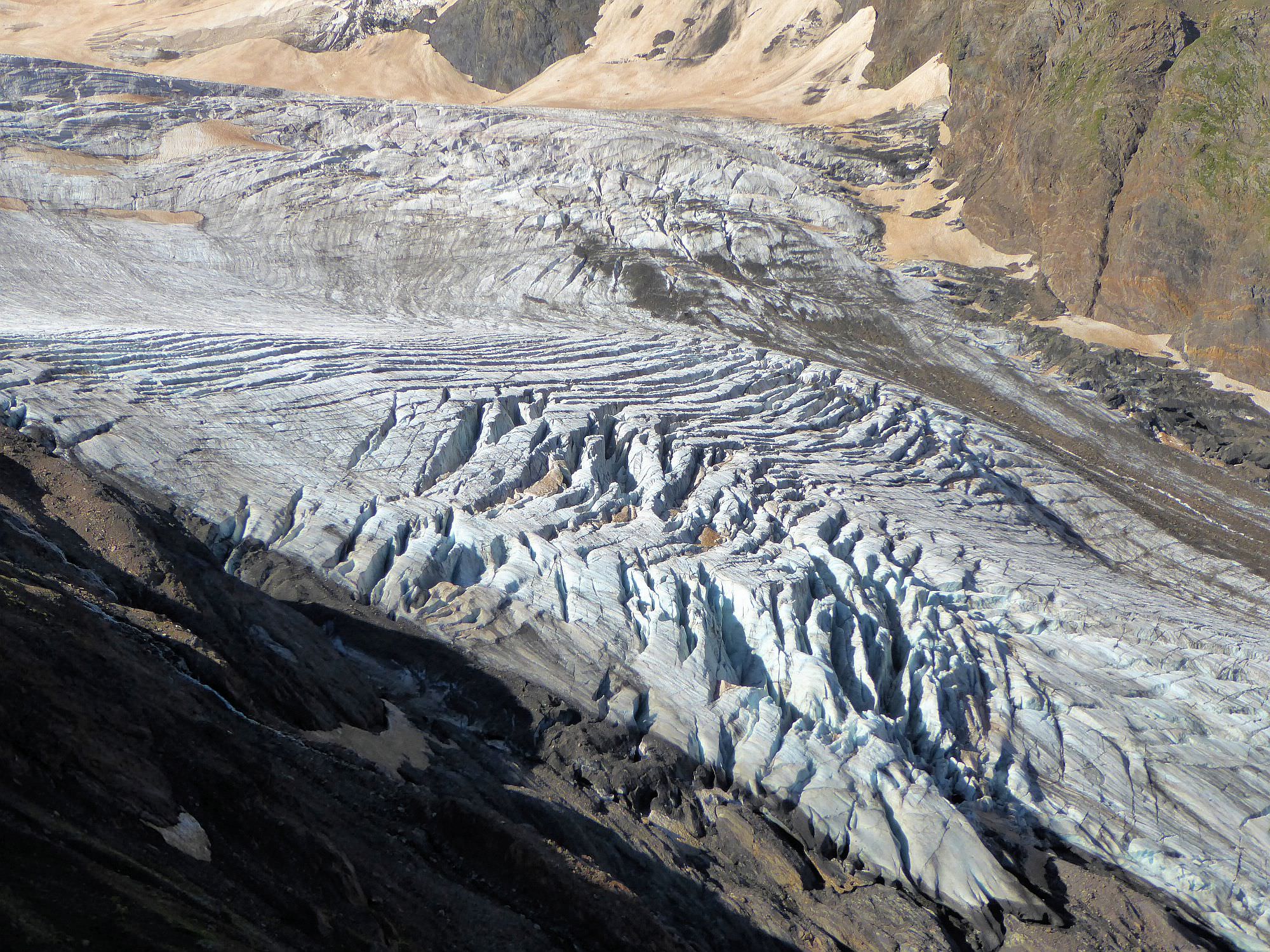
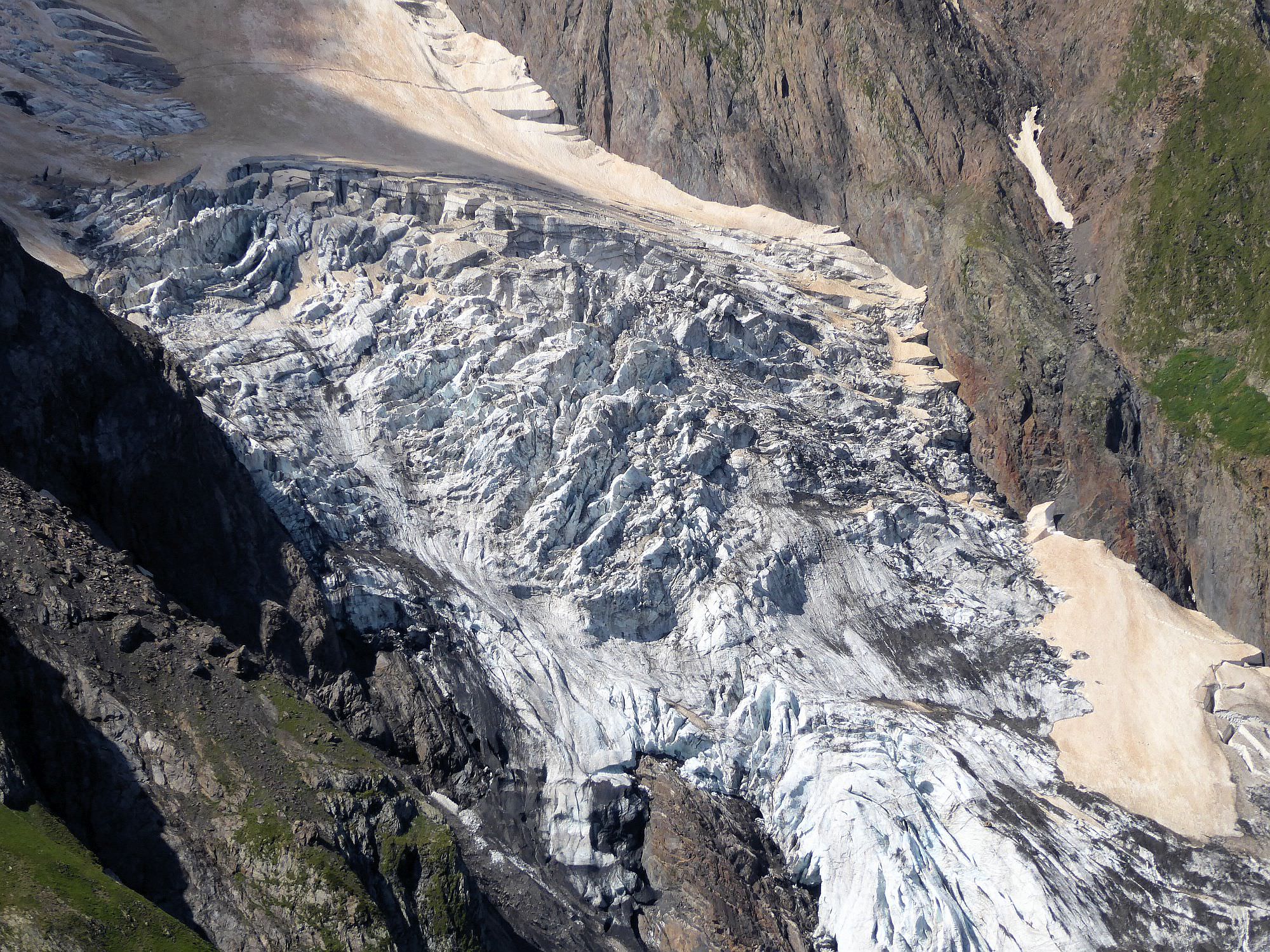
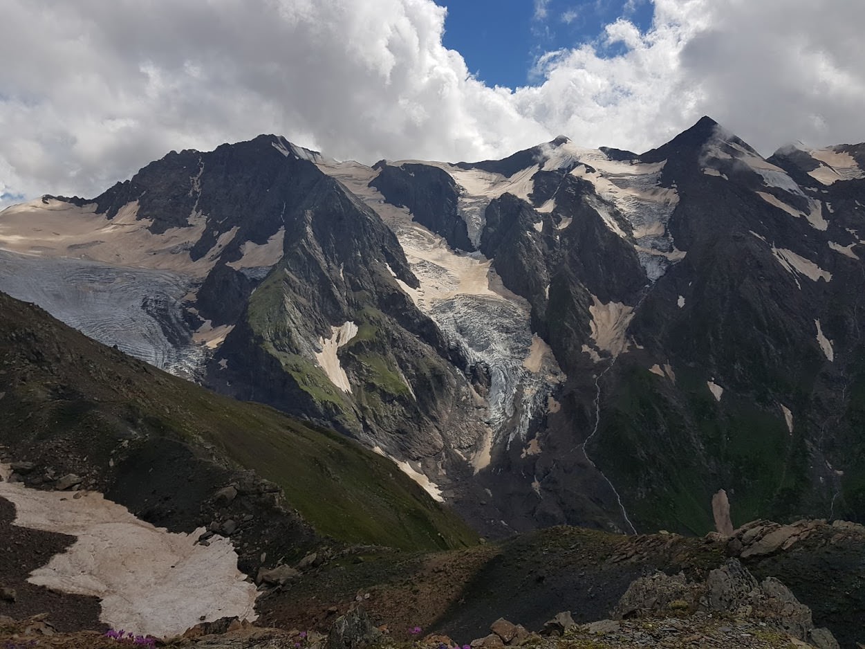
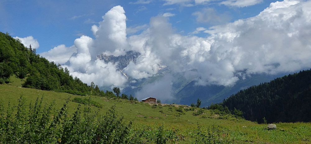
The Laila base camp gets into sight about halfway down, once you get around a rocky outcrop. Just follow the trail and once the terrain ahead starts rising ahead, turn right and descend right to the campsite (elevation 2850m). The location is very interesting since you are camping above the foot of the glacier. The surrounding is stunning - you can admire not just Laila and the glacier, but also numerous icefalls and other ice formations covering the surrounding mountains.
The "Base Camp" consists of two campsites separated by a small ridge. You can find here also several stone shelters - most of them are ruined but one of them is quite large and clean. In the morning, you can hike to the glacier, then break a camp and return the same way you arrived.
If you want to do this trek in three days, you can camp at the plateau at 2600m (or at the shelter at 2200m if you started late). Then, on the day 2, cross the pass, reach the Basecamp and hike lightly to the glacier. On the Day 3, you can return to Tviberi.