Nice day trip, exploring the upper reaches of the Dolra valley
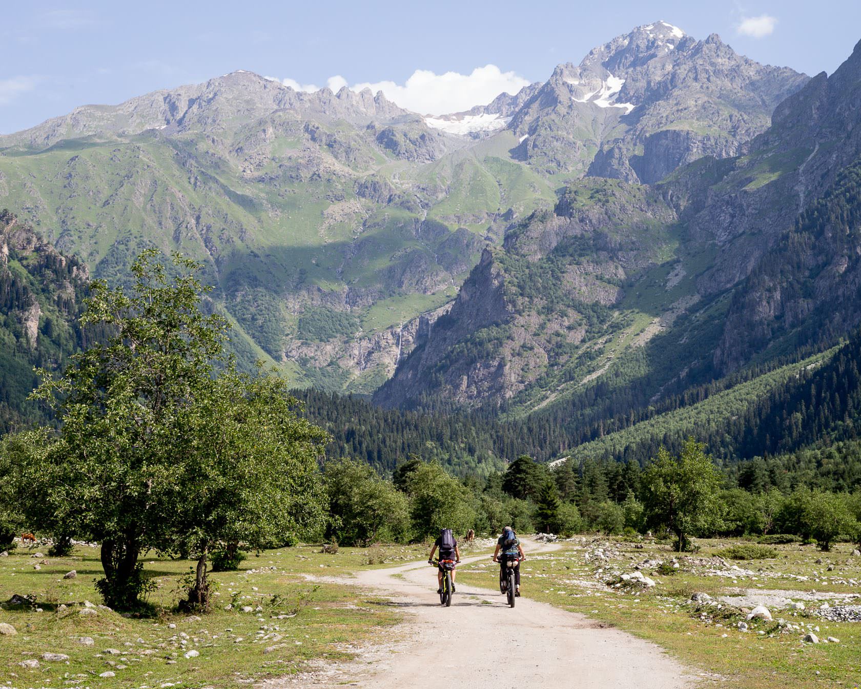
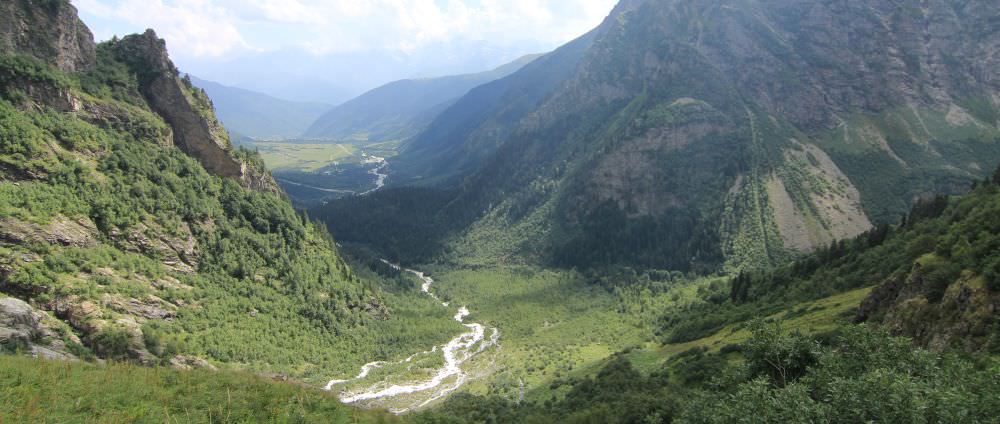
This nice day trip explores the upper parts of the Dolra valley. The good thing is that you can adjust it according to your preferences and a fitness level. If you want to take it easy, your destination will be Shdughra waterfall, the highest in Georgia. And if you want a challenge, you can reach the Ushba glacier lying 600m meters higher. But either way, you should have a good time - the views of the mountains are really nice.
Just one more thing - the area lies close to the Russian border, so better bring your passport. They usually don't ask from daytrippers but one never knows.
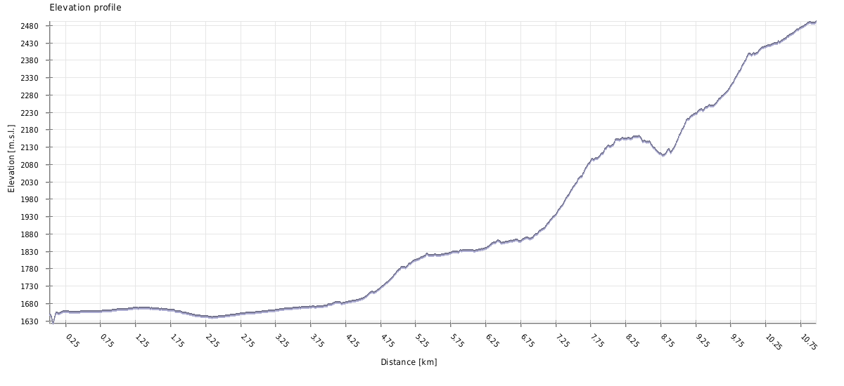
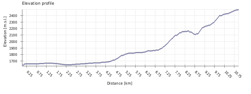
Over 5 hours of walking to the glacier and more than three hours back. If you want to reach only the waterfalls, it´s some 5 hours in total.
The hike to the glacier is definitely Hard. There are 22 kilometers to walk with elevation gain over 1000m up. Also, some sections of the trail are steep, exposed and require caution. And there is one, possibly tricky, river crossing.
If you plan to reach the waterfalls, none of the above applies and the hike is of Moderate difficulty (17 km, 500m up and down).
There is no public transportation to Mazeri. The closest road served by marshrutkas lies 7 kilometers away, at the mouth of Becho valley.
So, while you can take the morning marshrutka from Zugdidi to Svaneti and tell a driver to drop you at Becho community, it's not too convenient. A preferable transport, apart from walking, is the taxi, most easily arranged at Mestia. The ride will costs you some 80-100 GEL. If you want to take a taxi to Mazeri from Zugdidi, it will easily cost 300 GEL.
There are also are two nice day walks connecting Mazeri with neighboring villages - Mestia and Etseri.
There is no public transport to Mazeri. The closest road served by marshrutkas lies 7 kilometers away, at the mouth of Becho valley. Therefore, you may have to hire a taxi, either to the main road or even to Mestia, if you want to catch marshrutka. The price of the ride to Mestia starts at 80 GEL (but can be also much higher, depending on the driver, situation and the level of your desperation).
There are also are two nice day walks connecting Mazeri with neighboring villages - Mestia and Etseri.
| Distance | 21,2 km |
| Trail type: | Roundtrip |
| Max. elevation: | 2492m |
| Min. elevation: | 1639m |
| Total climb: | 1123m |
| Total descent: | 1123m |
Before we start, let´s clarify one thing - there are two ways to cover the first half of the trail. A shorter route follows a new road built on the east bank of the river and uses the bridge deeper in the valley. The problem is, that this bridge gets occasionally destroyed by flash floods - so consider this route only if locals confirm that it stands. The route described below follows the western bank and should be passable under all circumstances.
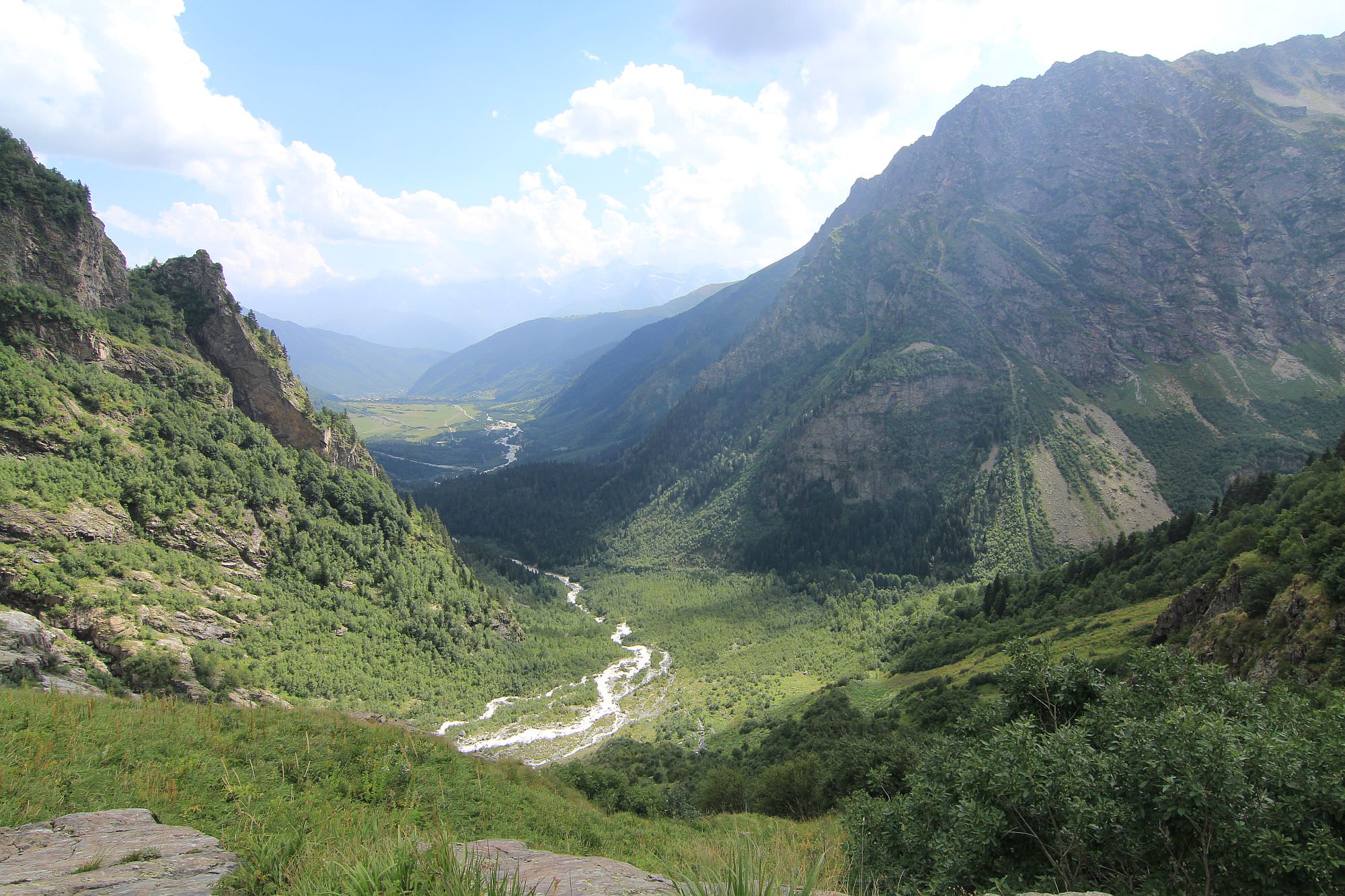
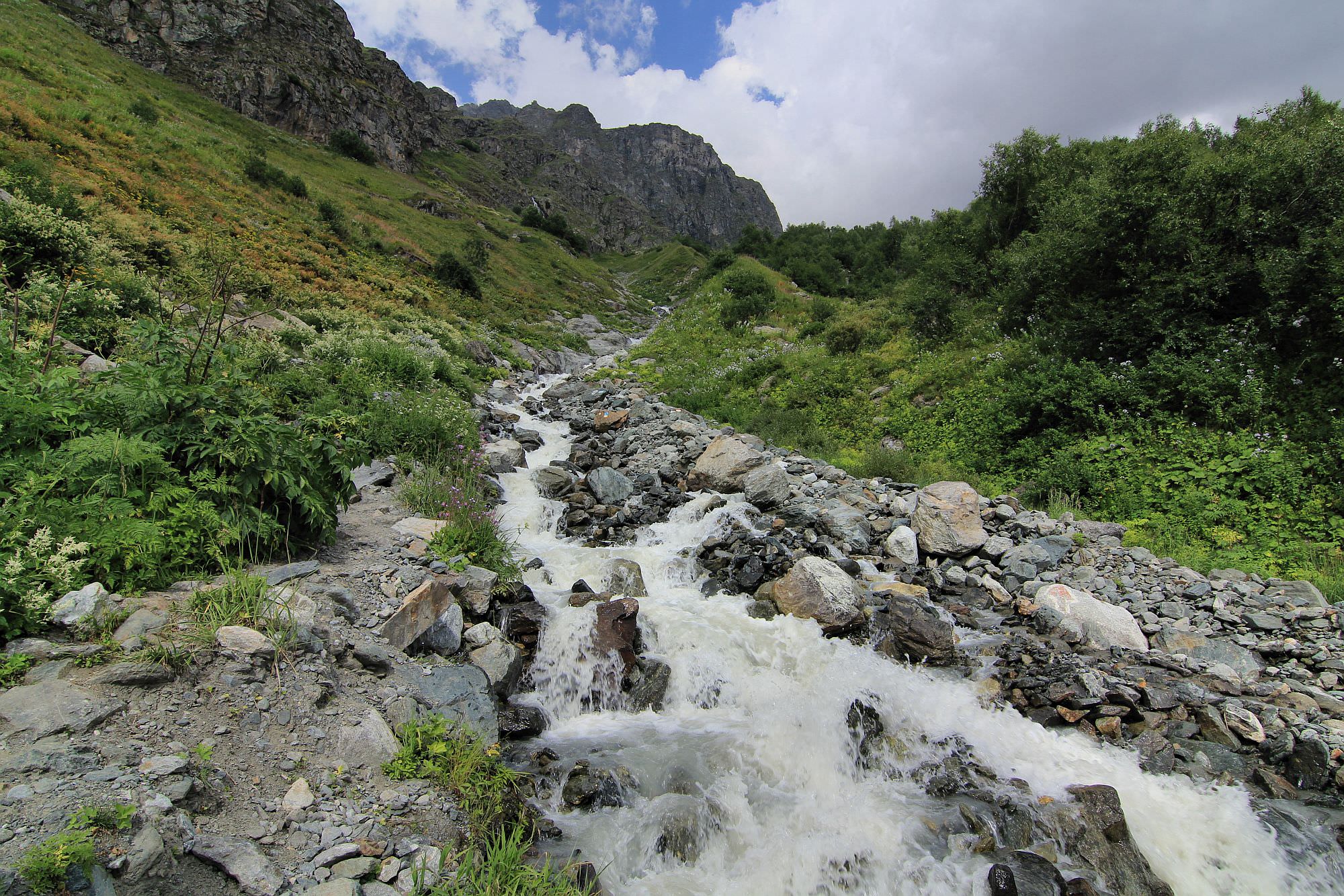
The trail begins at the center of Mazeri village and heads to the west - it´s marked by white/red rectangles. Soon, you will need to cross a large bridge over the Dolra river and then turn right. Then it turns right and follows the old road past some farmhouses and a small chapel dedicated to St. Michael. It also crosses a subsidiary of Dolra river - the cars just drive through but if you don´t want to get wet, look for a footbridge hidden in the forest, some 20 meters to your left.
Some 4 km from Mazeri, you will come to another bridge over Dolra (if it stands) - this is the place where the eastern and western route reunite. Nearby stands "Hiker´s café", the only place to get some refreshments on the trail (apart from places in Mazeri). Right behind, there is another spot where you need to make a small detour from the road and use the bridge to cross another subsidiary of Dolra.
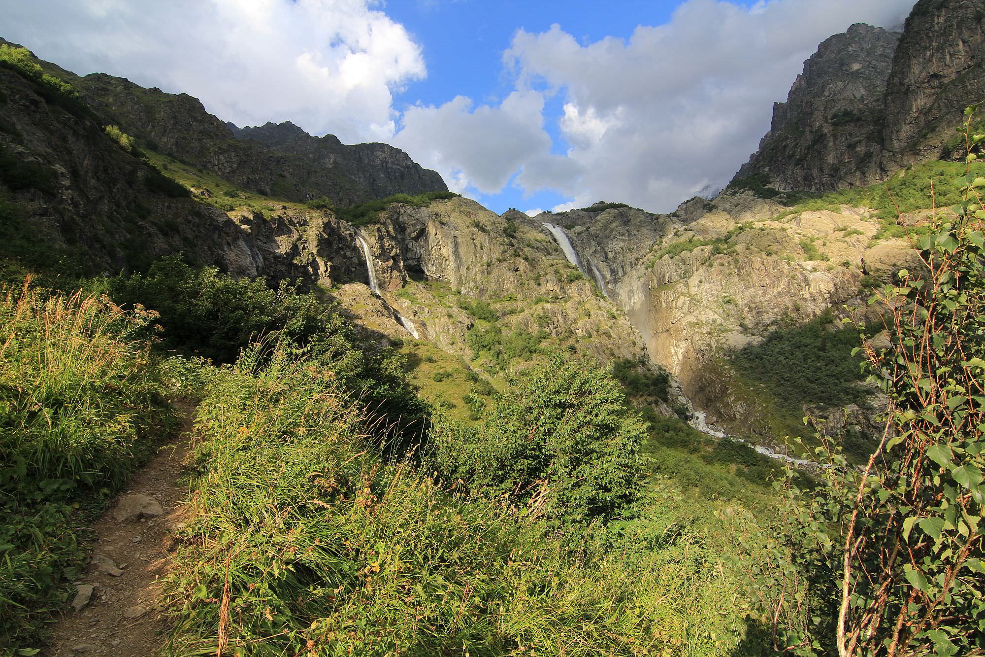
Soon after comes short but quite steep climb, you will need to cover some 150 elevation meters. At these sections, the road enters a beautiful pine forest and turns into a pleasant footpath. It will eventually lead you to the broad wooden bridge. At the other side lies the Georgian border guards post. Soldiers may want to check your passports, tho the chance is quite low.
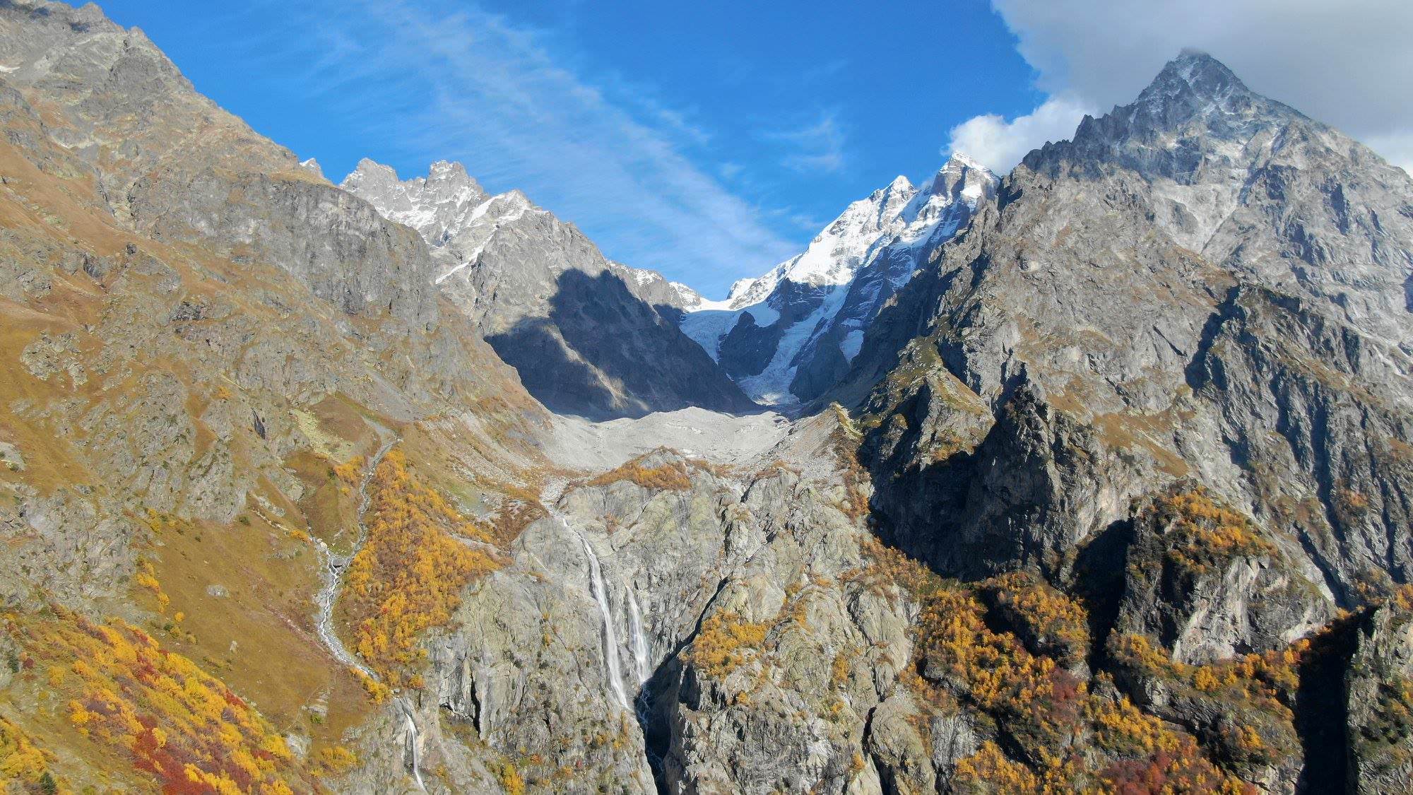
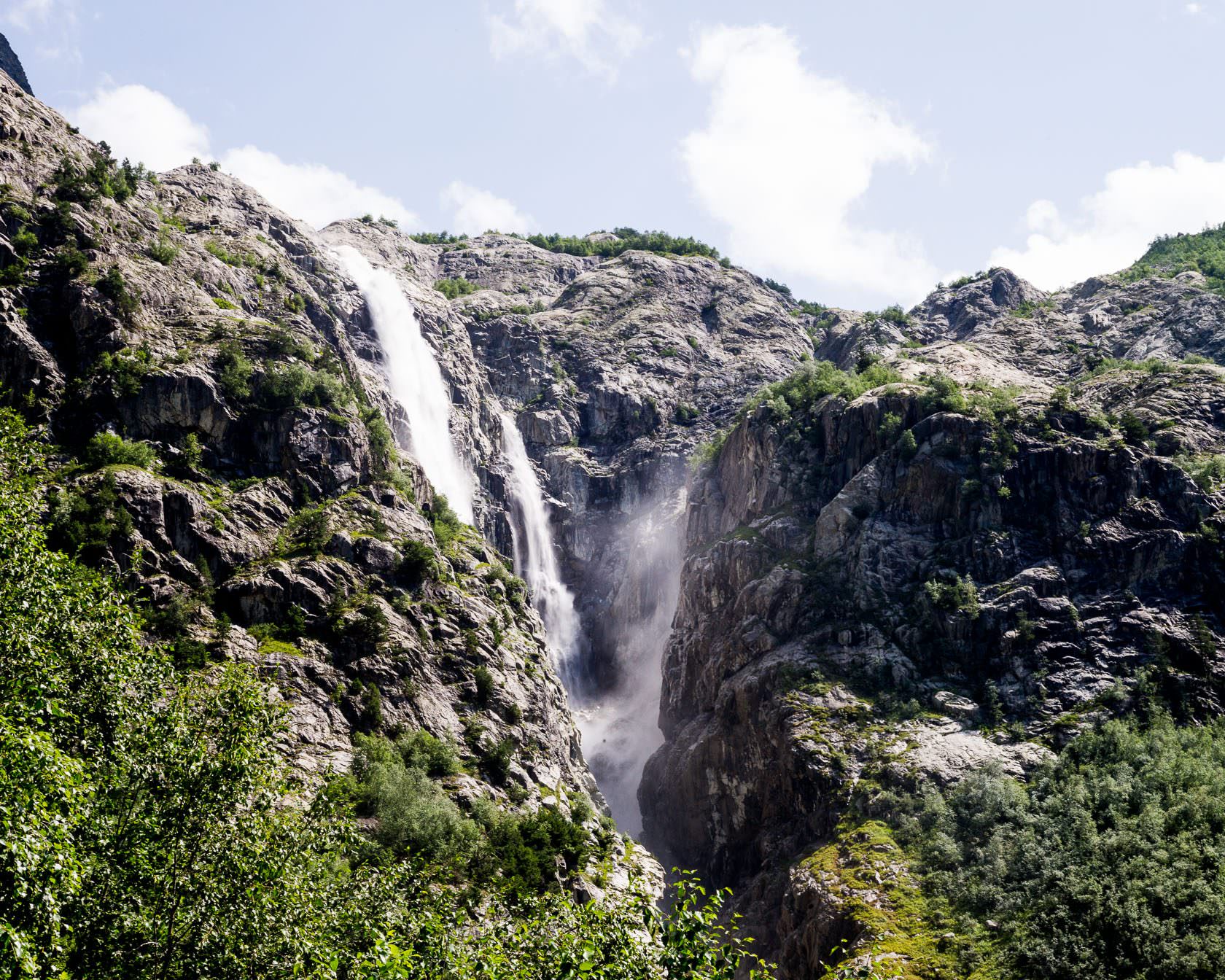
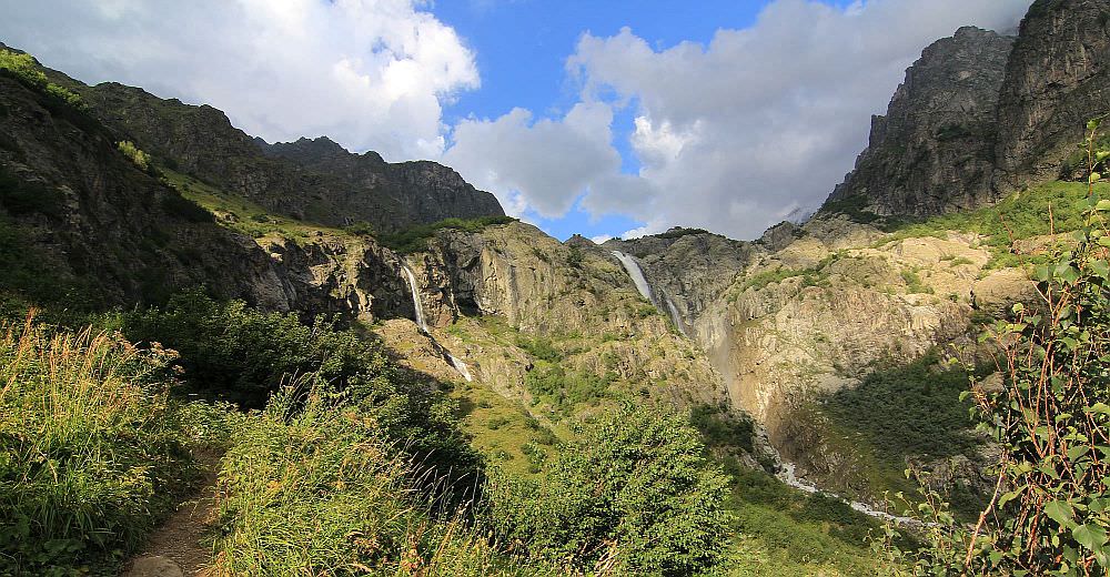
Behind the camp, the trail climbs again through the forest. At its end is the turn-off to the Shdughra waterfall, the easier one of two destinations of this hike. The distance to the viewpoint beneath the waterfall is only 300m so it´s worth doing even if you are going for the glacier (maybe on the way back).
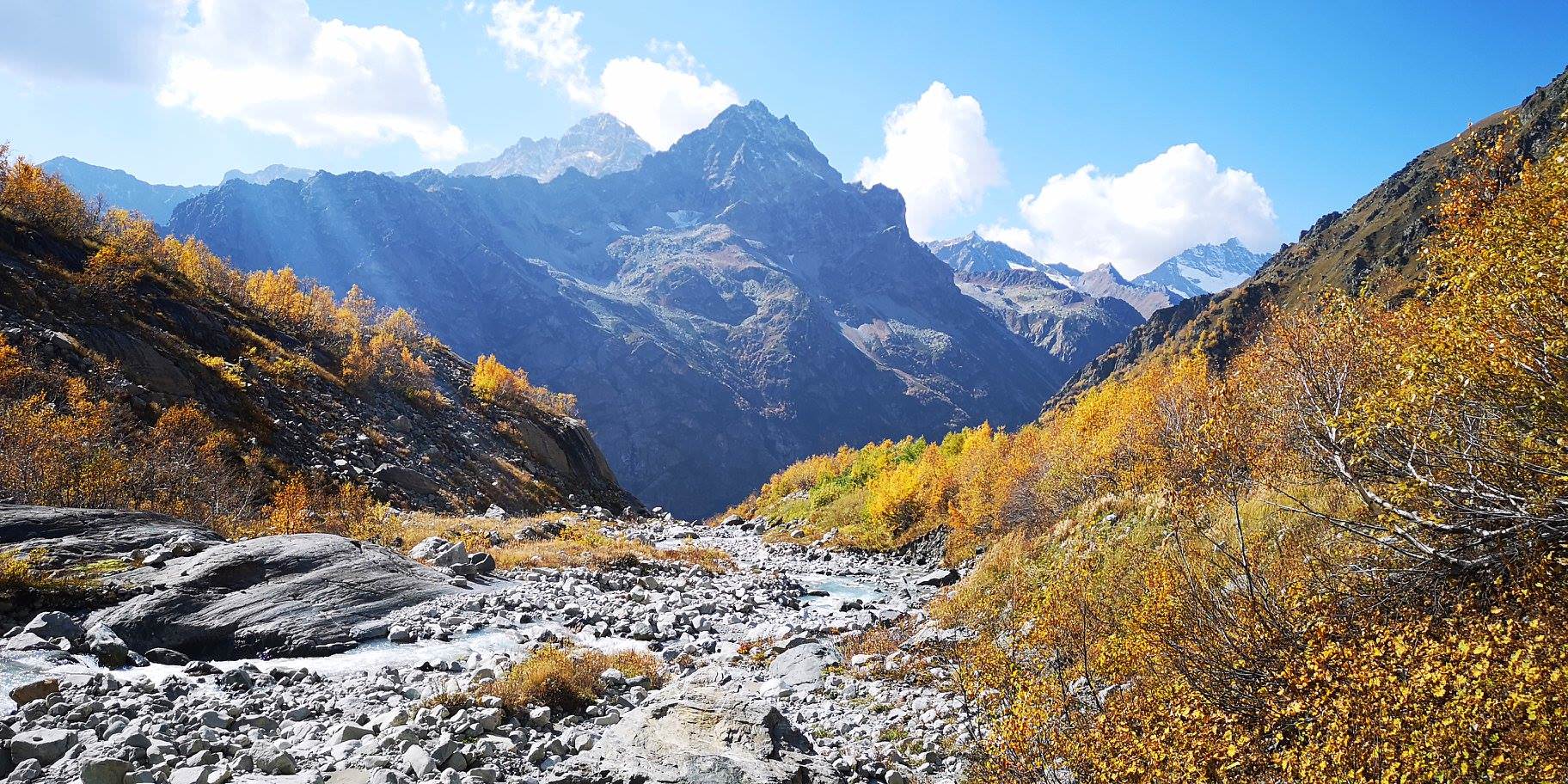
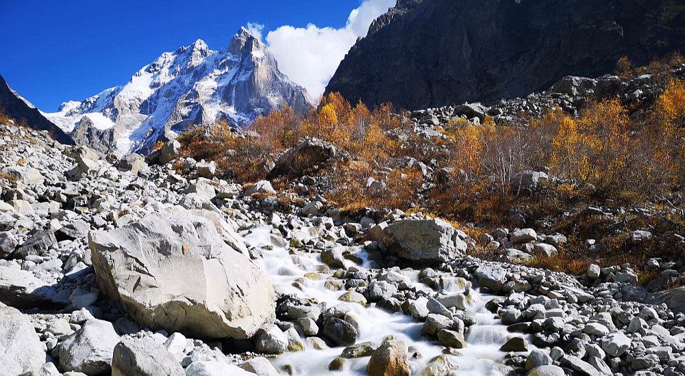
If you plan to climb to the glacier, stay on the larger trial which follows the top of a small elevation between the Dolra valley and a rocky depression (it probably turns into a creek after rains). It soon turns left into one of the hardest section of the hike - a very steep climb on a slippery trail (soil mixed with small stones). You need to climb only 120 elevation meters but the terrain is really bad. If you have hiking sticks, they will come very handy here.
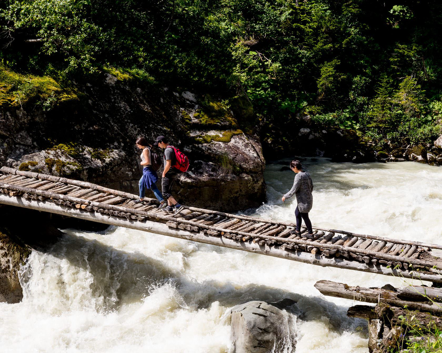
At the elevation of 2220m, the trail turns sharply right and starts traversing the hillside. It goes through the young forest, is narrow and sometimes obscured by branches so also this section requires the utmost care. Then you will reach another tricky spot - a crossing of the river which forms a smaller of the waterfalls. It can be a bit menacing, probably the best spot is marked by the stone cairns.
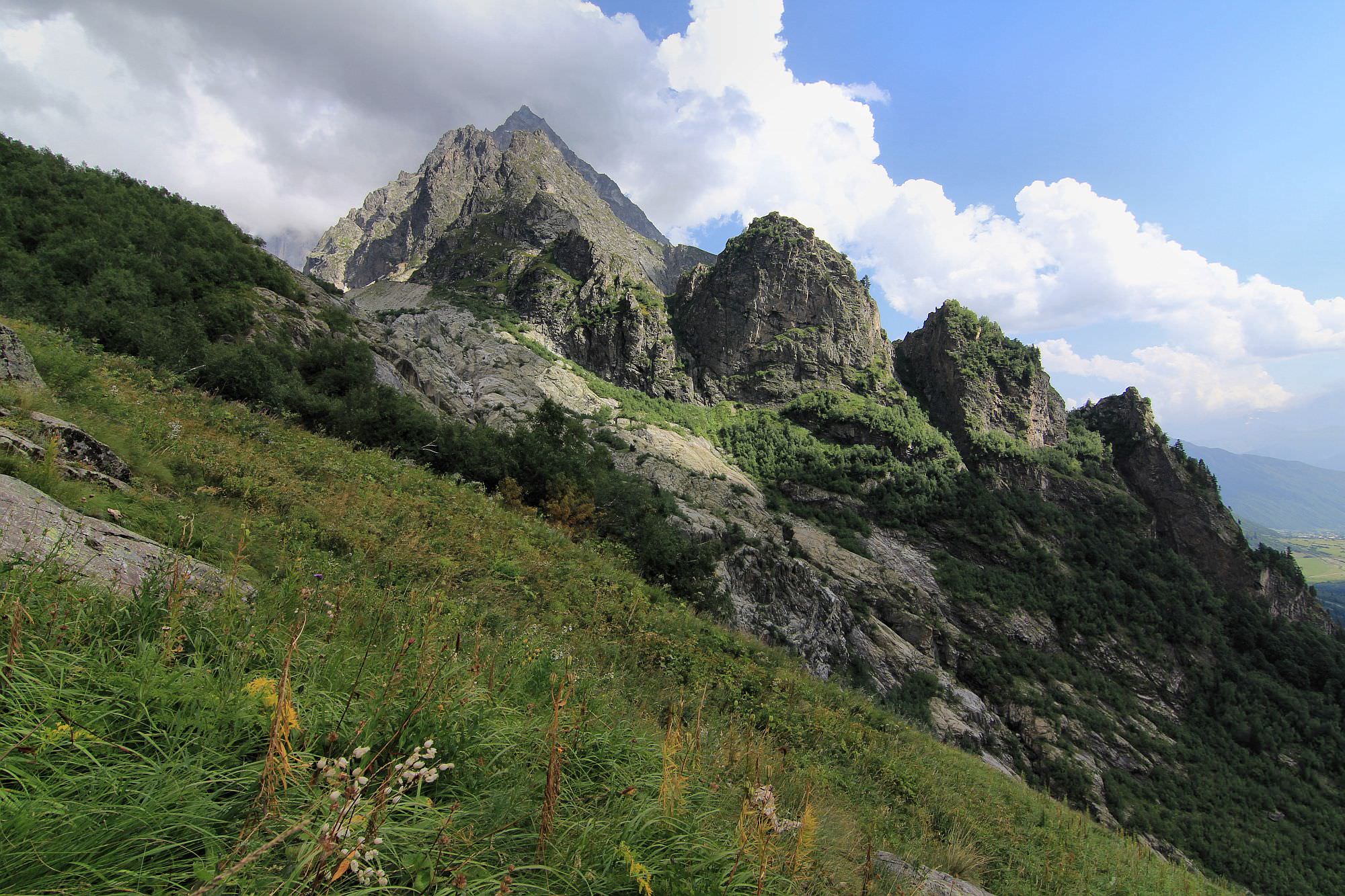
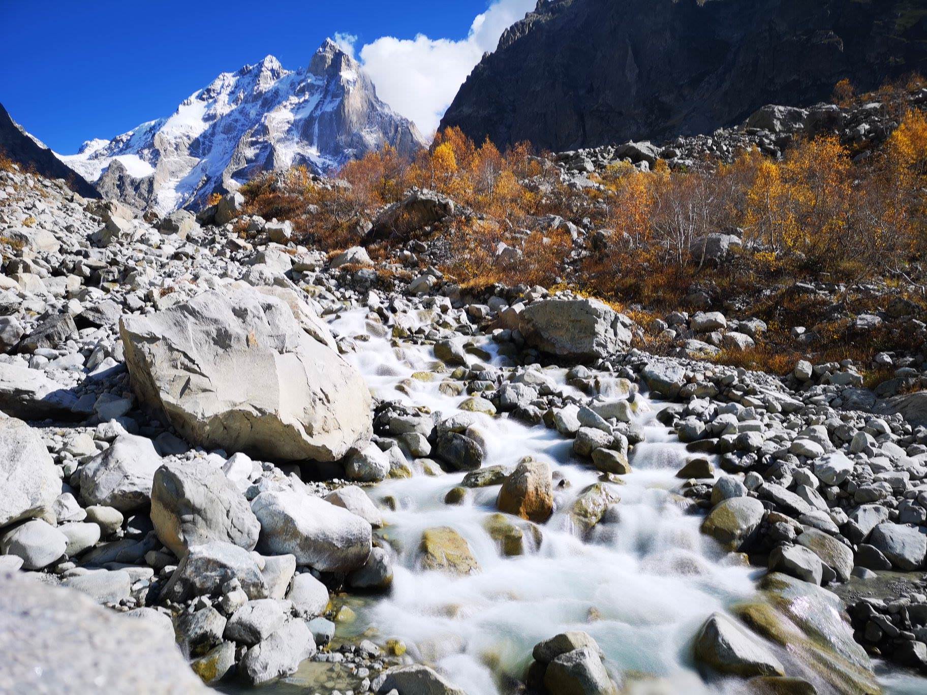
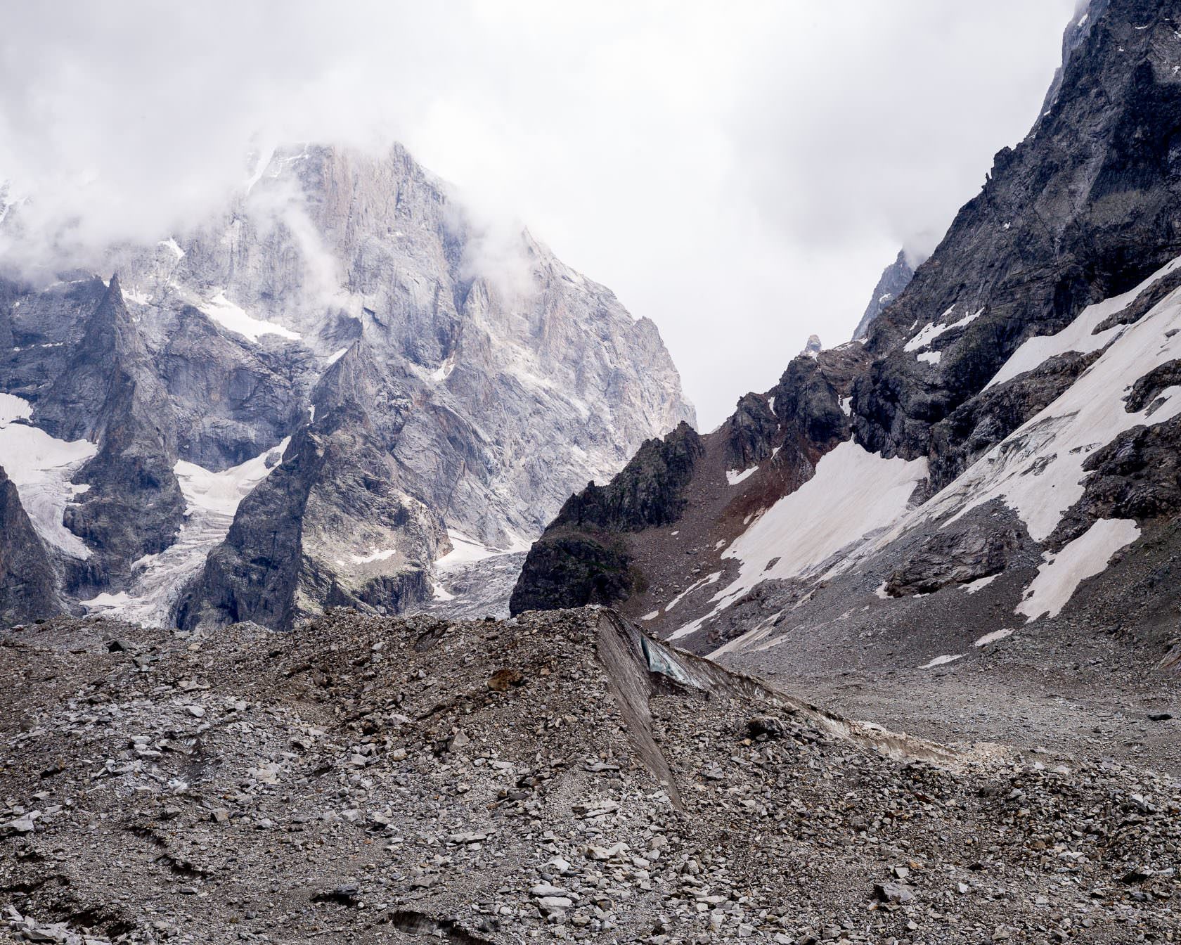
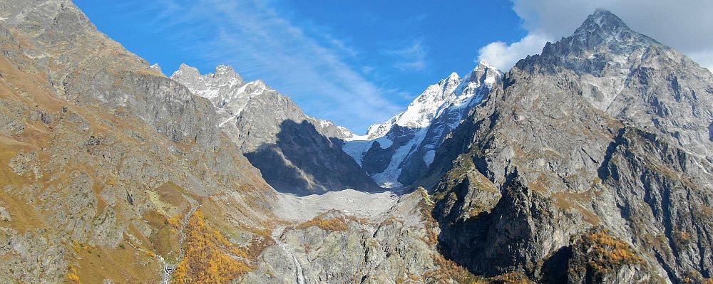
Once at the other side, cross another thicket and reach the beginning of the rocky moraine. Now you can see the glacier (and, hopefully, also Ushba ahead. The surrounding mountains are just as impressive - you should be able to see Mt. Shelda (4 368 m) on the Georgian-Russian border to the north and Mt. Mazeri (4 010 m) to the south.
Just remember that falling rocks present a real danger and the past killed or maimed several visitors. The best recipe to get hurt is to come as close as glacier as possible, then turn around and start posing for photos. So take care and once you are rested, return the same way you arrived.
Mazeri is, from the hikers perspective, the best village to stay at since it provides the best access to the hiking trails. Of the numerous guesthouses in the village, these are some of the better ones
Lia Jamdeliani´s guesthouse - traditional homestay established in the old house at the center of Mazeri (location on Booking.com is way off). Rooms and beds are quite basic, but this place is still a very pleasant - it has a nice, laid-back atmosphere. Moreover, the food is very tasty and abundant. The house is inhabited by friendly 3-generational family. When we got there, they were fully booked but offered us at least dirty, unused room at the upper floor (with a discount) with an option to move to the normal room on the next day.
Guesthouse Shuan - modern, very pleasant guesthouse at the southern edge of Mazeri village, close to the mineral springs. Malkhaz and Rita are wonderful hosts and in spite of looking new, the place has still retained its "family atmosphere".
Grand Hotel Ushba - first just one clarification, the name is a bit misleading - this is rather an upscale guesthouse. It is located few hundred meters north from Mazeri village which adds to the sense of isolation. Overall, it provides higher quality compared to other Mazeri guesthouses, but also for a higher price. It´s main assets are good food, nice rooms and very comfortable beds. And, of course, it´s co-owner Richard. This Norwegian academic knows about Svaneti more than you will ever need to know - if he is not around, check at least his books :).
Mila guesthouse - traditional Svan guesthouse known for terrific, homely-grownd food. Ladies running the guesthouse are very kinddly and while they don't speak English, with mutual effort, there is no problem with communication.
Phones were provided by Radovan Bieleny, Vix Balaz, Daniel Wakefield Pasley and a few of them are also mine. Also great thanks to Willem van der Bilt for corrections of the text.