Trek crosses remote Khde valley and offers splendid views from 3500m high Kibishi pass.
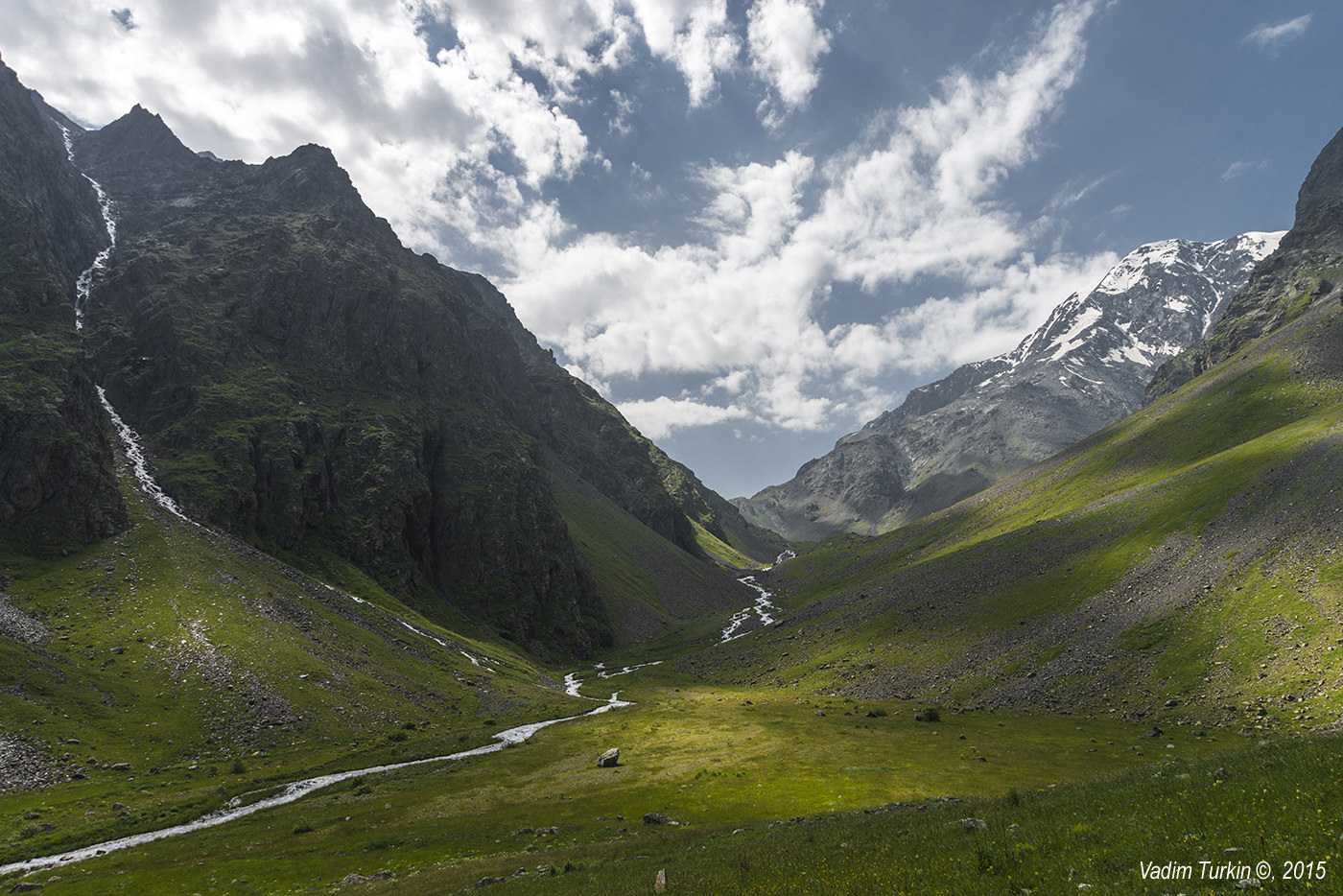
This route connects Darial gorge with Juta village. It crosses the beautiful, wild Khde valley with several waterfalls and offers splendid views from the 3500m high Central Kibishi pass. Even though it lies in the close vicinity of Kazbegi, it´s almost unknown to the broader public. The reason is its difficulty - to get to the Kibishi pass, it´s necessary to cross the glacier (more on that below). Therefore, this route is certainly not recommended for beginners.
Trekkers willing to explore this beautiful valley can either make a return trip to the Kuro ridge or turn west below the glacier and cross LeraKT pass to Sno village. Or, if they want to avoid the glacier, climb the Western Kibishi pass instead - from what I heard, it's a bit easier than the central pass.
Just keep in mind that even though you don´t need designated equipment for these alternative treks, they are still quite hard and not recommended to beginners.
Trail navigates the overgrown Khde gorge, but the main obstacle is Kibishi pass - to reach the pass, one has to cross the small glacier, and even though it’s stable and not steep, great care and crampons/microspikes are recommended for the crossing.
You will have to carry a tent.
There is no public transport to the Dariali gorge, so you will have to hitchhike or take a taxi. It should cost you no more than 40 GEL (50 at most) and the drive takes up to 30 minutes.
You will need a car to get out of Juta. Luckily, especially in the afternoon is the small parking lot at the beginning of the village full of taxi drivers. So you should be able easily able to find someone willing to drive you to Kazbegi - the usual price is 40-50 GEL.
If you are really low on cash, you can also prolong the walk and get to Kazbegi on foot, it takes 4 to 5 hours and Juta valley is quite nice (at least for the first 2 hours).
To hike in Khde gorge, you need a permit. You can obtain it from border guards at the Dariali gorge border crossing (some 300m north of the mouth of Khde river). Deeper in the valley there is another border post,
but guards there don´t issue permits and may send you back if you don´t have one.
Getting the permit at the border may be problematic if you don't know where to look - only few people go hiking to Kibishi which means that people working at the customs building might be dumbfounded by your request, not sure what you are even talking about (personal experience). You need to get to the administration building, but it is not easy to find. You need to find an unmarked dirt road on the left, starting some 100 meters before the customs building, by some cargo insurance offices. It immediately turns right, so you will pass the customs building, but don't worry, you are not taking a backdoor to Russia. Soon, you will pass some power substation and an office building with red roof is right behind it. Jump over the small stone fence, walk around the building and enter by the front door. As I said, it is not too intuitive :)
Here, all goes smoothly, local officers are friendly and know what to do. You just need to look fit and experienced and they should pose no problems. This paperwork will take 20 minutes or more, depending on the size of the group - combined with the fact that the office is open from 9:00 till 17:00, you might want to arrange everything a day before so you won't face delays on your trekking day.
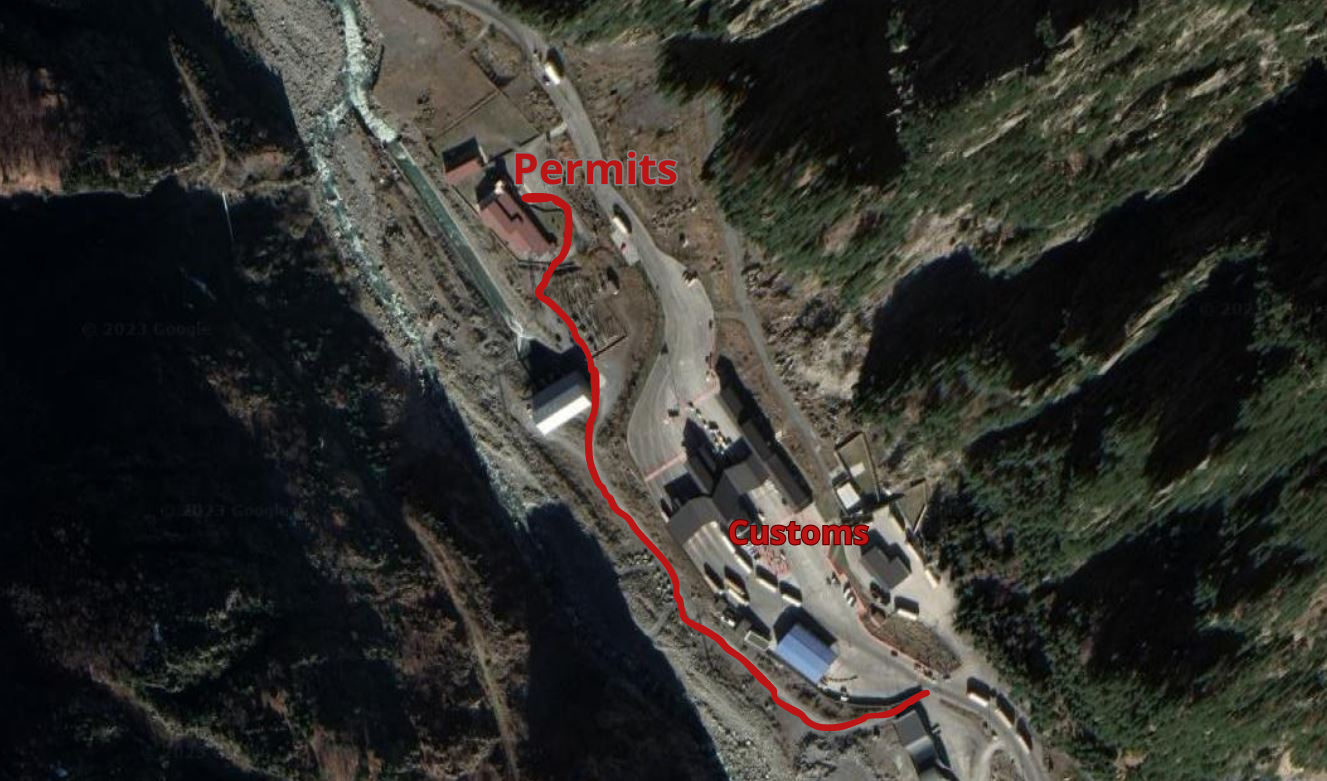
Route to the administrative building at the Dariali gorge border crossing
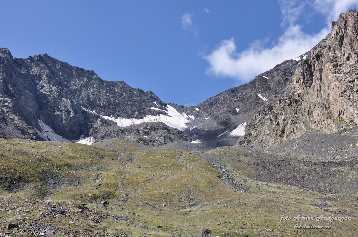
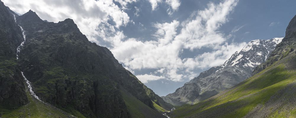
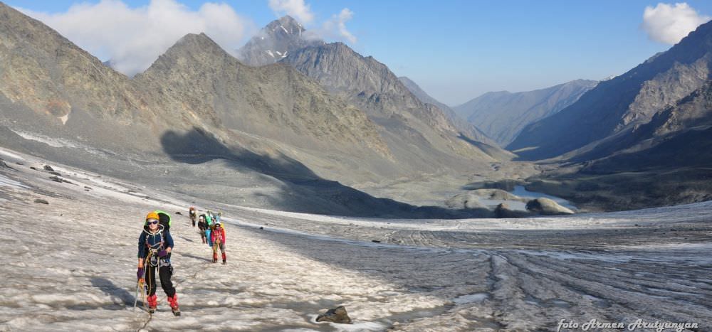
Central Kibishi pass ahead. Looking pretty friendly, isn't it? :)
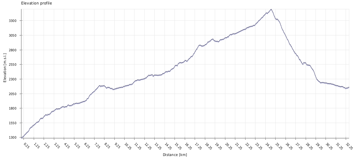
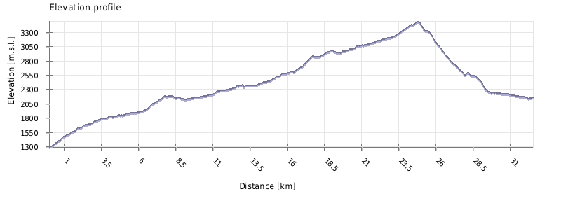
| Distance | 28,7 km |
| Trail type: | AB trip |
| Max. elevation: | 3504m |
| Min. elevation: | 1304m |
| Total climb: | 2735m |
| Total descent: | 1867m |
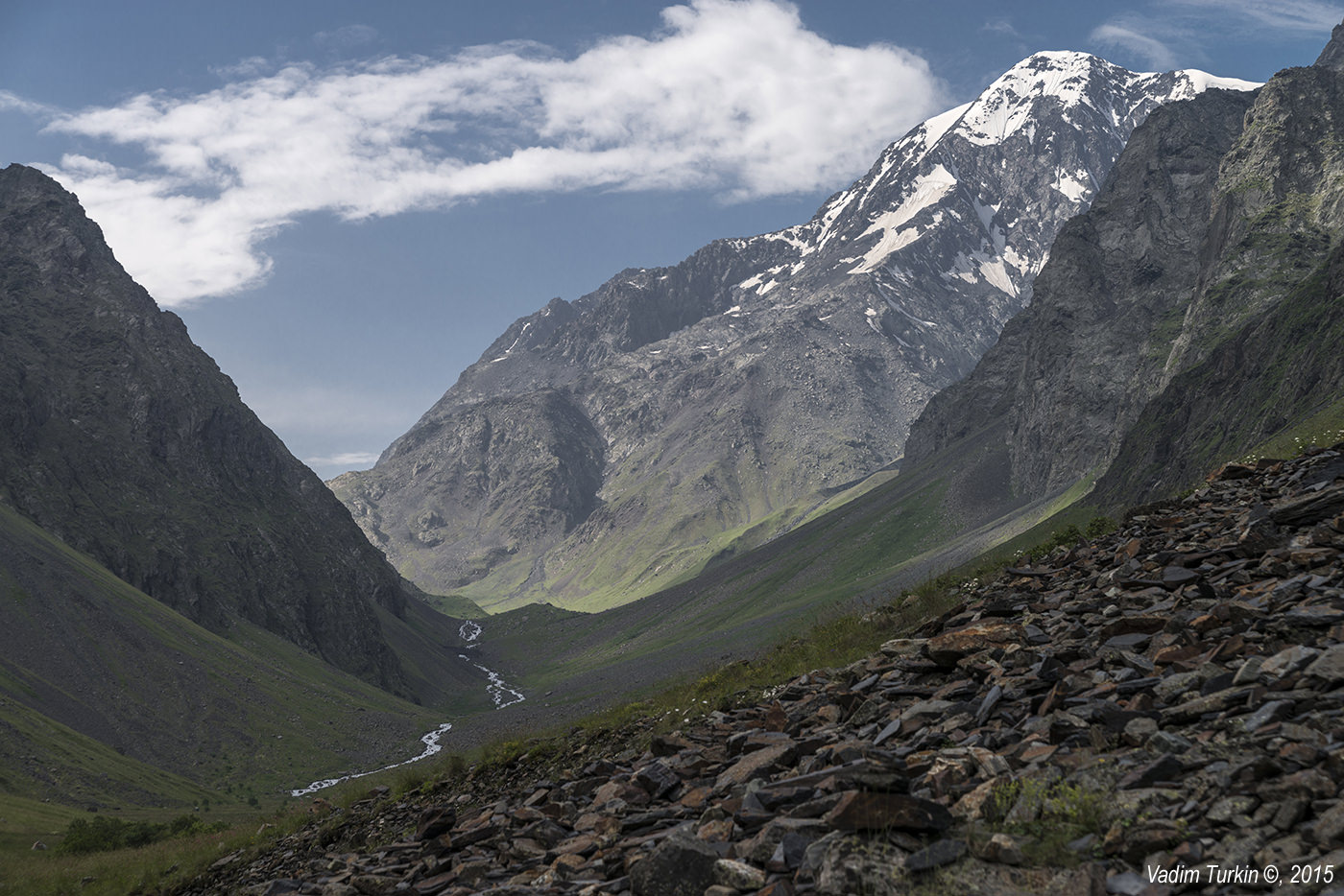
The trail starts at the elevation of 1300m in Darial Gorge, at the right bank (northern side) of Khdestskali river, in Russian sources also known as Kistinka. First, it follows a dust road and in serpentines climbs deeper into the valley. After some 40 minutes, you shall come to the "Mountain path" sign, pointing left, upwards onto a narrow rocky trail (about 100 meters before the Khde Hydroelectric Power Plant (HPP).
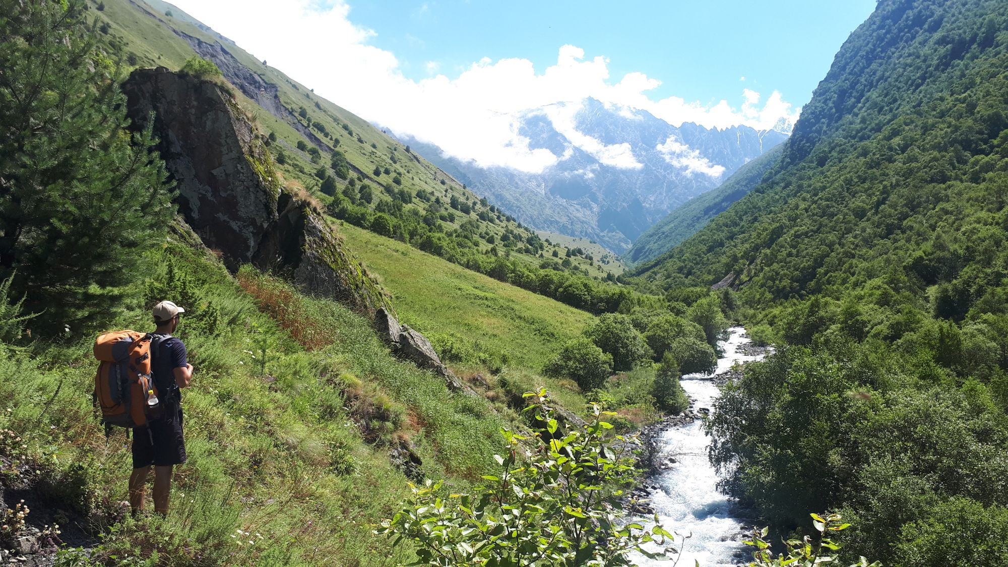
The trail steeply climbs for a while, then kinda flattens up and not much later, you will find yourself by the river again. Then it follows the river bank - occasionally overgrown, but still obvious and easy to follow.
At the elevation of 1750m trail reaches the rocky ledge which stretches all the way to the river and blocks the way. It can be crossed through a rather narrow crevice, located approximately in its middle.

Khde valley with a rocky ledge in the foreground
The next section is tricky since the trail leads onto a heavily overgrown meadow full of nettles and disappears. You have to keep following a river, sometimes finding the trail in the young forest, only to lose it again in another meadow. You also will pass several creeks with heavily overgrown sides and boggy marsh around.
For about one hour or even more, you will have to fight your way by the river. Then, you shall see that the progress close by the river is no longer possible. The northern bank is eroded, so you have to continue a bit further from it - there is a small hill ahead with a solitary tree right in your path. Climb it.
Once the terrain flattens a bit, look to your left - there should be a border guard waving at you. Make a small detour to their camp, checking permits may take some 20 minutes. While waiting, you can refill water at their spring which lies a bit downhill.
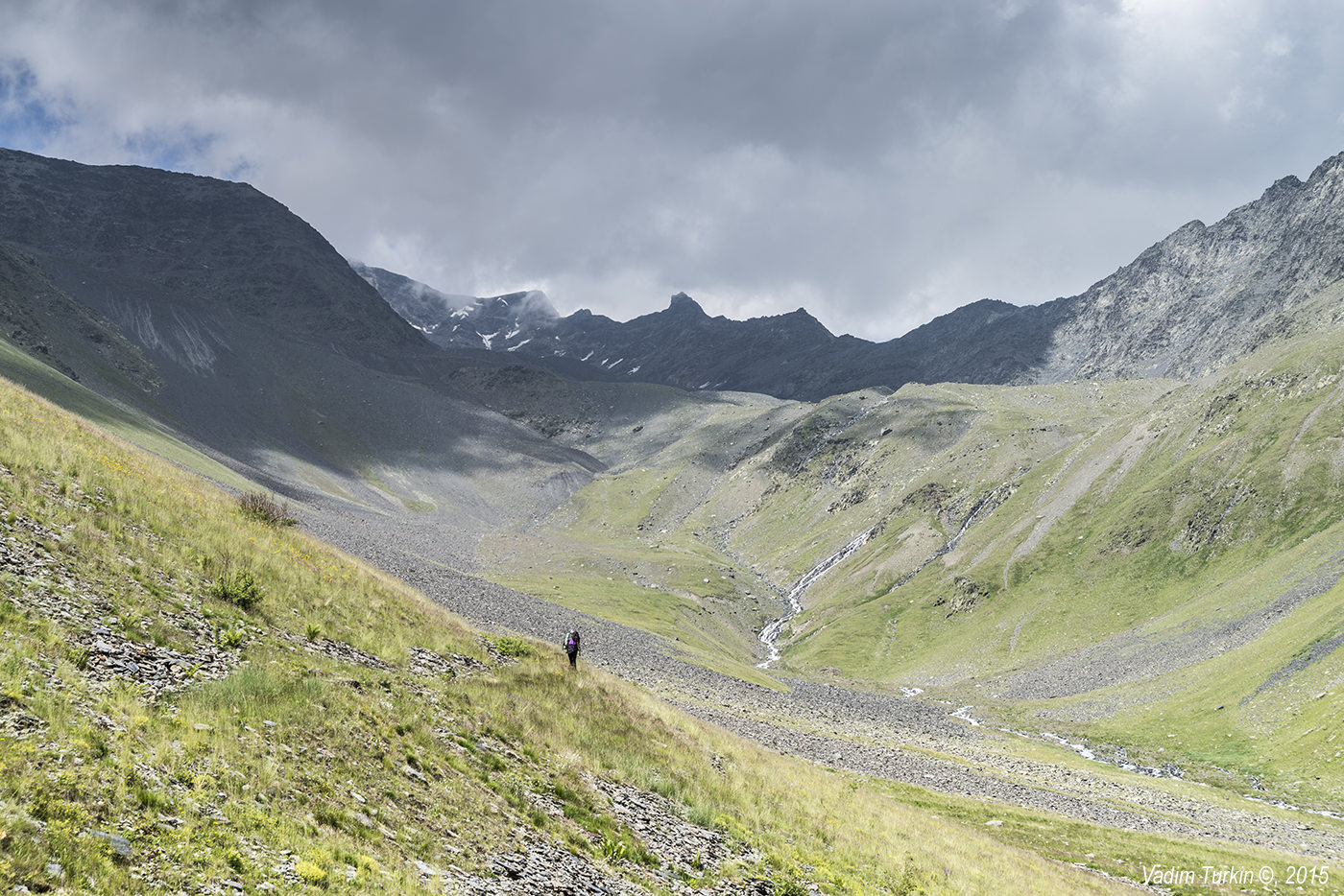
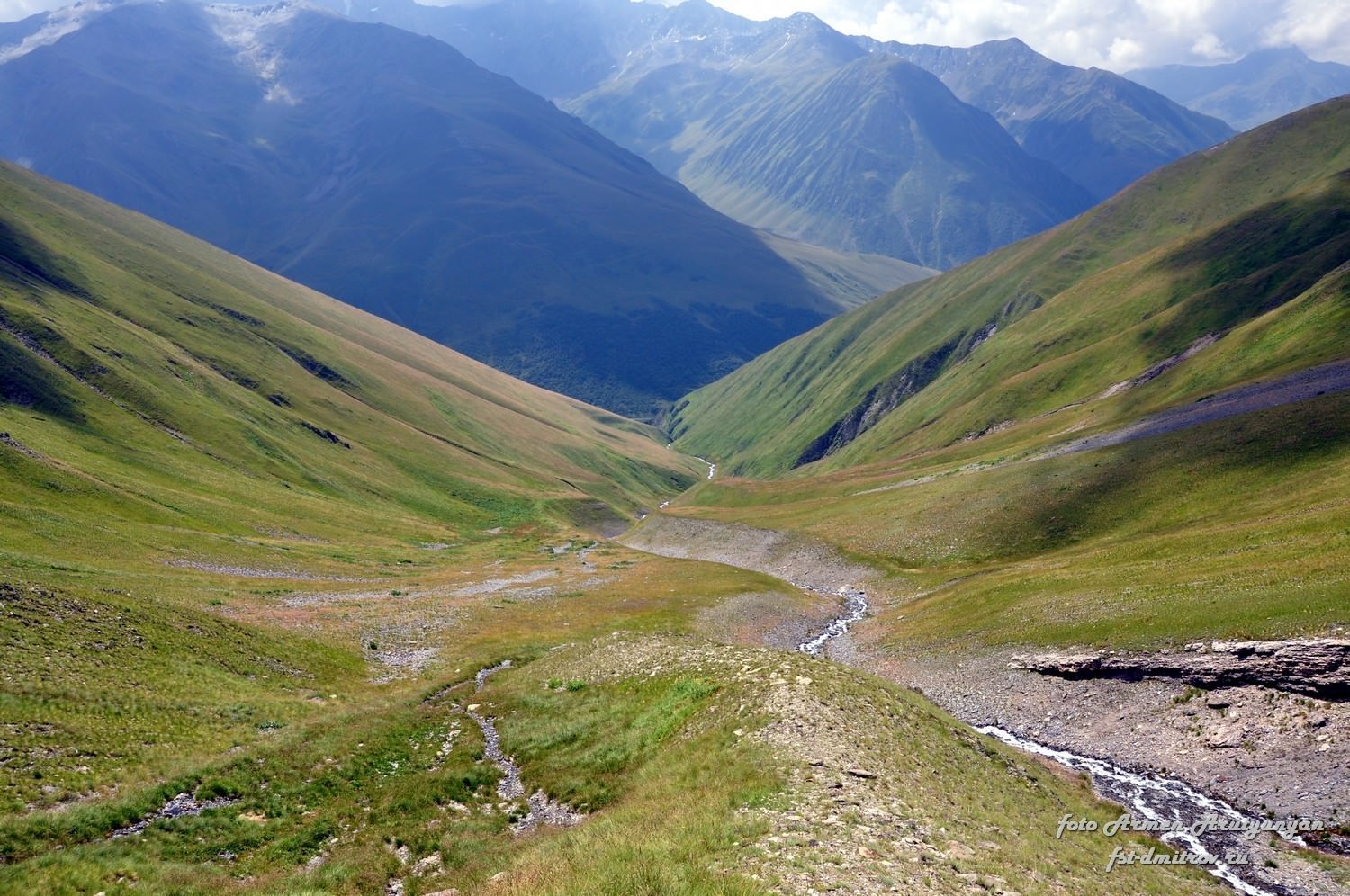
Behind the guard's post, the trail slowly descends back to the Khde riverbed. You will be walking at the bottom of a wide, rocky riverbed, which gets full maybe only in spring. The valley then turns north.
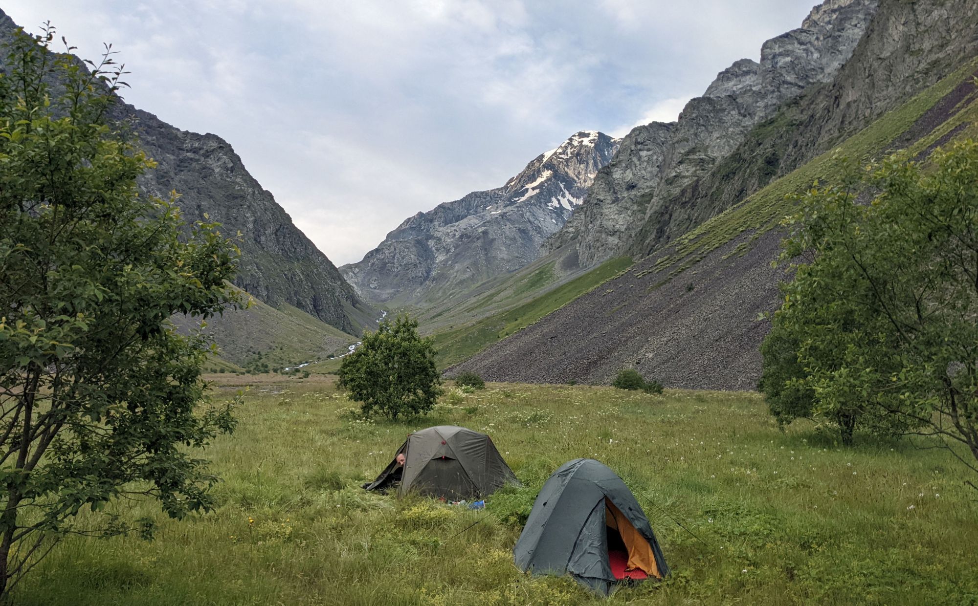
Ahead, you can see the river dropping by a narrow gorge from some wide plateau. To the left of the river, there is a large, eroded hillside, so you have to stick to the right. Enter the gully, follow it for as long as you can and then cross to the western bank. A short climb then brings you to the plateau, where you find a nice, flat grassy (albeit a bit wet) meadow suitable for camping.
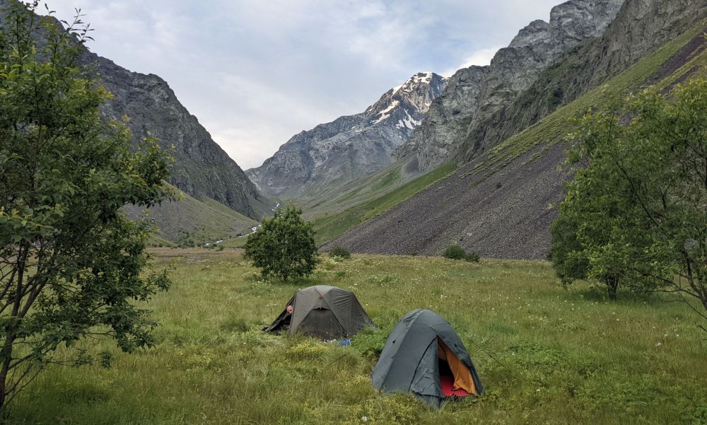
Campsite in the Khde valley
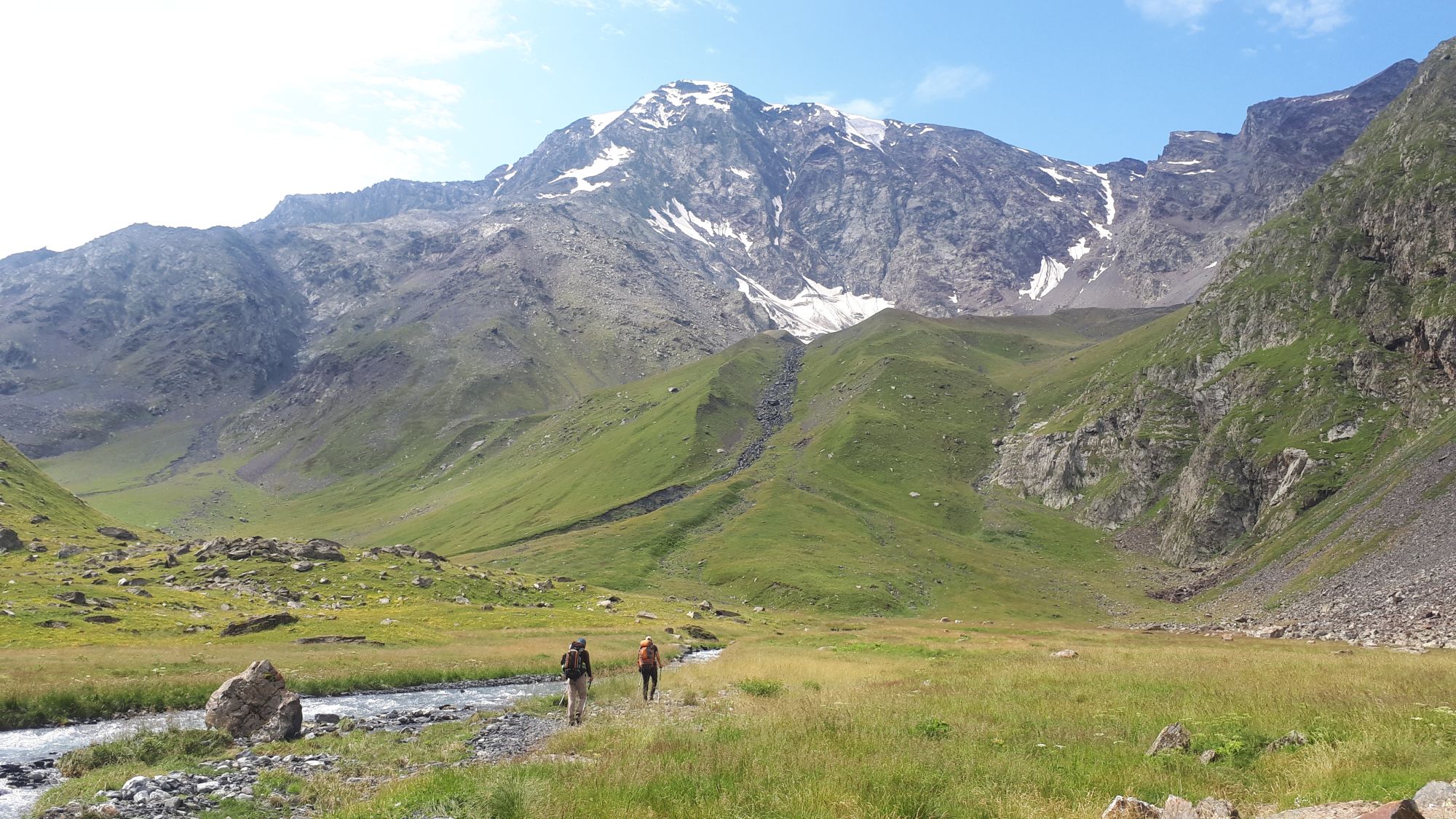
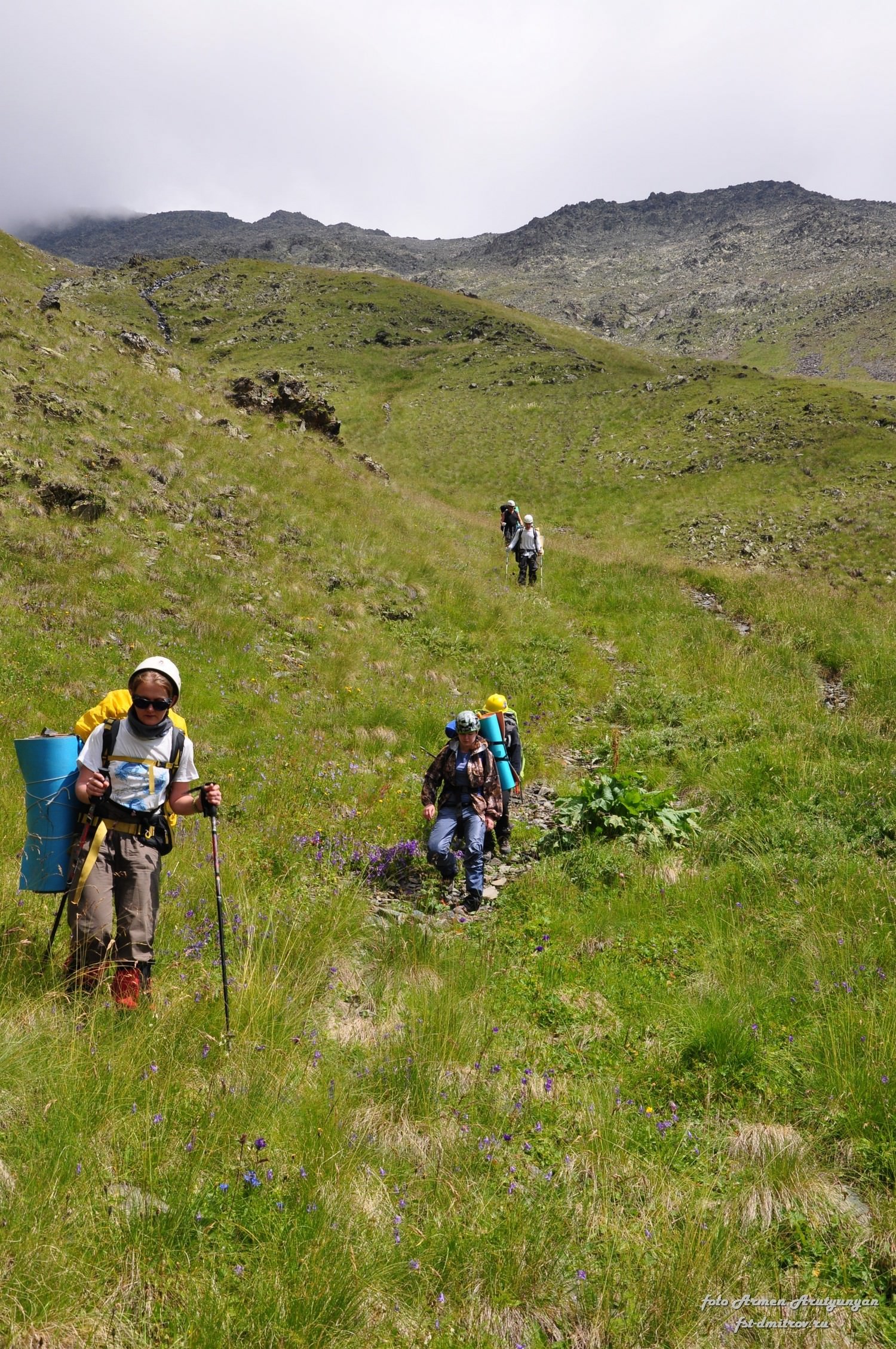
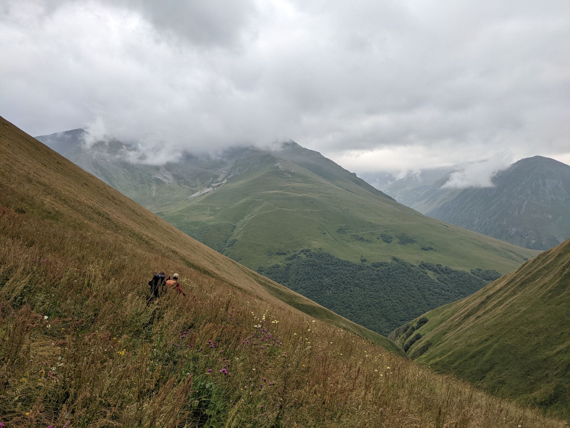
Continue deeper into the valley, following the western bank of the river. Once you pass the plateau, the trail starts climbing again, but the gradient is pleasant. There is no trail, but it's not even necessary - you left the jungle far behind, and now you walk on some small rocks overgrown with grass. Right in front of you, you can admire mountain Shino (4043m) from its "hidden" side.
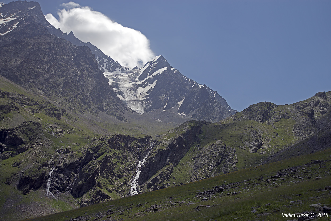
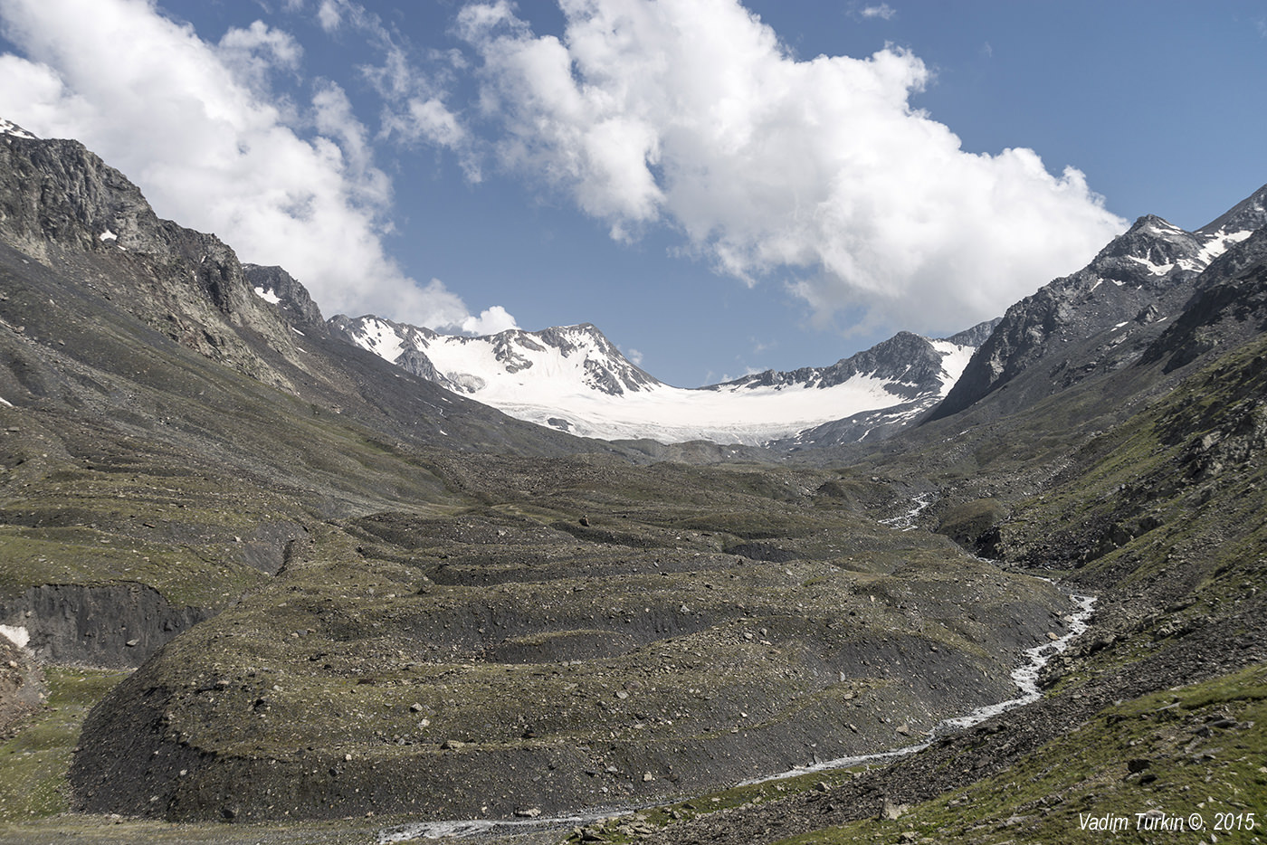
Soon enough, you will reach a large grassy meadow at the altitude of 2600m and ahead you can see another, much higher level of the valley (altitude 2800m) with a waterfall. It´s called “Kibishi ledge” (ok, I made it up - it is mentioned only in Russian articles as "Ustup Kibishi". If you can invent a better, English name for this geomorphological formation, I am open to suggestions. Does it even have a name in Georgian?).

Kibishi ledge ahead
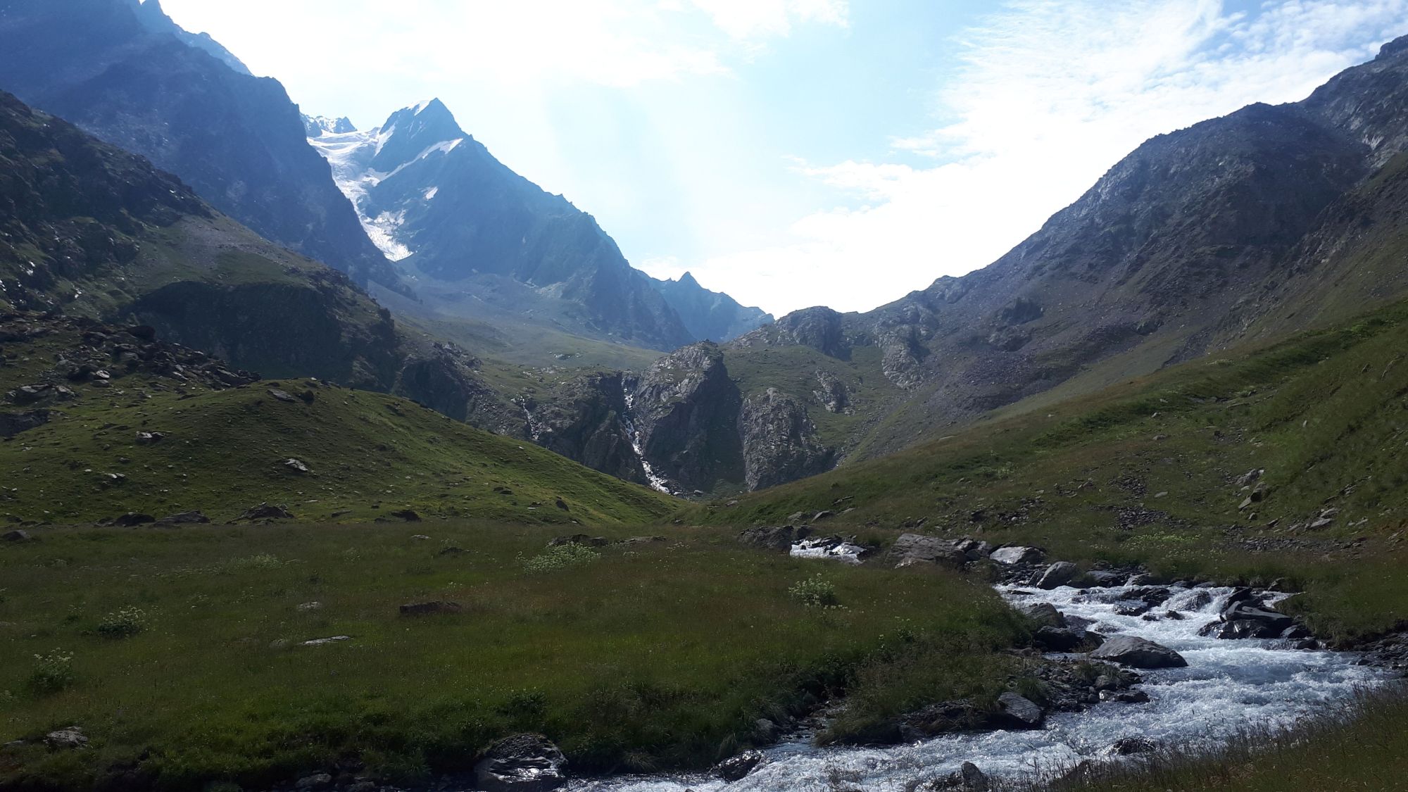
To climb the Kibishi ledge, we chose the route to the right of the waterfall which looked more approachable. Still, it was pretty steep, at some places, I kept wondering that if I lost balance, I could easily make an ugly tumble backward. Hiking sticks came in really handy here. In front of you, you will see Rustavi glacier and also Mt. Kuro right behind you comes into view.
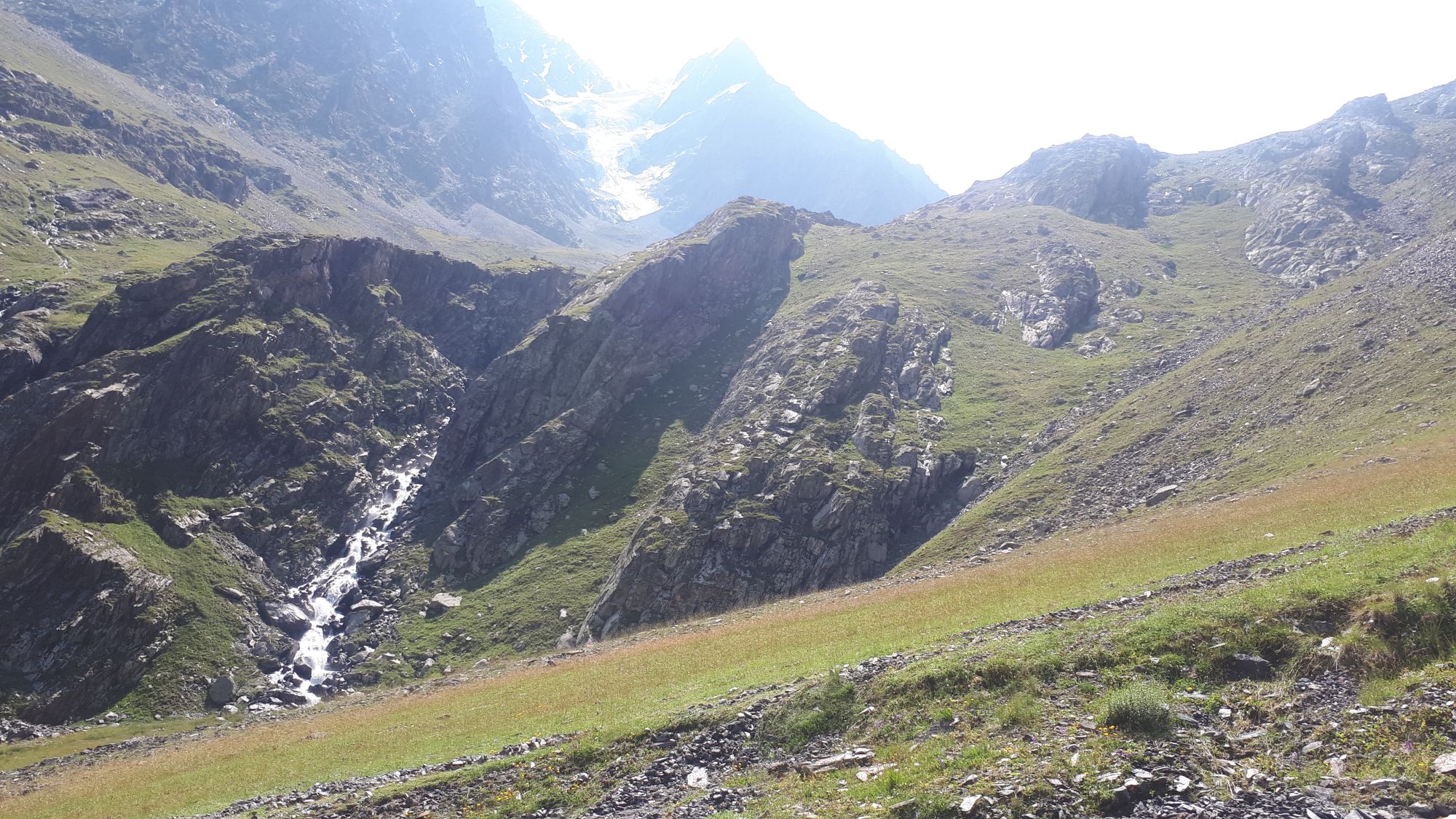
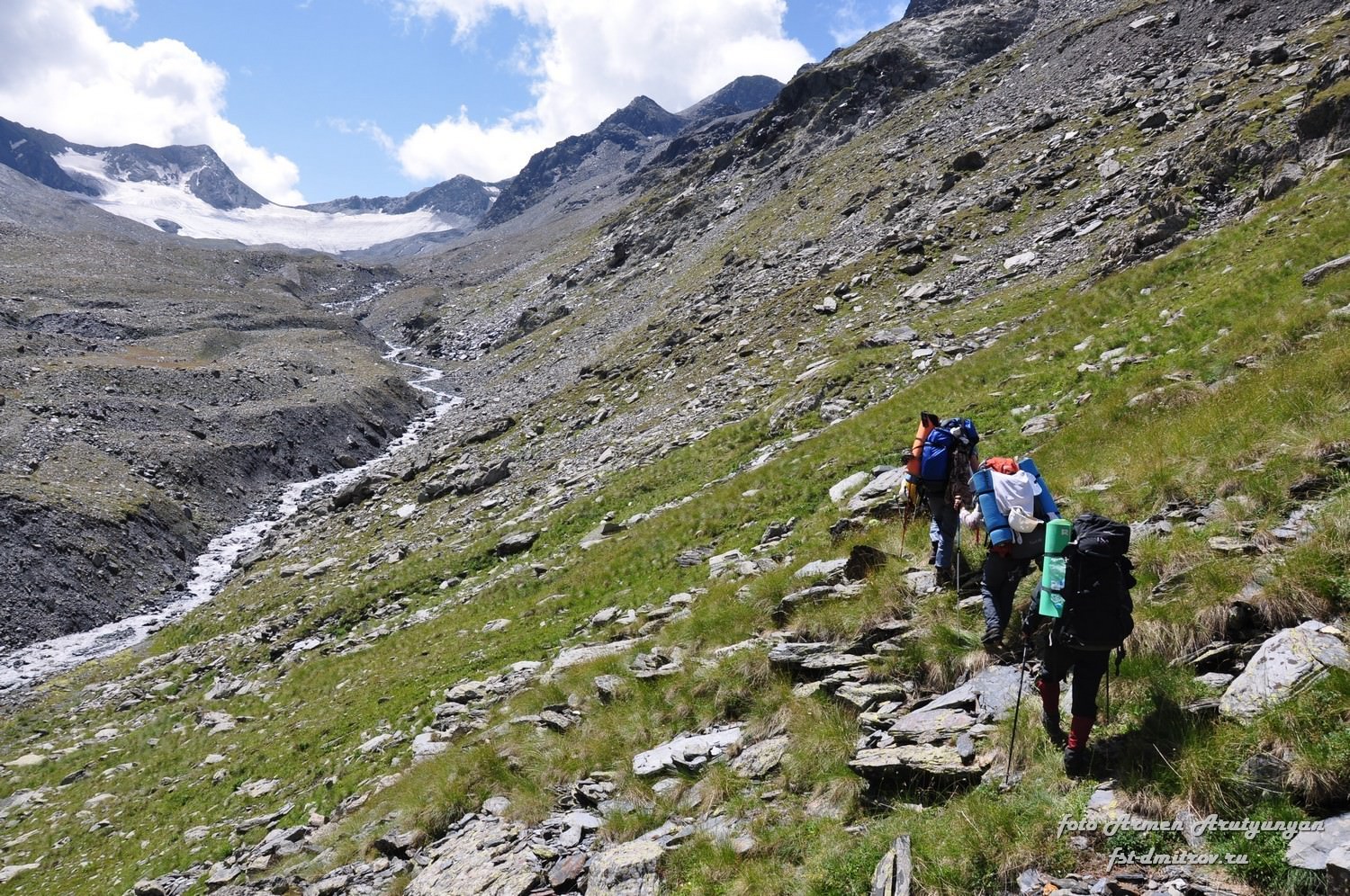
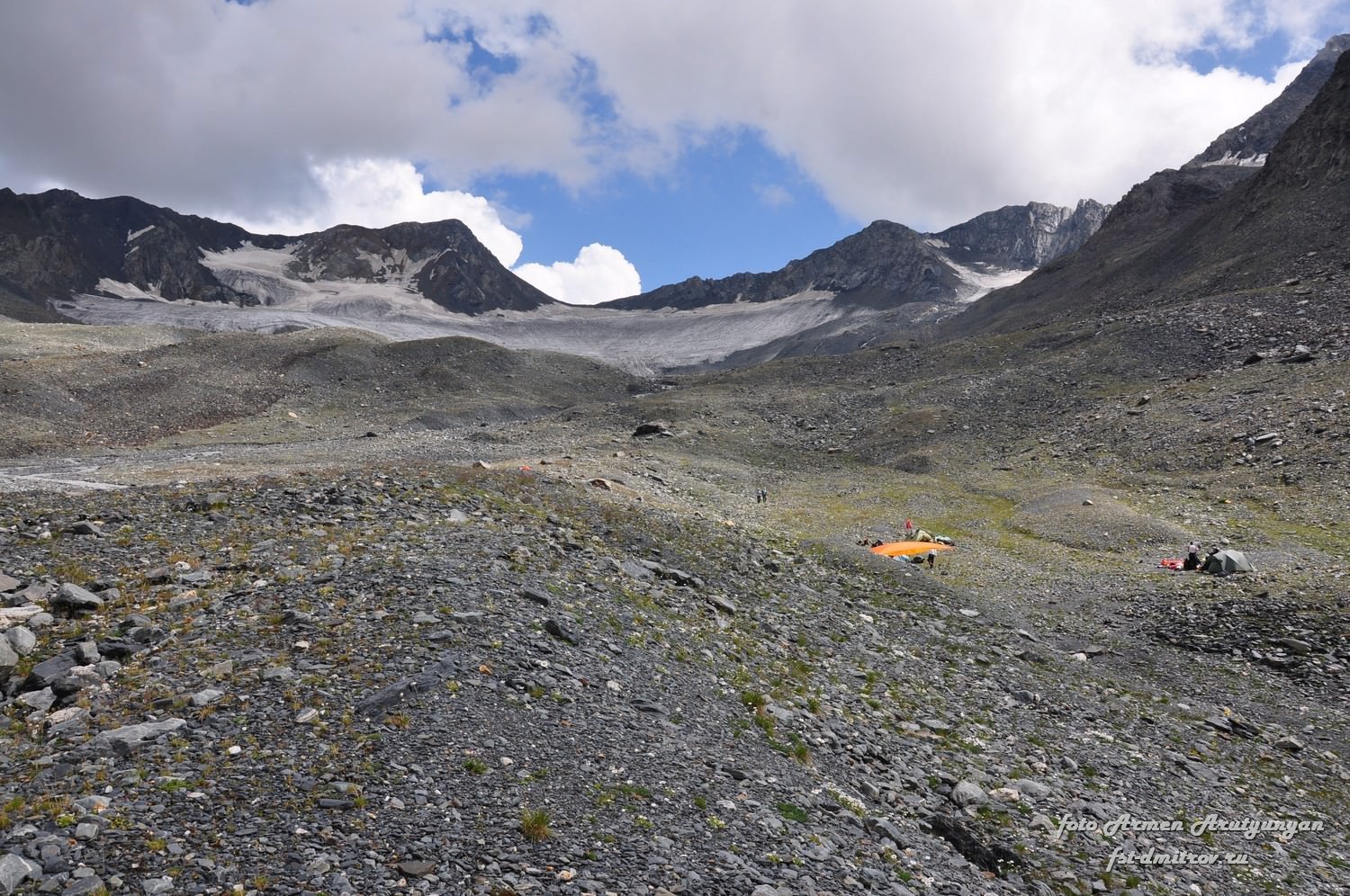
Once on the ledge, head further into the valley. You are entering a moraine - a maze of rocky mounds, with a river forcing its way between them. For a while, we abandoned a river and followed the western side of the valley. Then, once it became too steep, we joined the river, followed it a bit and crossed to the eastern side.
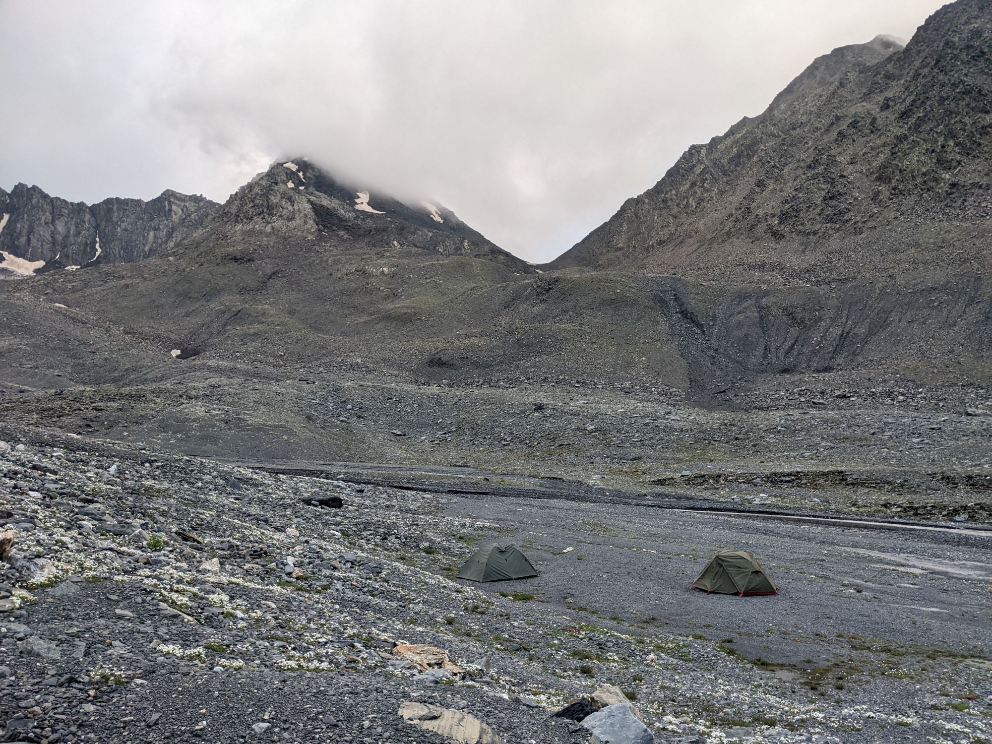
From there, it was only a short walk to the huge, perfectly flat field, right in the middle of the moraine. This would be a decept campsite as well, but we decided to walk another 500 meters and camp closer to the glacier. Our chosen campsite was also flat, maybe a bit more muddy, but close to the creek. Little to the east we observed a small glacial lake.
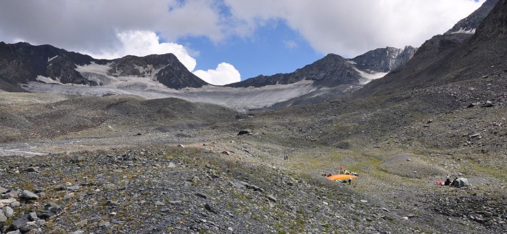
Camping beneath the Kibishi Glacier
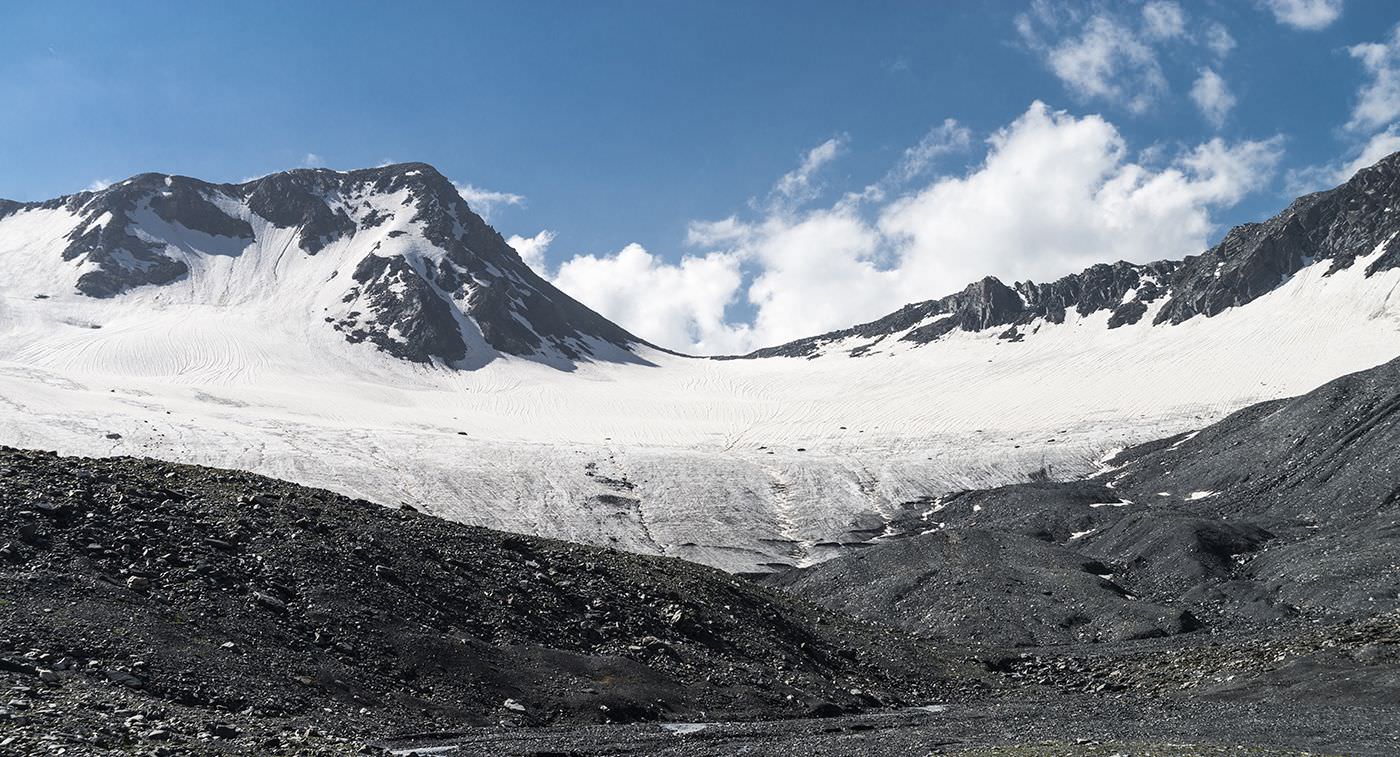
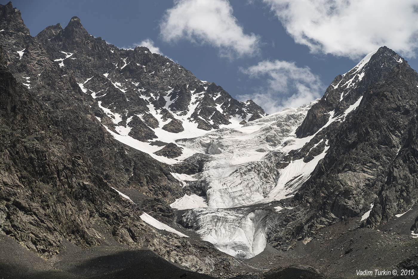
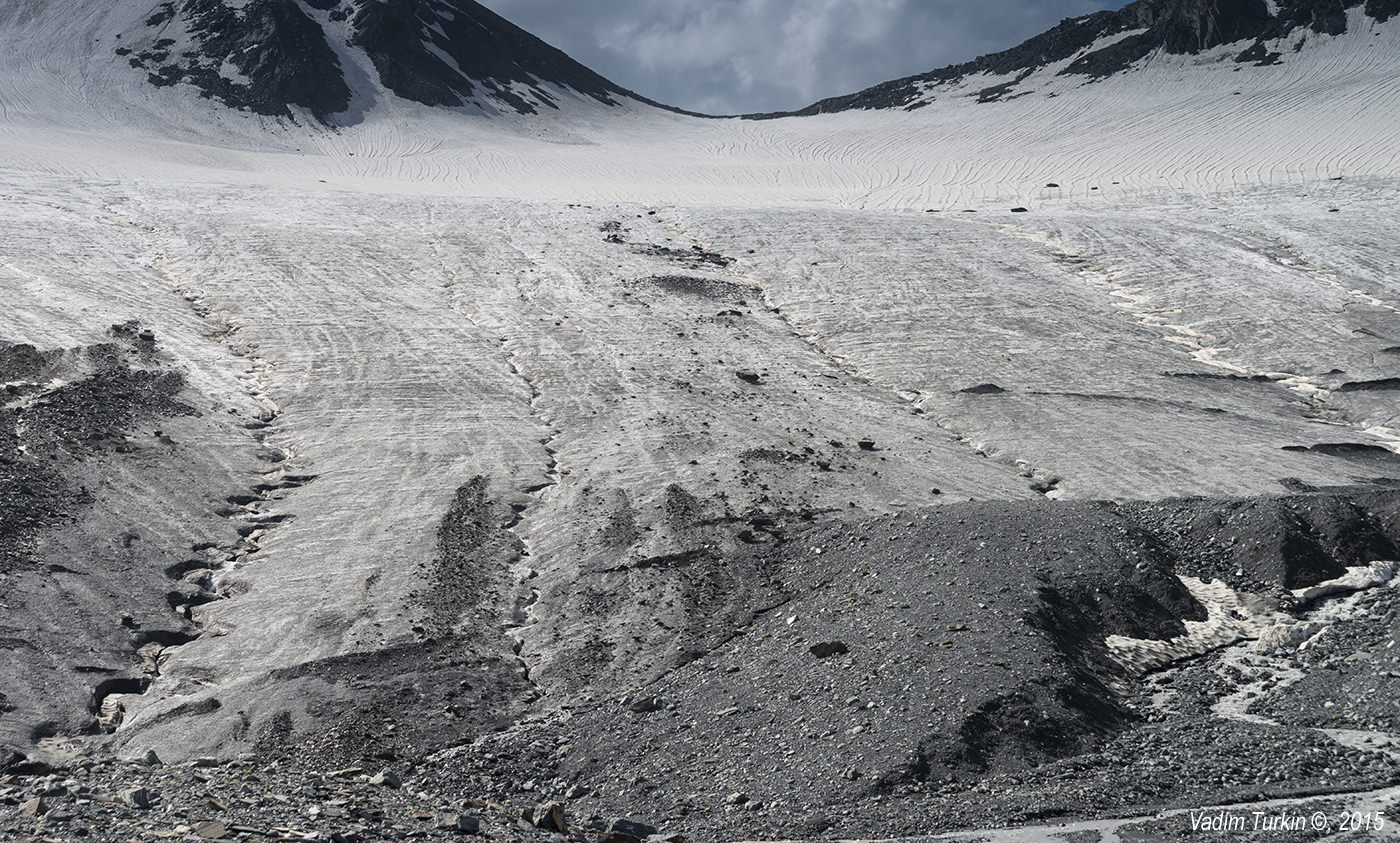
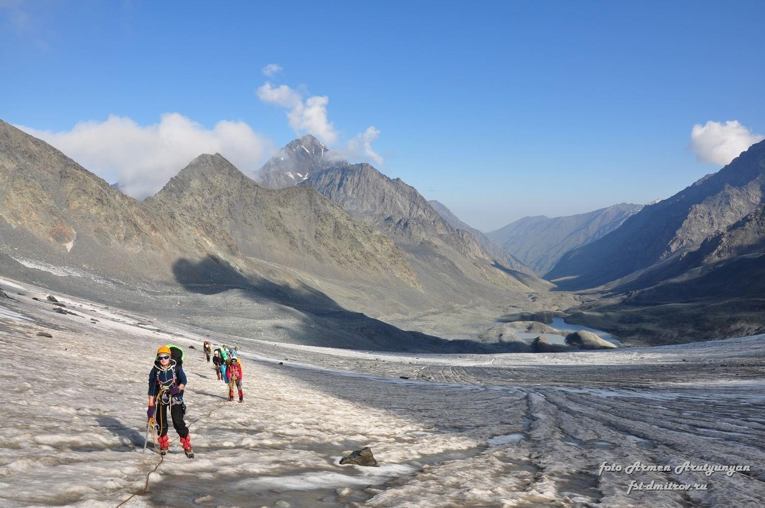
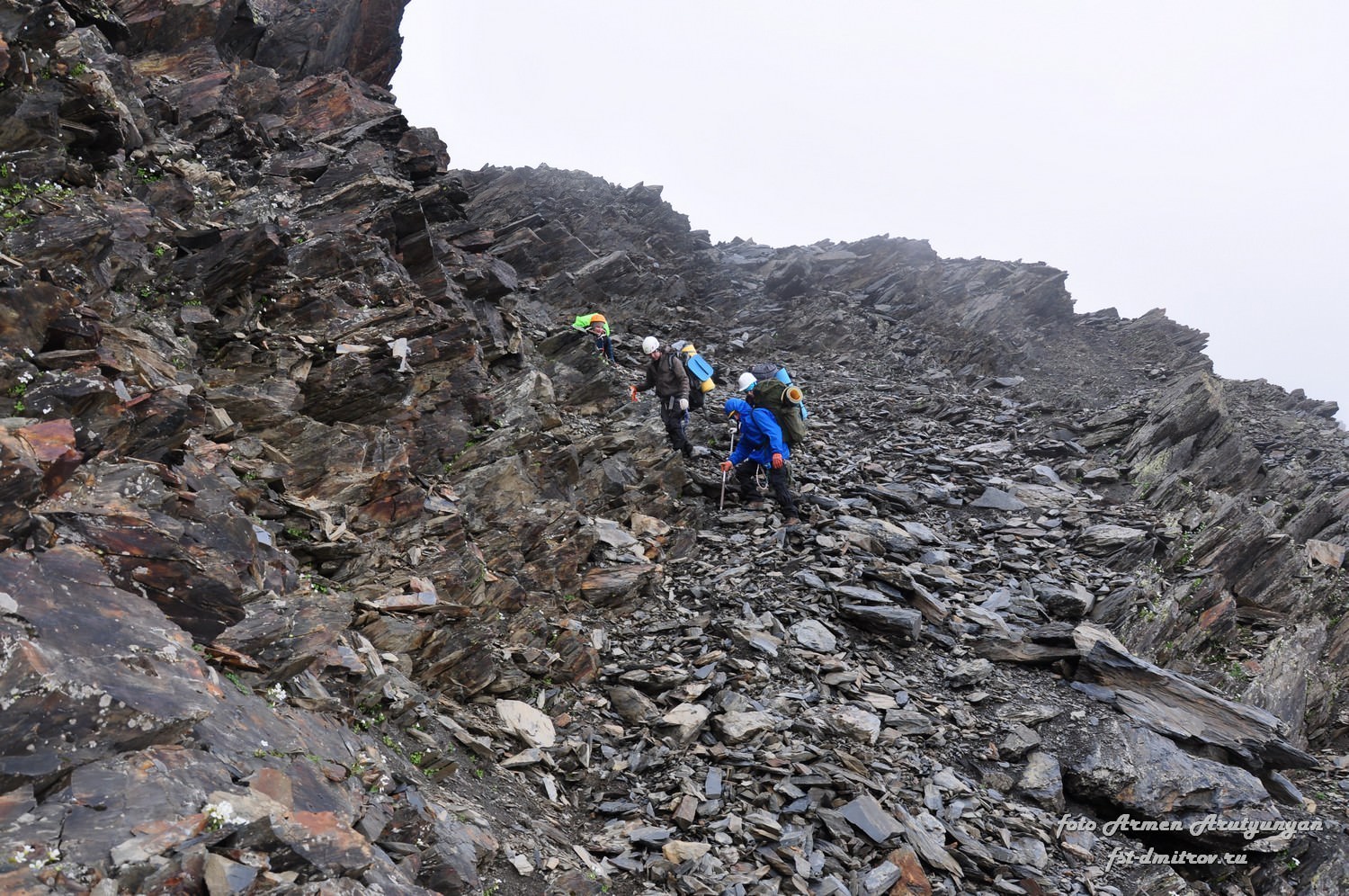
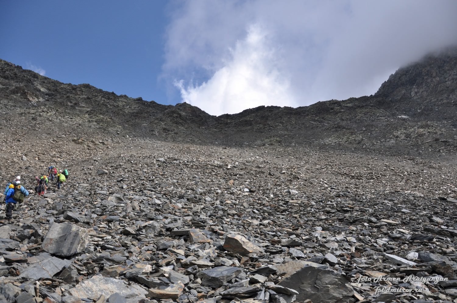
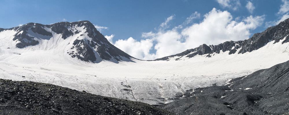
Navigate the moraine to Kibishi glacier. It´s much smaller than on the old Soviet maps; currently, it starts at 3280m and is less than 1km long. It´s solid, without cracks, covered by firn and reasonably steep (gradient 15-20°, in the upper part up to 25°). The route is obvious, climb directly to the pass - it shouldn´t take longer than 1 hour.
The glacier ends a little below the pass. Then comes a short, but rather unpleasant climb through the rockfield. There is a path, but everything is wet and slippery, with rocks just lying on the solid ground.
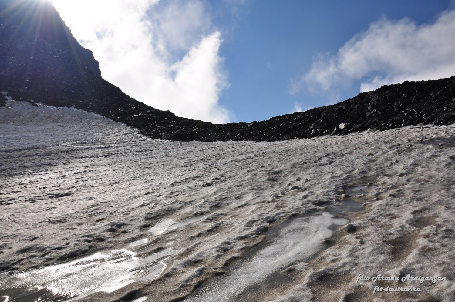
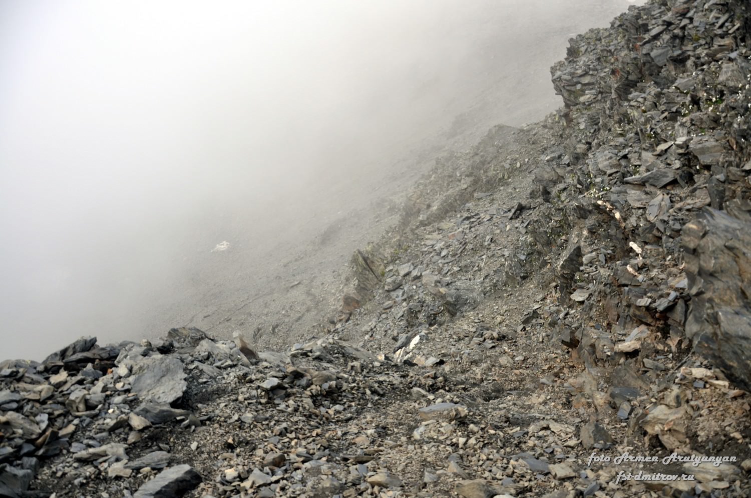
Kibishi pass lies at an elevation of 3500 meters and is a great spot for a break, but don´t stay here too long; there is still a long march ahead. It's crucial to hit the proper descent route - follow the ridge a bit to the east and watch for a cairn and an arrow painted on a rock. It will navigate you into a steep (30%), rocky couloir. Watch out for stones loosened by your buddies - unpleasant section, but only 200 meters long.
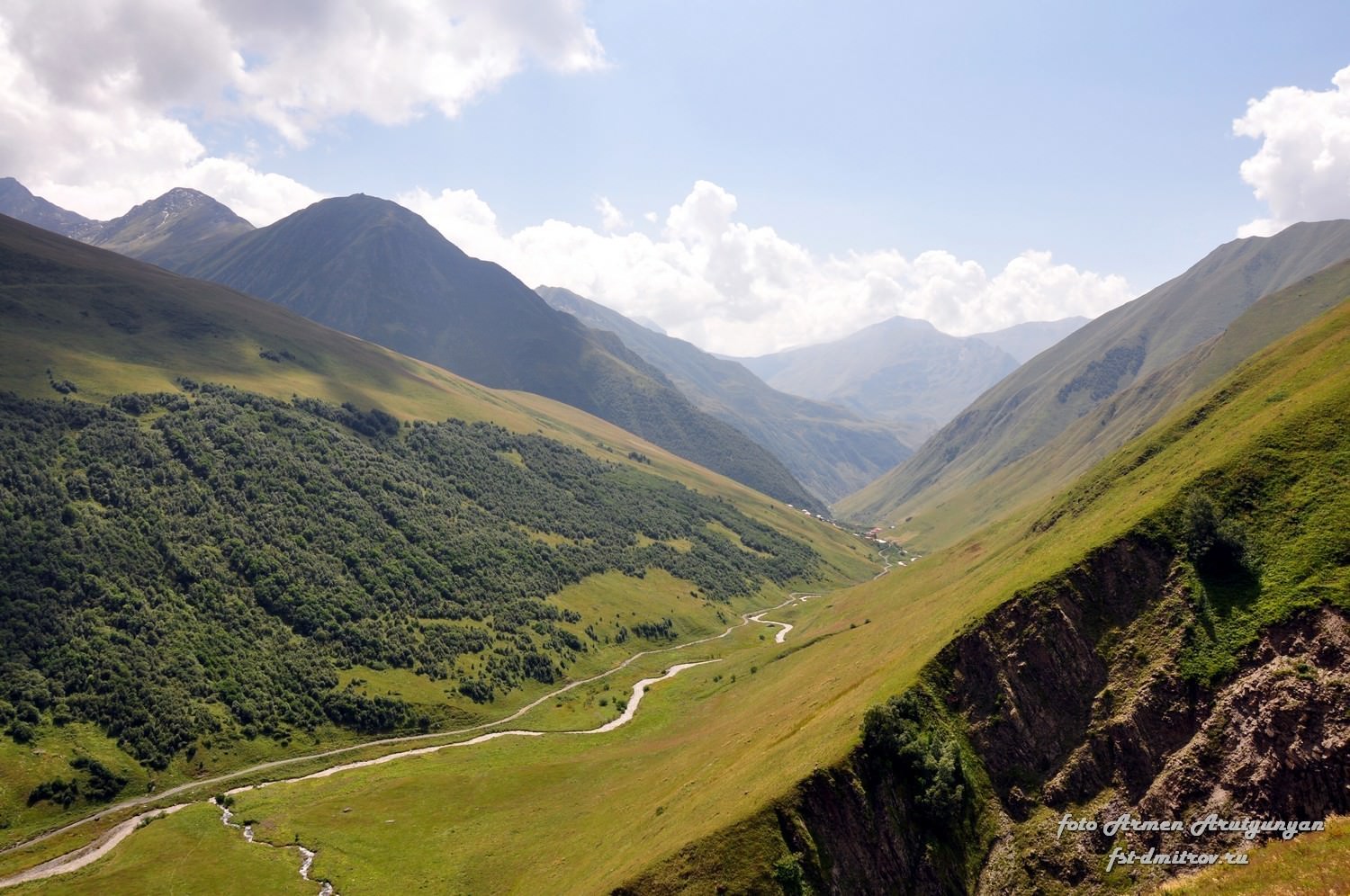
From now on, it gets easier as you navigate large rock fields, which eventually get replaced by scree and grass. You will descend through Sharovanistskali valley (an actual creek appears at about 3200m). Way down is also quite challenging - there is no trail to follow and traversing steep, overgrown hillside is never fun. We chose to follow the left bank of the river - just don't stay too close to the riverbed, because that's where the slopes are the steepest, so keep some distance.
Finally, you should make it to the Juta river - from the pass, it takes about 4 hours, during which you lose 1200 meters of elevation. If the water level allows so, cross the river to the new road. From here it´s just an easy walk on to Juta village.
This article is based on very detailed trekking report, published by "Federation of mountain tourism" from Dimitrovsk area, Moscow.
They also provided me their gpx log and photos - more of them can be found
at this address. Thanks a lot!
Remaining photos were provided by experienced Russian trekker and photographer Vadim Turkin.