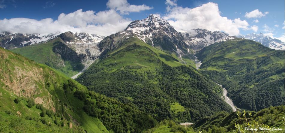
Massive, deep and extremely long valleys of Rioni and Tskhenistskali form basically the only entrance into Georgian region Racha - Kvemo Svaneti. Between them stands Lechkhumi ridge, which, with its elevation of 3000 meters, always formed an impenetrable barrier. Until now, no passable road crosses the ridge - an ideal place for a nice trek, isn´t it?
That the ridge can be crossed, we understood from photos on Google maps. That´s how we also figured our trek route. On the spot, we also found the familiar red and white marking - a long time ago, the trail was marked.
We start our trek Ghebi village, following the main road up the stream of Rioni river (not all cars can make it to the village and further west, it´s only for 4WD cars). Not far behind the village, right from the bank outflows one of many local mineral springs - protected by a fence from animals and a good place to get water. Here we meet the collective of teachers from Tbilisi. When they find out that we´re walking to Svaneti, they are very surprised. Their driver asks whether we have a rifle - valleys ahead of us are full of bears. I show him my small Swiss army knife. “Ooh, molodci, molodci”. They wish us a safe journey and we depart towards the mountains, accompanied by sounds of thunders.
Road leads through alluvial sediments, densely overgrown by hazels, alders, and pretty nice beeches. But it´s already heavily raining and even though we have new raincoats, we are wet in a matter of minutes. Then the river bends in such a weird way, that we are suddenly not sure, which needle on our compass points to the north. Enough. We erect a tent at the first flat spot, which doesn´t resemble a pool.
It rained all night, but gradually, the nature shows some mercy and the sky clears up. We finally orientate in the tangle of rivers and streams, ford one of them and after a while, the road leads us to the settlement Brili.
Here it´s necessary not to cross the bridge on the nicer road to the north, but to follow the side road, leading to seven houses in the middle of an overgrown meadow. People live even here and naturally are curious who strayed into their community. They ask us where we came from, then offer us a loaf of fresh cheese. We compare our knives (the longer knife is better against bears) and inquire about our hike. This year, nobody finished it yet (it´s 30th June) and the road will be very overgrown. Only about 50 people do it every year. We want to pay for the cheese (money is, unfortunately, the only thing we can offer), but they refuse - it´s a gift.
So we just thank them and follow an inconspicuous trail in the meadow. Not much later, we rest again and stuff ourselves with cheese. It´s fantastic when paired with local bread, especially when flavored with fresh onions...
Our trail once served as a cart road, but nowadays is used only by cows and horses. It gradually disappears due to dense vegetation and landslides, which would be not such a problem if we didn´t have to fight our way through tallest hogweeds in the heavy rain.
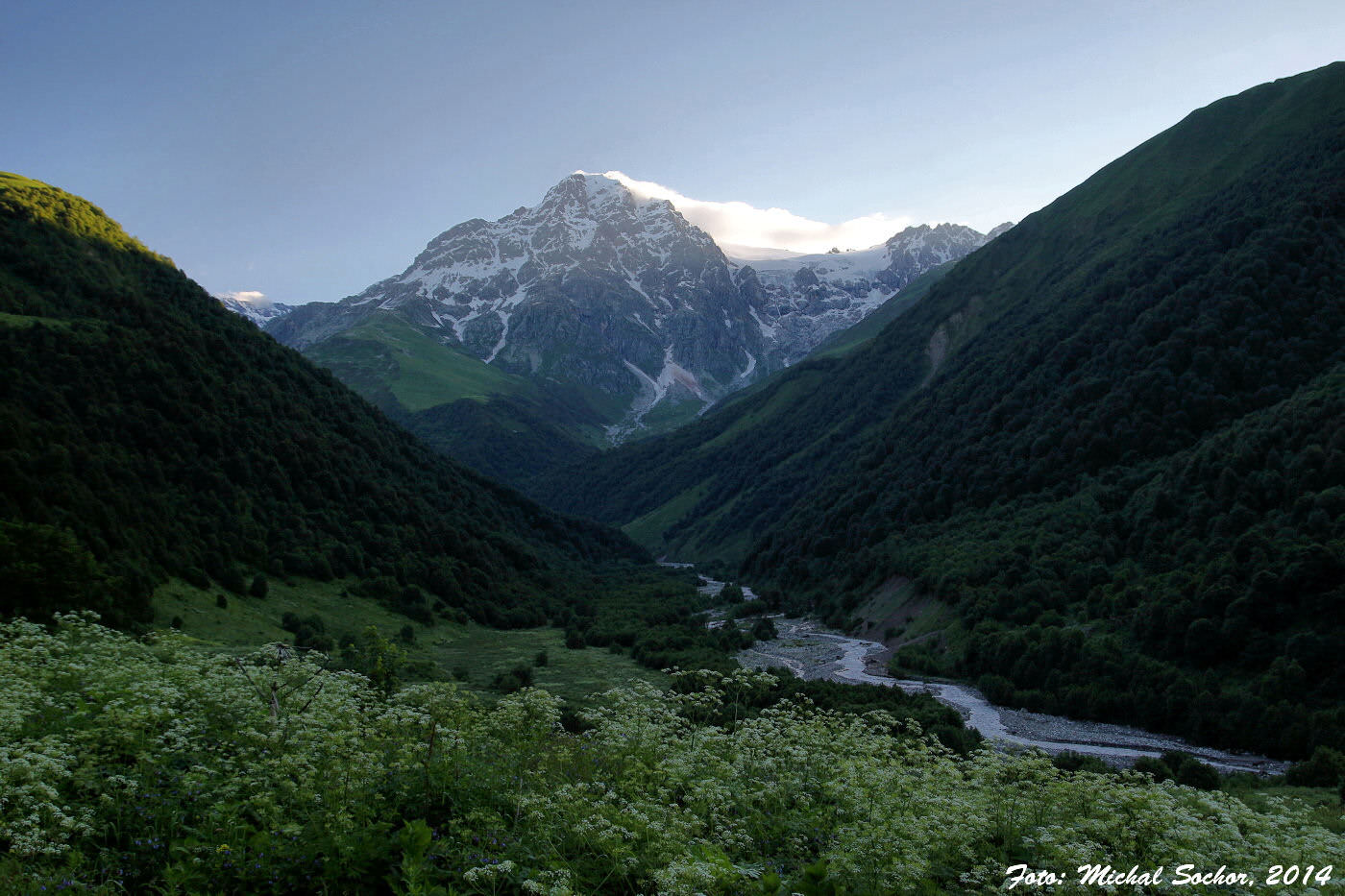
But we don´t give up - it is too soon to camp and there should be a “turbaza” (tourist´s refuge) near the trail. We don´t know where - locals told us about it - but the vision of roof above our heads drives us ahead in the heavy rain. And truly. As the Edena glacier appears to the north, we come to a brick building.
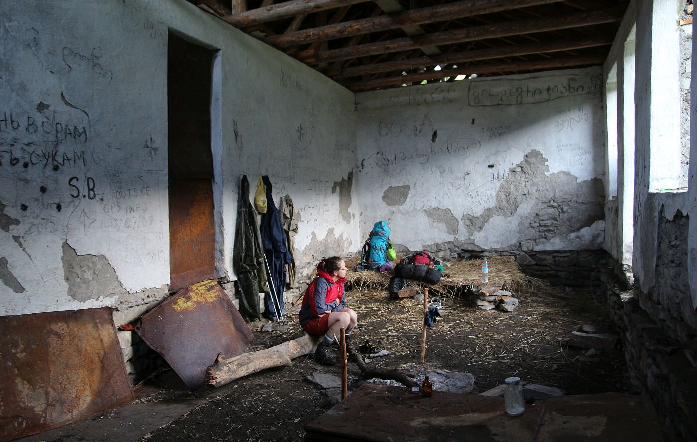
From a distance, it looks OK. On the closer look, not so much - we are not sure if it´s truly a hiker´s refuge or shepherd´s hut. Half of the roof is missing. In the first room is a bed made of planks, fireplace, and a rusty stove. Other rooms, only partially covered by roof are full of muck and obviously serve as a stall.

In the old hiker's refuge
So we make ourselves comfortable in the first room and read writings on the wall. Even some Czech hiker was here, almost a year ago. After a while arrives a couple of Georgians. They are dressed in fatigues and Wellington´s and there is a Kalashnikov rifle, sticking out of their backpack. They speak only Georgian, so communication is problematic. First, we don´t understand whether they are hikers or inhabitants of the hut, but they came from Svaneti, so probably tourists.
We are glad that they “walked” the trail for us. Georgians accommodate themselves in the next room, which they also partially dismantle to get dry wood for the fire. They invite us to warm up, but we don´t understand at first so they make another fire in our room. That´s great in the beginning, but after a night spent in this smokehouse, we really can´t wait to be on the fresh air again.
Fortunately, there is no rain in the morning so we can set off into 3-meters tall comfrey, cross the river barefoot and climb onto the ridge. In the beginning, all goes well - not so much thanks to our Georgian colleagues (we don´t see their footprints) but because of well-visible traces of the old road, climbing into the beech forest. At the first bend, we even find surviving tourist marking - third one we noticed so far.
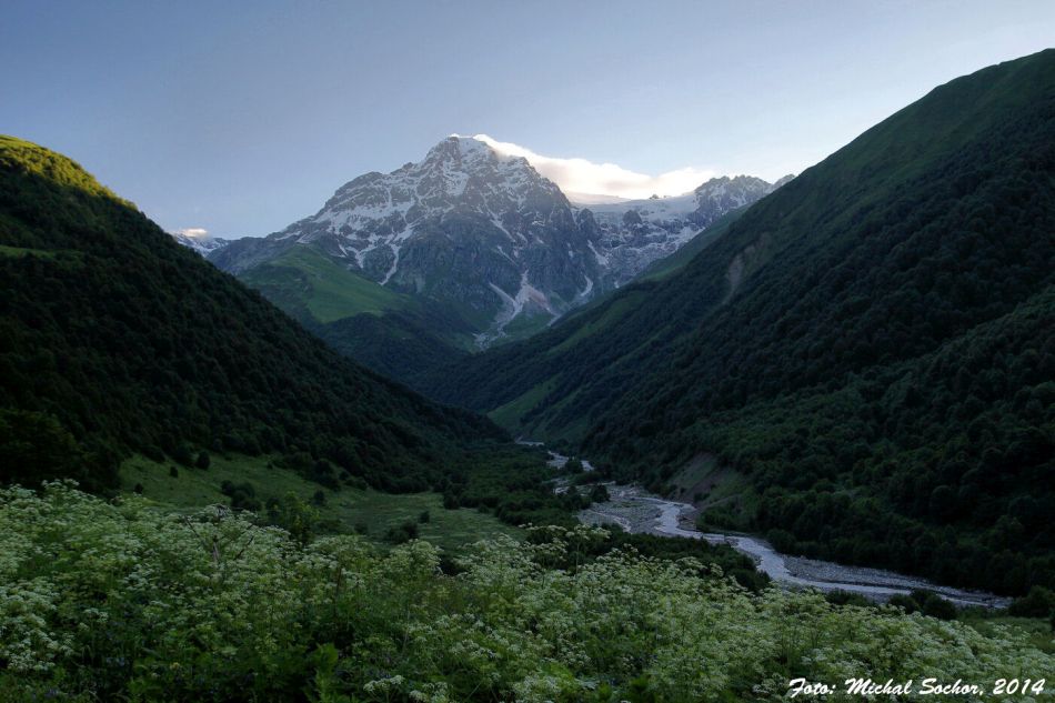
Edena glacier in the morning
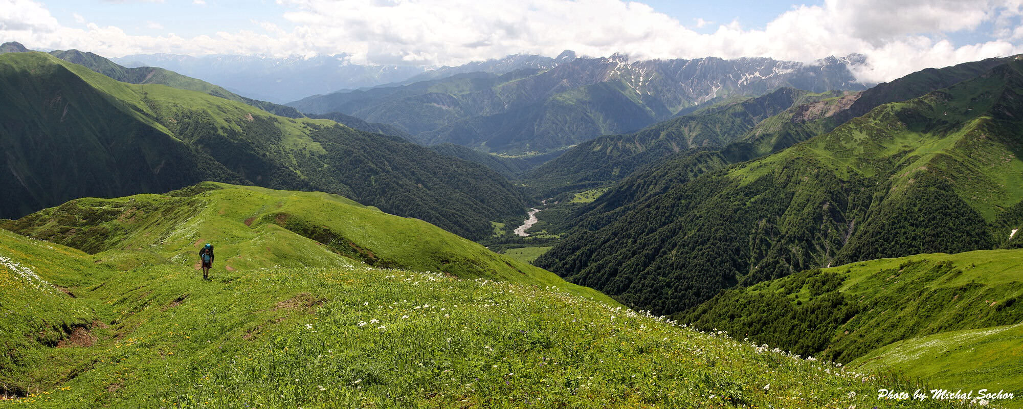
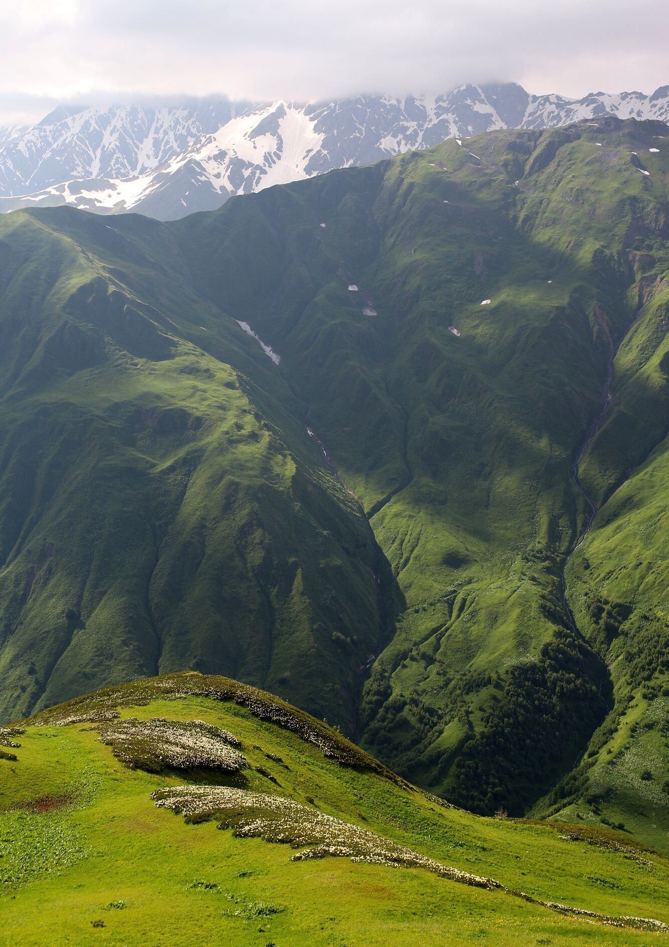
Leaving Rioni valley behind
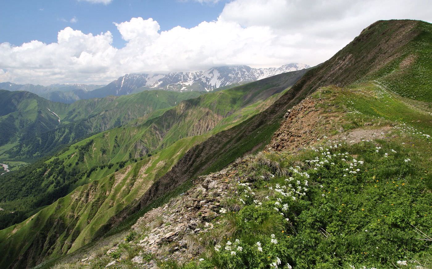
Ascent is relatively comfortable, apart from the fact, that we have to climb 1000 meters and fight our way through blooming hogweeds. But the weather is fine and we have great views of Edena glacier, main ridge and most of the Racha. We even see all the way to Ossetia.
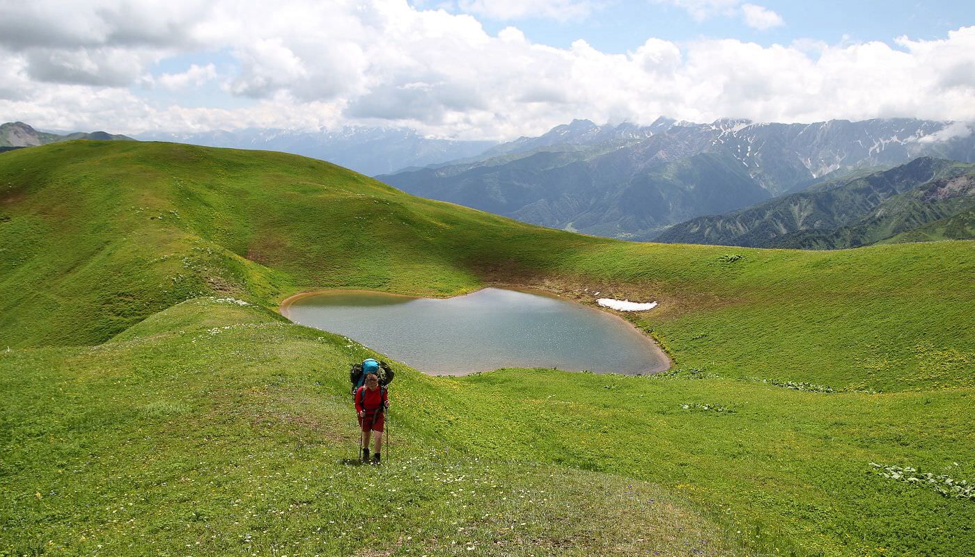
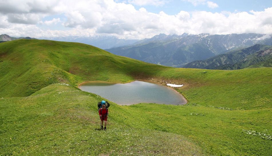
It doesn´t take long and we are sunbathing at the top of the ridge with a 1000m drop below us. The goal of our ascent is Sasvanostba lakes. Luckily, we get slightly off the trail so we notice the cleanest of them, the one with potable water. It´s quite small but still big enough for a swim. In spite of the snow lying on its banks, water is surprisingly warm. And the location is almost schmaltzy. We have to take another break.
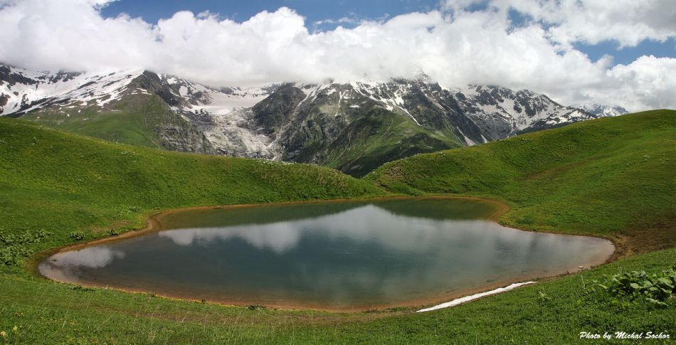
One of Sasvanostba lakes
Leaving Sasvanostva lake
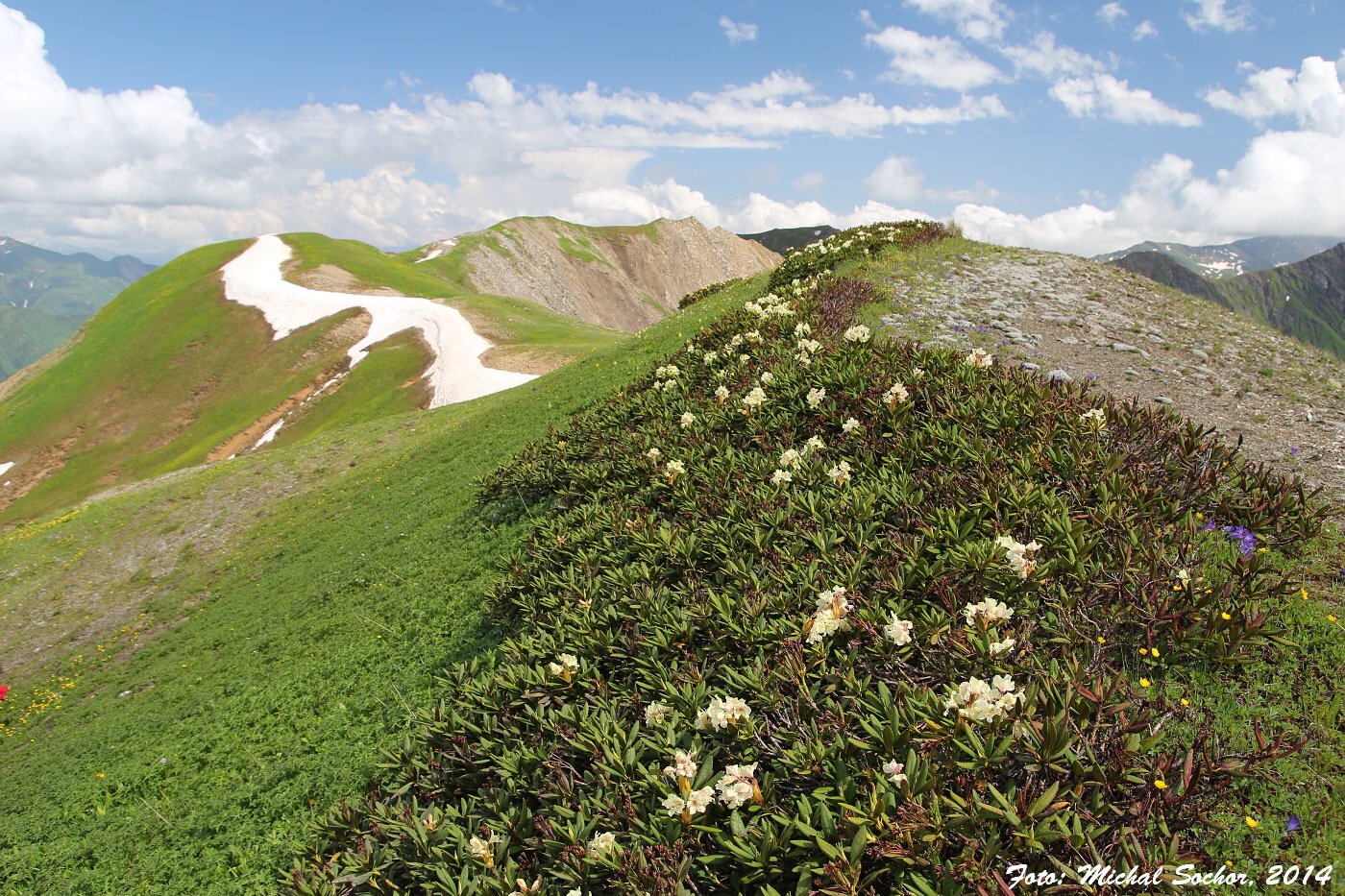
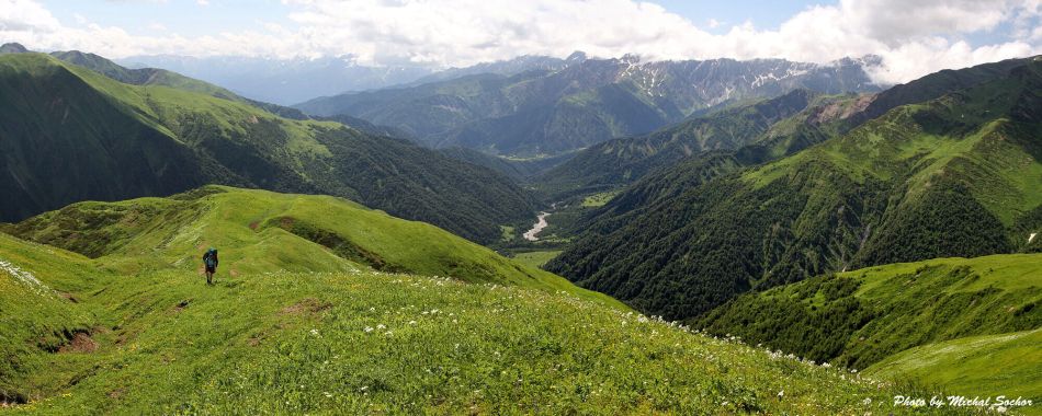
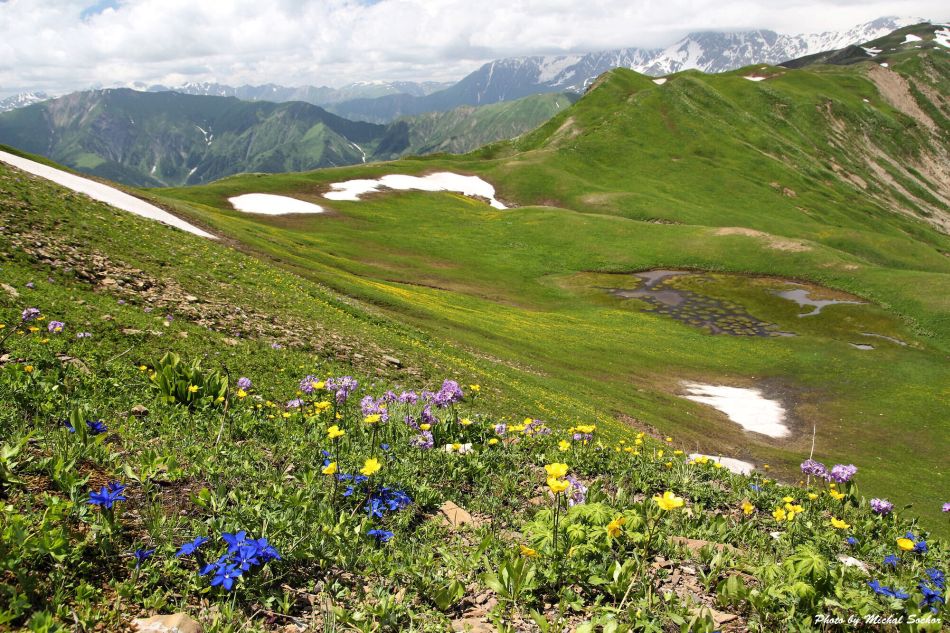
Other lakes are muddy, so we don´t waste more time and continue our journey. It´s pure joy. Even though we still have to walk uphill, surrounding scenery makes up for it - blooming meadows, snowy mountains, lakes, and valleys. We loiter, but finally, we come to Vatsistsveri pass (2910m). Below lie hillsides covered by blooming rhododendrons, another glacier, and bottomless Tskhenistskali valley. We have no other choice but to walk all the way down again.
Smallest of the lakes, slowly disappearing

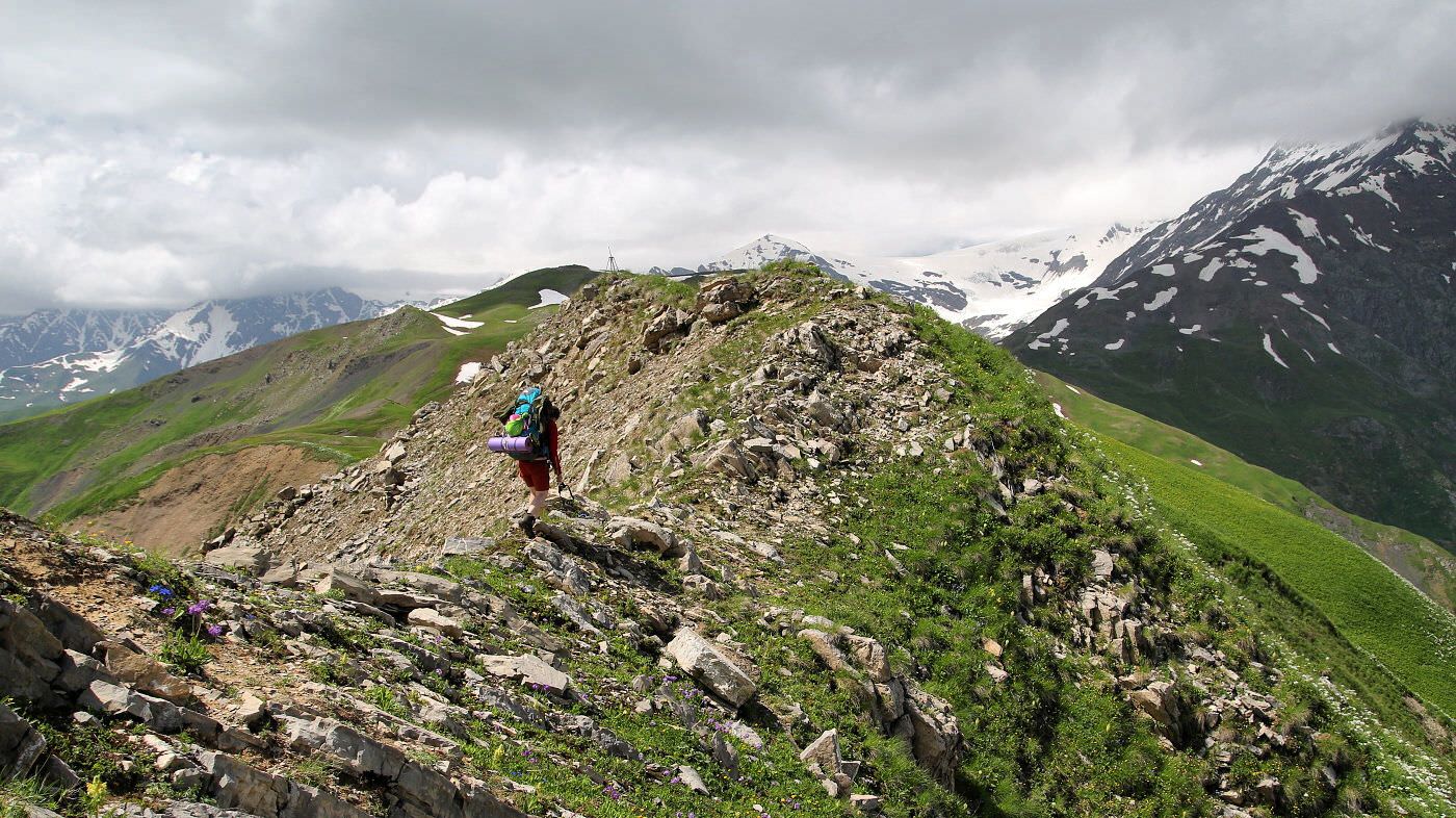
Steep slopes of the Lechkhumi ridge
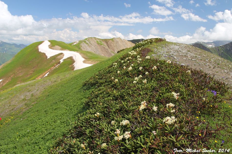
On the Lechkhumi ridge

Near Vatsistsveri (eagle) pass
Trail in our historical map follows the forest line in the upper part of the valley, then goes down by the river and climbs the opposite ridge again. Locals at Brili gave us the same advice and in the opposite hillside we can see some serpentines, so there was a road in the past. We start our descent.
In alpine meadows, it´s going well, we even find an old road, marked on our map. However, on the first steeper slope, it got ruined by a landslide. We descend three meters and definitely lose it. Nothing can be done, we have to fight our way through rhododendrons and tall vegetation. We head to the patch of grass, bordered by small snowfield, which we see from the distance and where we finish today´s walk. Mountains, mountains everywhere.
In the morning, we try to find the trail again. We see a line in the slope high above us, so we try to reach it and head to the upper part of the valley, to the glacier. Rhododendrons alternate with sliding scree and then with a 2-meters tall jungle again so we pick a most negotiable variant - in the riverbed. When torrent becomes too powerful, we swerve into underbrush of young birches.
It is an endless grind. When we, after several hours of effort, make it to the bottom of the valley, we accept the harsh truth - there are no trails down here. No footpaths, no cowpaths. Nothing but abandoned, overgrown meadows, glacial river, and impermeable forests. But it´s beautiful here, we have to admit that. With a pinch of optimism and lots of uncertainty, we follow the river.

Looking from Eagle pass into Tskhenistskali valley
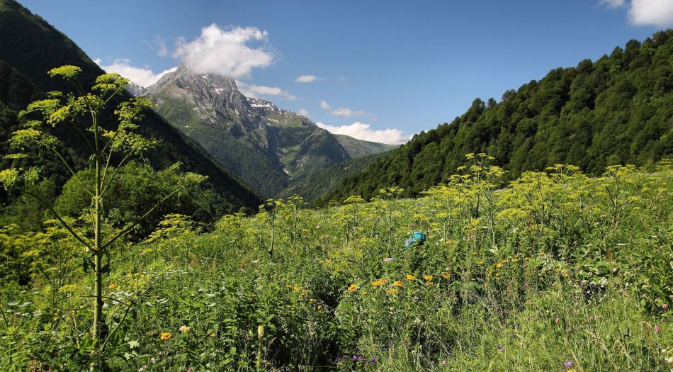
Overgrown Tskhenistskali valley
This report was originally written by Michal Sochor for Czech hiking magazine, I translated it and publish it here with his consent. Second part of the story can be found here