I lie in a sleeping bag and don´t feel well. I´m hungry, thirsty, exhausted, scratched, stung with countless nettles and burned by hogweeds. My psyche is not much better, I keep thinking about “Blair Witch Project” and Dyatlov pass incident. In spite of the fatigue I can´t fall asleep because of unbearable itching. And so I, just in my thoughts, review the past day and ponder, where we made a mistake.
And now, after catchy introduction, let's start from the beginning. In our case, it´s located in Arkhoti valley (in my last blog, I described how to get there)
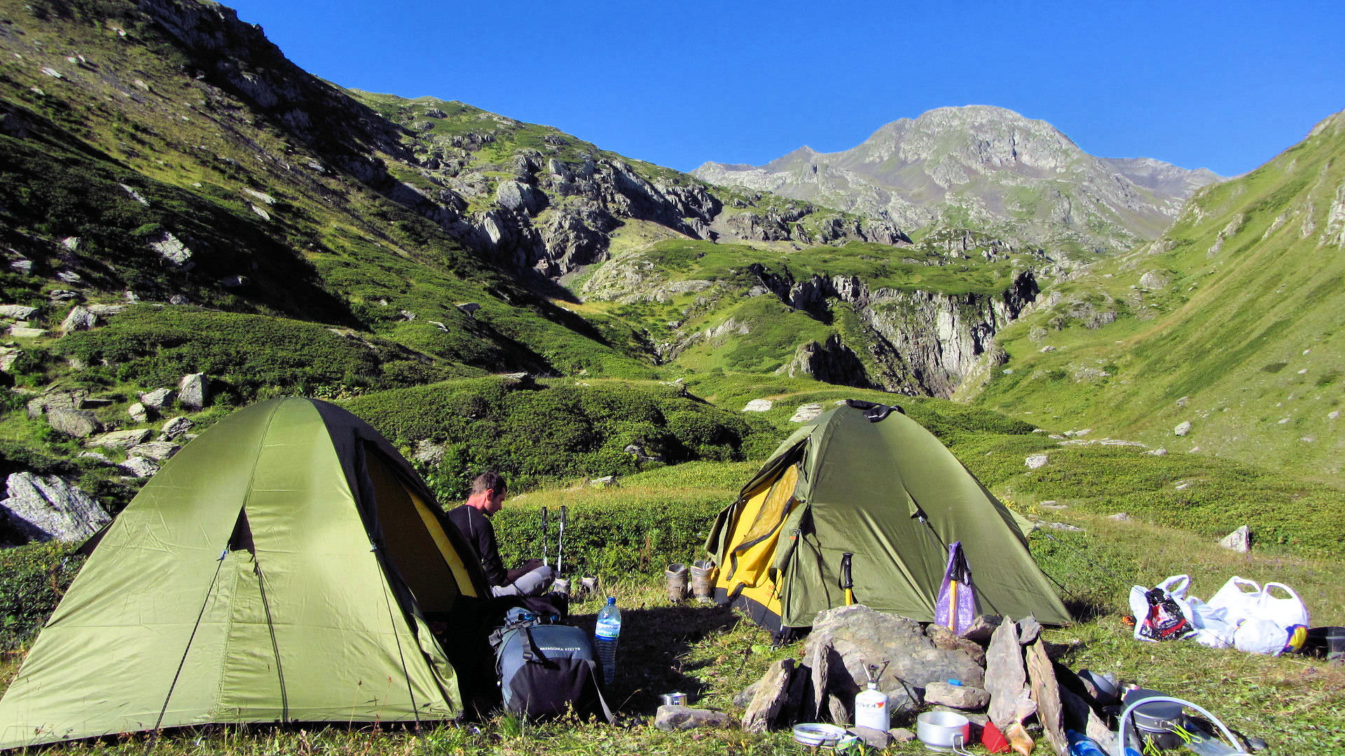
It around 7:30 am. when I crawl out of my tent. It looks like another great day - sky is clear and in the morning light, the valley looks truly beautiful. We have a breakfast, pack our tents, bath in the stream. There is no need to hurry, to Roshka, it´s just some 5 hours of walking.
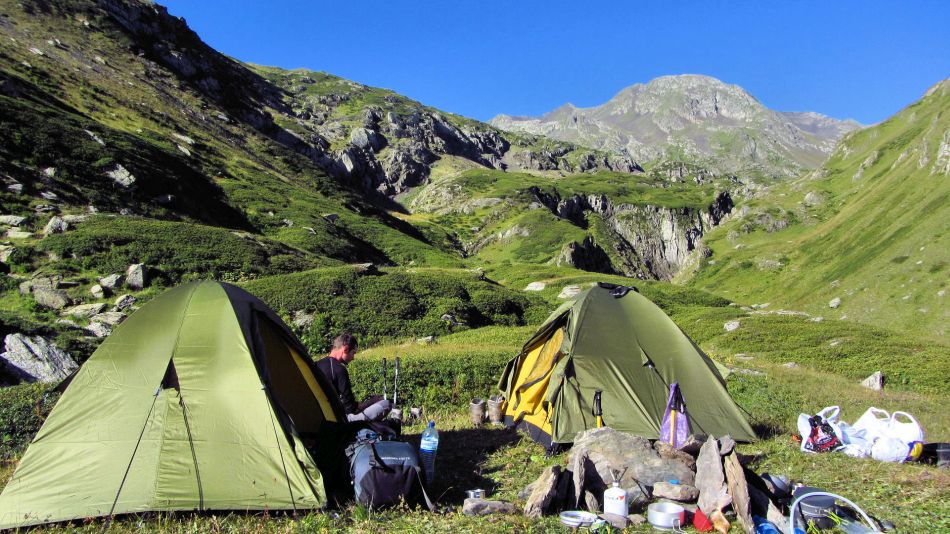
Morning in Arkhoti valley
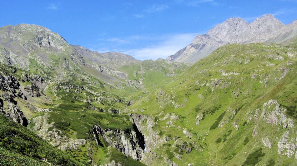
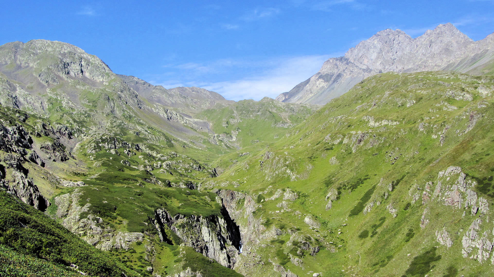
Arkhoti valley
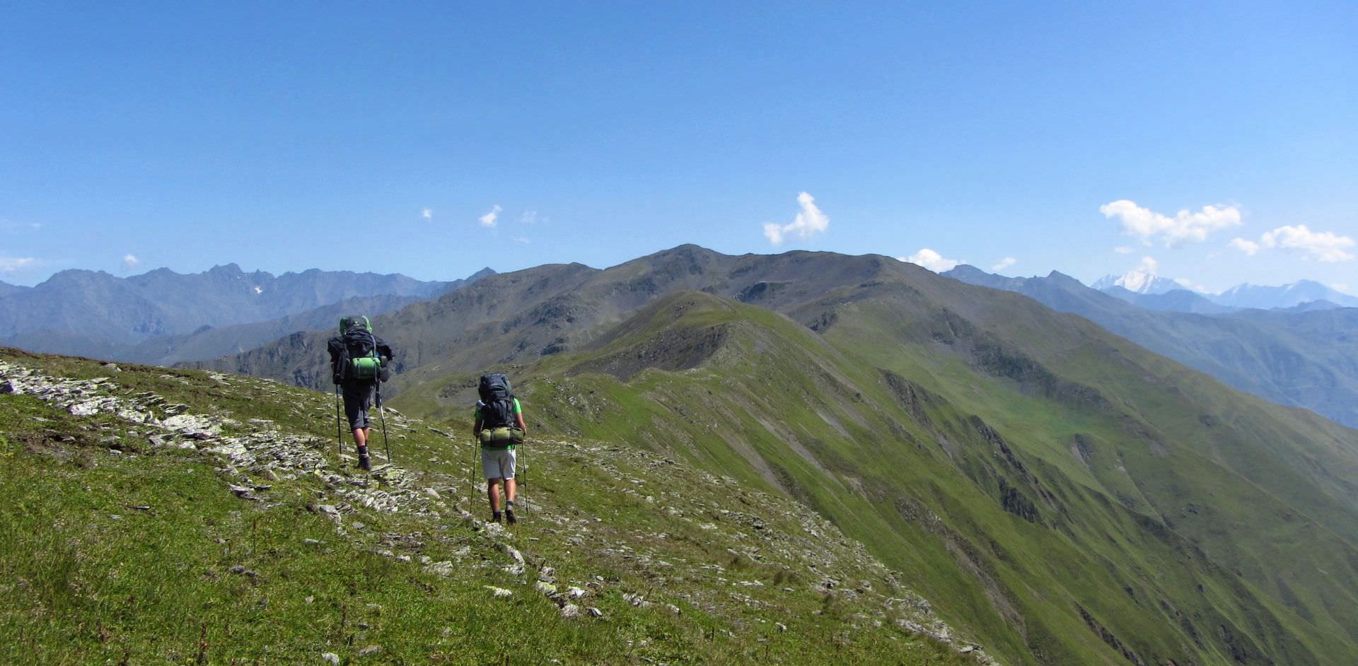
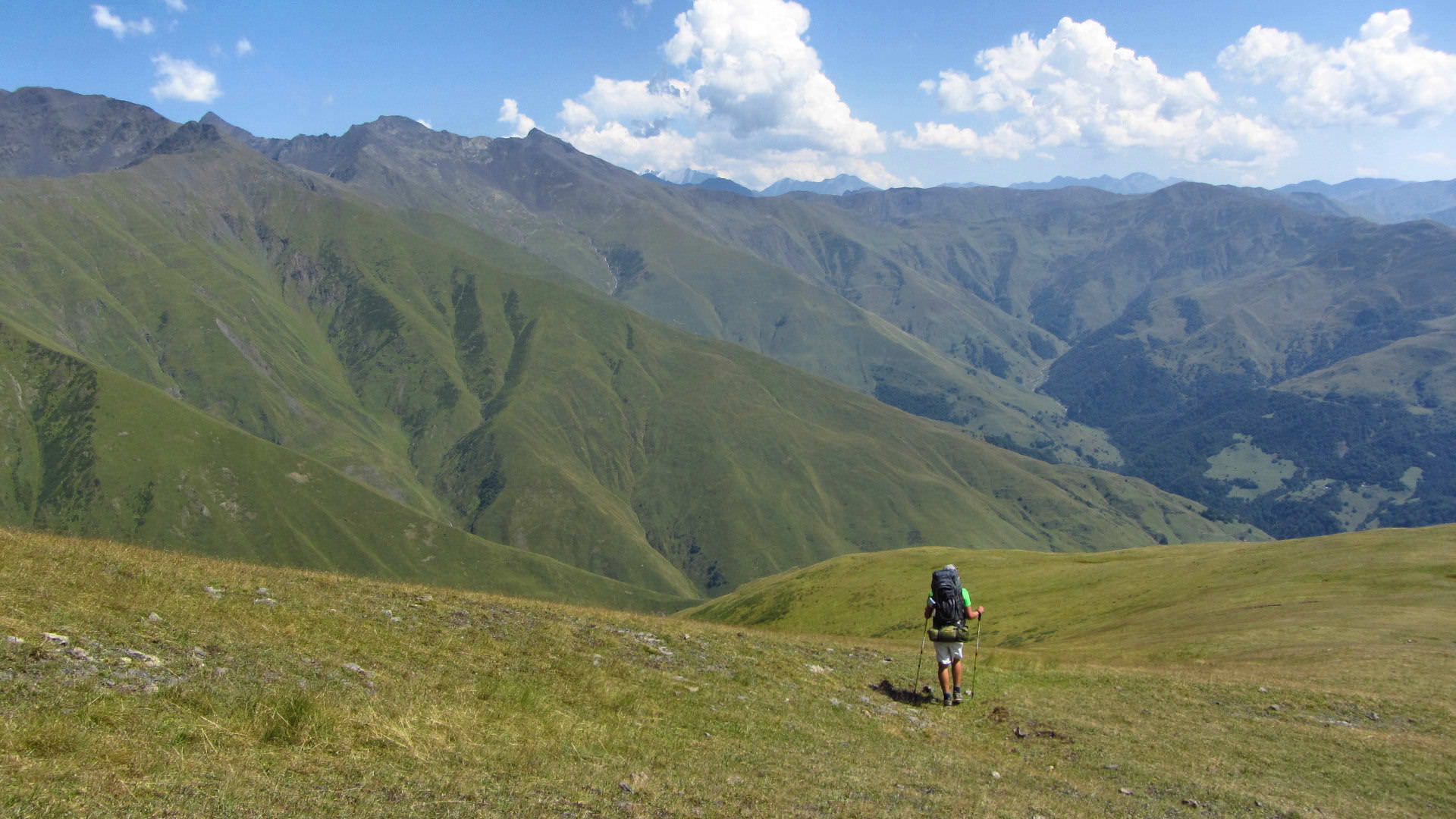
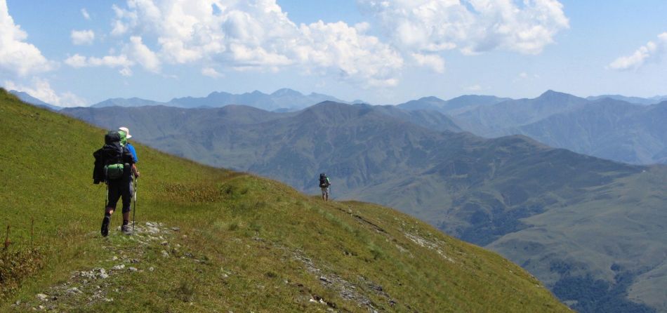
Around 9 am, we leave our camping spot and start climbing into Bogovachisghele pass (2968m). It´s quite a steep climb, but we are still fresh and reach the pass in less than one hour. We take a break - not because we would need it that much, but because of views. Ordinary tourists usually walk in the Caucasus with the head turned upwards so now we even more enjoy moments, when we can look at the world from the sizeable altitude.

Bogovachisghele / Roshka pass
We check the map, where to go next. Tourist path heads to the southwest and sharply descends into Roshka. But then, a side ridge, lying to the southeast catches our interest. It descends more slowly and promises great views. All we have to do is to follow the main ridge to Arkhotisghele pass (2935m) and join a trail crossing it. We squint into the sun and it seems that we truly see it, zigzagging in the hillside - it will lead us all the way to the road to Shatili at the spot where it crosses Arghuni river. If we walked to Roshka, we would have to hire a jeep or walk another two hours to the main road, so this will be actually a shortcut.
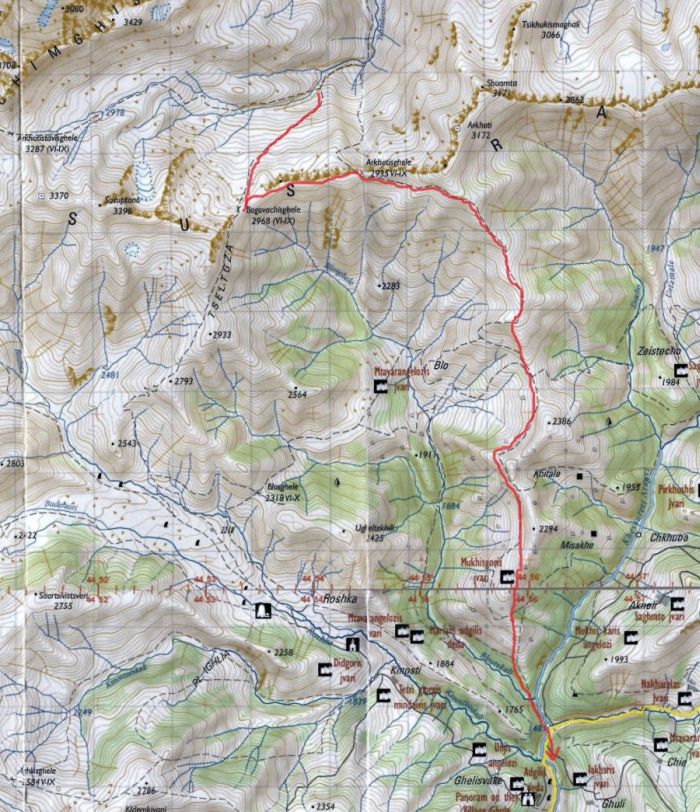
Our new plan
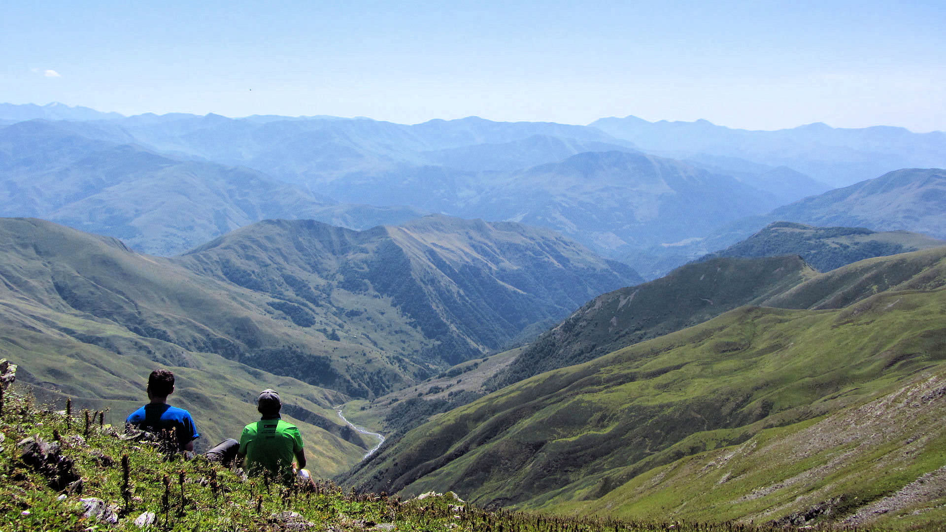
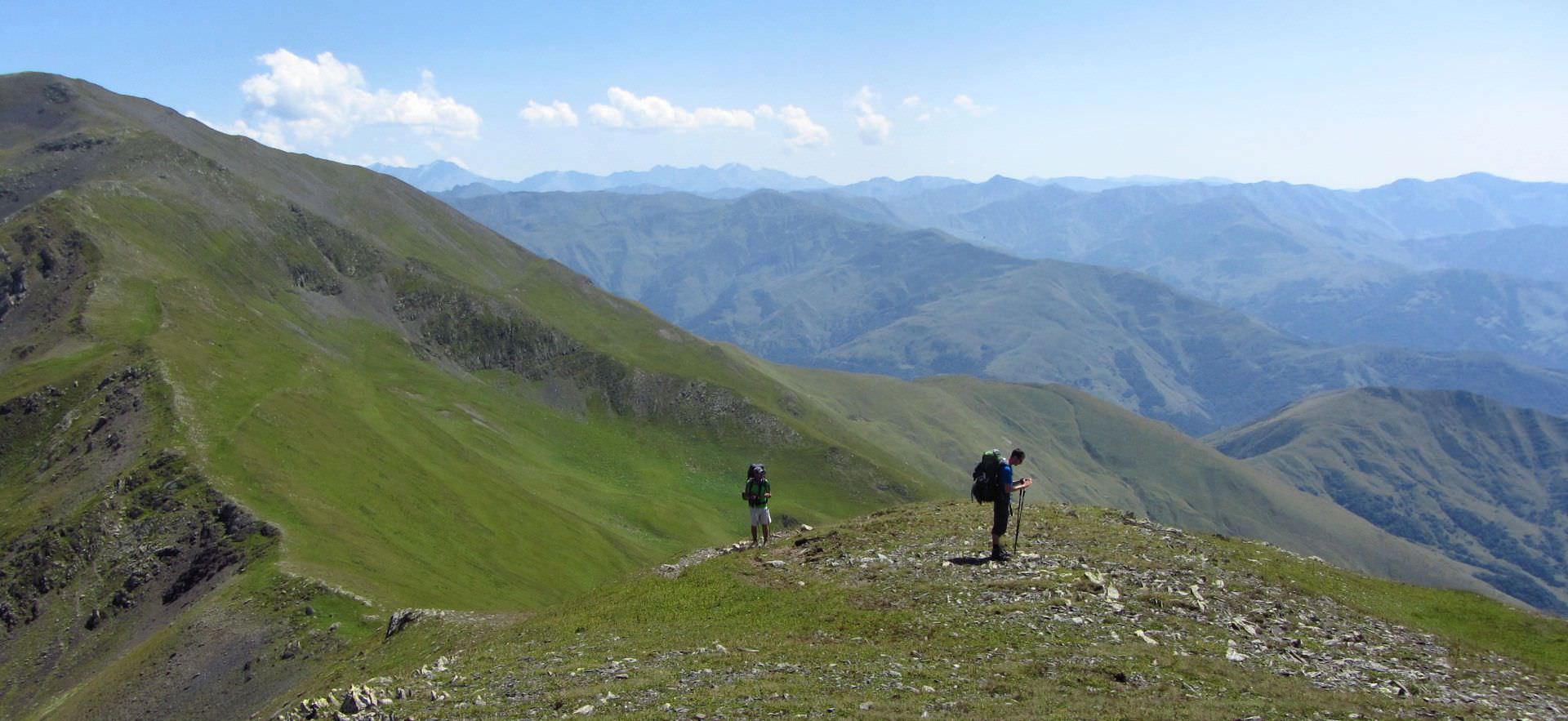
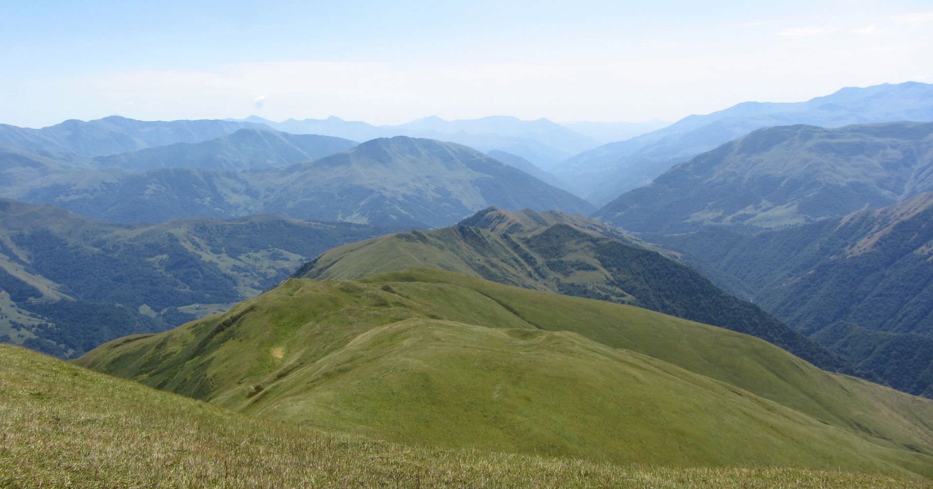
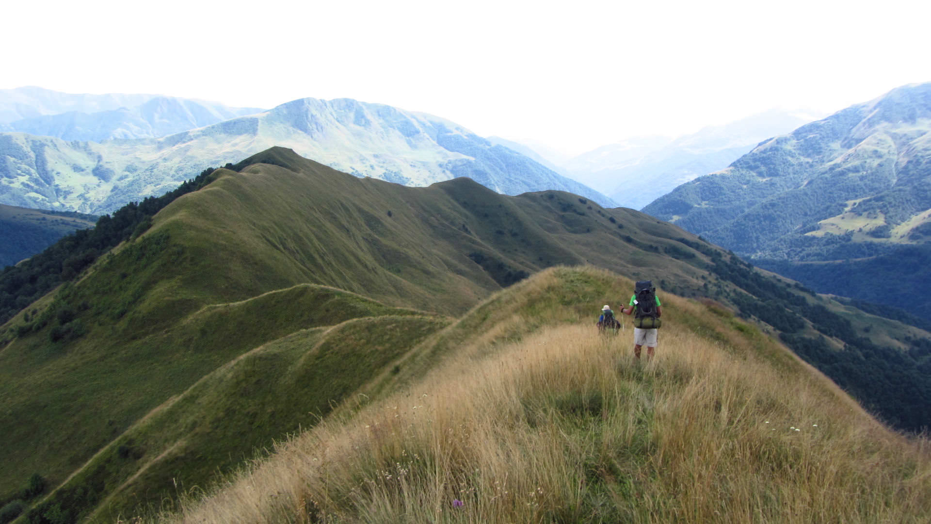
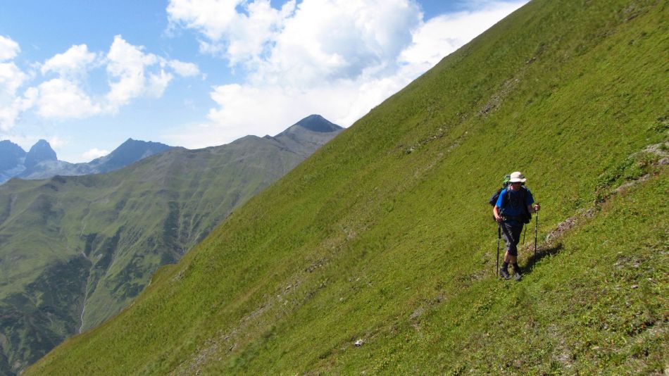
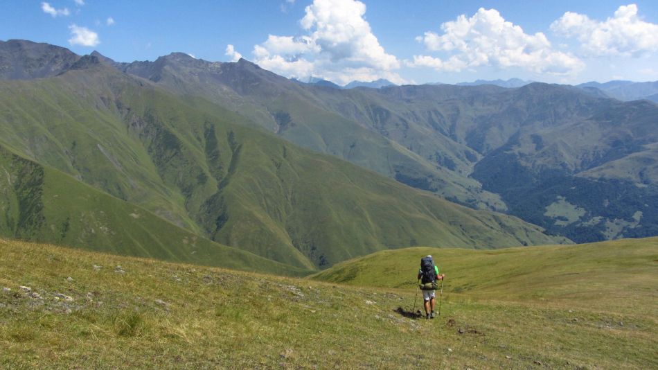
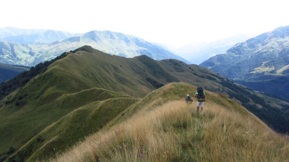
It´s decided, “the scenic route” wins. We set off on the ridge, the terrain is pretty walkable. Sky is clear, we even see Mt. Tebulo in the distance. I really like this section, it’s much different compared to previous days. In Georgia there are few “ridge walks” compared to Slovakia, tourists usually follow old shepherd’s roads which try to get from one valley into another as fast as possible.

On the ridge

On the ridge

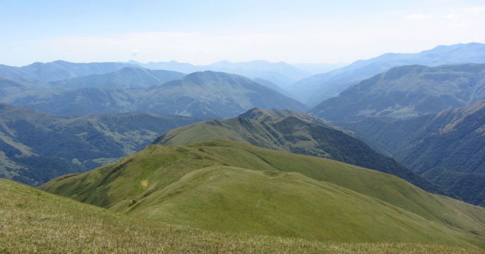
Above the Arkhotisghele pass
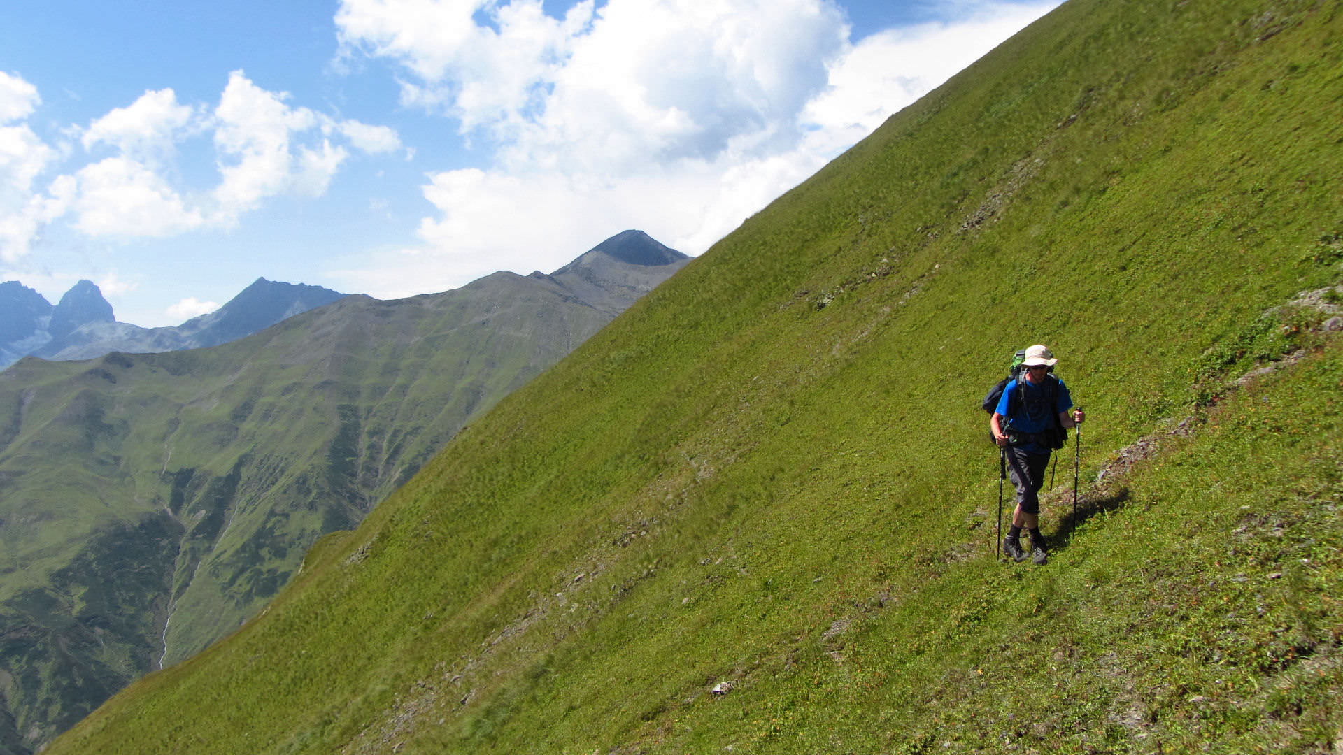
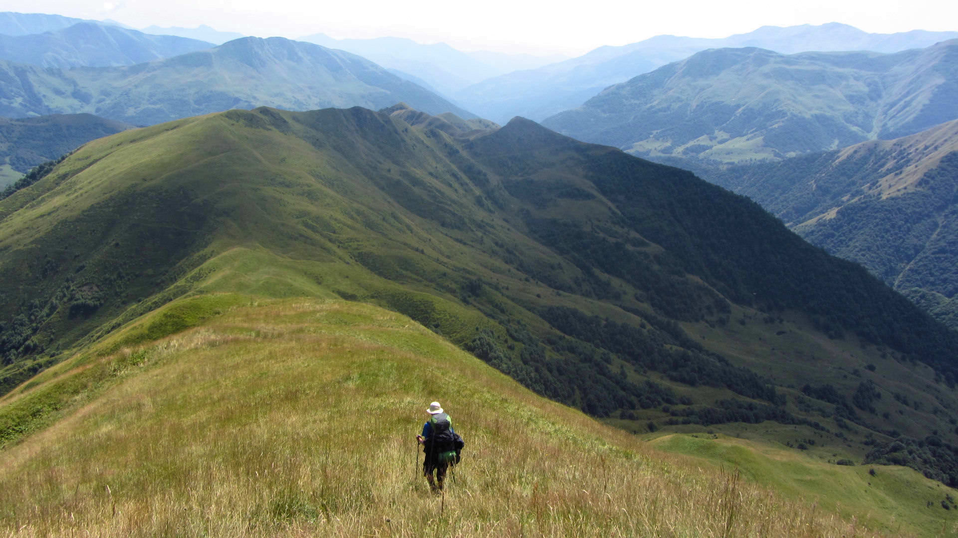
In Arkhotisghele pass, we join well-trodden path. For some time, we follow a contour line and around 1 pm. start descending.
Behind the pass
Traversing
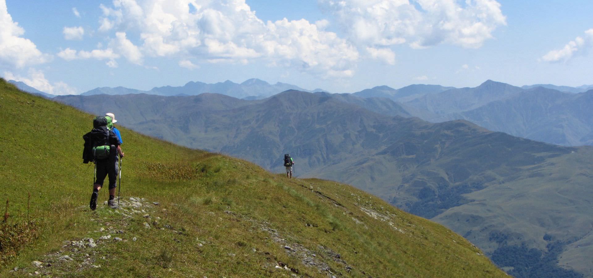
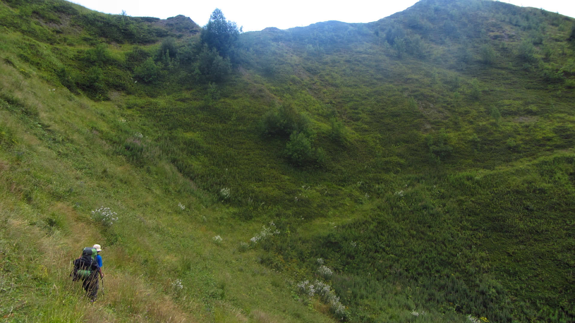
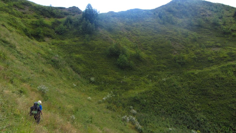
Initially is the grass quite stunted, but with decreasing elevation meters it reaches higher and higher and soon we have it above our knees. Our sparsely used pathway definitely gives up its fight with vegetation and before long we wade through pretty tall weeds.
Into the valley
Ridge ahead

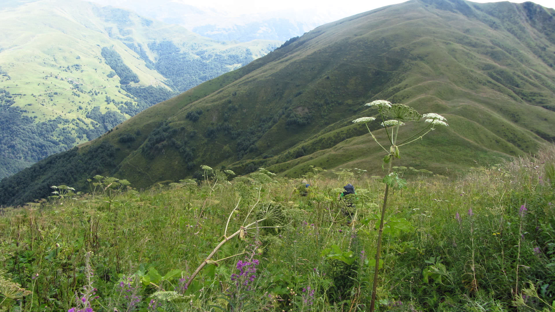
And the weeds are taller...
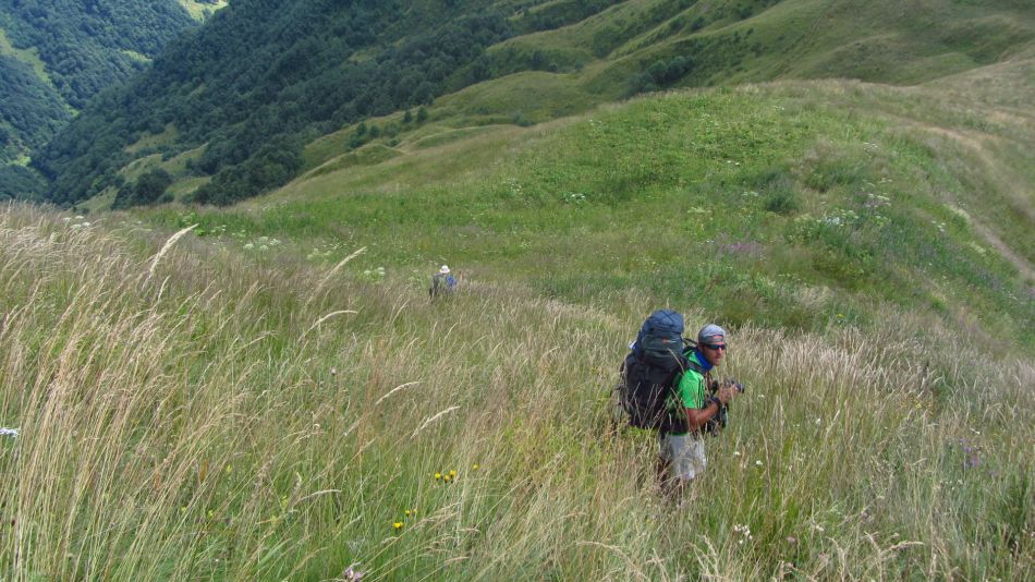
... and taller ...

... and taller
We sharply descent into some saddle. Ridge in front of us rises, but we are not in a mood to climb again and decide to traverse it. Not the best idea. The slope is steep and ragged. The dent in a slope, which we have originally mistaken for a path, is actually … well, definitely not a path. To traverse it is quite exhausting, each step could end with sprained ankle. Many blueberry bushes grow here, but they are only a small compensation for our sore legs.
Rough terrain
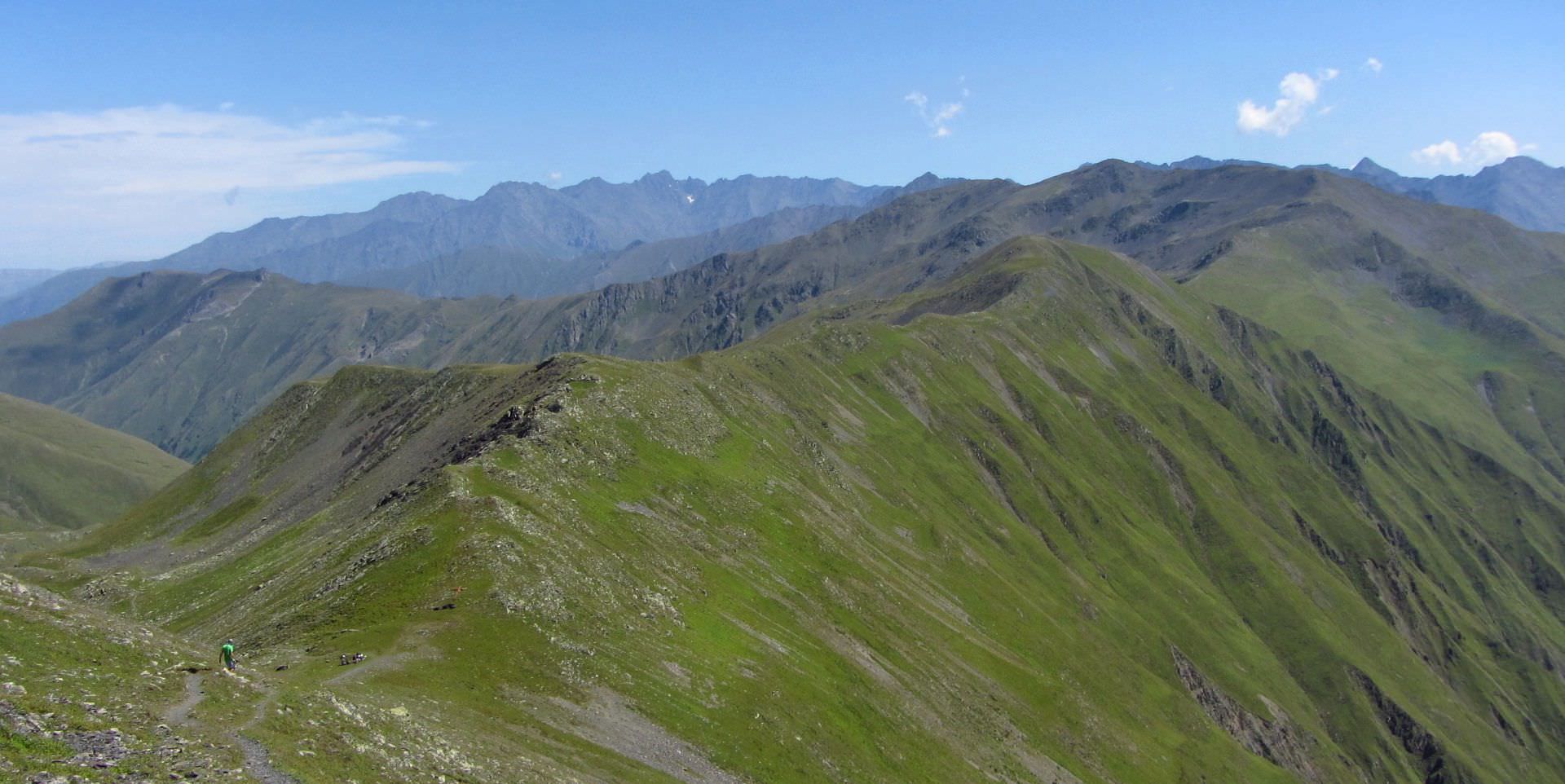
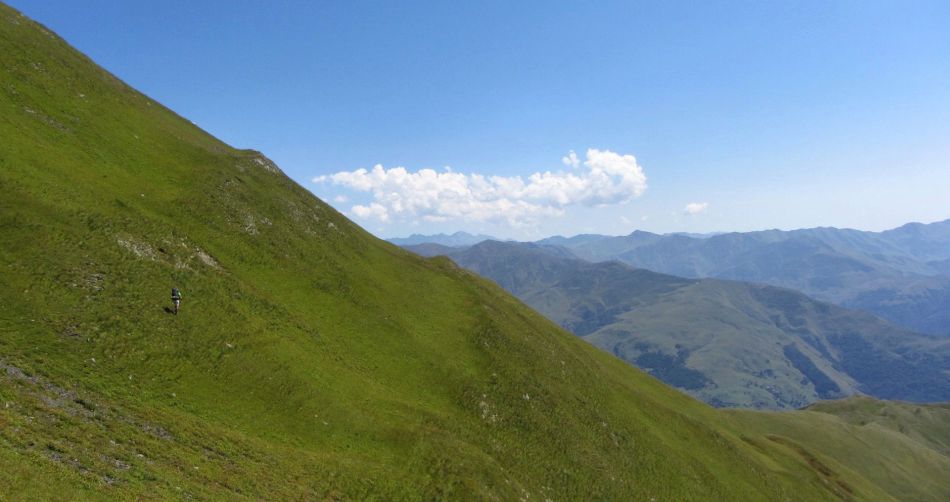
After we climb on one of the smaller side ridges, we decide that we can´t carry on like this and decide to climb back onto the main ridge. It´s truly easier to walk there, even weeds are not so high. The only nuisance is the swarms of flying ants. Also, the ridge is somewhat longer that we thought from the elevation of 3000 meters. During one small climb, I stumble and tear camera case I wear on a belt. I have to put the camera in the backpack.
On the main ridge again, one of last photos
Another hour passes till we reach the last elevation on the ridge. Here we find neglected “khati”, shrine typical for this region. It´s built of shale stones, about one meter high and decorated with bell and horned skulls. In the past, it was a place of rituals combining elements of Christianity and pagan faiths.
But right now, we care only about a single thing - how to get onto a normal trail. The terrain here sharply declines into forested jut, bordered by two merging rivers. Somewhere near their point of confluence should be a bridge and behind it, our coveted road - we even see a small part of it deep beneath us. We descent a bit and take a short food break beneath a lonely tree. Then we wade through meadows, which for ages haven´t seen a hungry ruminant.
Finally in the forest. We hope, that at least here we will be able to find a trail, which got hopelessly overgrown on meadows above. It´s half past four and sun is already slowly descending to the horizon.
Our wish comes true, we find several footpaths - but none of them leads in our direction. We slowly fight our way to the spot, where should be, according to the map, our bridge. The slope gets steeper and steeper. From time to time we catch a glimpse of a road behind a river, it can´t be further than 200 meters. But we still don´t see the river, only hear it - too deep below.
We put down backpacks and explore the area. I find one place when it “could work”. I take my pack and start descending, but soon it becomes too dangerous. Trees got replaced by bushes, which wouldn´t stop my fall. I don´t want to admit a defeat, stubbornly climb down - if nothing else, I want to see a river, find out, if the bridge is still there and we should keep looking for it. Lukas calls on me that I should let it be. There is another bridge on the map one mile upstream, maybe we will be able to cross the river there.
He´s right. I climb back, totally exhausted, backpack suddenly weights a ton. There is almost nothing to hold on, bushes break when I try to hold them. Finally up. I catch for a breath for several minutes, then I knock back all remaining water I have and I am still thirsty.
We set off to the west and after a while, we find a creek, first one since we left Arkhoti valley. I rush to it, thirstily scoop water into hands and I am not even bothered by tiny brown things, which swim in it and at the last moment save themselves by jumping back into the stream.
We carry on. I walk as the last on and my head is full of gloomy thoughts. This “scenic route” was truly not the best idea. If we want to catch the plane home, we need to be in Tbilisi on the next evening. But if we don´t cross the river even now, we will have a serious problem to make it on time. The river itself is not that deep - problematic are steep cliffs lining it, so we can´t get to the water (at least with all bones intact).
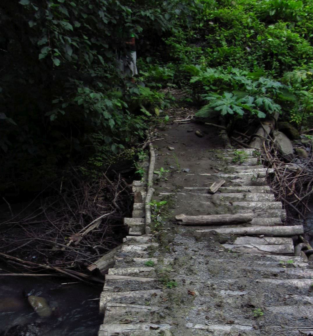
So far it´s looking good, we hear the river closer and closer. “Bridge!”, shouts Vic suddenly. And really. Trail in front of us turns into a hairpin bend, sharply descends and ends with a bridge. What a joy! We run down, I am so happy that I pull a camera from my backpack and make one last photo.
I cross the bridge, savoring every single step. We are on the other side… and our trail ends in a “wall of greens”. We mistrustfully walk there and back on a small piece of land, it has to continue somewhere! Well, it doesn´t. We brace ourselves and begin the last climb.
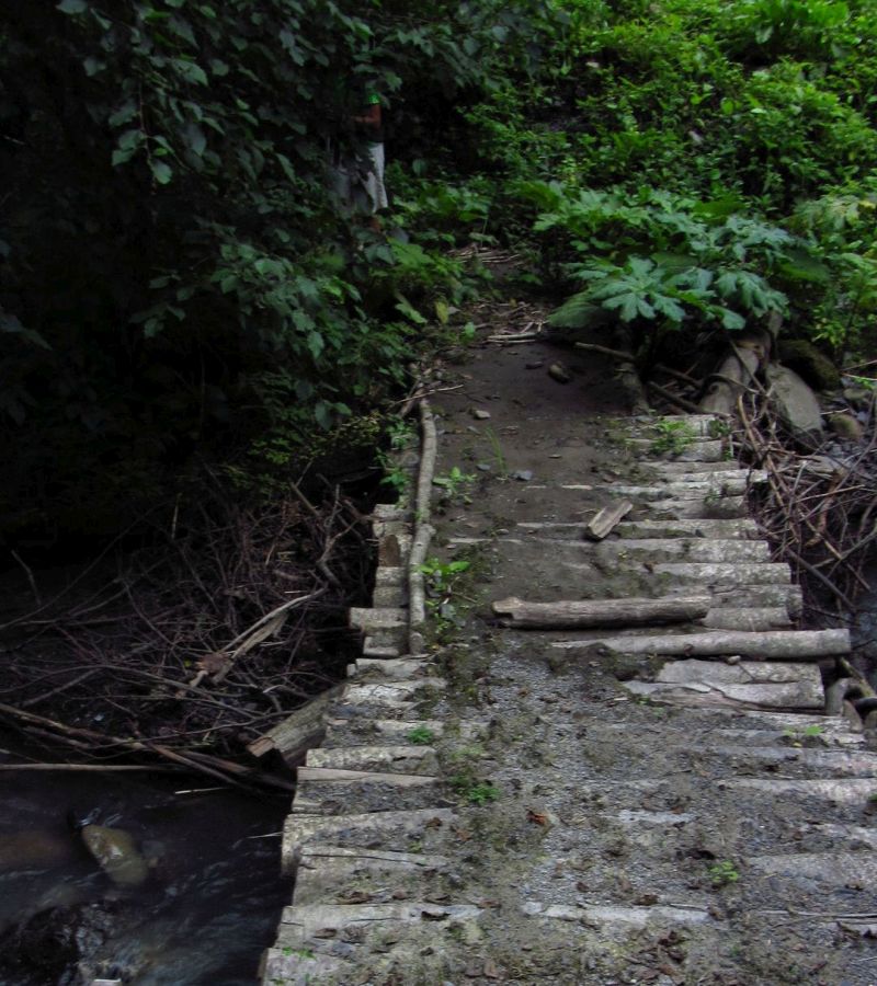
Our saviour
It´s pretty hard to explain, but since I am blogging, I will give it a try. So, first imagine a slope, quite steep one, let´s say with 45-degree gradient. Then densely populate it with huge burdocks, stinging nettles, raspberry bushes, and 2-meter tall hogweeds. And now imagine that you are climbing it, carrying a 20kg backpack. Active vacation for true gourmets.
We advance at the snails pace, each step is an incredible battle. The worst is stinging nettle. Vic, our main “weedbreaker”, at one moment stops and calls for a break, he can’t continue due to the pain. He puts on a long sleeve jacket. I should do the same, but at this moment, I simply don’t care. Let it sting, I will withstand it. My grandma told me once it cures rheumatism.
I wade forward, pluck stinging nettles, stomp on hogweeds, only raspberry bushes I sidestep with respect. I don´t think about anything, only mindlessly repeat mantras such as "Where the will is, the path is, too" and so on.
It took us over an hour to get out of this jungle. We get into the zone, where groups of trees alternate with overgrown clearings. The area is covered by cowpaths which lead everywhere and nowhere. We repeatedly find a nice path in the forest, only to get stuck in dense raspberry bushes 50 meters further. We realize that today we will not make it anywhere and look for a place to camp, but we can´t find a spot, which is flat enough.
In the meantime, it got completely dark. We turn on our headlamps, but we don´t have the slightest urge to wander in the dark in the unknown terrain - not all pieces of crap the destiny has sent below our feet today were of cow´s origin. Suddenly, we miraculously discover a small platform. We trample down weeds and build a tent - there is a place for only one, Lukas has to bivouac. I´m hungry and at the same time I´m in no mood to eat, so I force myself to digest half of Snickers bar and crawl into the sleeping bag.
I don´t feel well. I´m hungry, thirsty, exhausted, scratched, stung and burned. In spite of the fatigue I can´t fall asleep because of unbearable itching. And so I just lie, listen to the sounds of an awakening forest and wonder, what the next day will bring.