A harder and more scenic alternative for the last section of Mestia - Ushguli trek.
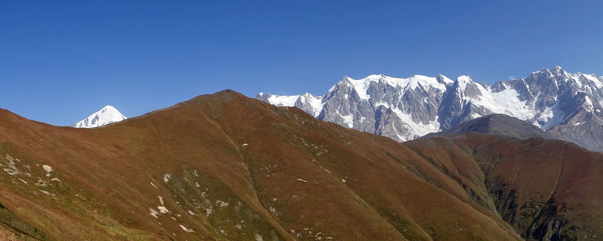
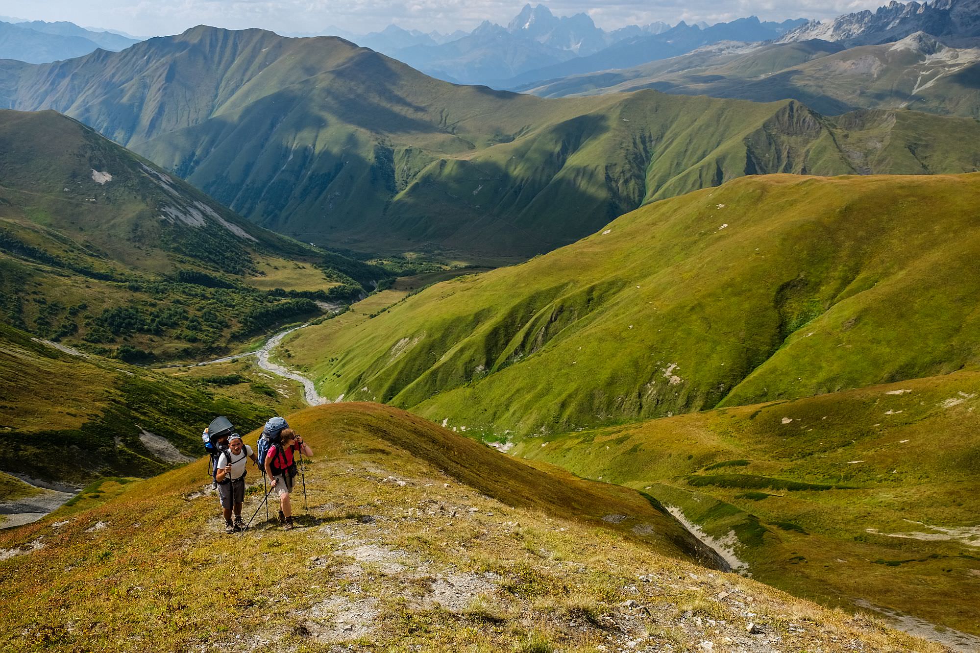
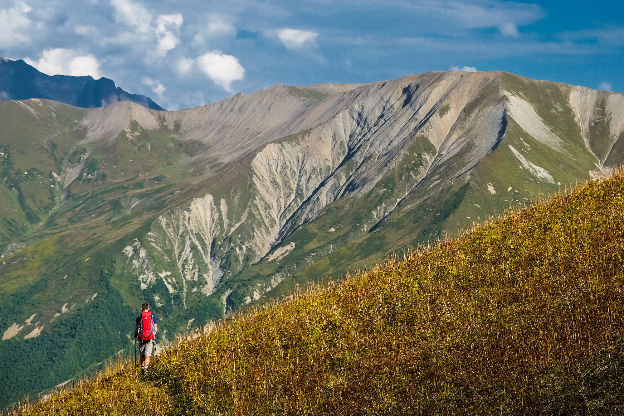
A great hike connecting some of the most beautiful valleys in Svaneti. The highlight of the walk is the crossing of the 3000m high Lagem pass (sometimes also known as Southen Karetta), which provides great views of the highest mountains of Georgia.
It should be however noted that this walk doesn't work that well as a standalone hike - it's rather a great alternative to day Four of Mestia - Ushguli trek for trekkers like the challenge. So instead of following the bottom of the valley to get to Ushguli, they use more scenic (and demanding) route across the mountains. As of 2018, the trail was little-visited but is steadily gaining popularity and in a few years, it has the potential to get as many visitors as the classic trail.
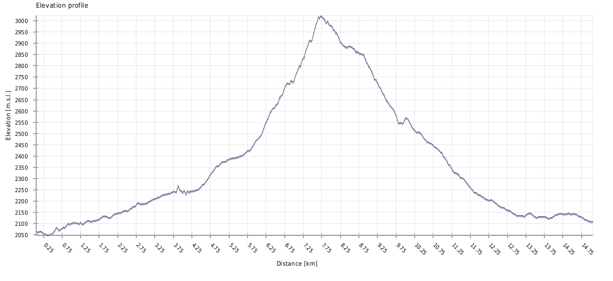
The trail takes 6-8 hours to finish (with breaks).
Based on its parameters, this is a trail of Moderate difficulty. Still, there are a few factors which can ramp it up. The trail is "unofficial" - it´s not marked, the bridge at the beginning is in a bad condition and due to the low number of hikers, some sections may be overgrown. Also, the terrain at both sides of the pass is pretty steep - this is not a good pick for hikers who prefer maintained, curated trails.
The majority of people planning this hike will probably get to Khalde on foot, following the classic route from Mestia to Ushguli.
If you, for some reason, want to do this walk only as a day hike, you will need a taxi to get to Khalde. The price for a ride from Mestia should be more or less the same as the ride to Mestia (200 GEL), only, in this case, it will be almost impossible to find other tourists willing to share the costs so you may have to book the whole car.
If you need to return to Mestia, your best bet used to be minivans making day trips from Mestia to Ushguli. They usually had a few empty seats on the return trip which occured around 3 pm. . However, in the past years, drivers became reluctant to bring hikers back since the Ushguli drivers try to claim all hikers that reached village on foot and other drivers don't want to have problems with locals. So don't rely on these buses too much. So what to do? You can either take a taxi from locals (costs as much as 40 GEL per person) or walk on the road towards Iprali and once the village is out out sight, try to stop some minivan with daytrippers, that should be a bit cheaper.
It's like cab mafia there, we managed to get in a bus for 20 GEL but the cab guys saw it, followed by car, stopped the bus and made us leave it. We kept walking since we didn't want to support this behavior and they even followed us half an hour by car. Later on the gave up and we manged to get another bus.
If you want to prolong your trek, you can cross into Lower Svaneti on foot via Latpari pass or Zagar pass.
| Distance | 15,1km |
| Trail type: | AB trip |
| Max. elevation: | 3022m |
| Min. elevation: | 2048m |
| Total climb: | 1248m |
| Total descent: | 1191m |
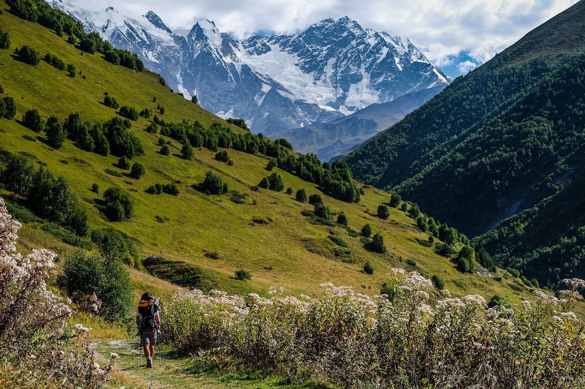
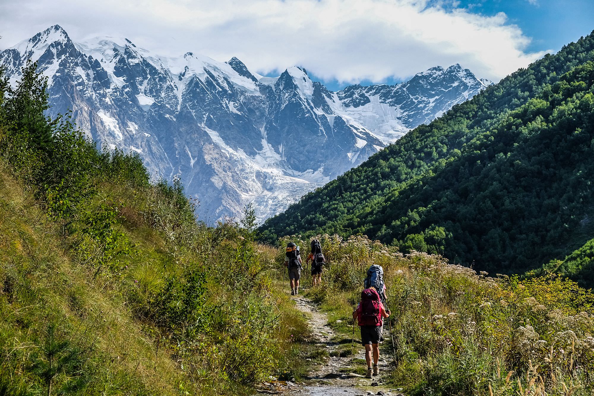
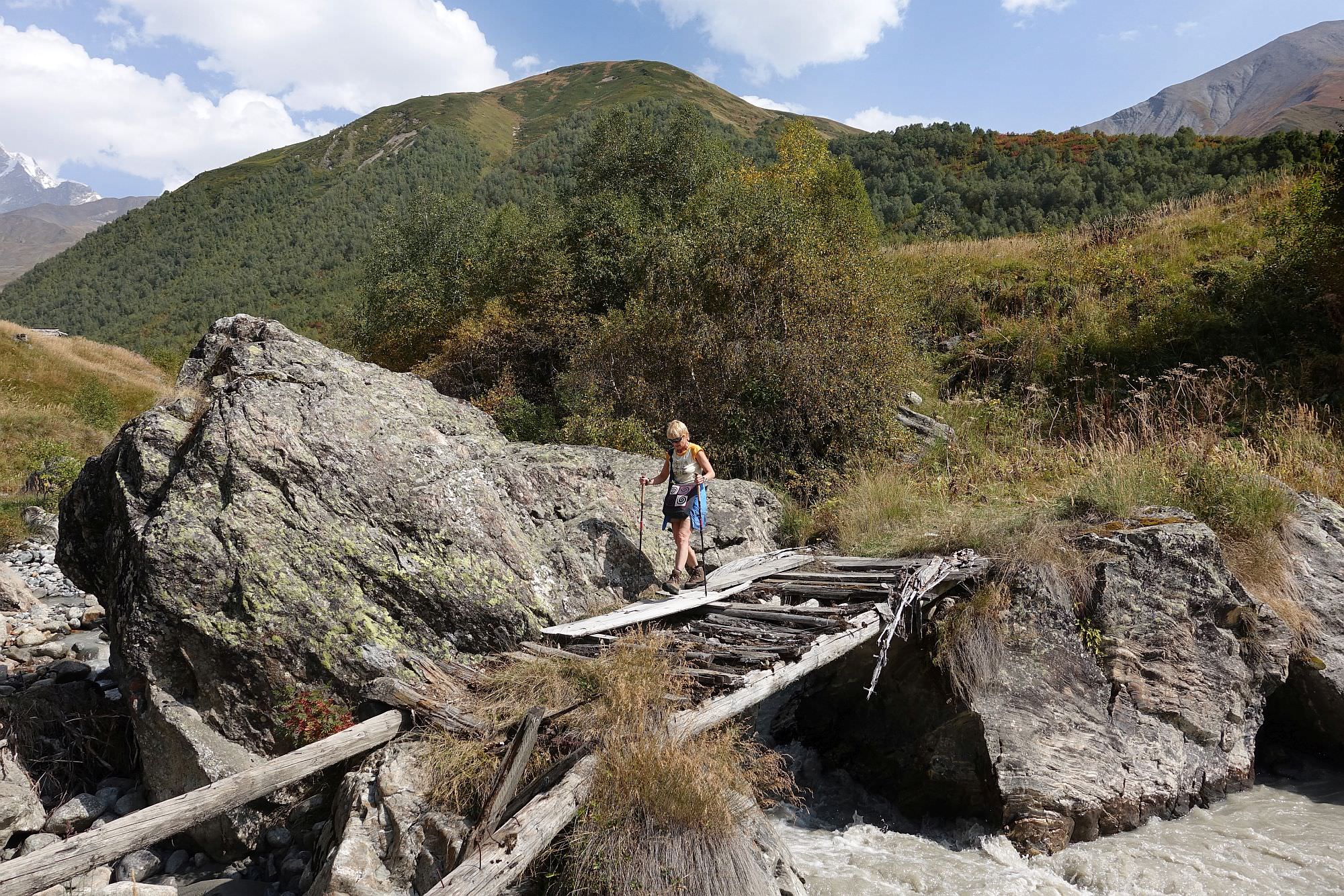
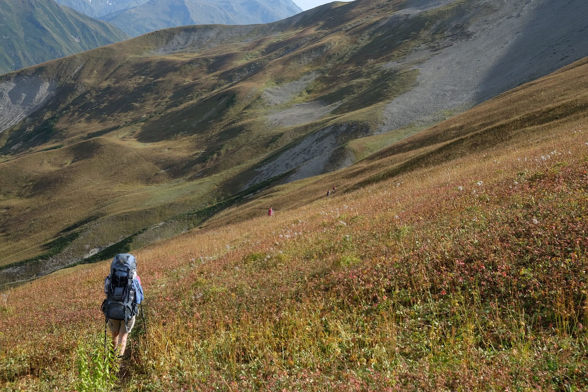
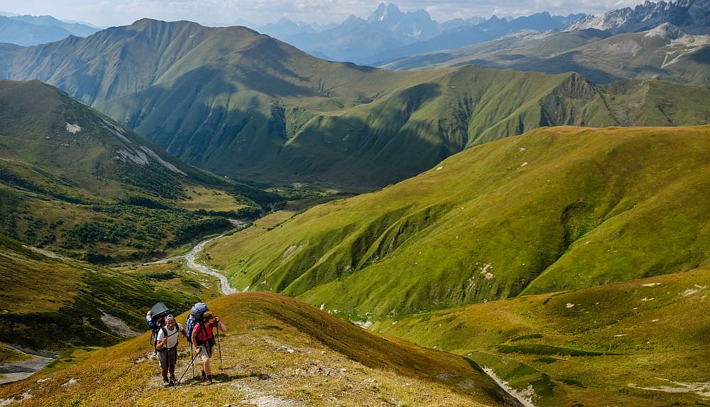
The trail starts in the Khalde village. First, follow the dirt track to the north (essentially backtracking if you came from Adishi on the previous day). Less than an hour later, you will reach the marker where the trail to the Chkhunderi pass branches to the left (you will see several shepherd huts on your right). From here, walk straight and look for a small path in a grass branching to the right. It crosses the swampy meadow and approaches the river. It may be overgrown and hard to find (depending on the "traffic"), if you are not sure, just follow the GPS log.
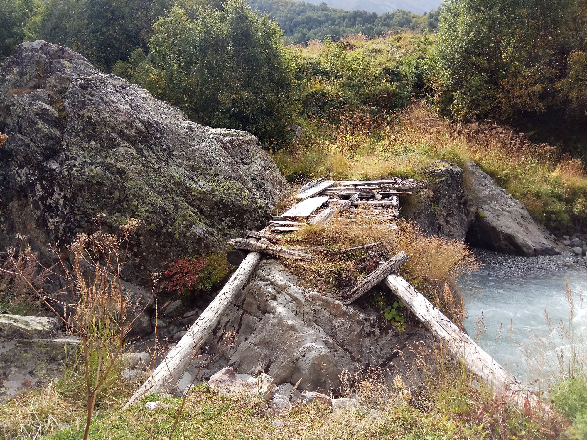
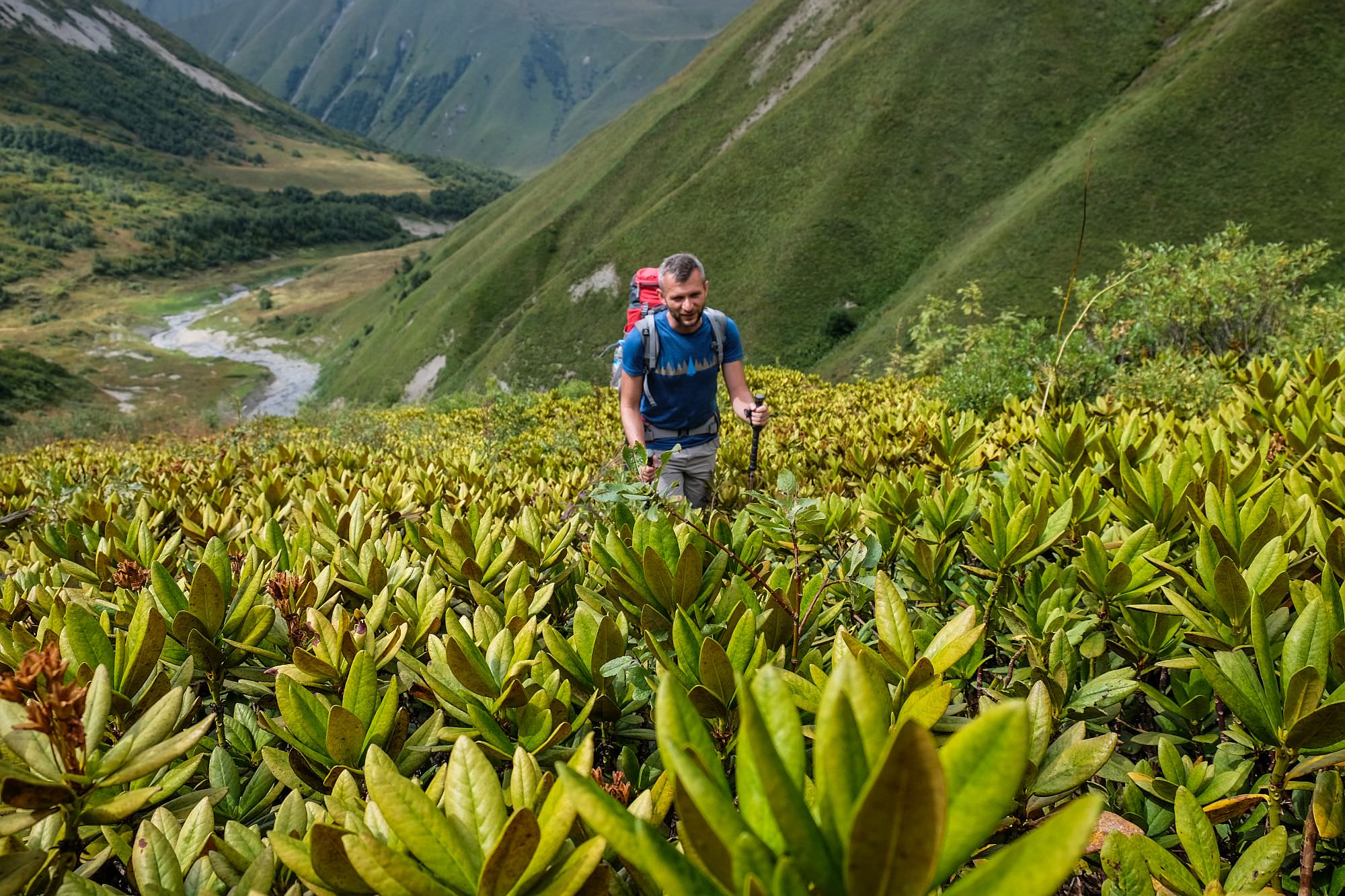
If you took the correct path, it should lead you to the bridge, partially hidden behind a large boulder. The bridge is old and not in the best condition, but still holding (in 2018). If you are doing Mestia - Ushguli trek with a tent, you can save the whole "to the Khalde and back" detour and sleep around here, there are some drier camping spots. From the bridge, head across the meadow to the south for some 200 meters until you reach a subsidiary of the Khalde river. Turn left here and follow it upstream - the trail here is somewhat hard to follow since it crosses numerous bushes and rhododendron fields.
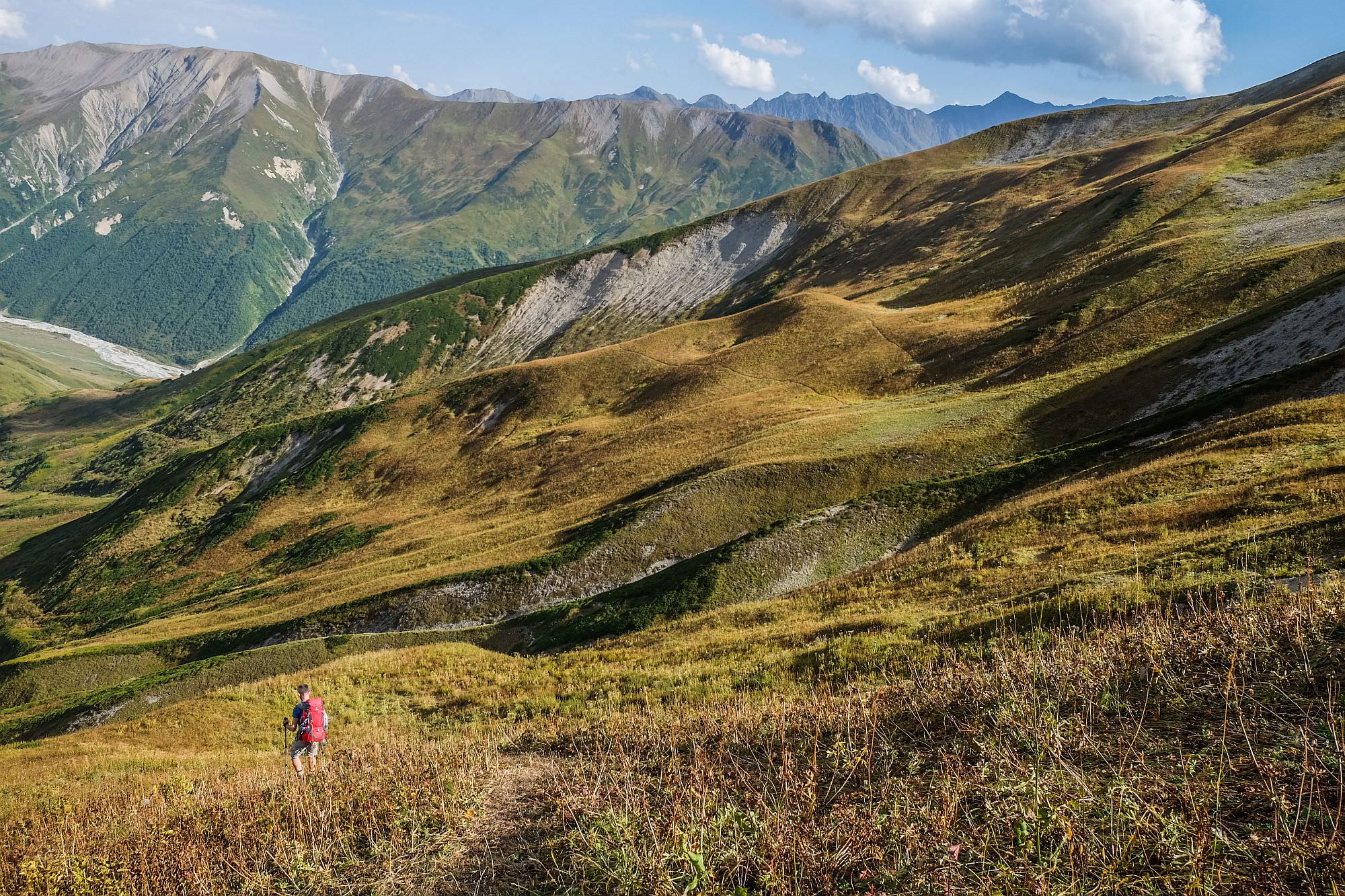
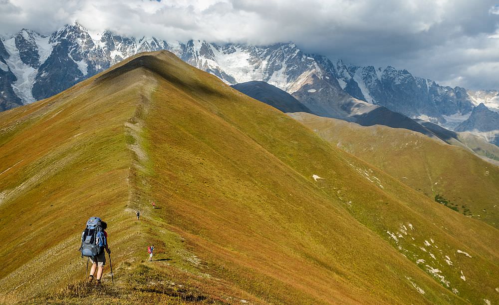
Some 20 minutes later, you will come to the place where the stream branches, follow the branch to the left (more rhododendrons!). Soon, you will come to the spot where it splits again. Here, you need to cross the stream and climb onto the ridge standing between the branches of the river. There is one last rhododendron belt to cross. At these moments, you can already see Lagem pass high above, it lies a bit north from a spot where the side ridge you will be climbing connects the main ridge.
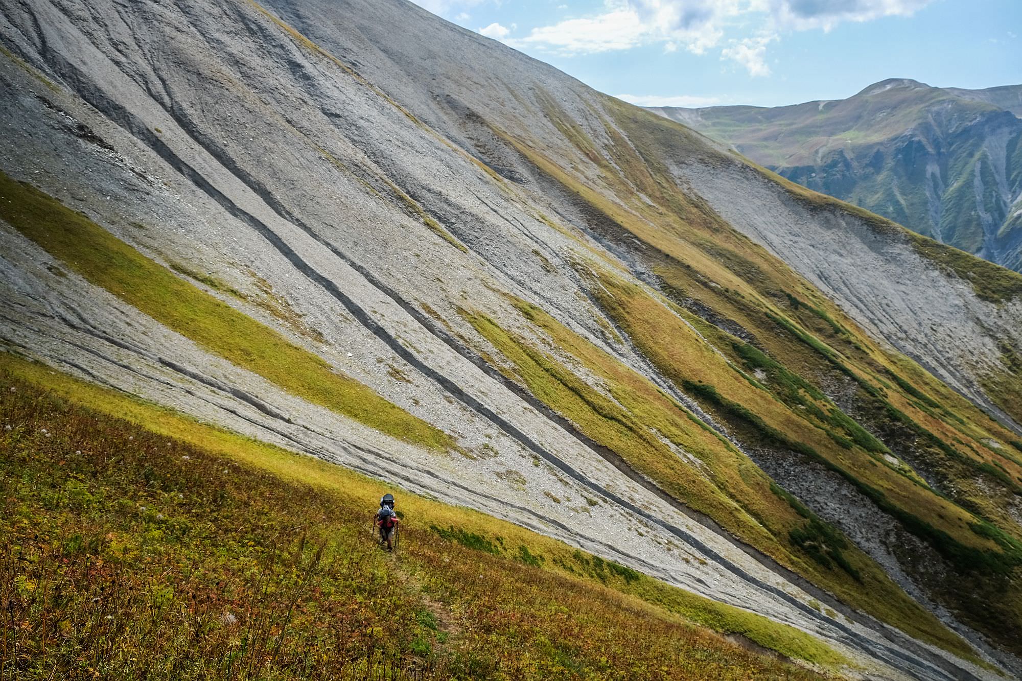
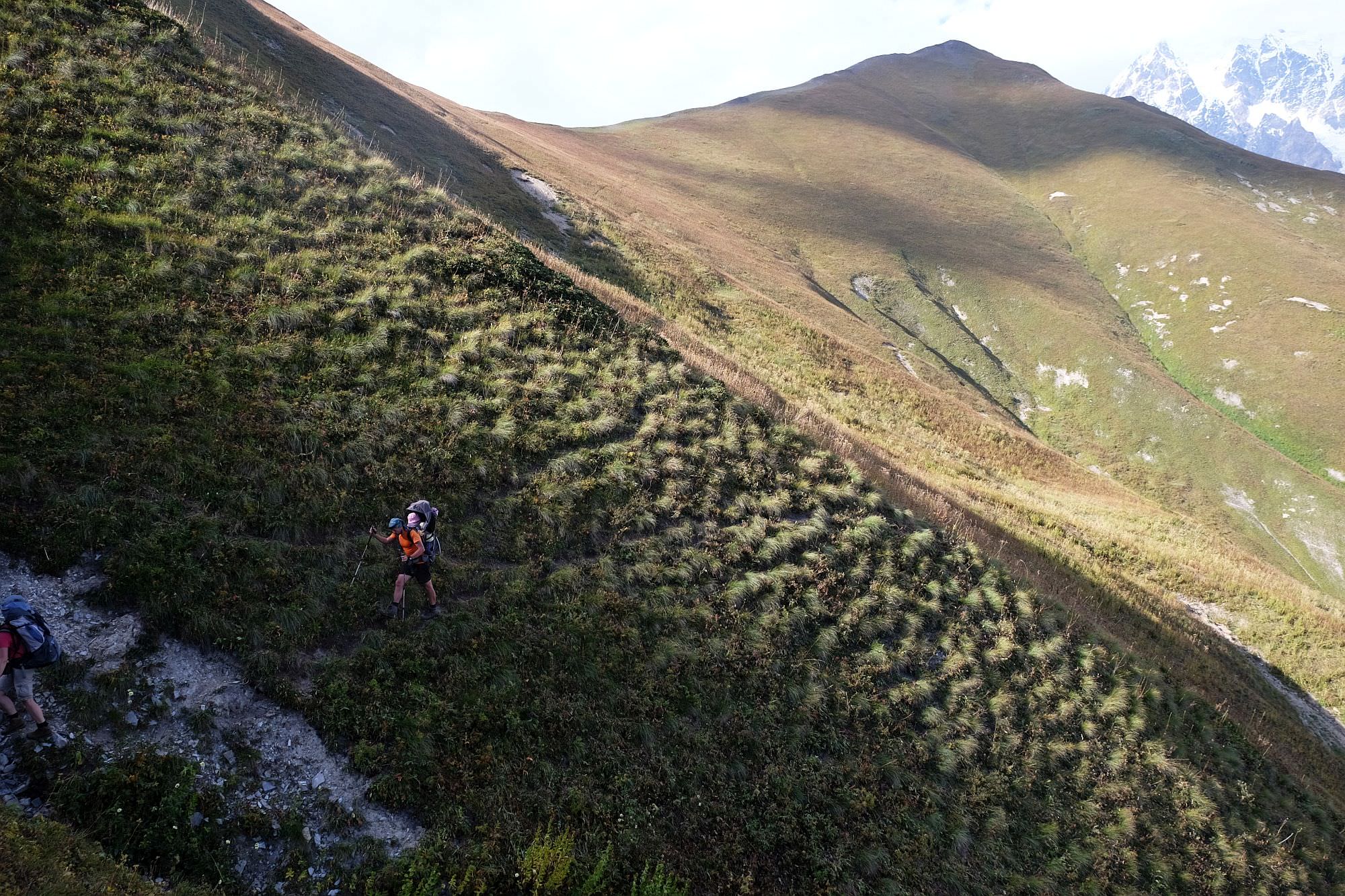
There is not much to write about the climb to the pass - it's difficult, tiring and very steep. There are almost no switchbacks, you just keep going straight up. The last section is the worst, you walk on the grass which is slippery even when dry and during rain may pose a serious problem.
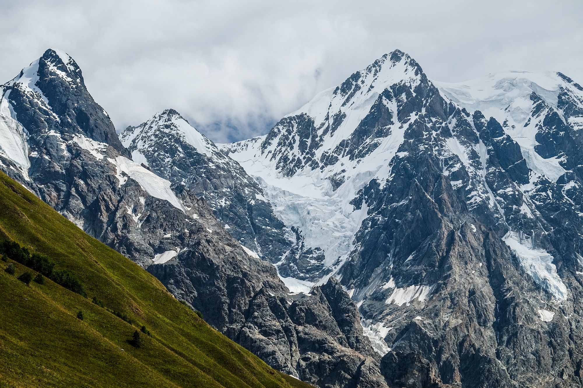
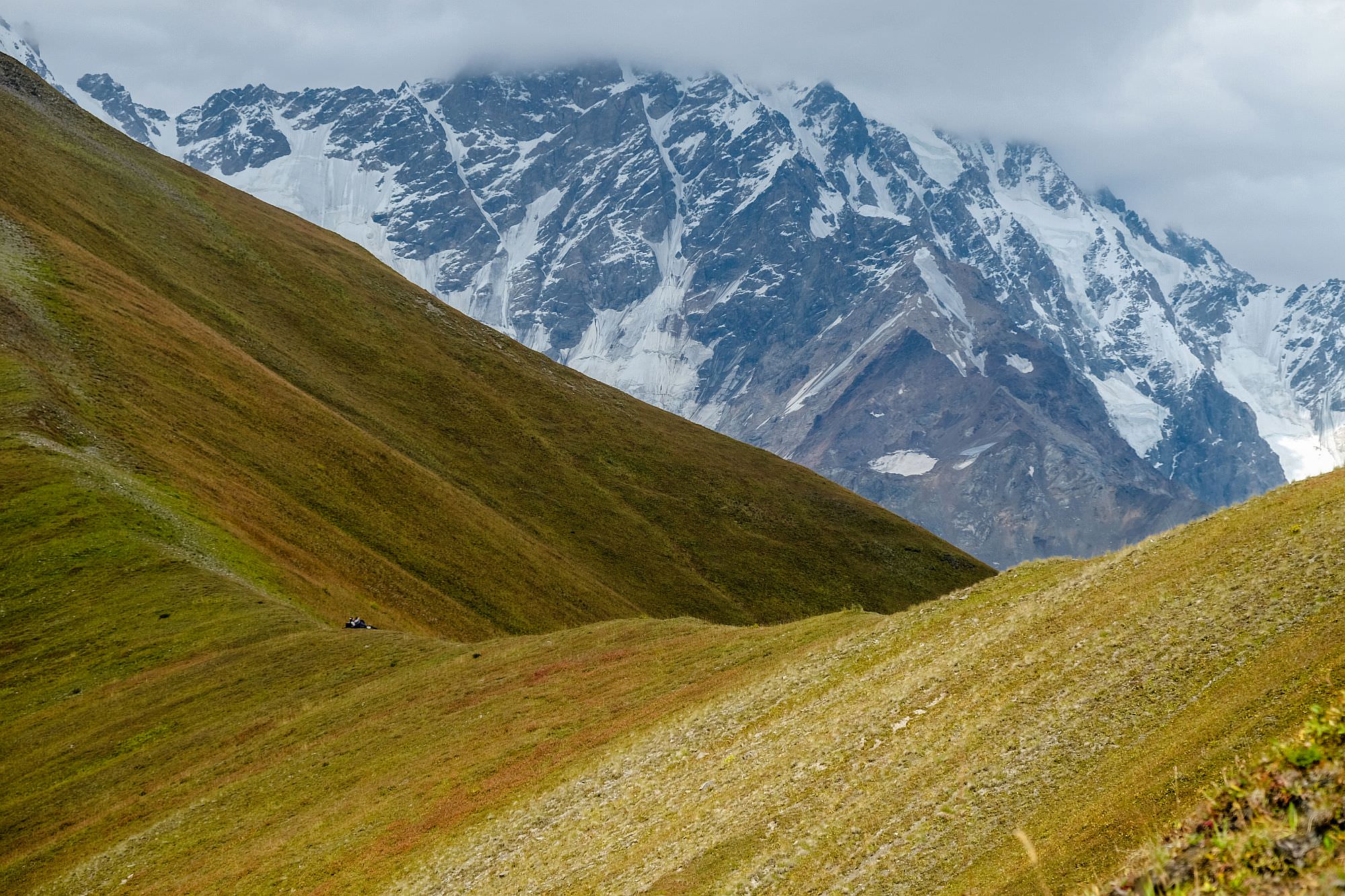
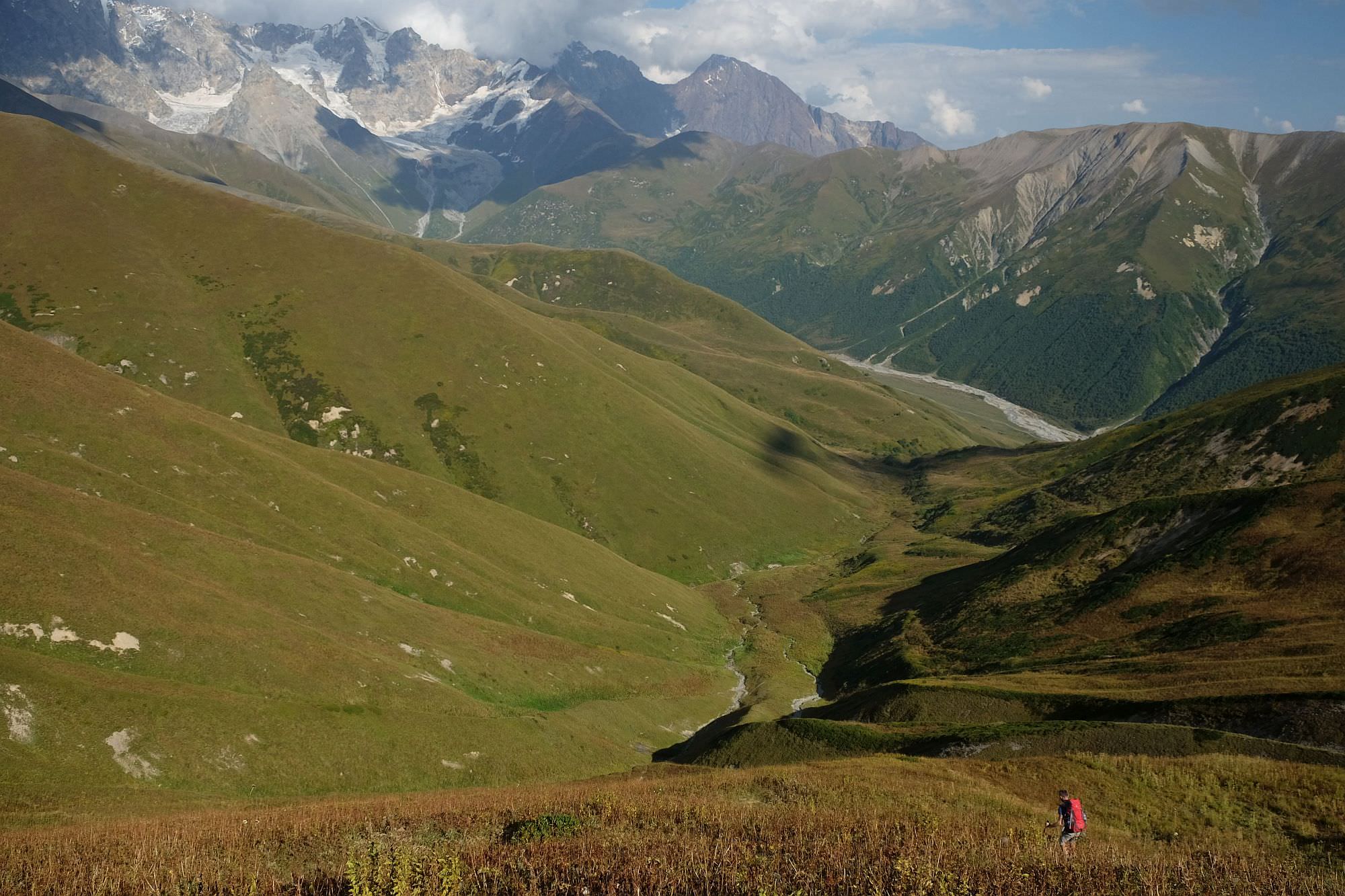
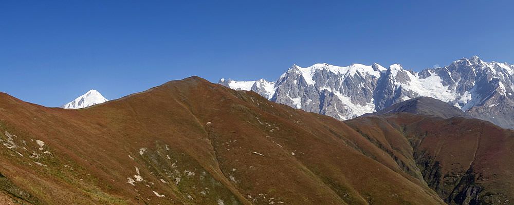
Lagem pass lies at the elevation of almost 3000 meters. If you have a good split time and the sky is clear, I recommend to climb also the elevation to the north (3200m) for even better views of Georgian side of the Khalde wall (Georgian side of the more famous Bezingi wall on the Russian side) with Mt. Shkhara (5193m), the highest mountain of Georgia.
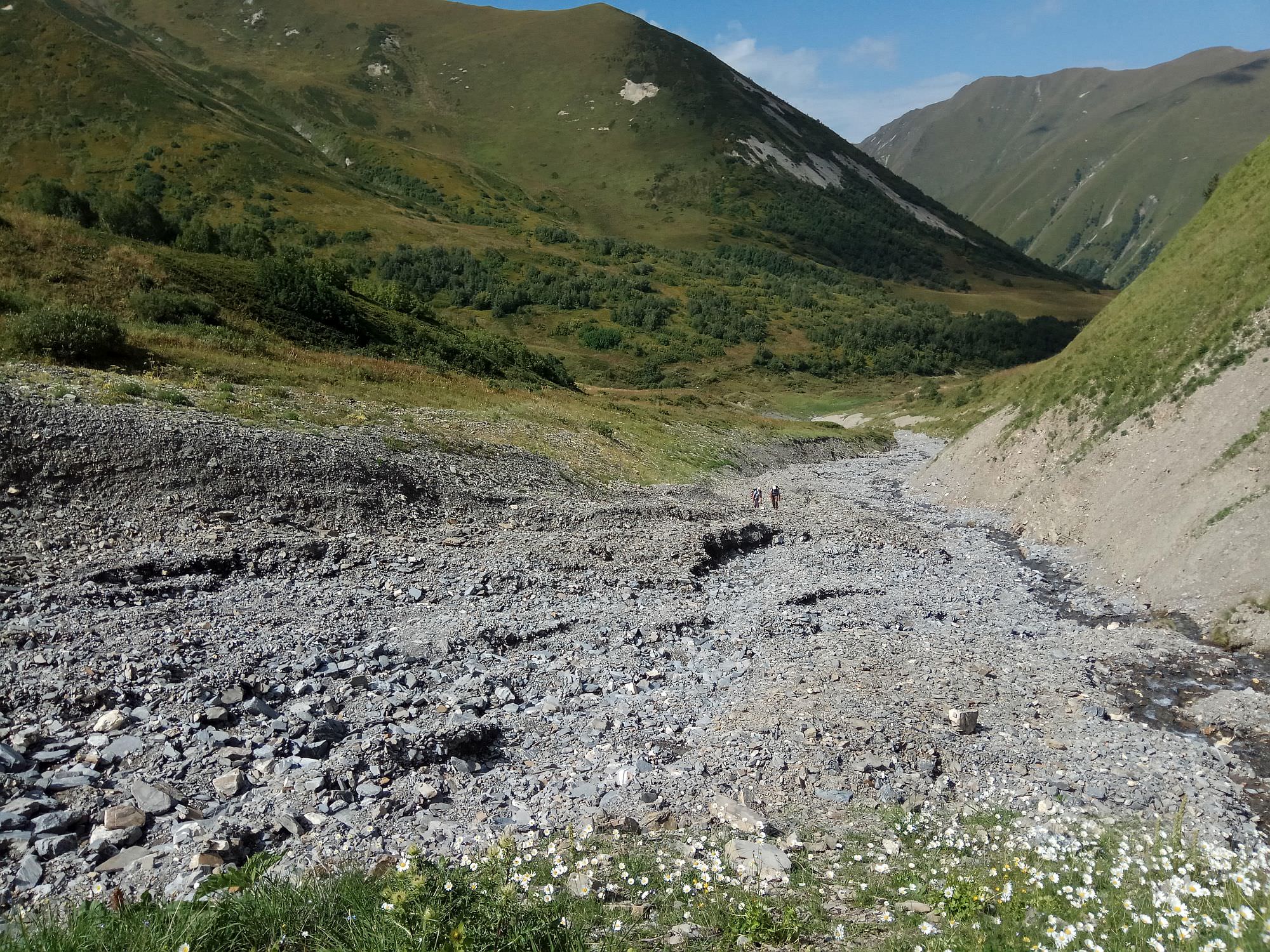
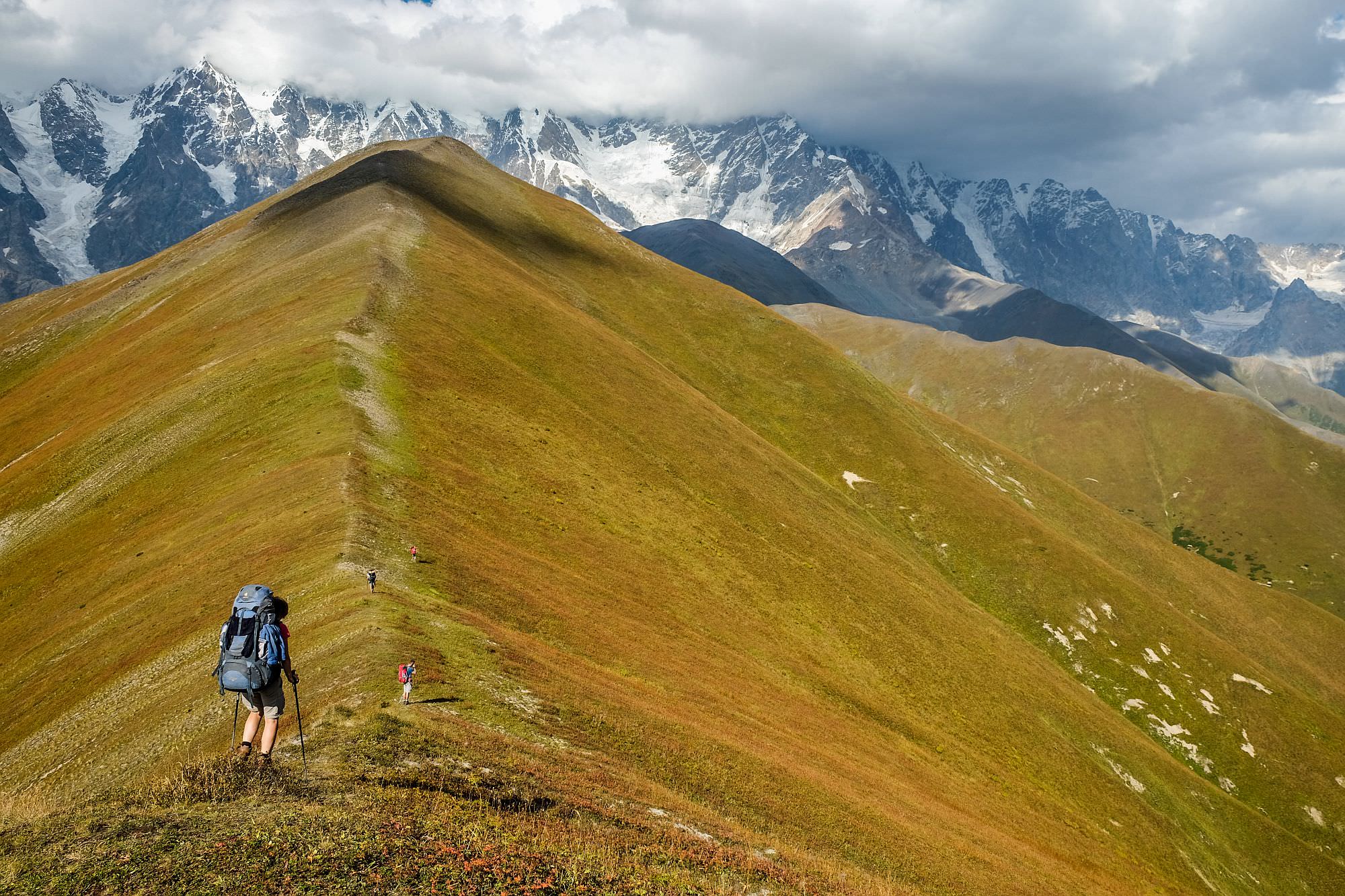
As for the descent, it´s not as straightforward as the climb. First, the trail descends only slowly and while sticking to the hillside heads south, in the direction of a small ridge. Deeper below, you can see a small creek running at the bottom of the valley. The trail passes it and starts descending only later, so you have this valley on your left. You head to the place where the side ridge you traverse drops to the confluence of Pakvlashi river and the creek on your left. However, at these sections, it may be hard to follow since the trail is in a bad condition. Therefore, some hikers prefer to descend to the bottom of the valley and just follow the riverbed (especially in the late summer when the water level is low).
No matter which way you choose, both routes meet by the Pakvlashi river. The route from here is straightforward since you already see Ushguli ahead. Just follow the trail while slowly losing altitude and getting closer to the larger track below which leads to the Shkhara glacier. Both routes eventually merge before the village. All you have to do then is walk another mile, cross the bridge over Inguri river and pass the Lamaria monastery. Welcome to Ushguli!
This post would lose a major part of its appeal if it wasn't for Anna Kwitowska who provided me with many great photos. Several other photos were provided by Jitka Jakešová and Michal Masztalski.