Popular 5-day trek connecting historical centers of regions Tusheti and Khevsureti.
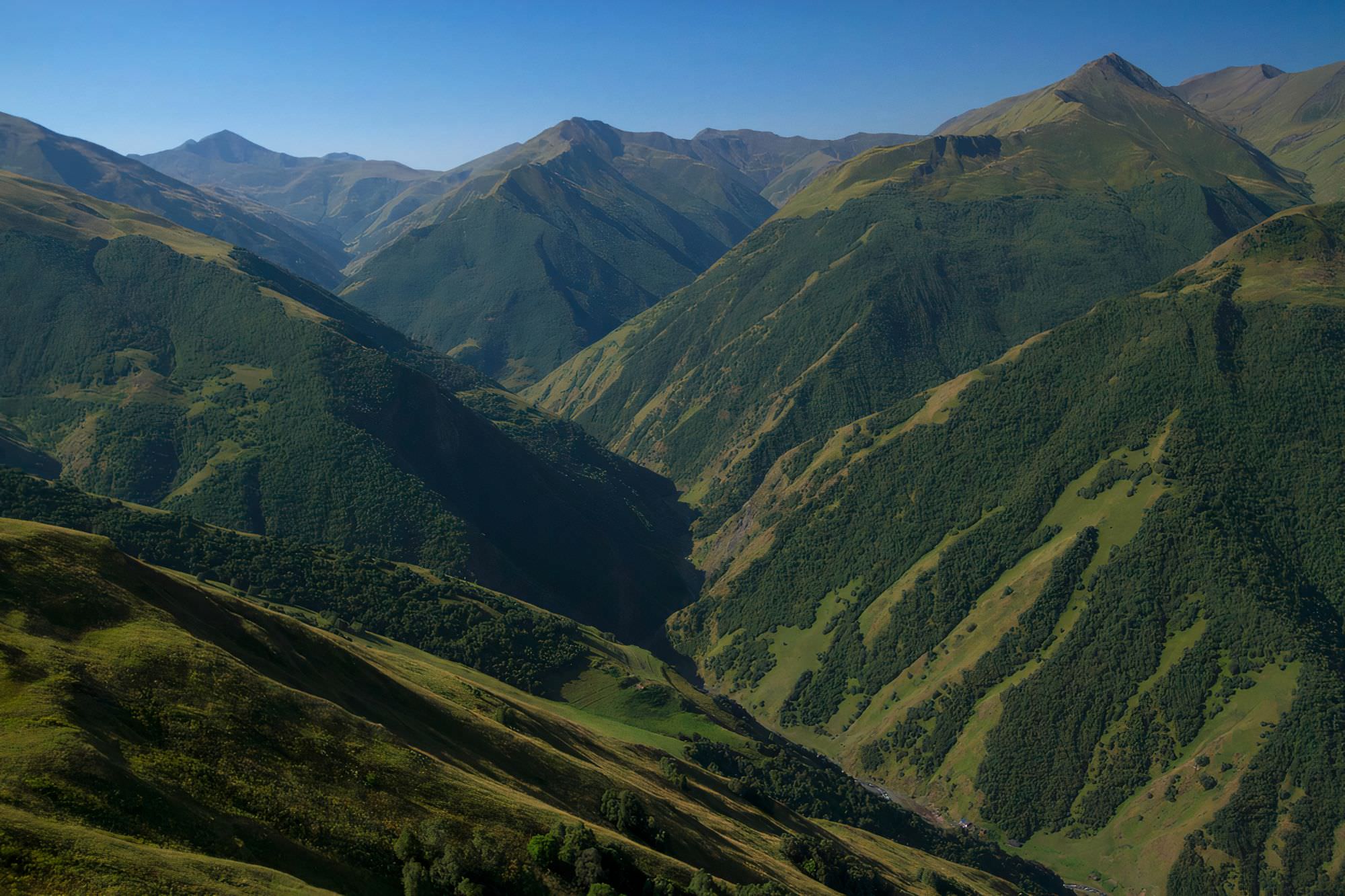
Trek from Omalo to Shatili is a marvelous 5-day adventure that connects villages Omalo and Shatili, historical centers of regions Tusheti and Khevsureti - both are still quite unspoiled due to poor roads. It offers a perfect combination of nature and culture - you will be amazed not just by mountain views but also by traditional medieval villages dominated by stone towers.
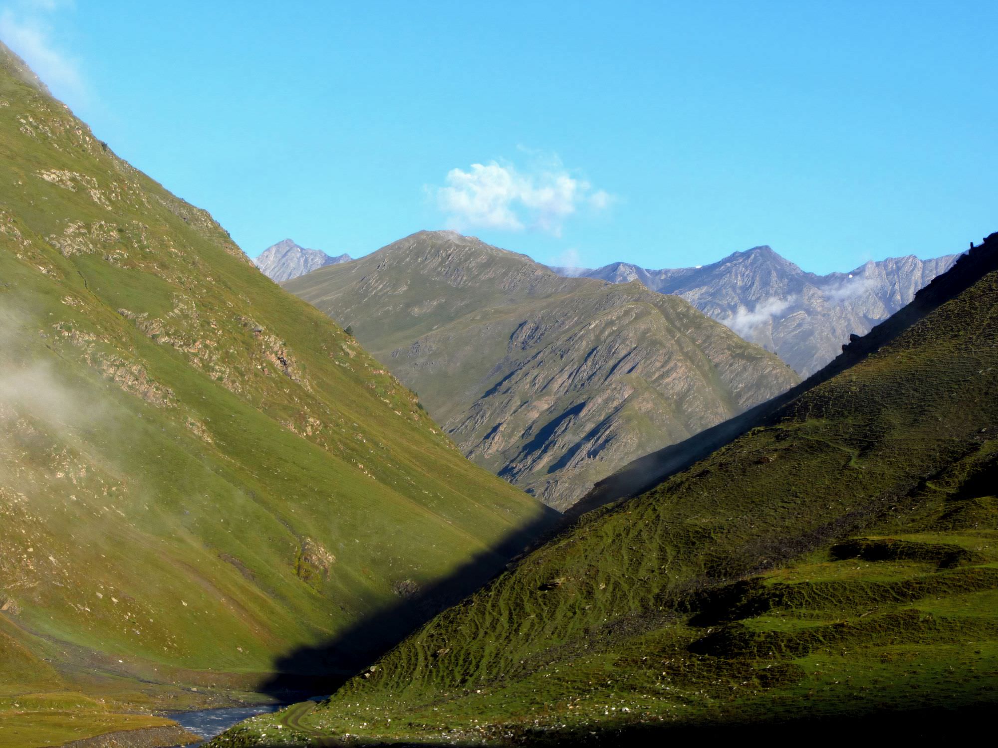
The trek follows an old shepherd's path connecting both regions. The first two days are spent mostly on jeep road connecting villages of Tusheti and if you are not that much into villages
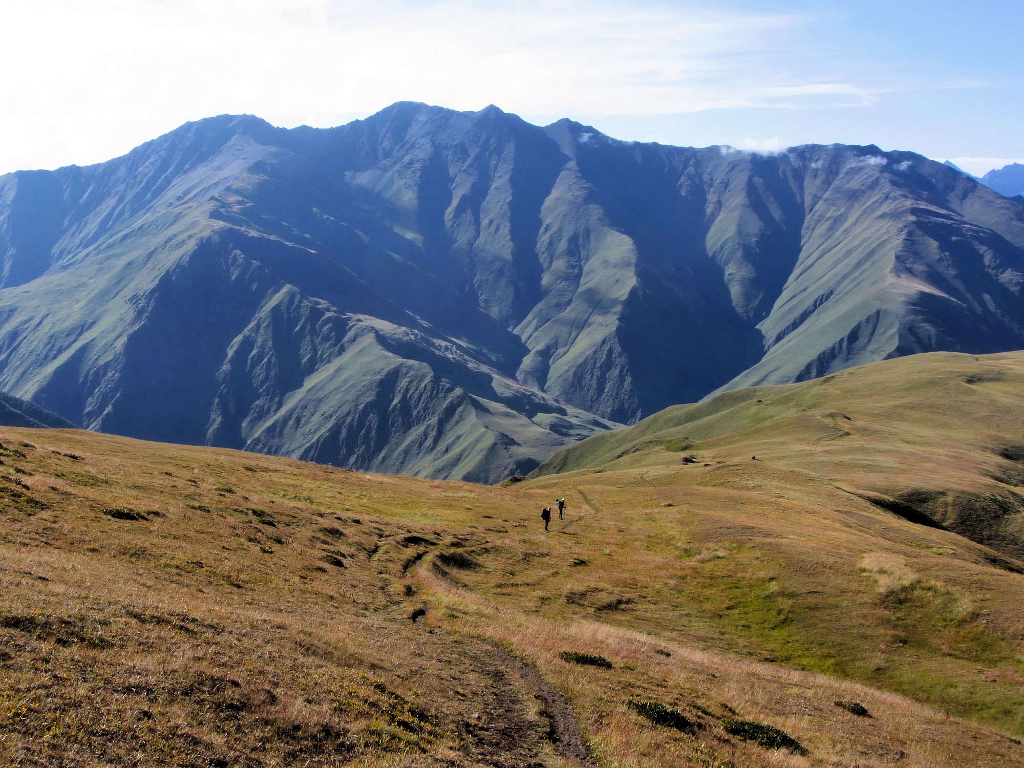
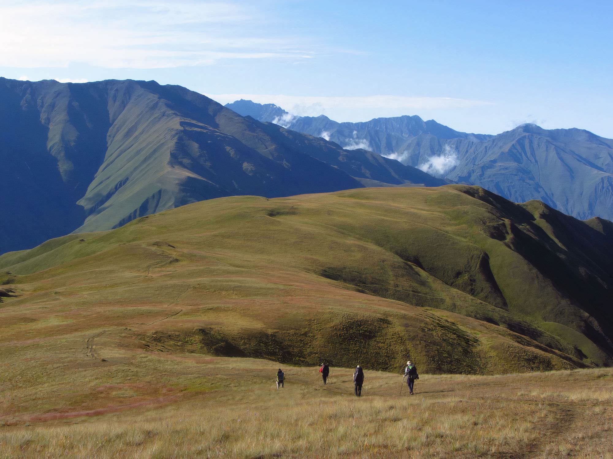
and prefer panoramic views, consider an alternative, higher route that traverses the Pirikita range. Then you leave hamlets behind and spend two days in the "wilderness" (for the lack of other word, don't expect anything extreme - at both campsites, there is already some tourist infrastructure). The trek is popular and therefore suitable also for people who would like to try a camping trip, but don't want anything too remote.
I describe a 5-day version of the trek, to finish it in 4 days you have to hike from Omalo to Parsma (or Chesho) on day 1 and from Parsma to Kvakhidi on day 2. Perfectly doable if the weather is good and you are at least averagely fit.
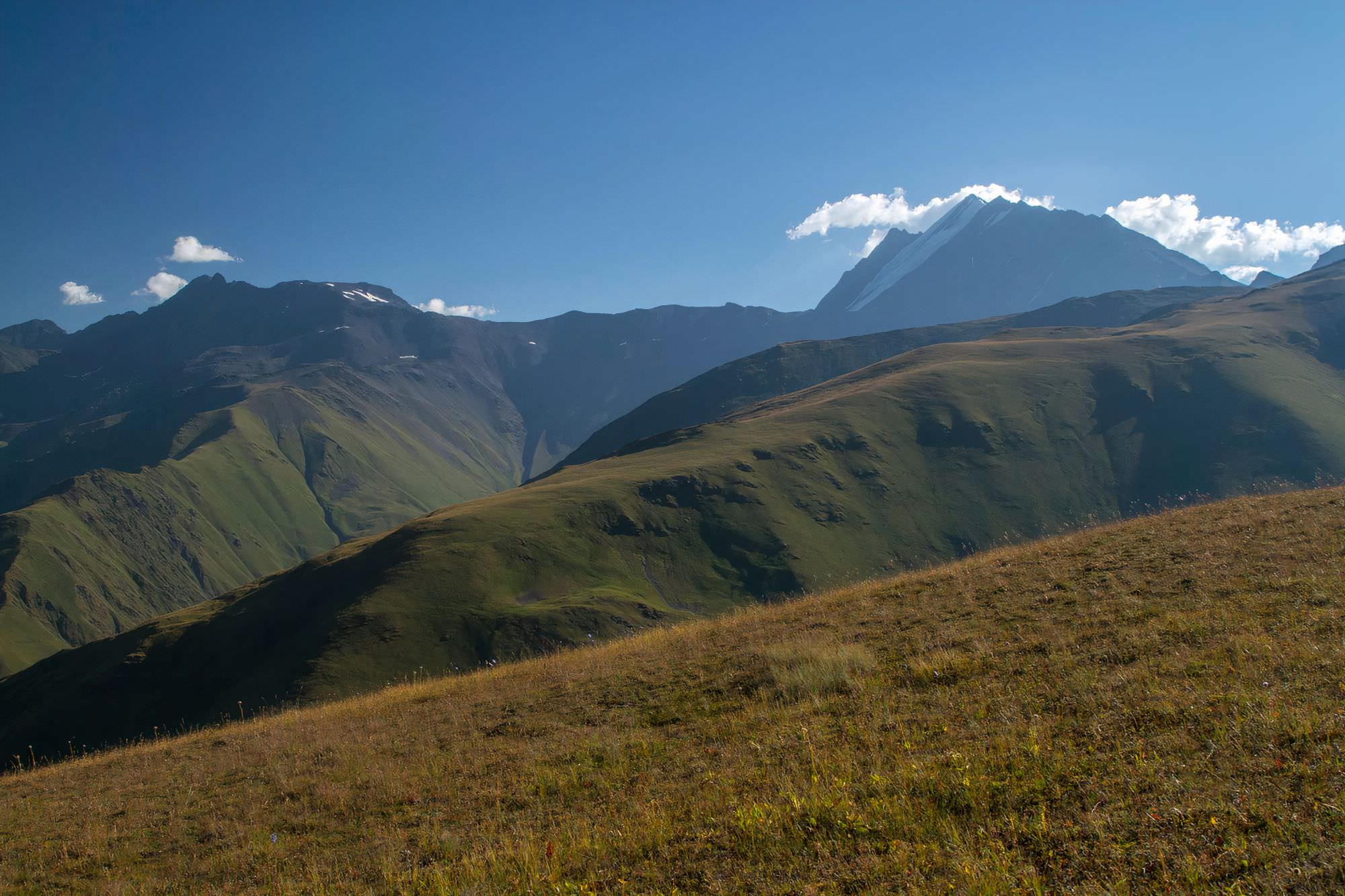
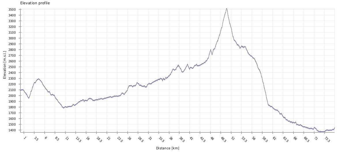
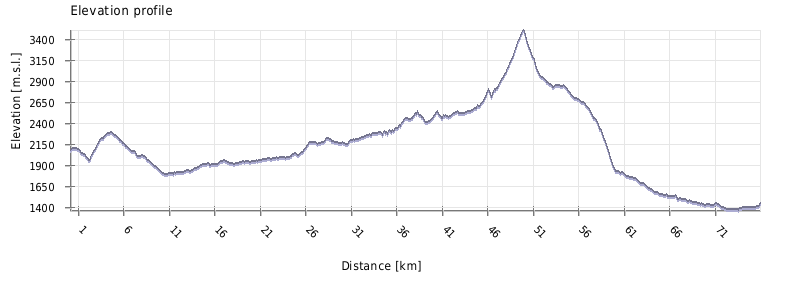
You will gain elevation quite slowly and the path is well-trodden, but the route is 75 km long, takes five days and you will need to cross a 3431m high pass. I will rate it as Moderate, but if you trek early or late in the season, the difficulty goes up due to a higher chance of swollen rivers and snowfields around the pass.
Some nights can be spent in villages, but still, you will need to carry everything necessary for a camping trip since at least two nights need to be spent outside.
By jeep:
There is no public transport to Tusheti. To get to Omalo, you will need to hire a driver with 4WD. If you are traveling from Tbilisi, you will first need to get to Kvemo Alvani village - this can be done by marshrutka or a taxi.
The marshrutka departs from Ortachala bus station in Tbilisi at 9.am and arrives at Alvani two hours later (price 15 GEL). Drivers are used to tourists and often arrange them further transport to Tusheti. Just confirm with the driver that he is going all the way to Alvani, they sometimes try to drop passengers in Telavi in order to make them hire another taxi to Alvani. Or they simply want to hook you up with the jeep driver from Telavi but that is OK if the price is right.
If you want to take a taxi from Tbilisi to Alvani instead of a bus, the price can be anywhere 100 and 150 GEL (it grows with your distance from the Ortachala station :))
In Kvemo Alvani, the bus or taxi will drop you at the main (and the only) junction. This is the place from which depart jeeps to Tusheti so if you get here before noon, you should be easily able to hire a driver.
The ride to Omalo takes about 4-5 hours and costs 70+ GEL per passenger (or about 350-400 GEL for the whole jeep). BBC once placed it among the "10 Most Dangerous Roads in the World", but with a good driver, it definitely doesn´t feel like that. In navigates pretty steep mountainside but the road is usually wide enough and unless you are passing another car and need to navigate to the very edge of the road, there is no reason to feel nervous. Still, the accidents happen here and the road claims a few lives every year. Therefore, even if you have your own car, for this stretch of the road, it may be better to use the service of the local driver.
By hitchhiking:
Hitchhiking can be "hit or miss" since jeeps traveling to Omalo are usually booked by tourists and full. And even when they are not, tourists might be reluctant to pick someone who just walked a few hundred meters beyond the departure point and raised a thumb (especially if he is dressed up in Arc´teryx gear like a couple of "travel hackers" we saw there the last time :)). Professional drivers will rarely pick you up for free. Therefore, your best bet will be locals heading to Omalo for a visit - but it may take a while until some show up.
Another option is the Kamaz truck which brings supplies from the lowlands to Omalo. These drivers usually pick up passengers for a symbolic price but the truck has no fixed schedule. It departs like each other day in the morning, so it can´t be relied upon.
Marshrutka to Tbilisi leaves every Thursday and Sunday at 12:00 am and costs 20 GEL. During the season, it's often full so I strongly recommend buying tickets in advance on the day before.
Ask around the village where to find the driver.
If you missed the marshrutka, you would have to hitchhike or take a taxi. Taxi to Tbilisi costs about 300 GEL, to Barisakho village it's 150-200 GEL.
Here, I collected (and answered) questions I get most often.
The best time to go is July-August. For people looking for a shoulder season - the Atsunta pass usually becomes passable during the second half of June and shepherds leave the area with their herds in the first half of October.
You should know that this trek is different from the others which you can attempt all year long. Here, you need to pass several border outposts - and guards don´t want to risk the hassle if some hiker gets hurt. So they send people back if they think the crossing is too dangerous. Unfortunately, there is no fixed date when the trek becomes "open", it´s up to their decision (but several years in a row, they started letting people through after 25th June). So, in the first half of June, there is a solid chance that you will be turned back and the second half of the month is not safe, either. If you are coming in the early summer, better call the Tusheti National Park Administration office ( (+995) 577 101 892, they speak good English) to save you from possible disappointment.
Looking for a place to stay in Omalo before the trek?
Here are some of the better guesthouses.
This trek will cost you as much as you decide to. If you bring all food and camp each night, the bare minimum to reach the trailhead from Tbilisi and get back is 77 GEL (about 20 EUR). Bus to Alvani is 7 GEL, jeep to Omalo 50 GEL and marshrutka back from Shatili 20 GEL.
This was my modus operandi when I was younger, believing that true hiker has to do it "on cheap", eat pasta and camp each night - now I see it as saving money at the wrong place. Part of the charm of this trek is that while you have to camp, you can also spend some nights at guesthouses, meet locals and try traditional mountain food. It´s not even expensive - night at the guesthouse, with dinner and breakfast could cost as little as 60-70 GEL. Good compromise is to stay at guesthouses in Omalo and Shatili as start and ending point of the trek and also at one village in-between (either Dartlo, Parsma or Girevi). I guess it´s not necessary to stress that there are no ATMs in Tusheti or Khevsureti, for whatever expenses, you will need cash.
If you want to hike with even more comfort, you can hire a local with a horse to carry your baggage - this service costs about 200 GEL per day. Apart from days he spends with you, you will be charged also for the time he needs to get home (it takes them two days to return from Shatili to Omalo). Cheaper option is to hire a horseman at Kvakhidi meadow, before Covid, they used to offer horses for the crossing of the river (ask hikers walking in the opposite direction if it´s necessary) or even to carry your luggage to the Atsunta pass.
This is a pretty safe trek. Sure, usual hazards are present also here, but the risk is more than acceptable. Bears? Most of the time, you are moving through the open valley and the chance that you will surprise a bear is close to zero. Snakes? Yes, several hikers reported seeing a viper in upper Kvakhidistskali valley but considering the amount of feedbacks I get, it is not too common - just watch your step (this is always a good thing) and you should be fine, never heard of anyone who got bit on that trail. Lightning storms? Those can occur, but most of the time, you hike at the bottom of the valley, you are exposed only around the Atsunta pass. Shepherd's dogs? Yes, some hikers had unpleasant encounters with them at the Tusheti side, got surrounded, barked at, but sooner or later, shepherd came, they were never in a grave danger. Moreover, this risk can be usually mitigated if you know how to behave.
Which brings me to one thing that can pose an actual problem - two crossings of Kvakhidistskali river, shortly before the Atsunta pass from Tusheti side. When we crossed it in August, there was zero problem - a creek three meters wide, water up to knees. But some groups, especially those hiking in early July or after major rainfalls got unlucky with the water level and found waist-deep water, which is no fun in case of these fast-flowing creeks. The chance that it will be that high is small, but better calculate also with this scenario - consult hikers coming from the opposite direction, hire horse at Kvakhidi meadow if you think it´s necessary, choose crossing points properly and if you don´t feel comfortable and the weather is good, wait till the next day (if the water level is high due to rainfall). Or, at worst, turn back - don´t try to cross if it´s not safe just because "there is a trail".
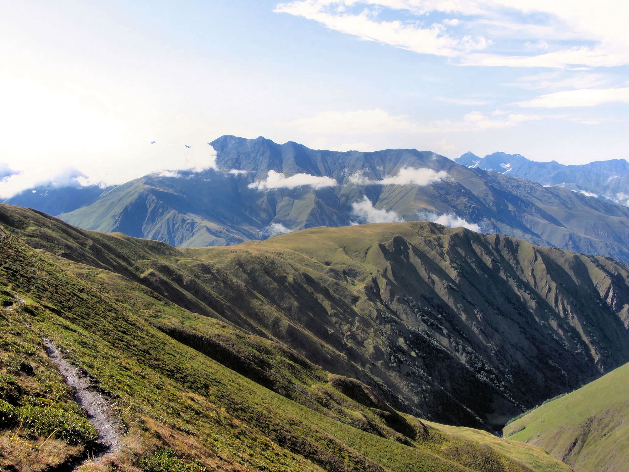
While both directions are feasible, I slightly prefer the direction from Omalo to Shatili. It's more pleasant as you will gain elevation slowly for several days instead of a steep ascent from the other side. Also, I like it more when "the highlight", in this case, Atsunta pass, lies more towards the end of the trek, so I have something to look forward to. But opinions differ, bikepackers as well as some hikers prefer the opposite direction since after two days of hard work, they can enjoy pleasant downhill - Tusheti is a great reward, even though a longer walk on the road is a bit of an anticlimactic ending.
In the end, the direction of the trek will depend on the rest of your itinerary. From both villages, you can return to Tbilisi by car (ride from Omalo is longer by 2 hours). If you plan to keep hiking, from Shatili, you can follow up with with a popular Chaukhi pass hike or difficult and rarely visited trek to Kalotana pass or Isirtghele pass route. If you want to continue trekking from Omalo, you can cross south to Pankisi gorge via Sakorno or Samkinvrostsveri passer or tackle a difficult, rarely visited trek south to Kakheti.
There are several weather forecast websites - of them, I prefer "Norwegians" - yr.no. Checking the weather from Tusheti side is easy, there are several villages they monitor (Omalo, Dartlo, Parsma, Girevi). Just be careful when checking weather forecast for Omalo - there are two Omalo villages in Georgia and they both lie in Kakheti. The easiest way to distinguish between them is by altitude - Omalo in Tusheti lies at 2096m, while Omalo in Pankisi gorge is mere 696m.
From the other side, you can check the weather forecast for Shatili, but much better it´s to check places such as Mutso or Ardoti since these lie much closer to the Atsunta pass.
Just usual gear you bring for your camping trips, amount of food will depend on how many nights you plan to spend in guesthouses (at least for two days). If you don´t go camping too often, you can use my trekking packing list for the inspiration, it was made also with treks such as this one in mind.
Many people ask how cold it gets during the night, so they can bring the proper sleeping bag. Not saying that the weather can't surprise, but at usual campsites, it very rarely freezes during the hiking season. Sleeping bag with T[comf] around zero orlittle below should be therefore sufficient.
| Distance | 75,13 km |
| Trail type: | AB trip |
| Max. elevation: | 3413m |
| Min. elevation: | 1360m |
| Total climb: | 2948m |
| Total descent: | 3578m |
This undemanding walk can be finished the same day you arrive in Tusheti providing you leave Telavi early in the morning (but it´s not worth it in my opinion, you would be in a rush and Omalo is certainly worth a visit). You follow the dirt road to Dartlo, but soon, approximately 1,5 km behind the village starts a shortcut - you need to follow the serpentine climbing the meadow to the right of the road, over the hill and into the forest (see map).
Shortly afterward, you will reach dirt road again. Climb a bit further to the small pass - the meadow above is called Ghele and due to its location, in the past, it served as the meeting point of elders of all three valleys. From there, follow the slowly descending road all the way to Dartlo - from the pass, the walk should take less than 2 hours.
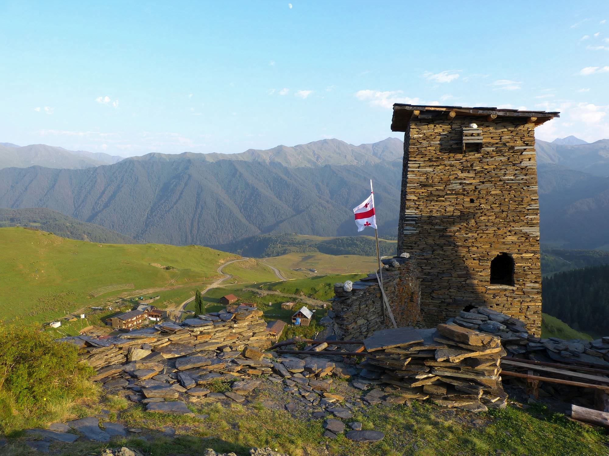
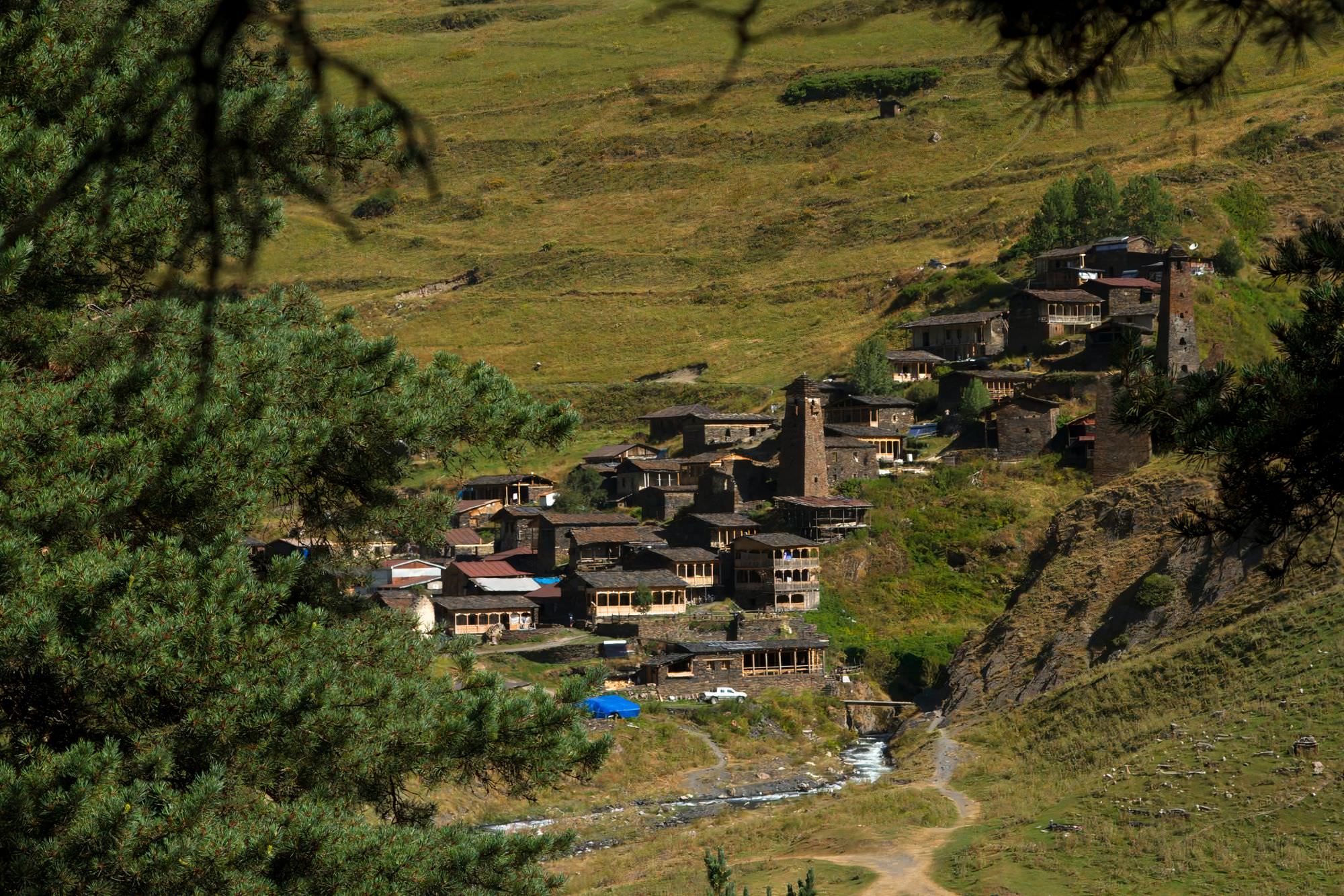
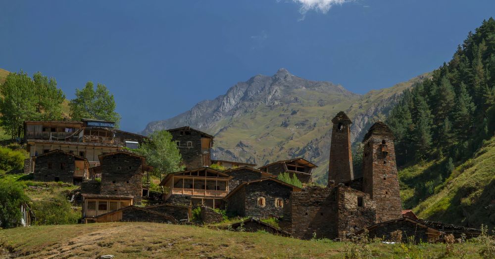
The village is pretty nice - there is also a guesthouse, two restaurants, and a small grocery shop. For even better sights, I recommend climbing to the Kvavlo tower, standing some 200m above the village. A good place to camp is by the river, beneath the village.
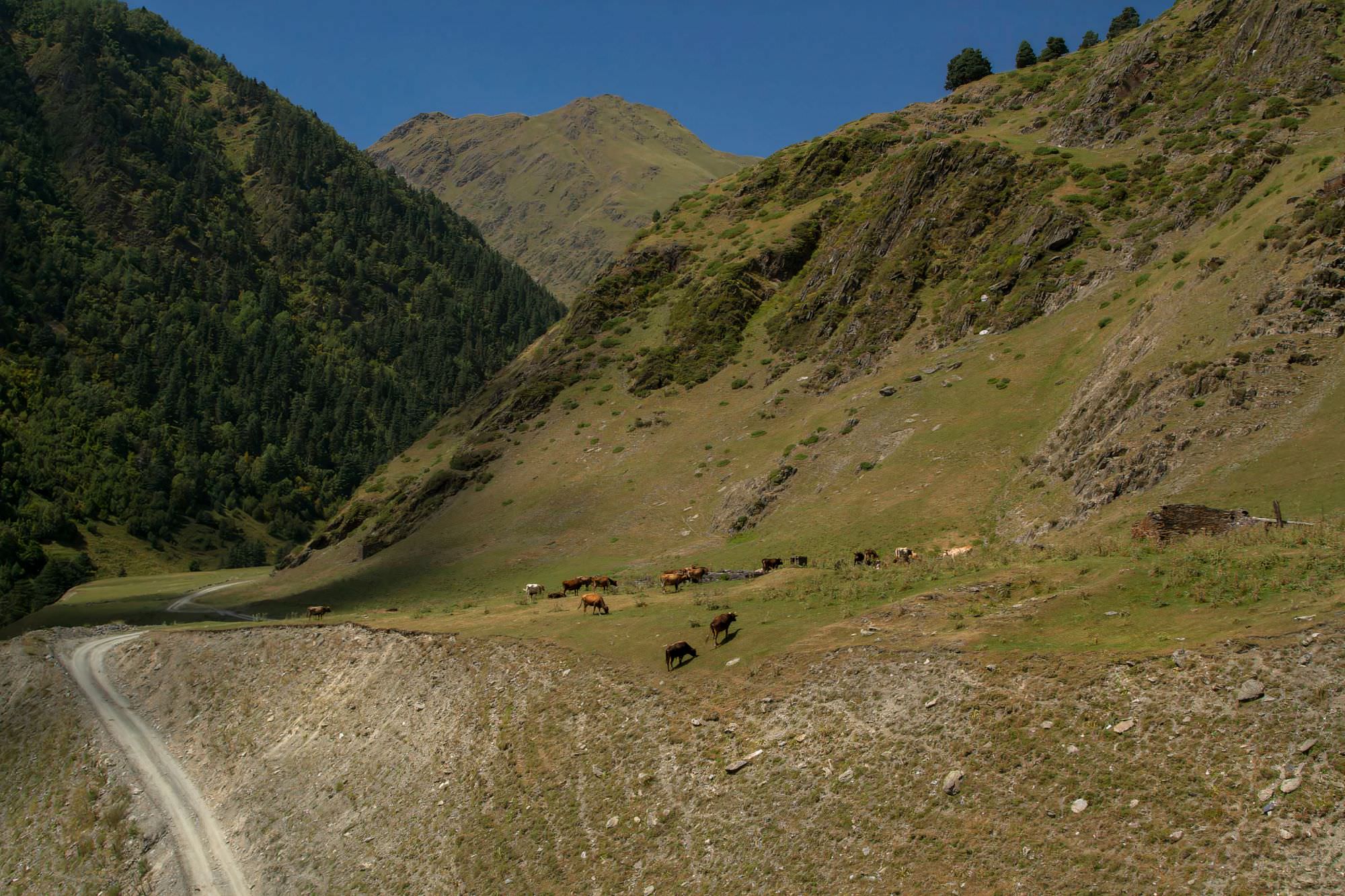
In the morning, you can pick from two roads. One follows the Alazani river all the way to Parsma; the other one goes a bit uphill, passes Dano village, and descends to the river again in a series of switchbacks. But almost everybody just follows the river, few people are in a mood for detour early in the morning.
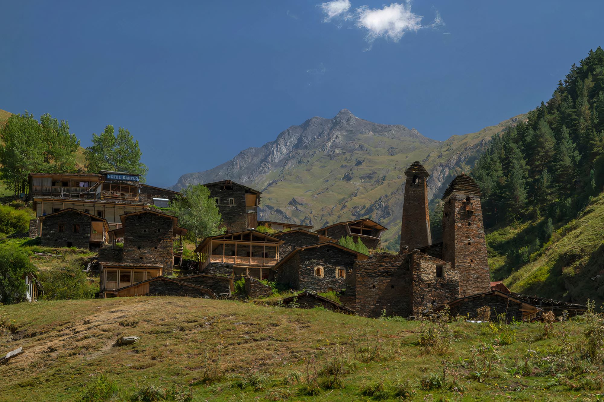
Not much can be said about the next section, you just follow the river on the dirt track. One hour later, you will pass Chesho - the village is unremarkable, but has pretty good guesthouses so if you are doing the trek in 4 days and want to sleep this night in a bed, this is a place to stay. Parsma, the next village in the valley is the exact opposite - ancient, atmospheric, with several impressive towers. But the guesthouse is very basic (or at least it was 2019).
In the afternoon, leave the jeep road behind and continue walking by the river, toward the Girevi. The path sometimes leads on the rocks very close to the water, but keep going and stay on the left bank. In Girevi, you will need to visit a border guards post (lies by the river a little southwest of the village) and fill in registration forms for trekking in the border area. It could take 15-20 minutes.
Unlike Parsma, at Girevi, there are several guesthouses with a pretty good reputation. This is the one I have an experience with
Shio´s Stonehouse - A cozy little guesthouse that does everything well. Beds are comfortable and the food is great. But its greatestm asset are its very friendly and helpful owners. Thumbs up!
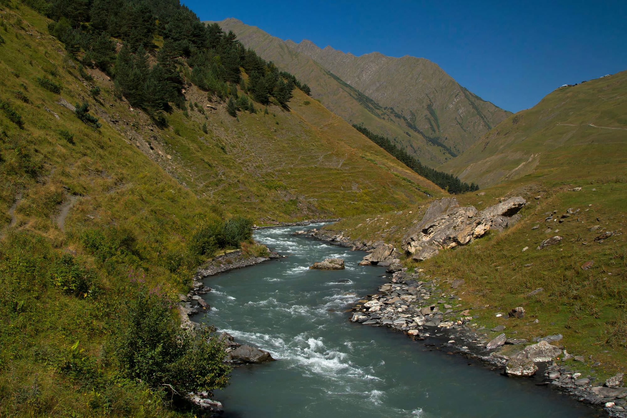
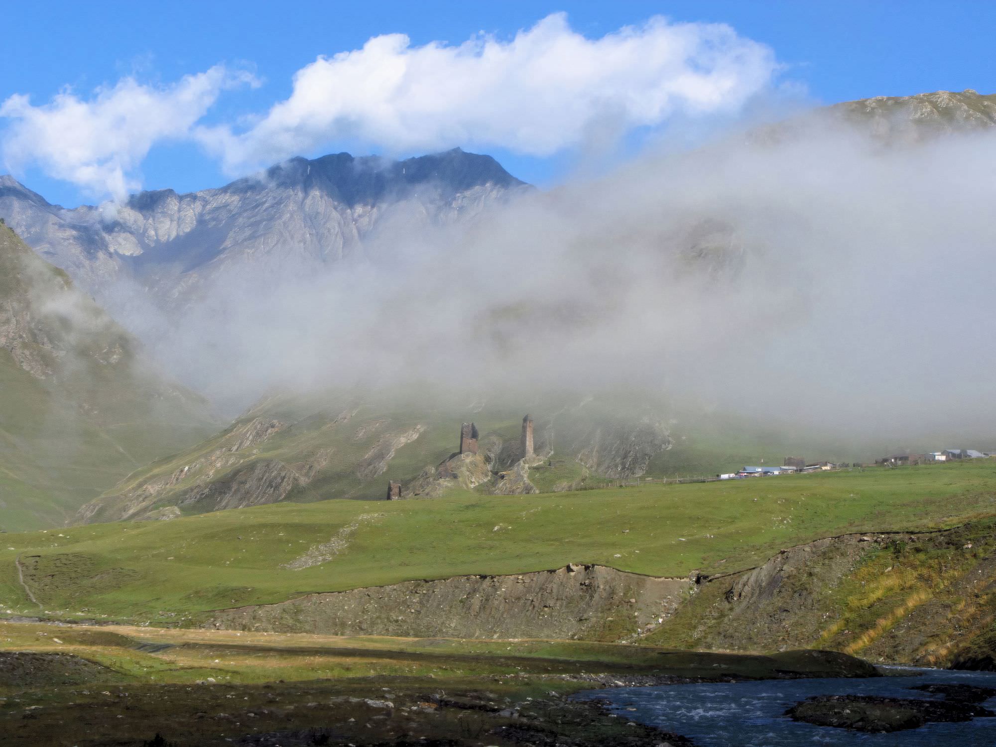
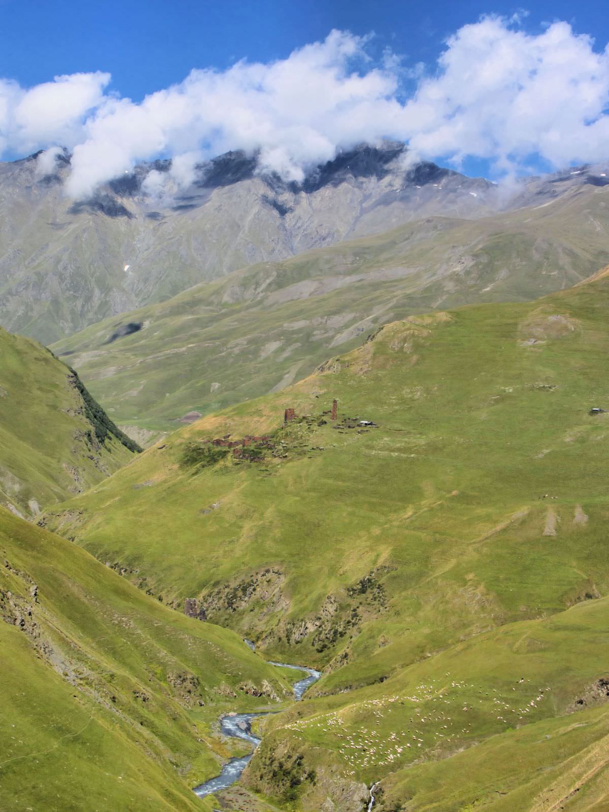
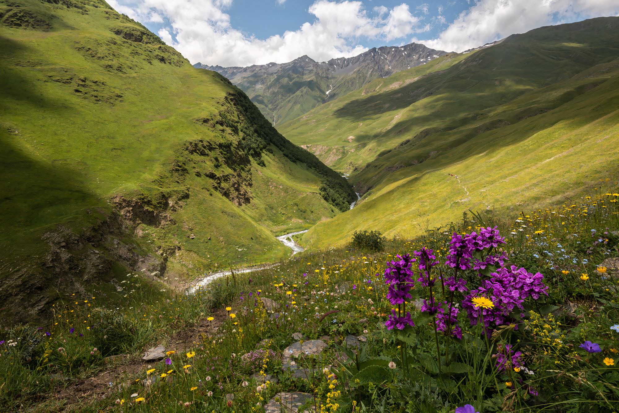
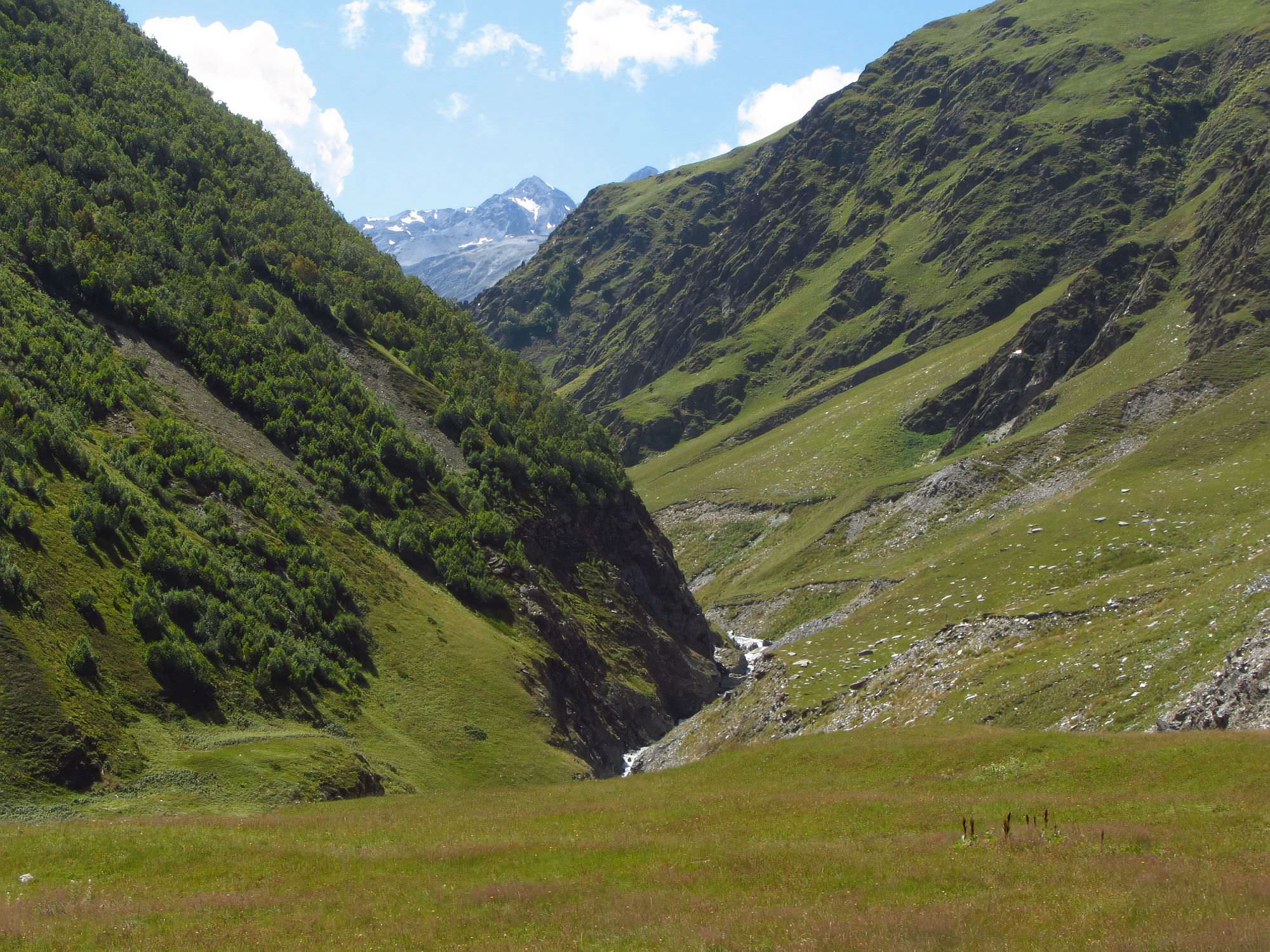
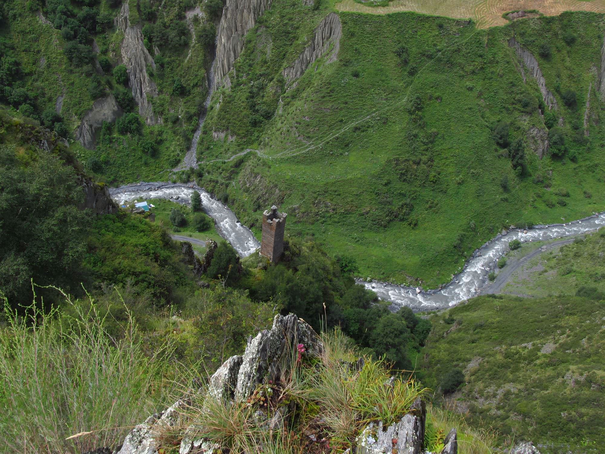
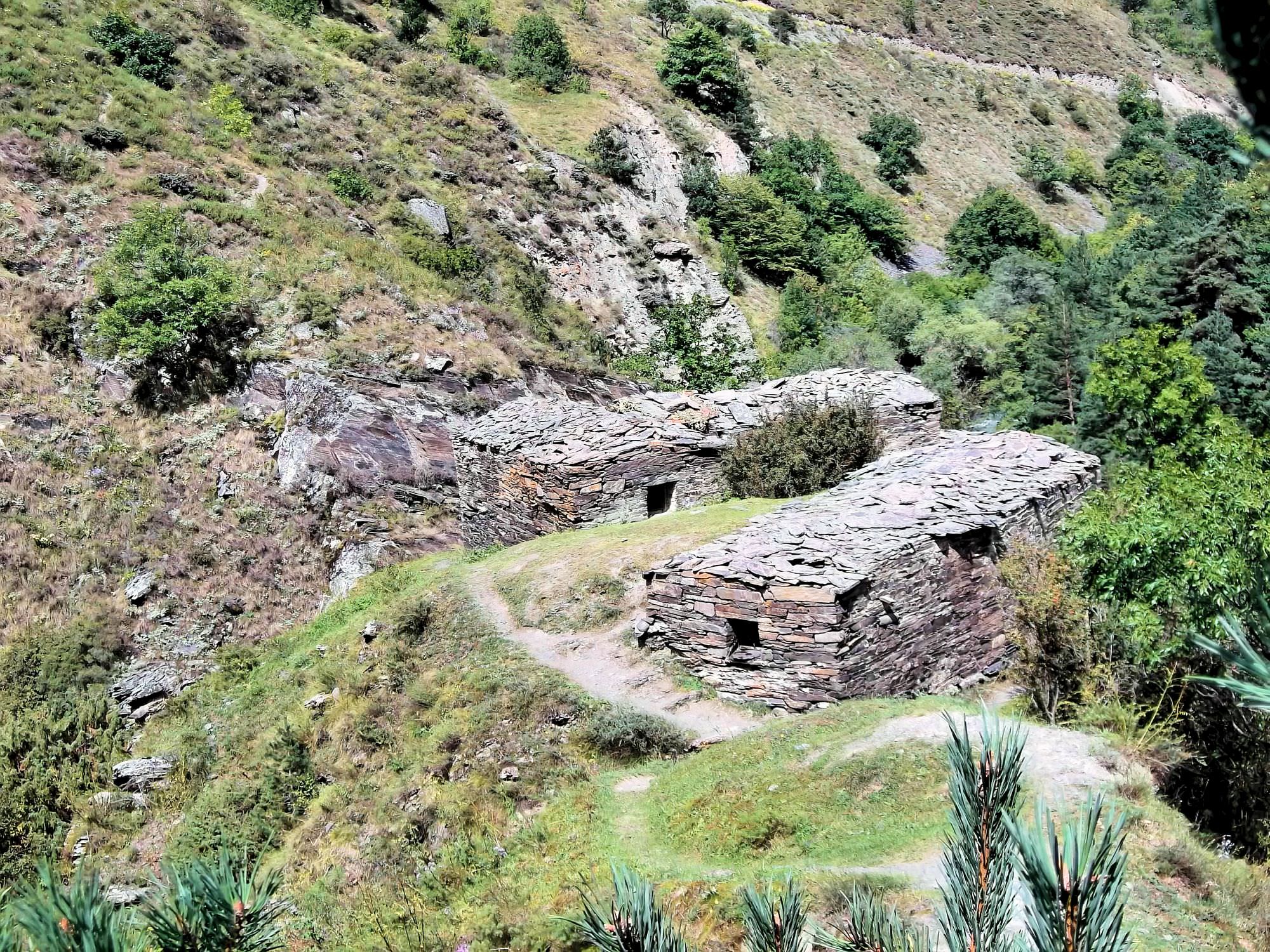
Not far behind Girevi village, Alazani valley splits into two. Follow the stream of river Kvakhidisitskali (valley to the right), the path is clearly visible. You will pass the ruins of Chontio village and then just keep walking up the valley.
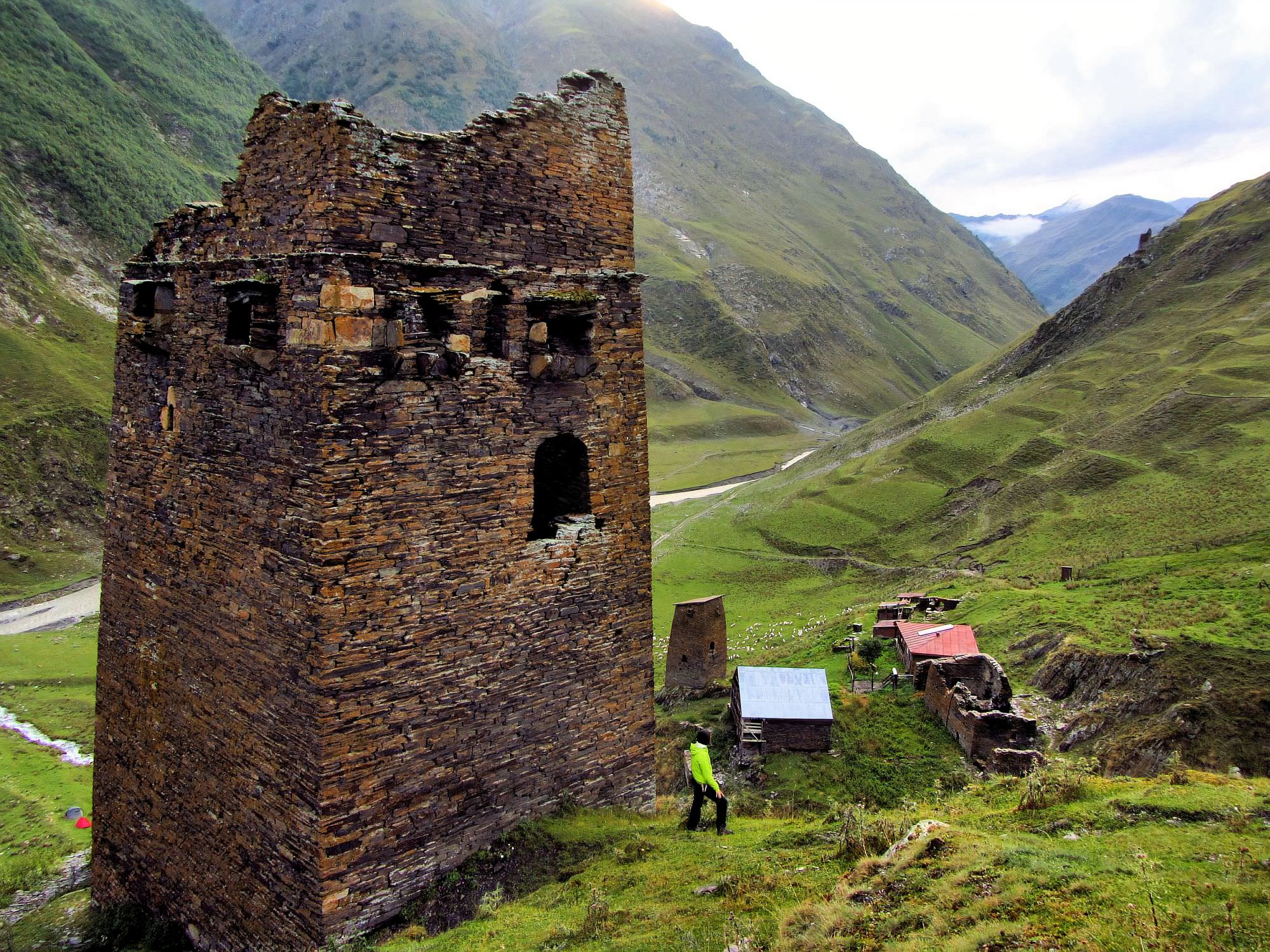
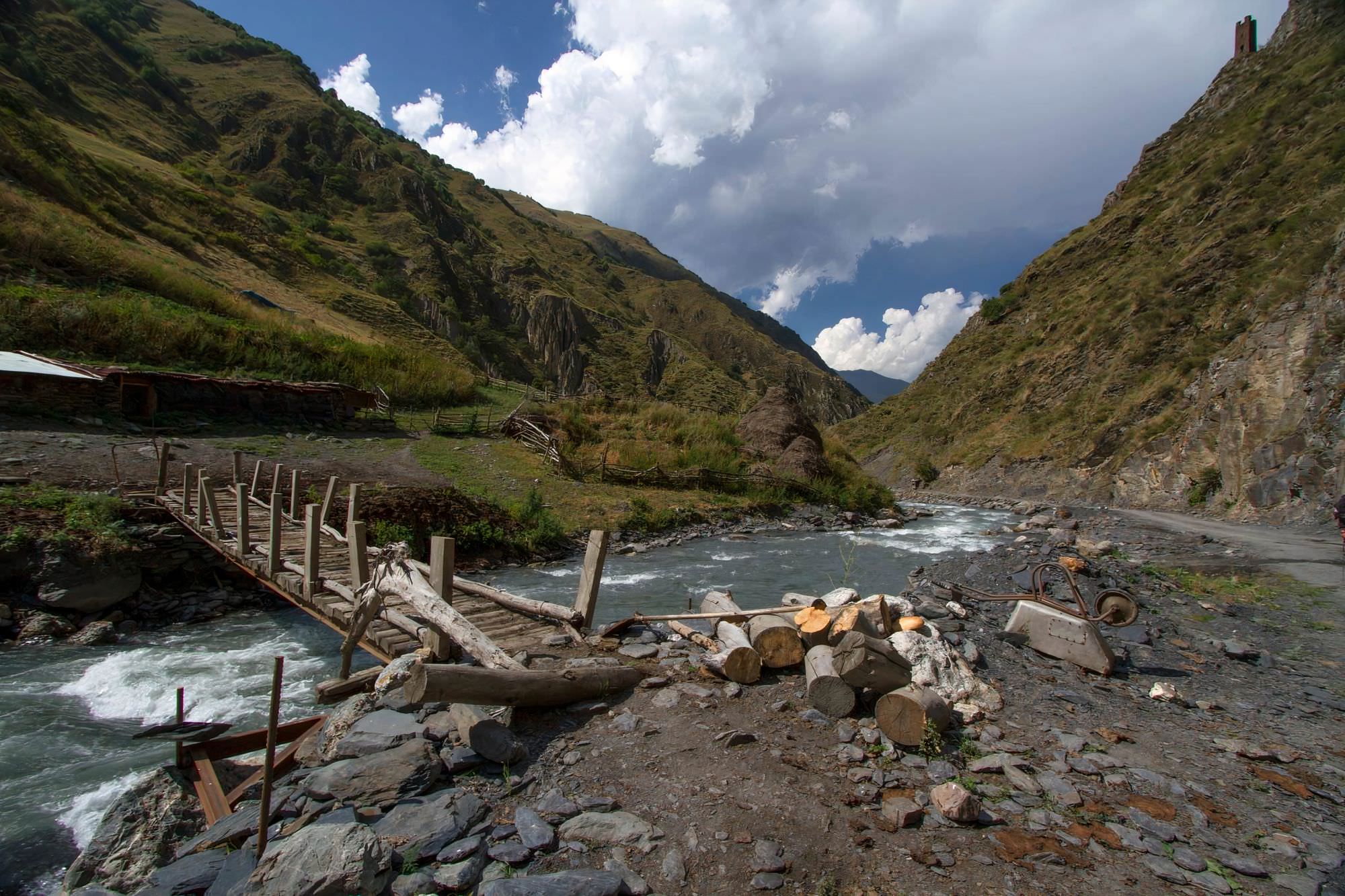
Finally, you will see a large basin ahead, situated at the confluence of several rivers - Khakhidi meadows. The trail will lead you to the bridge, which you will need to cross to get to the campsite. There is a lot of space, water can be taken from one of the smaller streams in the area.
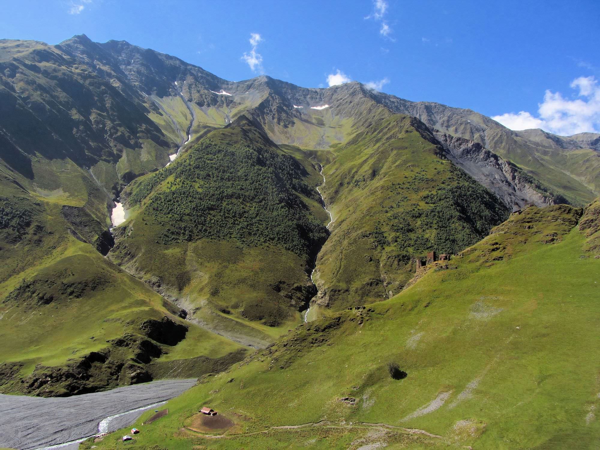
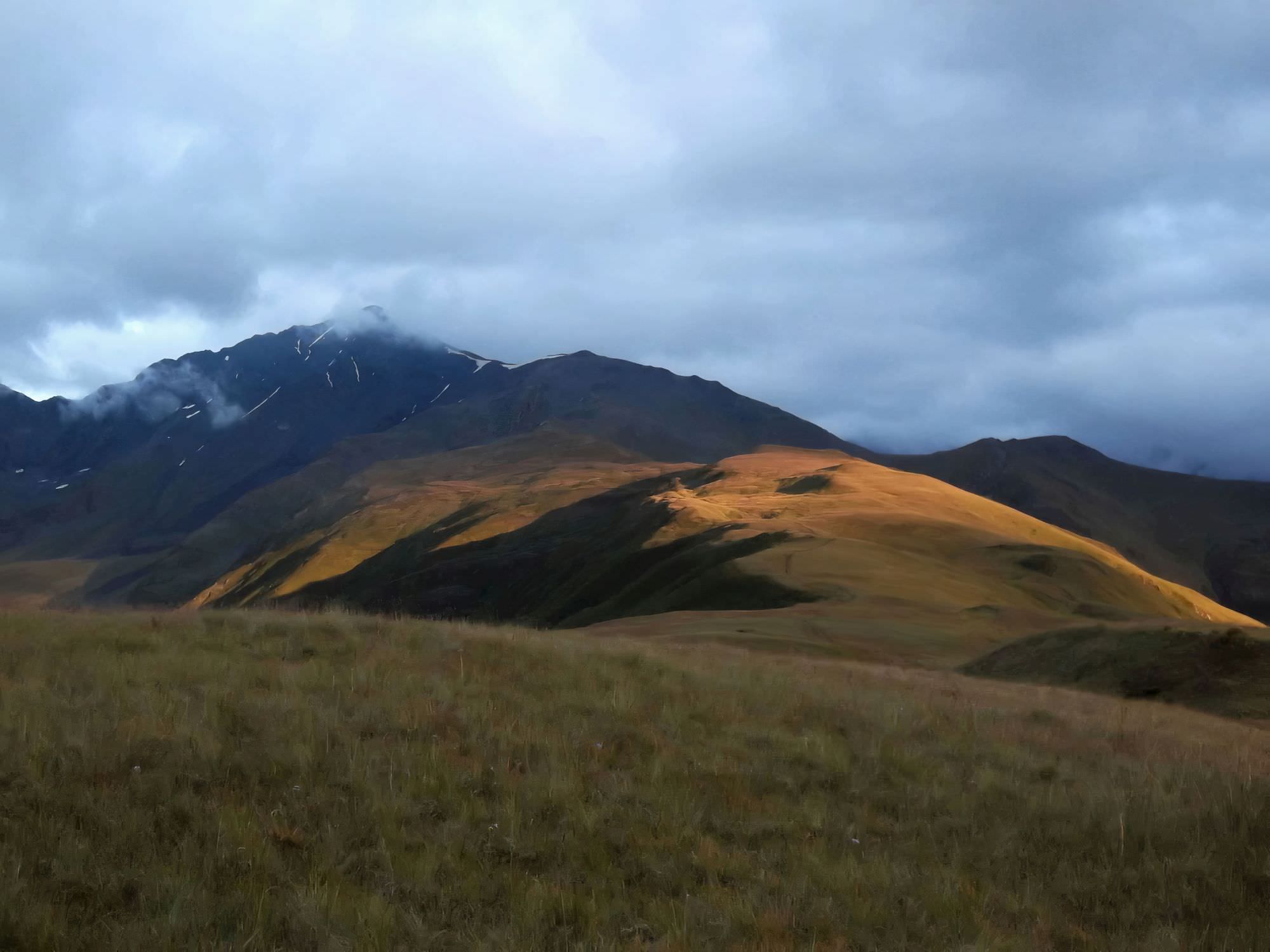
Year after year, this campsite is getting busier and busier. In 2016, one shepherd turned his shelter into a little food stall so you can buy here also some basic food and sometimes even beer. Meadows are ideal for camping (as in the photo, you can see them long before). We got water from one of the smaller streams in the area. Other enterprising shepherds with horses wait here for hikers and offer them to take their backpacks to the pass. They may even persuade them that a horse is necessary to cross the river upstream. However, most usually, it isn´t - ask hikers coming from the opposite direction about this crossing so you can decide if you need it or not. Overall, this camp might be too busy for the liking of some hikers - if you look for solitude, you might prefer smaller campsites described below.
Continue by Kvakhidisitskali river. You will have to cross it twice. Most of the time, this crossing is quite unremarkable but sometimes, especially during early summer and after major rains, the water level makes the crossing pretty uncomfortable and even risky.
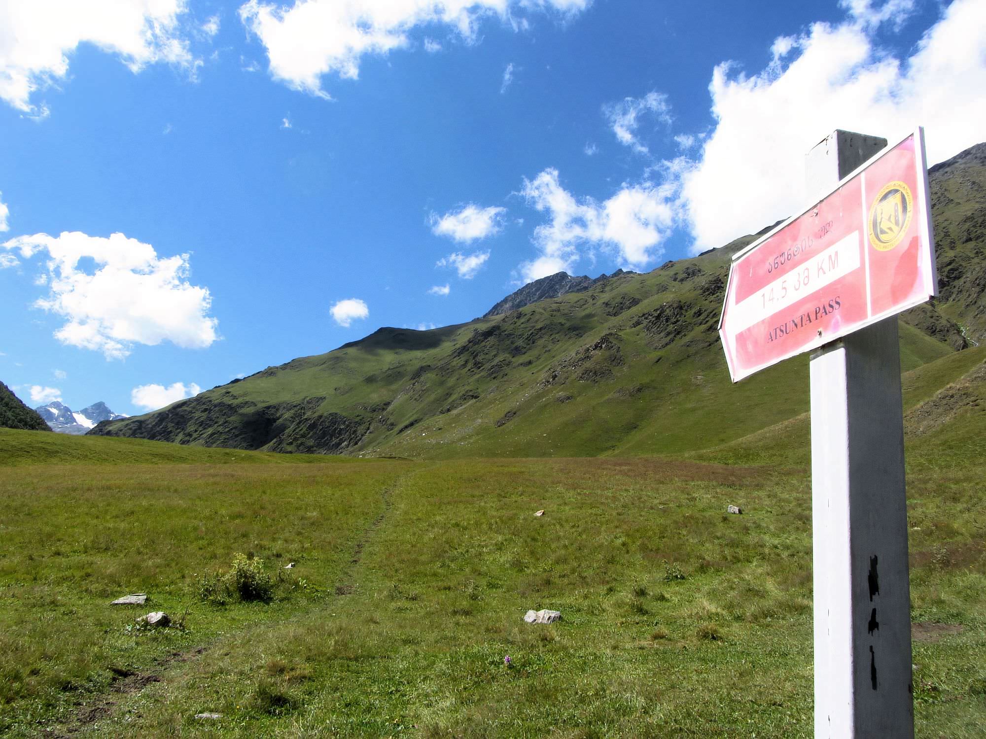
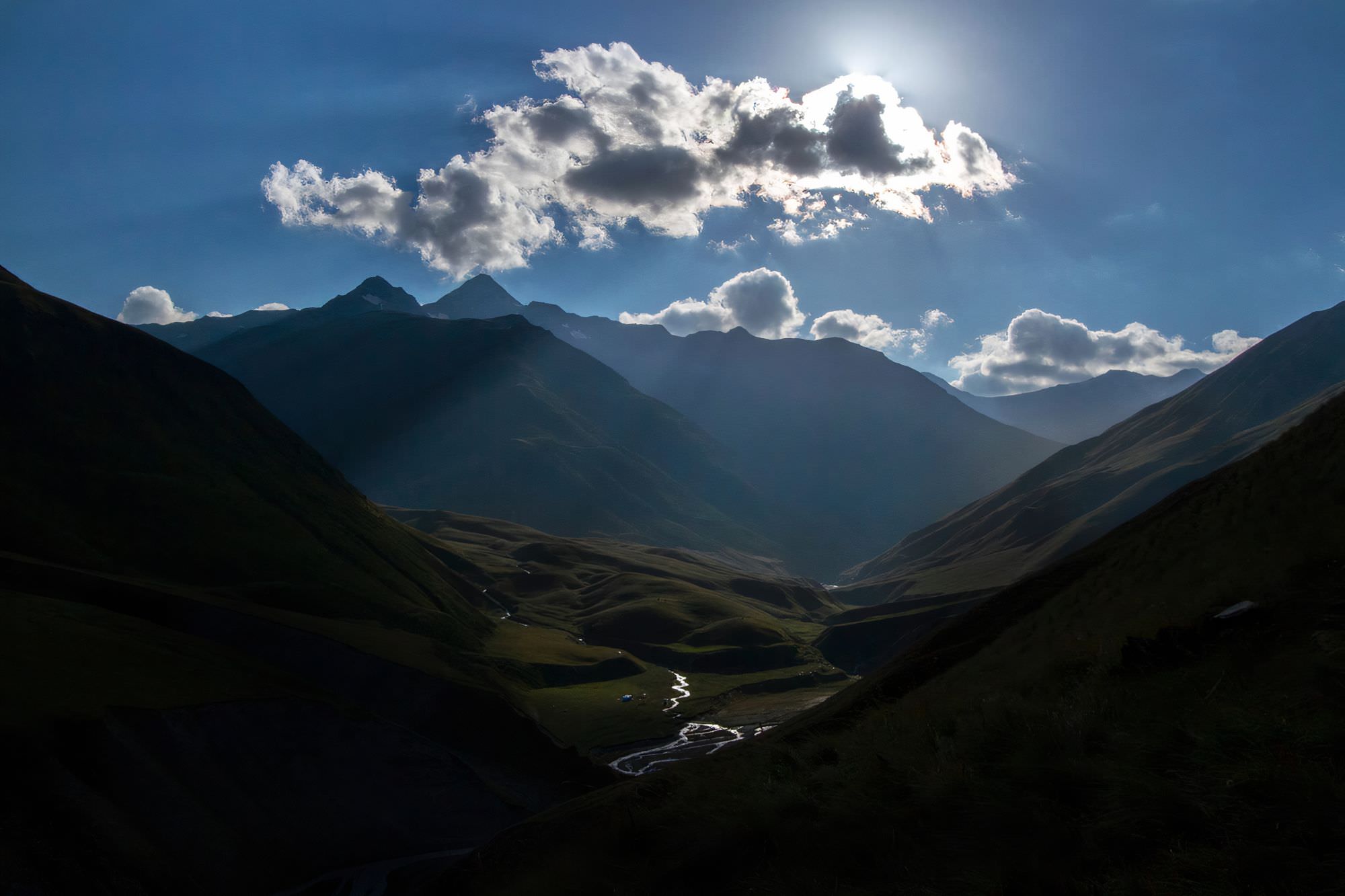
After you ford the river (there is a stone with Exit Shatili mark), you will see three valleys in front of you. Take the one to the right and start the ascent - the path in the lower section is not too obvious, but soon becomes much more visible.
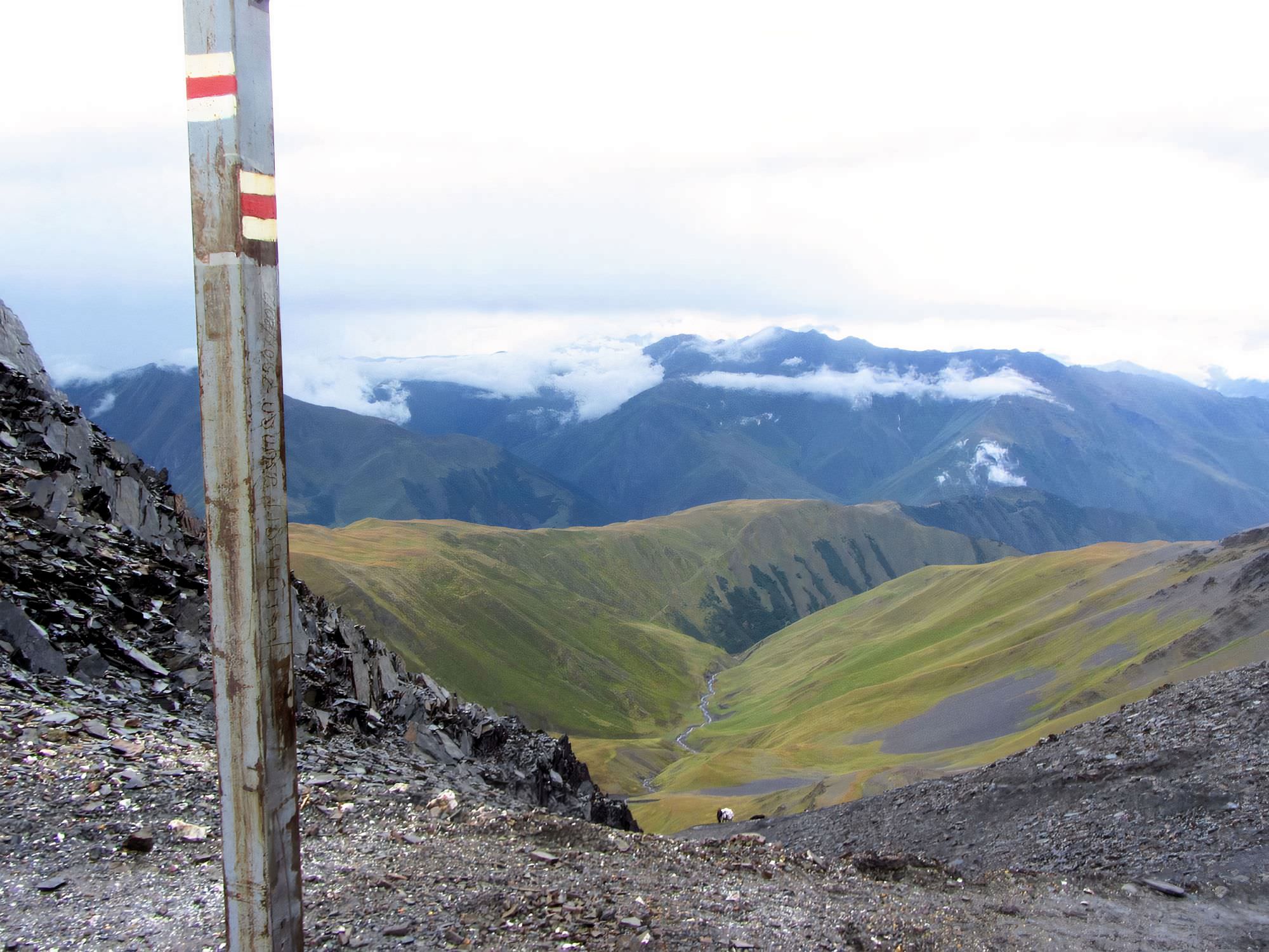
You will see a saddle that looks like Atsunta pass. When you think you are almost there, the path turns right and climbs a huge hill covered with shale - Atsunta is to the right of the lowest part of the ridge. But you can't miss it, just follow the path and the map. Climb the pass, enjoy the views, climb further a ridge to the right if you want. Here starts red touristic marking.
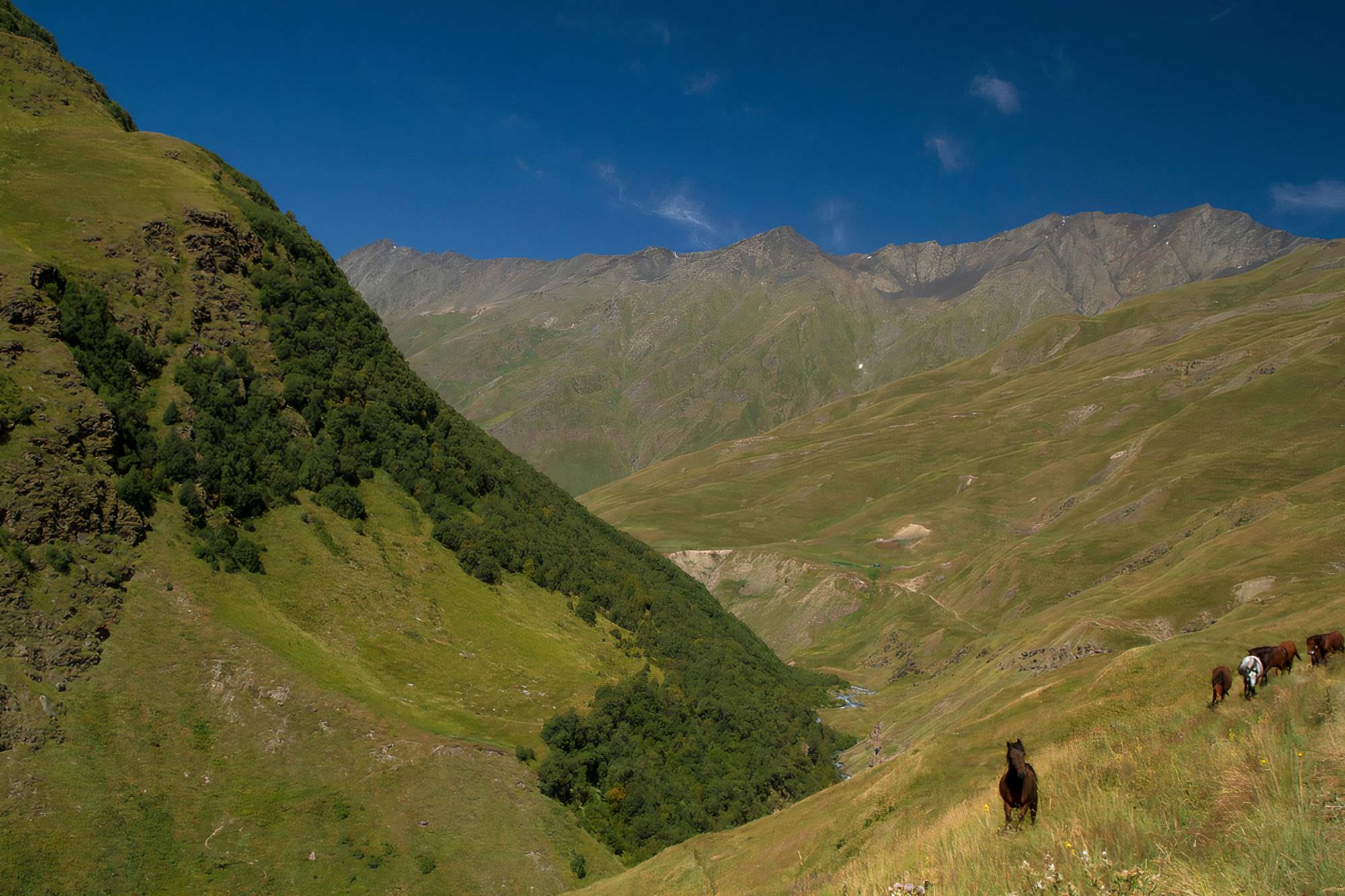
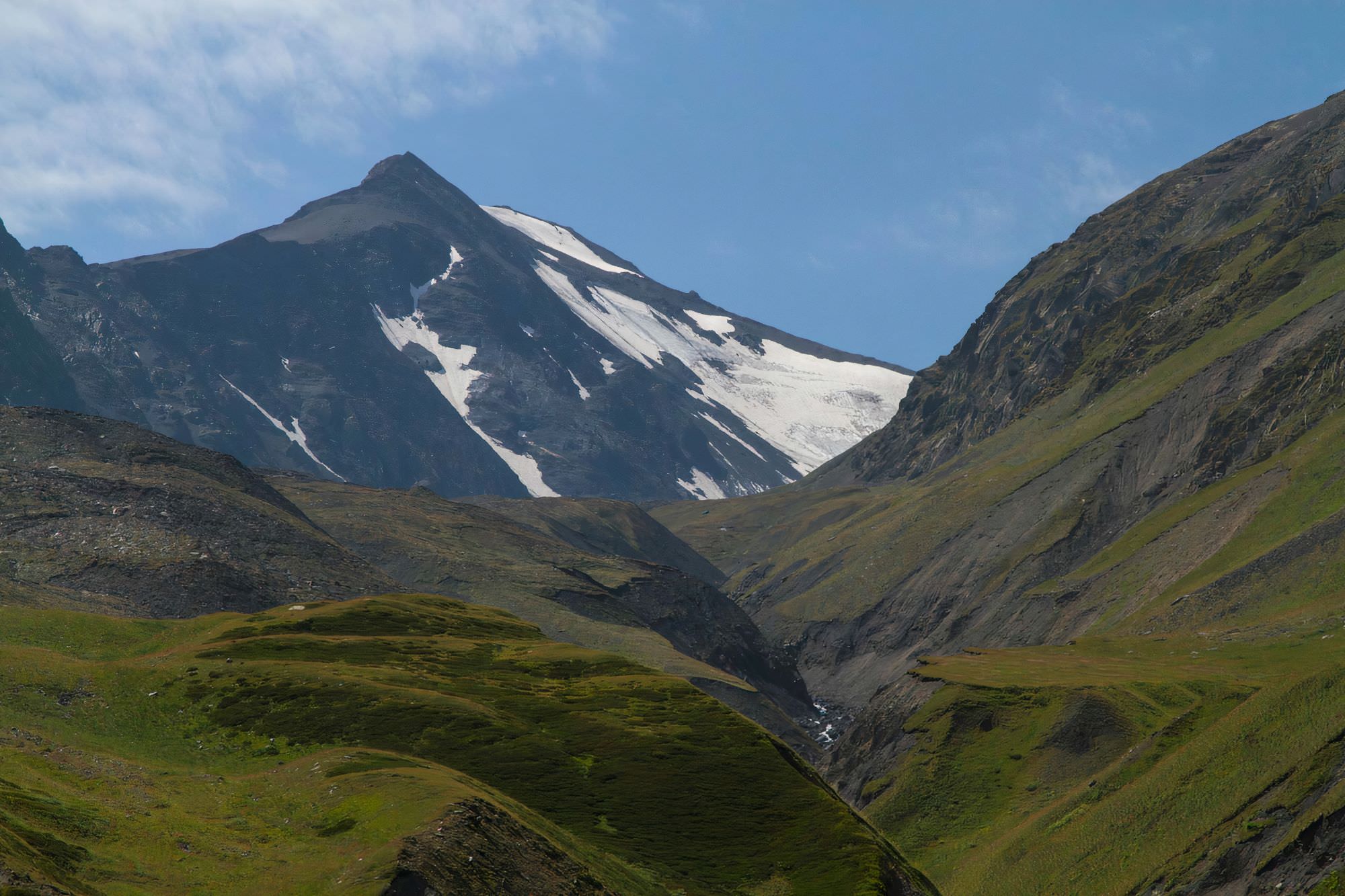
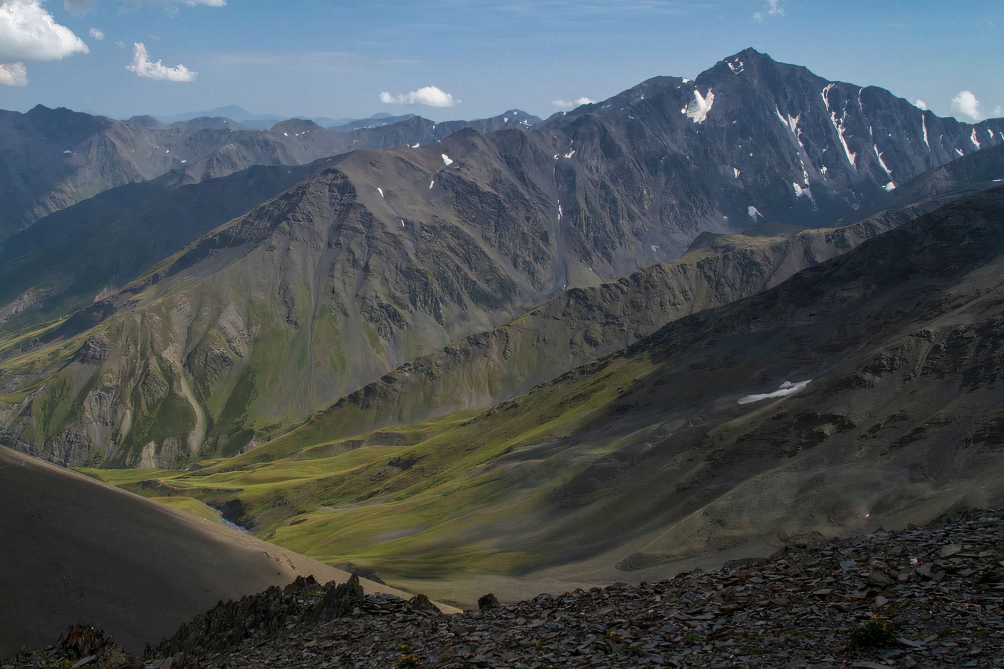
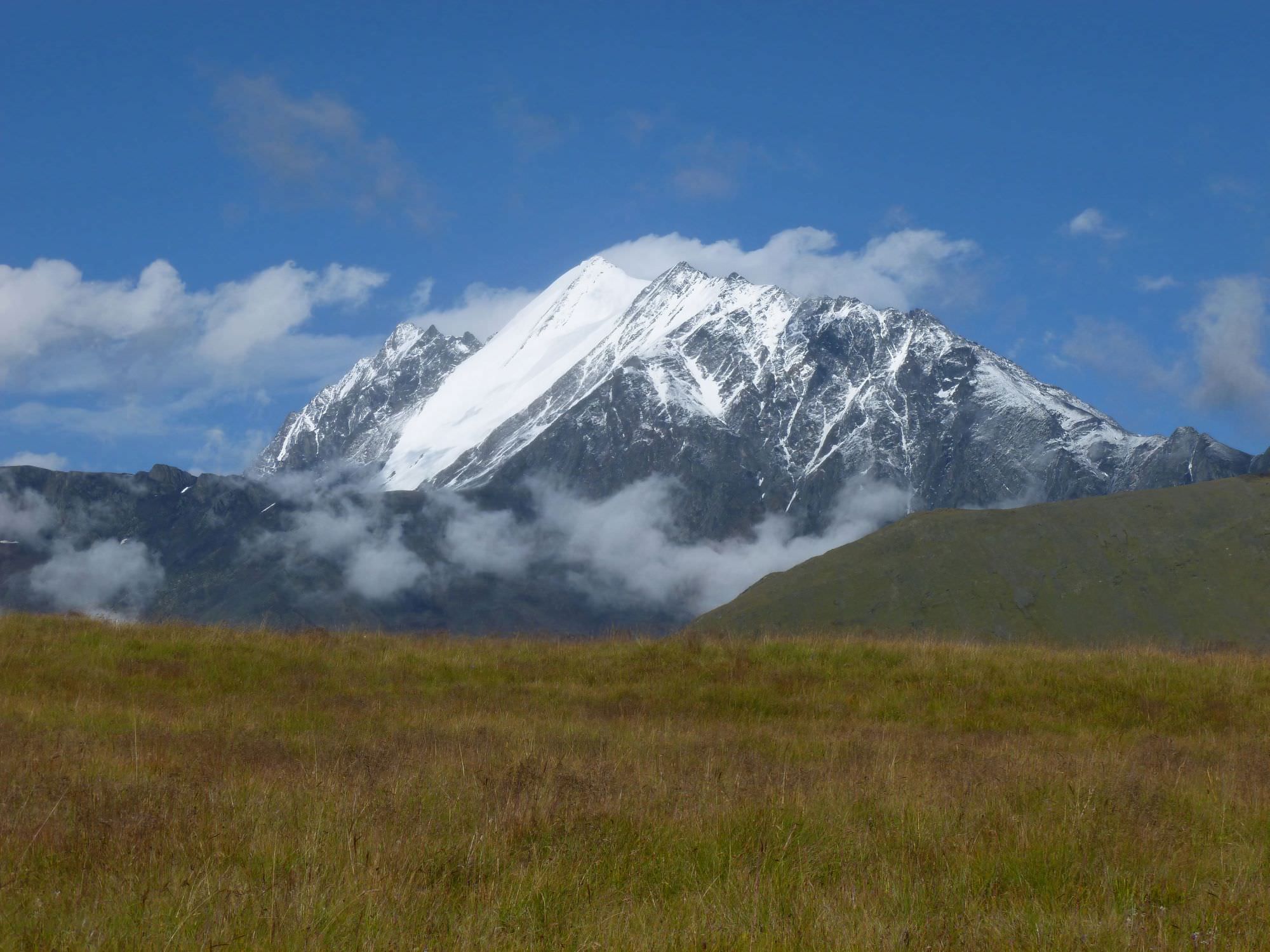
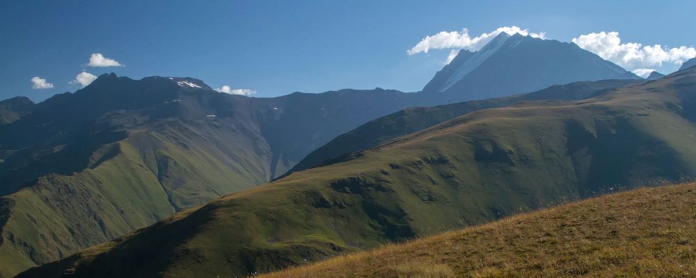
Descent from Atsunta pass is my favorite part of the trek. You may be tempted to descend all way down to the river, but don't do it. Stay on the left side of the valley and the trail will eventually bring you to Khidotanis range (this section might be risky if still covered with snow). It is an amazing place with a great view of Tebulo mountain. If you walk far enough, you will reach a border guards camp not far above the treeline level. Nearby, you will also find a water spring so this is a good place to break a camp.
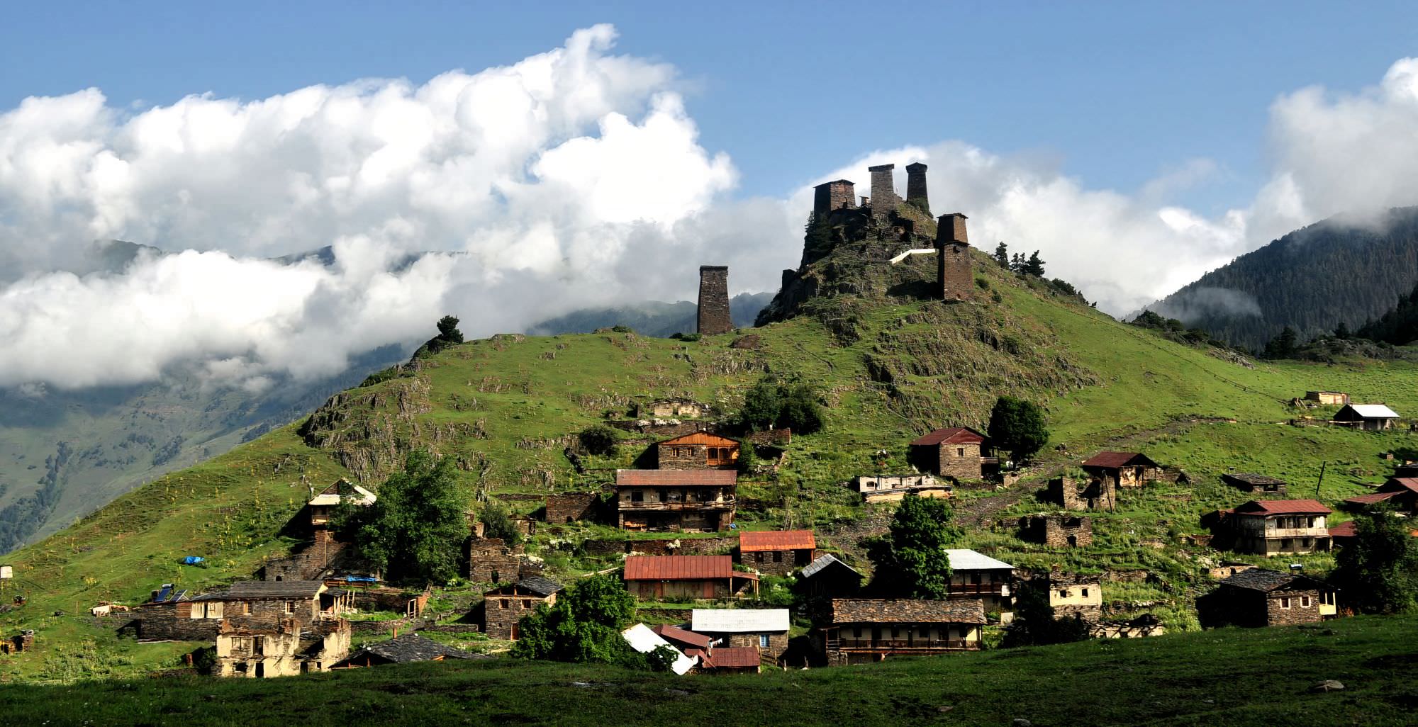
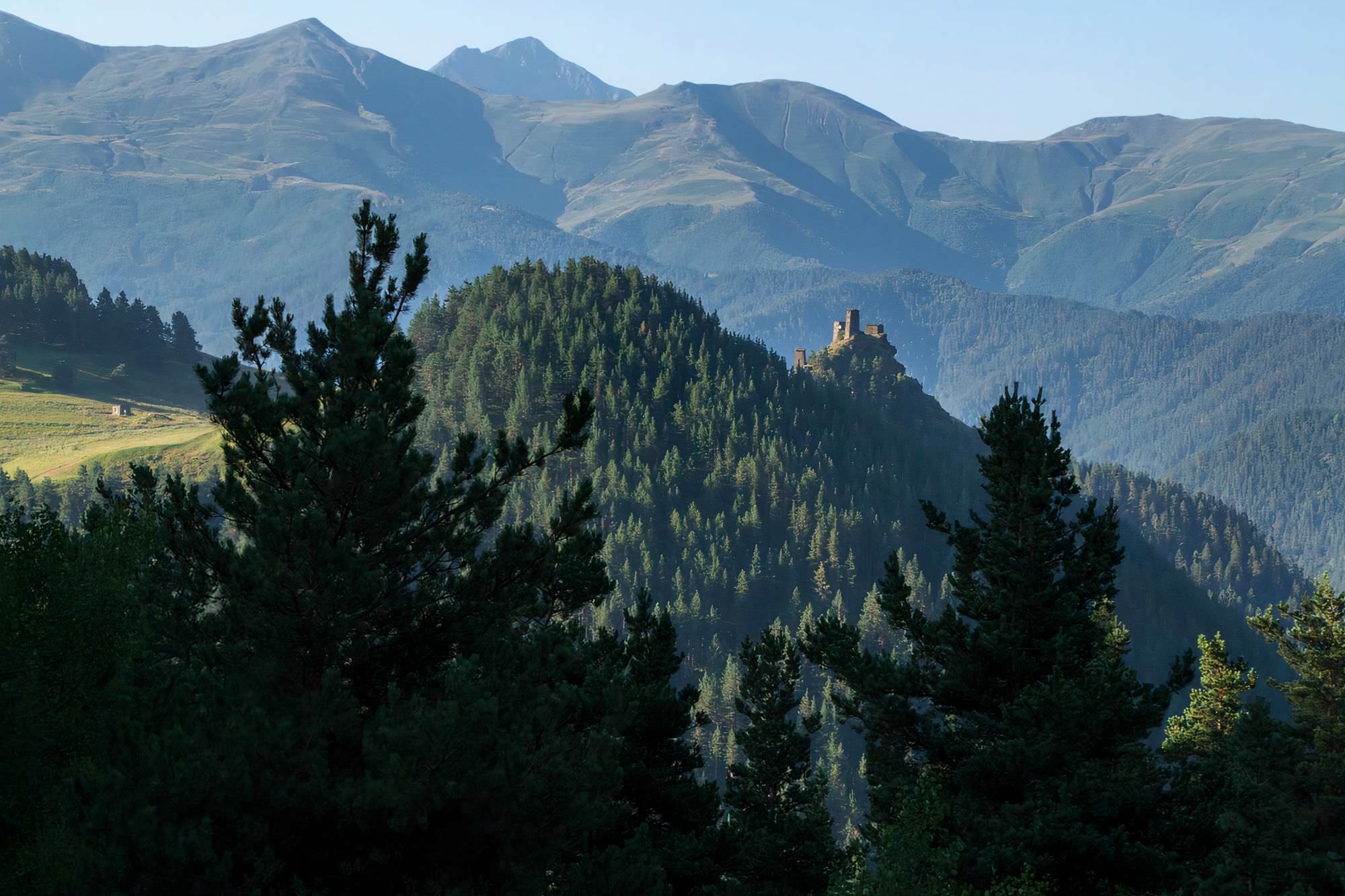
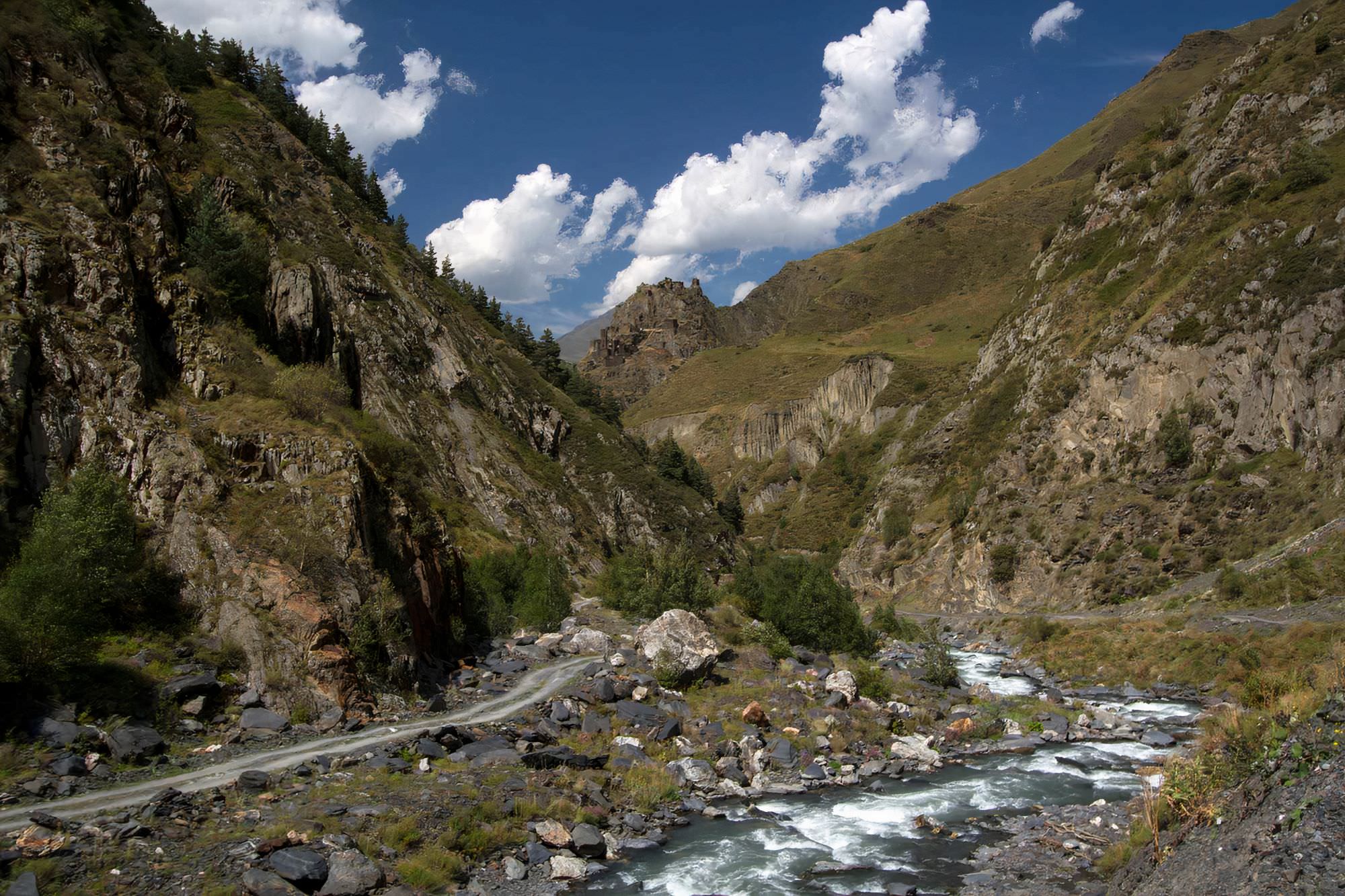
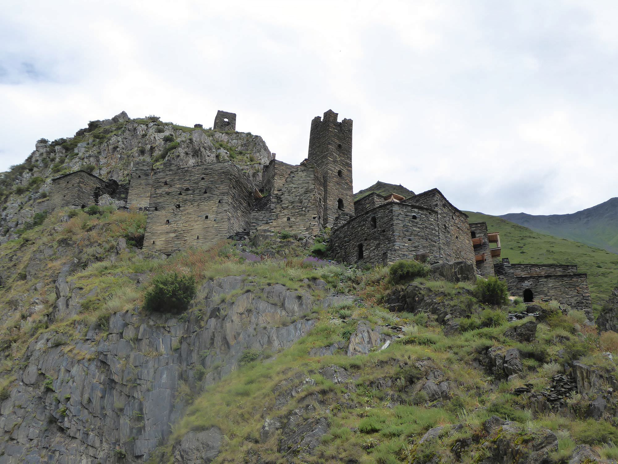
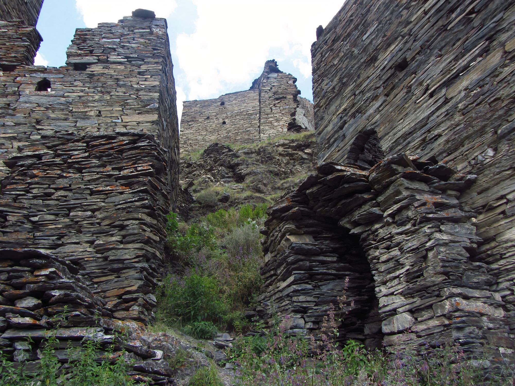
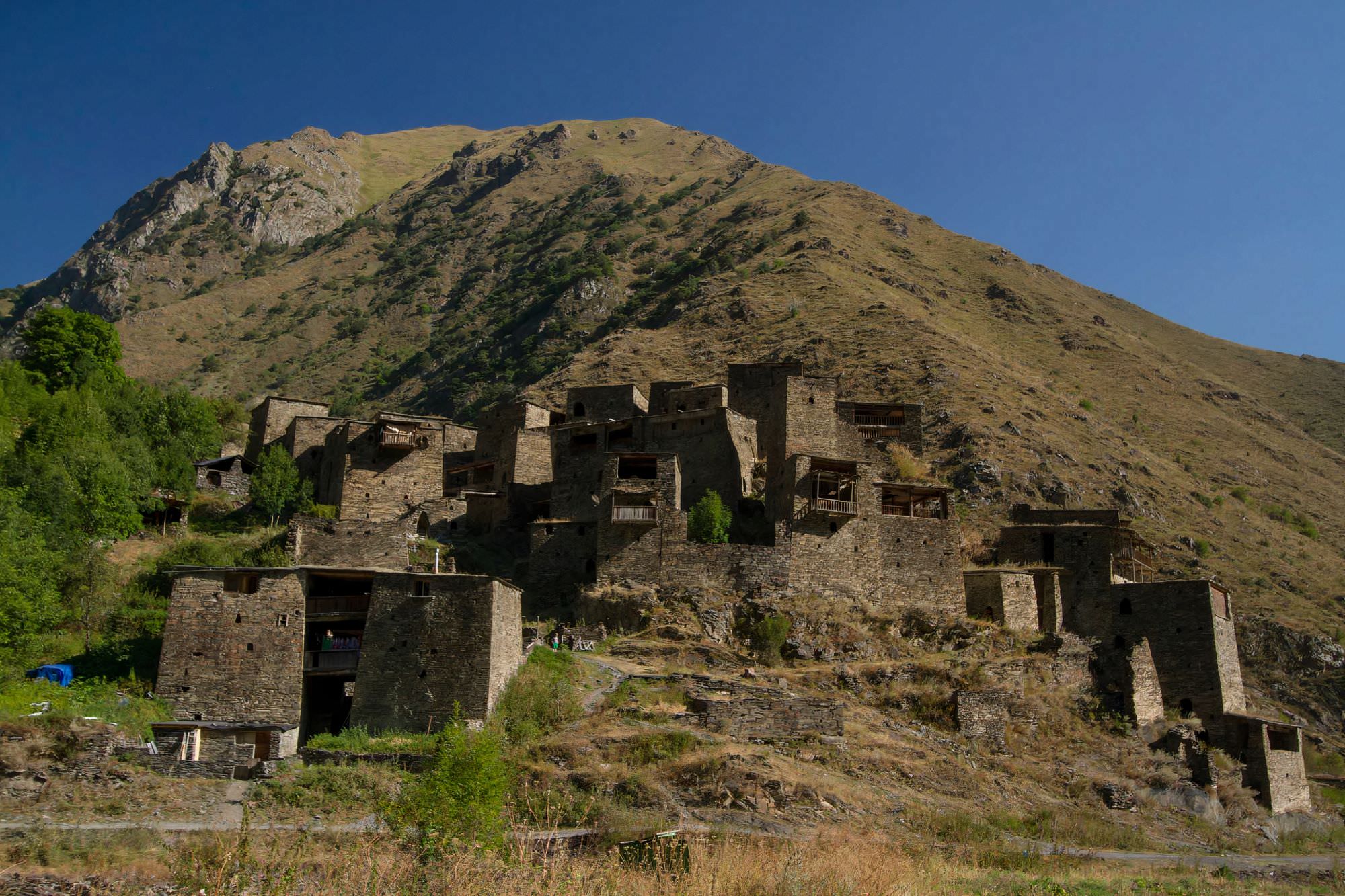
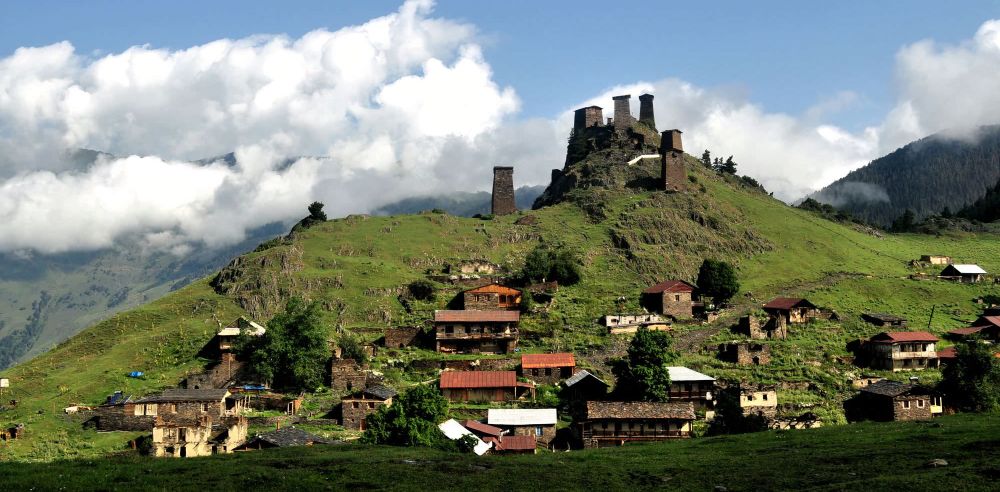
From the guard's camp, there are two ways down into the valley, both steep and muddy. One heading to the west descends to the Ardoti village but we will take the more straightforward one which leads to the north. The trail soon enters the forest and then comes a steep, arduous descent into the Khonistskali valley. Here the path turns into a dirt track again. Follow the road, it will lead you through Khonischala village to the confluence with Andaki river, where lies an ancient fortress Mutso (there is one more border checkpoint not far before the fortress).
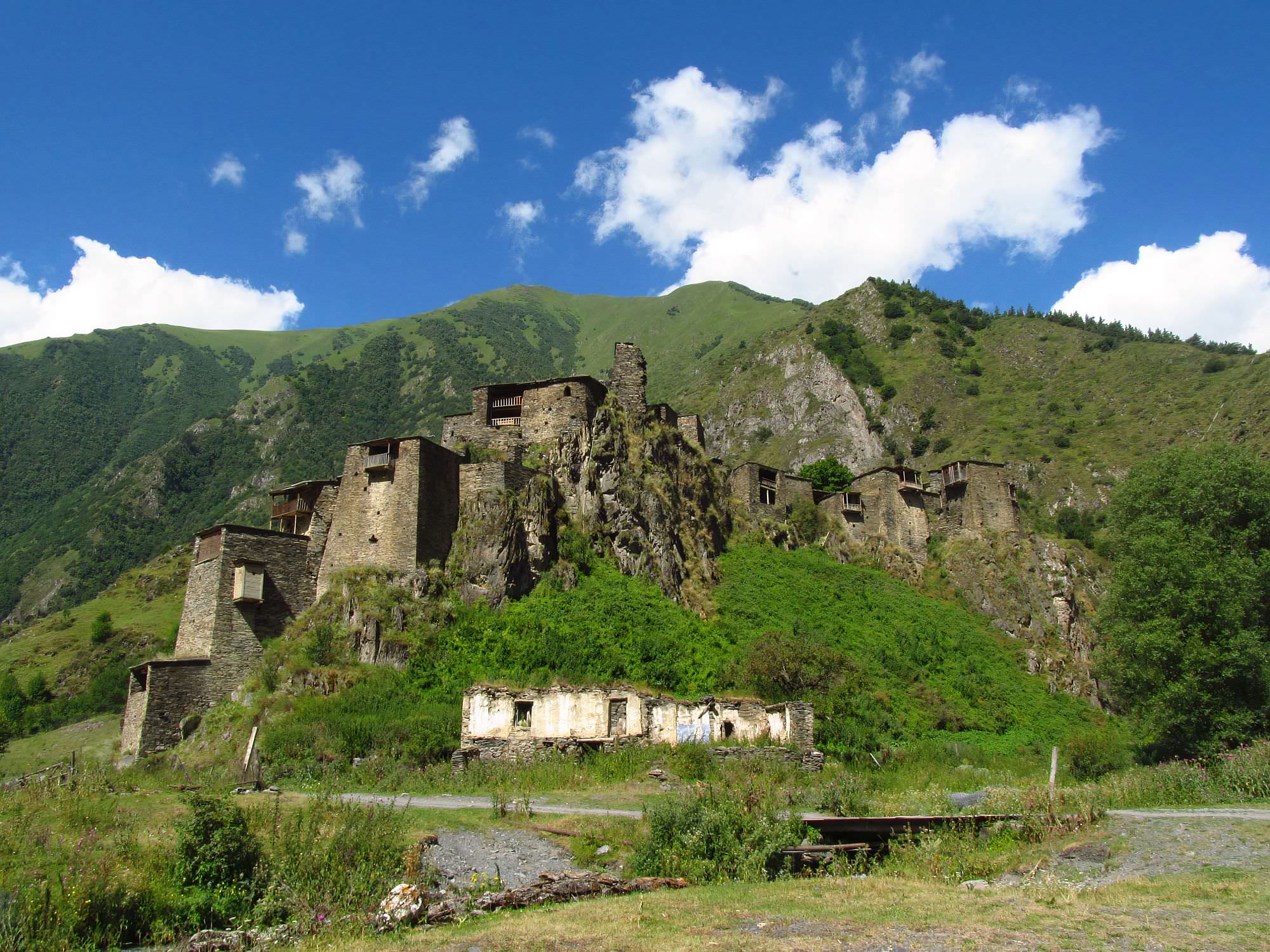
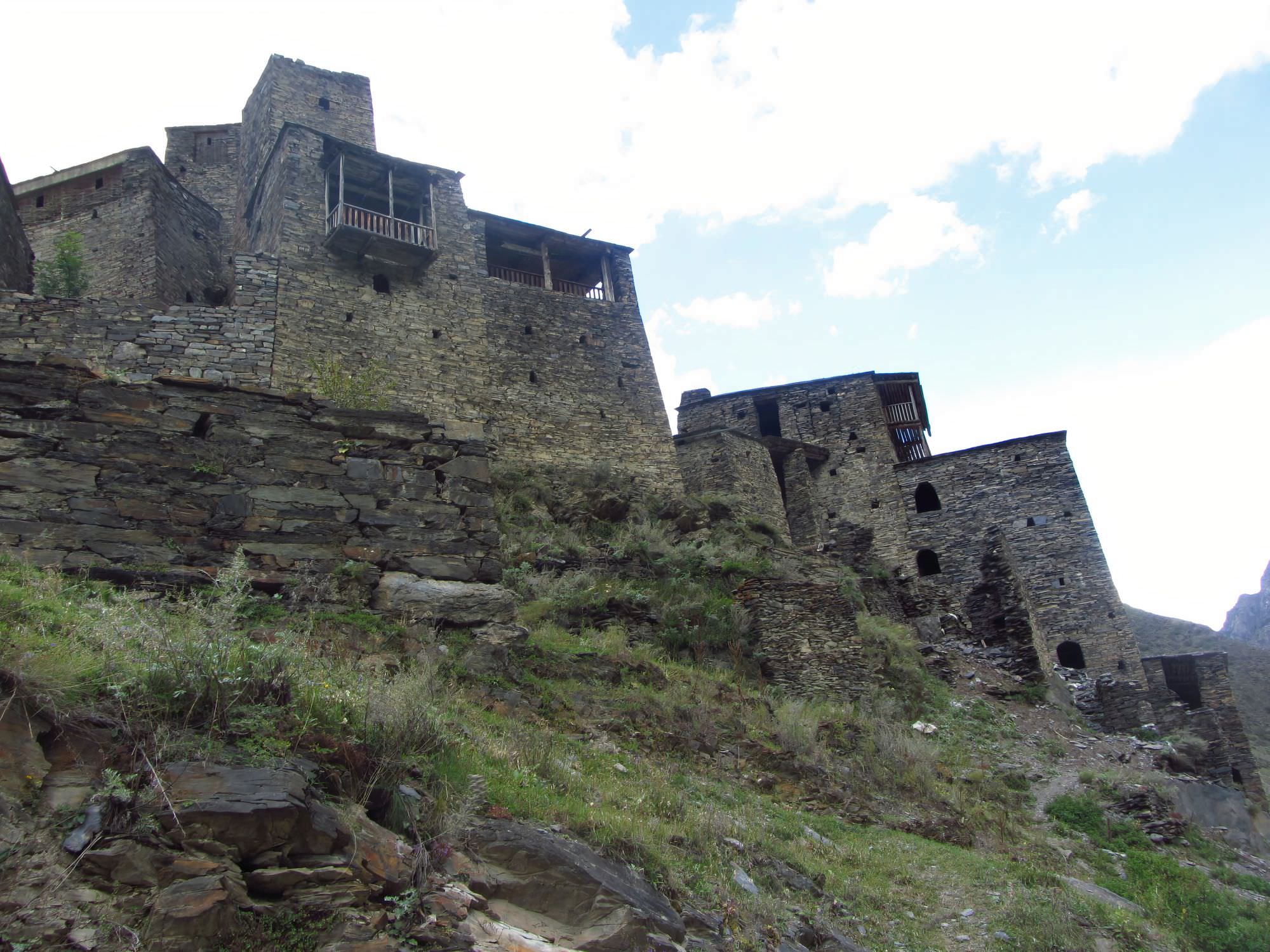
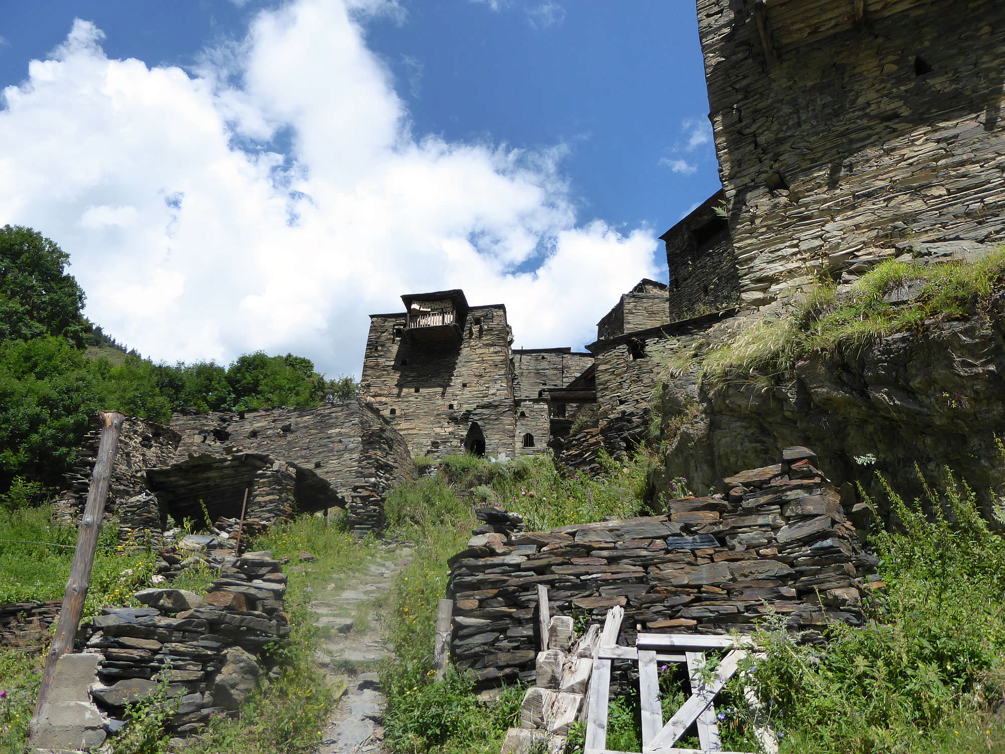
Mutso fortress is definitely worth a visit. There was a major reconstruction project going on (finished in 2018), so some areas turned into a building site. I must admit I liked it more when Mutso was empty and quiet, but even now it's ok - they didn't touch everything, just some buildings. There is also a small restaurant by the road, another place to get food on the trek. It is certainly worth climbing it to the very top, to the well-preserved, lonely tower standing above the fortress.
Continue down the road (or hitchhike, this section is not that interesting). Another interesting sight on the road is Anatori - House of the Dead in a place where the road bends back south. From there it's only 30 minutes to Shatili fortress.
When it comes to sleeping, you have several options in Shatili. You can camp - the best spots are by the river upstream from the village and at the football pitch above the fortress. In theory, you can also sleep in one of the abandoned tower houses - some were transformed into guesthouses but there are still many empty ones. However, this works better in theory than in reality since these towers are quite dirty and dusty.
Of course, there are also several guesthouses, some in the fortress, others in the upper village and there are also a few down by the river, opposing the fortress. Some good ones are:
Guesthouse Mziani - very pleasant guesthouse located in the new village, it´s the first house on your left if you enter the village from the direction of the football pitch. The hosts are helpful, friendly and speak English, German and Russian - thanks to them, the guesthouse, even though it´s fairly popular, retained its family atmosphere. Food is tasty and rooms modern, at least by Shatili standards. Overall, a pretty good pick.
Front castle - stylish guesthouse located in the large tower-house in the bottom part of the fortress, close to the river. Its main asset is the tower itself -it's simple, but elegant rooms with wooden and stone walls have the real Middle-Age feeling (but bathrooms are modern). The staff is also professional and speaks English.
Booking: shorenalikokeli@gmail.com
Jalabauri guesthouse - traditional guesthouse situated in the tower-house, close to the center of the fortress. This tower looks a bit more "lived-in" compared to the "Front castle" but just as much charming. The owner speaks English and knows the surrounding mountains very well.
Booking: dato.jalabauri@gmail.com
Many great photos used in this article were taken by Mario Sklenar. More of his photos can be found here.
One photo (Omalo village) was also taken by Nela Wurmová.