Scenic hike connecting Lower and Upper Svaneti. The highlight of the walk is the traverse of a Svaneti ridge.
Scenic hike from Upper to Lower Svaneti crossing Svaneti mountain range. The first half of the trek offers unmatchable views of the main Caucasus ridge.
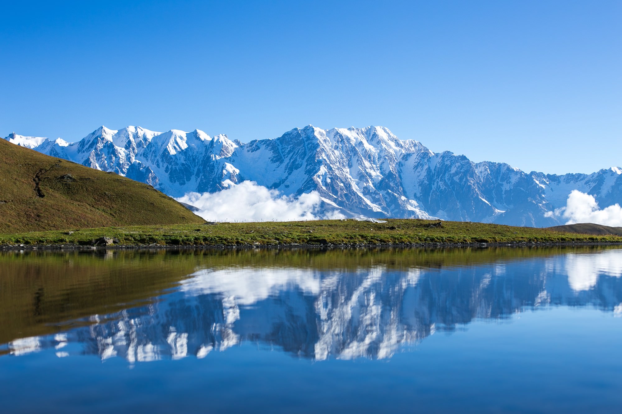
If you have time, it may be worth it to camp by one of several lakes on the ridge - evening are morning views are often even better
Hard - while the trail is obvious and easy to follow, you will have to overcome considerable distance and elevation.
Minivans to Ushguli depart daily in the morning from the Seti square. They wait until they are full, the usual price for a ride is 40 GEL.
If you prefer walking, very popular is the 4-day trek from Mestia. Ushguli is also accessible from Lower Svaneti
via Latpari pass or Zagar pass.
The marshrutka to Chvelpi departs from Kutaisi bus station each day at 12:00 (its final destination is Mele). The trip should take no more than three hours. On Tuesdays and Saturdays, there is one more marshrutka departing at 4 pm from the same station (red car, locals call it "Zafro").
There is a daily marshrutka to Kutaisi which passes Chvelpi in the morning (starting from Mele) - ask your landlord to call the driver so you won´t miss it. The ride takes about three hours.
Another option is, as usual, to keep walking by the road and hitchhike, but traffic for the first few hours will be very low.
The trail usually becomes passable in late May. However, be prepared for the possibility that you won´t be able to reach Chvelpi in time because of snow and will have to spend the night outside. By the middle of June, most of the snow has already melted and the trail becomes ideal also for day hikers.
The best time to hike is till the end of September, but the trail stays open also in the first weeks of October. Then it gets blocked by the first serious snowfalls.
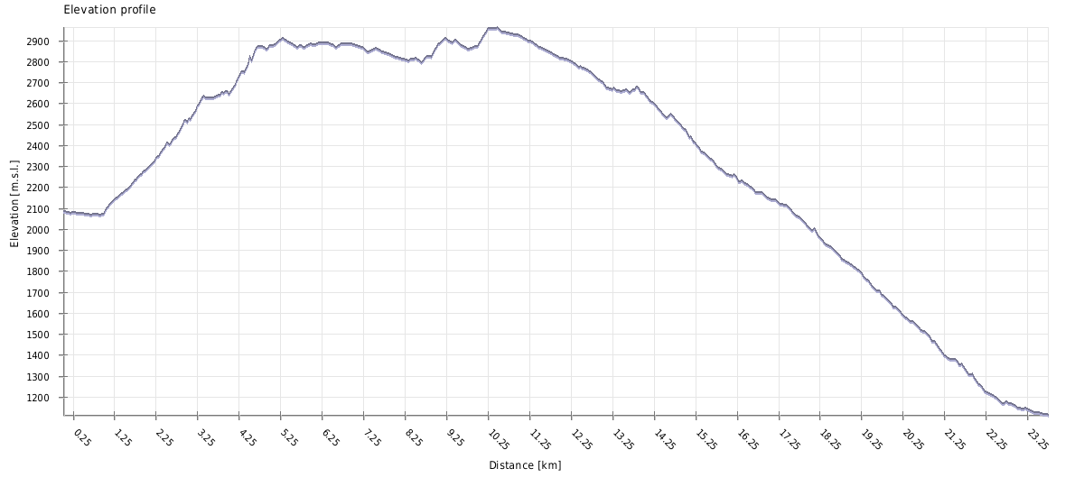
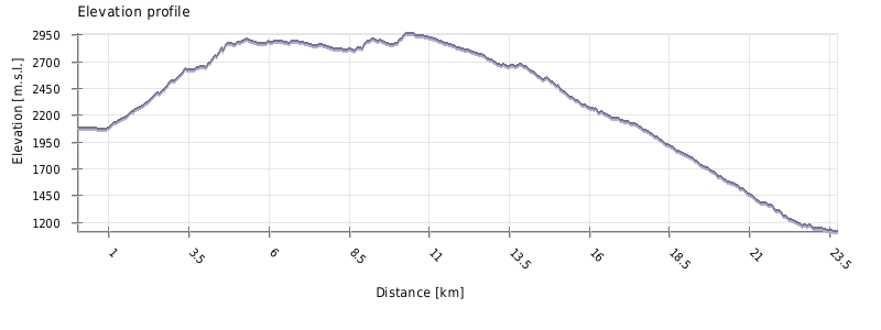
| Distance | 23,5 km |
| Trail type: | AB trip |
| Max. elevation: | 2963m |
| Min. elevation: | 1114m |
| Total climb: | 1280m |
| Total descent: | 2141m |
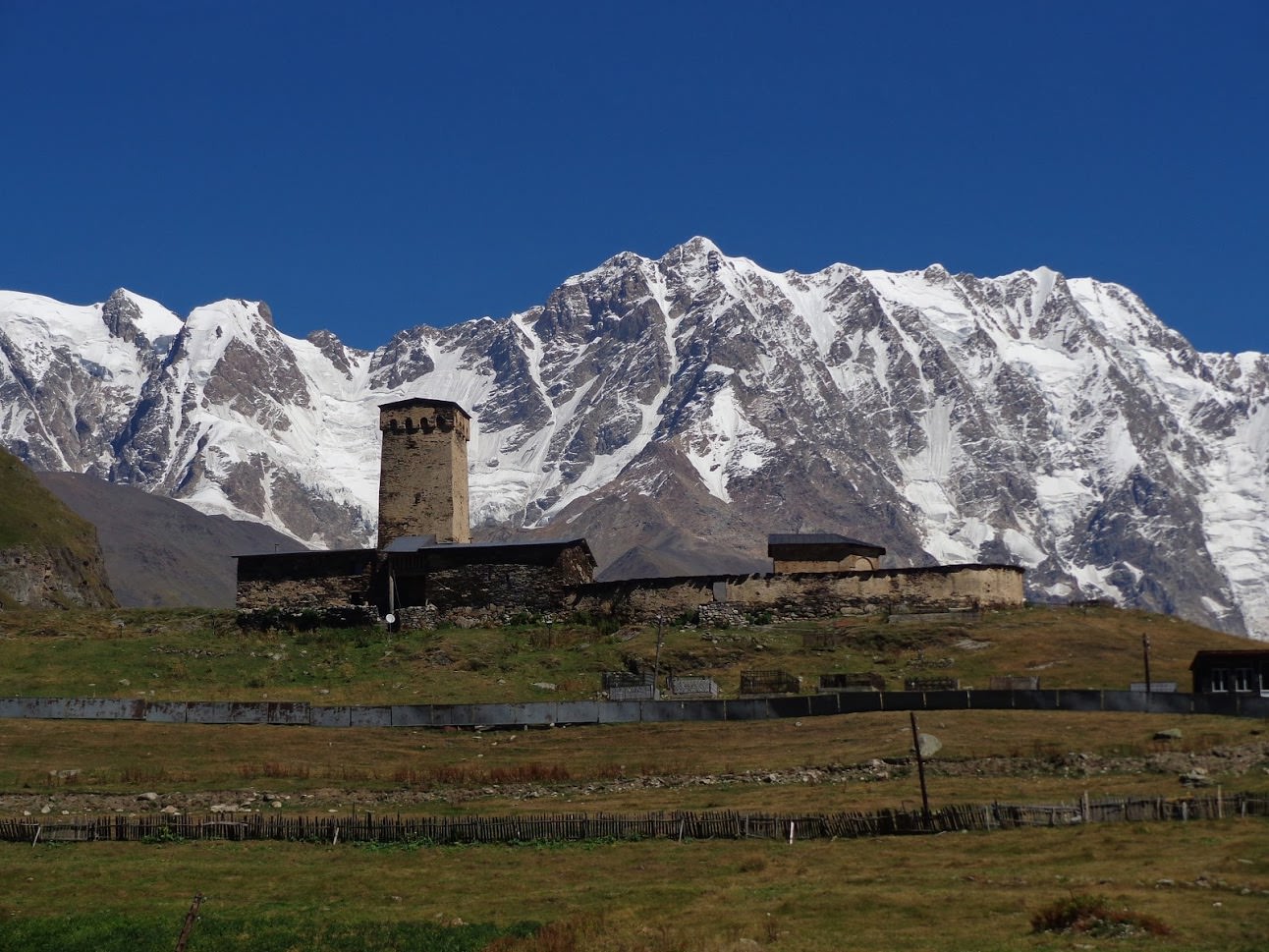
The trail starts by the bridge in Chazhashi, one of the villages belonging to the Ushguli community - there is also a pointer showing the way to Latpari pass. Cross the bridge to the left bank of the Enguri river, pass the museum and leave the village. Then continue walking downstream on the path running by the river until you come to the Murkmeli village (the village lies on the other bank of the river). The trail here turns to the left and starts climbing uphill by the smaller creek.
At the elevation 2150, the spring splits into two tributaries. You need to cross the left one and follow the right one. To the left, you can see a hill with ruins of several stone towers (known as Tamar´s summer castle) - if you would like to climb there, the trail branches off the main trail before the crossing of the creek.
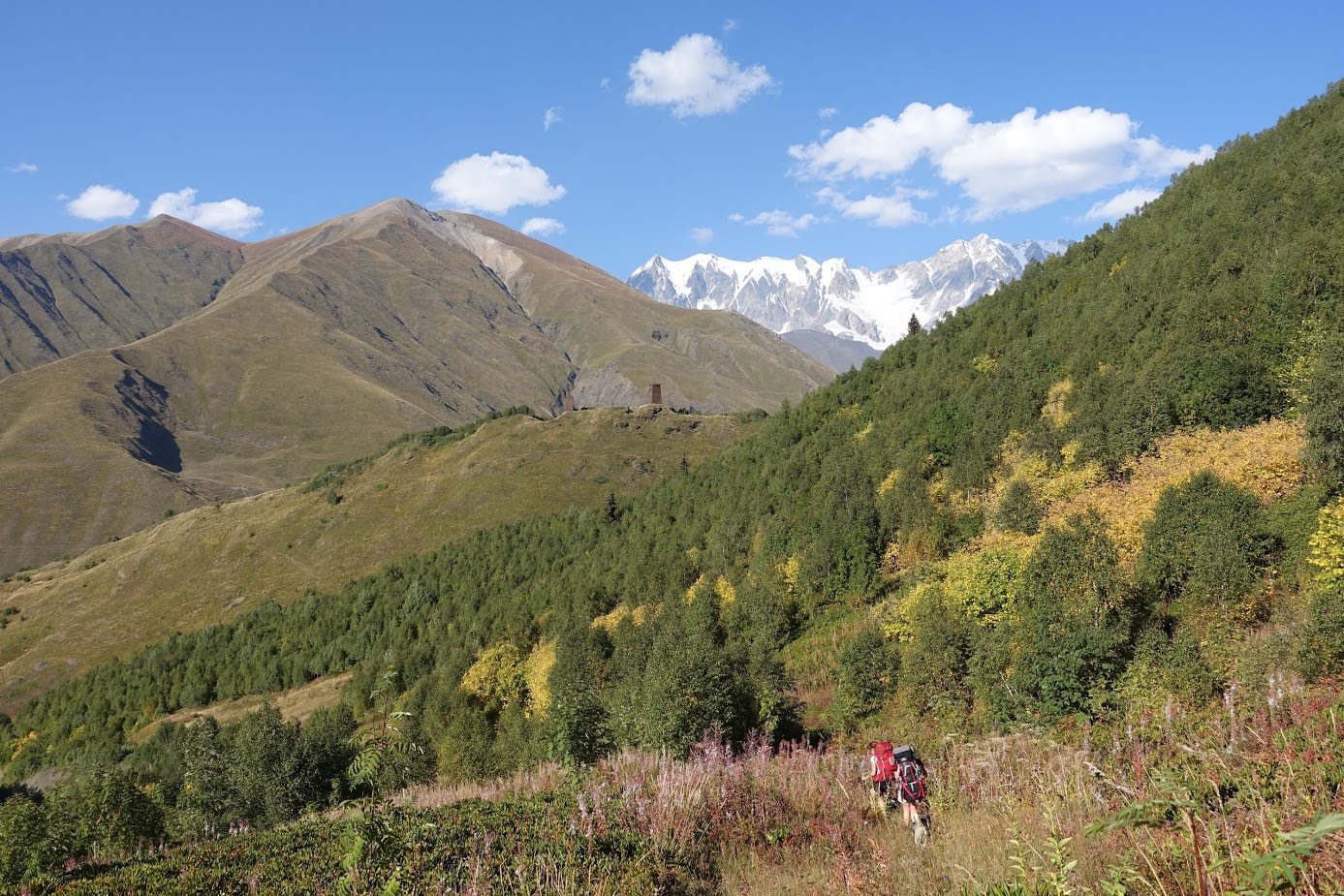
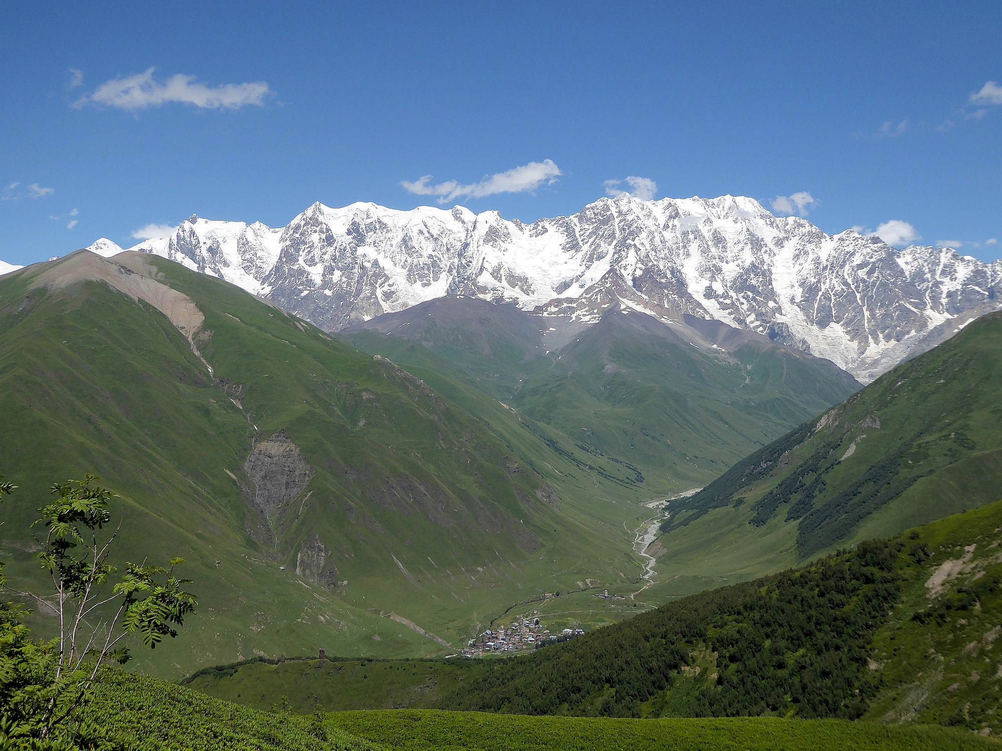
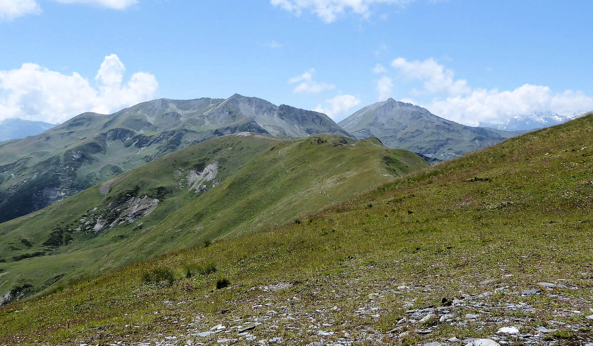
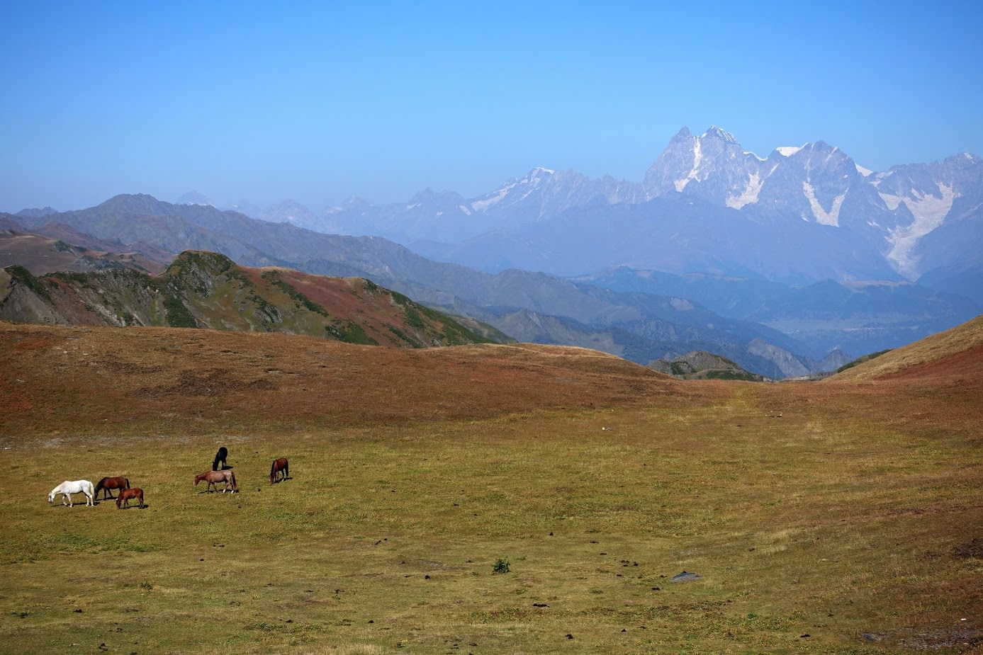
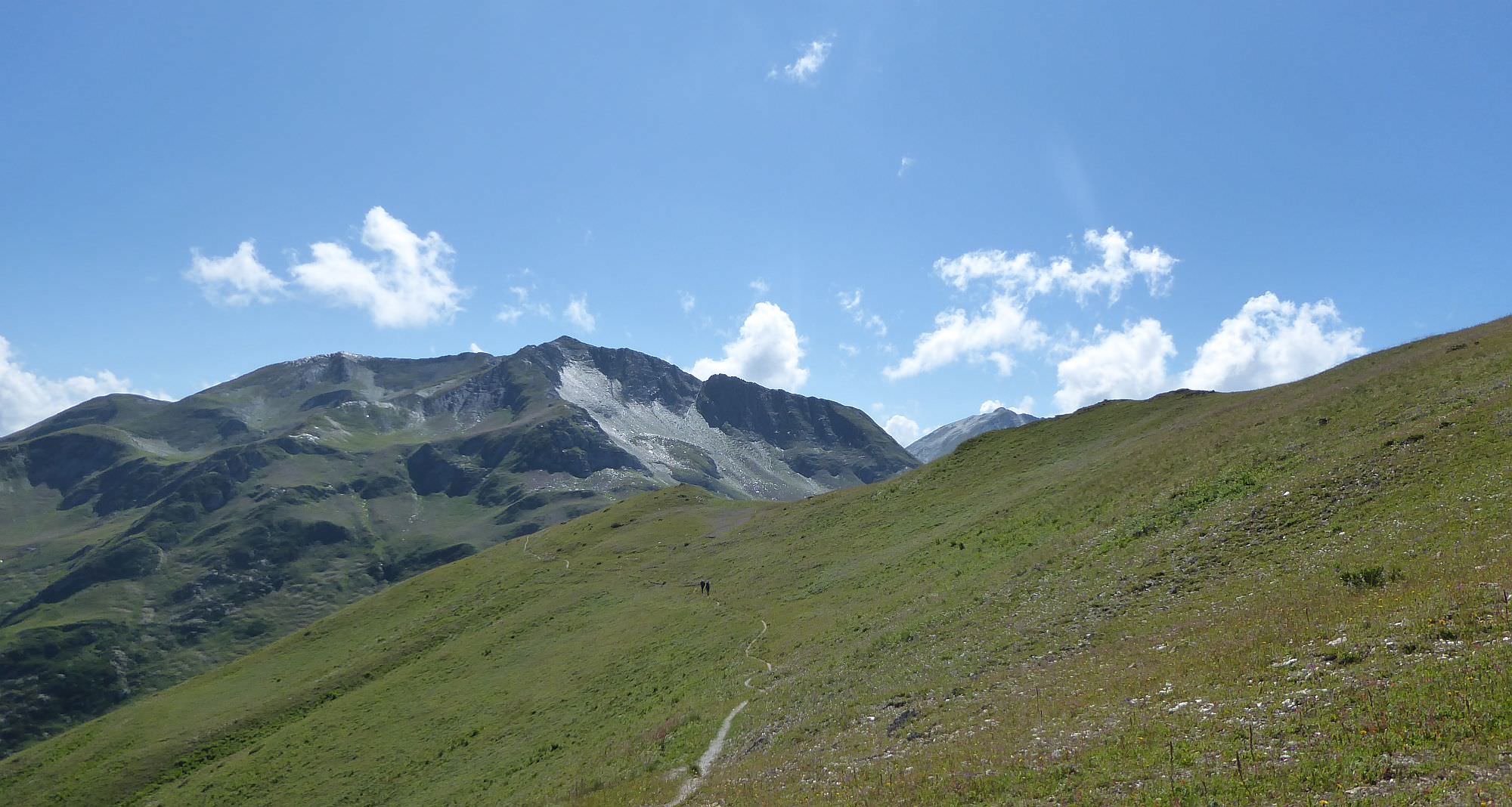
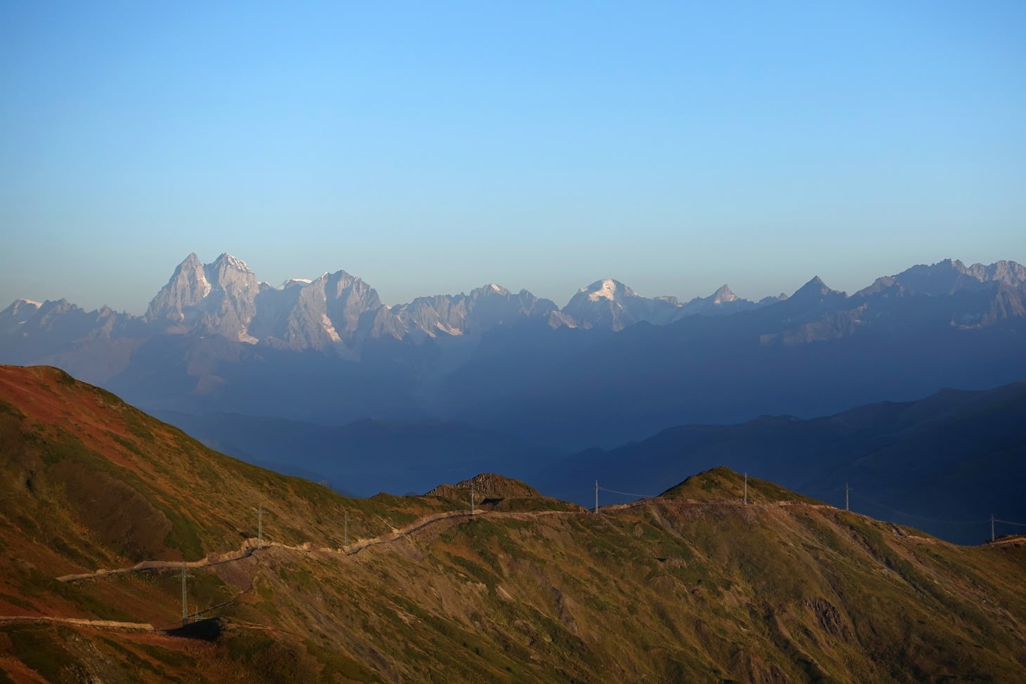
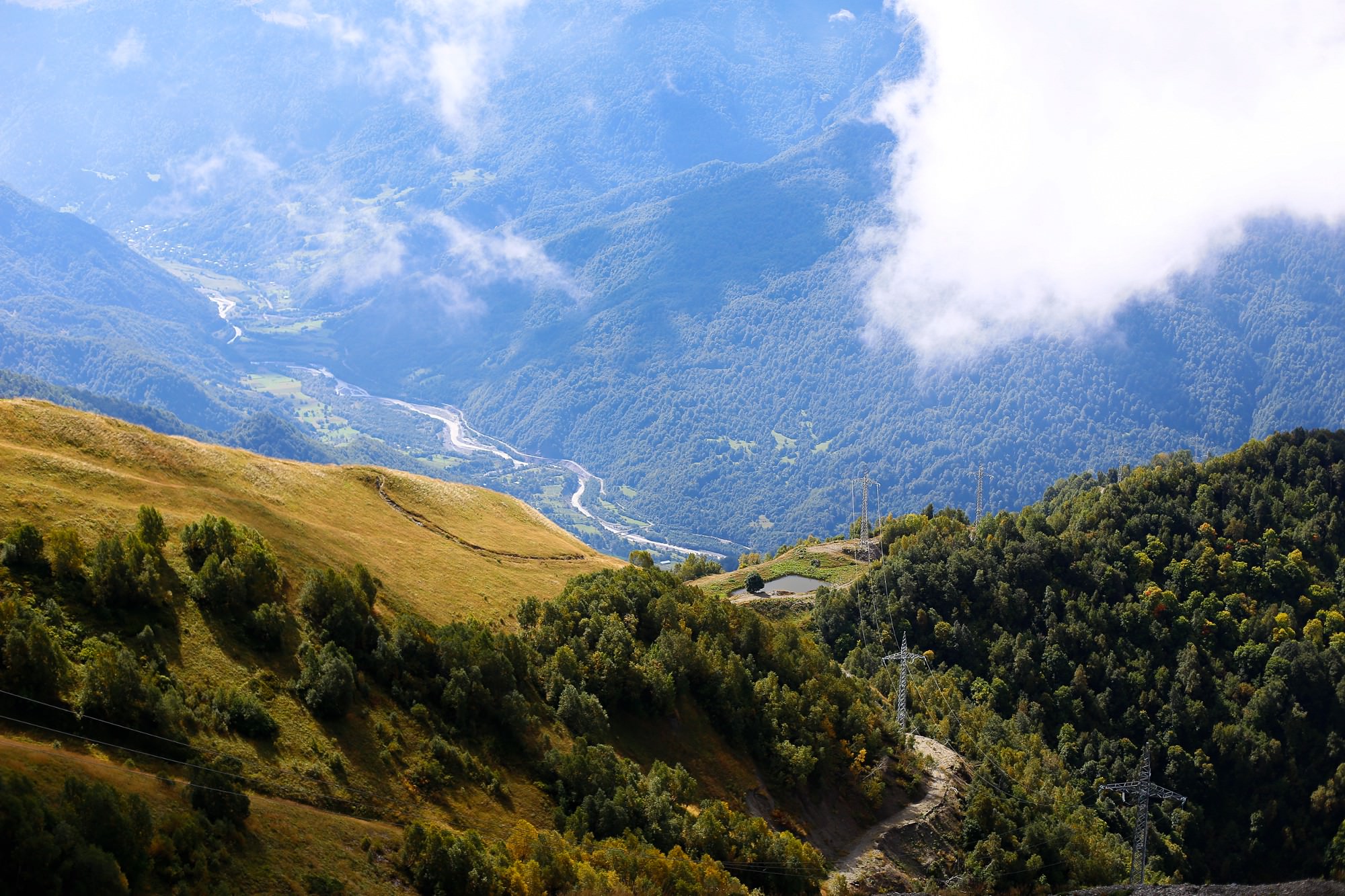
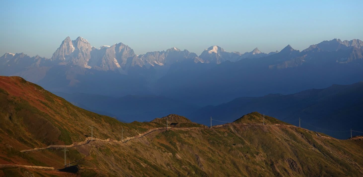
The path then climbs to the small plateau at the left side of the valley (altitude 2600m, there is also a small camping spot). One of the best things about the climb is watching how the mountains of the Greater Caucasus range appear behind you. At first, you will see only Shkhara, but soon pops up also Tetnuldi, then Ushba and even Elbrus (at least on sunny days). To the east, you will be able to admire mountains such as Koshtan-Tau, Ailama or Tsurungali.
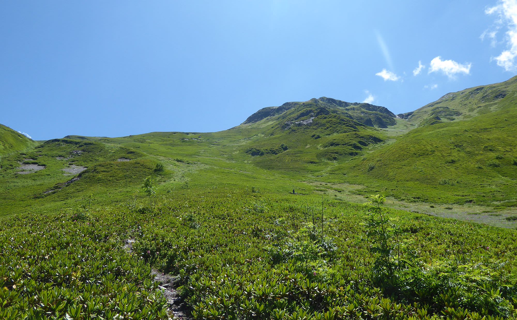
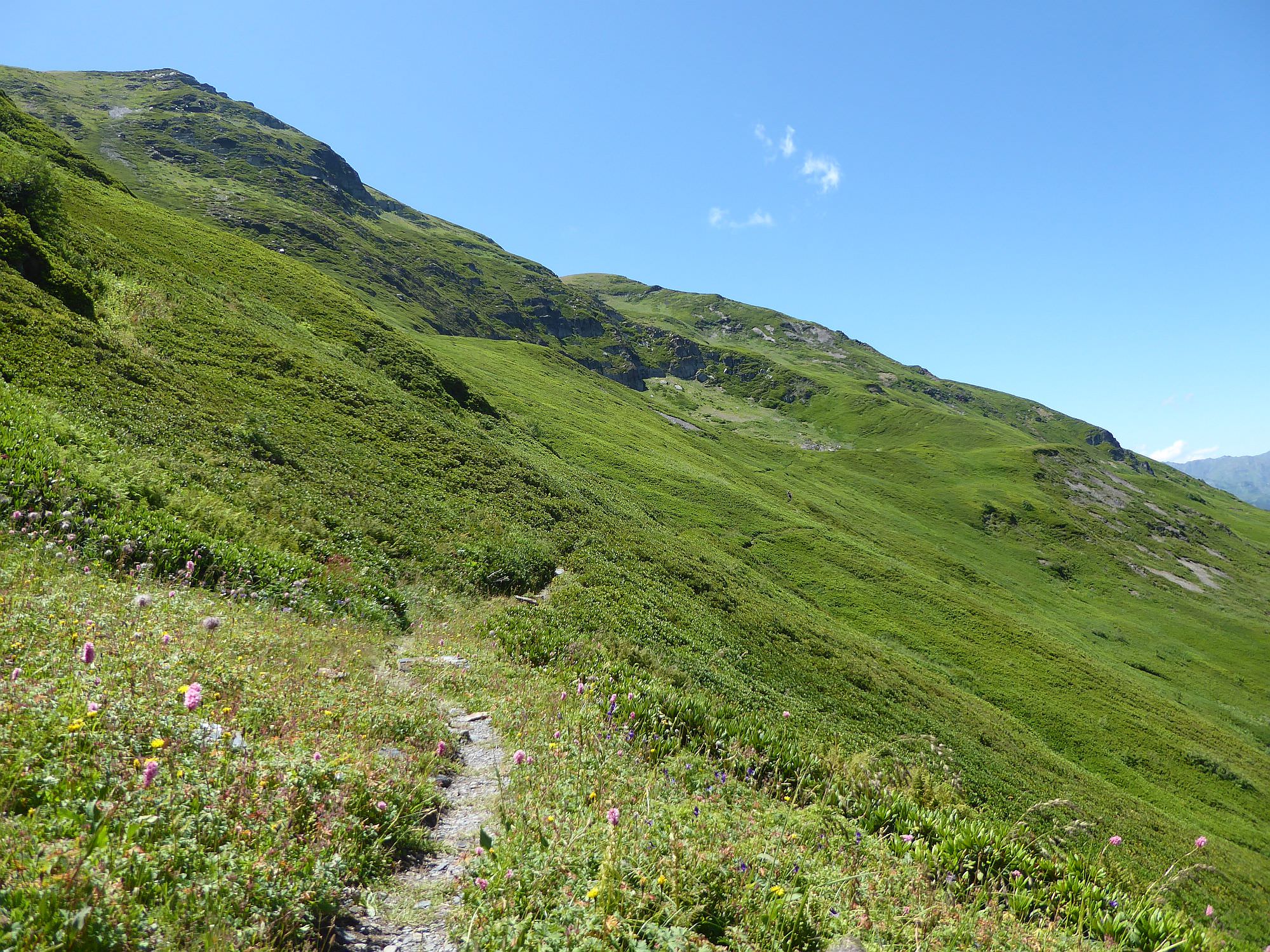
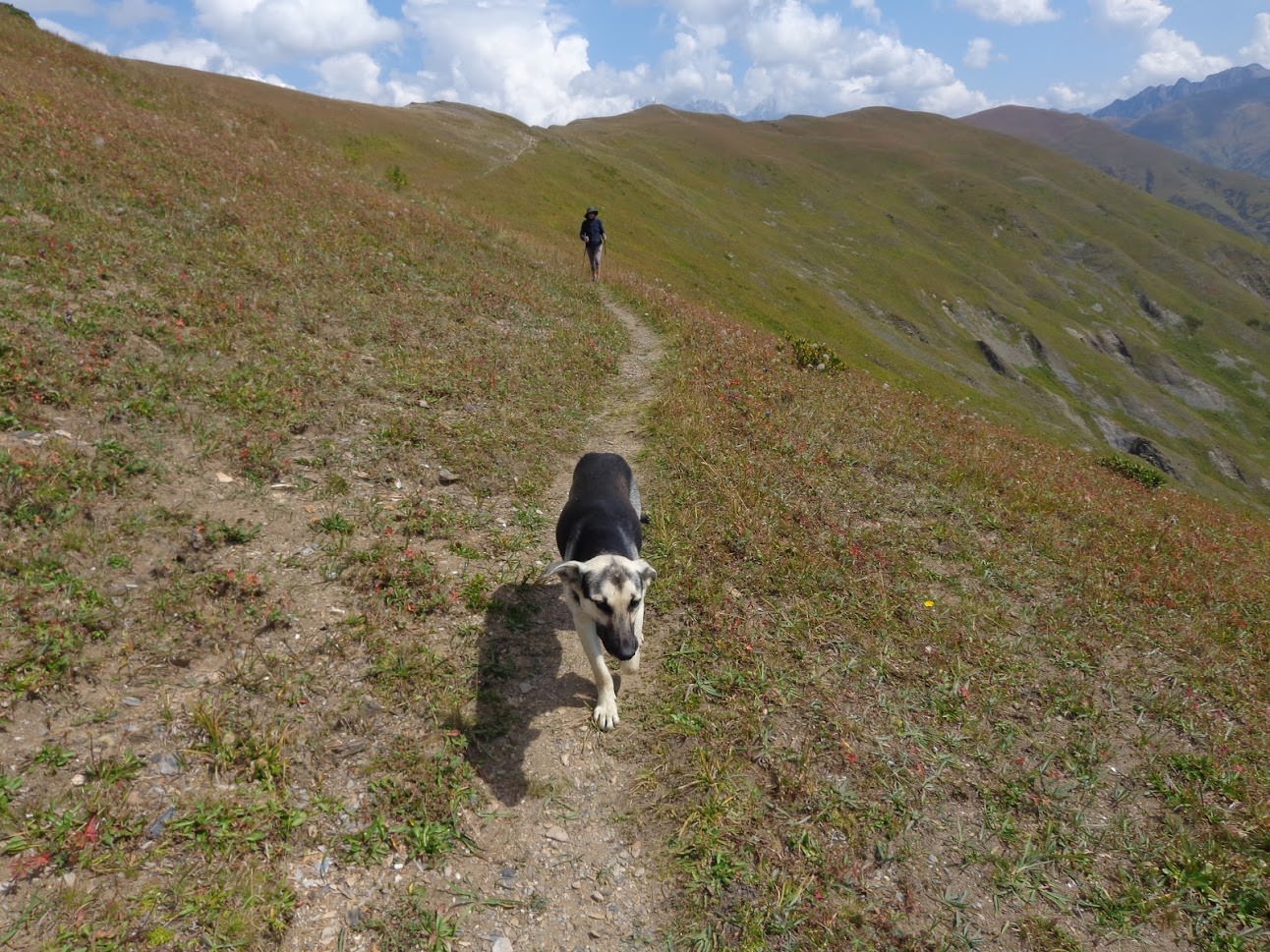
Once the trail reaches the small hill, it sharply turns to the right and traverses the hillside - there is a small trail passing through a huge rhododendron field. After 700 meters, it turns to the left and starts climbing again - soon, you will see Gorvashi pass (2972m) ahead.
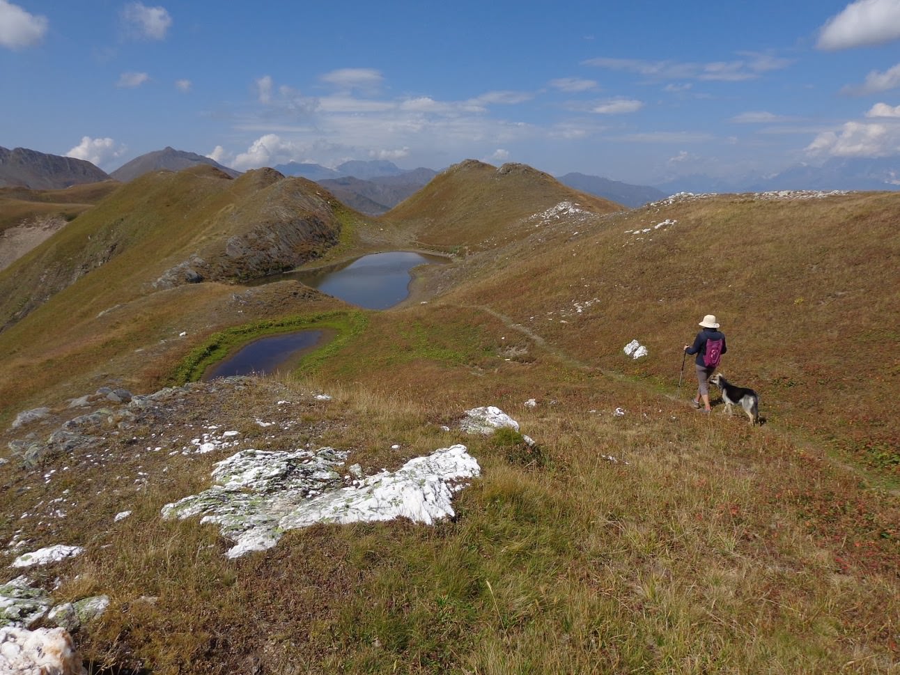
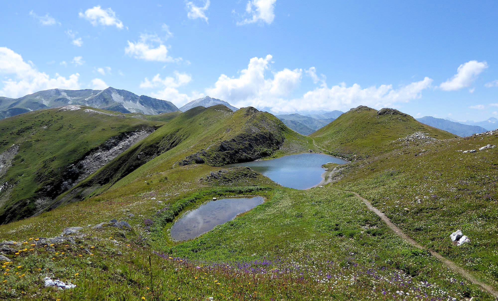
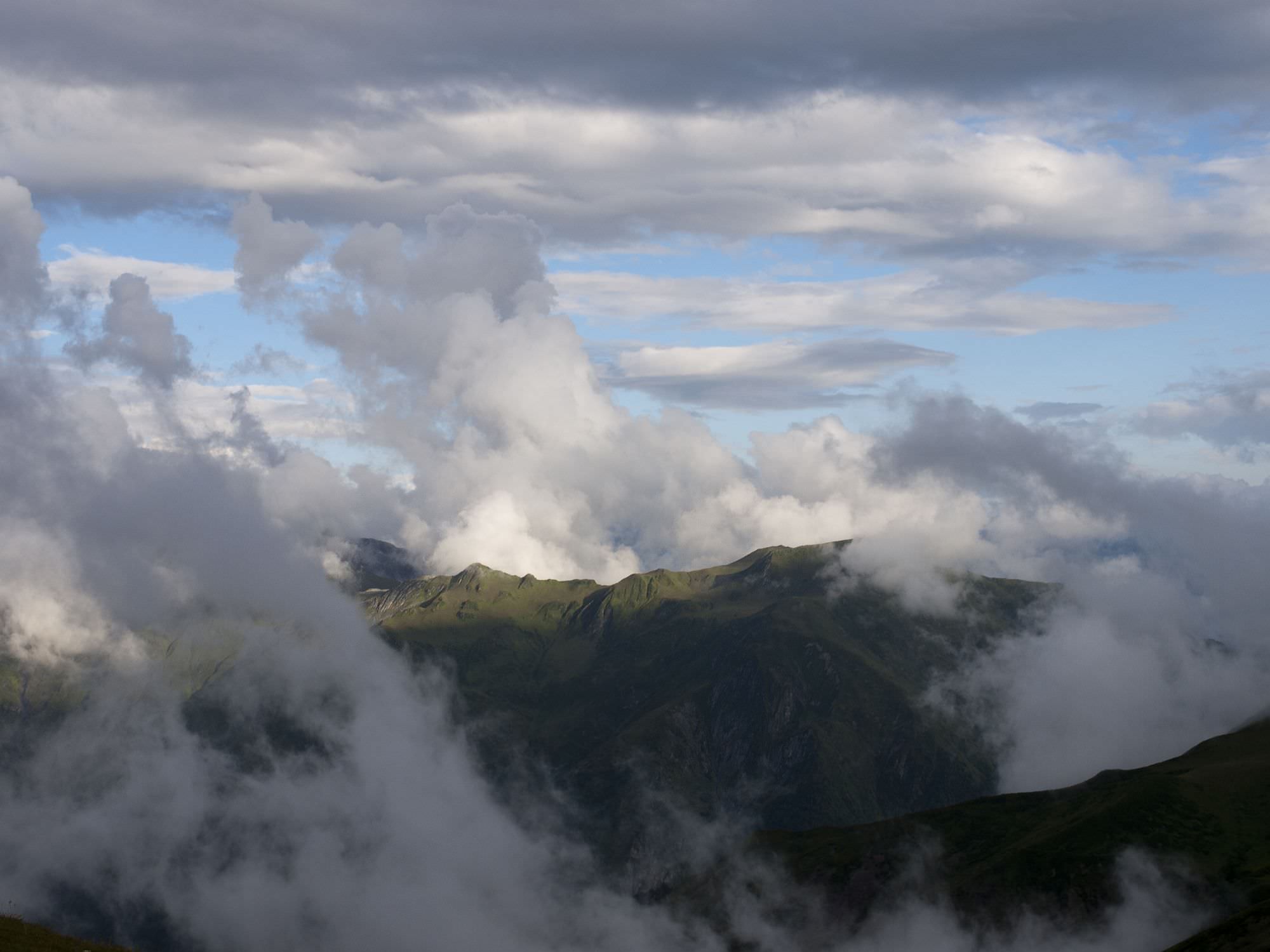
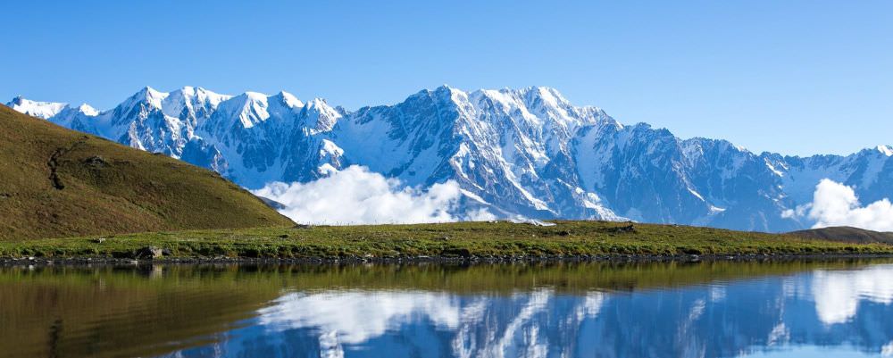
The pass is a great place for a break - you can admire not only the Greater Caucasus mountain wall but also Lechkhumi ridge to the south. The trail then turns to the west, more or less following the top of the ridge. Enjoy views, this is one of the most scenic walks in the Caucasus. Trail also passes a couple of small lakes where you could camp.
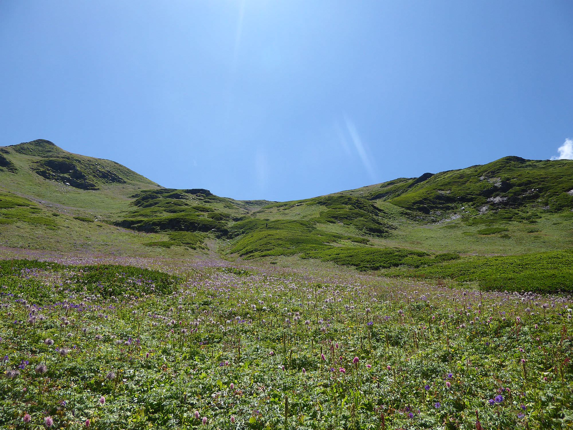
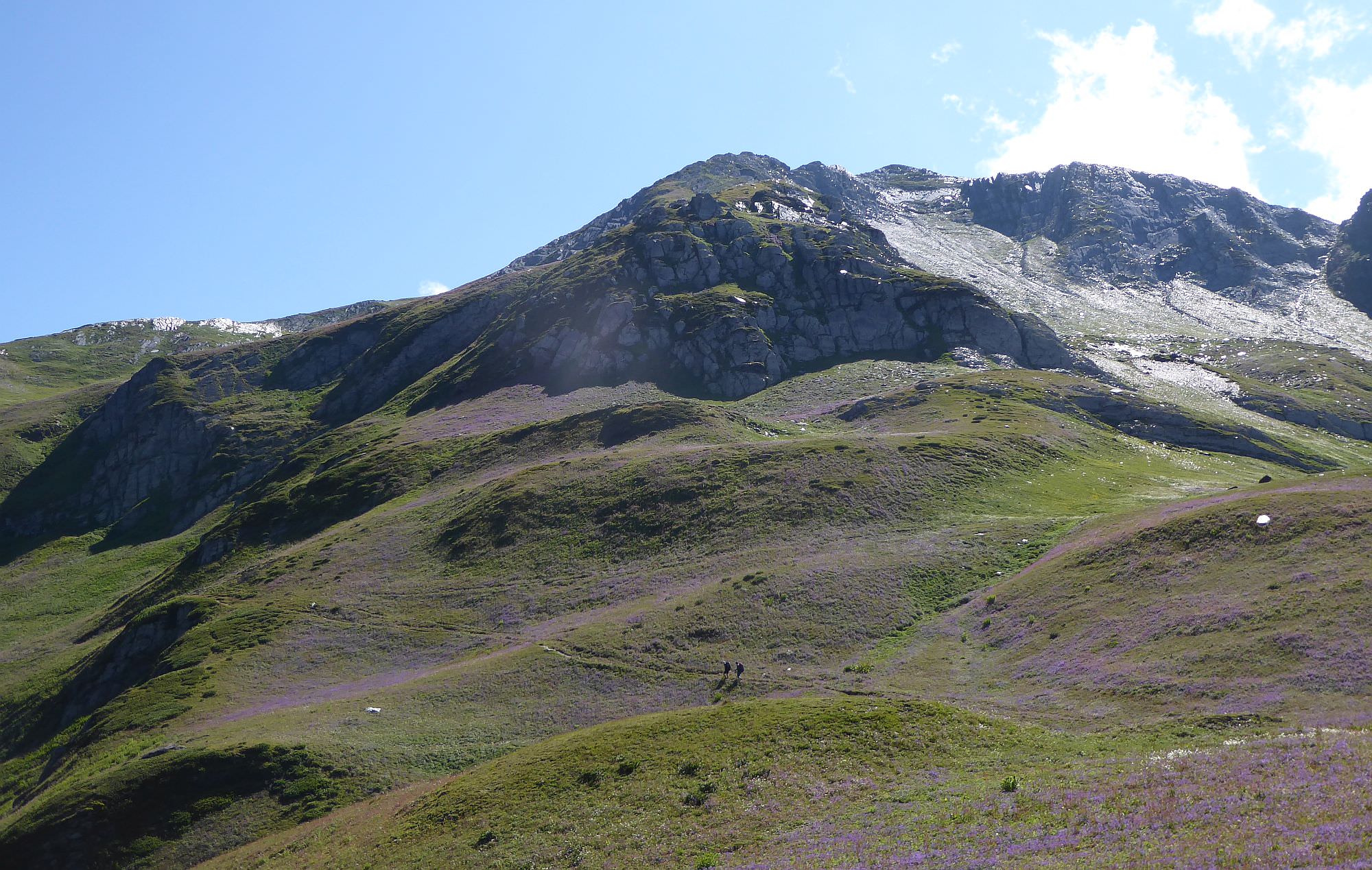
After approx. 2 km you will see a large mountain in front of you - Latpari pass is right behind it. Traverse this over 3000m tall, yet nameless hill from the left side - the trail goes up and down for a while till you reach another, much larger lake. Also here is lots of space for tents - this is probably the best one of all camping spots on the ridge.
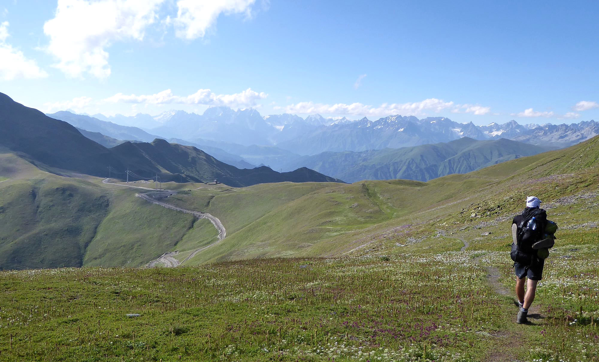
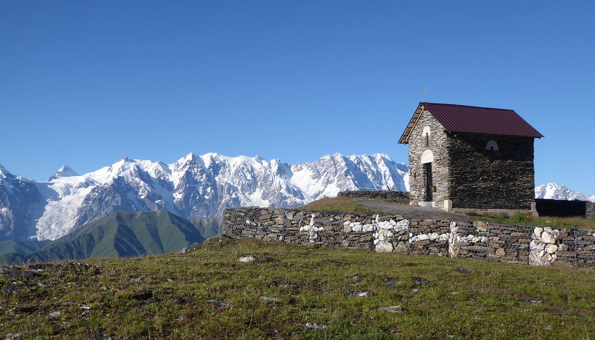
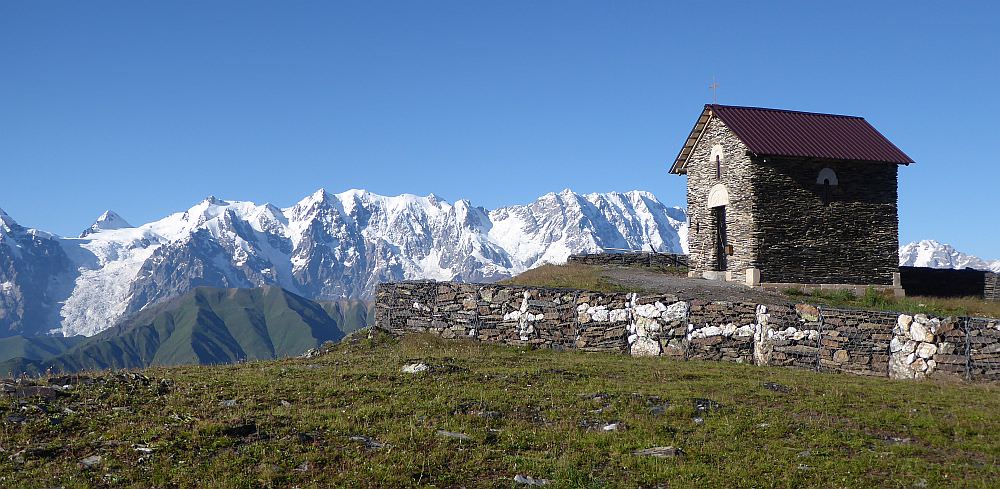
From the lake, you continue walking around the mountain, gradually climbing till the trail reaches its highest point at 2975m. This is actually quite close to the mountaintop so if you want, you can climb it. But, more importantly, you already see a Latpari pass ahead. Descent straight to it. At the pass, you will find a dirt road, another lake, and a newly built chapel.
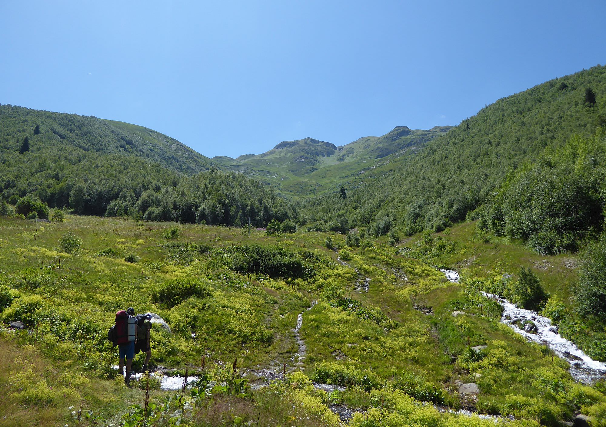
From here, it is straightforward and easy (at least when speaking about orientation, your knees would disagree). You just need to follow Kala-Chvelpi road and after the few hours of steep descent on the endless serpentine, you will make it to Chvelpi. About halfway down, you will pass a muddy lake that has a nice camping spot nearby. The water in the lake doesn´t look good so better stock up with water earlier - during the descent from the pass, you will stumble upon two clean streams flowing across the road.
The first house in the village is conveniently also a guesthouse - belongs to a guy named Valera (+995 577 953516, speaks Georgian/Russian). Valera also has a car and can take tourists from Chvelpi to Latpari pass for 150 GEL which is extremely convenient (and probably worth the money) if you are starting from the other side. I heard also there is one more good guesthouse deeper in the village, belonging to some Soso, but haven´t stayed there.
Title photo, as well as some others were taken by Ukrainian photographer Igor Peftiev. I recommend to check
the full photoreport.
Remaining photos were taken by another clever photographer Martin Bibza, Jitka Jakesova, and, of course, by me.